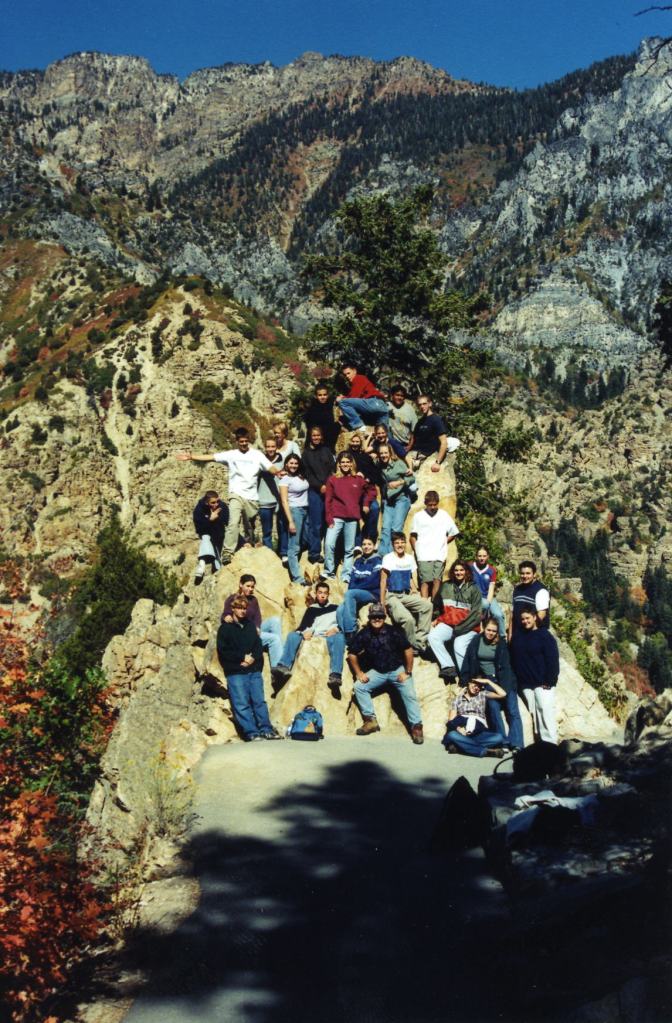
Timpanogos Mtn., UT
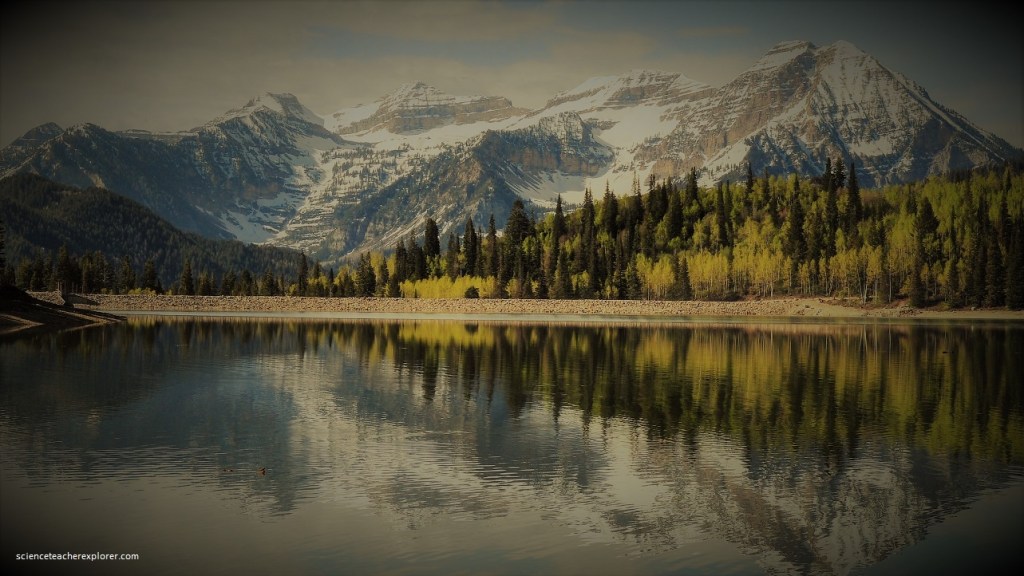
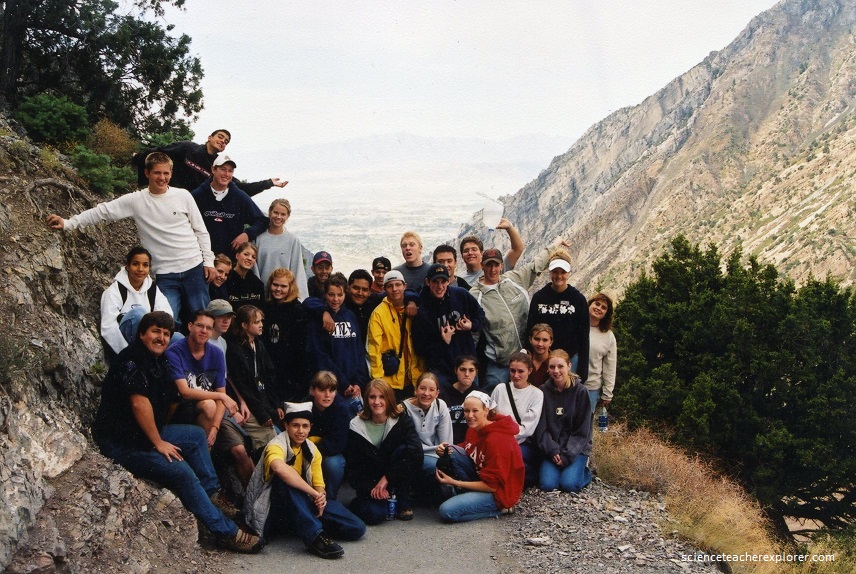
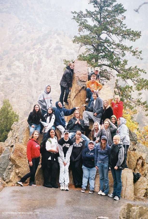
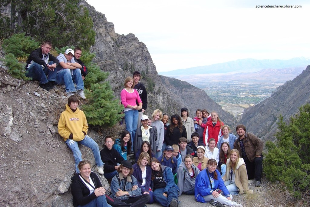
Over the years, I’ve led a number of groups up the side Timpanogos Mountain in Northern Utah near Provo, Utah, (imaged below).
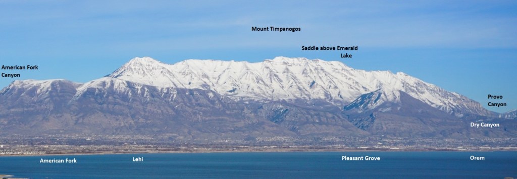
Timpanogos rises to an elevation of 3,582 m above sea level in the Uinta-Wasatch-Cache National Forest. The mountain towers about 2,100 m over Utah Valley (Happy Valley), including the cities of Lehi, Provo, Orem, Pleasant Grove, American Fork & Lindon, Utah.
The exposed massif of the mountain is made up entirely of limestone and dolomite from the Pennsylvanian period, and is about 300 million years old. Heavy winter snowfall is characteristic of this portion of the Wasatch Range, and avalanche activity is common in winter and spring. In 1984, I worked in Orem, Utah as a Engineering Technician. Becky, (my future wife at the time), had the opportunity to explore the area. Our first attempt to explore the mountain was to take the Bridal Veil Falls tram in Provo Canyon.
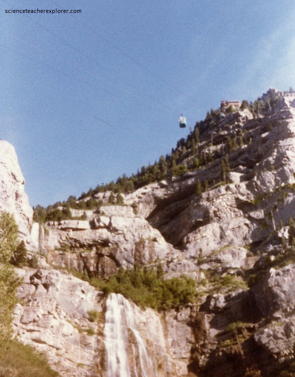
Pictured above, the Bridal Veil Falls Tram is permanently closed. It was destroyed in an avalanche in 1996 and no longer operates.

The aerial tram at Bridal Veil Falls Resort opened in 1961 and was said to be the steepest aerial tram in the world. At the top of the tram was a full-service restaurant in the 1970s. Pictured above, the original tram carried six passengers 200 meters and 584 total meters to the top of the falls.

The Bridal Veil Restaurant was shut down after the avalanche on New Year’s Day in 1996. After nearly 50 years in Provo Canyon, the tram line leading to the old Eagle’s Nest Lodge atop Bridal Veil Falls had to be cut down and the equipment was left abandoned.
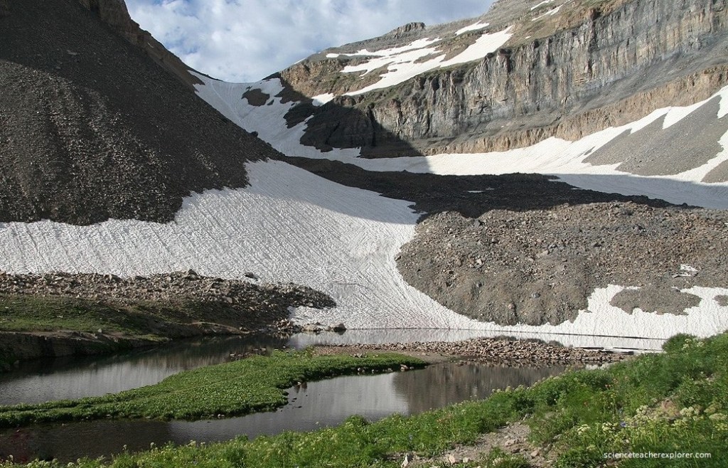
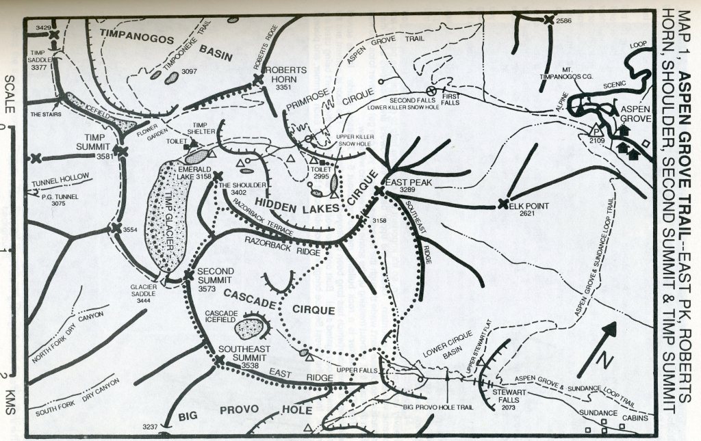
Pictured above, Emerald lake is northeast of the summit of Mount Timpanogos, at the base of the almost vertical northeast face of the mountain, with an elevation of 3,169 m. The now mostly vanished and completely buried Timpanogos Glacier, left behind a terminal moraine which now impounds the lake. The runoff from the snow field, (seen above) feeds the lake and colors it blue. Emerald Lake was accessible to me in 1986 by hiking from Orem, up through “Dry Canyon to the summit at the saddle above “Emerald Lake, and then down the Mount Timpanogos Trail (also known as the Aspen Grove Trail) to Aspen Grove.
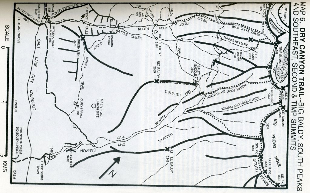
Picture above, the locally unique ice is a relic of the region’s formerly colder climate. I skied, (without skis), down this permanent snowfield as a shorter descent route to the lower cirques. My total trek over the top, was 56 km from the mouth of Dry Canyon to Aspen Grove, and took me 16 hours.
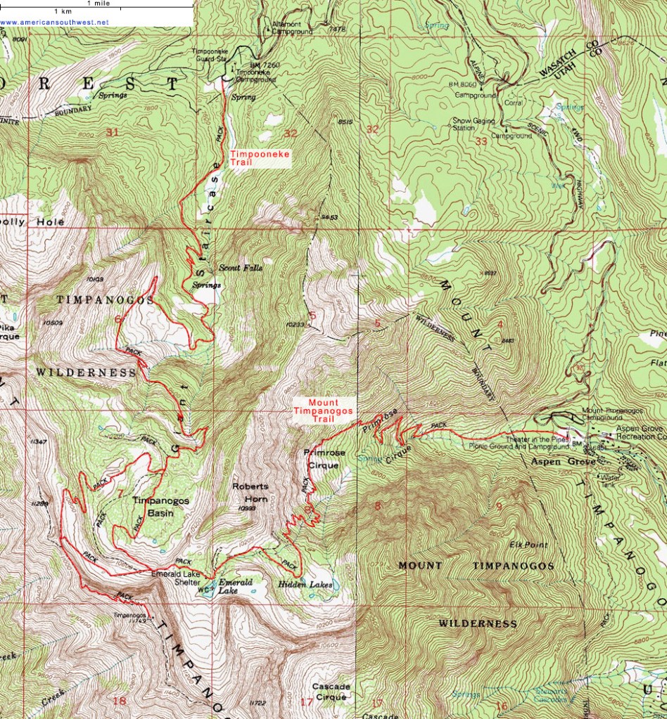
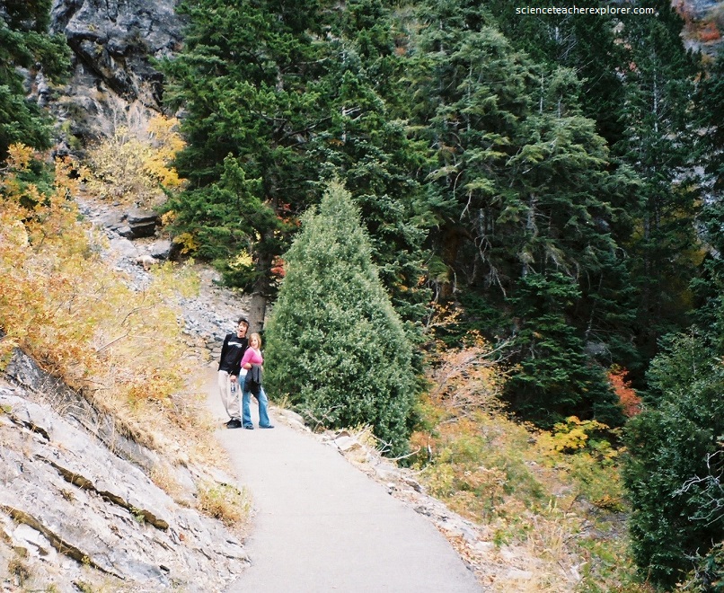
Mount Timpanogos is one of Utah’s most popular hiking/climbing destinations and is climbed year round. In spring, undercutting of deeply drifted snow by streams creates a hazard that has proven fatal on several occasions. Imaged above, there are two main trails to the top: the first starts at Aspen Grove with a trailhead elevation of 2,106 m, and the second starts at the Timpooneke campground in American Fork Canyon.
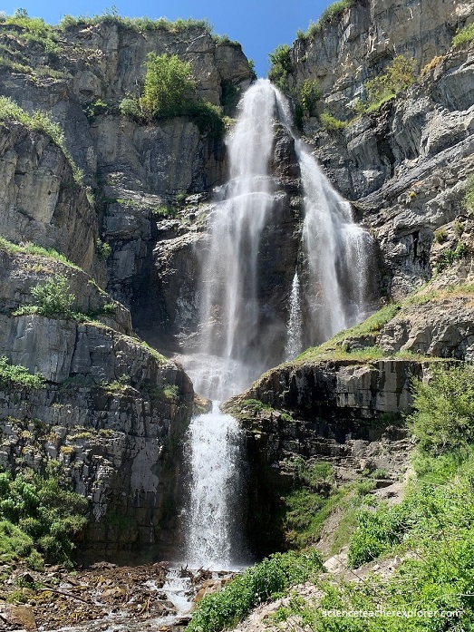
My 1984 ascent/descent took me through a montane forest, subalpine and alpine zones. This extreme hike was marked by waterfalls (pictured below), conifers, rocky slopes and ridges, snow-field, and a small Emerald Lake.
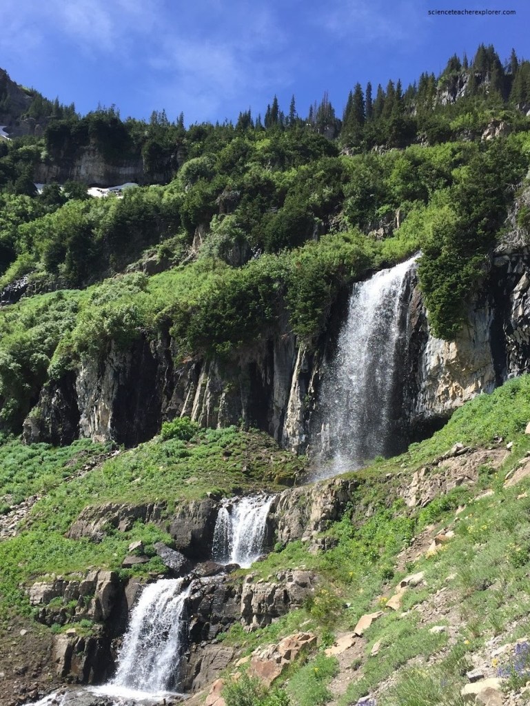
Additionally, in the Aspen Grove area, Stewart Falls is one of the most scenic and photogenic waterfalls in northern Utah. It falls in two tiers and is over 66 meters tall, (pictured below). It has its own trail with a moderate hike through a beautiful forest on the east side of Mount Timpanogos, starting in Aspen Grove near “Sundance Ski Resort”.
Pictured below, Timpanogos Mountain is also home to Timpanogos Cave National Monument, (a series of decorated caves in the north end of the mountain in that have guided ranger tours open daily to the public during the warmer months).
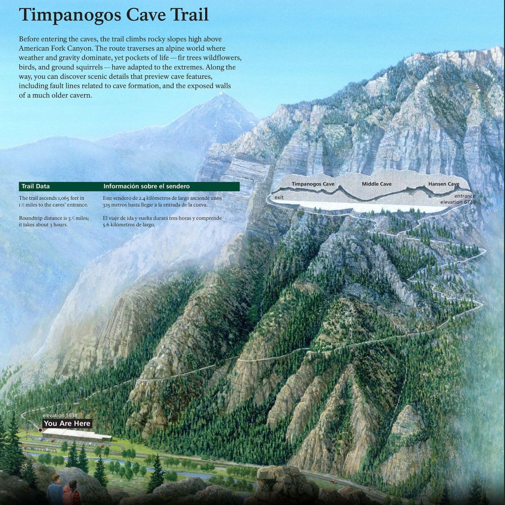
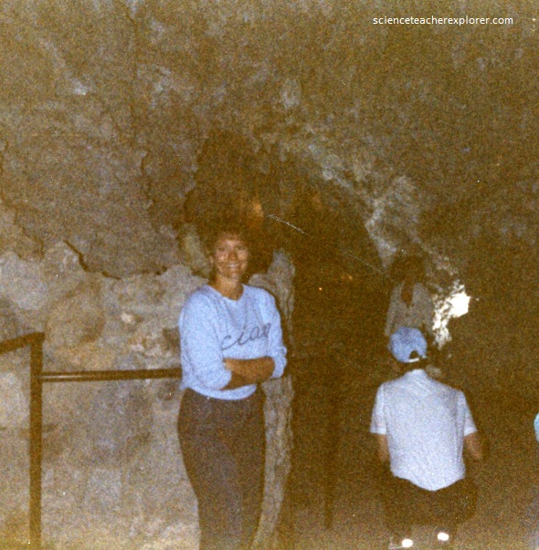
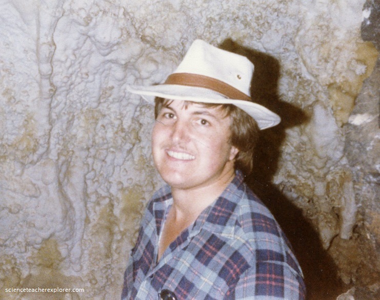
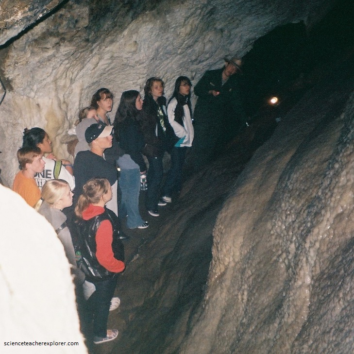
In the summer of 1984, Becky and I hiked the trail to the Timpanogos Cave in American Fork Canyon, (pictured below).
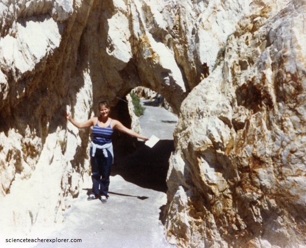
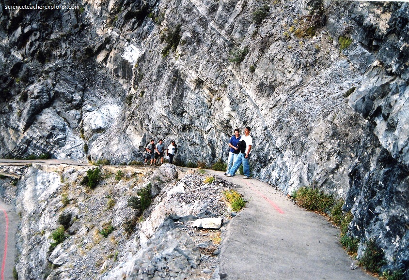
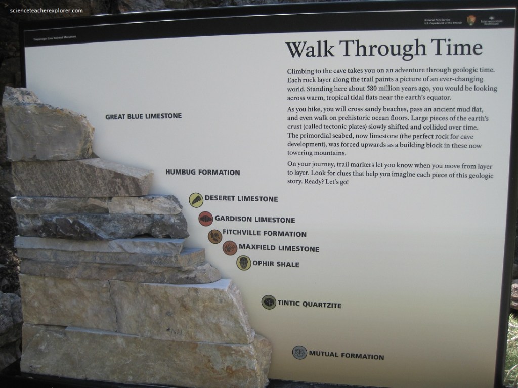
The Timpanogos Cave National Monument is managed by the National Park Service. Imaged above, the 2.4 km trail to the cave is steep, gaining close to 300 m, but paved and fairly wide, making the caves accessible to most.
The three caves of the system, one of which is specifically called Timpanogos Cave, are only viewable on guided tours with park rangers, when the monument is open, usually from May through September depending on snow conditions. Timpanogos Cave, Hansen Cave, and Middle Cave, now connected by man-made tunnels, lie near the west edge of the Wasatch Range in a geologically complicated area of intersecting faults and folds. These caves typify limestone caverns, having developed where groundwater, slightly acidified by absorption of carbon dioxide from air and soil, dissolved passages through cracked and faulted limestone.
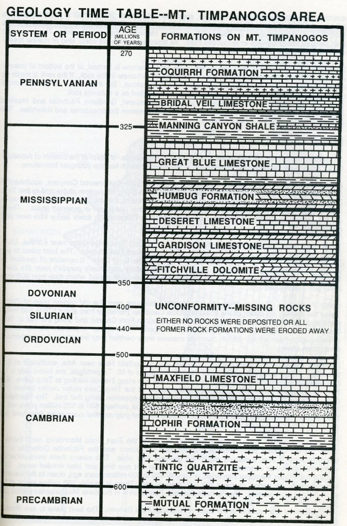
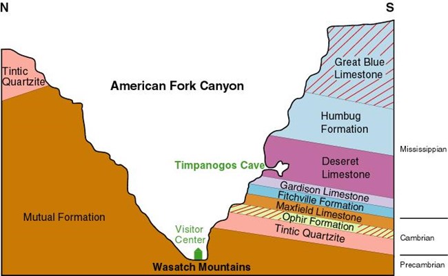
Pictured below, sedimentary rocks low in the walls of American Fork Canyon, (the Tintic Quartzite, Ophir Shale, and Maxfield Limestone), are part of a great blanket that stretched from Arizona into Canada in late Precambrian time, about a billion years ago.
Patterns of Precambrian deposition seem to have lasted into Paleozoic time. The equator then lay along the line of the present Wasatch Range, and for hundreds of millions of years the same line acted as a sort of hinge, with thick sedimentary strata characteristic of a deep-water basin deposited north of the equator (now) west) and thin sedimentary layers accumulating in shallow seas to the south (now east).
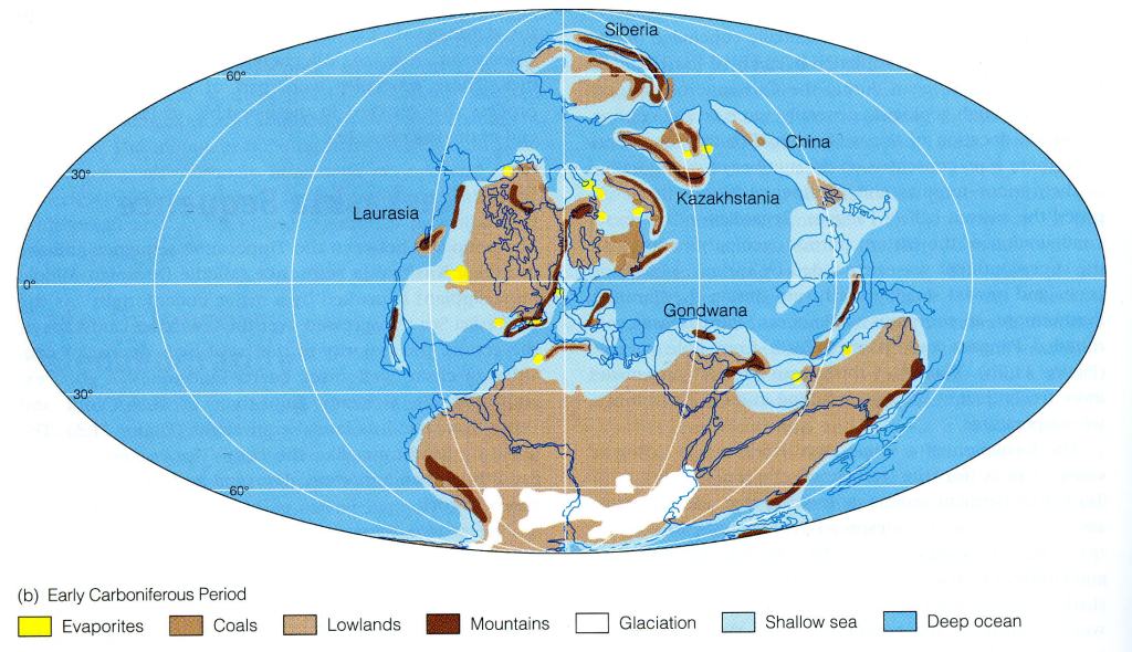
Imaged above and below, during the first part of the Paleozoic Era, the earth’s equator ran almost along the line of the present Wasatch Mountain front. Then there is a gap, (no record at all for the Ordovician, Devonian, and Silurian Periods). The region may well have been land, or what sediments were deposited were later eroded away.
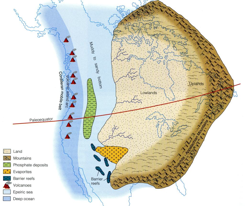
Imaged above, In Mississippian time, seas spread eastward again, and limestone layers formed from the accumulated shells of marine organisms, (thousands of meters thick in northwestern Utah).
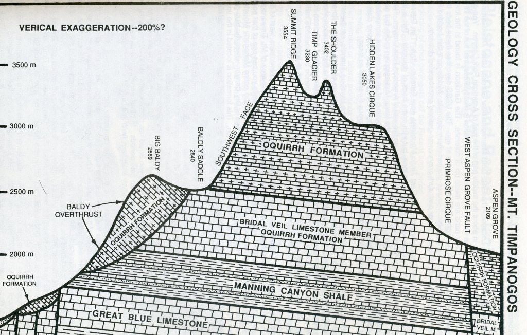
The Deseret Limestone, in which Timpanogos and it’s sister caves lie, is one of several Mississippian limestone formations recognized here.

Rocks younger than Mississippian do not occur within the monument area. We know from surrounding areas that mountains rose both east and west of Utah in late Paleozoic time. Gradually, too, the continent was rotating and drifting north. By the beginning of Mesozoic time, Utah was well north of the equator and only about 30 degrees awry relative to the present position of the poles.
Events of the Mesozoic Era involved uplift, erosion, and large-scale thrust faulting. A sheet of Precambrian and Paleozoic rocks slid perhaps perhaps 90 km from west to east across younger rock. Sedimentary strata outside the monument record a gradual change from shallow sea to delta and floodplain and then to sea again.
By the end of Cretaceous time and through the Eocene Epoch, westward drift of the continent led to folding and faulting and uplift once more of the Wasatch and Uinta Ranges in Utah. Later, crustal stretching between the Wasatch Mountains and the Sierra Nevada resulted in the fault block mountains of western Utah, Arizona, Nevada, and California. Uplift of the Wasatch-to-the Rockies region finally elevated the mountain states, mountains and all, about 1,500 meters.
In the Pleistocene time, (the last 3 million years), brought glaciation to the Wasatch Range as it did to other ranges of the Rockies and the northwest. Pictured above, American Fork Canyon, though never glaciated in its lower reaches, doubtless was influenced by the increases in snowmelt, ice-melt, and precipitation that accompanied the Ice Ages.
The abrupt face of the Wasatch Mountains and the steep, angular shape of the lower canyon indicate that this is a youthful mountain range, where lively streams have cut downward rather than swinging sideways, (pictured above). Steep rockslides on the north canyon wall are facilitated by the steeply sloping strata.
The cave system is located in the Deseret Limestone, a Mississippian age limestone formed around 340 million years ago. Notably the cave cavity was formed initially by a series of faults running off of the Wasatch fault. Since that time hydrothermal water action and uplift of the Wasatch Mountains has formed the modern cave system.
The speleothems first started to form within the last 750,000 years, based on paleomagnetism of iron deposits within the formations, as the cave system has been slowly lifted above the unnamed stream that flows though the canyon (and becomes the American Fork river at the mouth of the canyon).
The Timpanogos Caves typify limestone caverns, having developed where groundwater, slightly acidified by absorption of carbon dioxide from air and soil, dissolved passages through cracked and faulted limestone. The massive layer in which the caves have formed is steeply tilted and is part of the southern flank of a large fault-edged anticline, cored with granite, that crosses the north-south trend of the Wasatch Range.

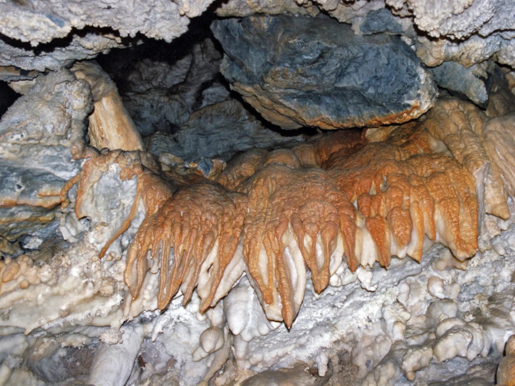
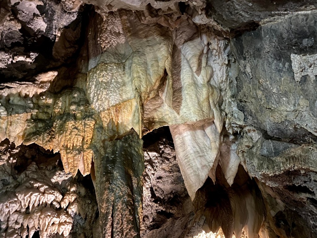
Solution of limestone caverns occurs most readily at and below the water table, where all the pore spaces, joints, and other openings in the rock are filled with water. Scientists fell sure that the Timpanogos caves formed at a time when the canyon of American Fork River was no deeper than the level of the present caves. As the river cut deeper, the water table dropped below cave level and solution ceased. But seeping groundwater derived from rain and melted snow still entered the cave, dripping from its ceilings, sheeting down its walls, and collecting in low spots as cave pools. As it percolated through overlying limestone layers, the water became saturated with calcium carbonate. In the caves it redeposited its calcium carbonate as calcite crusts and cave ornaments, (stalactites, stalagmites, cave popcorn, draperies, and strange curling helictites, (pictured below).
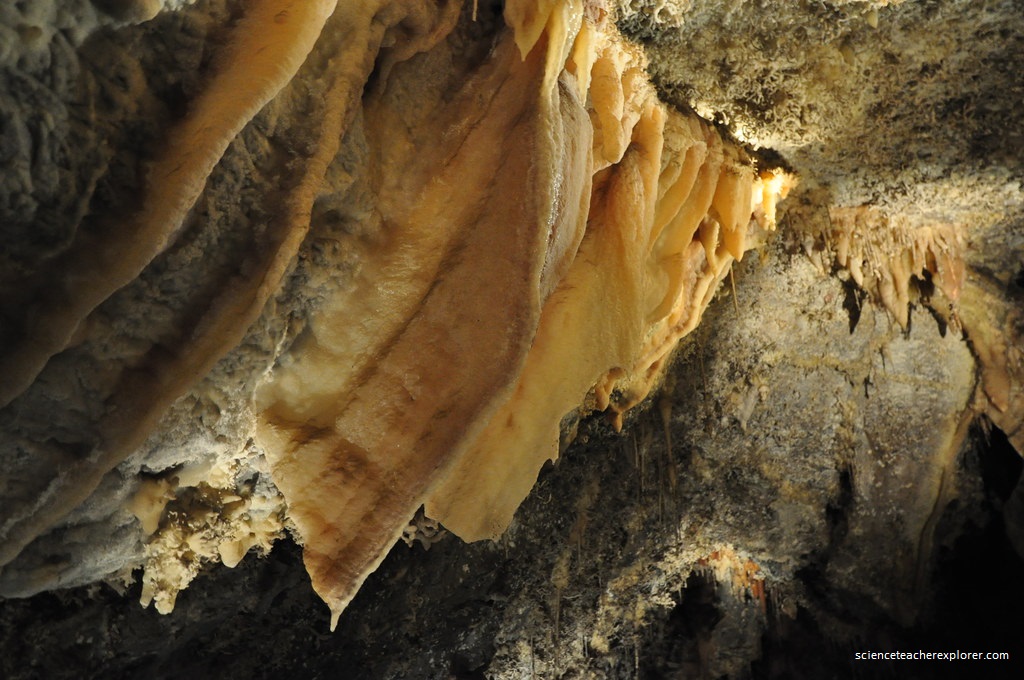
Pictured below, the helictites makes the Timpanogos Cave famous. Their twisted curlicues seem at odds with the vertical patterns of stalactites, stalagmites and draperies. They are thought to develop when thin layers of fine crystalline calcite coat cave surfaces in such a way as to seal the rock, so that water seeping into rock pore spaces cannot escape into the cave. Behind this thin dam, water accumulates and water pressure increases. Then, in places, the pressure pushes out tiny fragments of the calcite coating. Once the dam is breached, successive layers of newly formed crystals are pushed out at the same spots. Because the crystals may be wedge shaped, the growing helictites curve and curl, responding more to water pressure and crystal shape than to gravity.
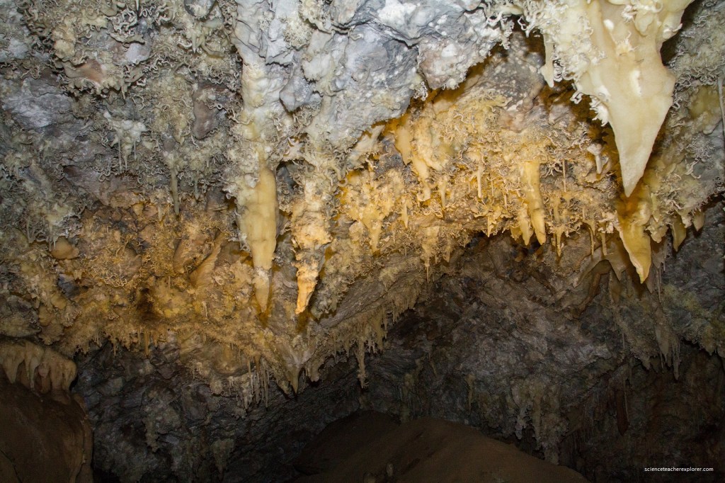
Cave ornamentation is still going on in the Timpanogos Caves. Cave surfaces are wet and dripping, with every drop adding a tiny bit of calcite to the ornaments.

Pictured below, an unusual feature of the Timpanogos Cave National Monument is the variety of color in the ornaments, (delicate tints of pink and yellow, green and tan. The colors are due to minute amounts of other minerals in the calcite. Iron and manganese oxides create buff and pink, lemon yellow is due to nickel, and green tones are a nickel-magnesium silicate. [Don’t confuse the green algae that grow near the electric lights with the green tint in the rocks].
The three caves at Timpanogos Cave National Monument, lie in an almost straight line along a fault zone that cuts northeastward through the mountain. I always point out the fault surfaces in the caves. Movement along the fault varies from about 30 meters in Hansen Cave to 40 meters in Timpanogos Caves.
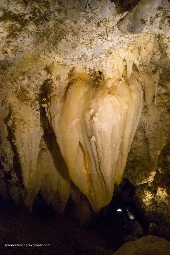
Pictured below, the famous 2-ton “Heart” of Timpanogos Cave hangs from a ceiling intricately decorated with twisting helictites. The Heart is nearly 2 meters long.
Pictured below, further up American Fork Canyon, I found one of the most beautiful viewpoints in Utah. Silver Lake, (artificial), gave me a truly spectacular photo shot I’ve rarely seen. Enjoy!