Chattahoochee N.F., GA
In August of 2023, Becky and I flew to Georgia to trek and explore part of the Blue Ridge Mountains called the Chattahoochee National Forest.
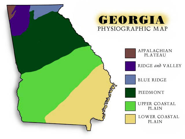
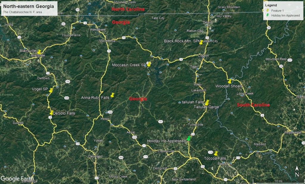
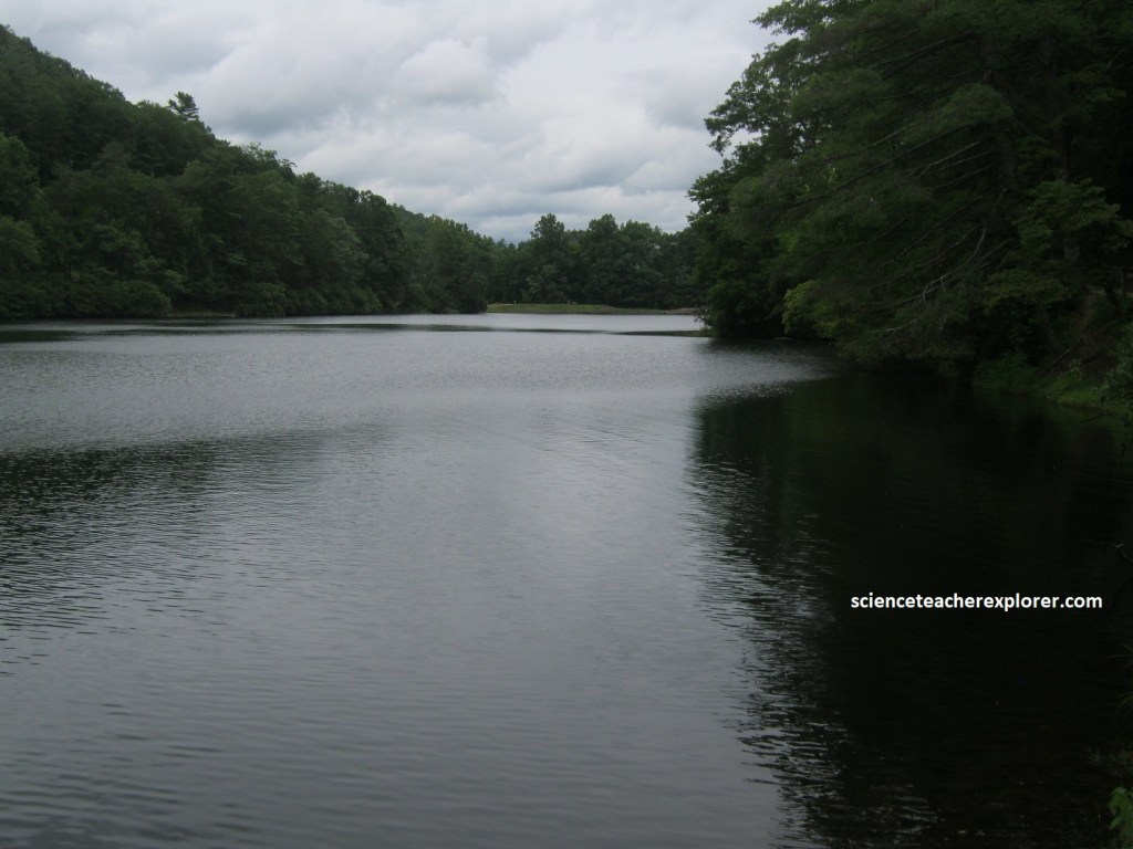
The Chattahoochee National Forest is located in the mountainous region of northeastern Georgia. We took flight to Atlanta, Georgia. From there we rented a car and drove northeast on Interstate 985 to Gainesville, Georgia.
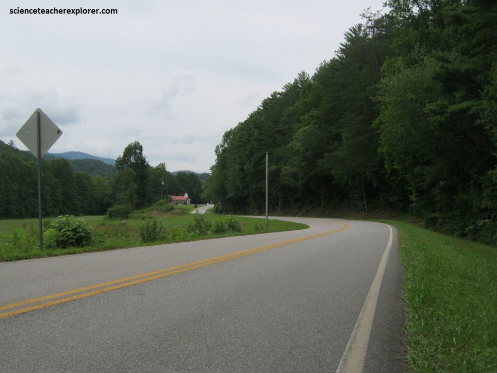
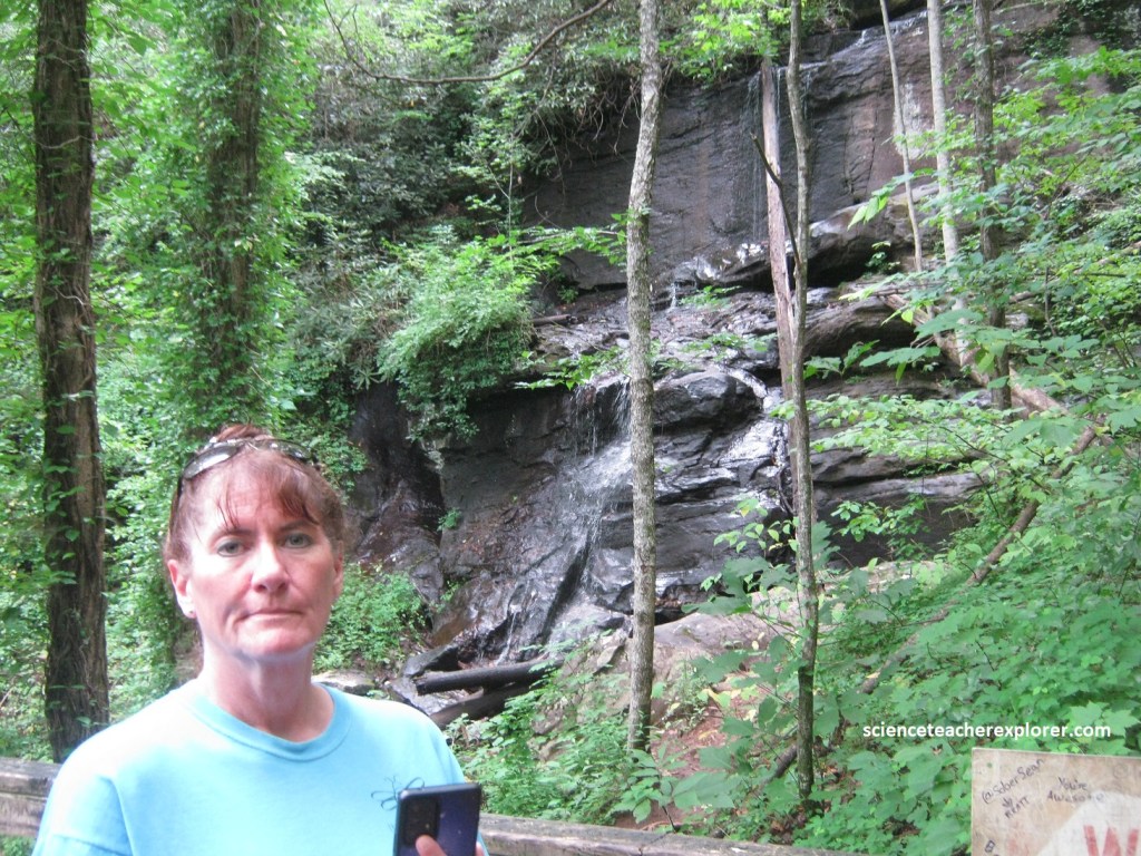
From Gainesville, we continued driving on US 23 to Hollywood, Georgia, (Appleseed Holiday Inn); where we stayed for a few days. Our first trekking destination was Toccoa Falls on County Road Alt. GA17, southeast of Hollywood.
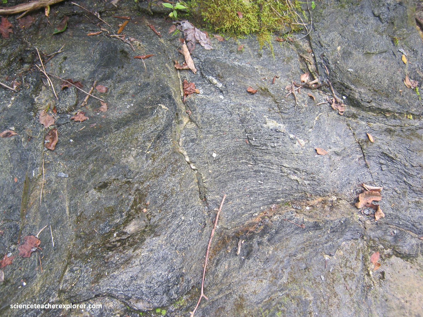
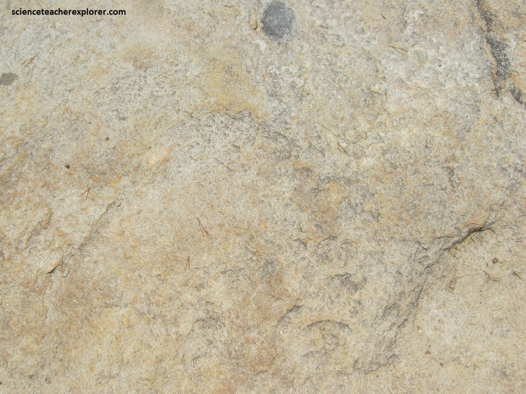
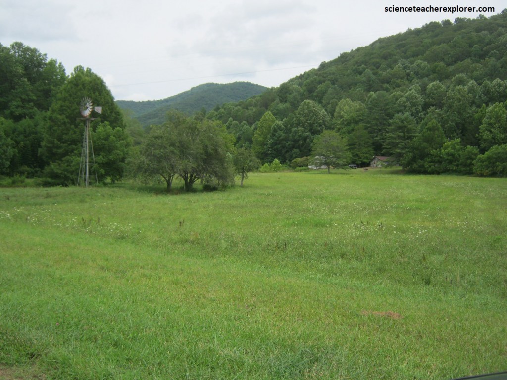
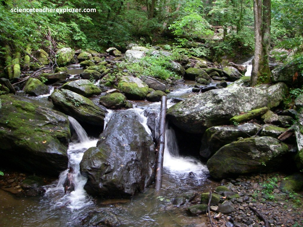
Alt GA 17 passes the Toccoa Reservoir and begins descending an escarpment about 13 km south of US 23 and 5 km north of Toccoa. Erosion resistant metagraywacke and quartzite underlie the higher elevations to the north. Whereas less-resistant amphibolite underlies the low ground to the south, (pictured below-left is the metagraywacke-quartzite and below-right is the amphibolite).
Southeastward-flowing streams, such as Toccoa Creek, have eroded head-ward into the resistant rock, (quartzite), and captured streams at the top of the escarpment that formerly flowed toward the Chattahoochee.
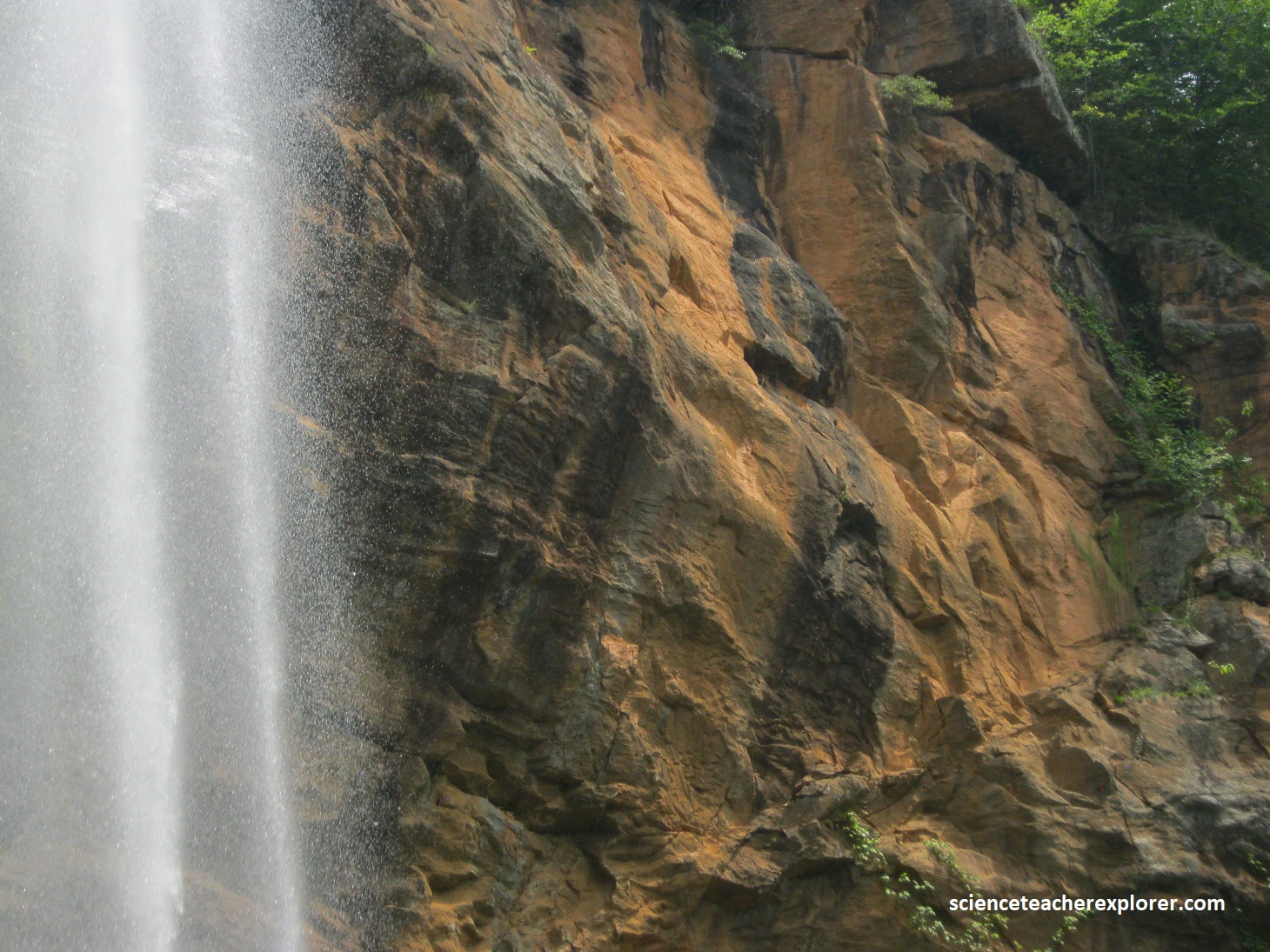
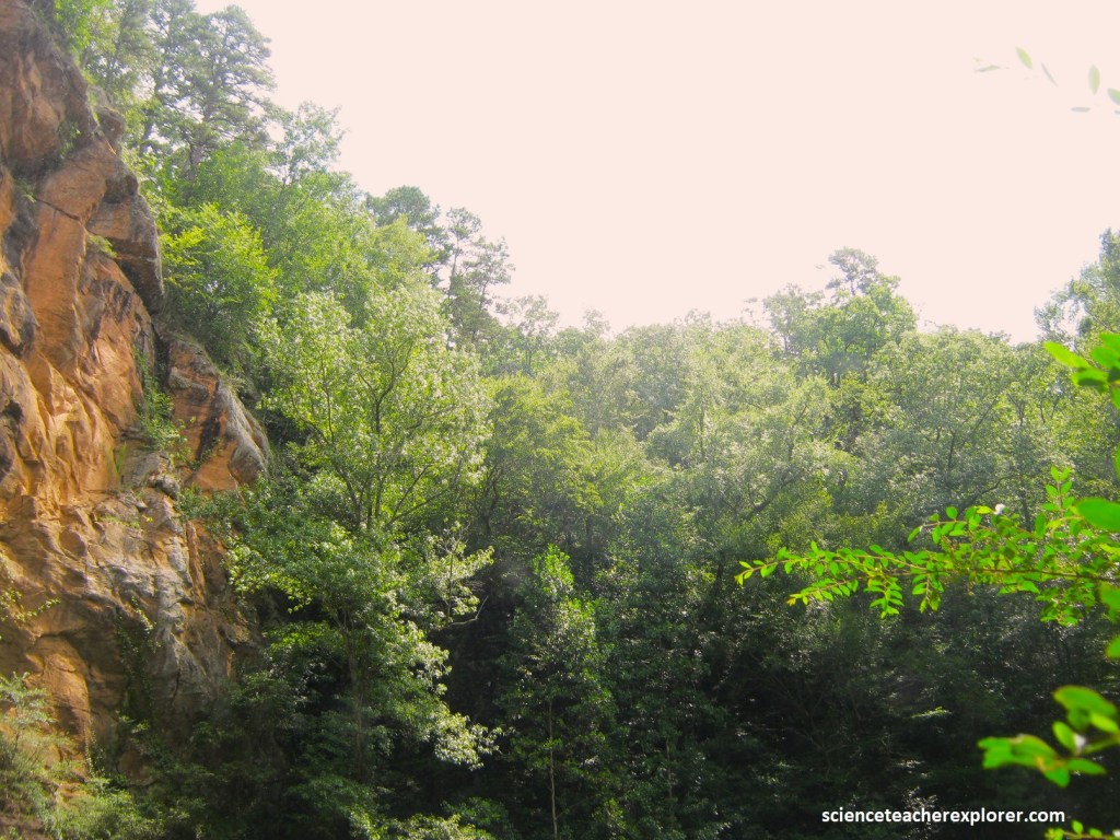
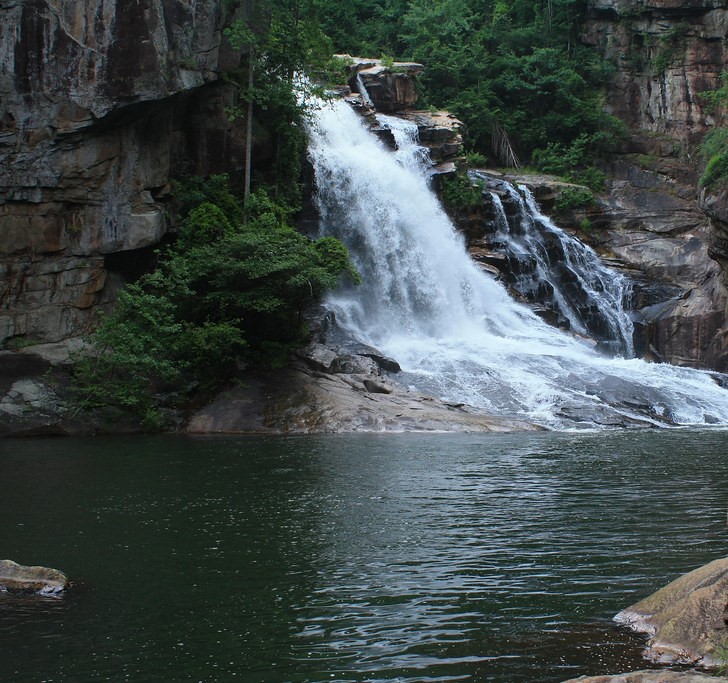
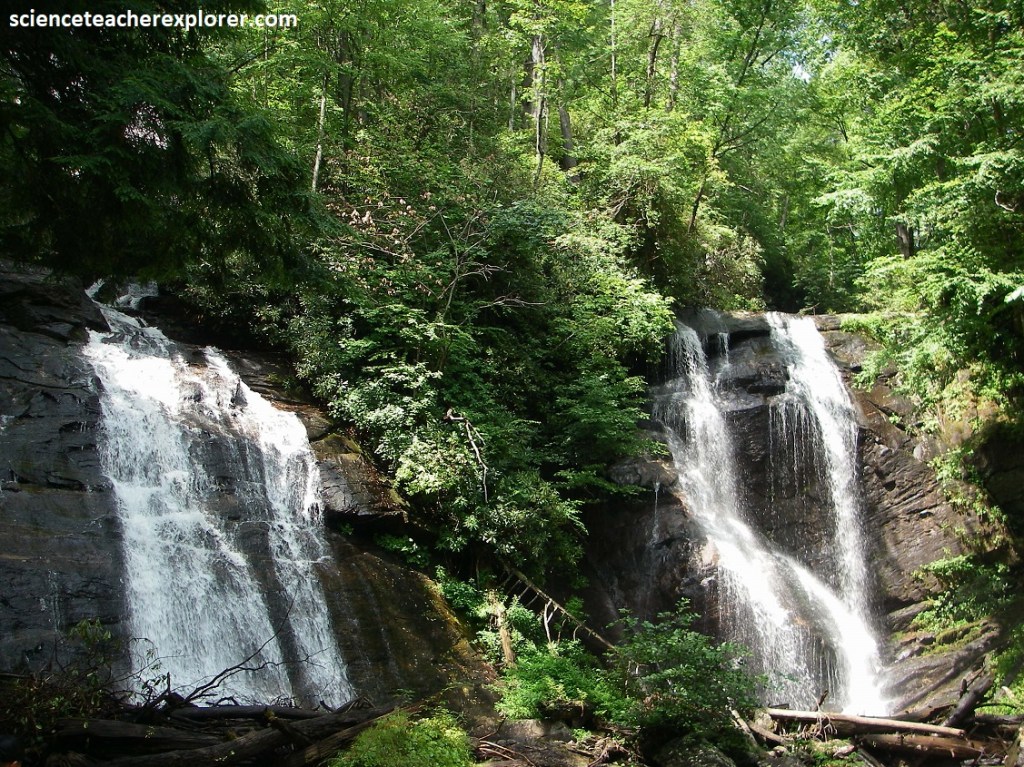
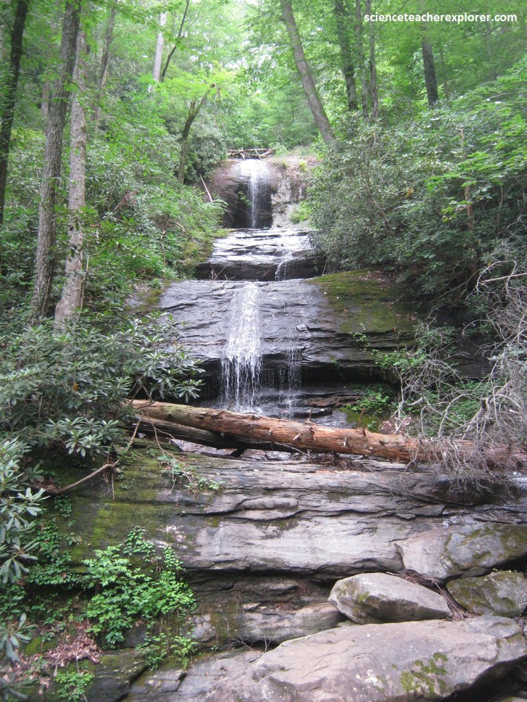
The increased streamflow, resulting from the captured stream basin, is part of the reason why Toccoa Falls is one of Georgia’s scenic attractions, (imaged below).
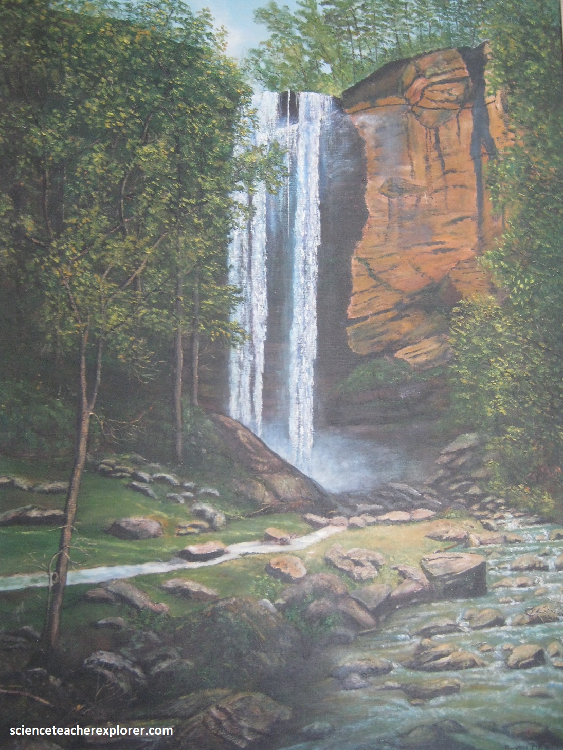
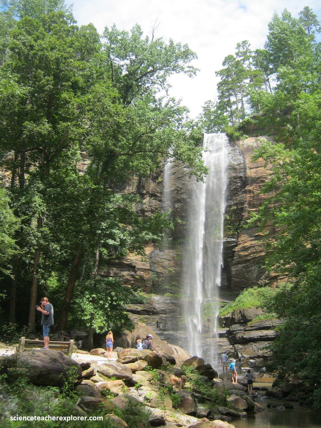
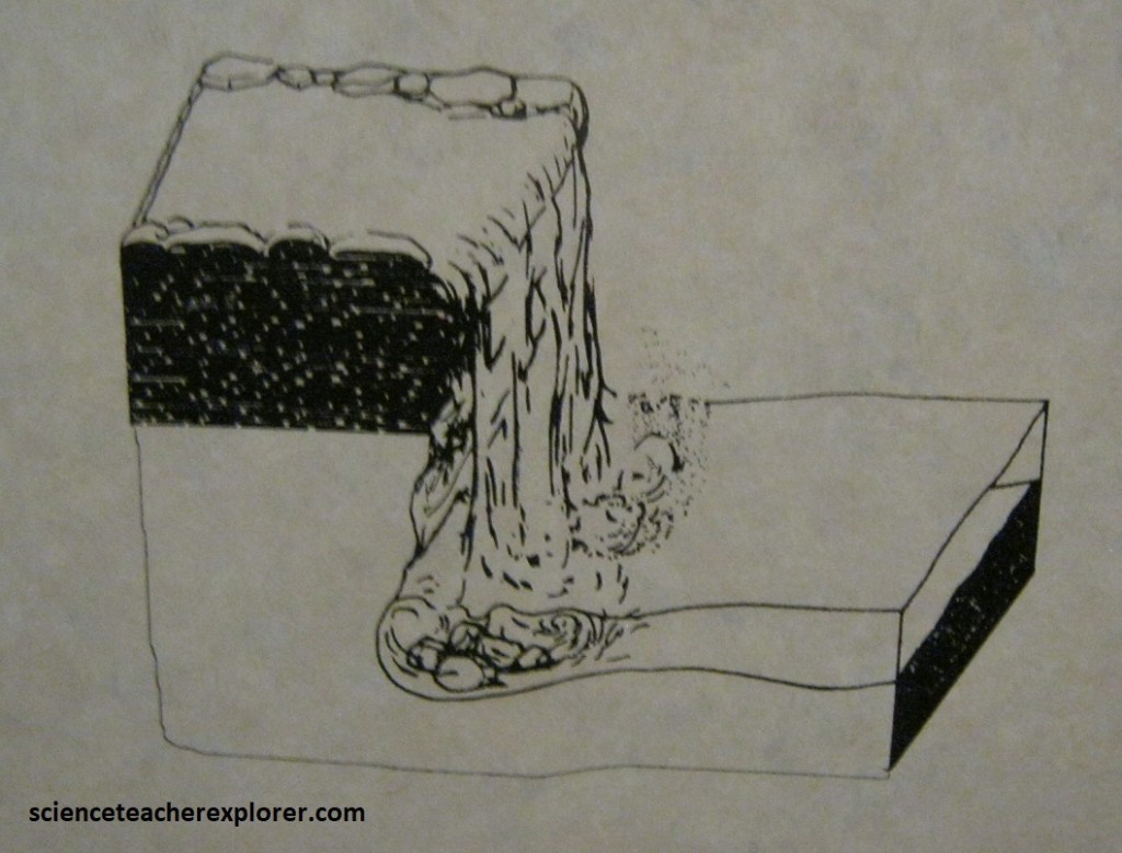
Pictured above, Toccoa Falls, just northwest of Toccoa, is one of Georgia’s most accessible waterfalls, (artist depiction of the falls on the left and Becky studying a map below the falls on the right). It is also one of the most beautiful because of its 62m sheer drop over a ledge of metagraywacke and biotite gneiss to less resistant amphibolite below, (pictured below). A 67m long pathway led to the falls.
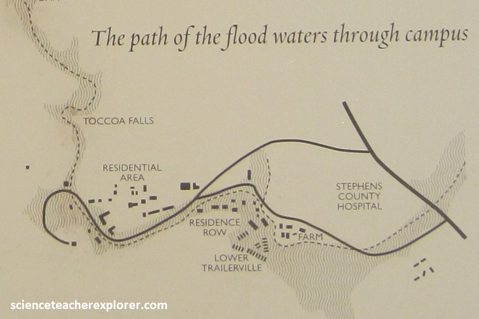
Toccoa Falls was also the site of a tragedy in 1977, in which an earthen dam above the falls, built in 1899 to provide hydroelectric power to the Toccoa Falls College, broke after heavy rains.
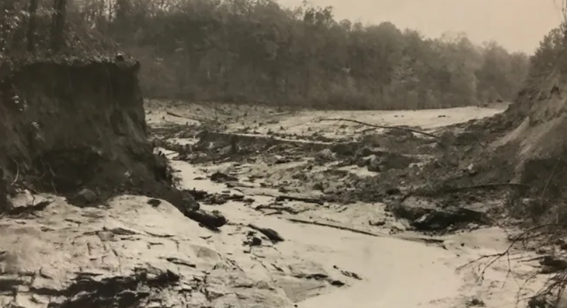
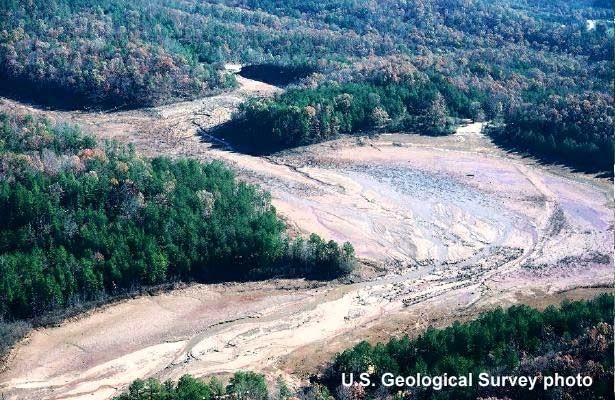
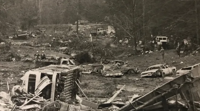
[Pictured above are public domain images (from the USGS), of the results of the 1977 dam-failure at Toccoa Falls, Georgia]
The resulting Toccoa Falls flood killed 39 people associated with the college, who are remembered in a memorial at the base of the falls.
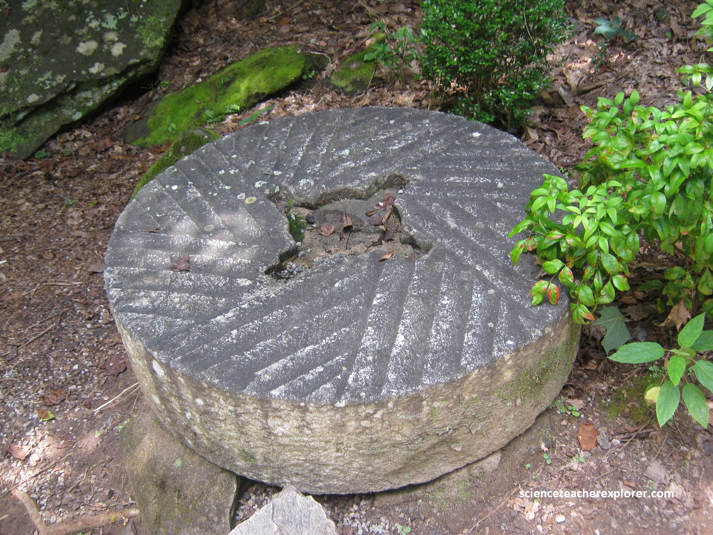
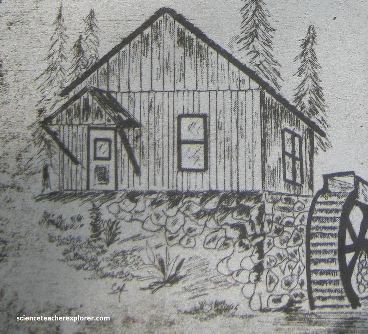
Pictured above, this millstone also lost in the flood of 1977. It was from a water-powered gristmill above the falls. Local businessman, Pinckney Heaton, operated the gristmill in the 1890s. The mill would grind different gains such as wheat, rye, oats, corn, or barley to produce flour or meal. However, the mill was washed away in flooding from heavy rains in 1899 that destroyed a number of mills along Toccoa Creek. The millstone was incorporated in landscaping the falls area in 1970. In 2008 the millstone was finally recovered in Toccoa Creek.
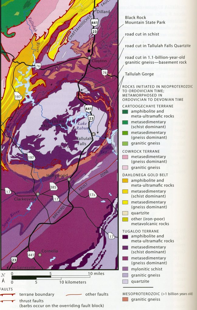
From Hollywood, Becky and I continued driving north up US 23 to Tallulah Gorge State Park. Along the way, US 23 passes onto the Tallulah Falls Dome. Images above, on the geologic map, the dome forms an oval about 27 km long and 18 km wide. Layers of rock around the margins of the oval seem to double back in an intricate maze, like the edges of leaves in a sliced head of cabbage. Notice that surrounding the quartzite dome is a ring of basement granitic-gneiss that lies under the quartzite and older. This rock has been radiometrically dated at 1.1 billion years.
Pictured above, Tallulah Falls Quartzite underlies much of the dome. It is more resistant to erosion than the surrounding rocks and forms the mountainous topography surrounding the town of Tallulah Falls.
This quartzite is a salmon colored rock, with little obvious layering, cut by whit pegmatite dikes, about 10cm thick. The quartzite was once sand deposited along a coastline as rising sea-level gradually flooded the deeply eroded, old landmass Laurentia (the basement rocks of granitic gneiss). The sand later became quartz sandstone, then metamorphic quartzite. The Tallulah Falls Dome example is a bit unusual because the basement rock layer is only 100m thick and occurs around the edge of a much thicker body of quartzite. Usually it is reversed. However, it may be that only a sliver of basement was brought to the surface on a thrust fault.
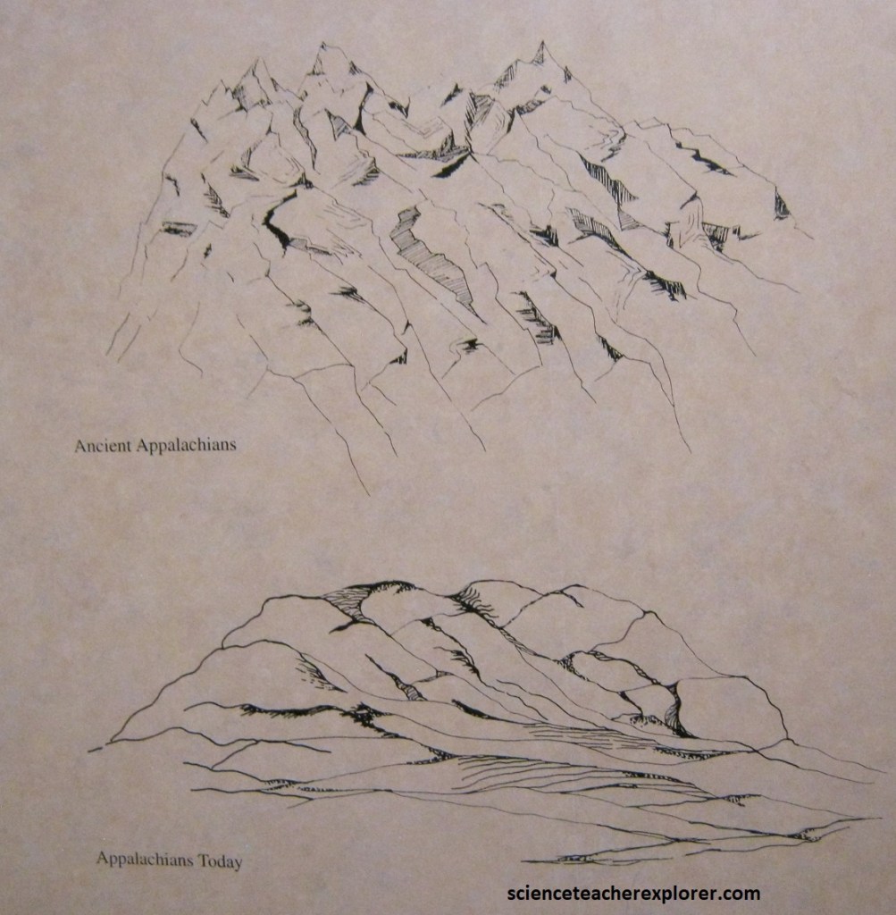
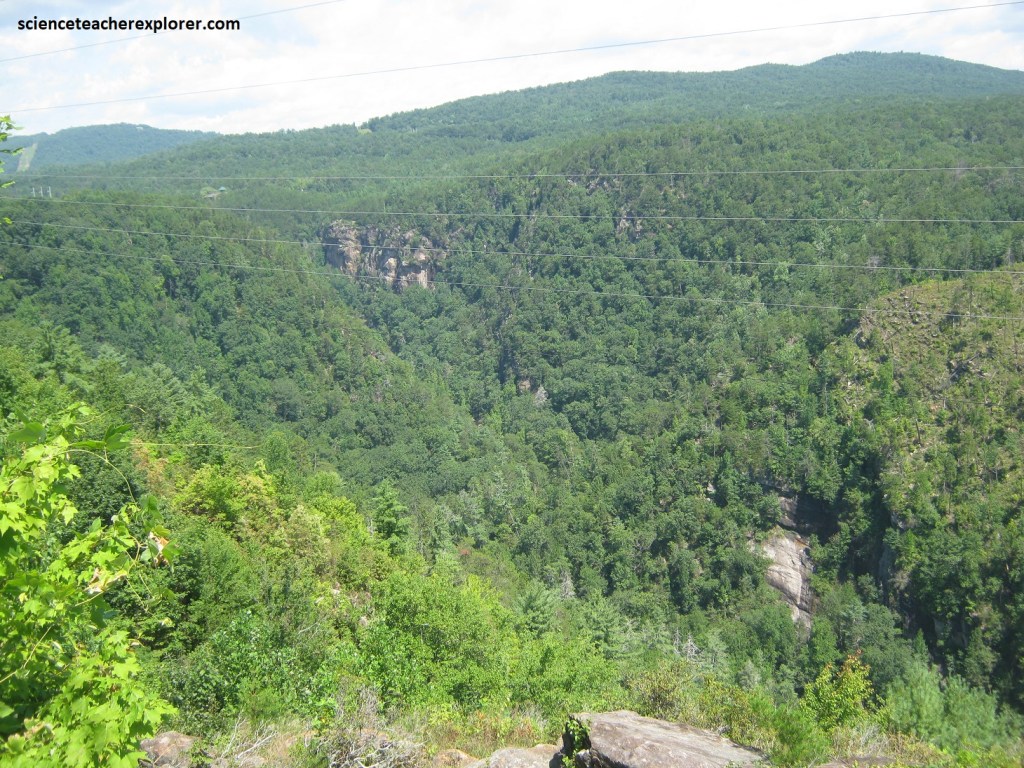
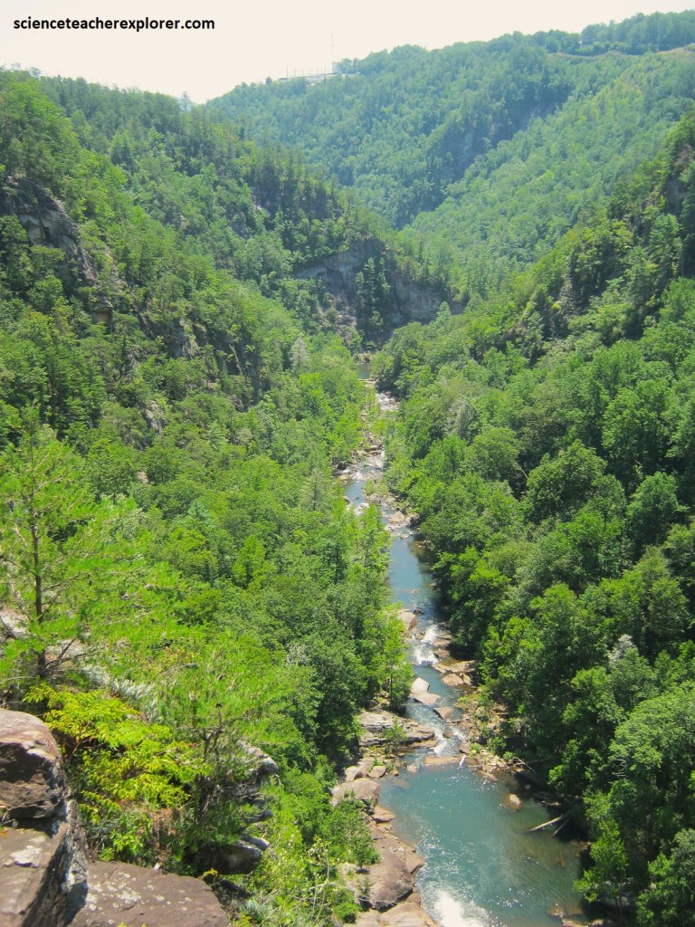
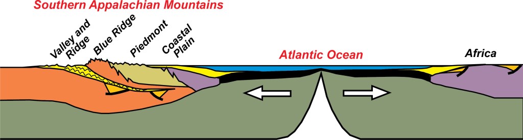
Imaged above, Tallulah Gorge is on the eastern edge of the southern Appalachian Mountains. Rounded and furrowed by time to barely 2 km high, the Appalachians are now the smallest and oldest of the great mountain chains in North America. [Note: when young, the Appalachian Mountains rose to nearly three times their present size and were higher than the Rockies are today. Nearly 3km of mountain tops have eroded from the southern Appalachians. This action built the coastal plain and continental shelf of the southeastern United States].
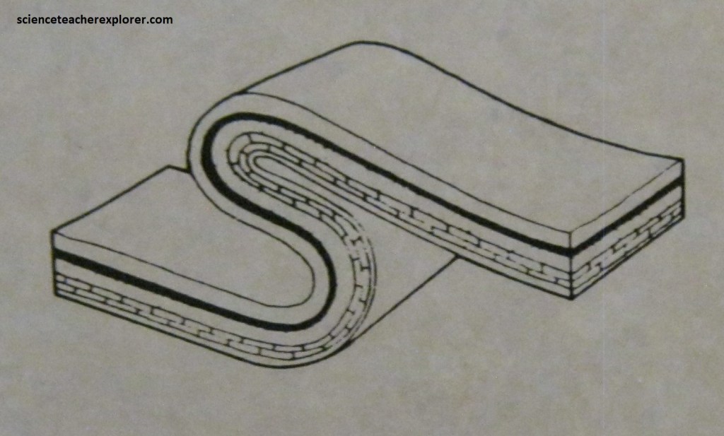
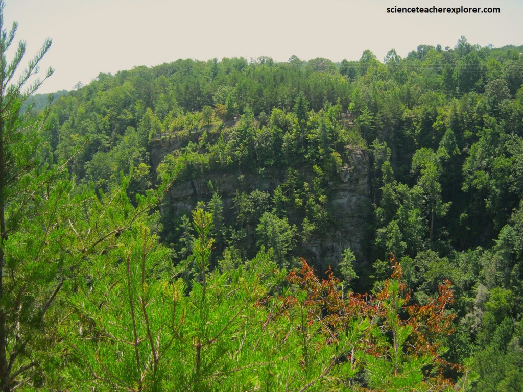
Imaged above, as the Appalachian Mountains rose, the quartzite and surrounding rocks were thrust forward and folded over themselves. This folding process resulted in a formation called the Tallulah Dome. Great contortions of land can be seen in the tilted rock layers throughout the gorge, evidence of powerful geological forces.
Pictured above, the Tallulah, strengthened by its decent into the Savannah, cut more deeply into the quartzite, (carving the gorge with greater speed). Waterfalls became a major way the river cut the gorge. A waterfall moves backward by undermining the caprock (rock surface of a riverbed) which eventually collapses, and the process starts over.
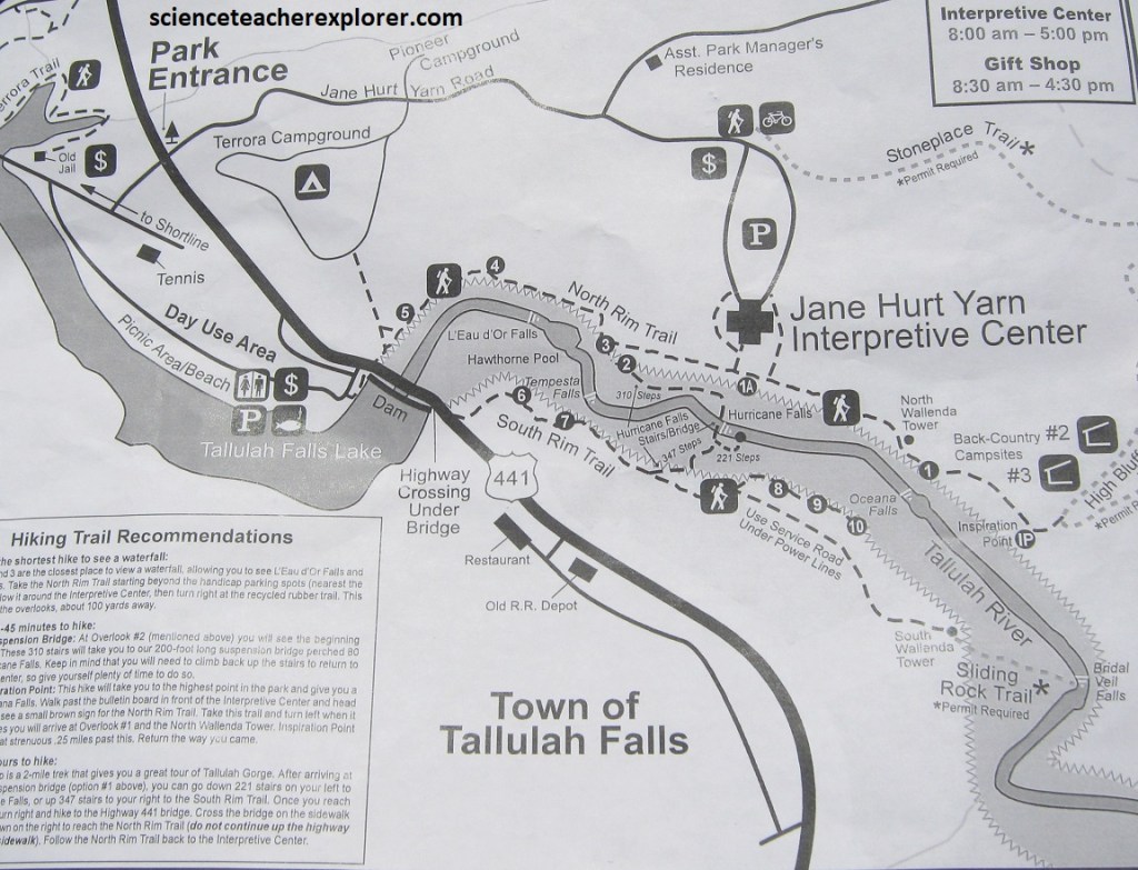
Image above, the entrance to Tallulah Gorge State Park is on the east side of US23, 17 km south of Clayton. The Jane Hurt Yarn Interpretive Center, with trail access to overlooks and displays on geology, ecology, and history, is 1.6 km from US23.
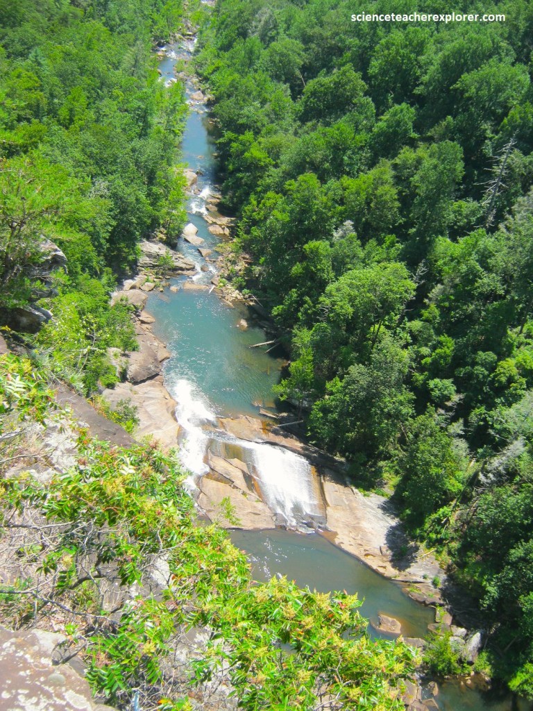
Pictured above, Tallulah Gorge is the 4th-deepest canyon east of the Rocky Mountains, (200m deep as measured from the rim overlooks to the deepest part of the gorge). The gorge is only about 330m wide for much of its length, so narrow that it has twice, (1886 & 1970), been the setting for a tightrope walk. Additionally, Tallulah Gorge has steeper slopes than any of the other 3 deeper eastern canyons.
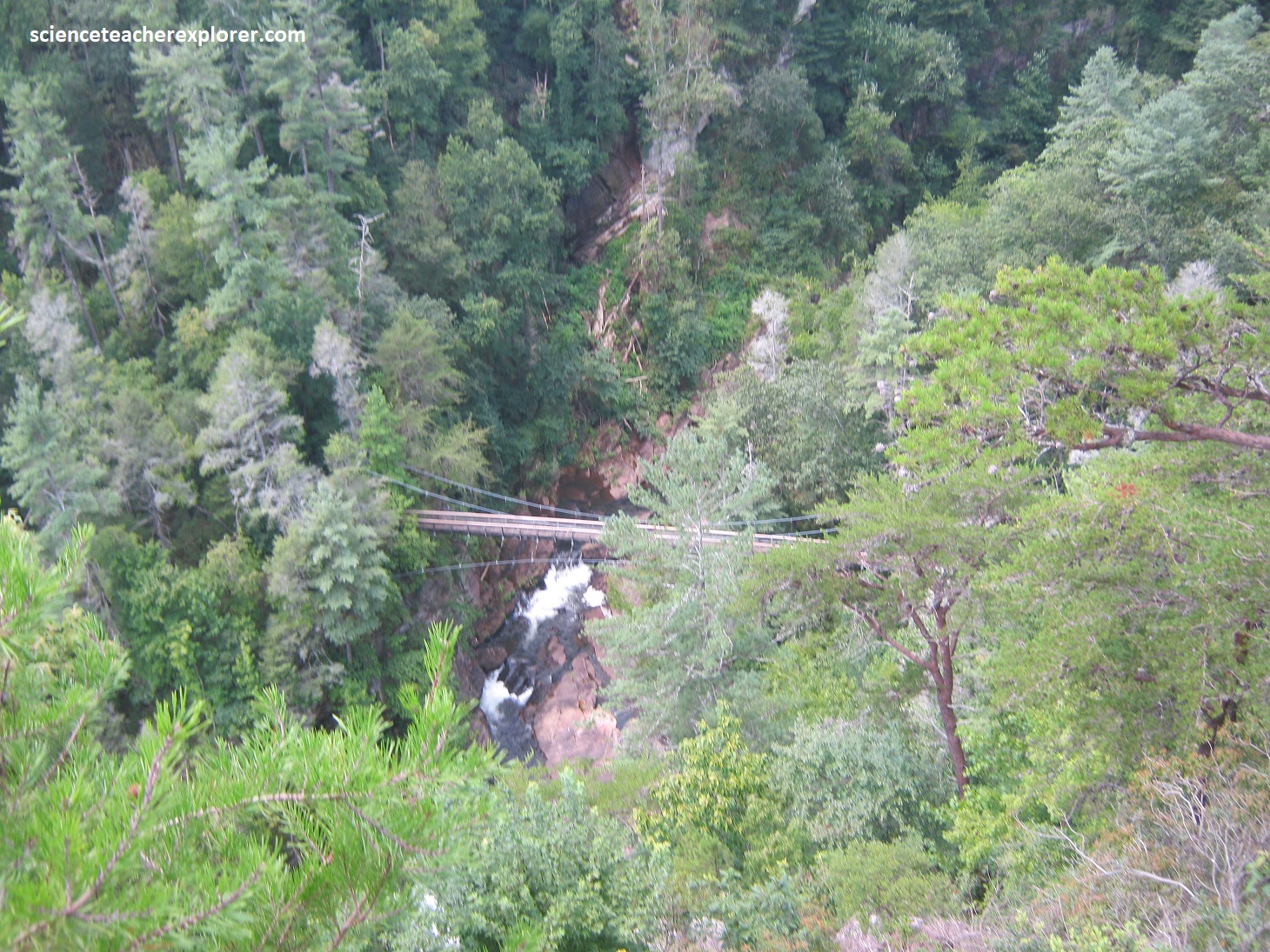
Overlooks, by the interpretive center, provide a view of 2 waterfalls and access to a staircase that leads to the bottom of the gorge, which is about 117m below. Pictured above, spectacular views reward descent into the gorge, where a swinging bridge crosses the river just above Hurricane Falls. The rocks exposed in the canyon are all Tallulah Falls Quartzite, and the 5 waterfalls flow over especially resistant quartzite ledges.
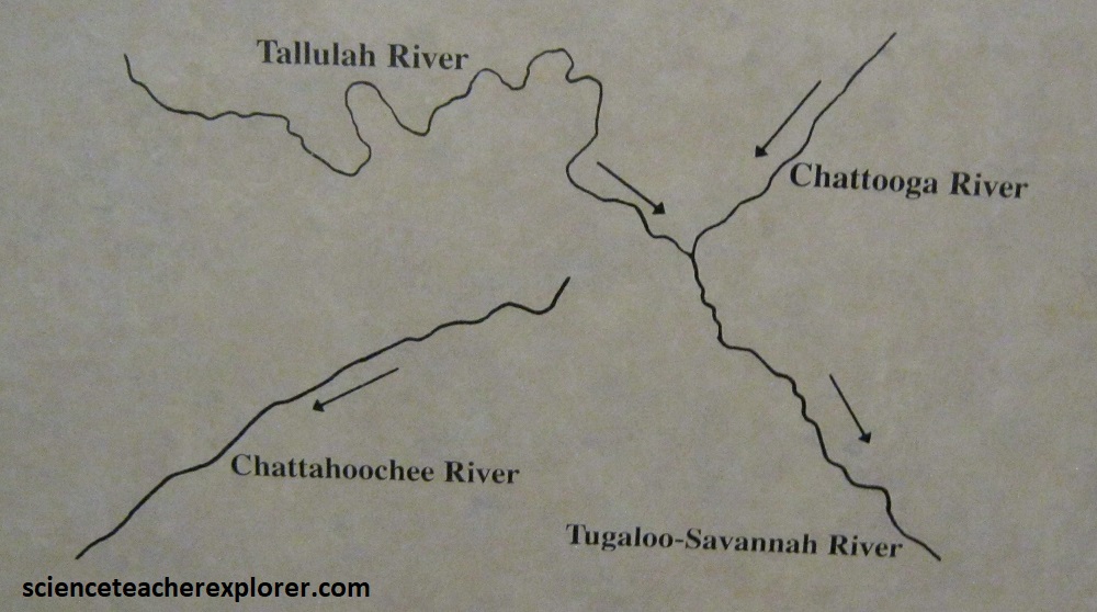
Pictured above, the exceptional narrowness of Tallulah Gorge and the steepness of its walls suggest that the gorge was cut relatively recently. The steep-walled gorge is likely the result of a stream capture event. The Chattahoochee River basin and the Gulf of Mexico would have been the previous recipients of the waters of both the Tallulah and Chattooga rivers, (imaged below).
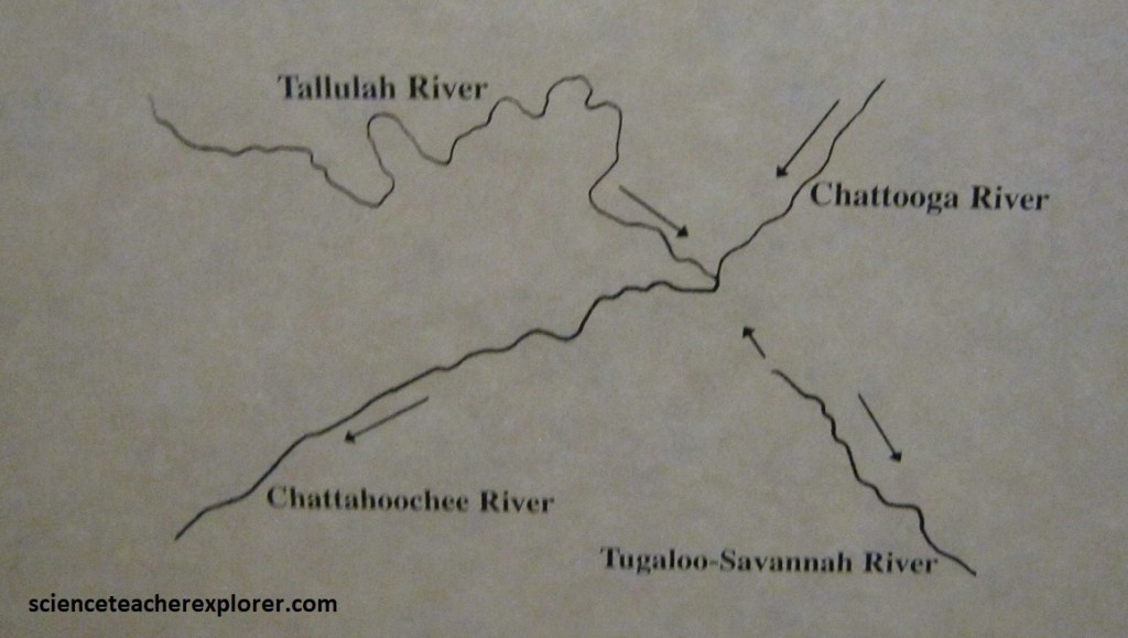
Pictured below, at some point, the Tugaloo River to the south, which flows toward the Atlantic, eroded through a ridge separating it from the Chattooga and Tallulah rivers and captured their flows. These rivers began to erode their streambeds down to the level of the Tugaloo, a process that is still going on, and the Tallulah carved its gorge.
From Tallulah Falls, Becky and I continued driving north on US23, through Clayton to the Georgia/North Carolina border. About 3 km north of Clayton, US 23 passes into darker metasedimentary rocks for which the 1214m Black Rock Mountain is named. Black Rock Mountain State park is Georgia’s highest state park, (imaged below).
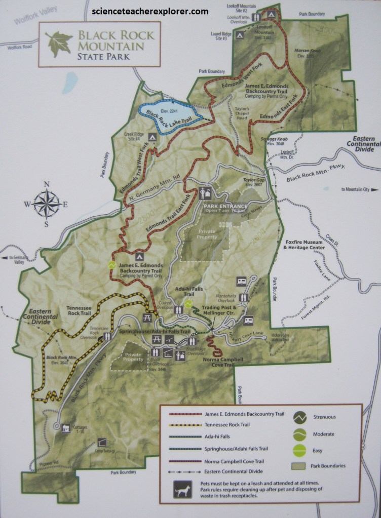
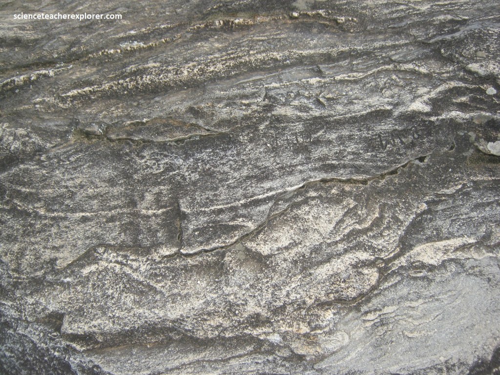
Pictured below, we could see an outcrop of biotite gneiss, showing the effects of multiple folding episodes, at Black Rock Overlook, adjacent to the visitor center.
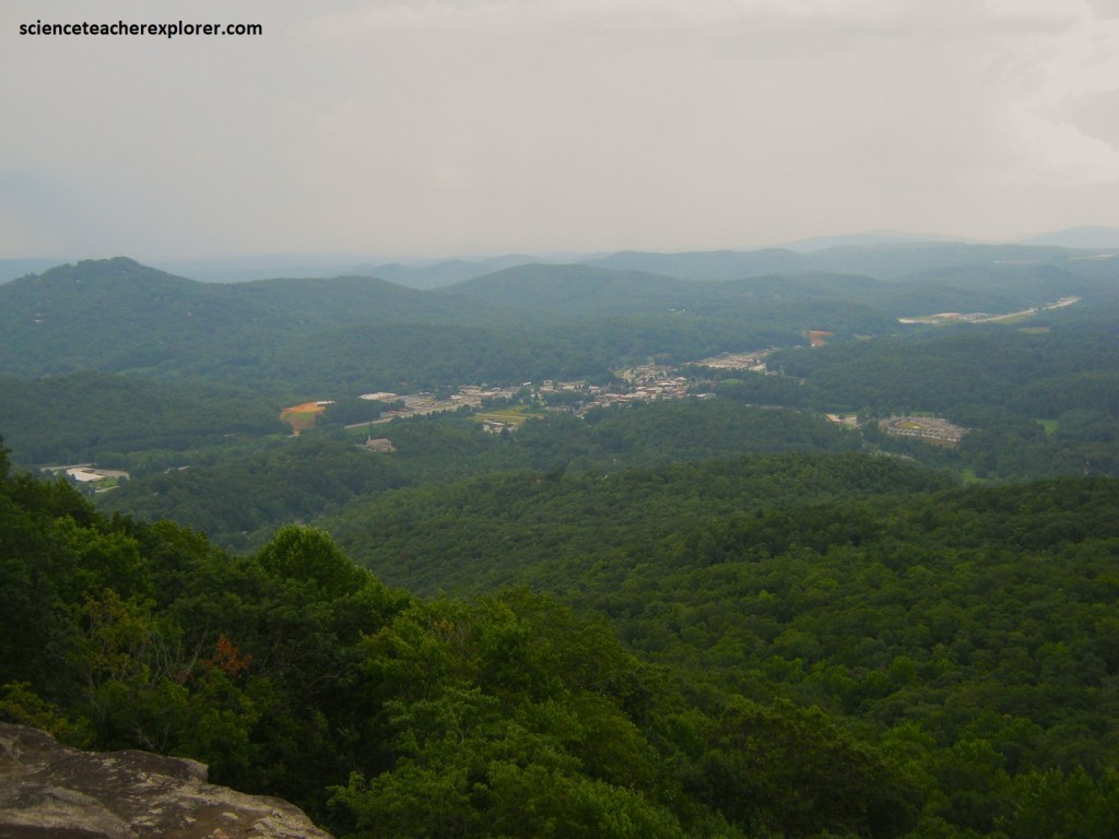
Pictured below, we could also see the drainage basin of the Tallulah River, nearly 500m below, directing water to the Atlantic Ocean.
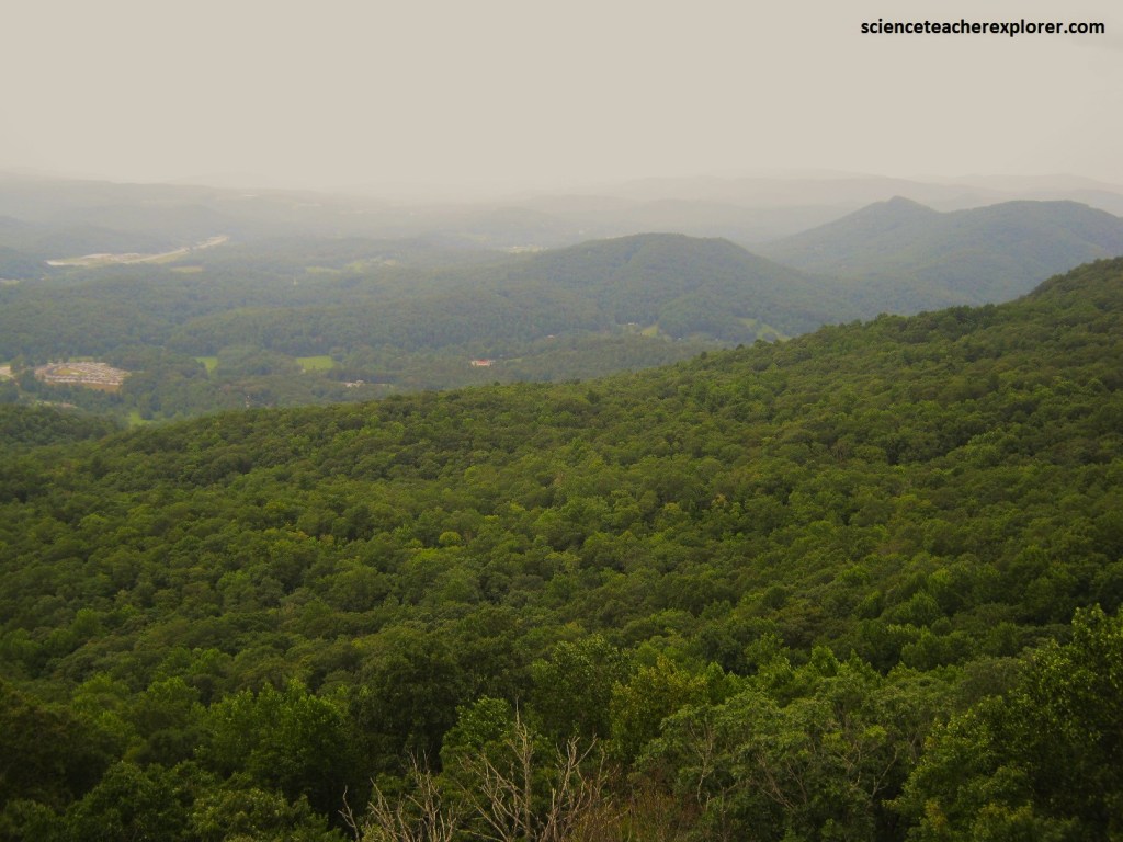
Pictured below, the paved road in the park follows the Eastern Continental Divide, and only a 30m to the north, waters flow down a more gradual slope toward the Little Tennessee River, and ultimately the Gulf of Mexico.
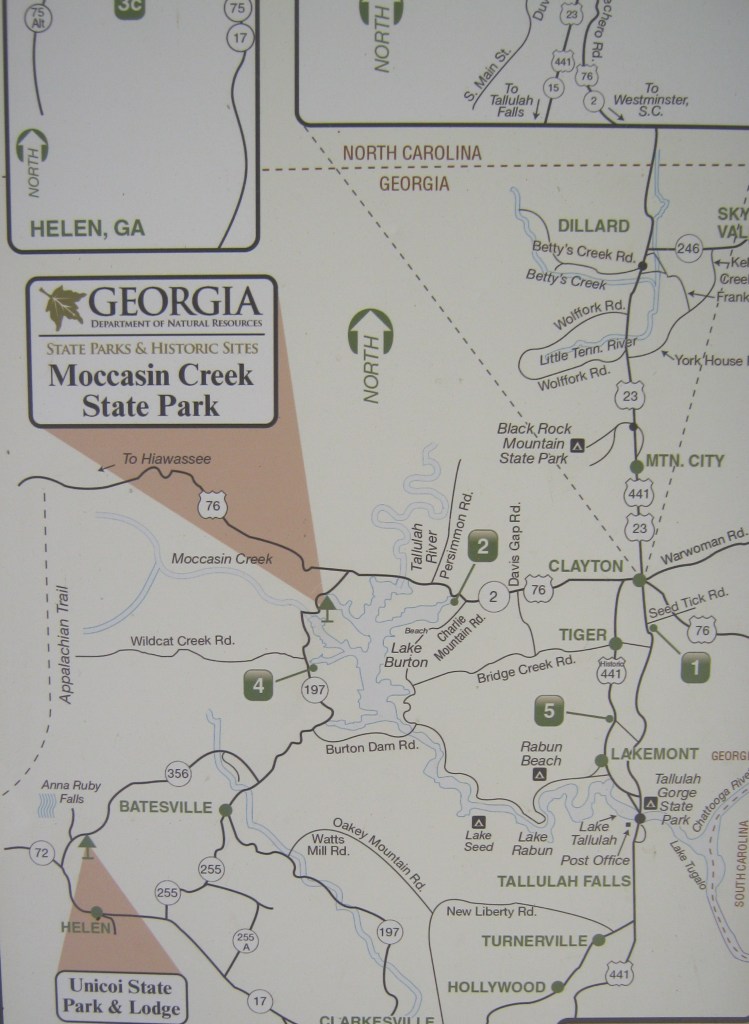
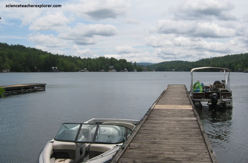
From the entrance to the Black Rock State Park, Beck and I had to back-track south on US 23 to Clayton. At Clayton, we turned west, (left), on US76 to explore the northern regions of Chattahoochee National Forest. We continued to Moccasin Creek State Park, (a pint-size playground that hugs the western shore of Lake Burton).
Pictured above and below, anglers come to Moccasin Creek State Park to cast for trout, bass, pan-fish, and bluegills. Others visit simply to enjoy leisurely walks along he lake’s shoreline and up the nearby slopes, a pastime that is especially appealing during the hot summer months, when the high elevation and deep shade of the forest offer relief from the heat. Actually, Moccasin Creek is known as “the park where spring spends the summer”.
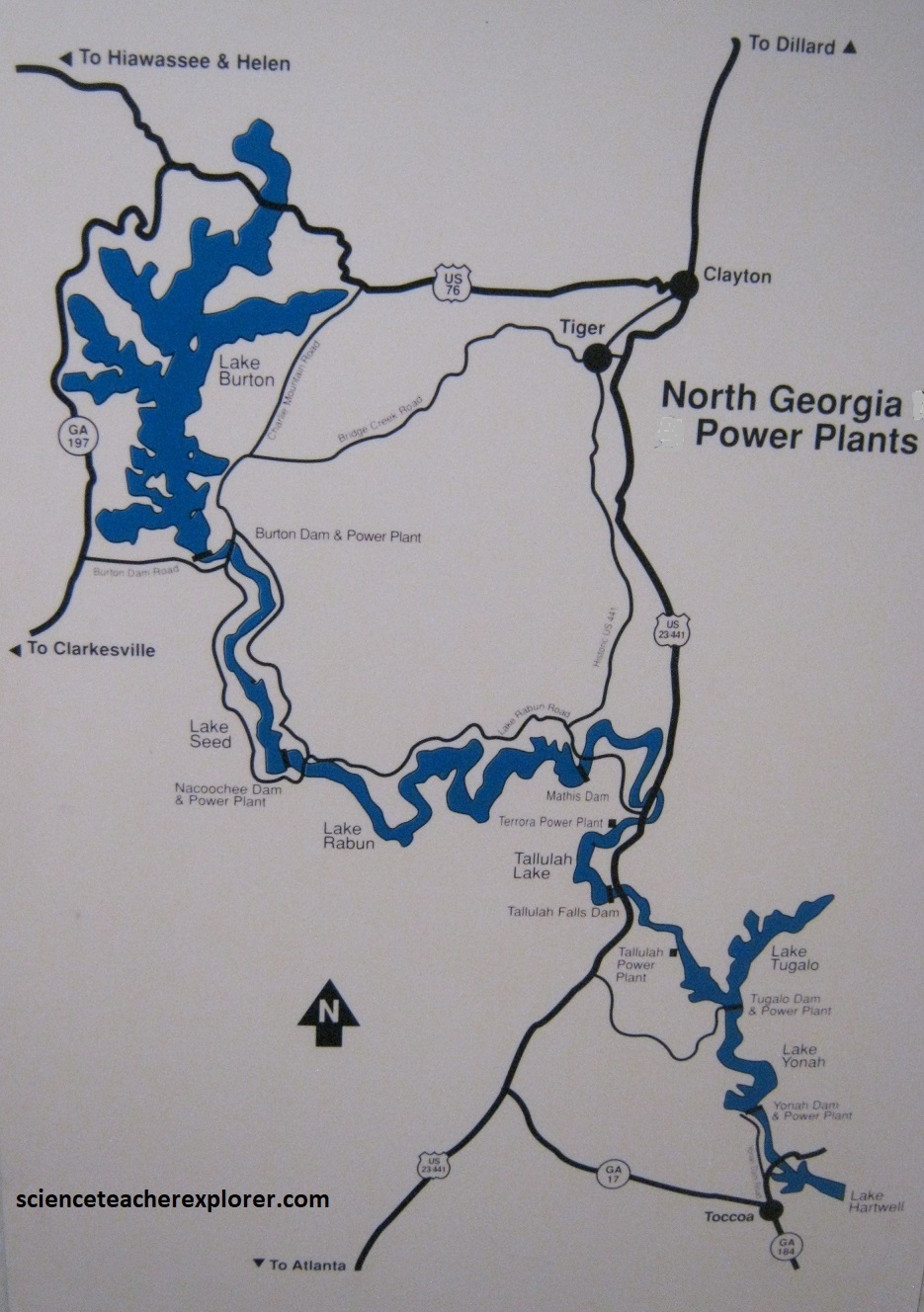
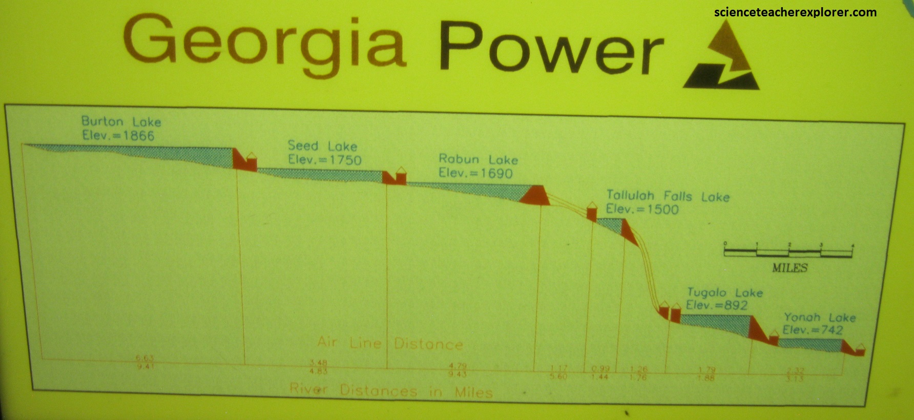
Pictured above, Lake Burton was constructed in a deep valley located along a 16 km section of the Tallulah River. With the introduction of hydroelectric power to America in the 1880s and due to the fact that the Tallulah River has the greatest verticality of any river in the east, a series of six stairstep dams was constructed in the period 1914–1927 over a distance of 28 miles. Lake Burton, being the largest and highest of the lakes, was intended to be the primary reservoir for the water needed to power the turbines downstream. This North Georgia Hydro Project was one of the first large, integrated hydroelectric systems to be built in North America. The electricity it provided would begin Atlanta’s growth into the economic metropolis it is today, (imaged below taken from an interpretive sign at site).
Once back on US76, we quickly come to the Popcorn Overlook, which took in the rumpled ridges that rose from Lake Burton.
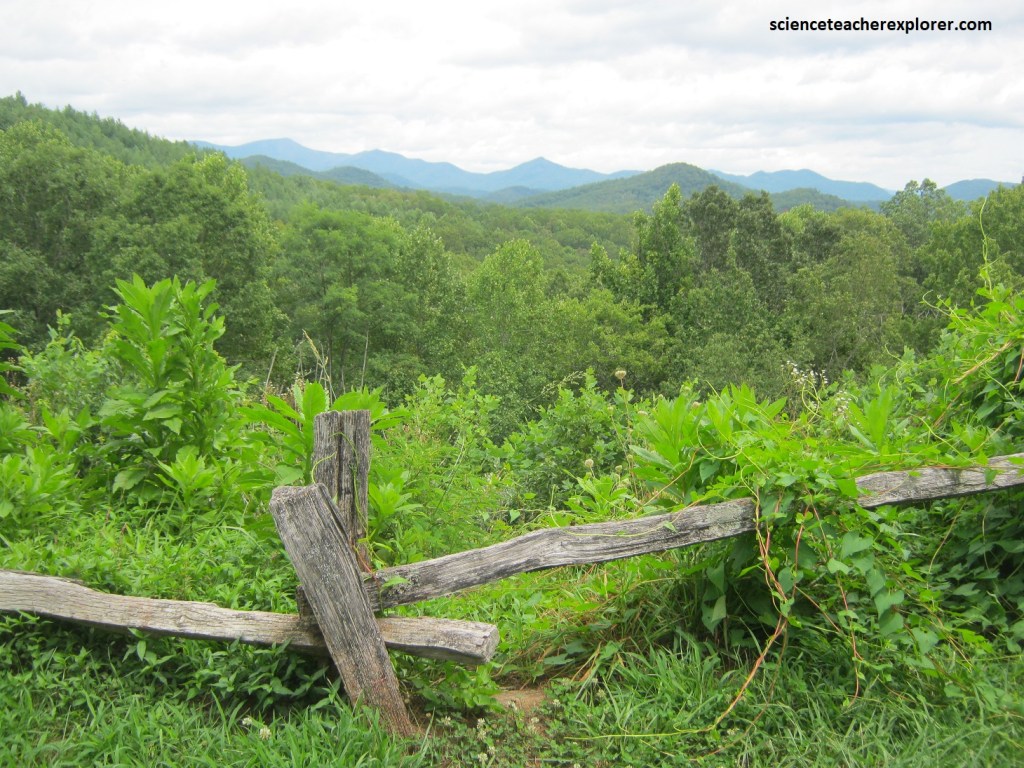
Here on US76 at Popcorn Overlook, it cuts across a rare kind of rock known to natives as greenstone. Geologists classify it, somewhat less romantically, as Lake Burton Dunite.
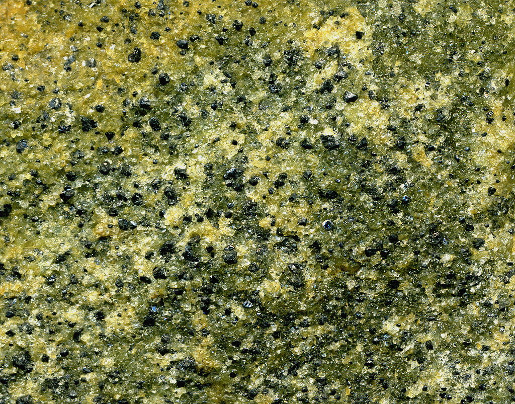
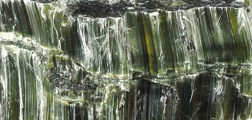
Pictured above-left, Dunite is hard, greenish in color, and has several valuable minerals associated with it, such as chromium, nickel, and corundum. Corundum is the source of rubies and sapphires. Across the highway, there were prospecting pits and trenches dug about 1890. Veins of talc and asbestos cut through the dense dunite rock. Pictured above-right; along the old road, bits of asbestos-serpentinite could be found, which closely resembled decayed wood. Dunite broke into fin-grained and sugary particles, while talc and asbestos-serpentinite had a greasy feel.
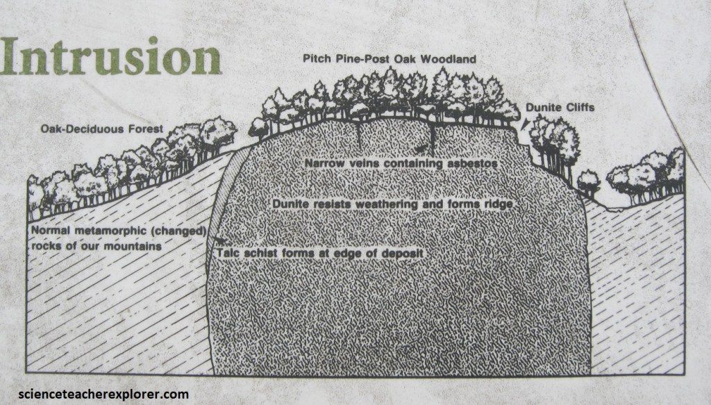
Imaged above, now weathered to a rounded outcrop about 867m x 267m in size, this rock first appeared millions of years ago on the ocean floor as a molten upwelling from the earth’s interior. Composed of the mineral olivine, the Lake Burton Dunite is quite different from the schists and gneisses that make up our mountains. These differences include alkaline rather than acidic soil conditions and low levels of certain soil nutrients. {The plant community was quite unique}.
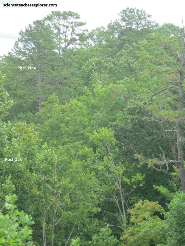
Pictured above, the hilltop vista at the Popcorn Overlook is often called a ‘pine barrens’. Due to the alkaline soil rather than acidic than acidic and lack of potassium, the plant community resembles a wooded prairie dominated by pitch pine, grasses, and post oaks. Acid-loving plants such as laurel, rhododendron, an blueberry, common over most of the north Georgia mountains, are absent here. Other plants on the ground included wintergreen, rattlesnake master, and ninebark.
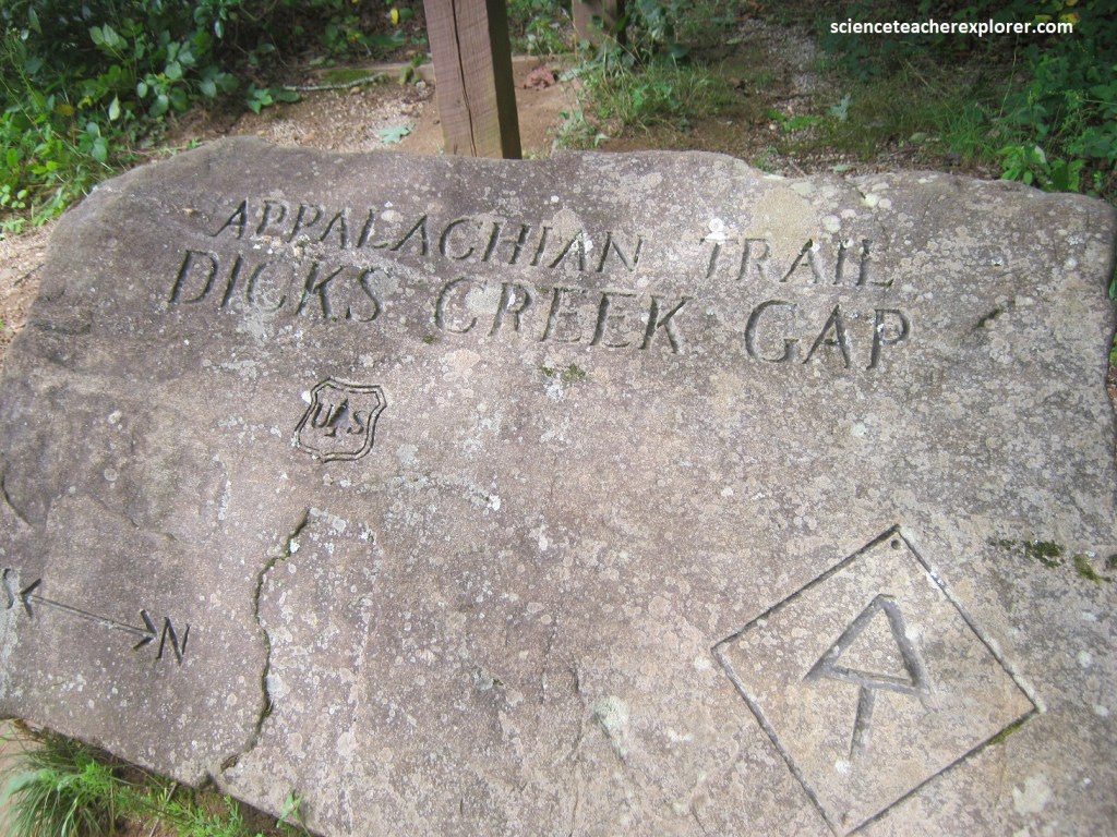
Pictured above, Becky and I went a little further on US76. Eventually, the highway crossed the Appalachian Trail at Dick’s Creek Gap, (a slender notch that has yet another inviting rest area with picnic sites and far-reaching views). The 3,526 km Appalachian Trail, stretching from Maine to Georgia, passes through 14 states, 8 national Forests, 6 national parks and more than 60 federal, state, and local parks and forests.
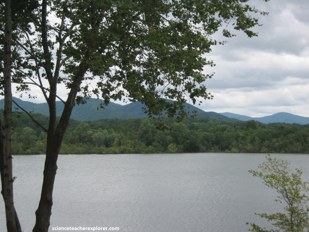
Becky and I continued driving west on US76. Our drive soon neared the glittering expanse of Chatuge Lake, (a reservoir that extends into North Carolina). Pictured above, the lake was relatively shallow with depths of 9m and reaches 144m by the dam. It appeared that camping, boating and fishing were popular here and the surrounding lakeside town of Hiawassee. Further down the road, we turned left (south) on US19 in Blairsville, Georgia.
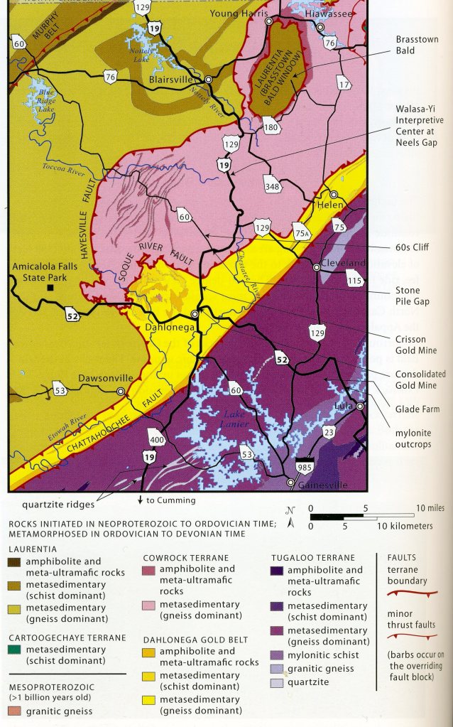
According to the image above, US 19 travels through faults that separate large pieces of crust called terranes. Collisions between tectonic plates welded the terranes to the edge of North America (Laurentia) between about 450 and 265 million years ago, during Paleozoic time. Some of the terranes began as volcanic island chains before they were accreted (scraped off) to North America (Laurentia), adding a great deal of landmass to the continent, (imaged below). [Laurentia basement-rocks are considered to be from the original craton-crust that is 1.1 billion years old].
Most of the rocks at or near Blairsville are schist and gneiss that are of Laurentia origin, (1.1 billion years old). These rocks were poorly exposed near the highway, but buildings were made of rocks. Pictured below, US19 crossed the Hayesville thrust-fault about 9 km south of Blairsville, entering the younger Cowrock terrane (Gneiss dominant).
Blairsville, an old-fashioned mountain town, was settled in the shadow of 1600m Brasstown Bald, Georgia’s highest mountain. The Russel-Brasstown Scenic Byway, a 61 km loop along Rtes US180, 17/15, 75A, and 348, climbs to just below the peak’s crest. Pictured below, we decided to take the side-loop to properly explore the Chattahoochee National Forest.
Surrounded at lower elevations by rocks of the younger Cowrock terraine, Brasstown Bald seems to be positioned at the center of a tectonic window. The rocks in this window are part of ancient Laurentia. Apparently, the younger Cowrock terrane was thrust over the older Laurentia rocks, but erosion cut through it and the underlying thrust fault, exposing the Laurentia terrane that makes up Brasstown Bald.
While exploring the Russell Brasstown Scenic Byway, Becky and I made a “trekking-stop” at the Anna Ruby Falls. Along the GA17 portion of the Byway, (4km north of Helen), we hiked a short paved trail that led us to the falls. Tumbling down from Tray Mountain, Curtis and York Creeks flow over exposed metamorphic-gneiss to form two extraordinary waterfalls. Pictured below, the taller of the two, formed from Curtis Creek, drops 51m, while York Creek joins it with a 17m drop. Together, they form Smith Creek at the base of the falls, (pictured above). Legend has it that a local confederate soldier found the waterfalls while horseback riding in the area and decided to give both falls the name Anna Ruby, after his only daughter.
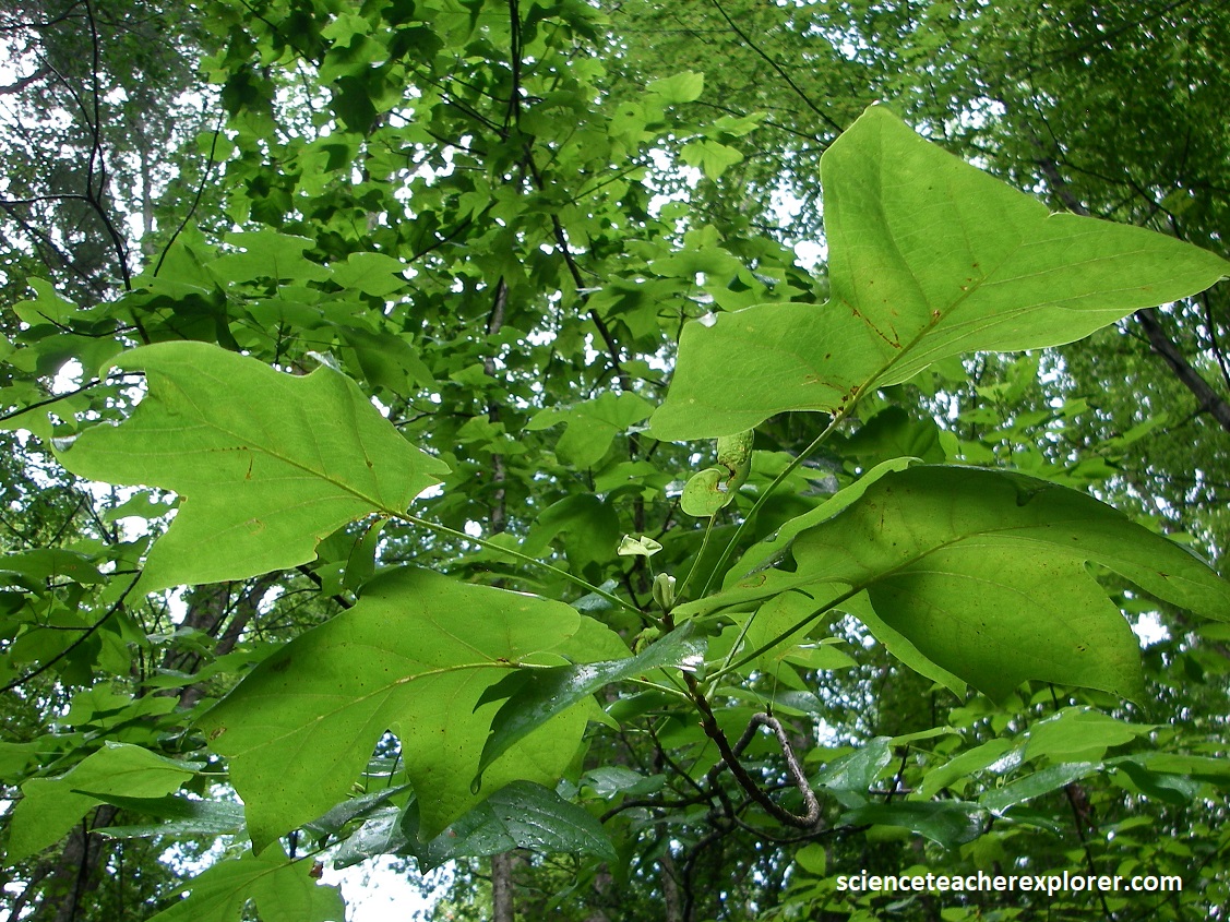
We noticed a tree along the Anna Ruby trail called the Canoe Tree. Also called a tulip tree, tulip poplar, or yellow poplar, this tree was a favorite among the Cherokee people for making dugout canoes. This beautiful native species can reach height of 67m and will often have no limbs until more than halfway up the tree, making it extremely valuable to the timber industry. The large green leaves resemble the silhouette of a tulip flower, (pictured below).
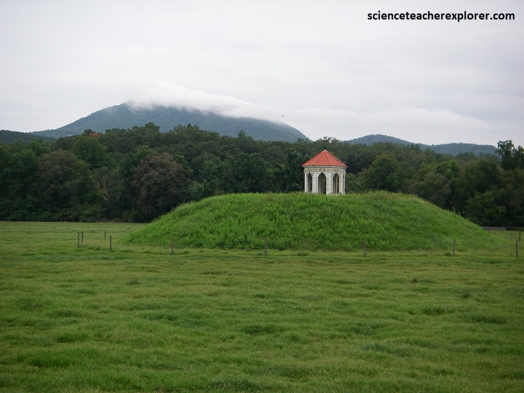
Just south of Helen, Georgia, is a gazebo atop a reconstructed Indian mound. In the Nacoochee Valley, about 300m south of the intersection with GA75 and GA17, the historical marker states that this is the site of a Cherokee village visited by Hernando de Soto. (However, this hasn’t been confirmed by scientists).
Becky and I returned to US19 by way of GA348. After completing the Russel Brasstown Scenic Byway, we turned south (left) on US19, where we were greeted by a cascade on the approach to 220 ace Vogel State Park. The area’s centerpiece, Lake Trahlyta, was surrounded by a ring of mountains cloaked with dense forest, (pictured below).
As US19 arcs past the rugged Blue Ridge foothills. It threaded through Neel’s Gap, a narrow pass shared with the Appalachian Trail, whose southern terminus lies just ridges away.
As Becky and I finished our loop around the Chattahoochee National Forest, we visited and trekked the DeSoto Falls, (pictured above). We were treated to a duo of tumblers, which could be viewed along a five kilometer stretch of trail, (pictured below).
Known as Upper and Lower DeSoto Falls, they drop, respectively, 67m and 7m. As a historical footnote, the falls, like many places in the South, take their name from Spanish explorer Hernando De Soto.
According to one local legend, a piece of armor that was found here was said to have belonged to the conquistador, (DeSoto), who trudged through this region in the early 1500s searching for riches.
