Samaipata, Bolivia 2019
While trekking central Bolivia, I stayed a couple of nights in Samaipata on July 30th and 31st. Samaipata is famous for it’s strange Inca ruins just a few kilometers east of town.
Located in the remote mountains of central Bolivia, 120 kilometers southwest from the city of Santa Cruz, the ruins of Samaipata are one of the most enigmatic ancient sites in all of South America.
Perched at 1949 m above sea level, the site was first discovered by the early Spanish and named ‘El Fuerte’ as it was believed to have military significance. Archaeologists no longer believe in the military use of the site but consider it to have had religious significance. However, the site is strategically located in the foothills of the eastern valleys of the Andean Range, in the department of Santa Cruz de la Sierra, Bolivia.
Due to it’s privileged location, “El Fuerte” has been the “melting pot” for different cultures: (1) A ritual and ceremonial center for the Chane from the Gran Grigota, (800-1300 AD). (2) Resting and pass-by for warriors such as the Guaranis, (1400-1450 AD). (3) Trading and administrative center for the Incas, (1400-1450 AD). (4) The Spaniards used it as a colonial trading center and a fortress to stop Guarani Warriors, thus allowing the free commerce between Asuncion (Paraguay) and Lima (Peru).
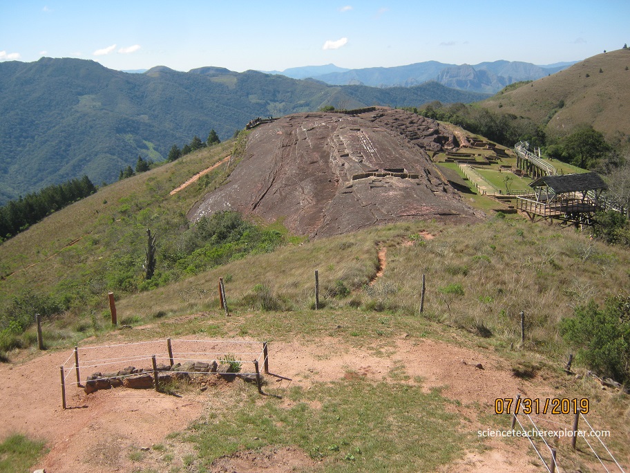
This archaeology site in Samaipata constitutes an ancient compound, both ritual and managing center, of universal and outstating value from pre-Hispanic era. “El Fuerte” is actually divided in two main areas: the religious area and the administrative area.
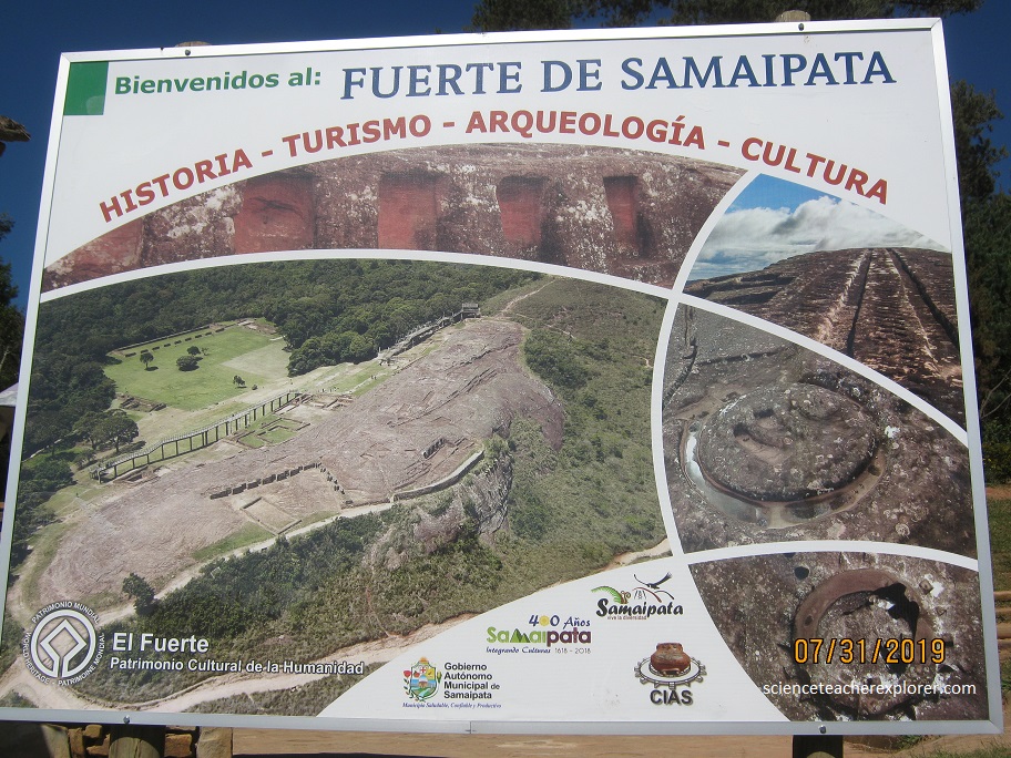
The first one is conformed by the Roca Esculpida (Main Rock) as its physical and space central vertex which is a monolithic sandstone composite, (220 m length 65 m width). The mentioned Rock is entirely covered by carved works such as: Zoomorphic and anthropomorphic images, geometric patterns, niches, and channeling system, vessels and so on. All of them hold significant magical and religious meaning and are executed with great precision, demonstrating their mastery at stone carving. It is considered as one of the largest re\itualistic sites in the world. It features some amazing characteristics such as advanced hydraulic systems used for purification and fertility rituals, idol worshipping animals as representatives of their sacred gods and goddesses, a suspected solar or astrological calendar that signifies the beliefs and views of those who created it.
The administrative area is quite different from the other because it is a mixture of architecture styles belonging to various cultural settlements during different periods of time. The administrative area includes watch-towers, agricultural land, military camps, a market, and more.
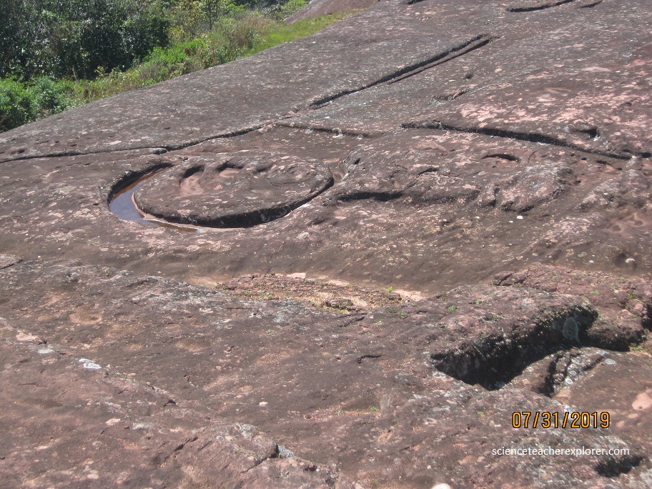
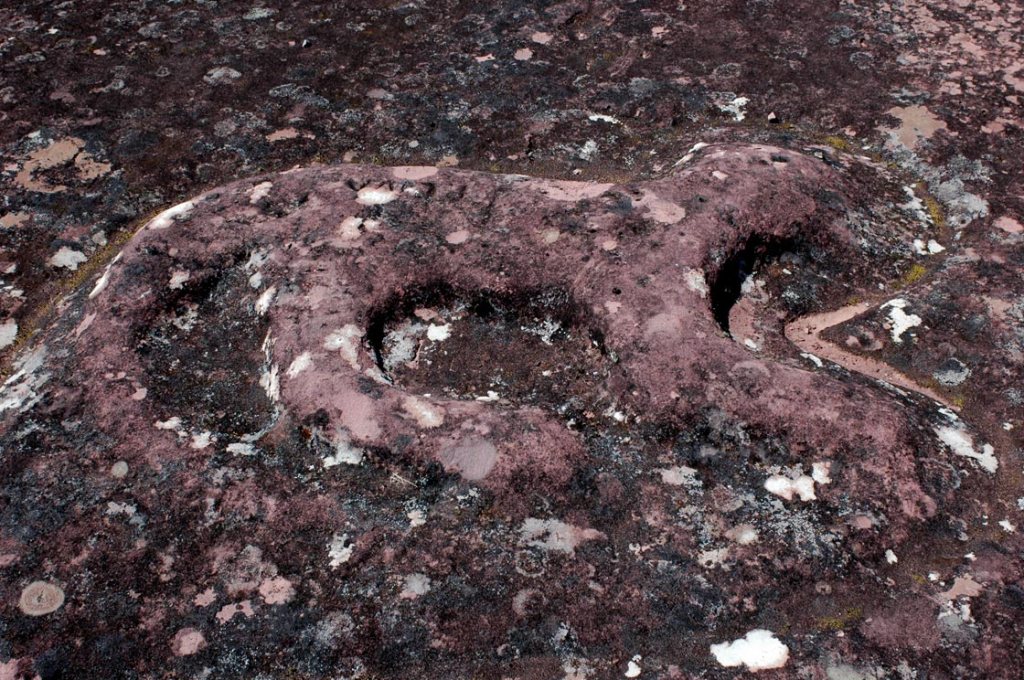
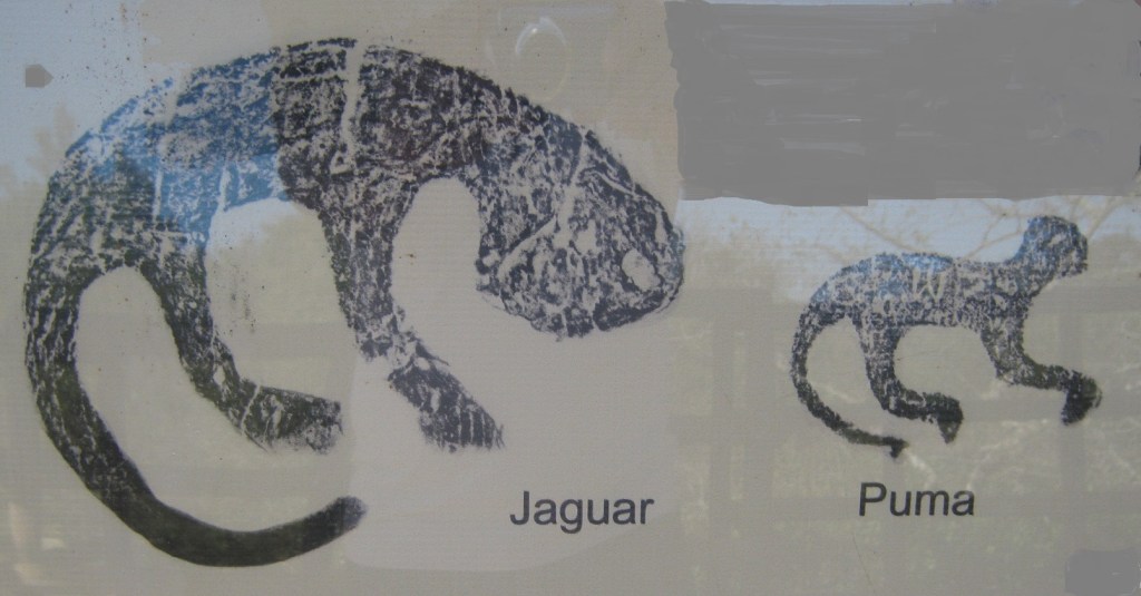
On the western side of the Roca Esculpida are the carvings of two cats, (pictured above), each in circular lifting. A third cat is almost in front of an Inca wall superimposed on the Rock.
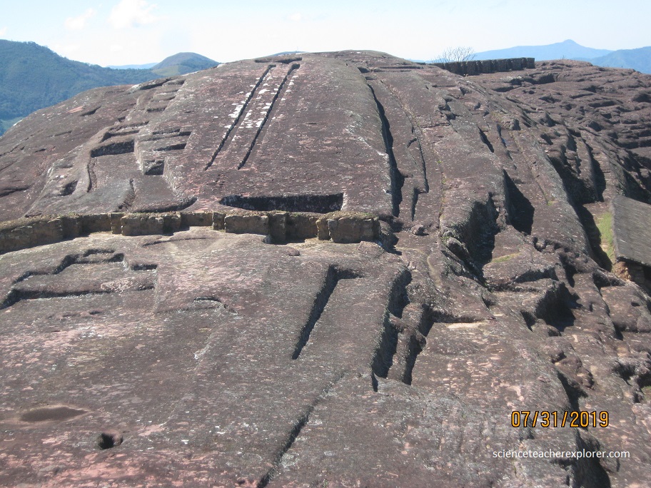
The Inca wall was built of well-cut stones. On the west side has three double jamb niches and back three simple niches. Based on these details we can say that this is a typical Inca wall. This wall in its southern part cuts or is superimposed over an older carving, (this means that the carvings were not made by the Incas, but by other older cultures).
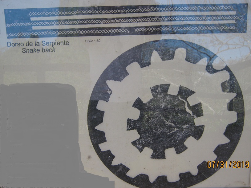
Pictured above, behind the wall are well marked two parallel channels. Pictured below, on its sides are accompanied by fine incisions in a double zigzag, forming continuous diamond. The original function of these carvings were apparently ritual, as they have the appearance of a live snake while the water flows through them. For this reason the set is named “The Snake Back”.
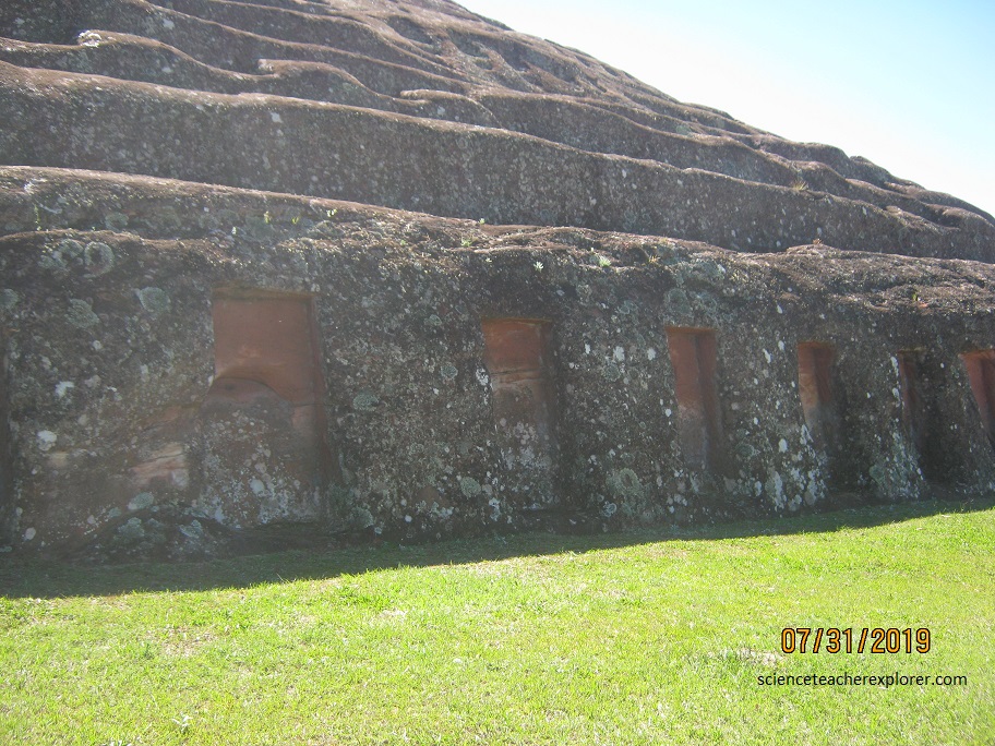
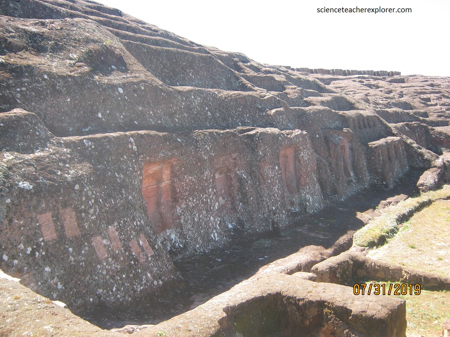
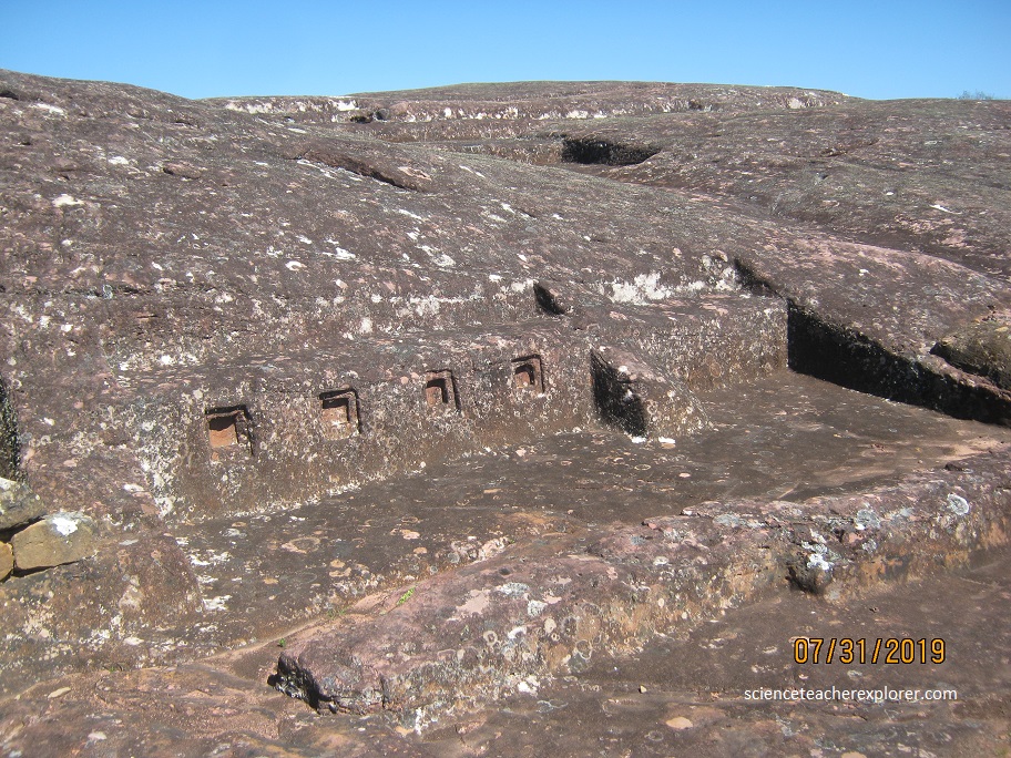
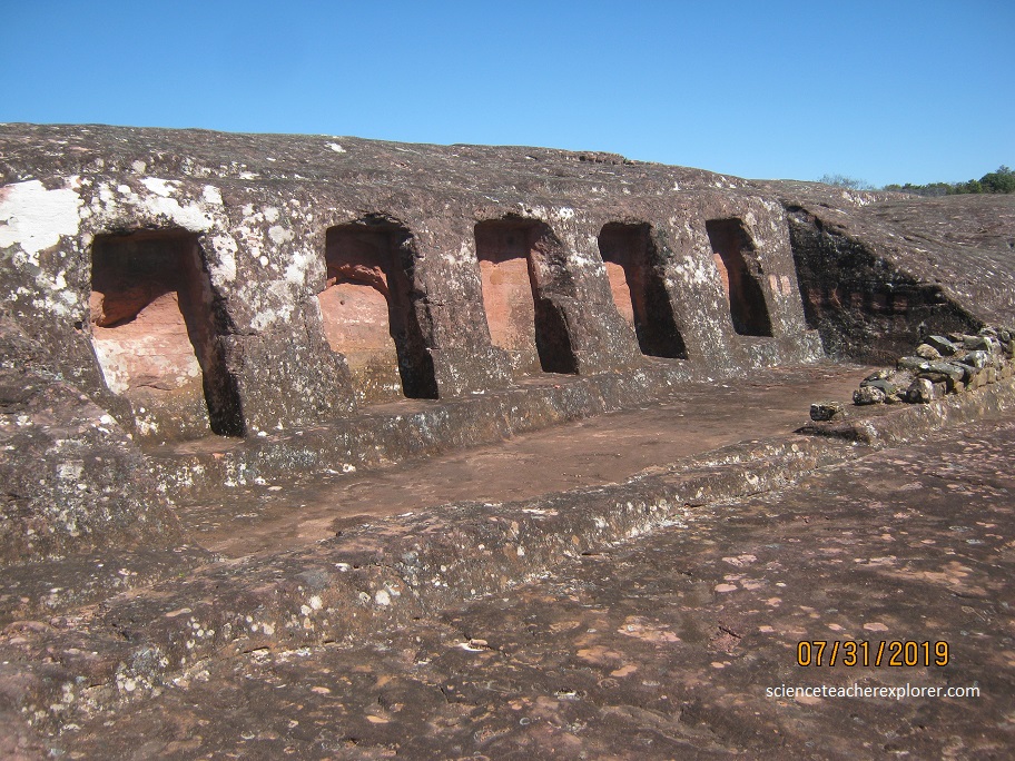
Although not the most visually spectacular, the most important part of the ceremonial sector is the “coro de los sacerdotes” (choir of the priests) at the highest point of the rock, imaged above. This consists of 18 niches, probably used as seats for individuals, carved into the rock. At the bottom of the rock are 21 carved rectangular niches which may have served as residences for priests or for the storage of ceremonial items. .
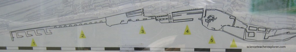
The south area of the Cerro Esculpido (Sculpted Hill) has a series of grouped niches dug in the rock. The main groups are located in the image provided above. (Temples 1-6)
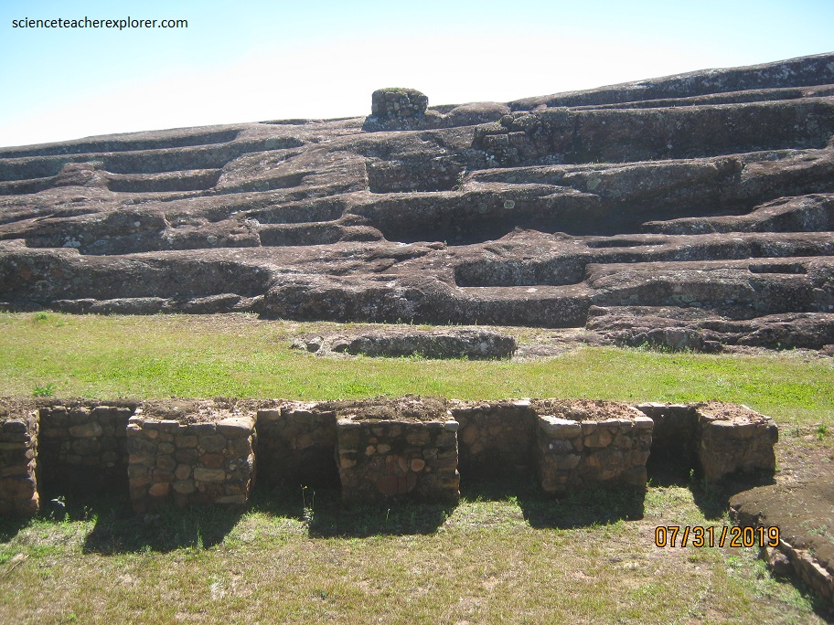
The first temple is called the Temple of the “Sacristy”. It consists of five enclosures, of which four have “walls” in form of “L”s carved in the rock. In the wall of each enclosure you can recognize a big niche and two small, except for the last one that only has a one big-niche.
The second temple has ten big trapezoidal niches. As in all the temples, there is a base in the top to sustain the ceiling.
The third temple, built in a lower level, has five big niches. At the sides, there is a stepped wall with small niches of simple and double jambs. To their east side, there is a central stairway that leads to the summit of the rock.
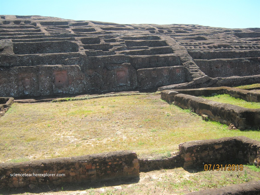
The fourth temple, in front of the colonial house, is totally cut in the rock. We can note the vertical lines that seem to mark the delimitations of the finished niches.

The fifth temple is already almost completely destroyed, but the remains of two of their niches can still be recognized. The sixth temple has been dug in the last times. Showing four big niches and the same as the first and fourth temple, a wall of delimitation totally carved in the rock
The form of most of the niches are trapezoidal. This means that the temples were probably made during the Inca time. According to colonial sources, the Incan kept the mummies of their ancestors or the statues of their gods for the daily prayers, in the niches.
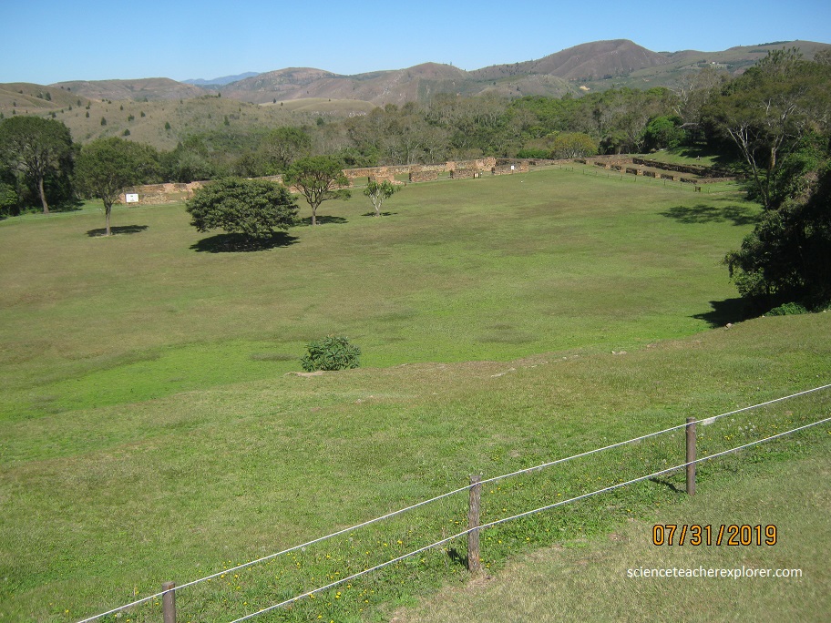
In Quechua, “Kallanka” means big building. For the dimensions of 70.5 m long and 14.3 m wide, it would have had an administrative and/or military use. It possesses walls of stone ambles and mud. In the interior, the building was divided in three naves, of which are two lines of wooden columns that supported the roof. The roof had a height of 12 m. The building presents the main façade of 8 doors and one door in the back. Also visible, is a longitudinal channel which could pick up the water of rains coming from the roof.
Immediately west of the Kallanka is the Tambo. These type of structures generally accompanies the “Kallankas”, and has a storage functionality. It’s dimensions are 34.5 m long and 8.2 m wide. It presented 5 doors in its façade of 1.9 m wide and 6m high.
Residence structures are between the Kallanka and the Tambo. They were used by the captains and generals of the Incan army.
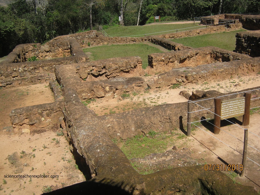
Pictured above, a group of 8 houses are found west of the “Kallanca”, and are dated for the Incan period. The houses are around a central patio opened up toward the south and subdivided by several walls. In this type of construction, the walls built in stone and mud to an approximate height of one meter. Below the level of the floor are vestiges of other cultural groups, probably from Amazonas and valleys. The vestiges included are “arivalos”, jars, pots, batanes, hoes, and necklace bills.
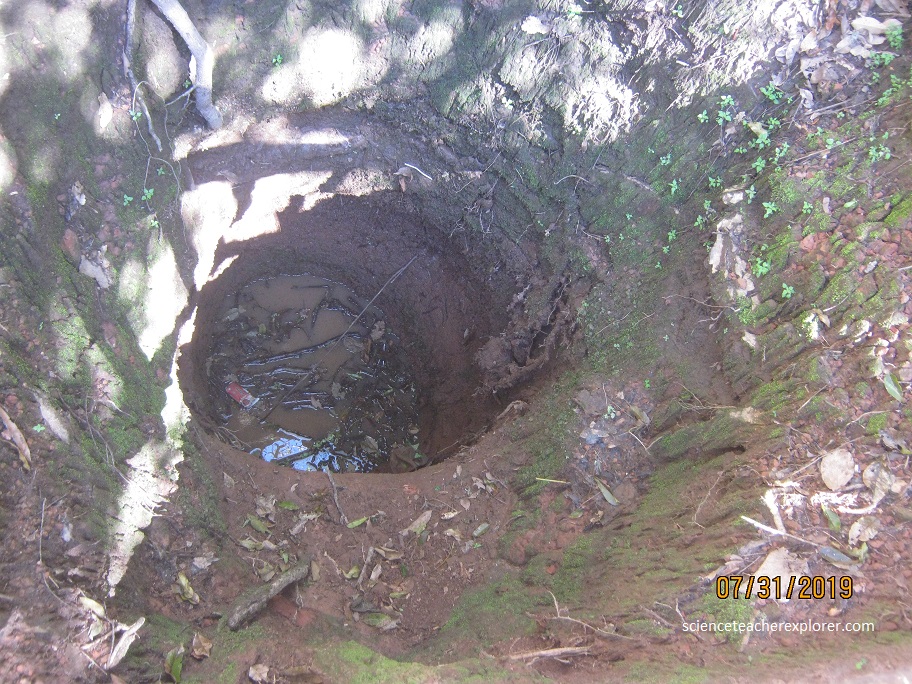
About 200 m down hill to the southeast is an artificial well excavated in a spiral shape, called a “chinkana” in Quechua. It has an average diameter of 1.4 m and a depth of 16 m. It’s functions is unknown but could have been used as a complex escape tunnel in case of attacks to the site.
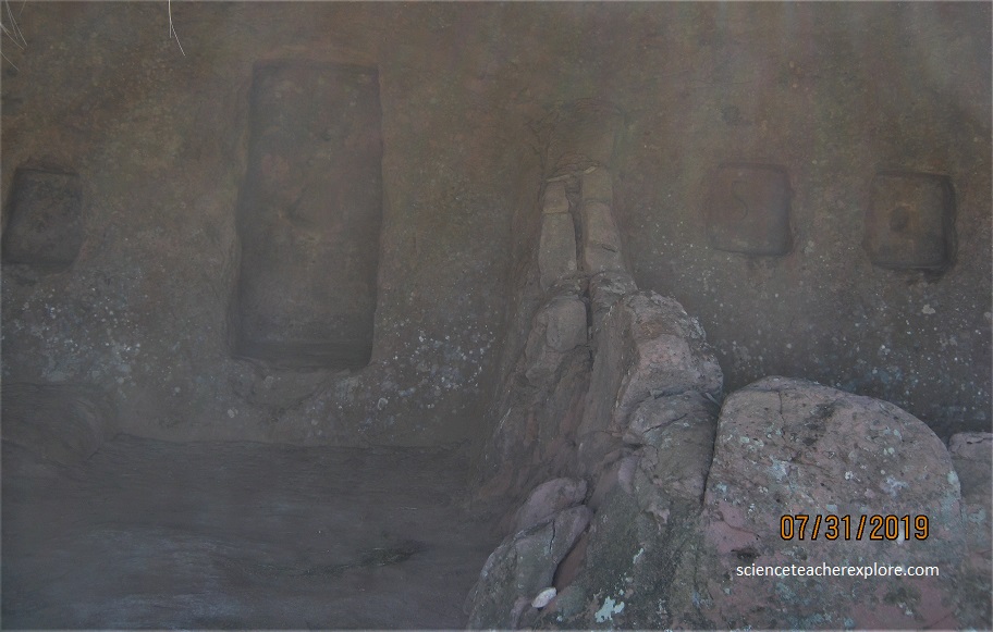
Pictured above and below are two temples that might of been used by the priests. Called the “Temples de las Hornacinas”. Pictured below are five niches that are extremely deep carved into the rock. The Inca structures to the east of these temples seem to be built for astronomical observations. The entire elongated ridge seems to run in an east-west direction, possibly aligning to the solar and lunar extremes.
The whole site represents a symbiotic relationship with the natural environment with stunning views of great symbolic potential, which as a whole expresses the wisdom and creativity needed to make the best use of the sandstone as a material. All of these qualities along with the rock art and architecture are what make “El Fuerte” a unique world-wide monument. The site of “El Fuerte” was man-made and must have required the work of many specialists to construct it not only in regards to the artistic carvings but to the skills and knowledge needed in architecture and engineering in order to masterfully create this site.
Samaipata was used mostly as a religious, ceremonial, and residential function. Its construction was probably begun by the Chané, a pre-Inca people of Arawak origin. There are also ruins of an Inca plaza and residences, dating from the late 15th and early 16th centuries as the Inca empire expanded eastward from the Andes highlands into the sub-tropical foothills. Chané, Inca, and Spanish all suffered raids from Guarani (Chiriguano) warriors who also settled in the region. The Guarani conquered the plains and valleys of Santa Cruz and occupied the Samaipata area. The Guaranis dominated the region well into the Spanish colonial period.
During the last three decades the archeological site has been excavated and studied scientifically and has just started to reveal evidence related to it’s origin and function, particularly in the role that Samaipata played as a meeting place where the following main eco-systems joined, the immense Amazonian Plains, the Gran Chaco and the Andes.
