Kanas Lake, China 2008
In the summer of 2008, I flew to China to explore and trek Northern China. This was the same year of the China Olympics. However, I didn’t participate or attend the Olympics. Ironically, I watched the opening ceremony for the Olympics, while trekking the Kanas Lake locality.
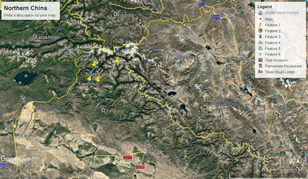
Kanas Lake is located in Burqin County of Altai Region, about 800 km north of Urumqi, China. It is one of the most famous and beautiful scenic spots in the Xinjiang Province. Kanas Lake is a world geological park that is recognized by the United Nations Educational, Scientific, and Cultural Organization (UNESCO).
My trekking group flew into Urumqi and hired a “Black Car” to take us to Kanas Lake for 9 hours, (pictured below).
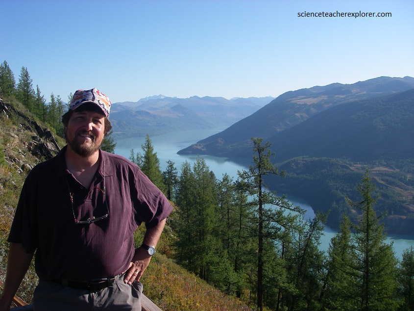
In Mongolian, Kanas means gorgeous and mysterious. The Taiga forest is made up of Siberian larch, and Siberian spruce, (pictured above). In the distance, the highest peak is Gora Belukha, which rises along the border of Russia and Kazakhstan.
Kanas Lake is located in a valley in the Altai Mountains, near the very northern tip of Xinjiang and the province’s borders with Russia, Kazakhstan and Mongolia. Rugged and dramatically picturesque with a wealth of habitats, (coniferous and broadleaf forests, rich alpine pastures, barren ice plains, lakes and thousands of glaciers), the Altai Mountains run diagonally northwest to southeast where China, Russia, Kazakhstan, and Mongolia meet. But it’s not just the biodiversity that is rick: “Altai” means “gold” in both Kazak and Mongolian languages because of the gold reserves in the mountains.
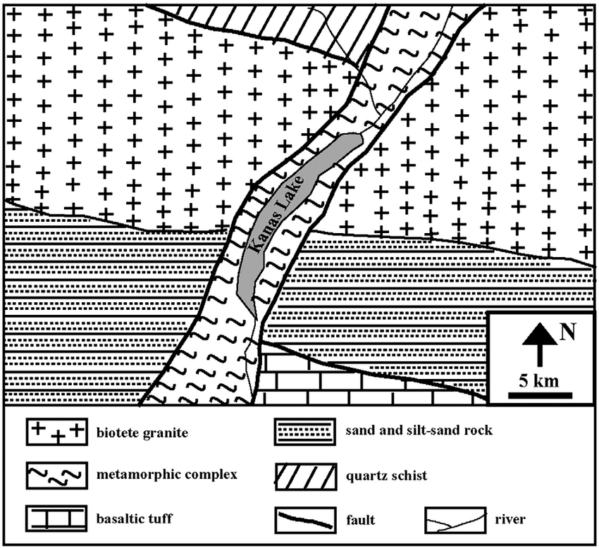
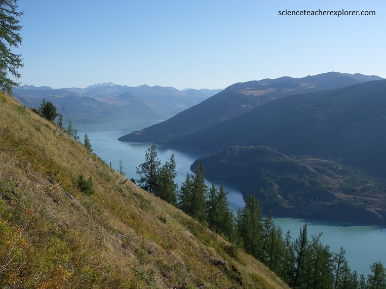
The lake was formed around 200,000 years ago during the Quaternary period as a result of glacier movement. The crescent moon shaped lake has an estimated water storage capacity of 53.8 billion cubic meters, coupled with an average depth of around 120 meters. The Kanas region is located on the south slope of Youyi peak which is the main peak of Altay Mountain. This region is the largest center of glaciation in the Altay Mountains and it has recorded the complete sequence of the glacial geography since the mid-Pleistocene.
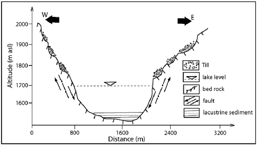
The Altay Mountains underwent long-term tectonic movement, including complicated fold and faults in which huge granite blocks were intruded. Thus, geologic wonders formed of gigantic, intricately carved and unusually shaped rocks have been formed by long-term surface weathering and fluviation.
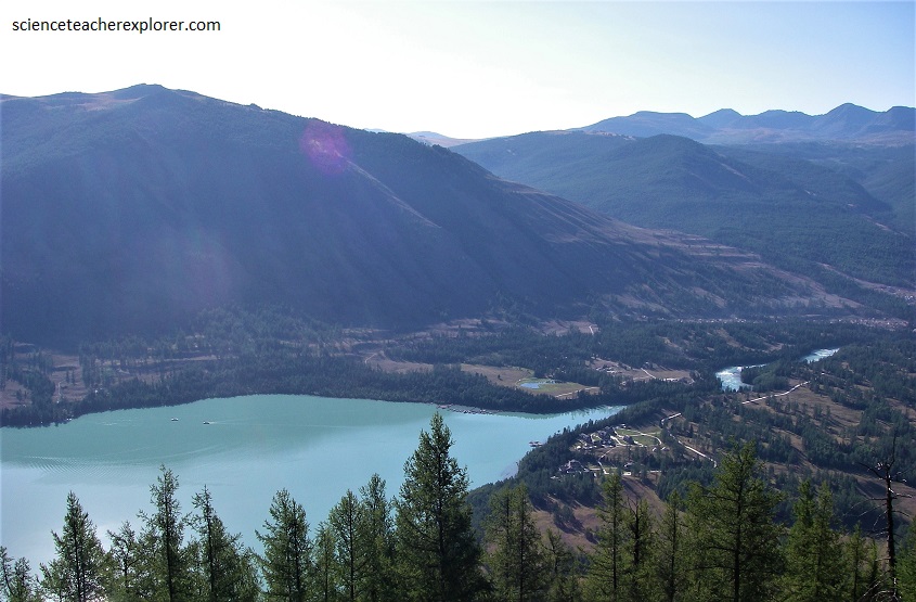
Kanas Lake is famous for its changing colors from green to blue. Water from glaciers contains very small particles which are sinking very slowly. As a result, such water is a bit “milky” and has unusual colors. Color of Kanas Lake is changing from emerald green to deep blue, depending on the time of the day and weather conditions.
For several centuries there have been sightings of large lake creatures in the waters. First efforts in research of these legends were done by Yuan Guoying of Xinjiang University, who observed fish of enormous size in 1985. He and his students assessed that the fish could be 10 – 15 m long and weigh more than 4 tons, with total population in excess of 50 individuals.
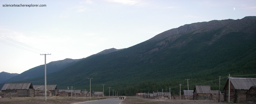
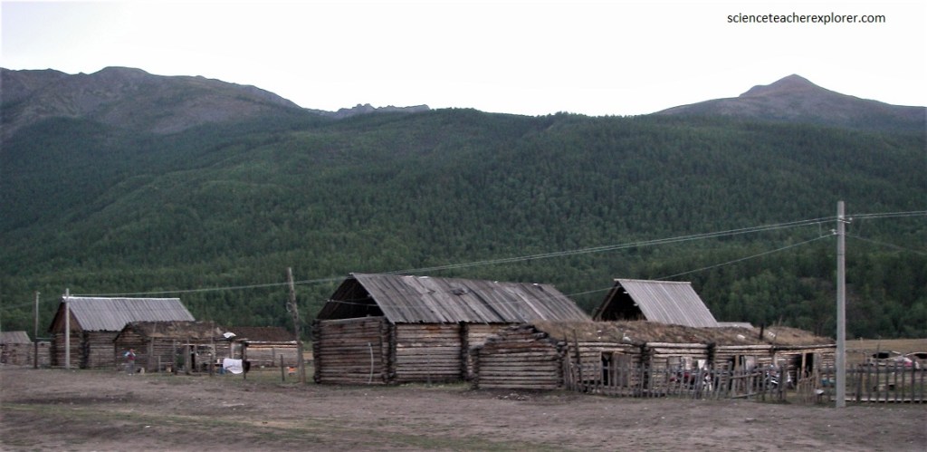
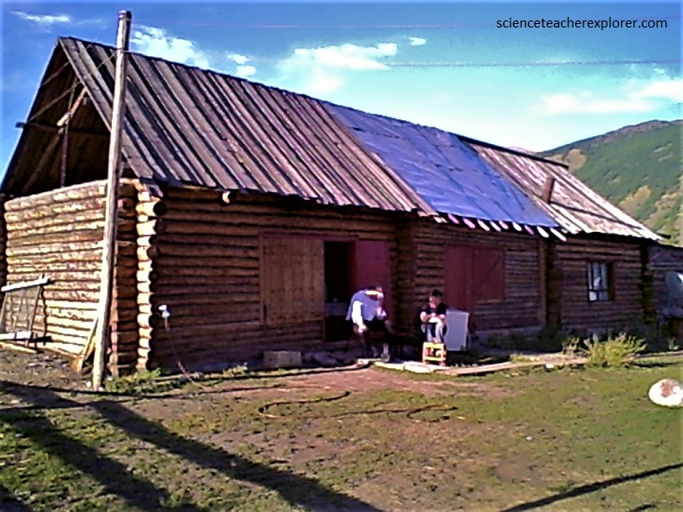
There is a large population of ethnic Tuvans and Kazakhas in the Kanas valley and the Xiaobotue Village. While most of these people have maintained their traditional agricultural and namadic life styles, many work in the developing tourism industry and have established facilities for trekkers to stay, (pictured below). Our first night there, we stayed in the Xiaobotue Village and watched the Opening China Olympics with the community on a 30 cm screen television. Notice how the community lives in log cabins, but recently got electricity. However, the local people still use their Mongolian Horses and wagons for transportation. Tuva is a branch of the Mongolian ethnic group. Believers of Lamaism, they live in their traditional houses and practice their centuries-old traditiion. The accommodations in the village, were very primitive.
The next morning, I hired a Tuvan guide to take us into the Altai Mountains east of Xiabotue, near Black Lake. We then saddled up some Mongolian Horses and headed out.
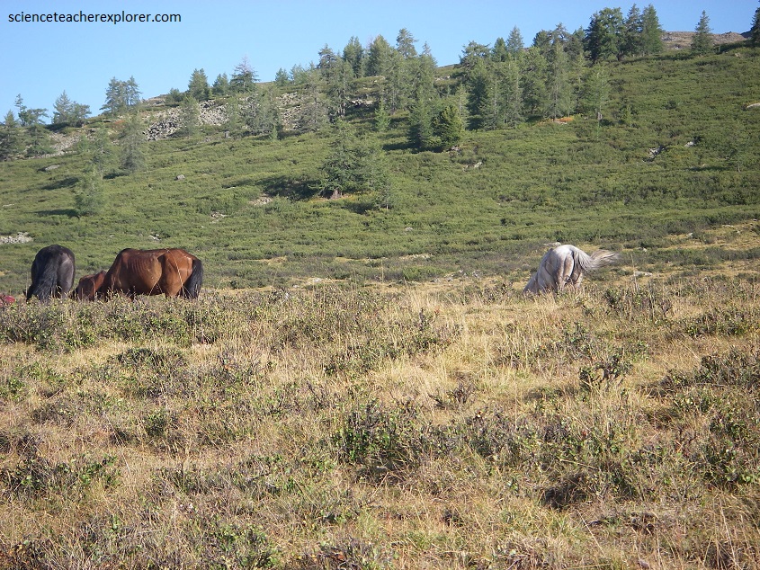
Our horse trek would take us into a region represents the most complete sequence of altitudinal vegetation zones in the Altai Mountains, from steppe, forest-steppe, mixed forest, subalpine vegetation to alpine vegetation.
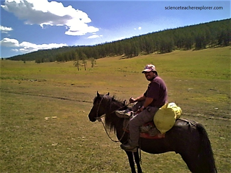
Mongol horses are of a stocky build, with relatively short but strong legs and a large head. The mane and tail of the Mongol horse are very long. Their strands are often used for braiding ropes for the Tuvans. Pictured above, the Mongol Horses have great stamina; although they have small bodies, they can gallop for 10 km without a break. My Tuvan Guide was able to do all kinds of tricks on the them, (from standing up and going under the belly at a gallop).
Pictured above is where I decided to camp due to it’s location to a freshwater spring. After the sun went down, I built a small fire for my group to cook dinner and socialize. Around 11 P.M., a strange short-statured Mongolian man came out of the darkness and sat down beside me. Knowing that this was the home territory of Genghis Khan in the 11th Century, it made me a bit nervous. I slowly reached into my vest pocket to retrieve and sugary-granola bar for a friendly gesture and handed it to him. His eyes widened to an excited look when he tasted it. It was as if he had never tasted anything so sweet in his life. I asked my interpreter to ask him, “What he wanted from us in the middle of the night”. My interpreter didn’t know how to speak Mongolian, so he asked him in Mandarin. Luckily the man sort-of-understood the question. However, he answered back in Mongolian. My interpreter made out enough of the answer to relay his warning. He apparently wanted us to know that we were in danger of being killed by wolves. I responded to my interpreter that I wasn’t worried about wolves and was quite familiar with them in my own country. However, I was a bit nervous of him. So I reached over to my personal-sack to give him another gift. It was a ‘glow-in-the-dark’ stick. {The kind that you have to break to activate it}. This would enable me to keep an eye on his location all night.
As expected, he was amazed by this technology. I believe that he felt it was a touch of magic and he strolled off to attend his herd for the night and watch for wolves. We all went to bed for the night and I crammed myself into a very small one-man bevy-tent, with a small hole in the top. All I could see was stars. However, I would occasionally look for my Mongolian man, with his newly acquired gift of the ‘glow-in-the-dark’ stick on the side of the hill, across the ravine about a kilometer away.
When the sun came up in the morning, I felt somebody kick me in the side to wake me up. My eyes opened to see four Mongolian women looking through my small window at the top of my bevy-tent. I immediately sat up with the woman chattering-on with their Mongolian language. What I could make out with their hand movements, is that they also wanted a “glow-in-the-dark” stick. The man apparently took his amazing glow-stick home and all the women there were amazed and wanted their own glow-stick. Luckily, I had four left in my bag and gave them all one-each. This satisfied the women and they left me sitting in my small-tent without a shirt. Since I didn’t speak their language, I couldn’t tell them that once you break the sticks, it is impossible recharge them. They would have to discover this on their own. I later got everybody up in my group to be on our way to explore with the horses.
The Altai mountains have retained a remarkably stable climate changing little since the last ice age. In addition the mix of mammals has remained largely the same, with a few exceptions such as extinct mammoths, making it one of the few places on earth to retain an ice age fauna. The Altai Highland, (Black Lake Steppe Region) is of importance for preservation of the globally endangered mammals, such as “snow leopard and the Altai Argali. Siberian Ibex also live in these mountains.
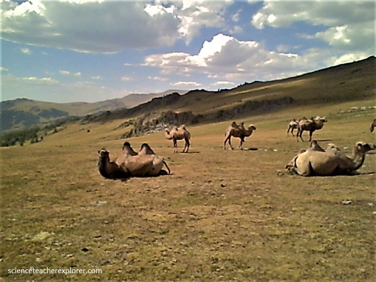
Pictured above, the “Wild Bactrian Camel (Camelus ferus)” is a critically endangered species of camel living in parts of northwestern China and southwestern Mongolia. It is closely related to the “Bactrian Camel (Camelus bactrianus). Both are large, double-humped even-toed “Ungulates” native to the steppes of Central Asia and here in the Altai Highlands. Until recently, wild Bactrian camels were thought to have descended from domesticated Bactrian camels that became feral after being released into the wild. However, genetic studies have established it as a separate species which diverged from the Bactrian camel about 1.1 million years ago.
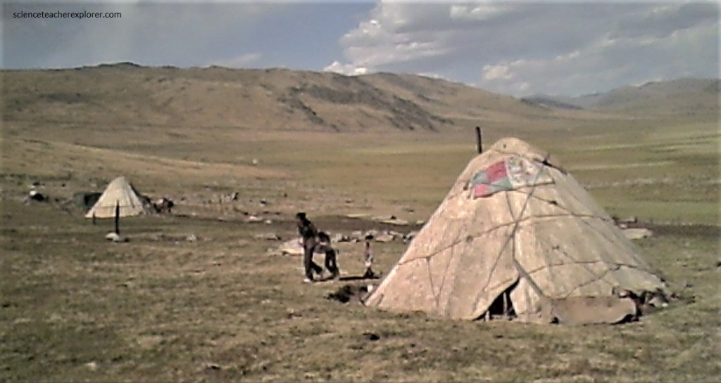
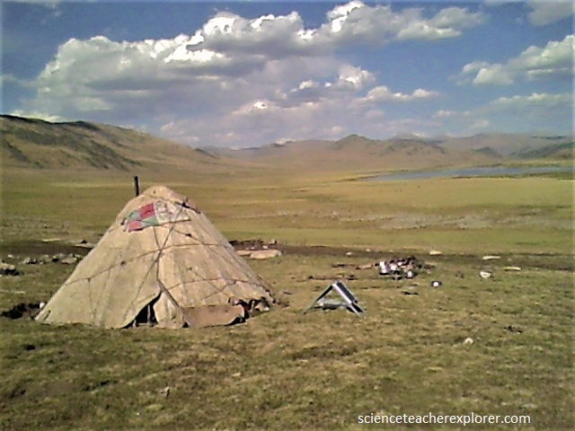
Pictured above, A traditional “Yurt” or “Ger” is a portable, round tent covered with skins and used as a dwelling by nomadic groups in the steppes of Central Asia. The structure consists of an angled assembly or latticework of wood or bamboo for walls, a door frame, ribs (poles, rafters), and a wheel (crown, compression ring) possibly steam-bent. The roof structure is often self-supporting. The top of the wall of self-supporting yurts is prevented from spreading by means of a tension band which opposes the force of the roof ribs.
Known throughout history as the “cradle of the nomads,” the mountains pasturelands were home to the ancient nomads of China. The Huns (Xiongnu), the Turks (Tujue), and Chengiskhan all lived here.
Pictured above, the Altai Highland Steppes, represents the northernmost region affected by the tectonic collision of India into Asia. Massive fault systems run through the area, including the Kurai Fault Zone and the recently identified Tashanta Fault Zone. These fault systems are typically thrusts or right lateral strike-slip faults, some of which are tectonically active. Rock types in these mountains were typically granites and metamorphic schists, and some are highly sheared near to fault zones.
