Volcan de Colima, MX
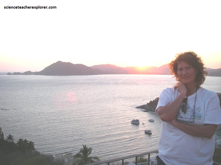
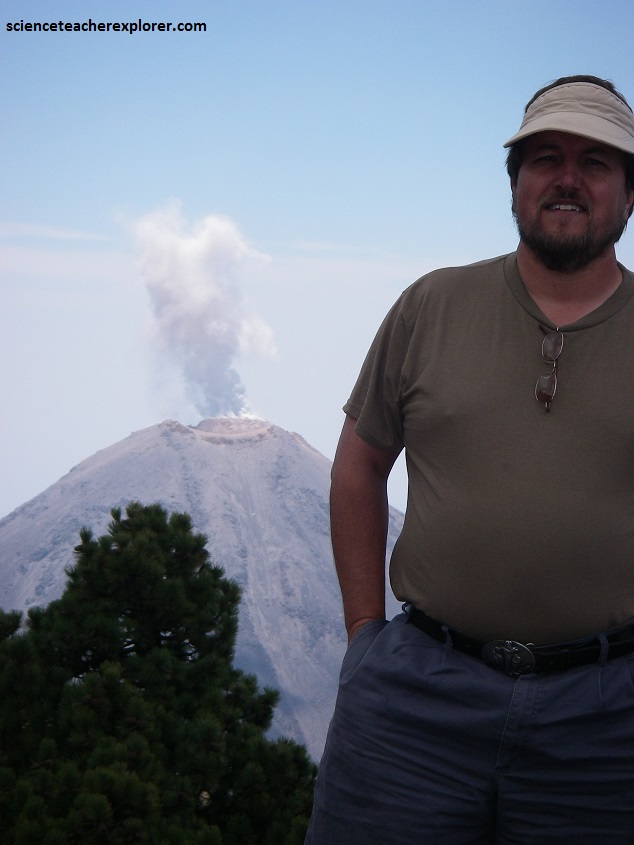
During Spring Break of 2009, Becky and I flew to Manzanillo, Mexico to stay and explore for a week. One of the primary locations that I wanted to explore was the Volcan de Colima, (Volcan De Fuego).
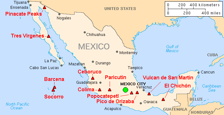
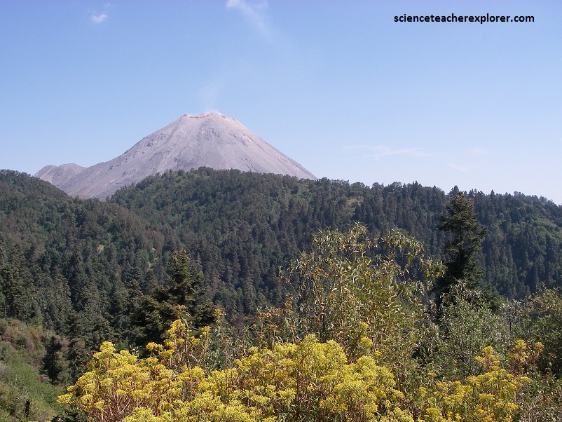
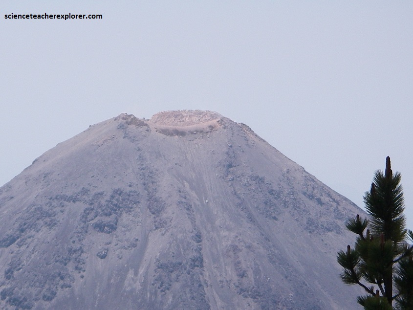
The Volcan de Colima is the most active volcano in Mexico, having erupted violently 40 times over the last 450 years. It is about 485 km west of Mexico City and 125 km southwest of Guadalajara, Jalisco. There are actually two peaks in the volcano complex: Nevado de Colima (4330 m), which is older and inactive, lies about 5 km north of the younger and very active 3860m-tall “Volcan de Colima” (also called Vulcan de Fuego de Colima). Since 1869-1878, a parasitic set of domes, collectively known a, El Volcancito have formed on the northeast flank of the main cone of Colima’s volcano.
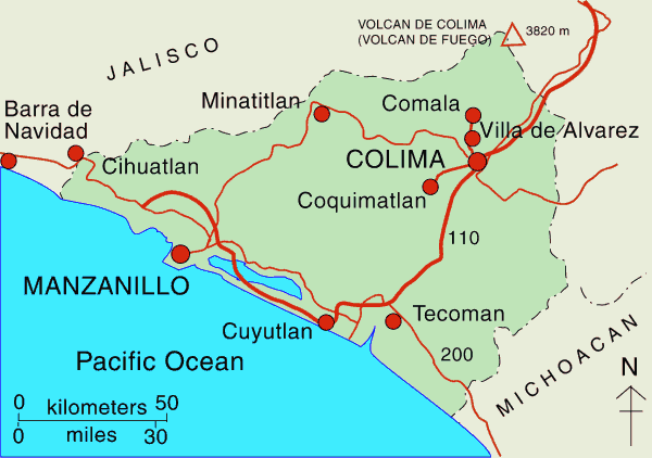
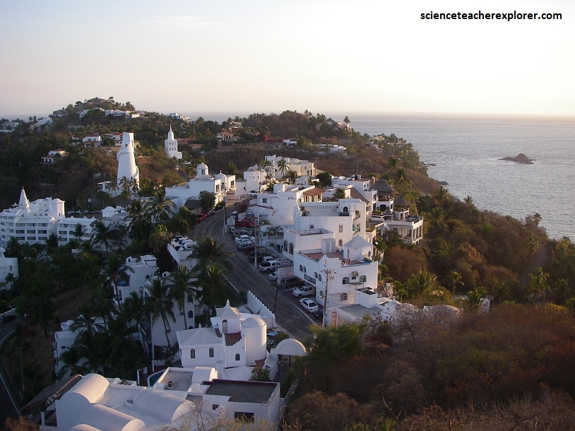
Becky and I stayed in Manzanillo, while preparing to explore Volcan de Colima. Manzanillo, located on the Pacific Ocean, contains Mexico’s busiest port that is responsible for handling Pacific cargo for the Mexico City area. It is the largest producing municipality for the business sector and tourism in the state of Colima.
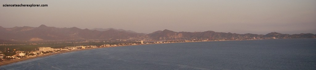
Manzanillo consists of two bays with crescent-shaped beaches, each about 4 miles in length. Bahia de Manzanillo is closer to downtown and is the older tourist section. Bahia de Santiago, to the west, is the newer and more upscale area. The two are separated by the Santiago Peninsula.
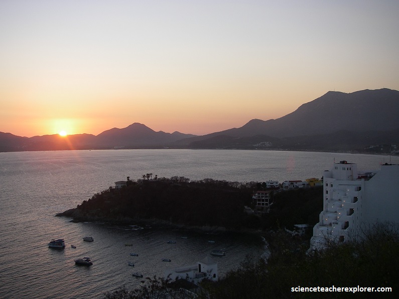
Manzanillo was once the scene of piracy and adventure. By 2011, its peaceful bays and sophisticated tourist and port infrastructure had made it one of the main tourist resorts and trading centers in the west of Mexico.
Manzanillo has a tropical savanna climate. The dry season, which is from November to May, has low amounts of precipitation, and temperatures tend to be cooler than in the wet season. The average temperature while we were there was 24 °C or 75 °F. However, there were alot of Jungle Cockroaches, crawling all over our room and deck.
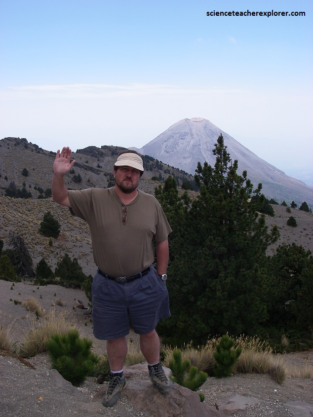
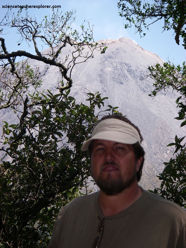
During mid-week, I caught a ride from Manzanillo with an Australian Puma-Biologist to get an up-close look at the Volcan de Colima. The Volcan de Colima was an hour and a half away from Manzanillo (the base was 150 km away).
The local conditions near the volcano was dangerous for the inexperienced and experienced mountaineer. I had to contend with ash infested jungles, cacti for handholds, and half a dozen kinds of unstable ankle-breaking ground-types.
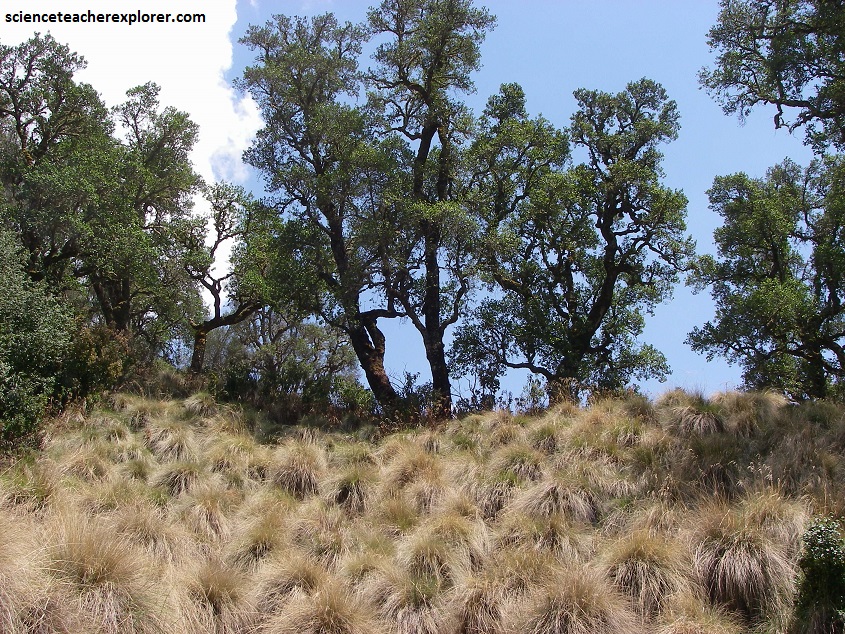
I viewed numerous types of birds and animals around the Volcan de Colima. Cows and horses perhaps were the most common, with several lizard species, scorpions and rattle snakes was seen. Humming birds and vultures were both common sights, as were dead armadillos. Puma and coyote tracks were frequent sights, which were exactly what my trekking buddy was looking for. Insects, especially of the blood drawing biting kind were limitless in the Volcan de Colima Mexican Jungle.
In the late Pleistocene era, a huge landslide occurred at the mountain, with approximately 25 km³ of debris travelling some 120 km, reaching the Pacific Ocean. An area of some 2,200 km² was covered in landslide deposits. Massive events, like this, seem to recur at Colima’s volcano every few thousand years.
The currently active Volcan de Colima cone is situated within a large caldera that was probably formed by a combination of landslides and large eruptions. About 400,000 people live within 40 km of the volcano, and in light of its history of large eruptions and situation in a densely populated area, it has been designated a “Decade Volcano”.
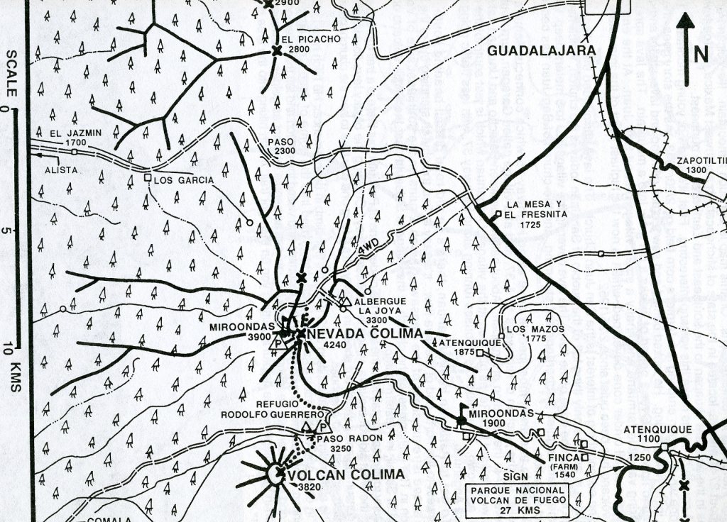
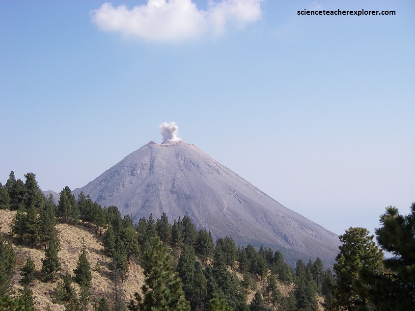
In recent years there have been frequent temporary evacuations of nearby villagers due to threatening volcanic activity. Eruptions have occurred in 1991, 1998-1999 and from 2001 to the present day, with activity being characterized by extrusion of viscous lava forming a lava dome, and occasional larger explosions, forming pyroclastic flows and dusting the areas surrounding the volcano with ash and tephra (pictured above).
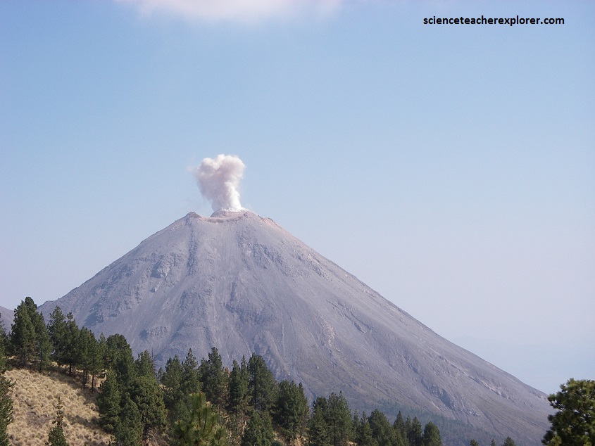
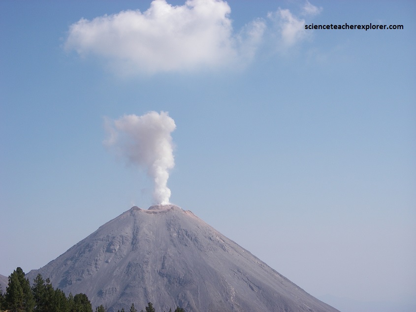
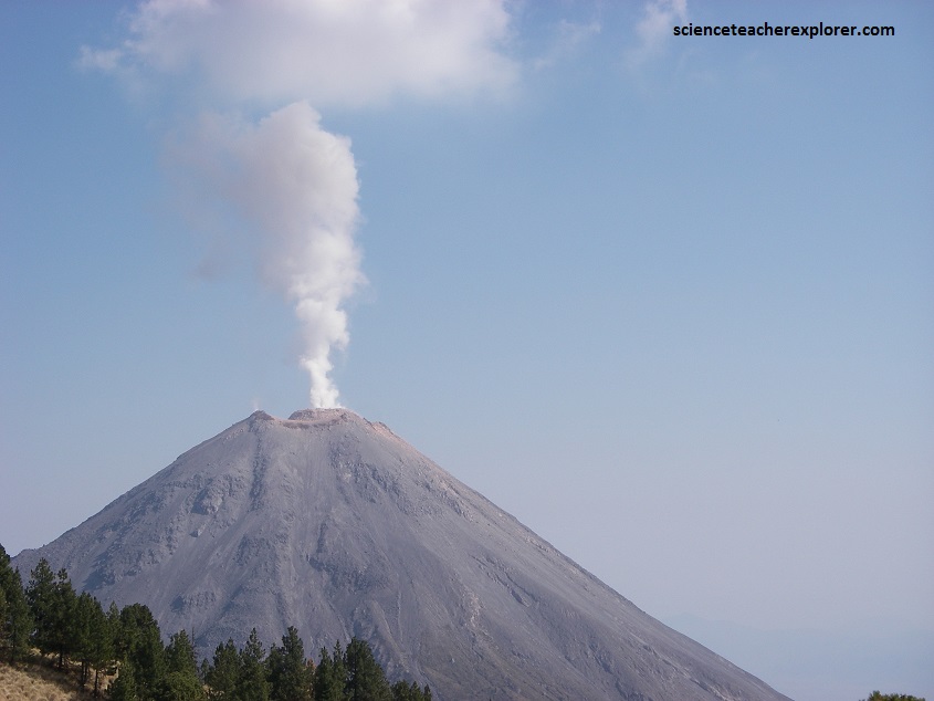
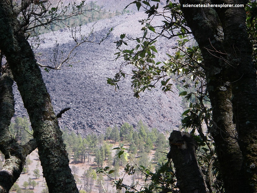
The largest eruption for several years occurred on 24 May 2005. An ash cloud rose to over 3 km over the volcano, and satellite monitoring indicated that the cloud spread over an area extending 110 nautical miles west of the volcano in the hours after the eruption . Pyroclastic flows travelled 4-5 km from the vent, and lava bombs landed 3–4 km away. Authorities set up an exclusion zone within 6.5 km of the summit (pictured below).

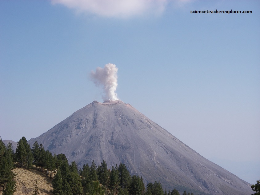
On November 21, 2014, the volcano erupted again. An ash column was sent 5 km into the air, covering towns as far as 25 km away in ash. No fatalities were reported, and no evacuations took place. There were eruptions on January 10, 21 and 25, with the ash from the January 21 eruption falling in towns more than 24 km away.
On Sunday, December 18, 2016, there were three eruptions. The biggest columns of ash reached 2 kilometers in height. And again, the Volcan de Colima experienced another strong explosion at 06:27 UTC on January 18, 2017. The eruption spewed volcanic ash up to 4 km (13,123 feet) above the crater.