Avebury, England 2016
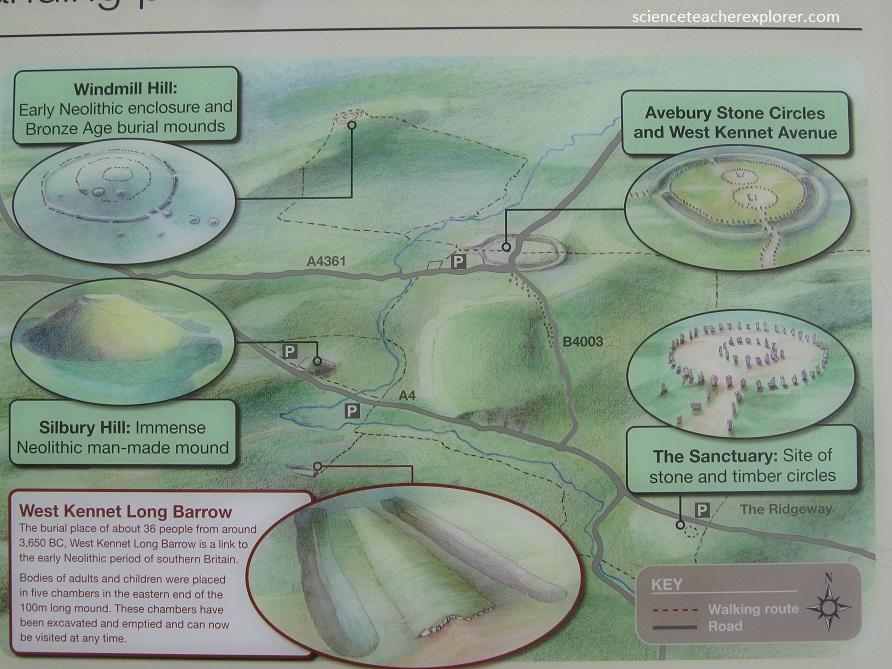
Since Stonehenge’s Megaliths came from Avebury, England (34 km north), I decided to explore that location on August 7th, 2016. I found that Avebury is part of an extraordinary set of Neolithic and Bronze Age ceremonial sites that seemingly forms a vast sacred landscape: The circle of ditch-and-bank at Avebury, cuts from the underlying chalk rock, encloses the remains of the largest stone circle in the British Isles. The largest prehistoric mound in Europe, [Silbury hill], stands less than a mile to the south, overlooked by one of the longest burial mounds overlooked by one of the longest burial mounds in Britain, [West Kennet long borrow]. One of the largest settlement sites of the earlier Neolithic period [Windmill Hill] is only a mile to the north, and the remains of the longest avenue of standing stones in the British Isles, [West Kennet Avenue] snakes it way south from Avebury towards Overton Hill and the Sanctuary. I attempted to reach some of these locations on foot from the Avebury village.
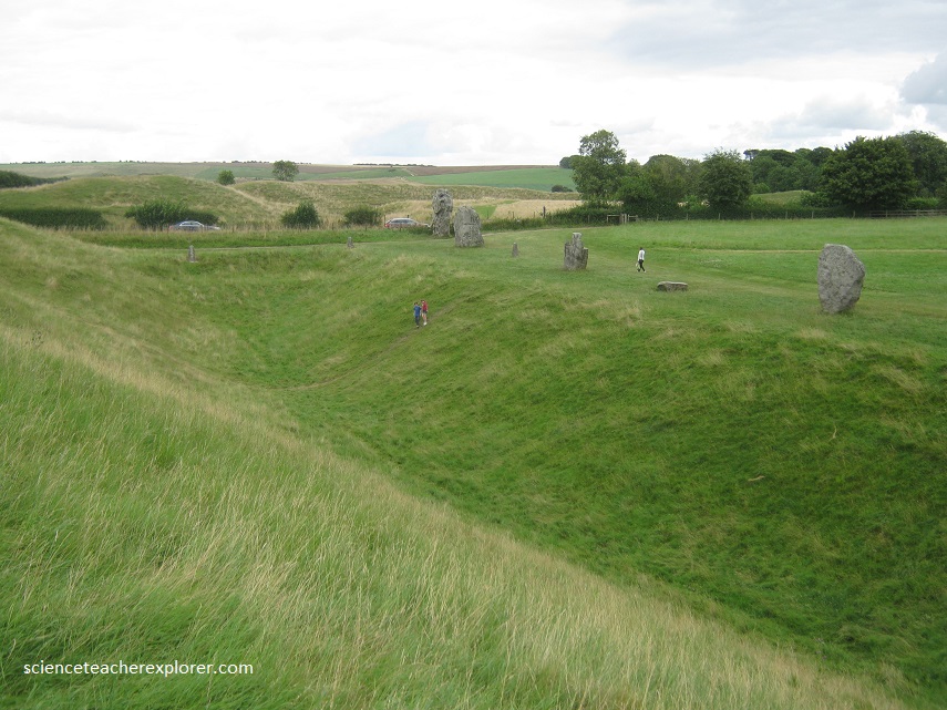
Avebury henge and stone circles are one of the greatest marvels of prehistoric Britain. Built and much altered during the Neolithic period, roughly between 2850 BC and 2200 BC, the henge survives as a huge circular bank and ditch, encircling an area that includes part of Avebury village. Within the henge is the largest stone circle in Britain – originally of about 100 stones – which in turn encloses two smaller stone circles.
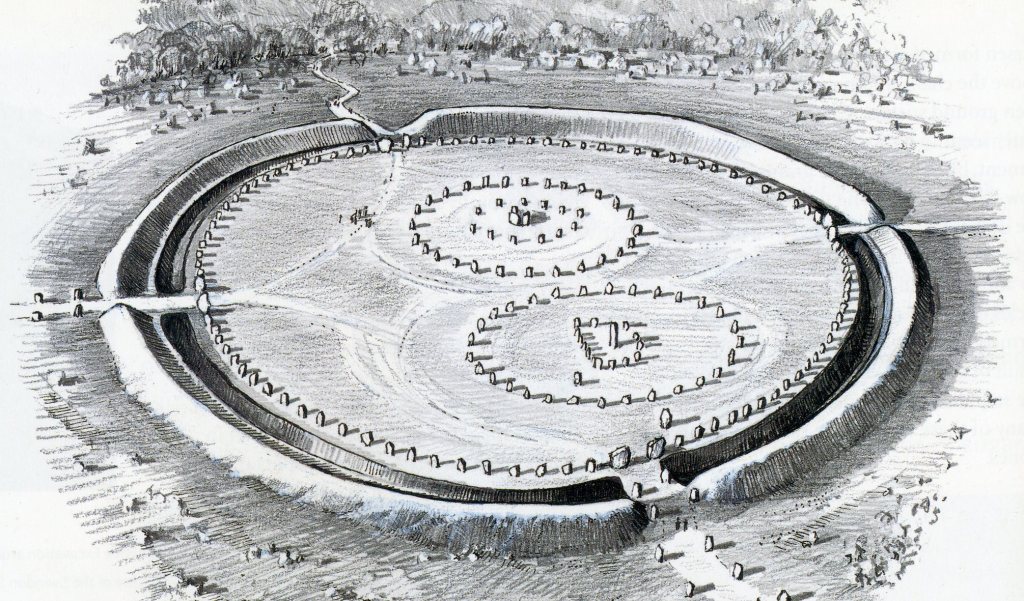
Below, is a picture of the immense stone circle in Avebury, Wilsire. The scale of Avebury is a amazing; just over 1 km around its bank, about 340m across the interior, the visible ditch 20m across and 3-4m deep enclosing around 11 hectares.
Limited excavations and more recent aerial and geophysical surveys indicate that many other features once existed within the enclosure. It is quite likely that, before the stone circles were erected, timber circles and structures may have originally filled the area within the bank and ditch, (pictured below).
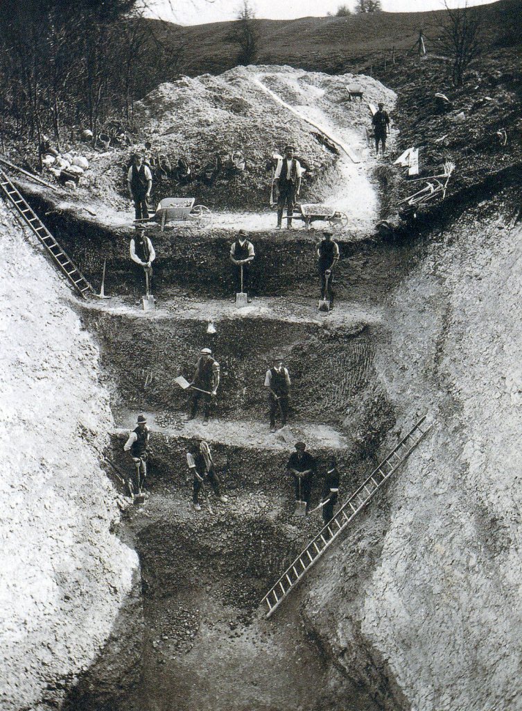
The construction of the stone circles was a feat of epic proportions for the locals who dragged the stones to the site from a quarry 3 km away. Laborers using deer antlers as picks and the shoulder blades of oxen as shovels dug 150,000 tons of chalk out of the ditch to make the bank. Pictured above, gleaming in white originally, it separated the sacred area inside it from the ordinary world outside.
Avebury henge stands within a landscape of stone, more obvious in the Neolithic period today. Wiltshire is chalk country, with rounded outlines to its hills reflecting the soft rock beneath the turf which originated in the seas of 100 m.y.a.. But the northern Downs, especially around Avebury and Marlborough, are spectacularly littered with younger rock, one of the hardest, most intractable rocks of the British Isles, [Sarsen Stones]. Sarsen stones formed about 30-35 m.y.a. above the chalk, and probably just below the then ground surface. It is a silcrete (a form of sandstone that has been solidified by the absorption of liquid silica. There is no way of knowing how the standing stones at Avebury were regarded when they were first dragged from the Lockerridge Dene and Marlborough Downs, (3-5 km away), and erected vertically.

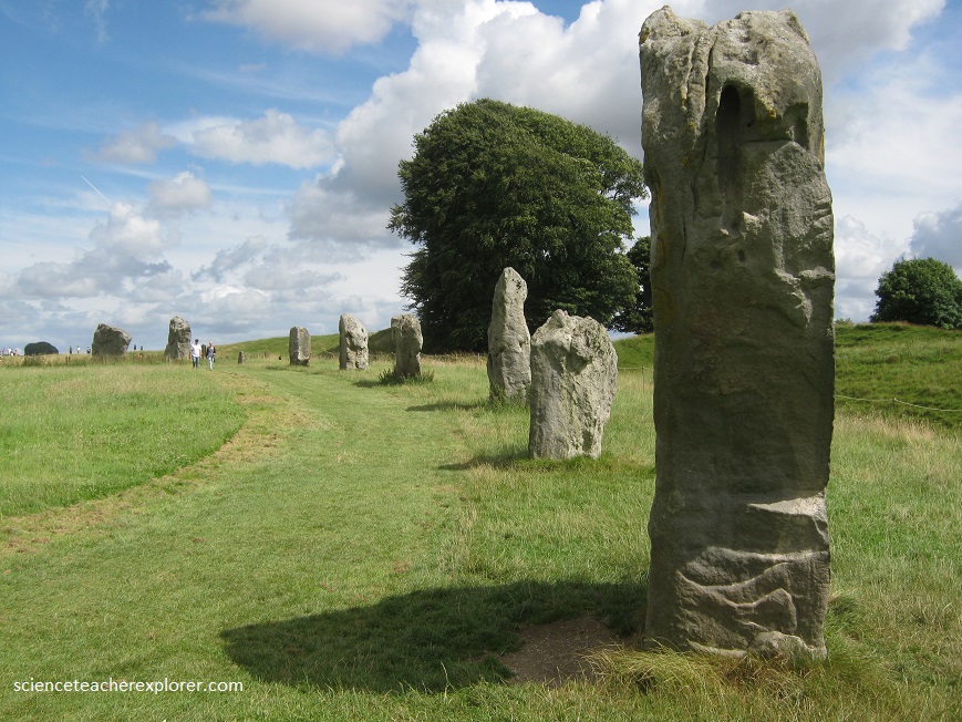
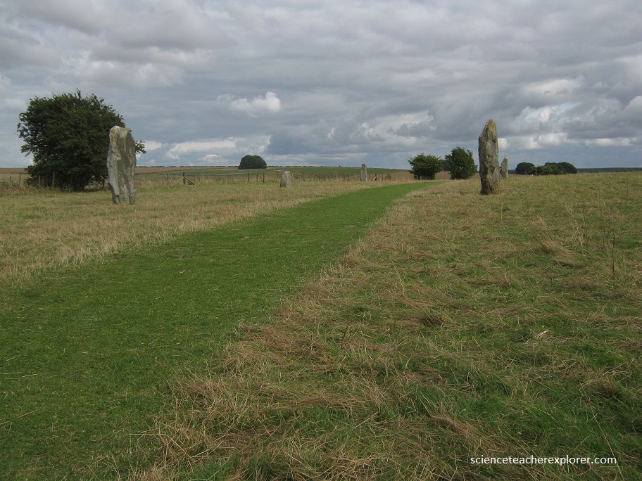
Next, I began walking down pathway marked by the aligned giant stones, towards the Southwest or Winter Solstice. This marked pathway was named “West Kennet Avenue”. Originally, the Avenue consisted of around 100 pairs of standing stones. These created a corridor 15 m wide along the entirety of the winding 2.5 km course. Each pair of stones stood about 24.5 m from the next. The sarsen stones used are not quite as large as those at Avebury and average about 3 m high. Each stone appear to have been selected for their shape; some are long and cylindrical, while others are broad and often triangular in shape. Generally, stones of the two different types stood opposite each other. It has been suggested that they may have been intended as male and female representations, the male being long and cylindrical and the female triangular.
Pictured below, Silbury Hill is a colossal man-made mound that rises to 43 m from the base and 160m wide, that cover 5 acres of ground. It occupies a valley-floor position, close to where the River Kennet rises at Swallowhead Springs and where it is joined from the north by the Winterbourne Stream, which as its name suggests, runs mostly in the winter. The mound is surrounded by a ditch, originally up to 9m deep, dug to provide material for the mound. Recent computer modelling has shown that the volume of the mound closely matches that of the ditch. Additionally, chalk rubble was added on a yearly basis and made into a pile that naturally settles at an angle of about 30 degrees, (angle of repose).

Pictured above, this hill is a flat-topped cone, likened to an upturned pudding basin, that was begun more than 4300 years ago and remains the biggest man-made hill in Europe. About 56 million basketfuls of turf and chalk were reckoned to have been needed. No sign of any burial inside. From erosion, it should of worn away within a few hundred years & became an amorphous lump. Yet there Silbury stands, intact, as if it had been built last week. It would be more appropriate to call Silbury a pyramid rather than a hill, because when it was built it would have been as resplendent as the pyramids of Egypt, similarly faced in limestone cladding. To ensure its stability, its builders made stone foundations and a core of alternating layers of impermeable mud. They almost certainly proceeded in an upward spiral rather than using the method of stepped terraces, as was thought up until recently.

About a 1km south of Silbury hill is the West Kennet Long Barrow. This huge earth barrow has a maximum height of 3.2 m and tapers out from the narrower western end to a maximum width of 25 m towards the eastern entrance. The barrow consists of a core of sarsen stones capped with chalk rubble from the surrounding quarry ditches and was built around 3700BC.
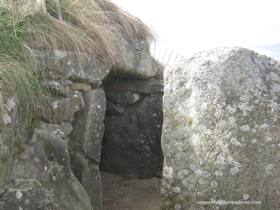
Remains of about 36 people were placed in the West Kennet Long Barrow chambers soon after it was first built. Many of the people represented by human remains from West Kennet are not complete skeletons. It seems that the dead were placed in the chambers as complete bodies, and the bones later moved around and reorganized.
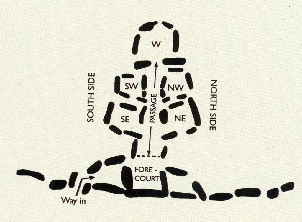
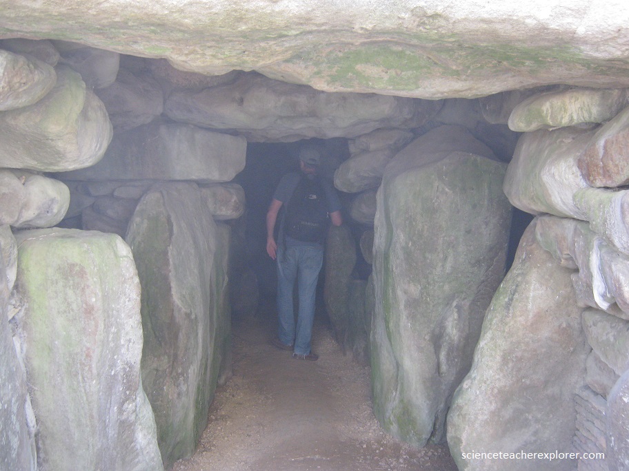
Imaged above, at the eastern end of the mound is an impressive structure consisting of five chambers opening off a central passage. This is fronted by a semicircular forecourt with a façade of huge sarsen stones aligned north–south.
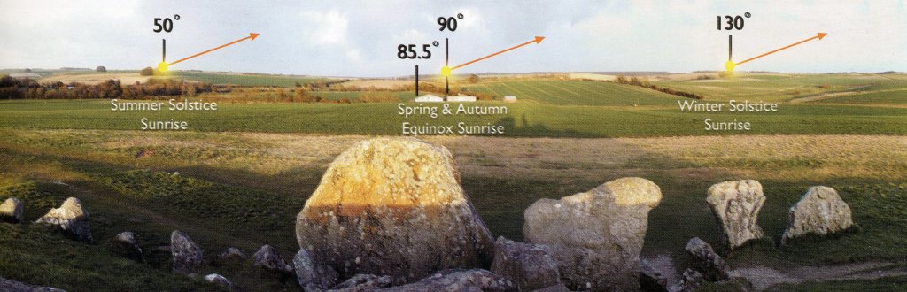
Pictured below, the sun’s movement around the sky produces curious light effect inside the West Kennet Long Barrow that change with the seasons. The most spectacular events may be seen around the time of the spring and autumn equinoxes when the sun rises due east and sets due west. For a few weeks either side of the equinoxes, a narrow beam of light enters the monument, (all the way to the back), shortly after sunrise.
Additionally, some rooms resonate strongly with sound at a specific frequency, (110 Hz & 84 Hz). When a note is sung that matches the resonant frequency of the rooms will sound louder than other notes, (due to reflection and constructive interference), and may also ring on for some time afterwards. Many of the Sarsen Stones inside the “West Kennet Long Barrow” have been polished for this reason. Possibly for chanting reasons.
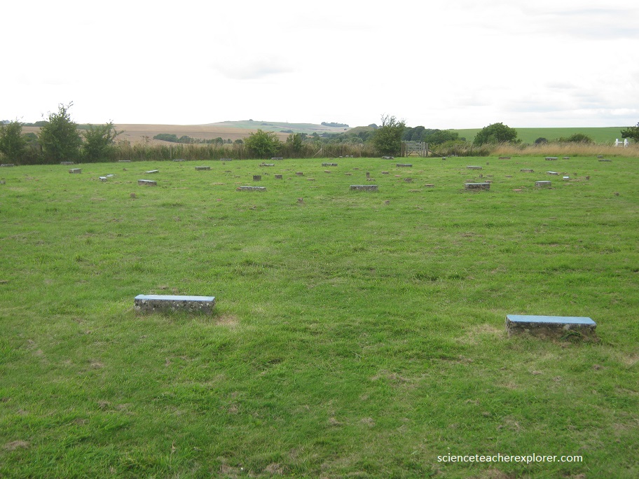
A few kilometers southeast of the Silbury Hill is “The Sanctuary”, (pictured above). It consisted of Concrete blocks marking the position of the original wooden posts and stones. Its function remains a mystery: possibly it enshrined the dwelling place of some revered person, and certainly huge numbers of human bones were found here, accompanied by food remains suggesting elaborate death rites and ceremonies from 2500-2000 B.C..
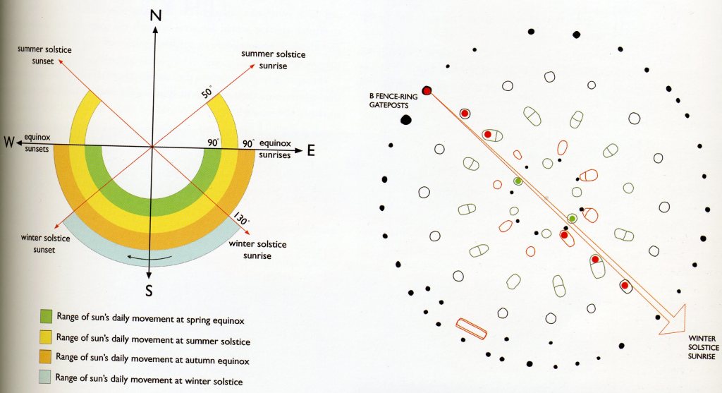
From the way that some of nearby monuments are aligned astronomically, it seems the Avebury people had an interest in the winter solstice, which is quite understandable. The Sanctuary could feasibly have been used to determine the arrival of winter solstice. Noting when the sun has reached its solstice and equinox positions forms the basis of a solar calendar.
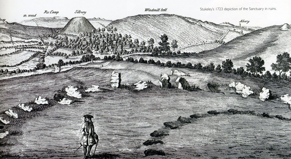
Imaged above, William Stukeley viewed the area from the Sanctuary in July 1723. There is geometry in the layout of the Sancturary that is not immediately obvious. Rather than a series of concentric circles, it could be considered as a series of overlaid regular polygons, with six, eight, twelve and sixteen sides. The polygons are symmetrically arranged on an axis running roughly, NW/SE through the centre post and between the two large ‘entrance posts’ of B, the Fence ring. The central axis through the Sanctuary is on a bearing of 123.5 degrees.

40 kms to the North-west of Avebury, I also visited the strange site of the “Uffington White Horse”. Surging to 30 m from its ridge on the Berkshire Downs, the summit of White Horse Hill commands panoramic views out over the ancient heartland.
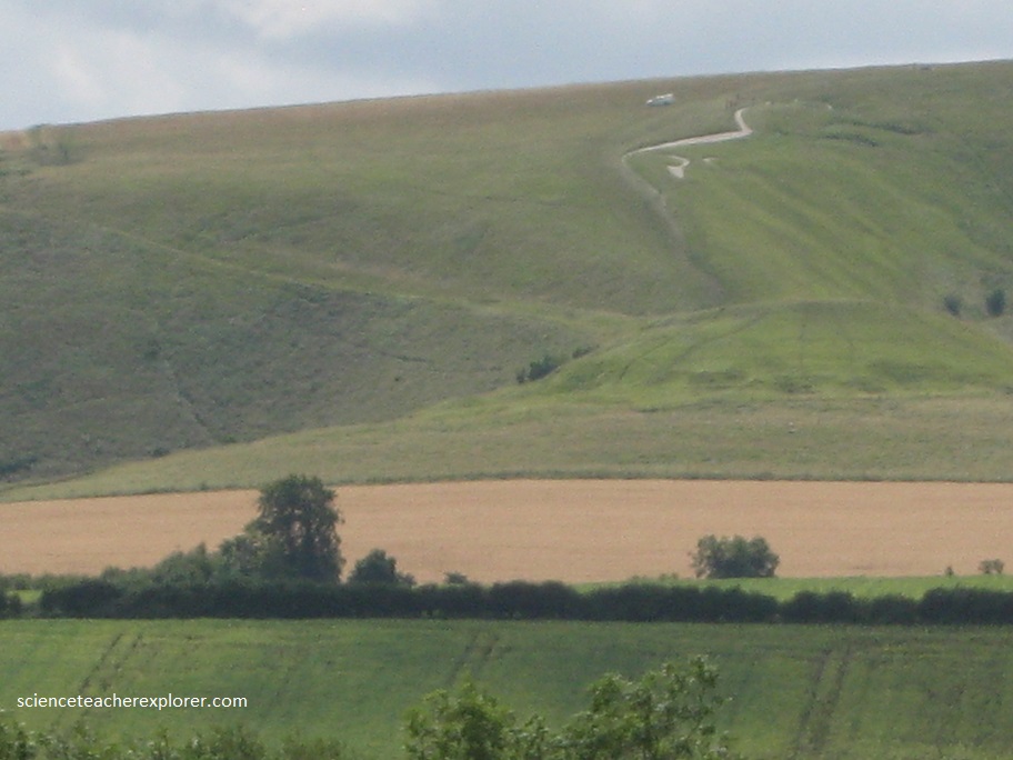
The White Horse, which measures 111 m from the tip of its tail to its ear, has been dated to the later Bronze Age or Iron Age, between 1740 and 210 BC. It may have been a territorial marker or a fertility symbol – its function is not certain. This bold, barbaric image is branded into an English down-land crest just below the Iron age hillfort of Uffington Castle.

