Sedona, Arizona 2011
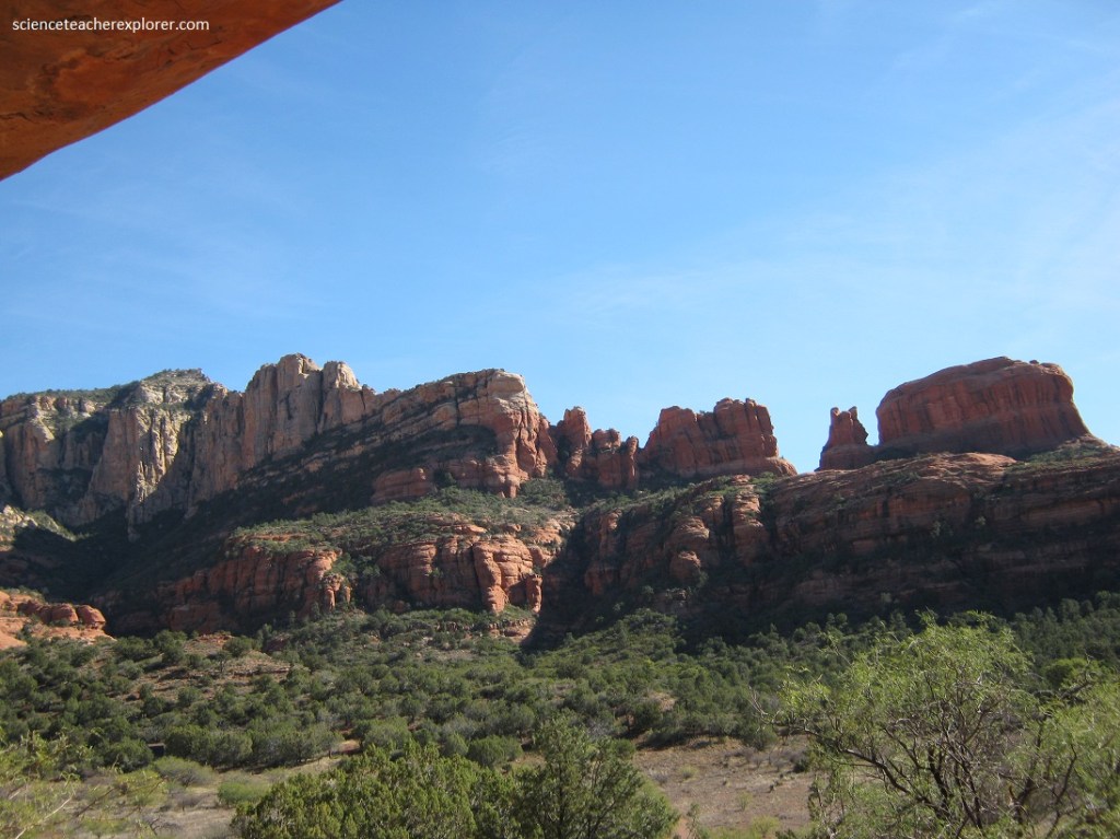
In November of 2011, Becky (my wife) and I spent the Thanksgiving Break in Sedona, Arizona. The town of Sedona is situated at the southern end of the Oak Creek Canyon in northern Arizona, where the cliffs open out, and provides a base for exploring the surrounding lands, which include many other canyons and an extensive, scenic red-rock wilderness in all directions.

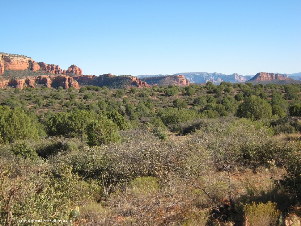
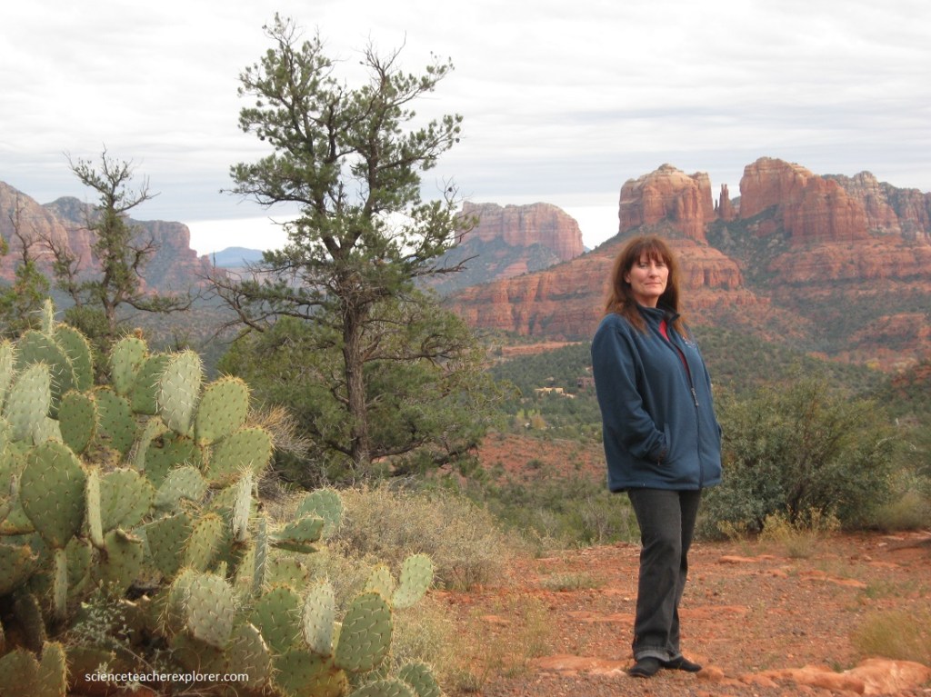
Sedona was established in 1902 but did not become a popular destination until the 1960s, since when it has become a well known center for various kinds of artistry, and a magnet for wealthy retirees, for followers of new age religions and for people just wanting to escape the pressures of city life. It is a pretty location surrounded by large red and white sandstone cliffs and buttes, with contrasting greenery provided by a mixture of trees, bushes and cacti.
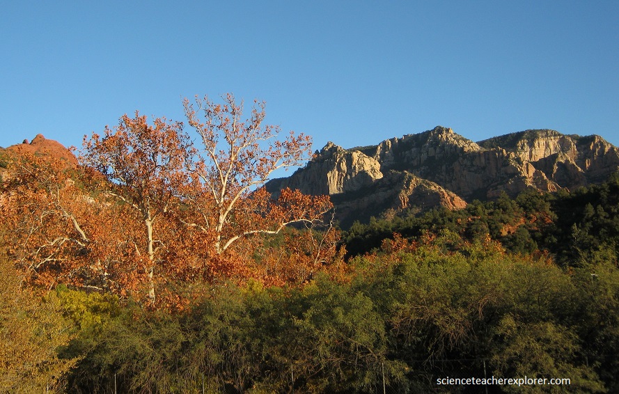
Oak Creek Canyon is blessed with a high elevation that ensures cooler temperatures and more rainfall than the hotter, mainly desert habitat common to Arizona. Here lush woodlands cover the canyon floor, making it a favorite escape during the summer months. The canyon is deep and narrow. A stream flows through it year round, reflecting the red sandstone of the lower walls and the white limestone higher up. Like all sandstone canyons, the walls of Oak Creek Canyon have been eroded into a myriad of rounded arched shapes where water has carved though softer sections.
Towering cliffs of rich red Schnebly Hill Formation, a mixed sequelnce of sandstone, siltstone, and limestone, surround Sedona. The Schnebly Hill Formation was deposited during a single rise and fall in sea level during Permian time about 275 million years ago. As sea level rose, a finger of ocean called the Pedregosa Sea invaded the area from the southeast, never reaching much farther than Sedona before retreating back to the southeast. Much of Permian Arizona was a desert environment. Rivers, flowing from mountains in what is now Colorado, carried and deposited silt, sand, and gravel onto floodplains and alluvial fans, now the Hermit Shale. Sedona is built on this soft and easily eroded rock, and it forms the round slopes below the colorful red cliffs. The Schnebly Hill Formation was deposited as the invading ocean replaced the floodplains with sandy beaches, silty lagoons, and salty tidal flats. A thorough but brief deepening of the sea laid down a thin hard layer of limestone, (the Fort Apache Member), on top of the Bell Rock. Once the ocean had thoroughly retreated from the region, extensive wind-blown sand dunes covered everything with the Coconino Sandstone. This light-colored formation crowns the higher bluffs north of Sedona.
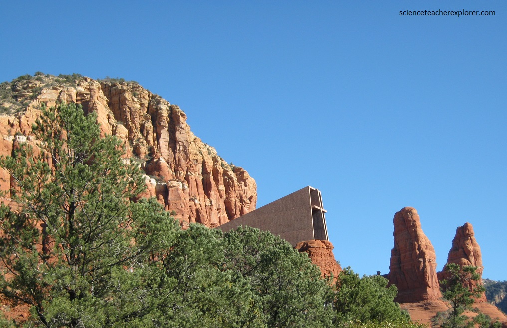
Pictured above, and tucked between massive red boulders, the Holy Cross Chapel is more widely known as one of America’s manmade wonders. The sunlight streaming through the windows is likely to make any visitor appreciate the glory of nature and man’s ability to harness that power to create beauty in the desert. The Chapel is located in the heart of what many describe as a vortex bringing gratitude to those who flock there. Sedona itself is well known to many for its connection to new-age mysticism and the purported energy vortices on the outskirts of the city. Despite this connection, the Chapel itself was actually built by a devout student of Frank Lloyd Wright named Marguerite Brunswig Staude in 1956. Staude wanted to create a lasting tribute to her religious beliefs, and was so taken with the beauty of Sedona that she began work on the Chapel.
The Sedona-Oak Creek Canyon area is situated in a Transition Zone between two great geologic provinces: the Colorado Plateau and the Basin and Range. The Colorado Plateau, a 130,000-square-mile region of vast plains, high mesas, buttes, deep canyons, volcanic fields and isolated mountains clusters, is built of thousands of feet of generally horizontal sandstone, shale, limestone strata and basalt flows. In north-central Arizona, the southern margin of the Colorado Plateau is the Mogollon Rim, that line of spectacular cliffs north of Sedona. The sedimentary and volcanic rock layers that form this part of the Colorado Plateau are beautifully exposed in the Mogollon Rim north of Sedona. In ascending order they are: the Supai Group, the Coconino Sandstone, the Toroweap and Kaibab limestone Formations, and the basalts of the San Francisco volcanic field. Basalts of the Mormon Mountain volcanic field cap the Mogollon Rim to the west of Sedona. South of Sedona, are dark-colored basalts of the House Mountain volcano and the white sedimentary layers of the Verde Formation. The oldest of these sedimentary rock units that is exposed throughout the region around Sedona is the Supai Group, deposited 310 to 270 million years ago. During this time the Sedona-Oak Creek Canyon region was a nearly flat, subtropical desert coastal plain bordered by shallow seas, at the latitude of present-day Central America.
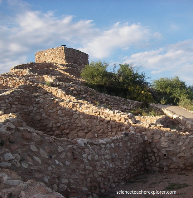
Pictured above, Tuzigoot National Monument preserves a 2- to 3-story pueblo ruin on the summit of a limestone and sandstone ridge just east of Clarkdale, Arizona, 120 feet (36 m) above the Verde River floodplain.
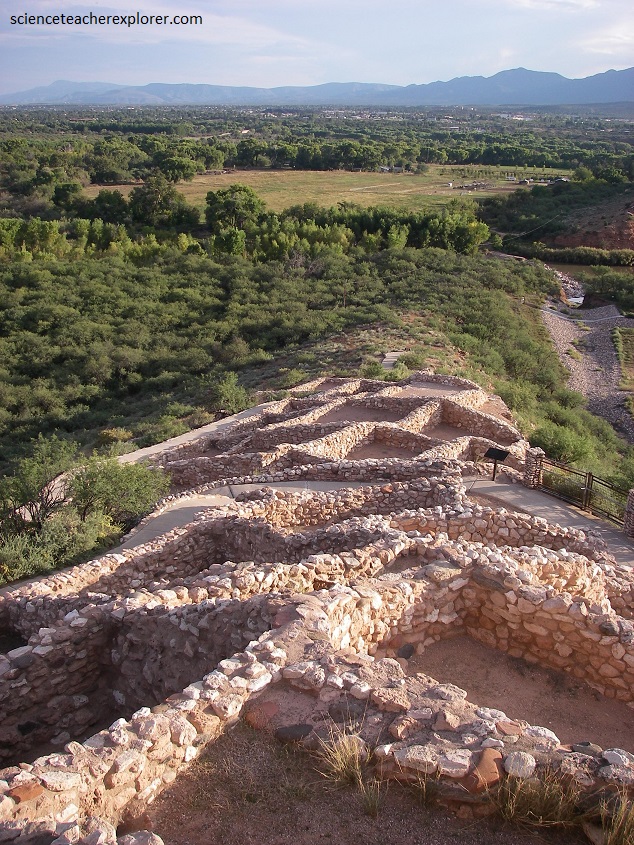
The Tuzigoot Site is an elongated complex of stone masonry rooms that were built along the spine of a natural outcrop in the Verde Valley. The central rooms stand higher than the others and they appear to have served public functions. The pueblo has 110 rooms.
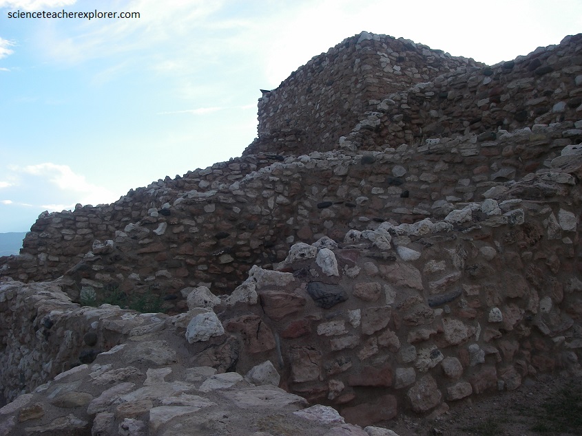
″Tuzigoot″ is a Tonto Apache term for “crooked waters,”from nearby Pecks Lake, a cutoff meander of the Verde River. The pueblo was built by the Sinagua people between 1125 and 1400 AD. Tuzigoot is the largest and best preserved of the many Sinagua pueblo ruins in the Verde Valley that surrounds Sedona. The ruins at Tuzigoot incorporates very few doors; instead, the inhabitants used ladders accessed by trapdoor type openings in the roofs to enter each room.
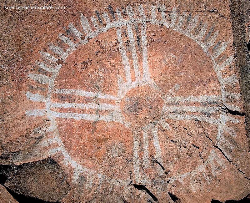
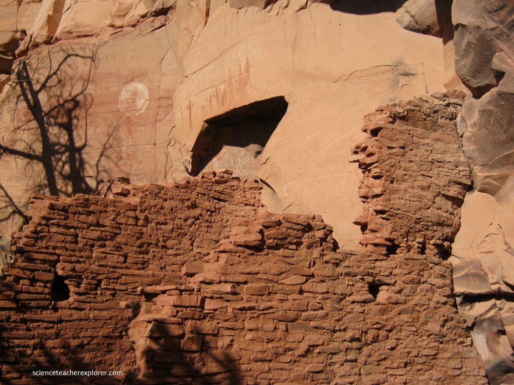
Pictured above, Palatki must have been an incredibly gorgeous place to live. Located in Loy Canyon in the Sedona red rock country of
Arizona, impressive blood-hued buttes and blazing orange cliffs
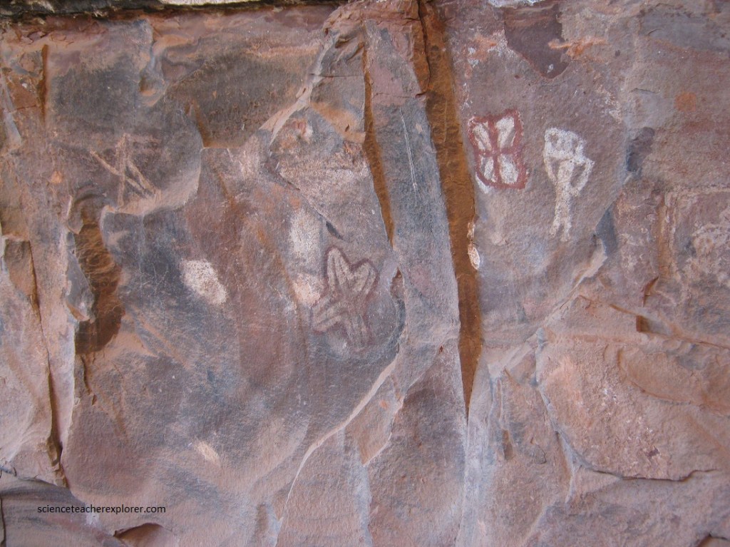
rise to dizzying heights. The largest group of pictographs (painted rock art) in the Verde Valley is located here at the Palatki Heritage Site. It spans six thousand years of human habitation, with many of the pictographs being made long before the cliff dwelling nearby was constructed. This rock art ranges from the Archaic Period (4000 BC – 300 BC), through the Basketmaker Period (300 BC – 750 AD) and the Pueblo Period (750 AD – 1300 AD), to historic times (1550 – the 1800’s AD).
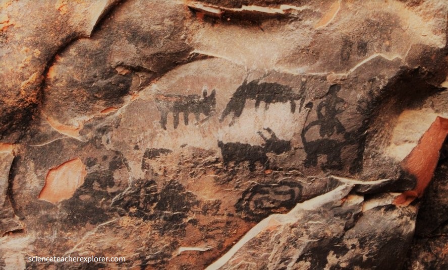
The Palatki pictographs are arranged in a number of shallow alcoves or grottoes and were executed in a variety of colors, including red
(hematite), white (kaolin), black (charcoal), and occasionally yel-
low (limonite). Many of the charcoal figures (pictured above), especially those showing mounted horsemen, are the work of the Yavapai and
Apache cultures, which arrived in the area about 1300 and 1500 AD
respectively. The iconography done in red or white are much older.
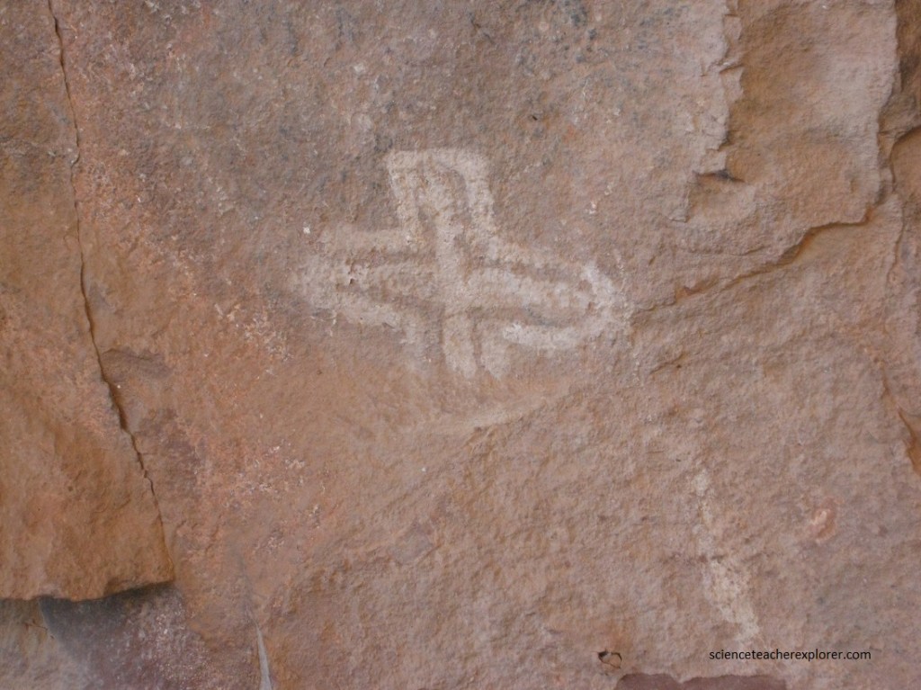
The imagery here includes sun shields, squiggles, grids, rakes,
star symbols, a star chart that might show the Milky Way, circles, dia-
mond shapes, patterns of dots, concentric circles or spirals, helixes, and snakes as well as human and animal figures. In addition, a few tall, ghostly humanoid figures similar to those found in southern Utah’s Barrier Canyon loom in red on the canyon walls. One Kokopelli figure, also known as the hump-backed flute player.
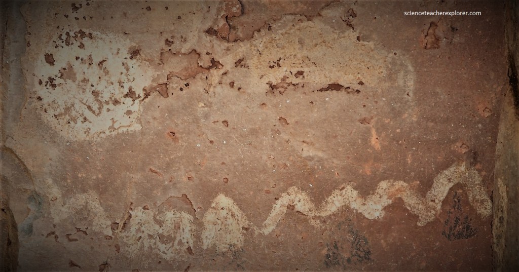
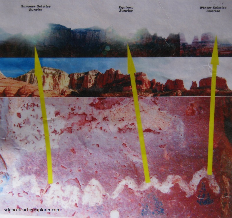
Pictured below, is another calendar pictograph at the Palatki Site that is shown to use shadows for a calendar.
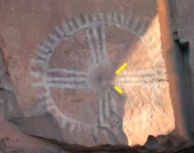
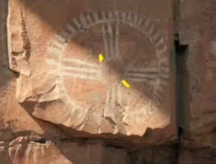
an interpretive sign (public domain)
The Palatki site has a set of ancient cliff dwellings in the red sandstone cliffs, built from 1100 to 1400 AD by the Sinagua people of the Ancestral Puebloans. The cliff dwellings were built under south-facing overhangs for shelter and winter sun. The Sinagua people planted crops and made pottery in the area. Palatki and Honanki, another nearby archaeological site, had the largest cliff dwellings in the Red Rock formation area from 1150 CE to 1300 AD.
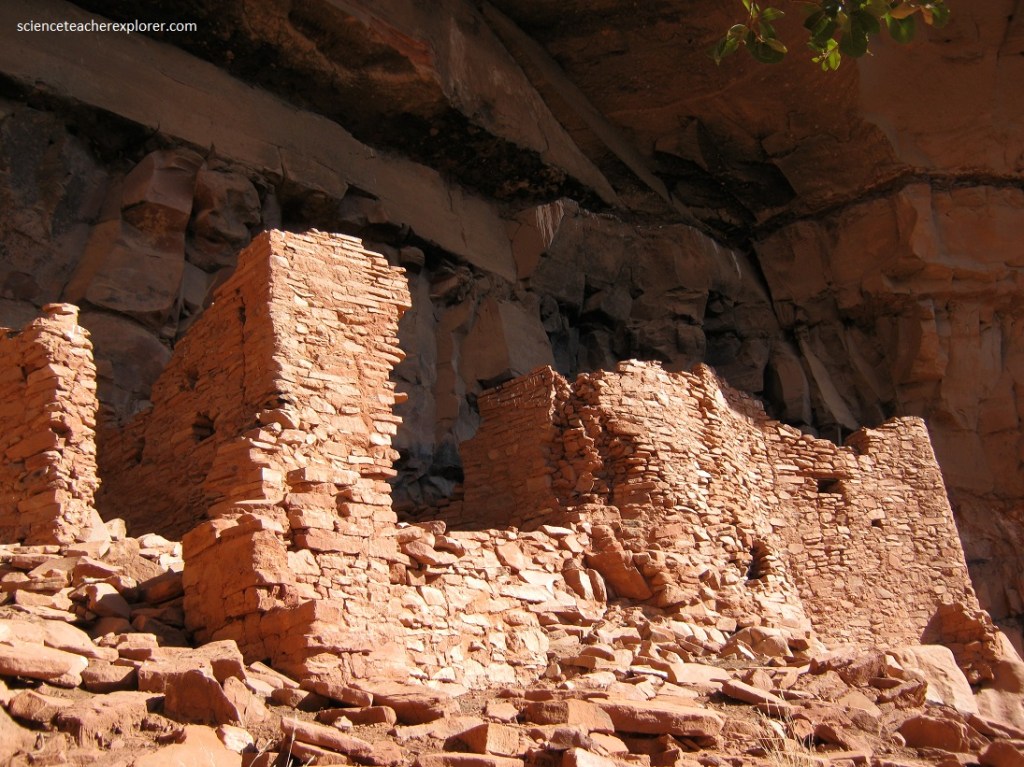
Pictured above, the Honanki site is much bigger. At the time it was inhabited, from 1100 AD to 1300 AD, it was the largest settlement in Red Rock Country. This entire period of Sinaqua culture was named after Honanki. One of the beams recovered from the ruins was tree-ring dated to 1270 AD. Same as with Palatki, Honanki is surrounded by pictographs and petroglyphs from different time periods, some from 2000 BC. Every culture that inhabited the site has left their mark, without disturbing any of the drawings from previous tenants. Honanki was last inhabited between 1400 and 1875, by Yavapai and Apache people, who also contributed their pictographs.
The Palatki and Honanki sites provide a glimpse into the lives of prehistoric peoples who lived in present-day Arizona. These are the largest settlements of Sinagua culture in central Arizona. Palatki had over 60 rooms, and unlike any other cliff dwellings I have seen, the pictographs and petroglyphs are right with the dwellings. Theories are that these settlements were inhabited since the end of the last Ice Age up to the near present. .
