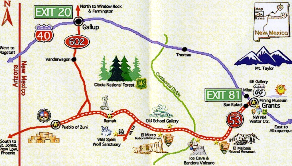
El Morro, NM 2013
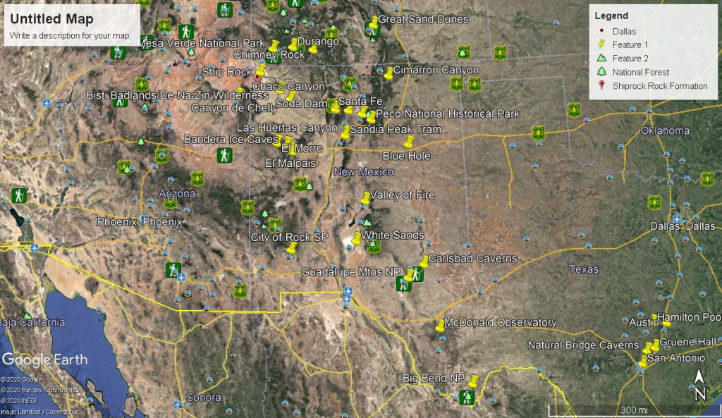
On my way back to Utah from Texas, I decided to explore the El Morro National Monument in New Mexico during July of 2013.
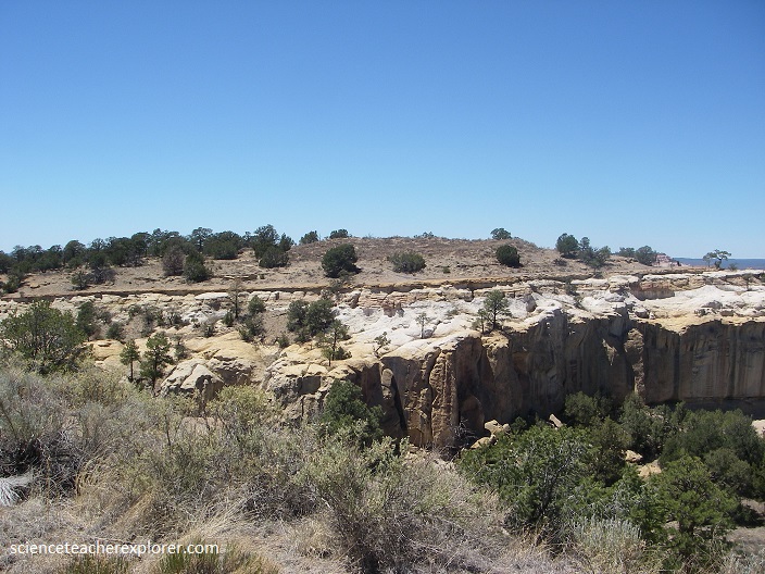
El Morro is on the southwestern flank of the Zuni Mountains, a subdued Proterozoic-cored uplift that formed during Laramide compressional deformation about 75 to 50 million years ago along the southern margin of the Colorado Plateau. The main thrust fault associated with formation of the Zuni Mountains is along the southwestern margin. The Proterozoic basement was shoved toward the southwest along the fault. The rocks within the monument dip gently (3°) toward the southwest away from the Zuni Mountains
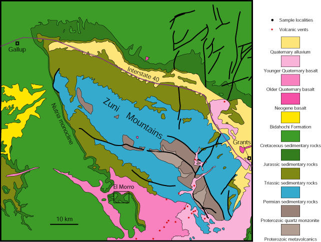
El Morro, which means “bluff” or “headland” in Spanish, is an imposing cliff made of Middle to Late Jurassic (155 to 165 million years old) Zuni Sandstone capped by Late Cretaceous Dakota (~95 to 96 million years old) sandstone and shale.
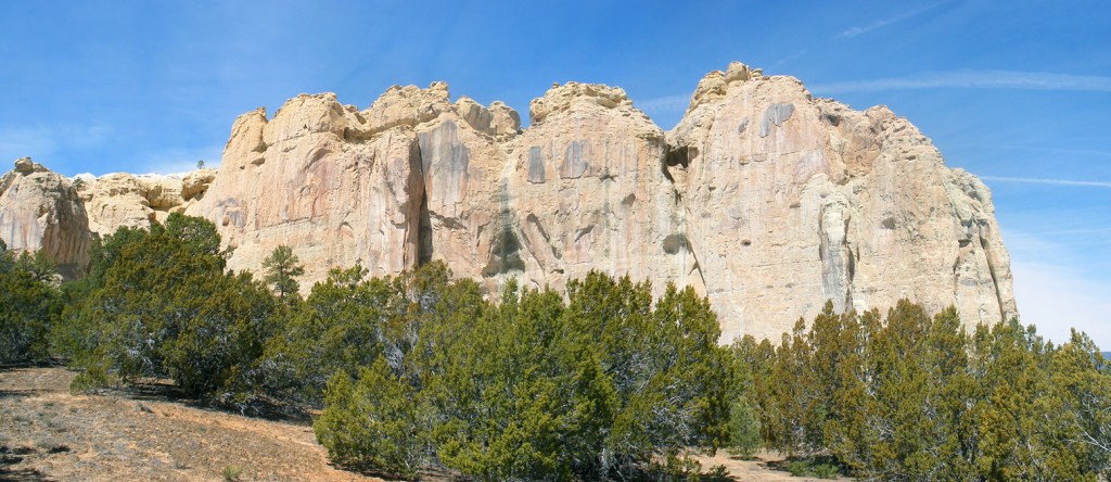
Pictured above, the Zuni Sandstone is a stratigraphic equivalent to the Entrada Sandstone and Bluff Sandstone in other parts of the Colorado Plateau. Sea level rose into Cretaceous time, and by about 96-95 million years ago, the shoreline of the Western Interior Seaway was located nearby. Rivers flowing to this sea deposited sandy sediment that became the Dakota Sandstone. Pictured below, Brown Cretaceous Dakota Sandstone stream channels cut into the top of the Jurassic Zuni Sandstone. Note the white paleo-weathering horizon at the top of the Zuni Sandstone.
Pictured above, the sandstone beneath the Dakota Sandstone is bleached to white several feet below the contact. This represents a time gap on the order of 60 million years and the bleached horizon is a paleo-weathering surface. In places, pieces of the underlying Zuni Sandstone have been incorporated into overlying sandy to gravelly stream deposits within this bleached layer.
Pictured above, travelers, including Native Americans, Spaniards, and citizens of the United States, have carved their symbols, names, messages, and dates of their passage into the soft cross-bedded Zuni Sandstone for centuries. Located on an ancient east–west trail in the western part of the state, the monument preserves the remains of a large prehistoric pueblo atop a Zuni Sandstone Promontory with a pool of water at its base, which subsequently became a landmark where many centuries of explorers and travelers left historic inscriptions that survive today.
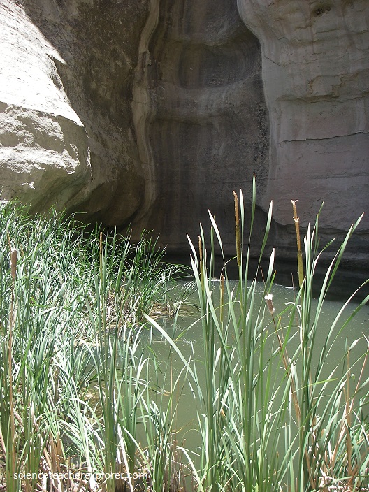
With its oasis-like source of water, El Morro served as a stopping place for numerous travelers through the otherwise arid and desolate region, many of whom left signatures, names, dates, and stories of their treks in the walls of the sandstone cliff. While some of the inscriptions are fading, there are still many that can be seen today, with some dating to the 17th century. Pictured below, I’ve used a filter to enable some of the inscriptions to be seen.
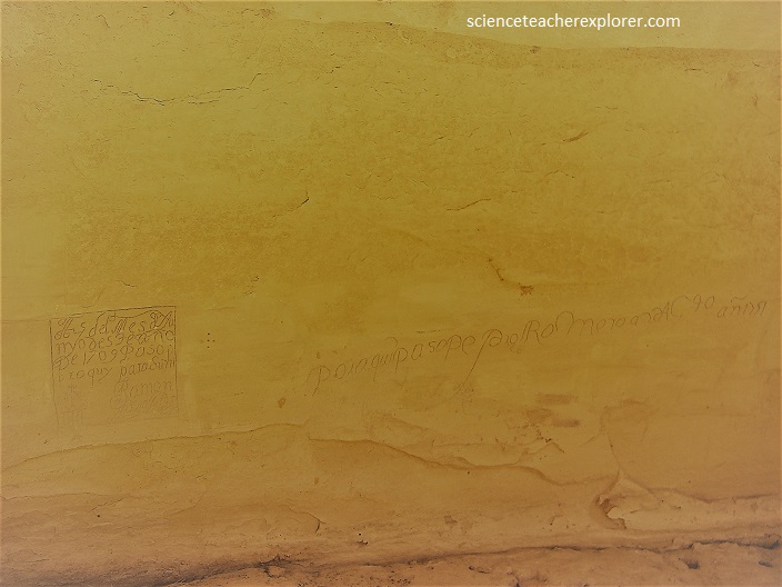
During the 1500s, Spanish explorers enslaved the Pueblo people in the American Southwest and tried to destroy their religious practices. In 1680, the Pueblos organized the first revolution against a foreign colonial power on American soil. Under the leadership of medicine man Popé (or Po’Pay), they successfully drove the Spaniards out of Pueblo territory back into Mexico in a surprise attack. The inscription below shows a signature dated before the revolt. The oldest documented signature belongs to Don Juan de Onate, wh dated his message “16 April 1605,” although some of the Native American petroglyphs pre-date this.
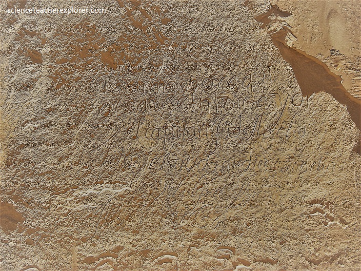
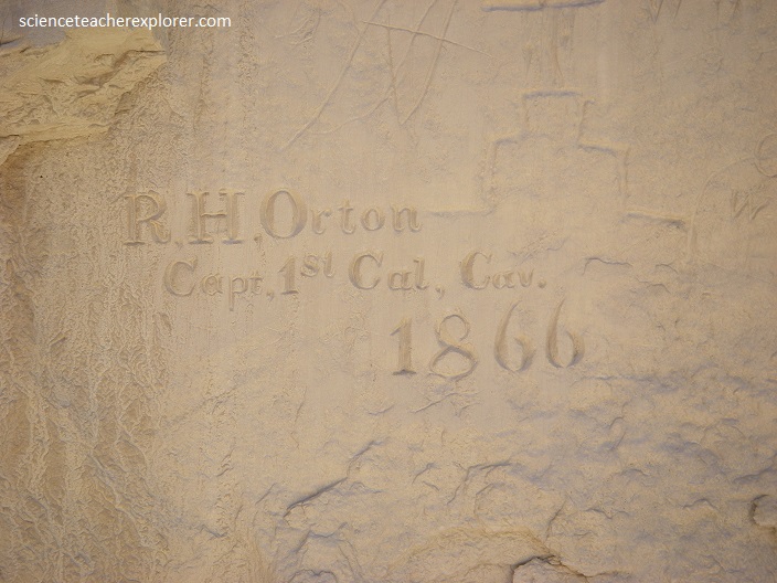
The Pueblo Revolt of 1680—also known as Popé’s Rebellion—was an uprising of most of the indigenous Pueblo people against the Spanish colonizers in the province of Santa Fe de Nuevo México, present day New Mexico. The Pueblo Revolt killed 400 Spaniards and drove the remaining 2,000 settlers out of the province, back into Mexico. The Spaniards reconquered New Mexico twelve years later in 1692. Pictured below is a 1692 inscription of a returning Spanish Soldier.
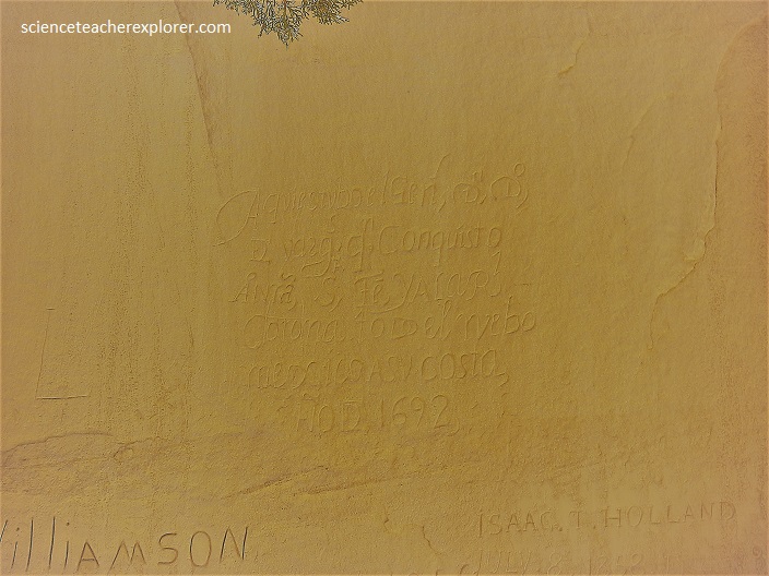
In August 1692, Diego de Vargas marched to Santa Fe unopposed along with a converted Zia war captain, Bartolomé de Ojeda. De Vargas, with only sixty soldiers, one hundred Indian auxiliaries, seven cannons (which he used as leverage against the Pueblo inside Santa Fe), and one Franciscan priest, arrived at Santa Fe on September 13. He promised the 1,000 Pueblo people assembled there clemency and protection if they would swear allegiance to the King of Spain and return to the Christian faith.
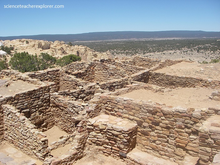
Pictured above, between about 1275 to 1350 AD, up to 1,500 people of the Ancestral Puebloan culture lived in the 875-room mesa-top pueblo. The village was situated on the old Zuni-Acoma Trail, an important prehistoric trade route. Spanish explorers visiting the area in the 16th century referred to the notable promontory as El Morro (“The Headland”); the local Zuni Indians call it A’ts’ina (“Place of writings on the rock”), and early Anglo-Americans called it Inscription Rock.
