Green River Cutoff Rd.
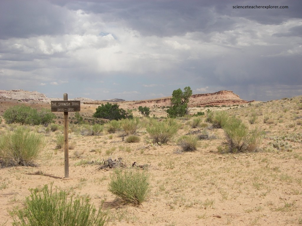
In the fall of 2005, I led a small group of students in motor-vehicles, across the San Rafael Swell, to explore the Green River Cutoff-Road. Imaged below, we started exploring the Green River cutoff from highway 6 between Price and I-70. This good dirt road traveled west off of highway 6 at mile marker 283.2 (26.4 km north of I-70 on highway 6).
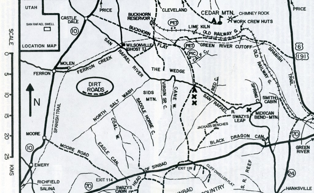
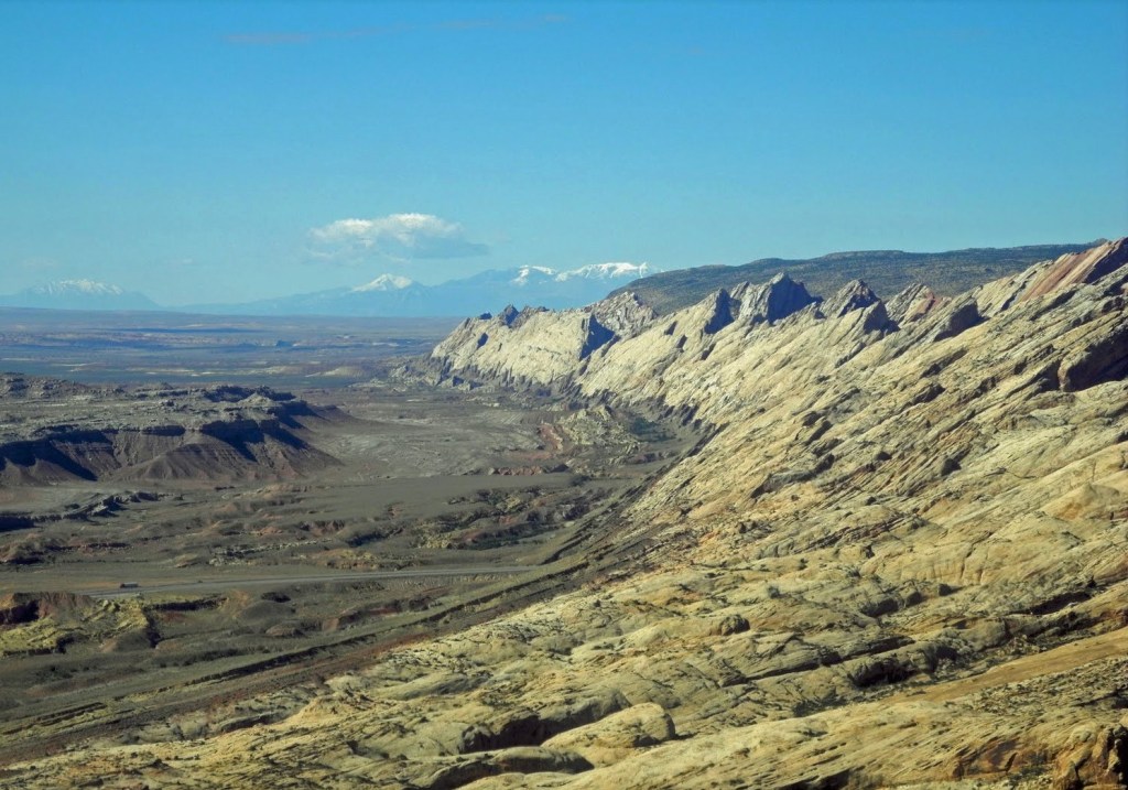
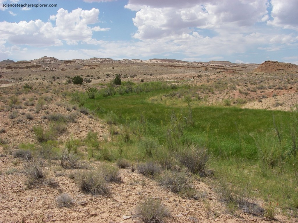
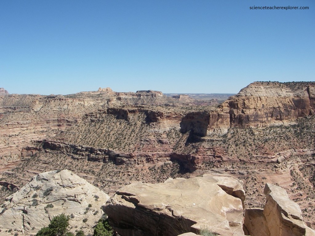
I picked the Green River Cutoff Road because of its significance to the United States history. South of the Green River Cutoff Road, is the infamous San Rafael Reef. The San Rafael Reef is a geologic feature located in central Utah, part of the Colorado Plateau. Approximately 120 km long, it is the name given to the distinctive eastern edge of the San Rafael Swell. Composed primarily of steeply tilted layers of Navajo and Wingate Sandstone, it has been eroded into tall fins, domes, cliffs, and deep canyons. These spectacularly beautiful canyons are often just a few feet wide and can be hundreds of feet deep, (pictured below).
Because of the surrounding mountain ranges, canyons, (Uintah, Wasatch, Grand, etc.) and the San Rafael Reef, it made it impossible for the pioneers to migrate through this area with horses and wagons. The Green River Cutoff road/trail was one of the few passages through the San Rafael Reef. This is where the old Spanish Trail, Gunnison Survey and the old Railway Grade went through the San Rafael Swell.
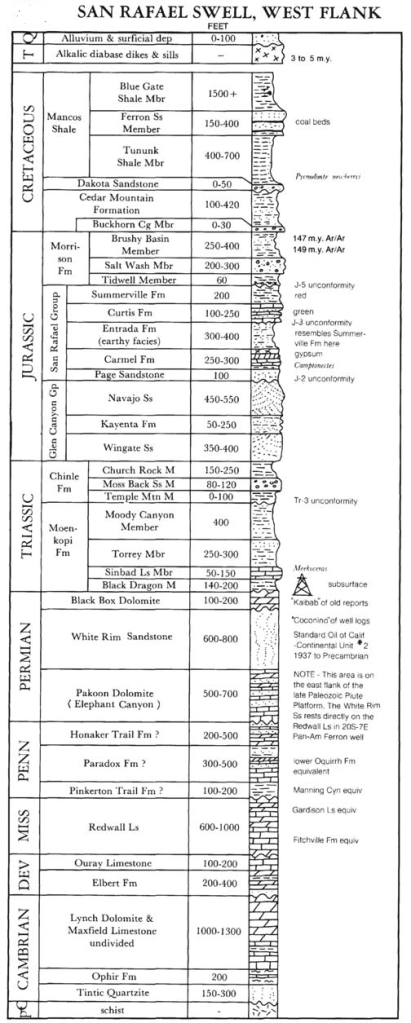
The San Rafael Swell has been described as a “land of naked rocks” because the sedimentary strata are so colorfully and well exposed. Imaged above, colorful sedimentary rocks, ranging in age from Permian to Cretaceous, are exposed across the San Rafael Swell. Additionally, Tertiary igneous dikes and sills cut the sedimentary rocks, mostly in the southwest corner of the Swell area. Unconsolidated Quaternary deposits, the weathered and eroded products derived mostly from the sedimentary strata of the area, are ubiquitous in the Swell, especially at the base of slopes and cliffs and along the more active stream courses.
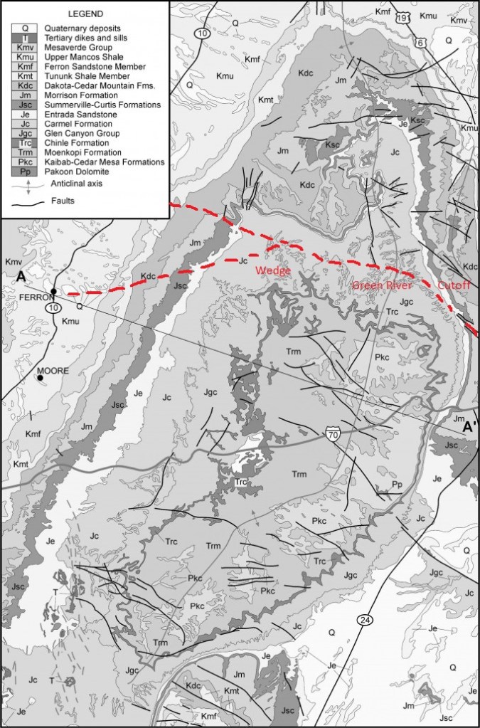
The geologic origin of the San Rafael Swell is tied to compressional tectonic forces responsible for uplift of the Rocky Mountains to the east and Uinta Mountains to the north. During this mountain-building episode roughly 40 to 70 million years ago, the rocks of the San Rafael Swell were also uplifted as a broad, arch-shaped geologic structure called an asymmetrical anticline (imaged below). Actually, the San Rafael Swell was formed earlier when deeply buried Precambrian rocks faulted, or broke, during this Laramide orogeny, about 60 million years ago. These “basement” rocks below the present-day Swell moved upwards relative to the surrounding areas and caused the overlying sedimentary rocks to fold into a dome-like shape. Since that time, the relentless force of running water has eroded the geologic layers, resulting in older rocks becoming exposed in the middle of the Swell, and younger rocks exposed around the edges. Many of the most impressive landforms are composed of more resistant rocks, including the Jurassic Navajo Sandstone, Jurassic Wingate Sandstone, and Permian Coconino Sandstone.
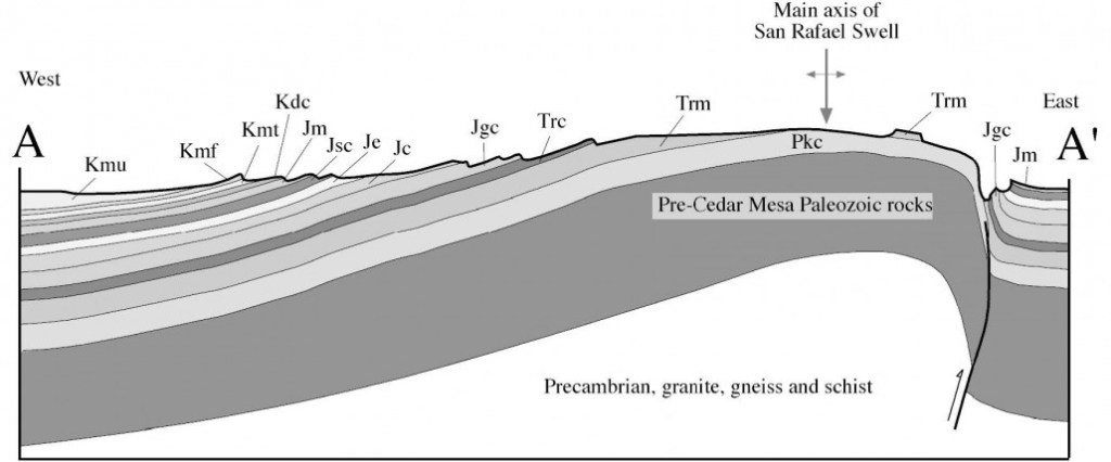
Sedimentary strata in the west limb of the anticline are gently inclined, whereas they are relatively steep in the east limb, forming the San Rafael Reef, (mentioned above). The anticlinal structure, as well as the relative resistance to weathering and erosion of the rocks, controls the topographic form of the Swell; hard layers form the steep cliffs and tops of benches, mesas, buttes, and flatirons or hogbacks (tilted surfaces) around the perimeter of the Swell, and intervening softer formations weather into slopes in the interior of the Swell. Streams have eroded into both hard and soft rock layers to form deep terraced canyons, which cut inward into the Swell from all directions.
The Green River Cutoff Road is part of the historical trade route known as the Old Spanish Trail, which connected the northern New Mexico settlements near or in Santa Fe with that of Los Angeles, California and southern California. Approximately 1,900 kilometers long, it ran through areas of high mountains, arid deserts, and deep canyons. It is considered one of the most arduous of all trade routes ever established in the United States. Explored, in part, by Spanish explorers as early as 1776, the Trail saw extensive use by pack trains from about 1830 until the mid-1850s. The trail provided a trade route for quality woolen goods produced in New Mexico, traded for a surplus supply of horses and mules raised on California’s ranchos. Trade with American Indians was also prominent, including an extensive slave trade of American Indian women and children who were forced to become domestic servants for ranchers in New Mexico and California.
In the 1850s and 1860s, portions of the Trail’s eastern end were mapped by U.S. government expeditions, while the western portion of the trail witnessed Mormons heading to California. U.S. government expeditions included Capt. John W. Gunnison in 1853, and Lieutenant E.F. Beale in 1853.
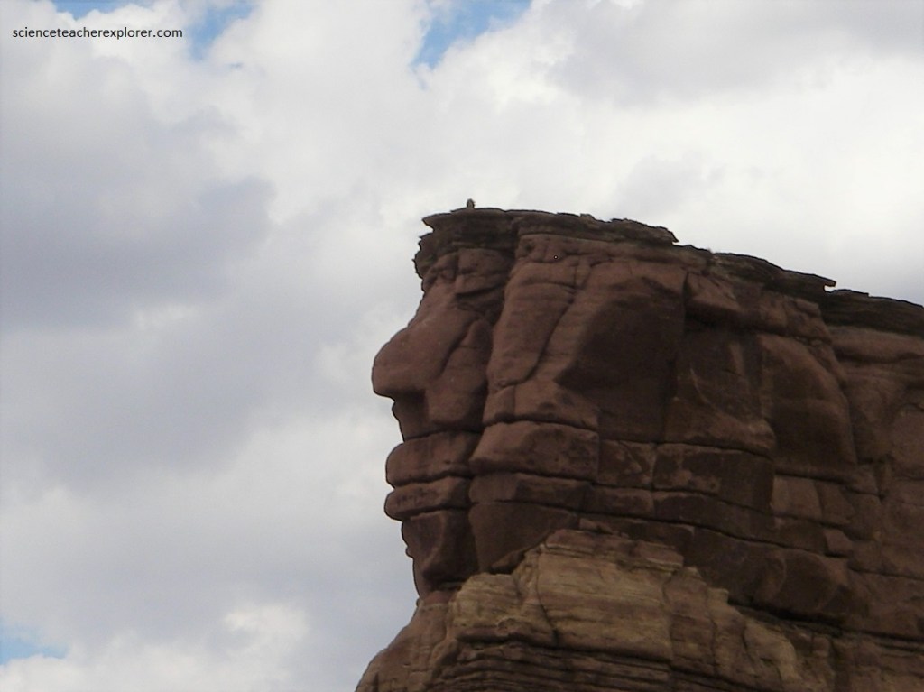
Pictured above, “Head Rock” was an important landmark for the Gunnison Expedition. The Gunnison Expedition took place only five years after the end of the official period of significance. The explorers noted that
they were following the Old Spanish Trail through this area.
In 1881 the D&RGW railroad company decided to extend their line through the San Rafael Swell. The line was planned to leave Green River, Utah, travel up and follow the Spanish Trail, across Buckhorn Flat, and to a junction near Huntington. From the junction, the line would split and go north to Price, Utah and south through Salina Canyon to Salina, Utah.
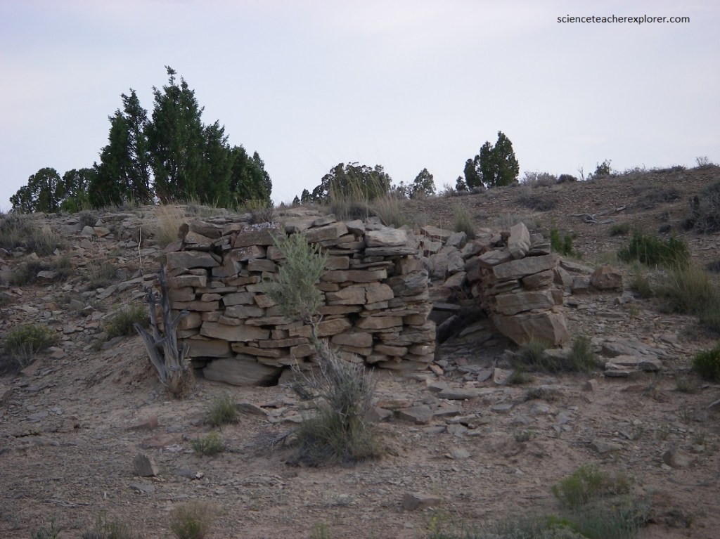
Though the railroad was never completed, hundreds of locals worked on the project and an impressive amount of railroad bed was prepared. There are a few places along the Green River Cutoff Road to see the railroad remains.
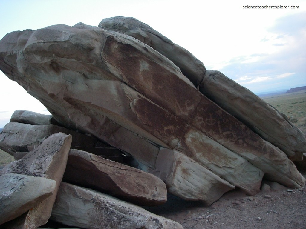
Pictured above, about 4 kilometers below the Buckhorn Wash Road and the Green River Cutoff Road junction, is a spectacular rock-art site. This panel, situated in a large rock shelter on the north side of the canyon, is partially obscured from view by a large sand dune. The petroglyphs, which cover an area about 25 meters in length, consist of stick-figure humans, some of which are holding hands and some in pairs, along with animals (mostly bighorn sheep) and abstract motifs. The stylistic affinities of these petroglyphs are uncertain, but they probably post date the Barrier Canyon Style pictographs found down the canyon. They may be related to the Northern San Rafael Fremont.
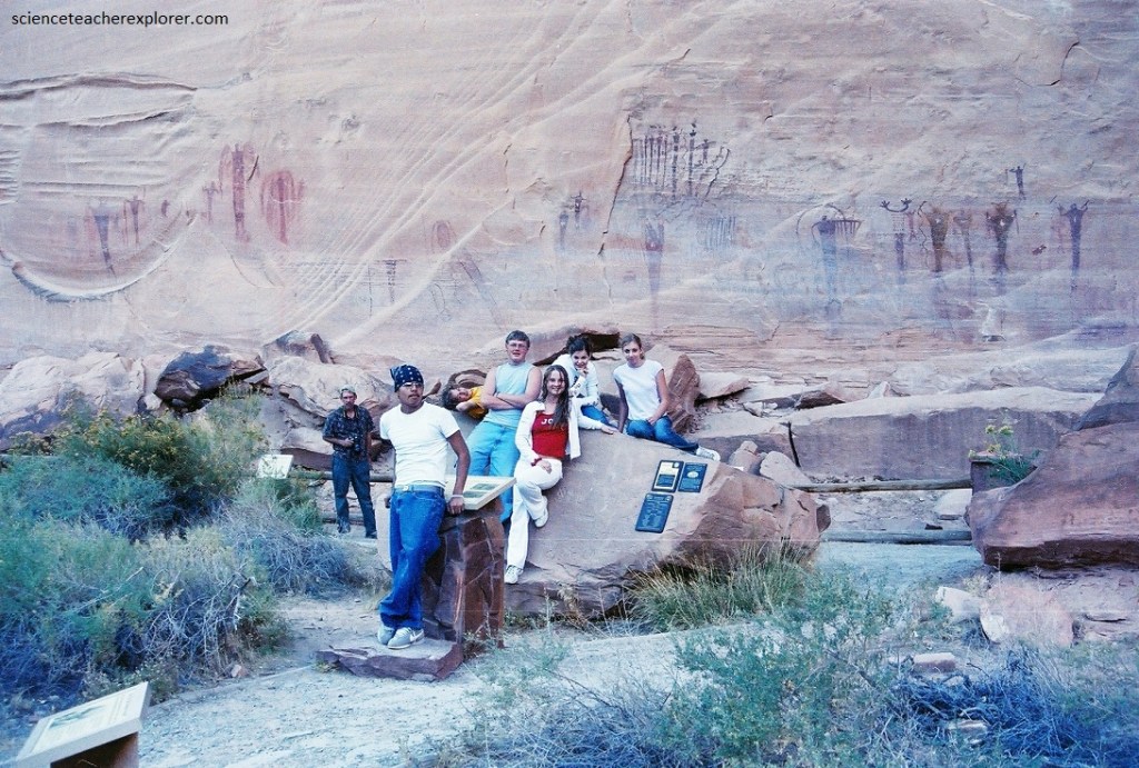
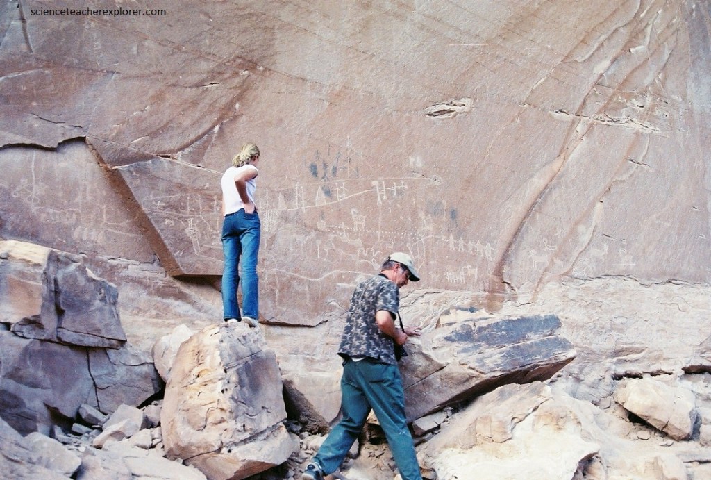
An additional 4.8 kilometers down the Wash Road from the above petroglyph panel is the “Buckhorn Pictograph” Panel. This outstanding panel of Barrier Canyon Style pictographs, dating back several thousand years to the Archaic Period, is featured on a 53 meter long section of cliff on the north side of the canyon, (pictured above and below). Note: The red and pale orange vertical cliffs of the Wingate Sandstone is home to the well-known Buckhorn Wash rock art panel.
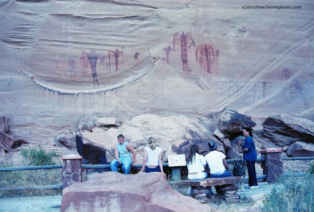
Pictured above, the Buckhorn Wash pictographs consist of a series of elongated anthropomorphs, some of which are life-sized, painted in shades of red, yellow, and beige. Some of these figures are shown holding snakes or other objects, and many are associated with snake-like wavy lines. In addition to snakes, there are also small birds or insects connected with these figures; both snakes and birds are often featured in Barrier Canyon Style pictographs, where they are thought to represent the shaman’s spirit helpers for visiting supernatural realms. Several of the anthropomorphic figures seem to have wing-like appendages, which may represent the shaman’s mystical soul-flight to other worlds in trance. This site, like most Barrier Canyon Style rock art sites, probably had profound religious and ceremonial importance to the ancient people who created it.
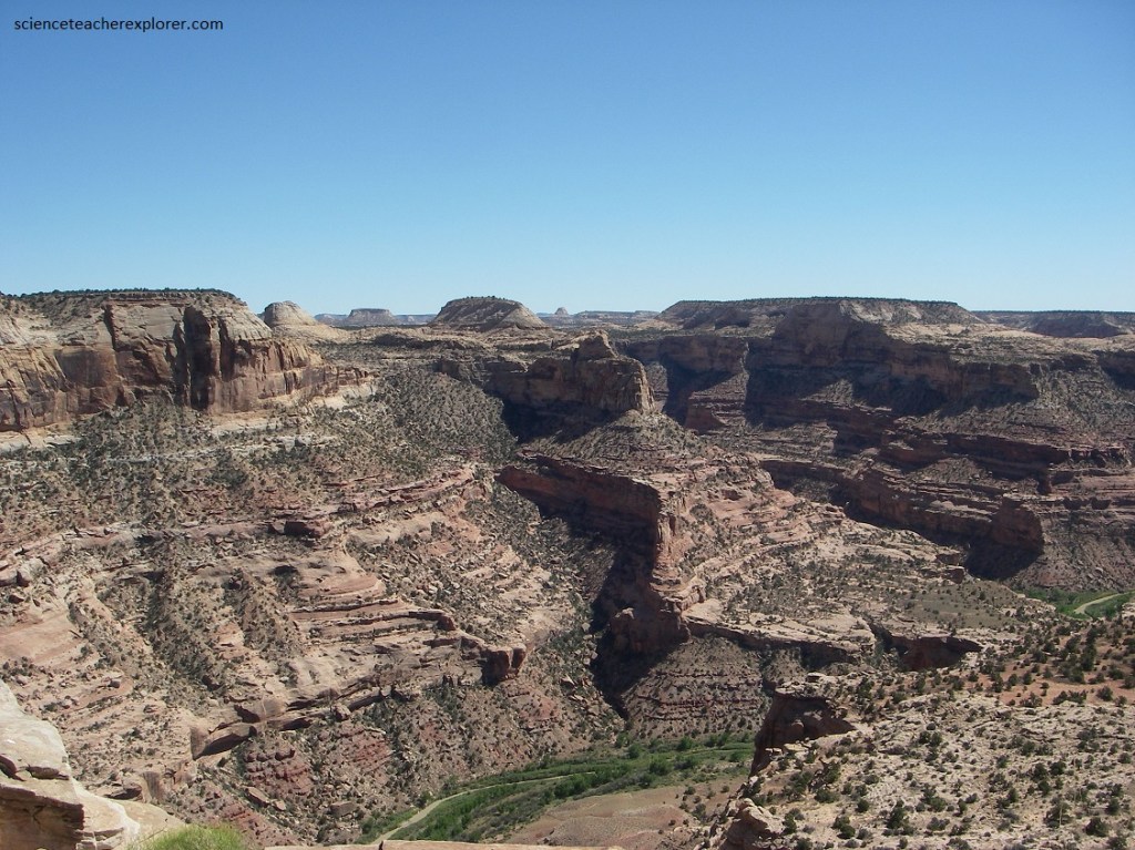
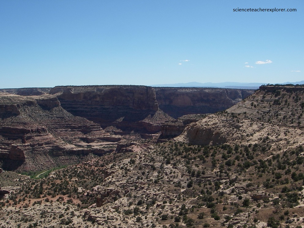
Back to the junction of Buckhorn Wash Road and the Green River Cutoff Road and a short distance of 5 kms is another road to the overlook called the “Wedge”. At the “Wedge”, numerous viewpoints along the dramatic Overlook provide stunning views of varied landforms sculpted mainly in multi-colored sandstone formations.
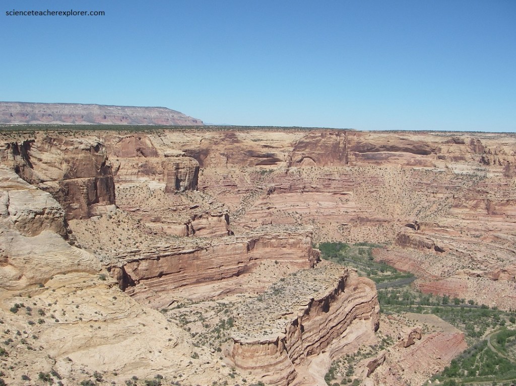
Pictured above and below, directly beneath the “Wedge” Overlook is a shear drop off of 400 meters to the San Rafael River’s deeply cut Little Grand Canyon. Panoramic vistas reveal the San Rafael River winding its way through canyons of changing widths, surrounded by multi- layered cliffs, buttes, domes, and spires.
As mentioned above, the Swell is an uplifted area where sedimentary rock layers were arched skyward into an elongate dome-like structure (called an anticline). The upwarp resulted from compressional forces in the Earth’s crust about 40–70 million years ago. Millions of years later, erosion began in force, eventually removing thousands of feet of rock from the Swell’s crest, exposing older rocks (about 300 million years old) in the middle region of the Swell surrounded by a ring of younger rocks (ranging in age from 100 to 230 million years old).
Numerous canyons were eroded into and through the Swell by rivers and streams. The San Rafael River, the largest river in the north part of the Swell, slices across the Swell, cutting deepest along the 3-mile stretch of the Little Grand Canyon, (imaged below).
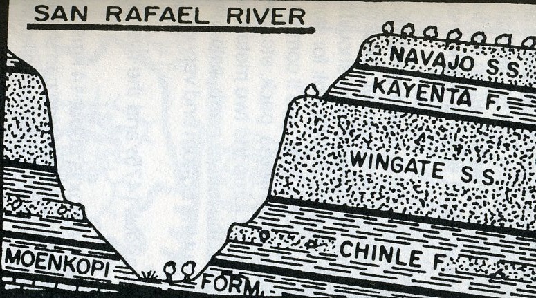
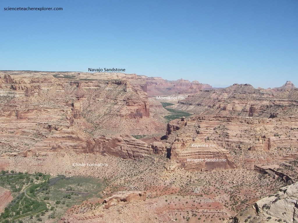
As we entered the Swell from the southeast, we followed geologic history back in time. From youngest to oldest, the strata include mostly sandstones of the Carmel Formation, Navajo Sandstone, Kayenta Formation, Wingate Sandstone, Chinle Formation, and Moenkopi Formation, which were formed in a variety of depositional environments (rivers, deserts, and shallow seas).
Driving on Wedge Road to the Overlook we crossed the Carmel Formation, which is composed of alternating beds of light-grayish limestone and light-brown fine-grained sandstone. The rock formation exposed at the edge of the Overlook was the Navajo Sandstone. It is composed of mostly light-brown to white sandstone, and is sometimes seen as sloped domes or rounded knobs reminiscent of the ancient sand dunes from which it formed.
Back to the junction of the “Wedge” overlook road and the Green River Cutoff Road. Instead of turning left, we continued straight for another 5 kms. At the junction of the “Old Railway Grade” Road, we turned right, (also the location of the Buckhorn Reservoir on the left). This road is officially named the “Lower Cedar Mountain Road”. From the turnoff onto the “Lower Cedar Mountain Road”, we drove another 4.3 kms to a dirt track on the left (north). We followed this track 0.3 kms to its end nest to the foot of the cliffs. There are two main petroglyph-panels here.
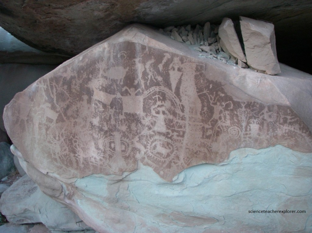
Pictured above, on the right near ground level is a panel of densely packed petroglyphs on a boulder with an exfoliating surface. There are superimposed figured of varying styles, some of the tapered, horned anthropomorphs indicate possible affinities with Barrier Canyon Style rock art, while other more closely resemble Fremont Northern San Rafael Style. Rayed, circular motifs enclose a quadruped and adorn other symbols. The anthropomorphs are of varying shapes, including rectngular, triangular, pear-shaped, and humpbacked.
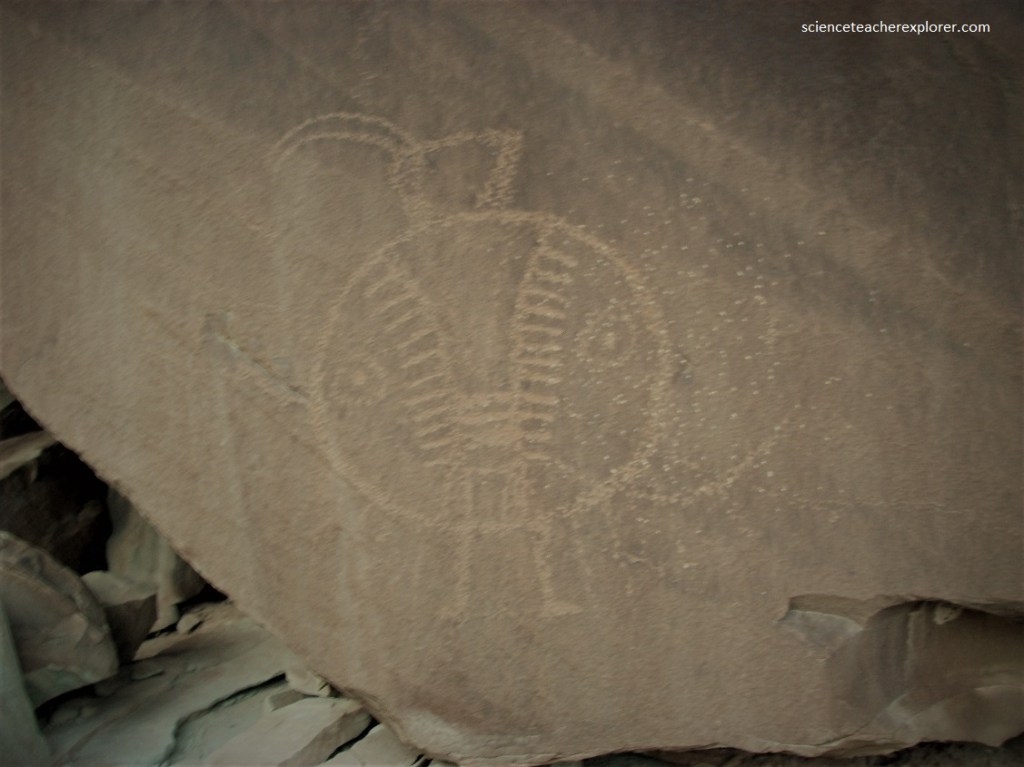
Pictured above, the other rock art at this site, located straight ahead (north) as we drove in, consists of a prominent, one meter high shield figure on the flat face of a large boulder, about 6.7 meters up. The Fremont anthropomorph is the “Silent Sentinel” for which the site is named.
Our next stop was about one kilometer further east after returning to the “Lower Cedar Mountain Road”. There was a large talus-boulder by itself on the left.
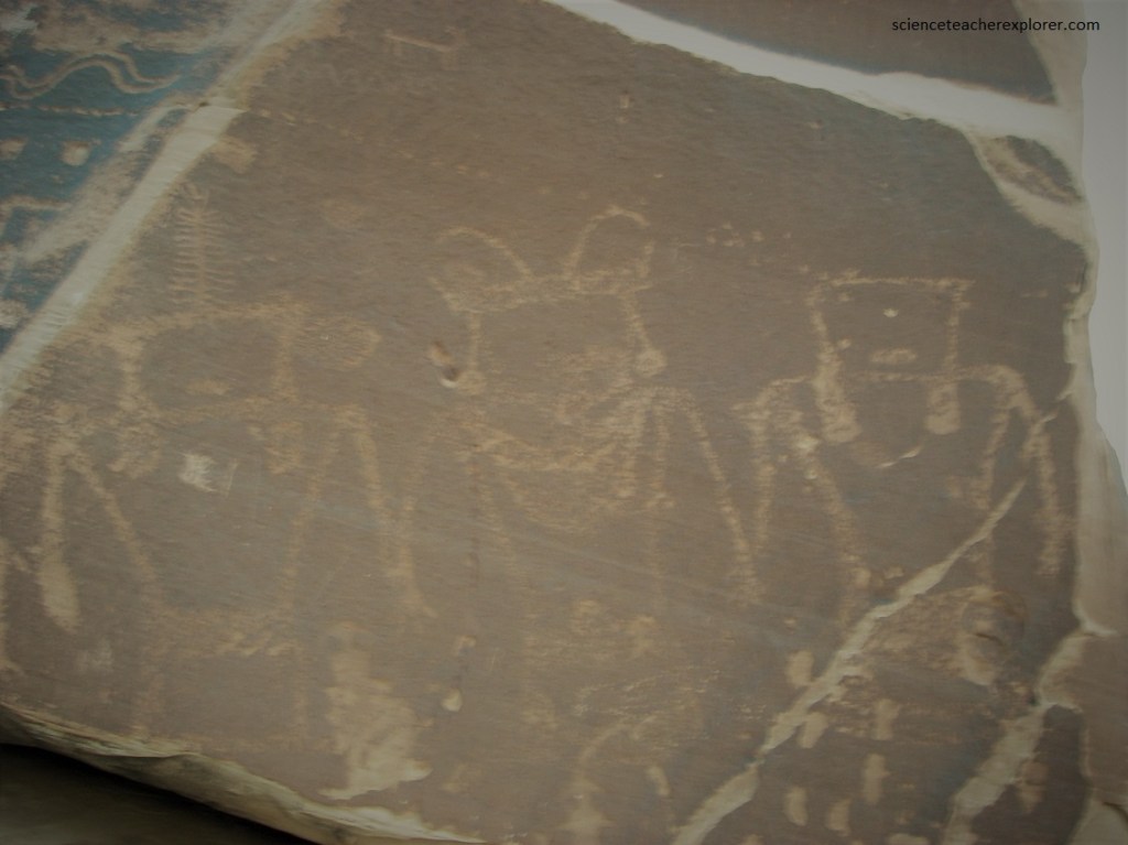
Pictured above, the main figures here are three Fremont anthropomorphs holding hands. One of these figures has a large Mickey Mouse type ears, and another appears to have a centipede headdress, but this image was probably added later. Also present are numerous images of snakes, as well as some historic graffiti from 1866.
Our next and last stop, was another 0.3 kms east of the “Daisy Chain”. We beared to the left on a dirt road for about 0.2 kms to a boulder inclined at an angle.
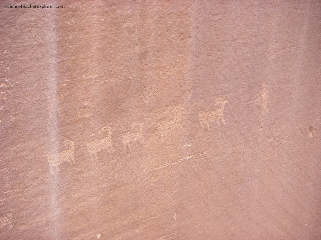
Pictured above, the “45 Degree Rock” petroglyphs were on a patinated surface of the inclined boulder, including several humpbacked figures, bighorn sheep, a large snake, and other motifs.
After this site, we connected to the “Green River Cutoff Road” again and continued west across “Buckhorn Flat” to Hwy 10, near Castle Dale, Utah. From there, we headed home.
