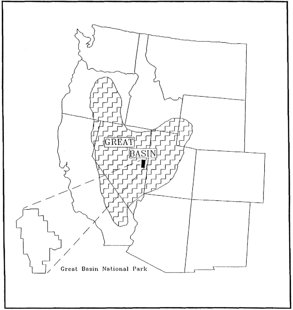
Great Basin N.P., NV
In the spring of 2004, I led a group of students and adult advisors to the Great Basin National Park in Nevada. Great Basin National Park lies in eastern Nevada near the town of Baker.
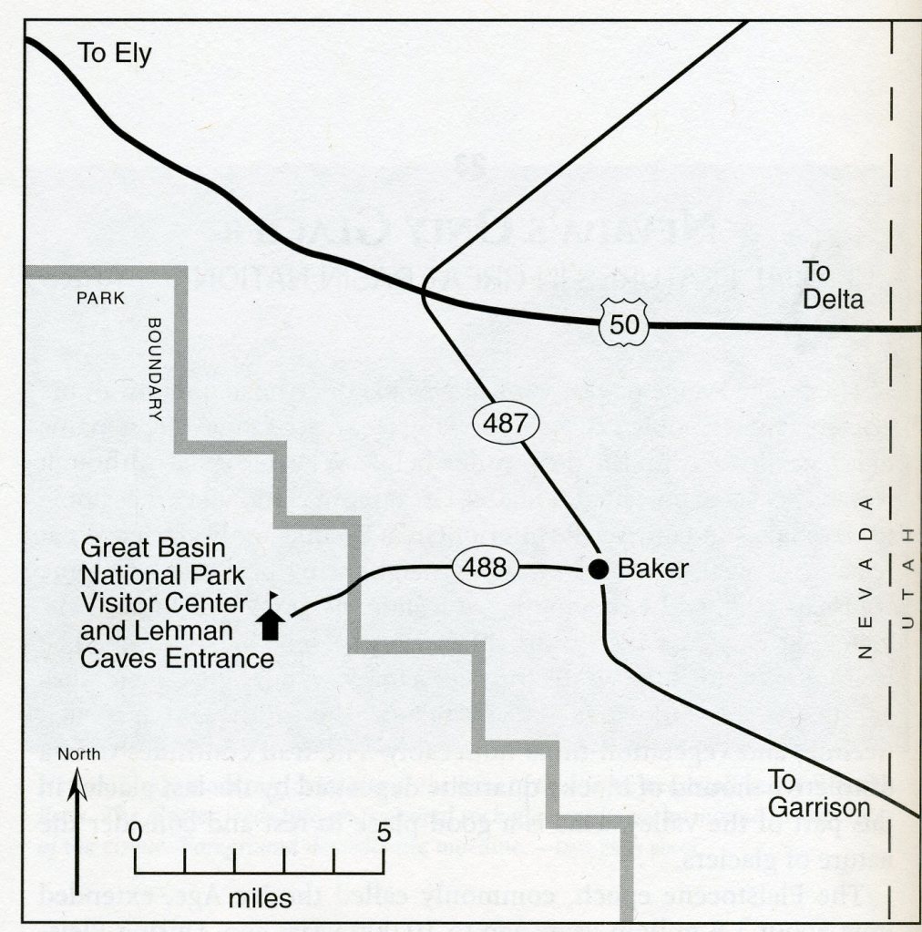
From Salt Lake City, Utah, we traveled south on Interstate 15, we then traveled 266 km west on U.S. 6, which joins with U.S. 50 at Delta, Utah. We then turned south on Nevada 487 and drove 8 km into Baker, Nevada before we headed west on Nevada 488 and drove 9.7 km to the park.
The Great Basin National Park and the Snake Range of eastern Nevada, are part of what scientists call the “Great Basin”. The Great Basin makes up about half of what is known as the “Basin and Range Province” of the western USA.
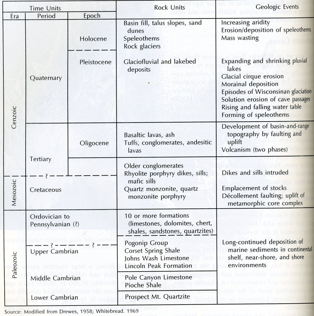
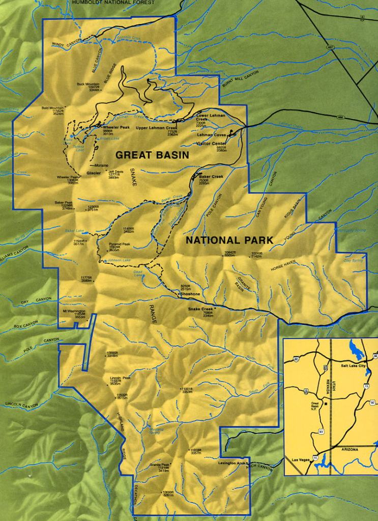
Great Basin National Park encompasses most of the South Snake Range. The bulk of the rocks exposed in this range are formed of sediments like sand, mud, and calcium carbonate. These sediments were deposited at the bottom of a shallow sea during the late Precambrian age and Cambrian period (around 560 million years ago). As layers accumulated upon layers, those sediments were turned into sedimentary rock. Sand became sandstone, mud became shale, and calcium carbonate became limestone. [Pole Canyon Limestone chemically precipitated out of the seawater & forms Lehman’s Cave].
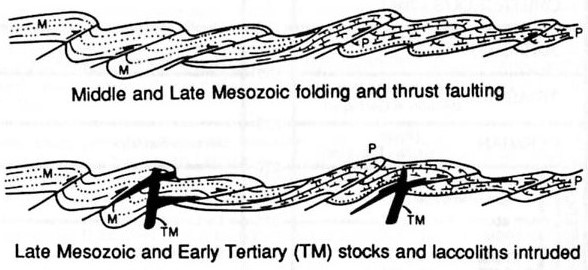
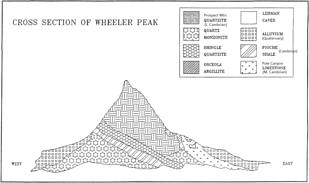
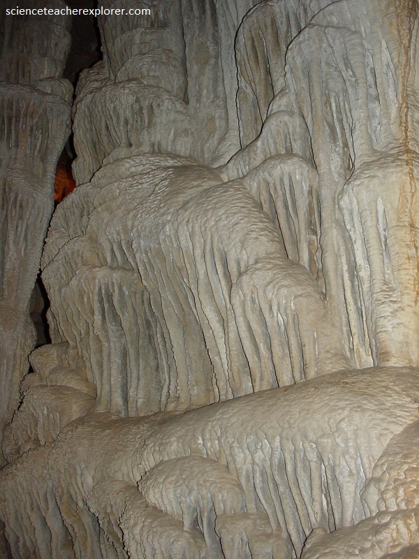
Imaged above, the rocks in the park were further changed during a mountain-building event around 200 million years ago, during the Mesozoic Era. This event, the Sevier Orogeny, pushed layers of rock on top of each other, doubling the thickness of the crust. The layers at the bottom of the stack were metamorphosed slightly where sandstone changed gradually into quartzite (i.e. Prospect Mtn. Quartzite), limestone to low-grade marble. Magma rose from deep within the Earth and pushed its way up into these layers. It did not come to the surface, however. Staying underground, it cooled to become granite. Where this hot magma was pushed up, the surrounding rock metamorphosed slightly more.
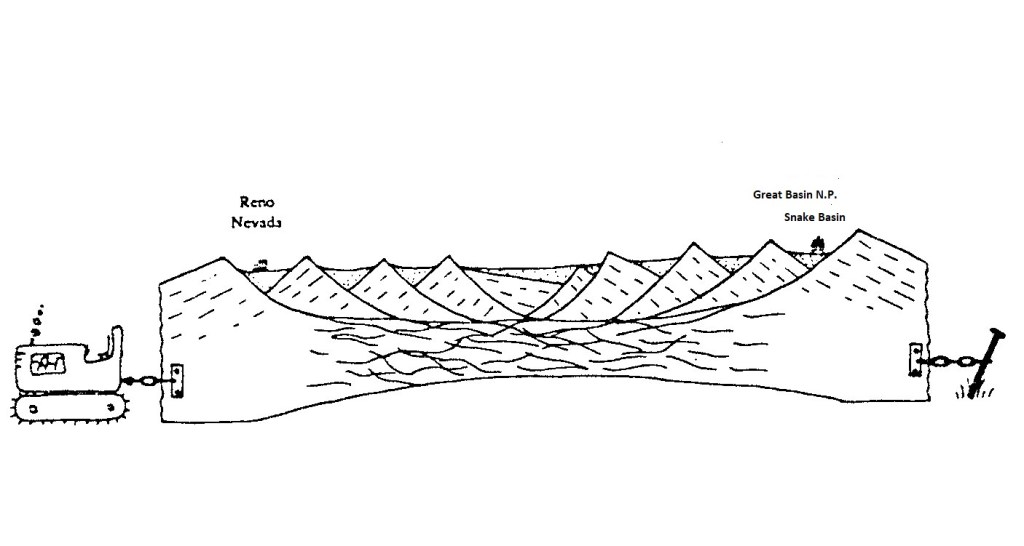
Imaged above, The modern basins and ranges began to appear only within the last 30 million years or so, during the Cenozoic Era, when the Earth’s crust in this area began to stretch in an east-west direction. Bedrock nearest the surface reacted to the crustal stretching by breaking into immense blocks several kilometers wide, tens of kilometers long, and thousands of meters thick. Many of these blocks fractured and the pieces tilted and spread out like a row of odd-sized books sliding out of place on a shelf. The remnants of these broken blocks lie beneath the sediment in the basins. Other blocks remained relatively intact and now form the mountain ranges. Because stretching is in an east-west direction, these ranges line up in a north-south direction.
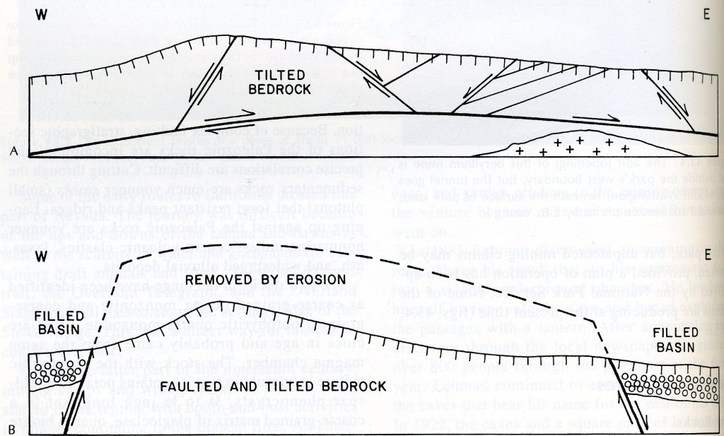
Imaged above, block faulting 5 million years ago, (the same faulting that produced Nevada’s alternating mountains and valleys), brought the Prospect Mountain quartzite and other metamorphic rocks to the surface throughout the southwestern United States. These faults bound the Snake Range of the Great Basin National Park on the east and west.
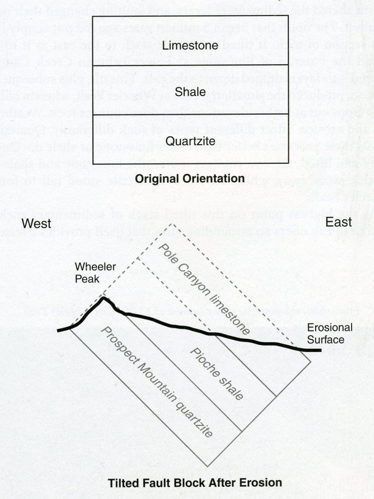
Imaged above, the Prospect Mountain quartzite, composed almost purely of quartz, strongly resists weathering, (the chemical and physical alteration of rock at the earth’s surface). In an undisturbed sequence of sedimentary rock, the oldest rock lies at the bottom of the stack and the layers get progressively younger above it. However, in this case, as we climb to higher elevations, we find the youngest rock, (Pole Canyon limestone), at the lowest elevations and the oldest rock, (Prospect Mountain quartzite), at the highest elevation. This is because the uplift that began 5 million years ago did not simply lift this section of rock. It tilted the whole stack to the east as it rose. Once tilted and lifted, the two younger units, (the Pole Canyon limestone and Pioche shale), quickly wore away, while the sturdy quartzite stood tall to form Wheeler Peak.
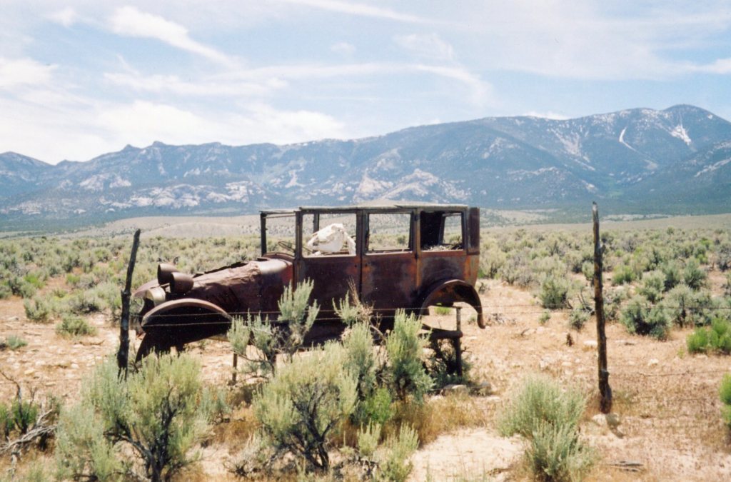
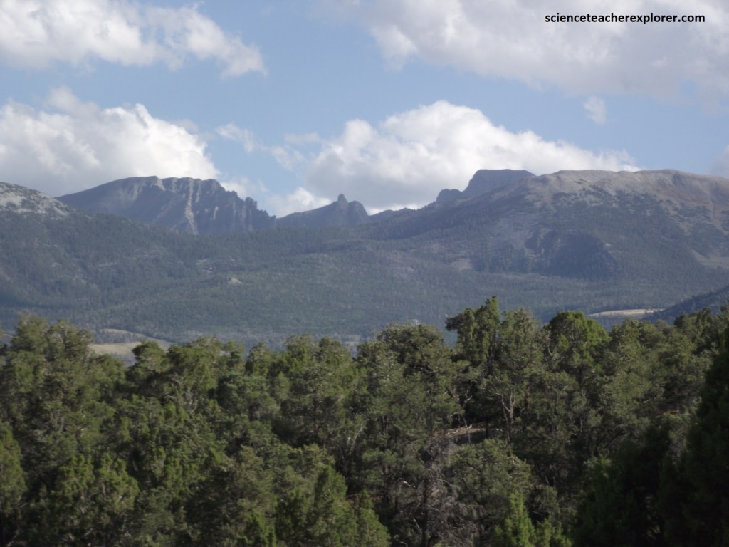
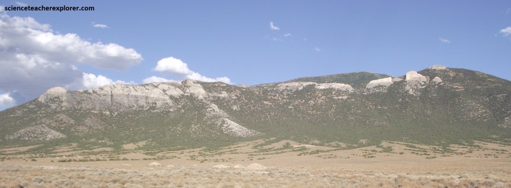
As the highest point on this tilted stack of sedimentary rocks, Wheeler Peak offers an astounding vista that itself provides a lesson in Great Basin morphology. Image above, Wheeler Peak stands 3,524 m above sea level and approximately 2,667 m above Spring Valley, west of the Snake Range. It is the second tallest mountain in Nevada.
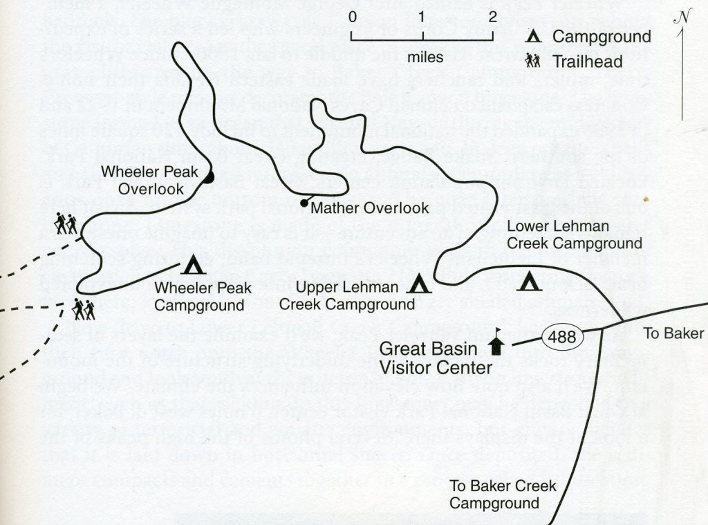
Imaged above, as an educational group, we took our first exploration trip up the paved road to the Wheeler Peak trailhead. The road gains 1,133 m in elevation over 19.3 km. Geologic processes create elevation; elevation, in turn, strongly controls temperature and precipitation. As we increase in elevation, air pressure decreases (air molecules move apart), the temperature drops. The temperature changes about 10 degrees Fahrenheit per mile, (1.61 km) change in elevation. As air rises over a mountain range, (usually from the west), it cools, thus losing much of its ability to hold moisture. The moisture falls to the earth as rain or snow. The air then sinks into the adjoining desert valley and warms, once again able to hold large amounts of moisture. [The Snake and Spring Valleys average about 10 cm of precipitation/year, but the higher peaks of the Snake Range receive more than 76 cm of precipitation/year].
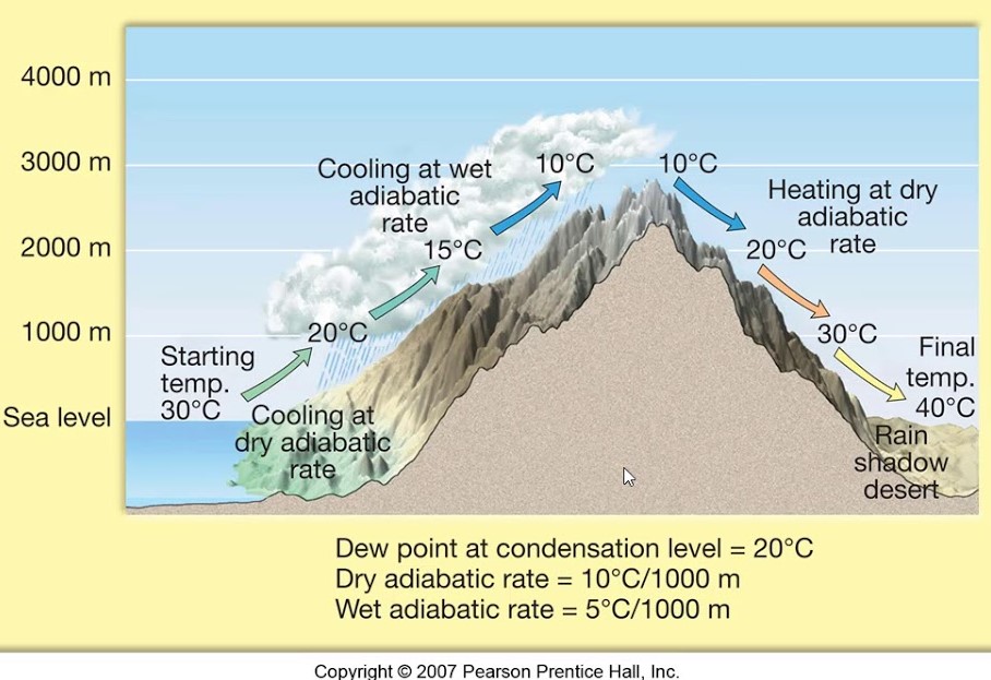
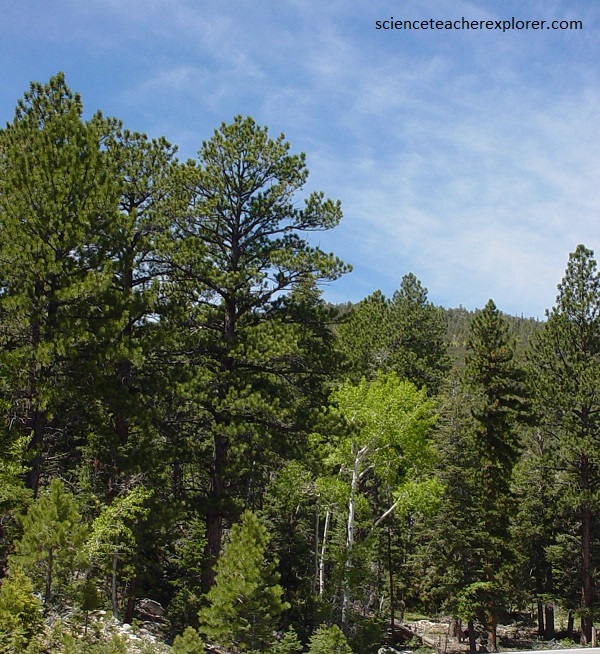
Imaged above, mountains in the Great Basin rise as climatic islands above the surrounding desert valleys. The mountain climates differ from those of the adjacent valleys in the long-term averages of temperature, precipitation, atmospheric pressure, wind, and solar radiation. Of these, temperature and precipitation most strongly influence local variations in plant and animal communities.
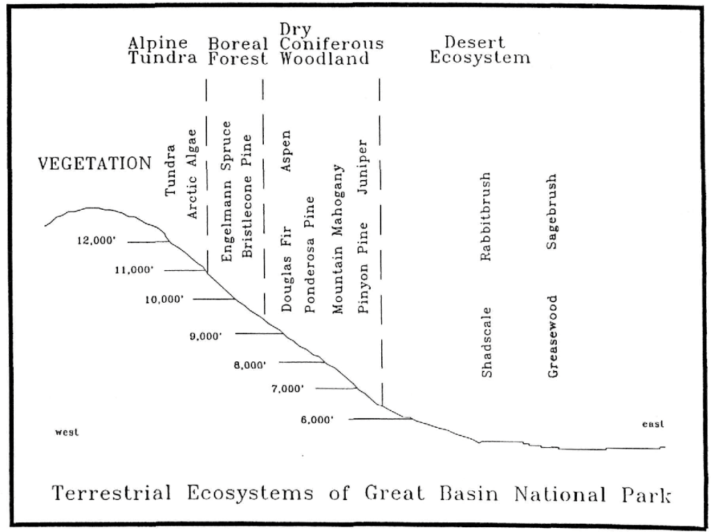
Imaged above, Great Basin National Park encompasses 6 distinct climatic zones, each supporting a unique community of plants and animals. As we drove the scenic road toward the Wheeler Peak trailhead, we passed through a series of climate zones, each reflected in the prevailing plant community.
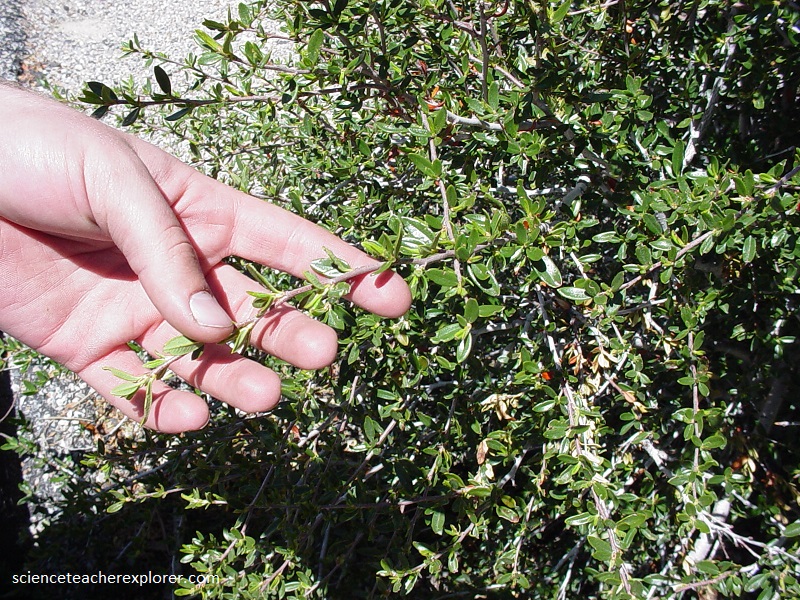
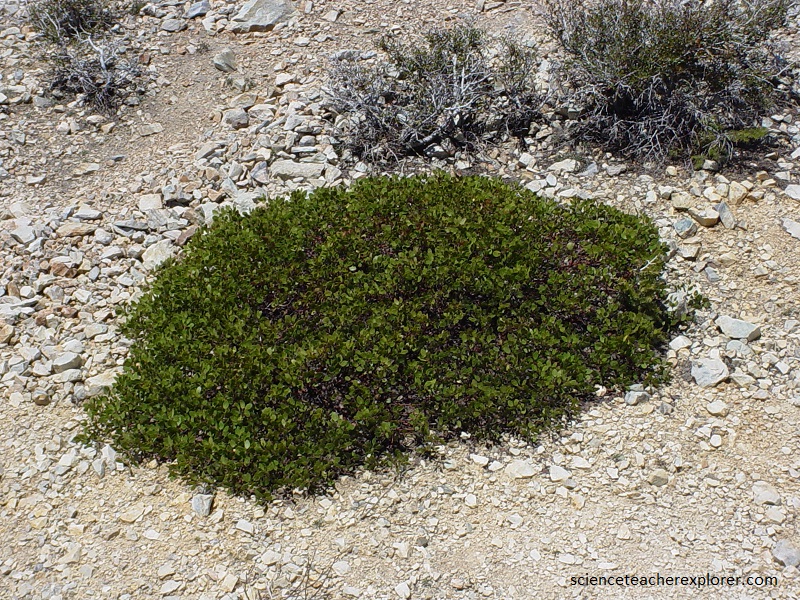
Pictured above, a sea of sagebrush surrounds Baker, just outside the park boundary, indicating the very dry conditions there. The A. tridentata, is the most common sagebrush in the park and the state flower of Nevada. Big sagebrush is a branched, erect, evergreen shrub with aromatic gray-green alternate leave. Leaves are lobed at the tip and have silvery hairs on both sides. Numerous, small, stalk-less yellow flowers appear in erect clusters in August. Flowers are wind pollinated and cause allergies in some people. Pictured below, the park boundary itself lies in a juniper-pinion woodland, slightly cooler and moister than the low-lying valley floor.
Pictured above, Juniperus osteosperma is one of the most abundant and widely scattered trees of the region. Typically found between 3,000 and 8,000 feet or (1,000-2,700 m) elevation, this tree grows amongst pinyon and sagebrush. The short scale-like needles are 1/8 inch (0.3 cm) long and last several years. Foliage and branches are stiff. Seeds are borne in berry-like scaled cones. The cones, when mature, are up to a half-inch (1.3 cm) in diameter and bronze in color with a bluish white frosting. Male and female cones are found on the same tree. Bark consists of many layers of fibrous elongated shreds.
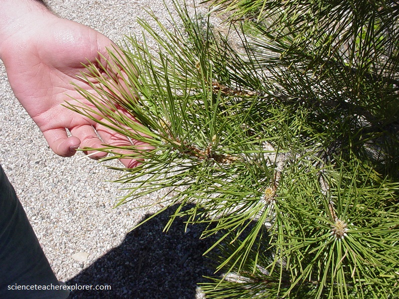
Pictured above, Pinus monophylla grows between 5,000 and 9,000 feet (1,700-3,000m) elevation, often mixed with Utah Juniper and sagebrush. Pinyon grows better in places where Utah Juniper is already established as the juniper moderates the microclimate by providing shade. Normally this reddish barked tree is small and many branched. This is the only pine to have a single needle fascicle. The needles are usually round or cylindrical in cross section, rigid and sharp. They curve toward the branch and are about 1 ½ inches (3.8 cm) long. Cones contain wingless edible seeds.
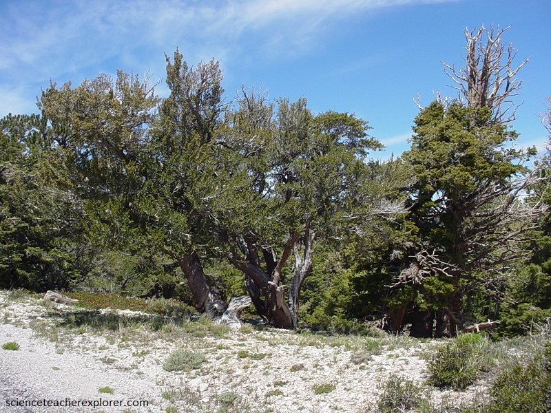
As we increased in elevation, we passed from juniper and pinon pine into mountain mahogany and manzanita.
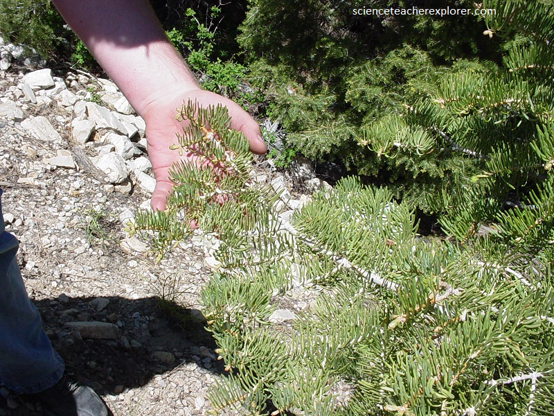
Pictured above, Cercocarpus ledifolius is a drought resistant tree common on dry hillsides and ridges between 6,000 and 9,000 feet (2,000-3,000m) elevation. It is a small tree with a tendency to be round crowned and sprawling. The bark is red brown and thick with a rough scaly surface. Wood is reddish, resembling true the mahoganies of the tropics. The leaves are evergreen, thick and leathery with curled under margins. They are dark green above and light green underneath. The foliage is a favorite food of deer as it is green year round. Yellow flowers produce hairy seeds in the fall. Each seed is tipped with a 2 to 3 inch (5-8cm) tail-like style. These tails twist hygroscopically, in moist weather where they are straight, but in dry weather they curl like a corkscrew. This twisting bores the seed down into the soil, anchoring it and increasing the chance of germination.
Pictured above, Arctostaphylos patula inhabits dry sunny sites in the open forests below 9,500 feet (3,200m) elevation. It prefers cooler areas than sagebrush. The crooked, ridged stems have a thin, shiny, smooth bark that peels and is dark red to chocolate in color. Bright, round, alternate, evergreen leaves have entire margins. Leaf orientation varies depending on the amount of light and heat. Shrubs in shady areas have horizontal leaves to catch all available light; ones in sunny areas have vertical leaves to reduce water loss.
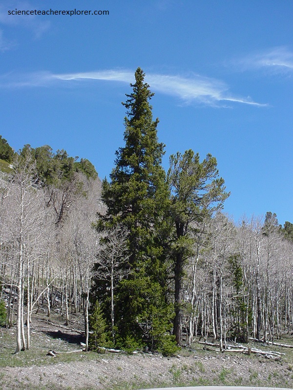
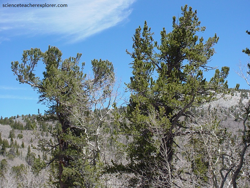
Pictured above, Pseudotsuga menziesii is the most valuable lumber tree of the west. Although it is not a true fir, Douglas fir’s one-inch needles are also Flat, Friendly and Flexible. Bark of young trees is gray and smooth becoming darker and scaly with age. Very old trees display deep furrows in the bark. Cones are red-brown, 2 to 4 inches (5-10cm), long with three pointed bracts extending from beneath the cone scales. Seeds have one wing. One of its distinguishing characteristics is long shiny pointy brown buds. Douglas fir is common between 6,500 and 9,000 feet (2,200-3000m) elevation. It may live up to 1,000 years.
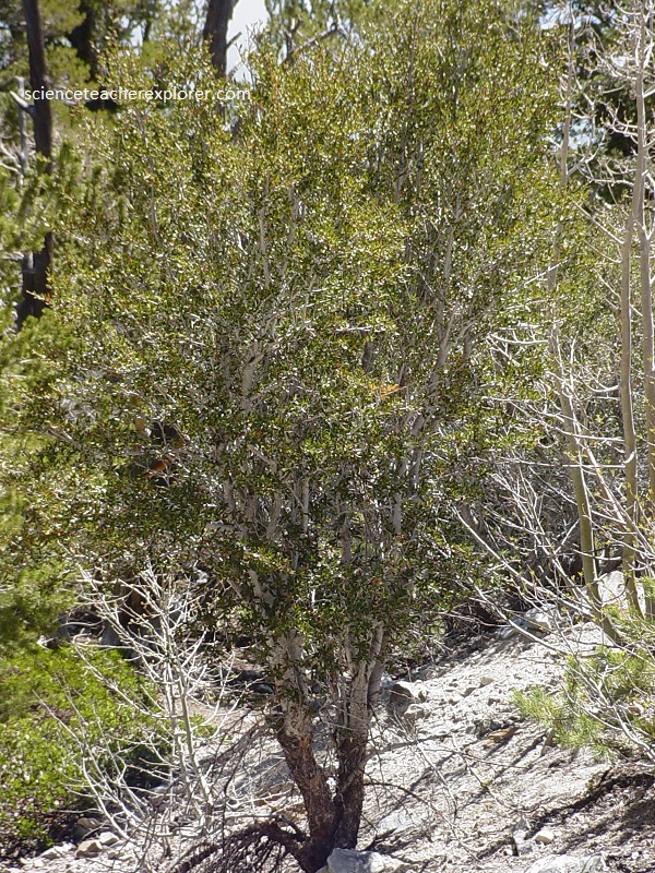
Populus tremuloides usually grows between 6,000 and 8,000 feet (2,000-2,700m) elevation. Aspens are usually found in damp places along watercourses. Trunks are straight and topped with small high open crowns. The bark is smooth and light on young trees becoming darker with furrows on older trees. The bark does not peel. Leaves are nearly round, about 2 inches (5cm) in diameter, and fringed with marginal teeth. Leaf blades are attached to twigs by long slender leaf stalks, which act as pivots so that the leaves quake in the breeze. Aspens grow in groves, which turn the hillsides golden in the fall. They are usually short lived, 100-200 years, due to heart rot fungus.
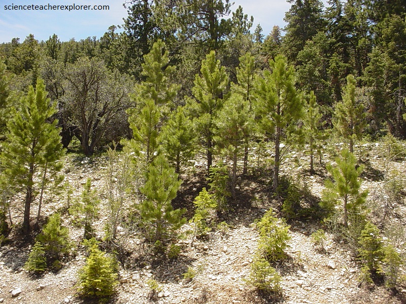
Pictured above, Pinus ponderosa is found throughout the west. Like the pinyon pine, the ponderosa migrated into the area since the last ice age. Ponderosa pines, in this region, are usually found between 7,000 and 8,500 feet (2,300-2,800m) elevations, on dry rocky slopes. Trees can attain heights of 100 feet (33 m). The bark on older trees is made up of broad orange or reddish plates consisting of thin scales. Young trees are blackish or dark brown with narrow furrows in the bark. Twigs are orange brown.
Pictured above, the Ponderosa Pine needles are about five inches (13cm) long, thick and flexible, they come two to a bundle. Cones are 3 to 6 inches (8-15cm) long and reddish to yellowish. They produce a mottled purple winged seed.
Pictured above, Pinus flexilis generally grows on exposed sites from 8,000 feet (2,700m) elevation to timberline. The bark is smooth and white on young trees becoming scaly and almost black with age. White Pine County receives its name from the limber pine (early settlers mistook it for white pine). Needles are 1 ½ to 3 inches (3.8-7.6 cm) long in bundles of five. They grow in short bottlebrush-like tufts on the ends of the twigs. Cones are 3 to 10 inches (7.6-25 cm) long with thick, woody, unarmed scales.
Pictured above, Picea engelmannii grows from 7,500 feet (2,500m) elevation to timberline. At timberline this tree will form krumholtz, becoming a shrubby thicket. The bark is thin, covering the trunk with loosely attached, rounded, red-brown scales.
The dark green one-inch leaves are flexible and sharp pointed, square in cross section and grow upward on the twigs. Englemann spruces are often rounded at the top with gently arched limbs. Cones hang down from uppermost branches. Cones are 1 to 2 ½ inches (2.5-6.4cm) long with thin, flexible, jagged scales. Seeds are dark and winged. These trees are vulnerable to fire and windstorms because of their thin bark and shallow root system.
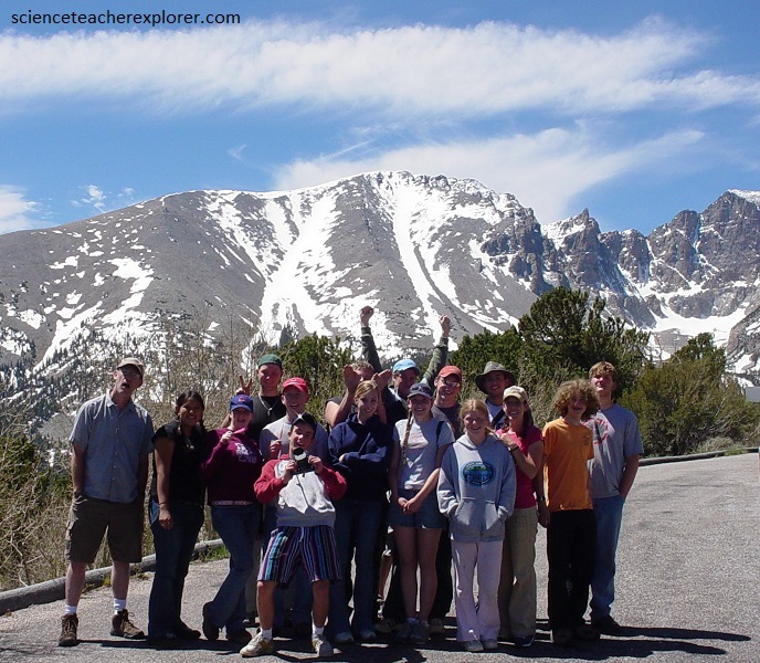
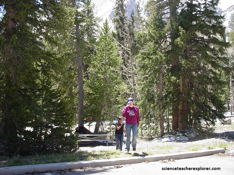
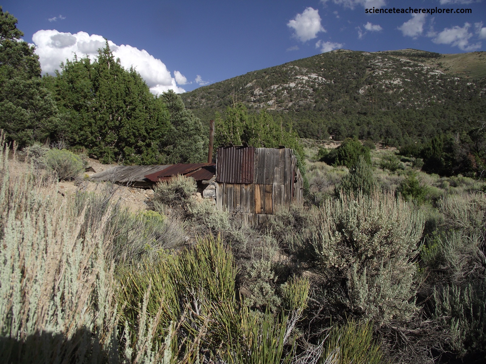
A few kilometers before the Wheeler Peak Campground, we reach the Wheeler Peak Overlook to take a group picture. I took the picture. We were standing at the edge of a cliff that would lead us down into the Lehman Creek valley. Steep slopes abound. Below the upper rock-covered zone on Jeff Davis Peak, a tongue of debris extends into the forested zone.
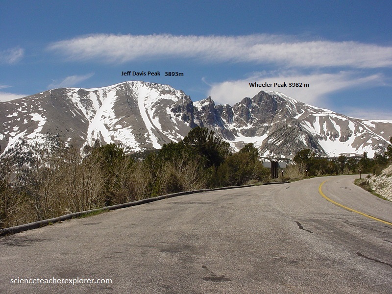
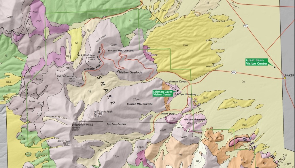
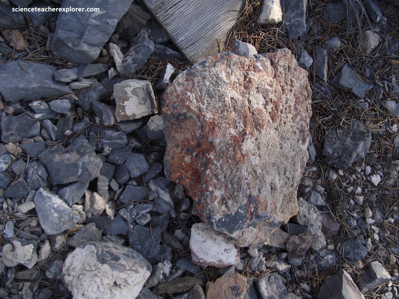
Pictured above, both Jeff Davis Peak and Wheeler Peak is made of the Prospect Mountain Quartzite. This quartzite formation, like all others, was originally sandstone, and probably laid down in an environment like todays Sahara Desert. It dates from the beginning of Cambrian times, or about 600 million years ago. Later it was covered up and squeezed and pressurized to create quartzite. This quartzite is pinkish gray to light olive gray on fresh factures, and it weathers to a rusty brown or tan. This is the most dominant formation in the Snake Range, both north and south. It’s about 1,500 meters thick.
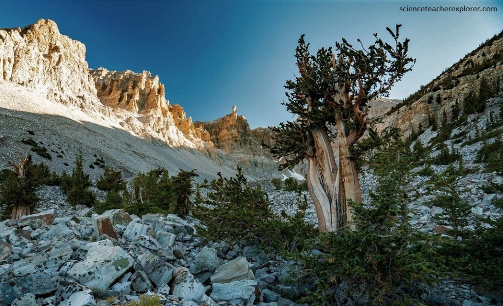
Pictured above, Pinus longaeva, the world’s longest living tree, has been known to live for over 4,900 years, (found here). It usually grows between 9,000 and 11,500 feet (3,000-3,800m) elevation although specimens can be found at lower elevations. Bristlecone grows on exposed rocky sites above the continuous forest. They will grow on the quartzite of Wheeler Peak glacial moraine. It forms woodlands alone or with limber pine and Engelmann spruce. At timberline this tree will form krumholtz. Needles are short, one-inch long, and in packets of five. The dark green needles surround the twig and tufts may extend back a foot (30cm) or more along the branch. Needles can last up to forty years. Bristlecones survive longest where conditions are most strenuous. They are slow growing and easily out-competed by faster growing trees so they have adapted to the harshest conditions where other trees won’t grow.
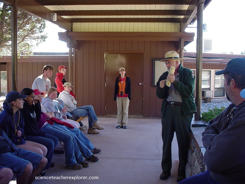
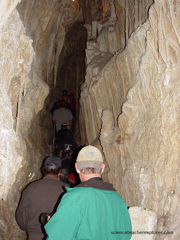
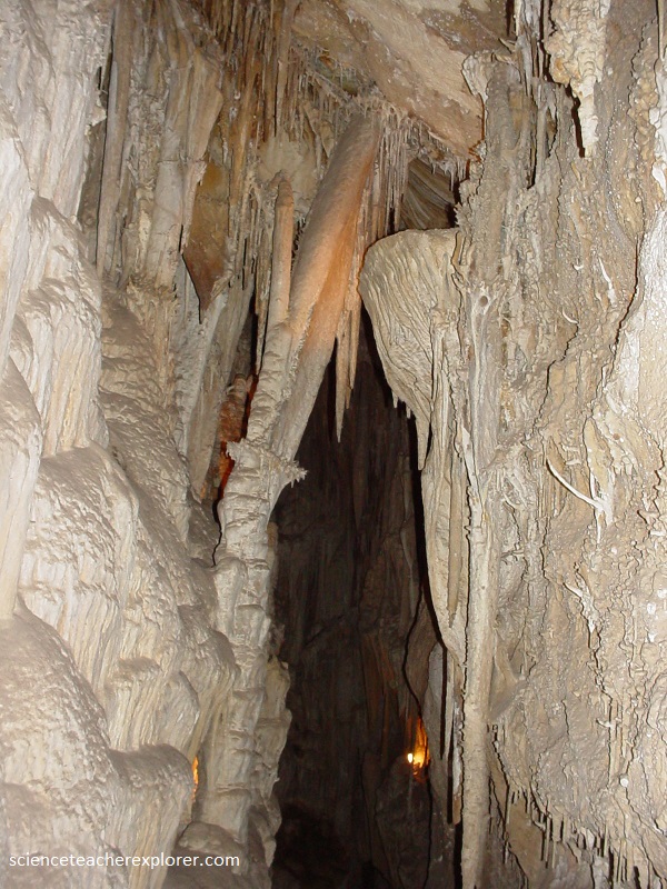
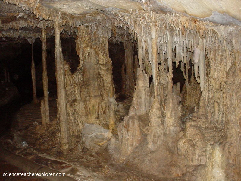
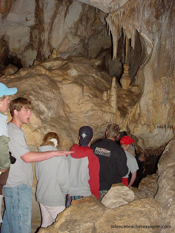
Once our group explored the road to the Wheeler Peak Campground, we camped for the night and returned to the bottom to explore Lehman Cave. Pictured below was our group’s orientation for the cave with a park ranger.
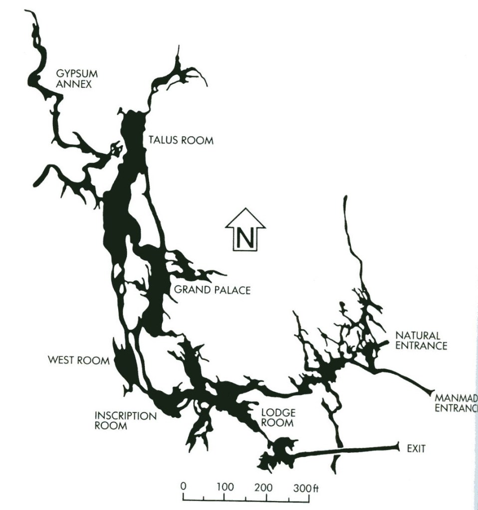
The geologic formation involved at Lehman Cave is the “Pole Canyon Limestone”, which originated something like 560 million years ago in the Cambrian Period.
In Cambrian times, the region of eastern Nevada was a low trough forming a shallow inland sea. At times, sediment entering this sea were sand and silt; at other times limey oozes simply settled to the bottom. The Pole Canyon Limestone was formed by this limey ooze which was made mostly of small sea shells. This deposition went on for millions of years.
Later, geologically, the land rose and fell, and was buckled and bent. this continued throughout the history of Nevada. When the area was in a state of uplift, sediments were eroded from the land, and carried to some distant sea for deposition. When the land was pushed down to form a sea, the new rocks such as limestone, dolomite and shales were the end result. About 65 million years ago, it was uplifted for the last time, during the Sevier Orogeny, ending all new marine deposits.
It’s been during this last period, from the end of the Cretaceous Period and into the Tertiary, that the land has become as it is today. There was much buckling and bending, which caused great pressures inside the various rock strata. Along with great pressure, heat was generated, which changed the original rock into various grades of marble.
This is what has happened with the Pole Canyon Limestone, which has five different members. The one member which is represented in Lehman Caves, is one that has been slightly changed, and is today a very low grade marble.
Lehman Caves have come about very late in geologic time, just in the past 4-5 million years. The bending, buckling and uplift had, for the most part, ended when the cave began to be formed. That explains why the cave runs almost horizontal, when the strata is tilted.
Limestone caves are formed by water percolating down through the cracks and crevasses in the rock, and dissolving away part of the rock to form underground cavities. Evidently, pure water cannot dissolve limestone or marble. But when rain falls, the water absorbs carbon dioxide from the air, and bedrock, it is essentially a very weak carbonic acid. This is what allows the water to dissolve the marble, thus creating the caves.

The next step in the building of Lehmans, is the stage of deposition. After percolating water made the empty cavities underground, the climate of the region became drier, and the water table dropped. So instead of the cavities being filled with water, they became filled with air. This coupled with some openings to the cave, allowed for a certain amount of evaporation. While there continued to be some water in the caves, as there is today, there was a drying out effect.
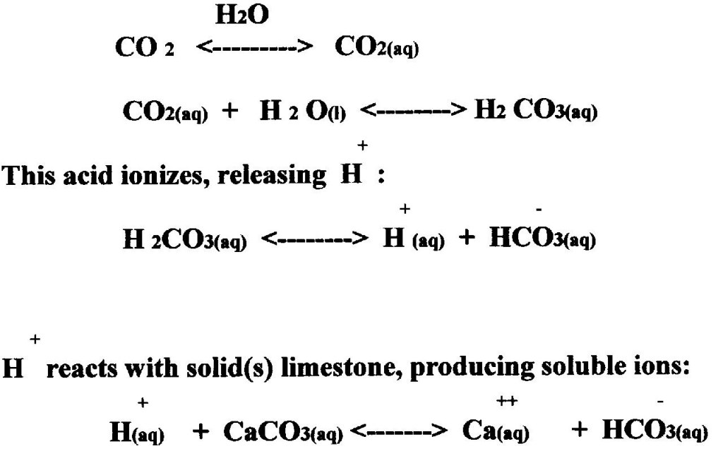
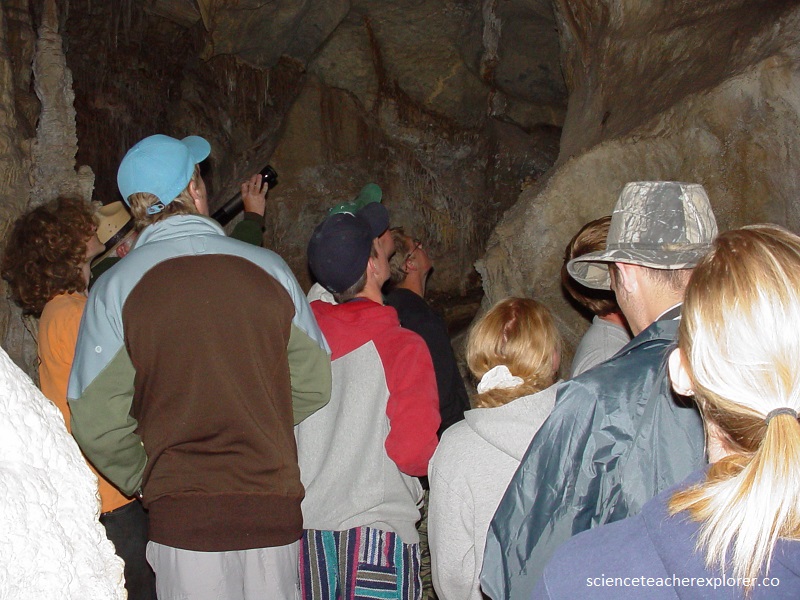
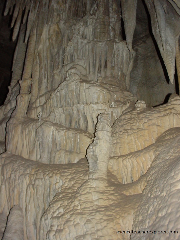
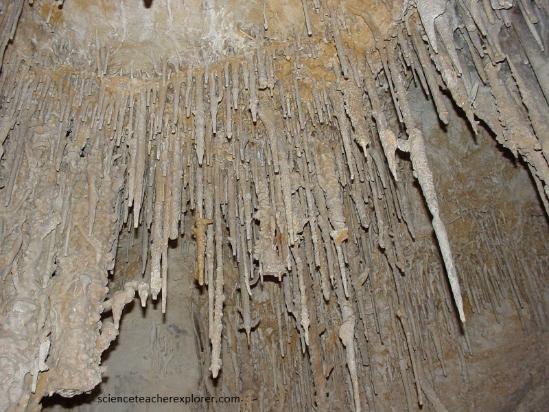
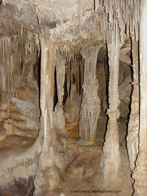
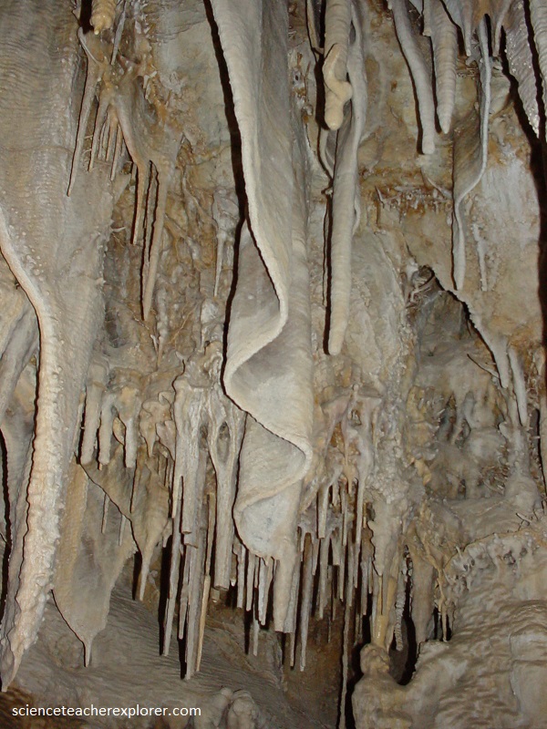
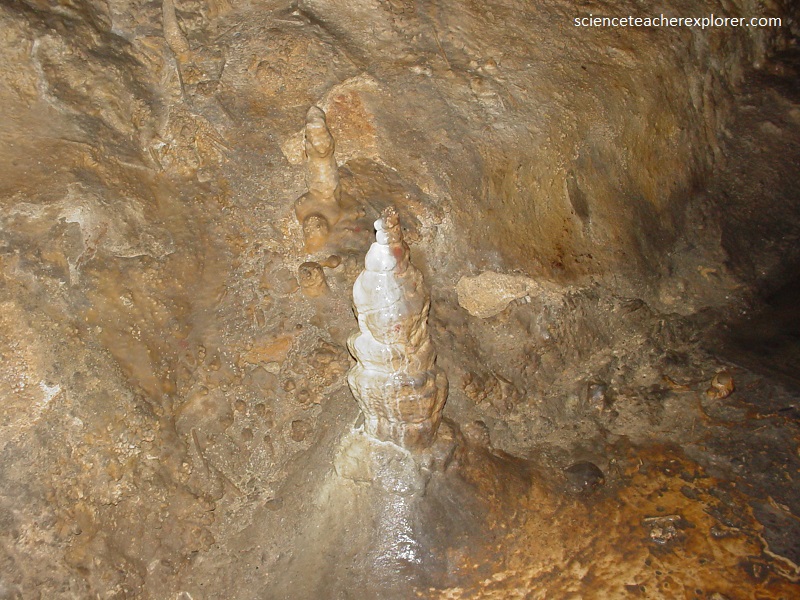
While there is some limestone or marble still being dissolved in the water, the smaller amount of water is exposed to the air, thus some of the water evaporates. This leaves the solids, which it has just dissolved on the way down, on the ceiling or floor of the cave. These end up as icicles-like features on both top and bottom. Those emanating from the ceiling are called “stalactites; those from the floor are called stalagmites. There are many other depositional features in the cave, each with it’s own descriptive name. However, overall they are called speleothems, (pictured below).
It took us about 2 hours to go through the cave. The inside temperature of the caves was a constant 11 degree C. (52 F), so we all wore jackets. Also, the humidity was nearly 100% all the time. Note, these deposits are not caused by the simple evaporation. Instead, as a water-drop clings to the ceiling, it loses some of it’s CO2 because there is relatively little CO2 in the cave air. This causes all of the reactions noted above to go backward. The solution becomes less acidic; the water hold less dissolved limestone; and the original mineral reappears as a small ring of solid CaCO3.
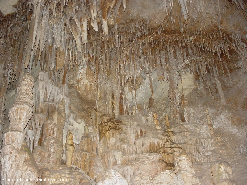
Drop after drop, ring after ring, the deposits eventually produce a hollow tube which hangs from the ceiling like a soda straw. Straw stalactites my grow to a length of a meter or more, (pictured above).
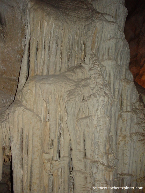
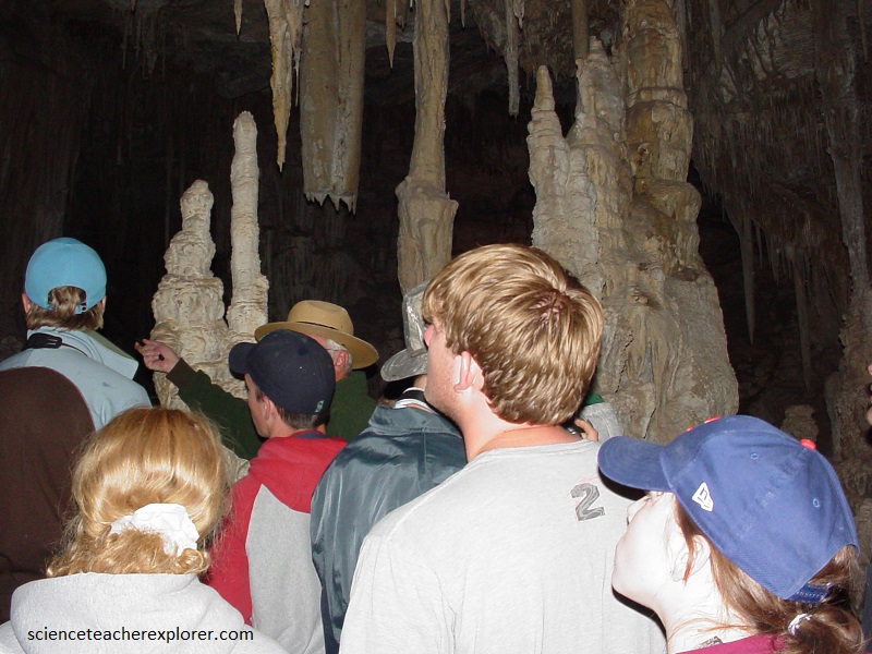
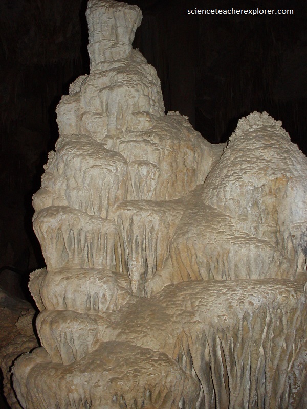
Pictured above, the hollow interior of the young stalactite often becomes clogged with sand or fungi. The water, forced to flow down the outside of the tube, increases the straw’s thickness by adding new deposits. The stalactite grows until it resembles a giant icicle. Mineral-rich drops fall to the floor, releasing CO2 as they splash. More calcium carbonate is deposited, slowly by building into stalagmites. Sometimes the two formations grow together, producing a continuous column, (pictured below).
The underground sculptures that we viewed in the cave were more amazing that they appear because they were produced by reactions which go in one direction, then in the opposite direction, driven by the amount of CO2 in the air.
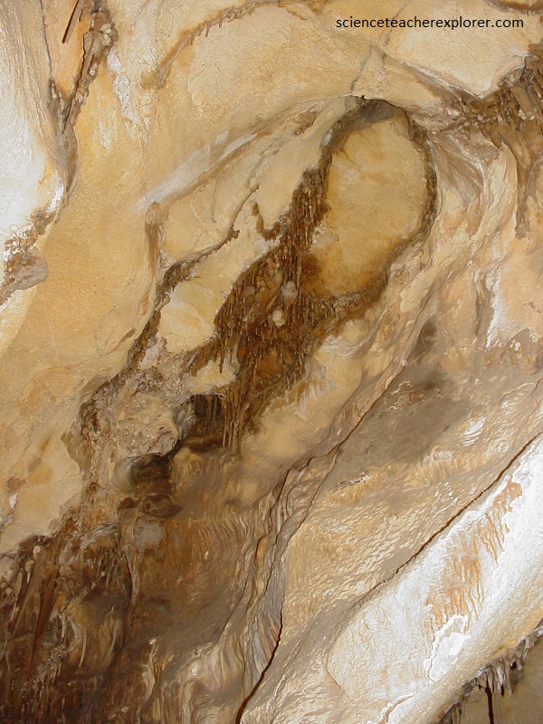
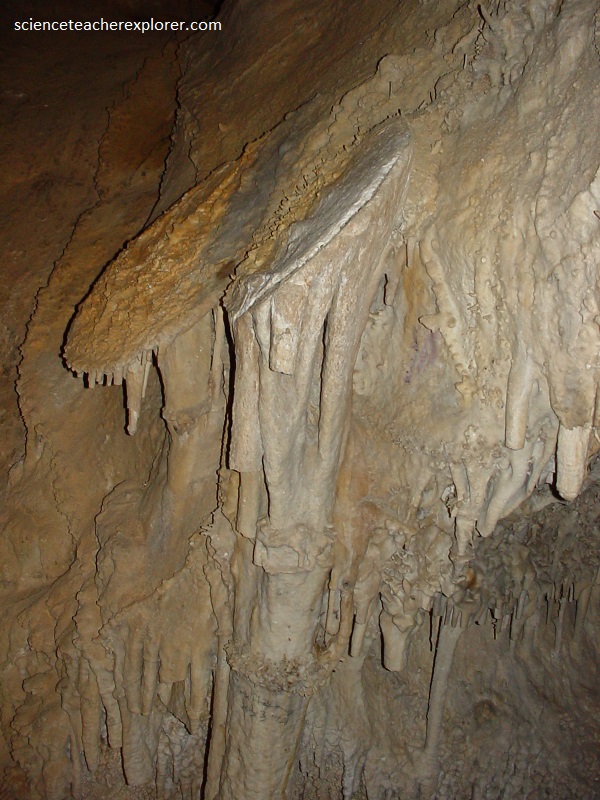
Pictured above, traces of iron compounds in many of the deposits give colors not commonly found in dripstone. Iron gives it a brown or reddish color like rust.
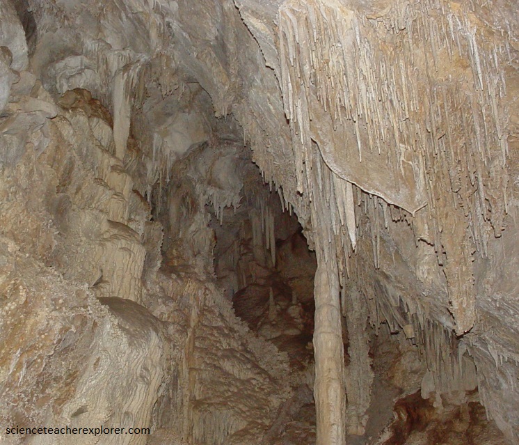
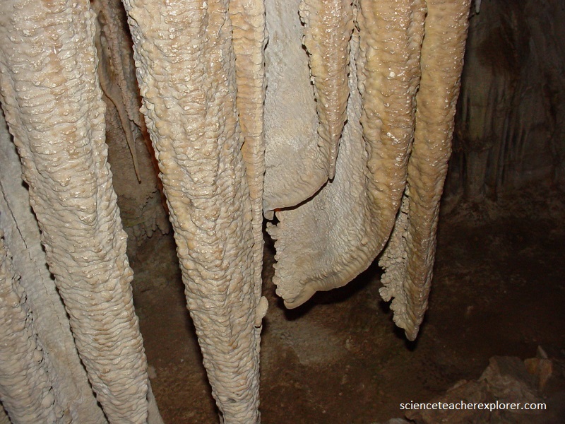
Pictured above, these structures begin to form on an inclined ceiling when the drops of water trickle along a slope. Gradually a thin sheet of calcite grows downward from the ceiling and hangs in decorative folds like those seen on drapes. These speleothems are called cave-drapery or cave-curtains.
Pictured above, flowstones consists of sheets of calcite that are deposited on the walls or floor of the cave by running water. Water in Lehman Caves seeps directly out of tiny pores in the cave walls and deposits knobby protrusions called cave popcorn. Cave popcorn can be isolated or joined into great clusters.
Pictured above, box-work structures form where intersecting fractures in the roof or walls control the flow of water. Water seeps out of fractures and builds ridges of travertine that mirror the geometry of the linear features. Travertine deposits called rimstone bound ponded water within the cave. Some of my students saw cave pearls within these ponds. Pearls are spheres of travertine that have precipitated onto sand grains. If dripping or flowing water constantly agitates the grains, the pearls cannot adhere to another surface and instead move freely within the pond.
Pictured above, the most unique speleothems in Lehman Caves are shields, also called parachutes. Shields look like tilted clamshells that have many small stalactites and columns protruding from the bottom side. It is hypothesized that cave shields form as extensions of joints or cracks in the floor, wall, and ceiling. The process begins when calcite-rich water under hydrostatic pressure moves through the joints within the bedrock. Once the water exits the joint, it loses carbon dioxide to the cave chamber and precipitates calcite on either side of the joint. This builds plates of concentrically layered calcite separated by a thin, capillary-sized crack called the medial crack. Shields grow bigger as more calcite is deposited on the outer rims of the plates. As you can imagine, the larger the shield, the longer it took to grow.
Pictured above, since travertine is a common mineral found in the cave, then gypsum maybe present in a dissolve state in water. The white on this stalagmite is more than likely a gypsum precipitate. Gypsum is a magnesium sulfate mineral.
Absalom S. Lehman came to the Snake Range as a miner in 1867 but astutely changed professions. He cleared land near a stream east of Wheeler Peak and began farming, supplying meat and produce to mining camps. In 1885, he chanced upon an opening in the ground. With rope and a lantern, Lehman lowered himself into the earth and discovered a series of beautifully decorated, interconnected passageways. Lehman publicized his discovery in the local newspaper and began guiding visitors through the cave. This cave system, as well as land above it, became Lehman Caves National Monument in 1922. The monument was subsequently enlarged and established as Great Basin National Park in 1986. We explored it in 2004.
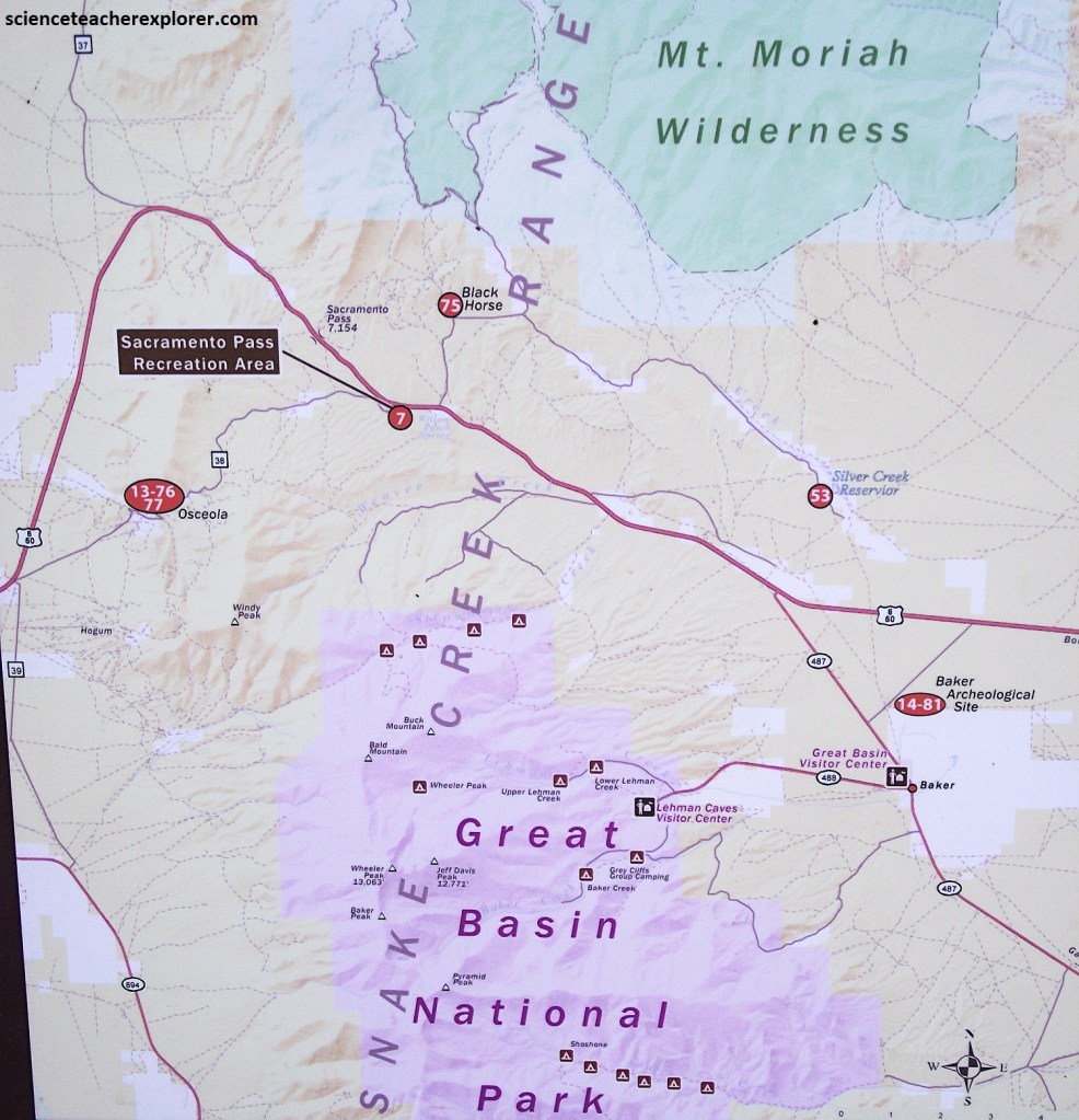
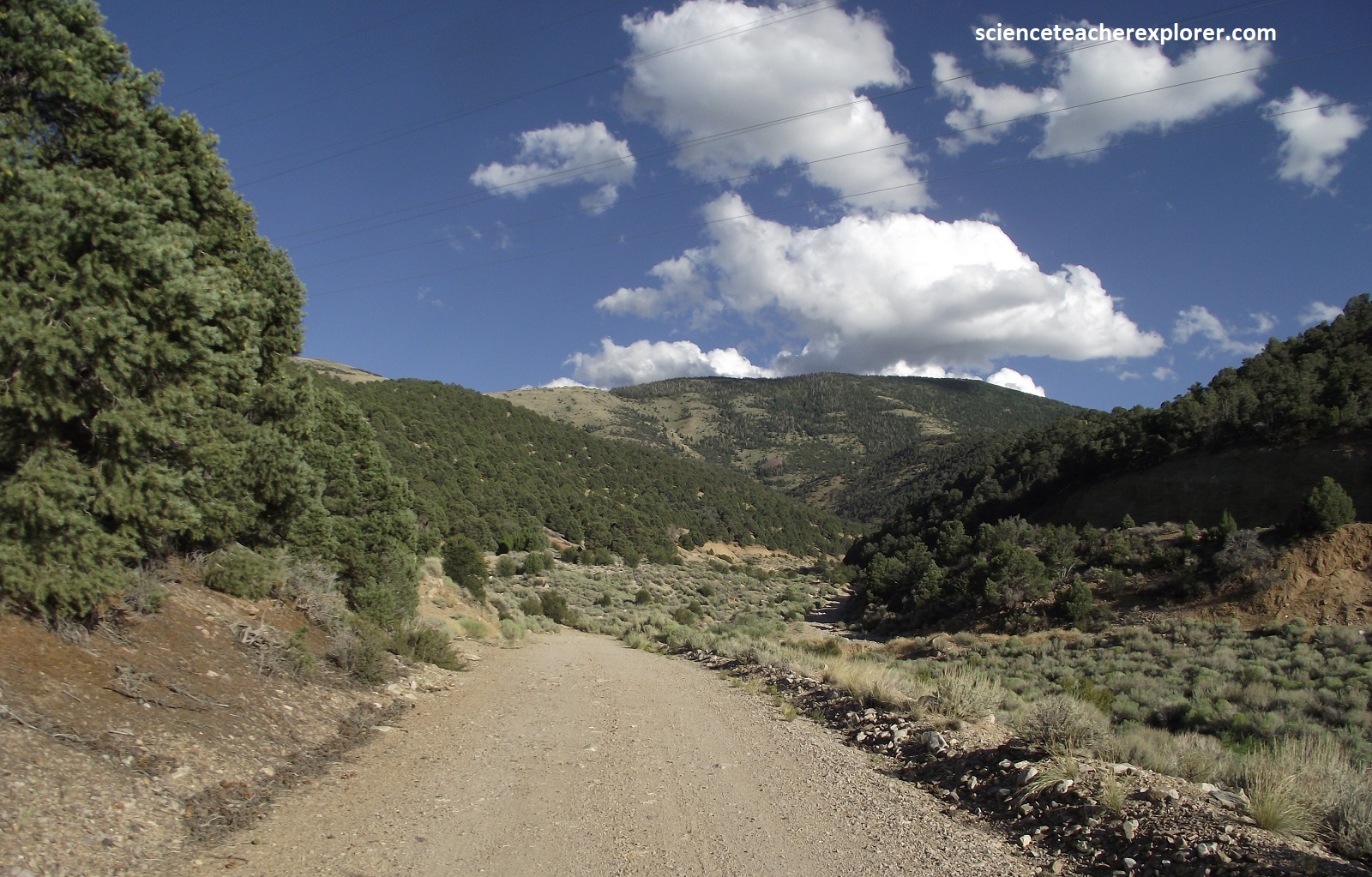
Following the arrival of the first settlers in Snake and Spring Valleys the first wagon roads were built to connect the ranches, mining, and timber operations. Often these routes took the most direct path. The first wagon road extended eastward from south Snake Valley to near present day Delta, Utah. From there if connected to Knoll Springs and later extended over Sacrament Pass to Osceola and finally to Taylor and Ward in Steptoe Valley, (imaged above).
In 1920 the longest transcontinental highway US-50 was built across the central Great Basin. It was named the “Grand Army of the Republic Highway”, a name that honors an American Civil War veterans association. The highway remained a gravel road until 1947 when a section from Ely to Baker was paved and became Hwy6/50. In 1952 the portion from Baker to Delta was paved. In the past, there was a bar/gas station at Sacramento Pass. Originally named “Sadie’s Place” and under subsequent owners re-named the “Sacramento Pass Inn” and the “Wheeler Peak Inn”. Remnants of the foundations can be seen at the beginning of “The Sac Pass Trail”, at the lower trailhead.
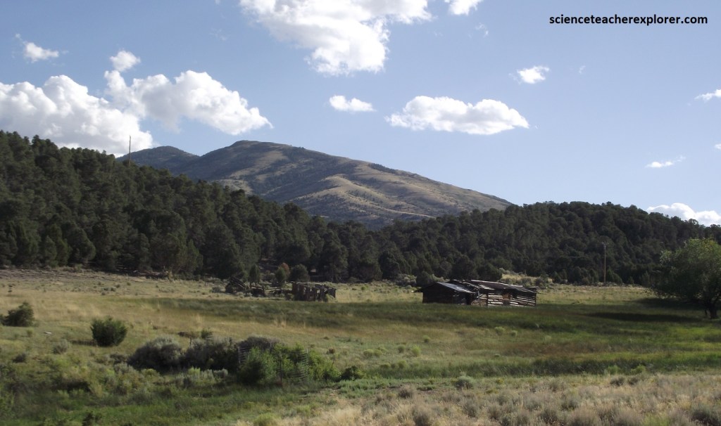
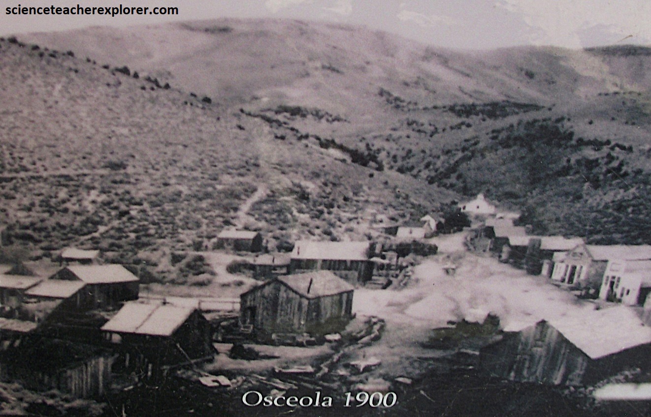
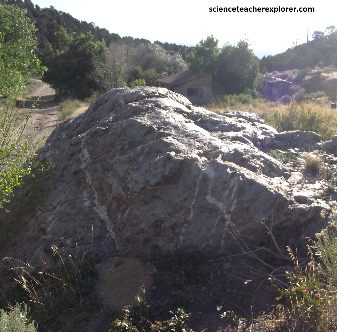
Gold was discovered 8 km southwest of Sacramento Pass in 1872. In 1877, placer gold bearing gravels from the same source were discovered and the town of Osceola was founded, (pictured above). {Note the historical photo of Osceola was taken from an interpretive-sign on-site & the other photo on the right of the same region was taken by me in 2024}
Pictured above and below, Osceola was where the largest gold nugget in Nevada was found, weighing 24 lbs. (10.9 kg) and at that time worth $6000.
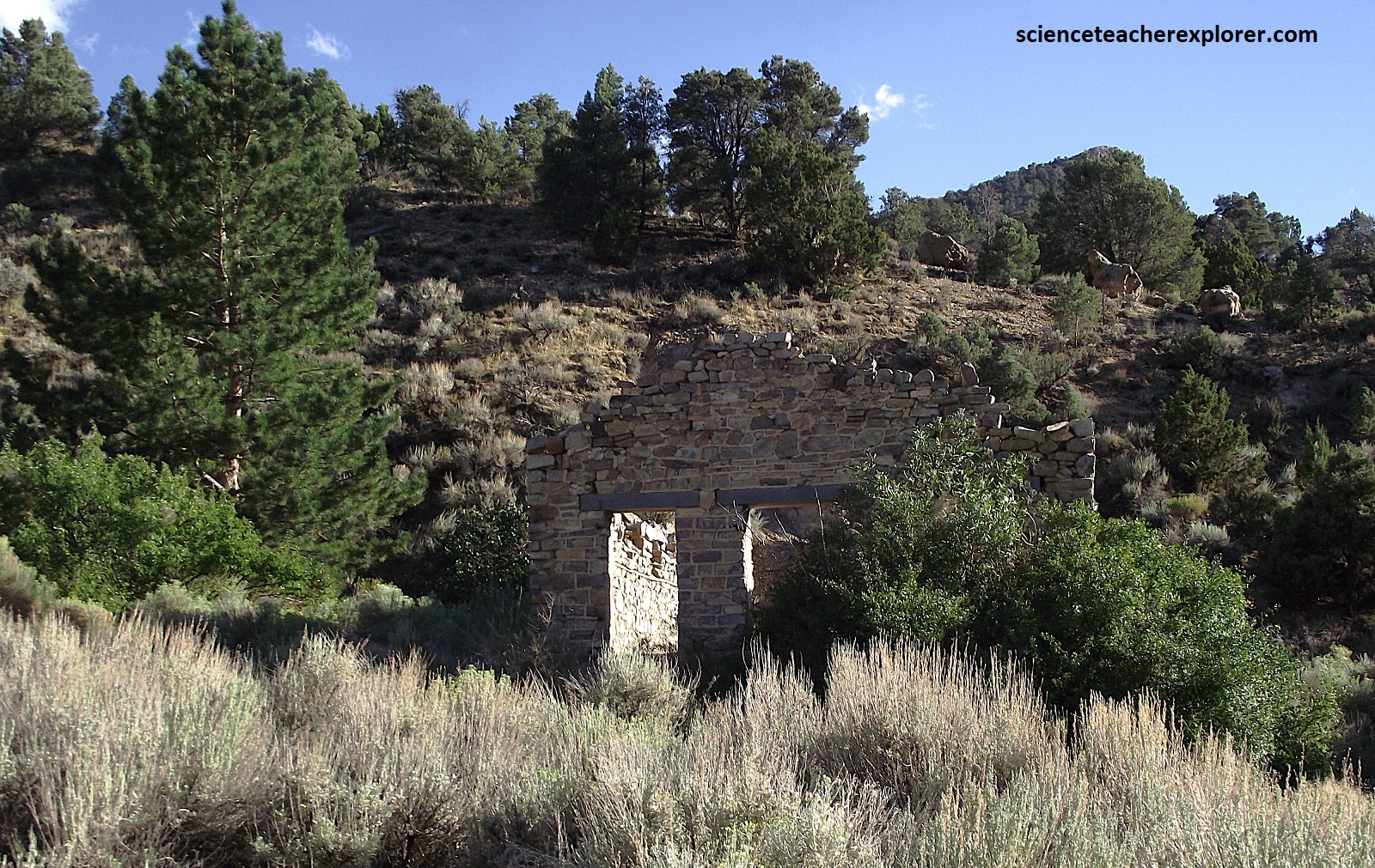
Pictured above, Osceola had a post office by 1878 and by 1882 the population reached 1,500. 48 km of ditches were built to bring water from streams on both sides of the Snake Range and hydraulic mining began. Osceola continued to prosper as a supply center for the area ranches and mines into the 1920s making it one of the longest lived mining camps in Nevada.
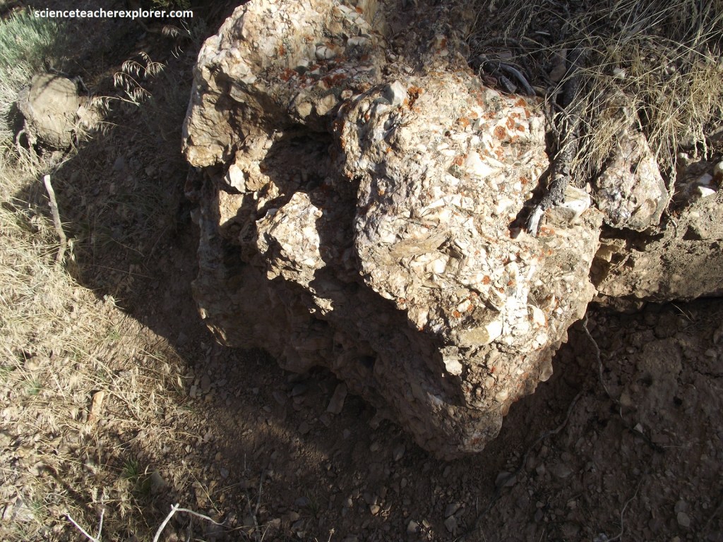
The gold-bearing quartz belt found in 1872 was 19.3 km long and 11.3 km wide. Placer gold was found in 1877 in a deep ravine indenting the area. Miners first used the simple process or the common “49” rocker. Hydraulic monitors later were used to mine the gold from the 3.3 – 66.7 m thick gravel beds.
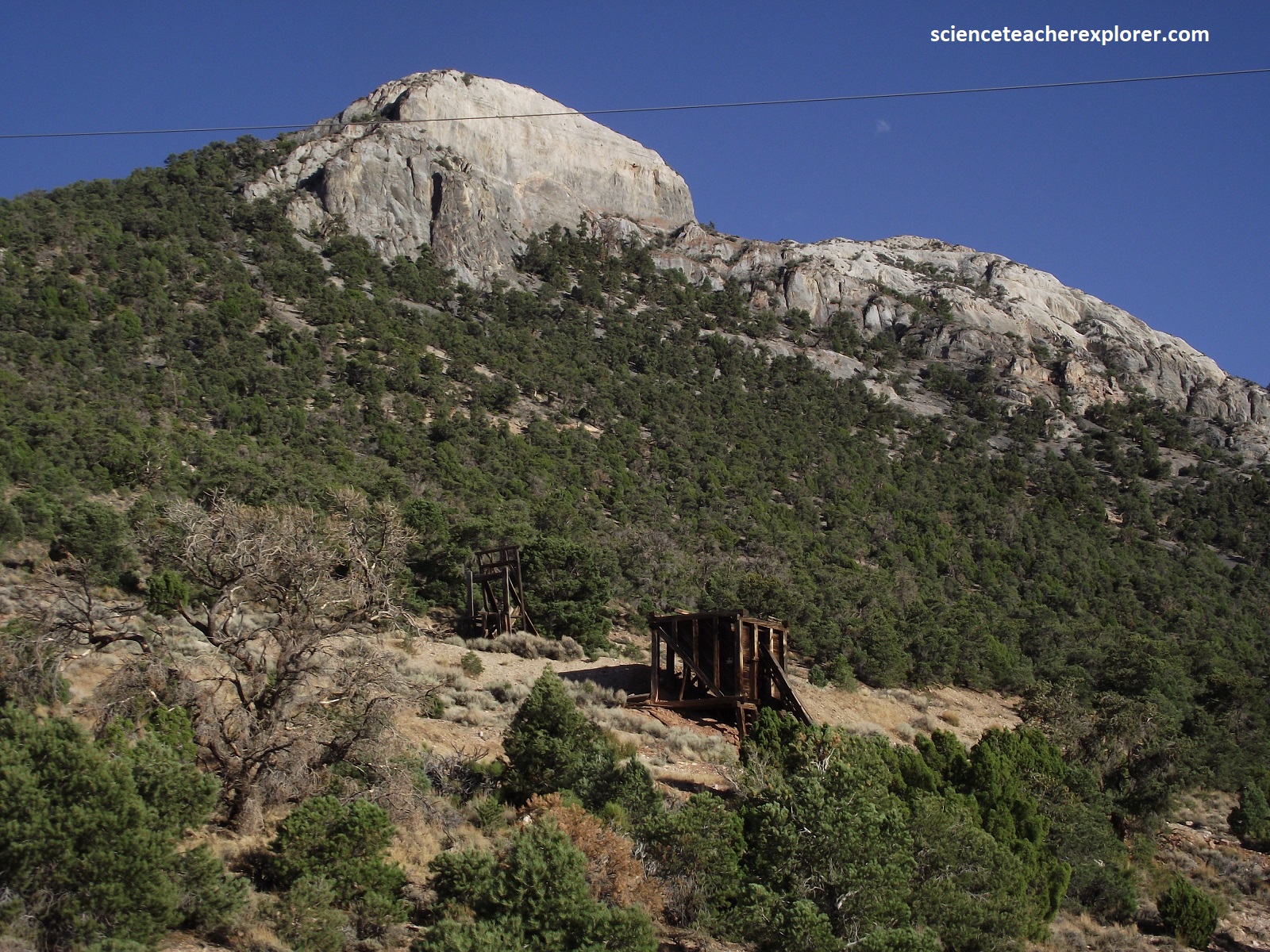
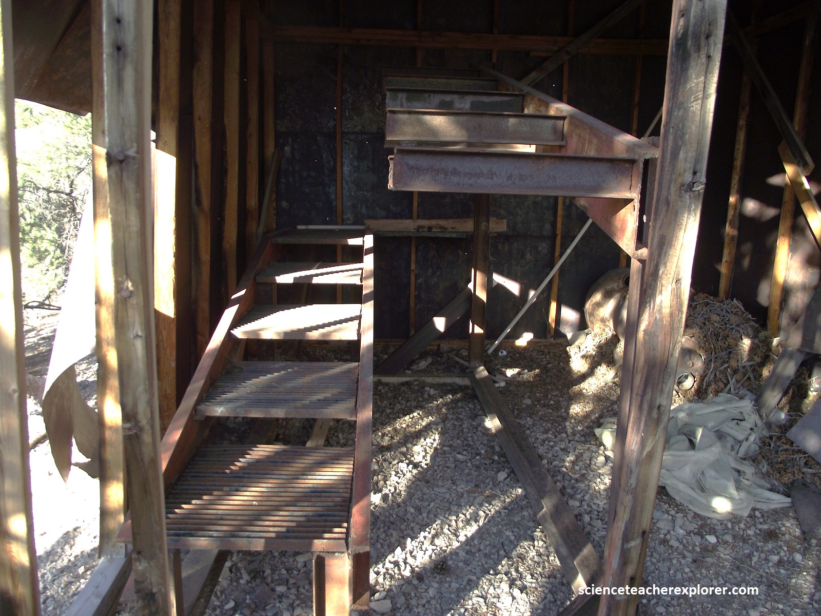
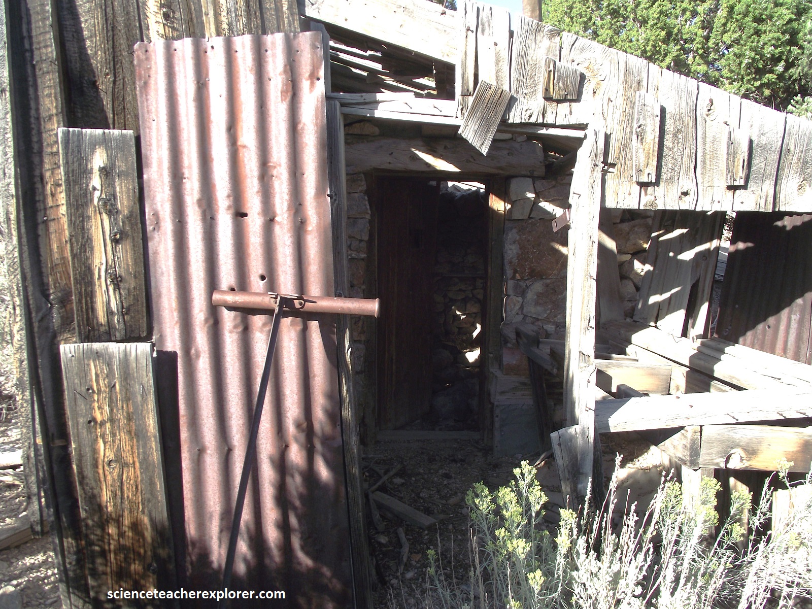
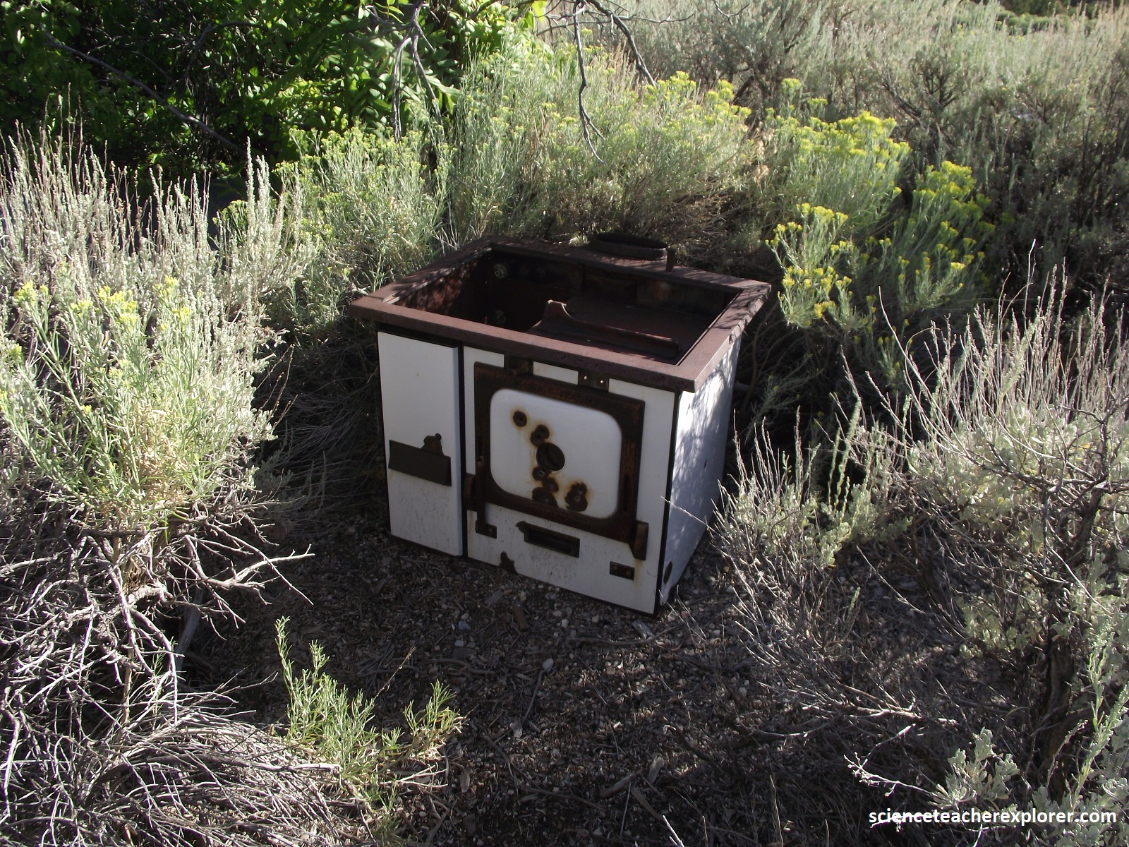
Other famous mines in the district were the Cumberland, Crescent, Eagle, Verde Stem-Winder, Guilded Age, Grandfather Snide, Red Monster, and the Saturday Night. The above photos were taken of the Hogum.
Ezra Granger Williams June 11, 1855 said “I was the first white man to gain the exalted summit” and named it Williams Peak. In 1855, during a military reconnaissance, Lt. Colonel Edward J. Steptoe named the mountain Davis Peak in honor of Jefferson Davis, then Secretary of War and later the President of the Confederate States. In 1859, James H. Simpson named the mountain Union Peak feeling the name was more appropriate as the nation edged closer toward Civil War. In 1869, the mountain was named for Captain George M. Wheeler US Army Corp of Engineers, who was conducting extensive military and topographic surveys in the region. Local settlers however generally referred to the mountain as Davis Peak. However, it has been concluded that the double peak mountain can be shared as the west peak is Wheeler Peak (highest) and the east peak as Davis Peak.
