Moore Cutoff Rd., UT
On September 22, 2010, I organized an educational group from the University of Utah to explore the science related sites on the Moore Cutoff Road in Central Utah. The Moore Cutoff Road is a paved road that connects I-70 with Utah Highway 10. The junction with I-15 is at the turnoff for the Eagle Canyon scenic viewpoint around mile marker 114. The junctions with Utah Highway 10 are between mile markers 16 and 17 and between mile markers 21 and 22.
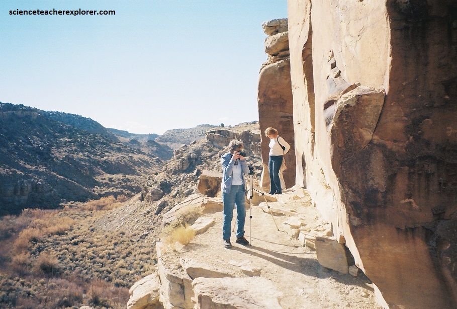
From Hwy 10, between the milepost markers 16 and 17 we started our trek along the Moore Cutoff Road. In about one kilometer we turned south onto a well-graded road and drove for about 6.4 km, passing a radio tower on the way to a trailhead. Our destination was the Rochester Petroglyph Panel. It was about a 15-minute walk to the site on a rough trail. The rock art panel was on a rocky point, high above Muddy River.
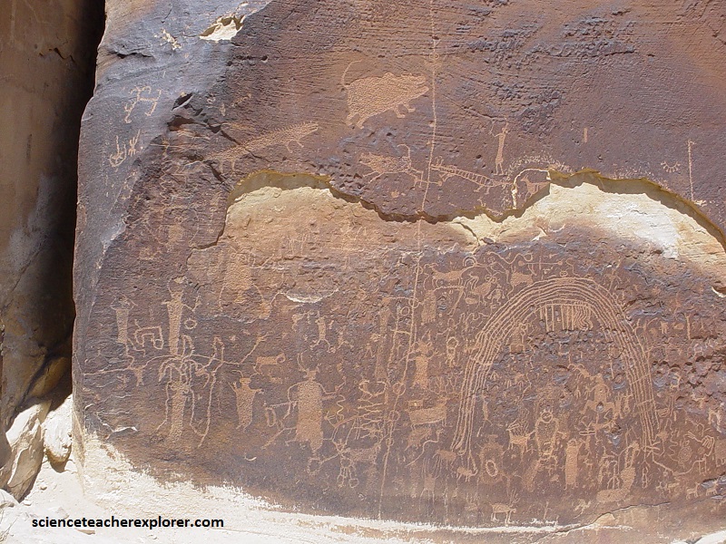
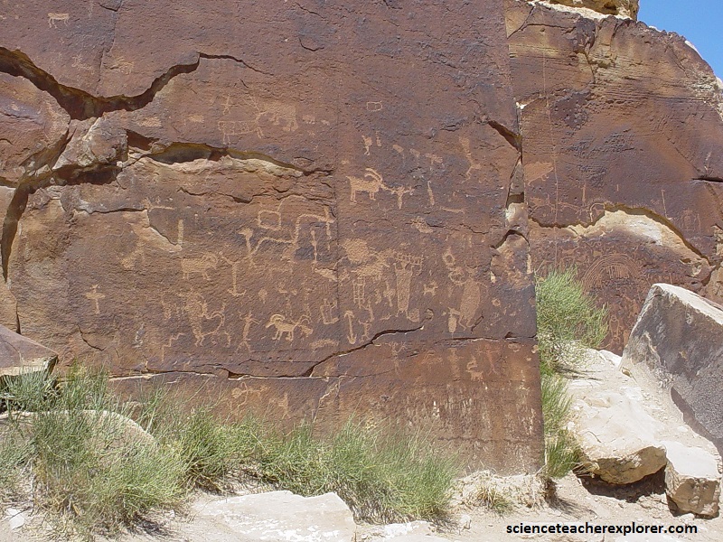
The Rochester Rock-Art Panel is a large, densely packed collection of Archaic and Fremont petroglyphs that include some very unusual images. Pictured above, centrally positioned, is a rainbow-like arch of eight carefully pecked parallel lines. Beneath the rainbow is a female human that seems to be displayed in a sexual nature with finger sized hole for her vagina. Of a less erotic nature are numerous anthropomorphs in the Fremont Native style. There are bighorn sheep and abstract designs. Most surprising, however, are numerous fantastic animals, made prehistorically. One resembles an alligator, another looks like a hippopotamus. Others are purely imaginary, even nightmarish that seem to be coming out of a single pecked line the vertically reaches to the to of the cliff face. They all appear highly aggressive with open mouths and bared teeth.
Pictured above, across the path, on another wall facing east, is a recumbent human male figure that has an erect phallus directed into a squatting female figure.
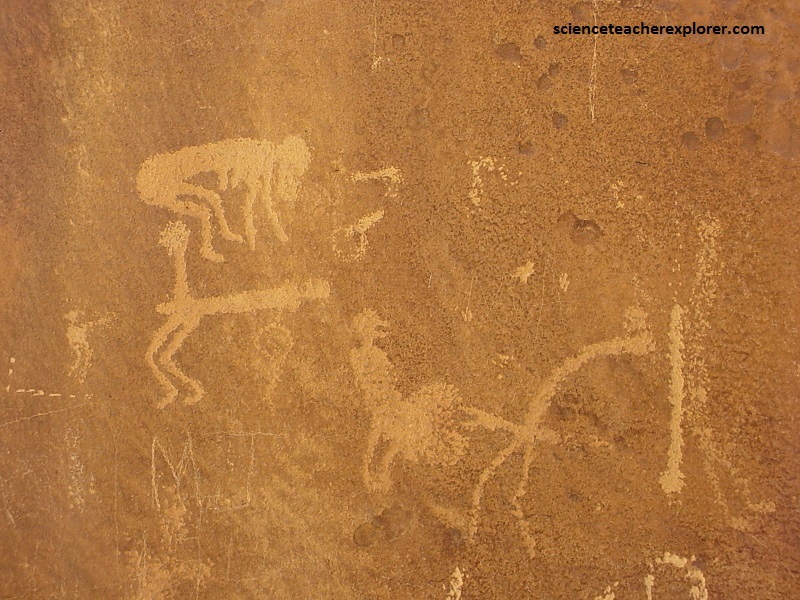
Just around the corner from the main panel, is another smaller one. This one seemed to contain more exotic animals like the bear and elk.
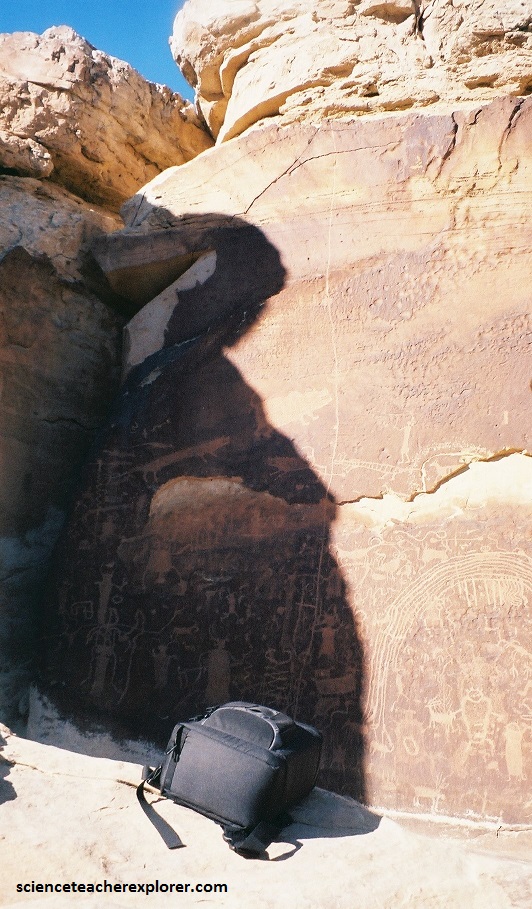
Years prior to the trip, I had the opportunity to interview the Piute Chief from Garrison, Utah (a remote village on the Utah and Nevada Stateline). He instructed me to investigate this particular site on the Autumnal Equinox, (September 22nd). There, I would be see a “Pregnant Maiden” from the “Spirit World”. Apparently, the single pecked line that I mentioned above is a doorway to the “Spirit World”. So here I was, on September 22, 2010, waiting for the “Pregnant Maiden” Spirit to appear with witnesses. At about 10 AM, there appeared a shadow figure that one of the group members saw. I took a picture of it below.
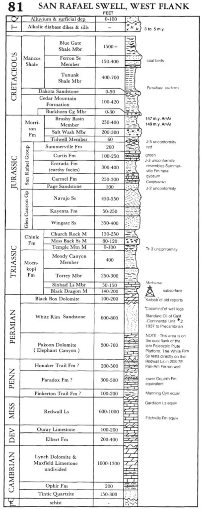
From the Rochester Petroglyph Panel Site, we continued down the Moore Cutoff Road, towards the east, for an additional 8 km. There, a pullout on the left (north) side of the road near the base of Molen Reef, (an asymmetrical ridge composed of the approximately 90 million year old Late-Cretaceous Mancos-Shale). The Mancos Shale’s hard and resistant Ferron Sandstone Member caps the ridge, and the underlying Tununk Member is exposed on the ridge’s cliff face.
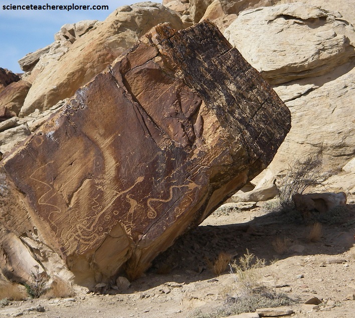
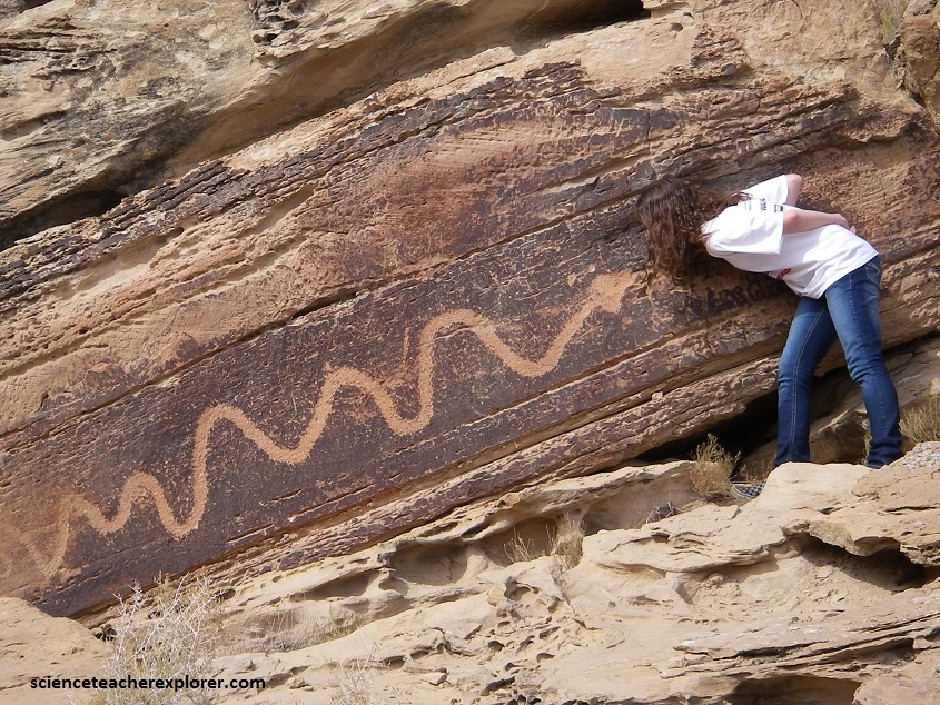
Picture above and below, various petroglyphs are etched on fallen blocks of Ferron Sandstone. Notice the Kokopelli figure with the snake grouping. Kokopelli is a fertility deity and trickster, usually depicted as a humpbacked flute player who is venerated by some Native American cultures in the Southwest.
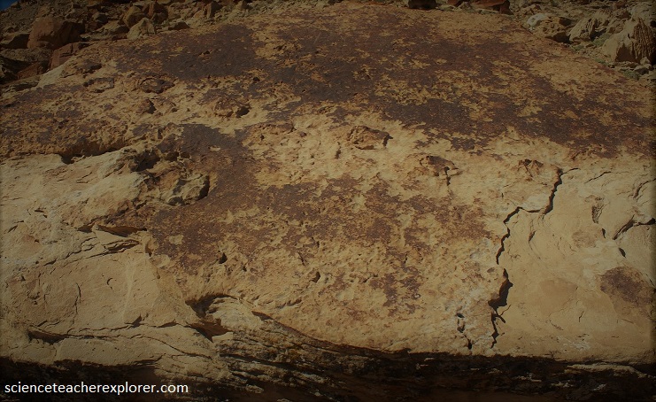
Pictured below, east of the pullout, a roughly 15 m diameter block exposes a dinosaur track-way.
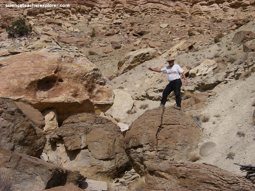
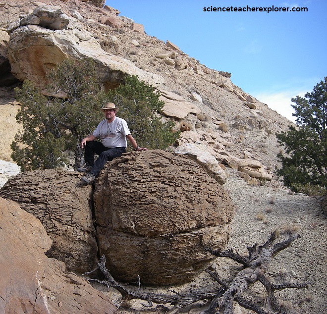
Another kilometer down the Moore Cutoff Road is a dirt road that cuts to the left (north). We turn left (north) onto an unnamed dirt road and traveled 4 km to a 4 wheel-drive trail on the left. We took this trail for another 2 km up “Short Canyon”. I prefer to name this canyon, “The Canyon with Big Balls” or “Big Ball Canyon”.
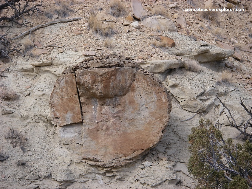
Short Canyon contains large sandstone concretions scattered around the cliff base. These 1-3meter-diameter spherical concretions weather out of a sandy, ledge-forming rock layer mid-way up the cliff within the Tununk Member of the Mancos Shale.
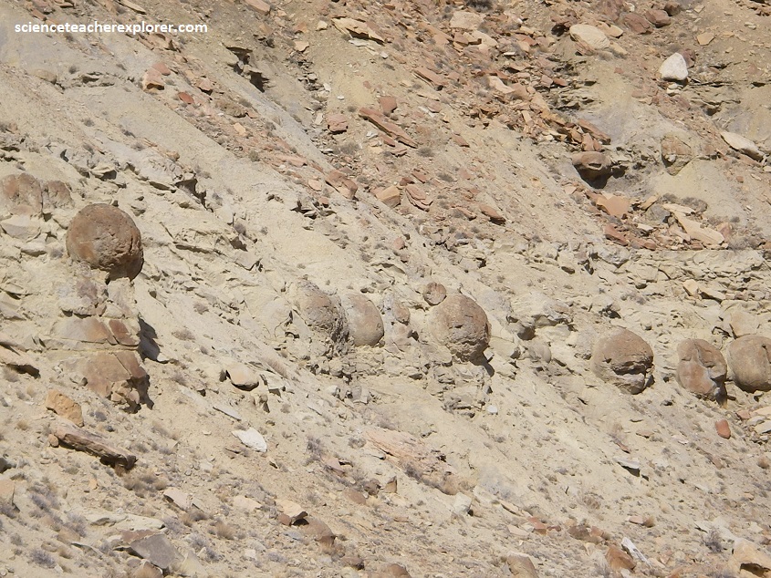
This concretion-bearing layer is informally called the Moore sandstone. Though not well studied or well understood, groundwater circulating through this layer is thought to have preferentially deposited mineral cements that glue the spherical concretions together.
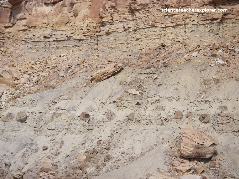
Roughly 100 million years ago, this area was an ancient shoreline with fluctuating sea levels. As the water rose, a leaf, bone or sea shell in the mud, somehow became the nucleus. With conditions just right, there was some kind of chemical reaction around the nuclei and minerals precipitated out of the groundwater & mud and collected around this center piece which grew to for a rounded ball which differed significantly from the surrounding mud or shoreline sand.
Most of these concretions are in a sandy layer of the Tununk Shale Member of the Mancos Shale Formation.
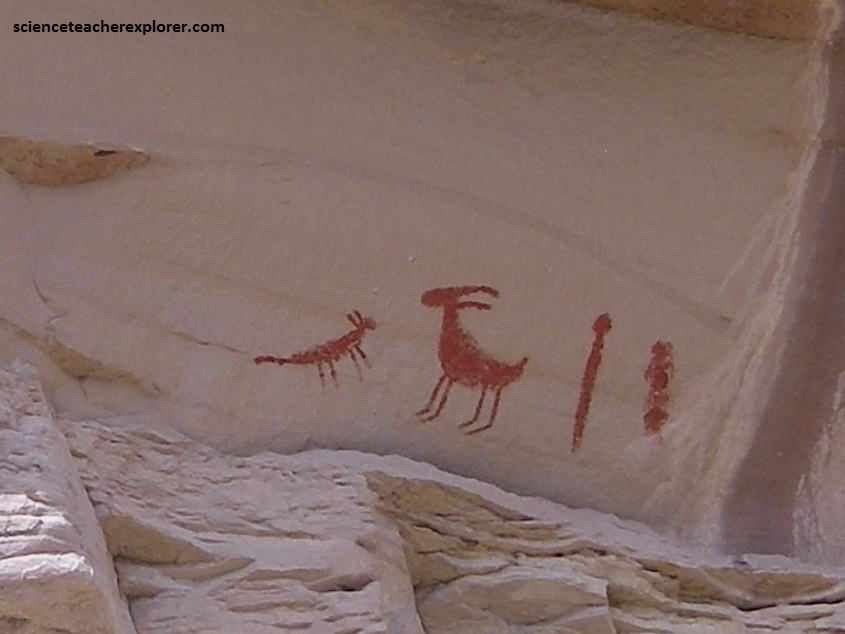
Near where Short Canyon divides, and 75 meters up the slope to the right and facing souteast, is a small anle of red pictographs under a protective overhang, (pictured below).