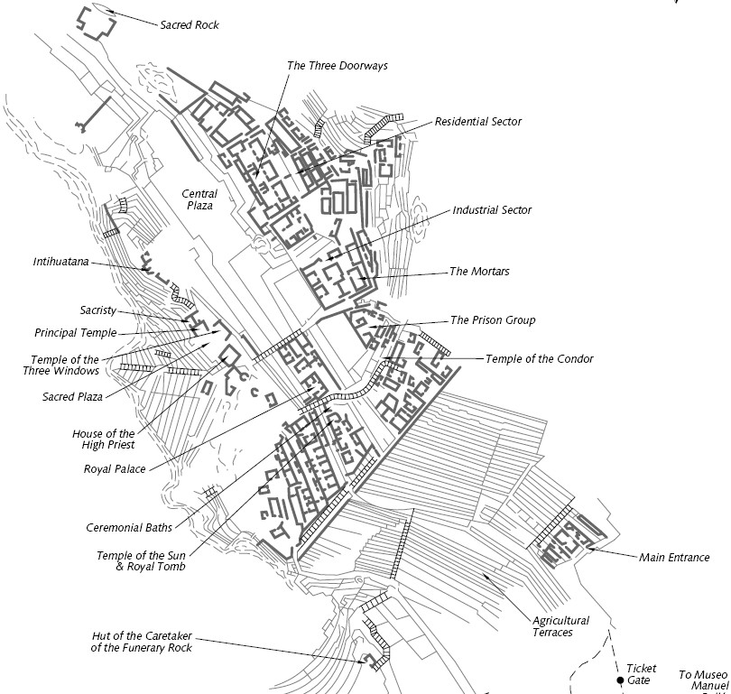
Machu Picchu, Peru
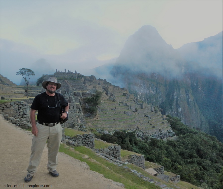
At the end of June, 2014; Kathy Stoker (another educator) and I visited the amazing location of Machu Picchu, Peru. Kathy and I were trekking together to explorer the sites of Peru.
Machu Picchu is built on a narrow ridge between Machu Picchu Mountain and Huayna Picchu Mountain at an elevation of 2450 m, 13 degrees south of the Equator. The ridge drops off steeply on both sides to the Urubama River 450m below. the river circles the site on three sides and eventually joins the Amazon. Because of its lower elevation and proximity to the rain forest, Machu Picchu has a wetter and milder climate than Cusco, (nearby city).
This incredible ruined city is believed to have been founded at the height of the Inca Empire, around 1400 to 1450, and to have been lived in for less than a century. The number of bones found here has led to assumptions that Machu Picchu was a place of sacrifice; the majority of the bones come from young women. The presence of many temples and religious sites seems to prove Machu Picchu had spiritual significance for the Incas.
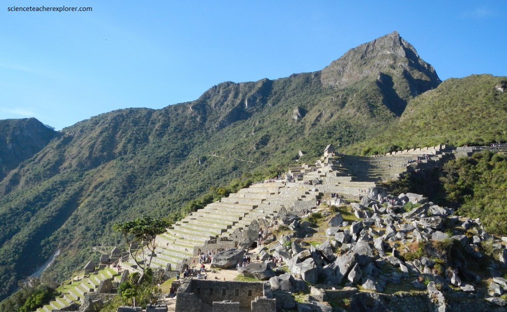
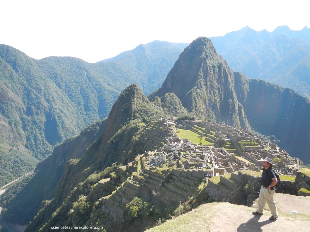
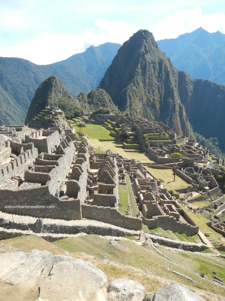
In Inca times you would have traveled for more than a week on the Inca Trail to get from the Inca capital at Cusco to Machu Picchu, stopping at way-stations along the route. Eventually you would have reached Intipunku (Gate of the Sun) and the final descent to Machu Picchu. What an awesome sight to behold: beautiful agricultural terraces, the city beyond with grand plazas, hundreds of thatched-roof stone buildings, temples, and a striking peak, Huayna Picchu, as backdrop. Forested mountain ranges and snowcapped peaks set if off like a jewel.
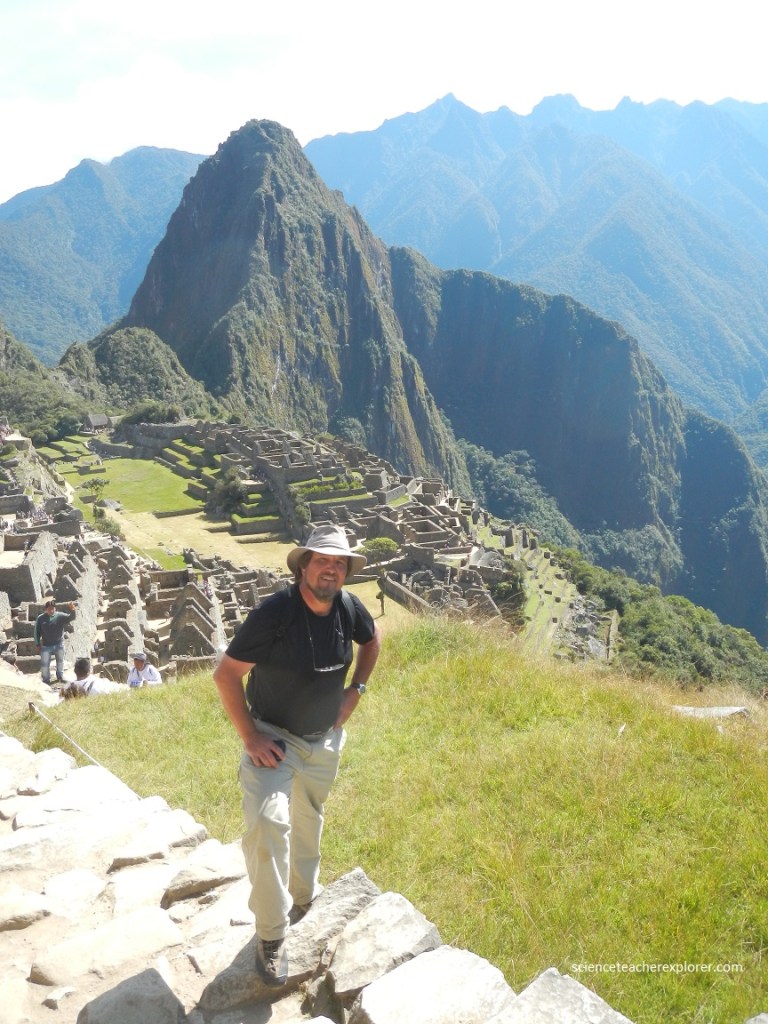
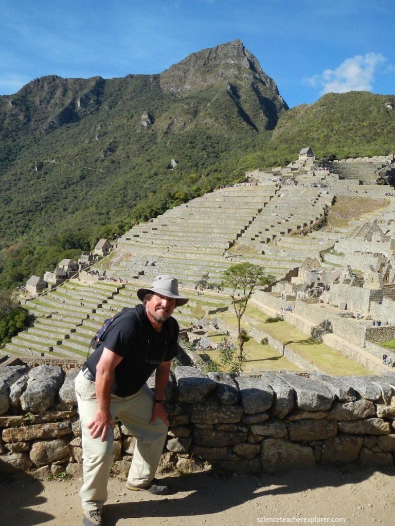
Pictured below, I’m posing near the Machu Picchu Guardhouse. Machu Picchu sits on a 150 square mile igneous intrusion, the Vilcabamba batholith, which is pushed its way into surrounding sedimentary rocks during the Permian era about 250 million years ago, and was gradually exposed during the periods of mountain building and erosion that followed. This created spectacular mountains and gorges, such as the Urumbamba Gorge below here.
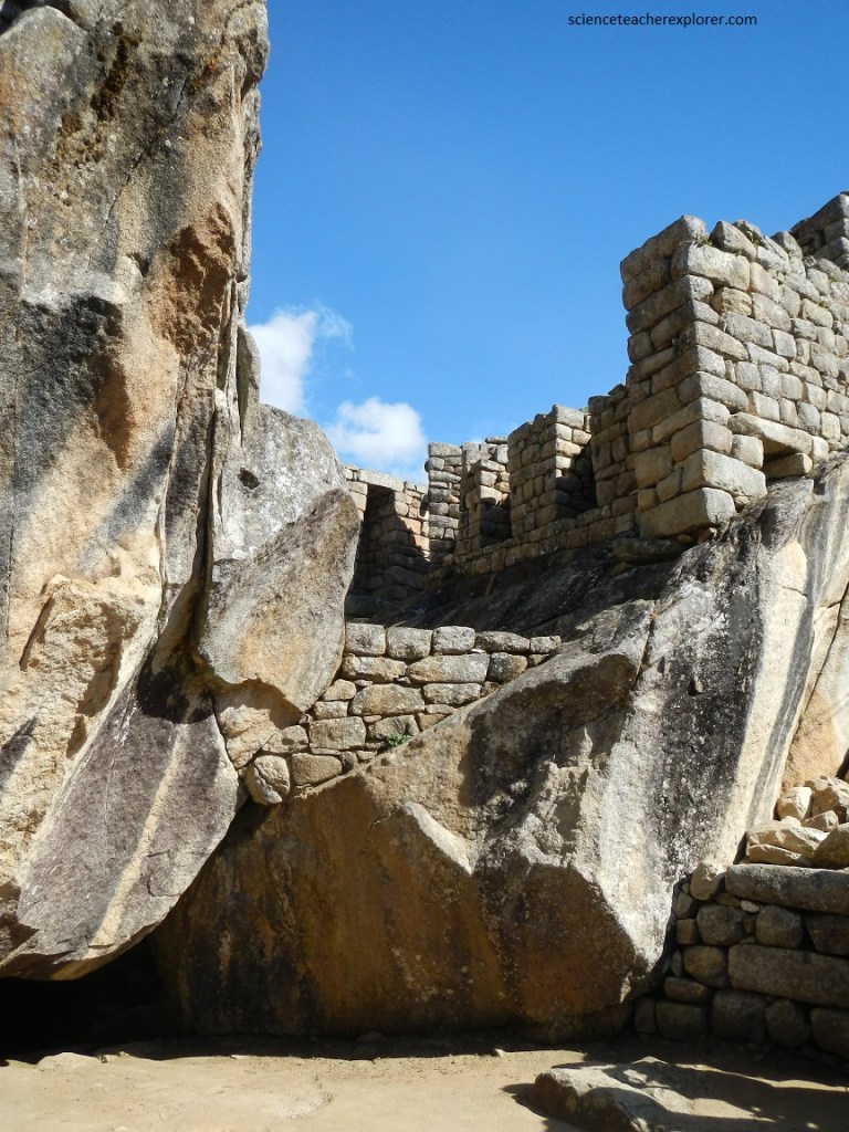
Pictured below, and near the House of Guardians, we found the so-called Funerary Rock. Human remains have been found in this area, indicating that it might have been used as a funeral site. All this is speculation without facts since no written records exist. This is why calling the area behind the Funerary Rock “The Cemetery” might be a long shot. Machu Picchu, however, was a huge Inca country estate and this place at least had the looks of a cemetery the site must have had. Some of the rocks show carvings (looking like drainage). There has been a debate about whether this site has also been used for sacrifices (human and/or animals).
The symbolism of the slanted surface of Funerary Rock, the steps, and the ring carefully cut on one side is unknown, but we can admire the craftsmanship required it its creation, using only hammerstones, bronze tools, and sand. Notice that it is surrounded by round rive rocks, symbolically bringing the powerful and sacred river to this mountain site. The river rocks are now scattered and insignificant looking, but were ritually important at one time.
There are two major geologic faults on either side of Machu Picchu, the Macho Picchu Fault (on the southside) and the Huayna Picchu Fault (on the northside). These high-angle reverse faults formed a wedge-shaped structural block that dropped relative to the peaks on either side. This block, or graben, is the ridge on which the Inca built their retreat, with Macho Picchu Mountain and Huayna Picchu Mountain on either side. Enormous effort was put into this virtually unbuildable site by constructing hundreds of wall to create flat spaces. Some 60% of the construction at Machu Picchu lies underground, providing foundations and drainage for the buildings and walls. But the Machu Picchu Fault also permitted the development of a perennial spring, without which the site would probably not have been chosen. In addition, the jumble of rocks from the faulting meant there was ready supply of granite building materials.
Machu Picchu has probably been a ritual center and not so much a real city (unlike Cusco or Pisac). The main temple consists of huge walls that have once been perfectly set. You can clearly see plenty of niches in the walls. Once sacred objects (huacas) would have been placed here. Imagine golden figurines depicting the gods, but also mummies of important ancestors.
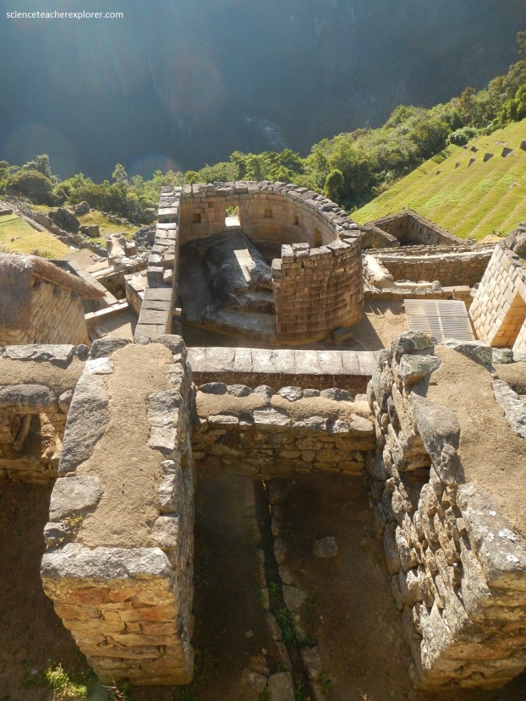
The “Temple of the Sun” is constructed on a natural rock formation and partially encircles the top of that specially cut rock formation with the finest stonework of Machu Picchu, (picture above). The sacred rock that takes up most of the space inside the curved wall was honored and protected by the Inca masonry that surrounded it. The straight ledge, which was created by cutting away part of the rock, bisects the sunlight passing through the eastern window at sunrise on June 21, the winter solstice. Therefore, the “Temple of the Sun” can be considered a solar observatory. Note that the south window with its four stone protuberances were likely used for astronomical/observatory purposes also.
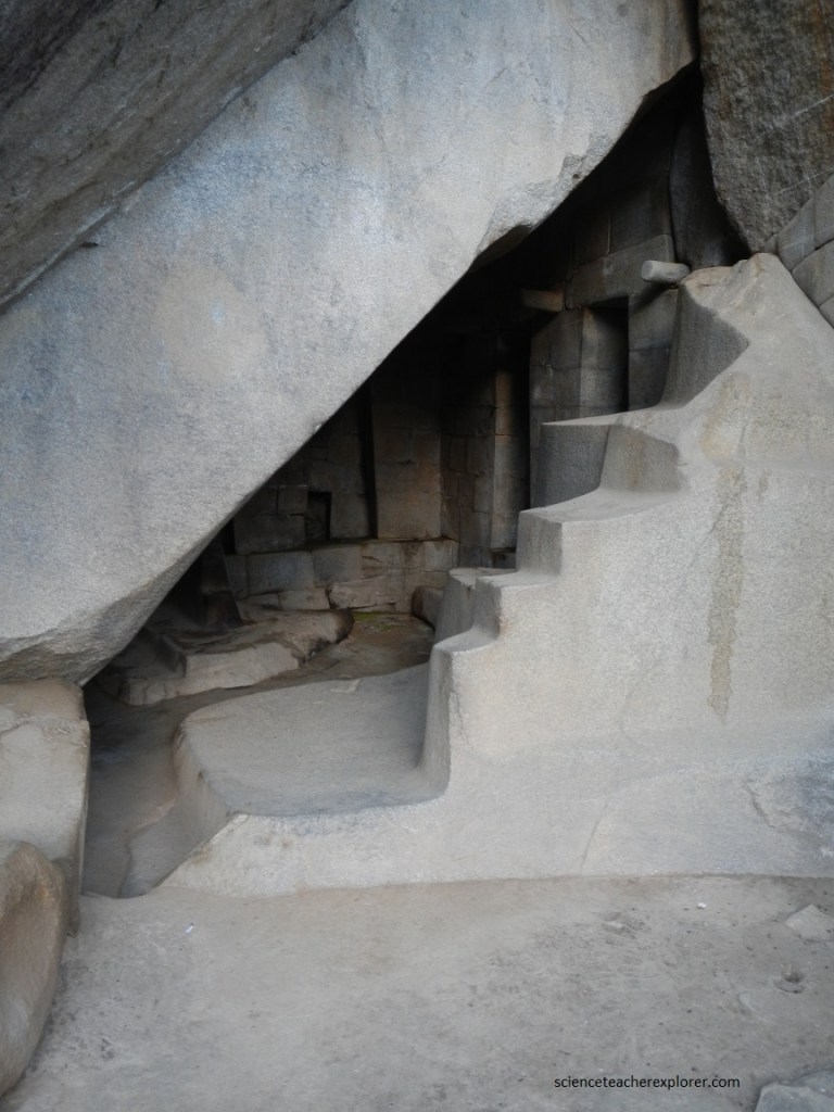
Pictured above, beneath the Temple of the Sun is a natural cave, part of the same rock formation. Note the exquisitely carved, stepped white stone at the entrance; the low carved stone on the floor with a shape similar to the Intiwatana stone; the unusually high niches; and the stones between the stepped stone and the natural rock on the left, carefully fitted into an hourglass shape, (not seen in the photo above). Additionally, attached to the Temple of the Sun is a small building often called “Nusta’s Bedroom”. This might have been the house of the high priest.
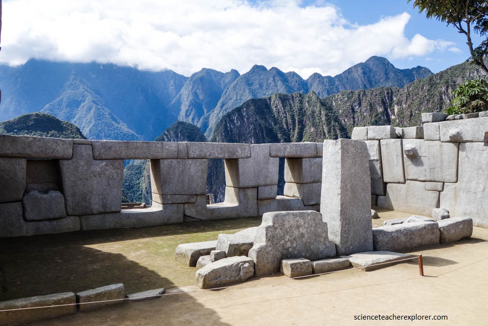
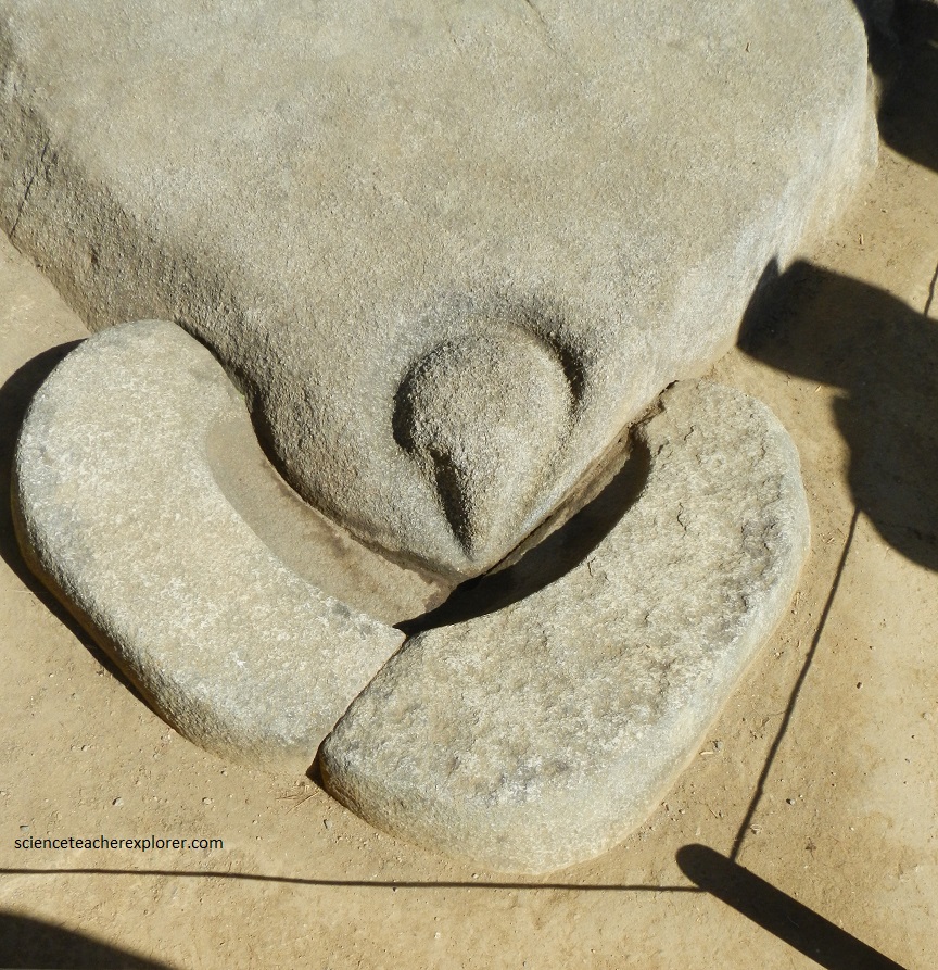
Just above the Sacred Plaza on the eastern side, lies the “Temple of the Three Windows. Polygonal stones of awesome size and shape, exquisitely fitted, make up its walls and windows. Originally there were five windows, the two outer ones later closed off to form niches. Pictured above, a small stepped stone next to the upright stone are found in the middle of the room and may symbolize a mountain.
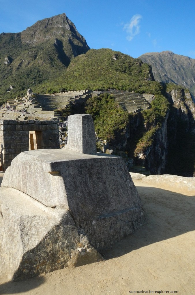
The Intiwatana was sculpted from the rock that formed the peak of what seems to be a natural pyramid, creating an elegant and multifaceted stone masterpiece of exceptional elegance and beauty. The original archeological discoverer of Machu Picchu, Hiram Bingham, mistakenly named it the Intiwatana, meaning “the place to which the sun was tied” in the Quechua language. Experts believe that the Intiwatana stone is associated with mountain worship. Taking the western steps up to the platform puts the Intwatana in direct juxtaposition with Huayna Picchu, replicating its shape and shadows in an abstract way. However, the Intihuatana does seem to indicate equinoxes and lunar movements. At midday on March 21 and September 21, the equinoxes, the sun stands almost above the pillar—casting no shadow at all.
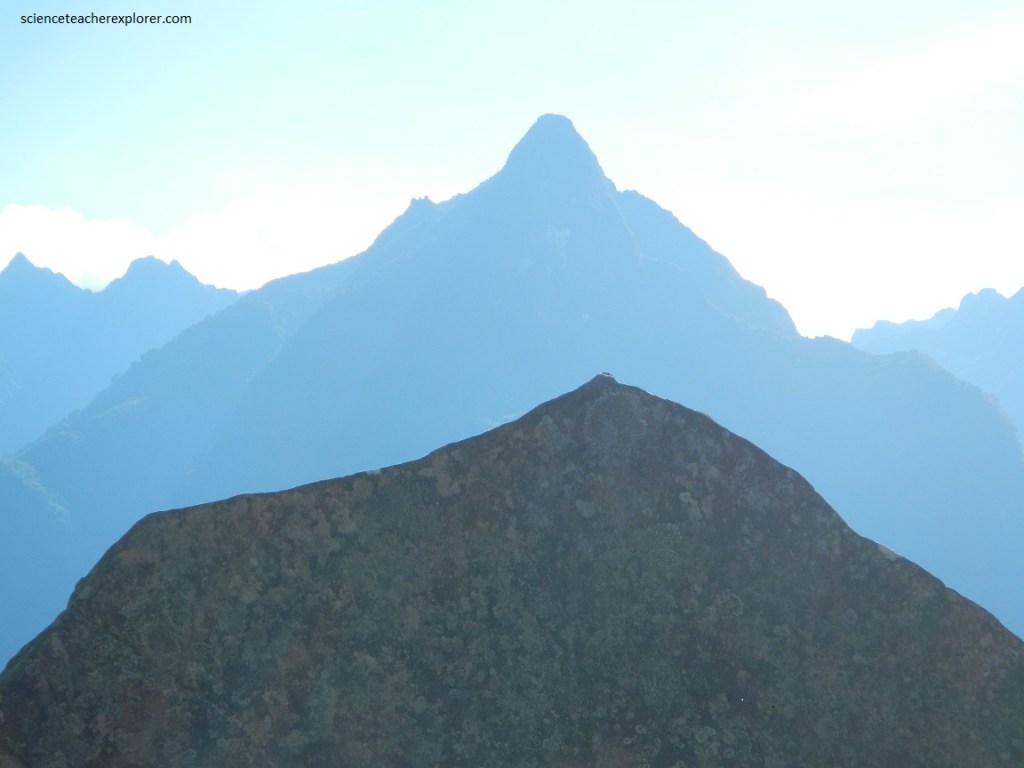
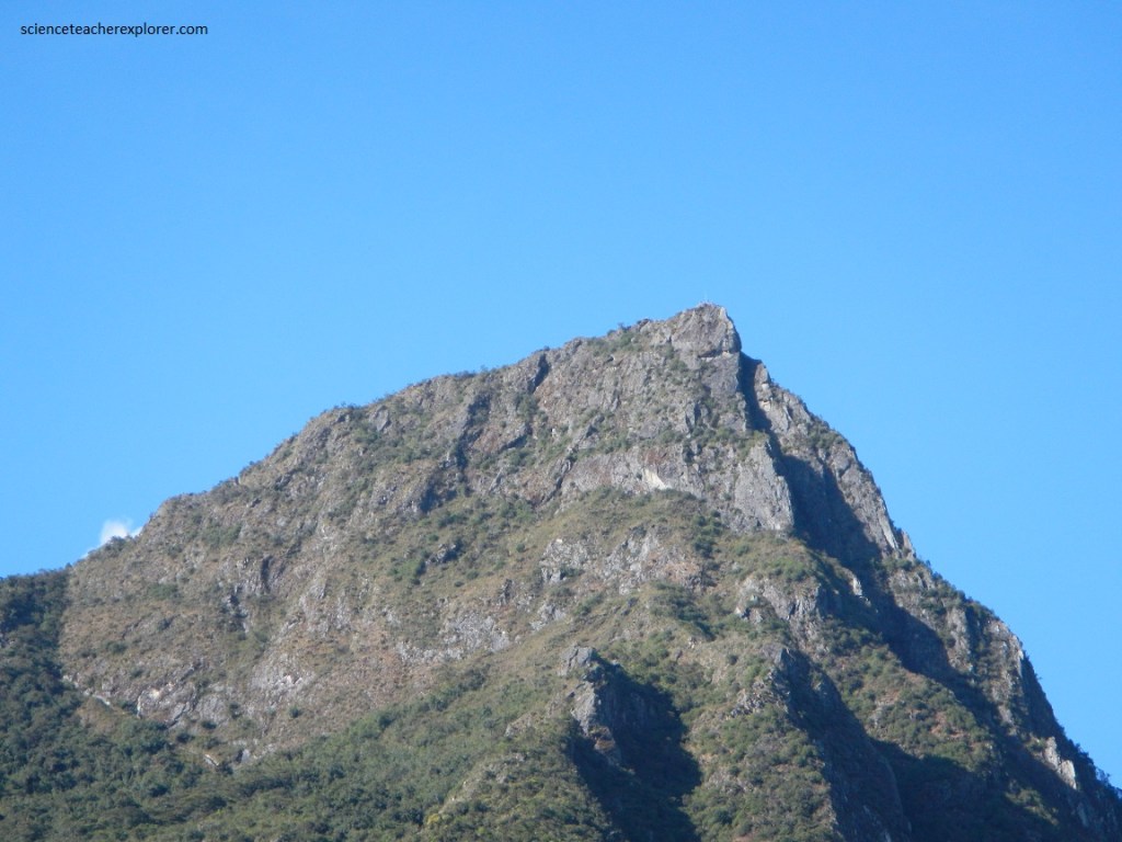
From here you can absorb breathtaking vies in all directions with extraordinary vertical relief. To the south is Machu Picchu Mountain, pictured above, to the west is the San Miguel Mountain Range, an to the north is Huayna Picchu with the smaller Una Picchu on its left. Then, to the east, the entire Eastern Urban Sector lies before you, with it’s Temple of the Condor, (pictured below).
With its fantastic rock formations, grottos and subterranean passage-ways, the “Temple of the Condor” is quite majestic. The stylized condor rock is a flat triangular rock with carved eyes and a beak, and two white semicircular stones creating a “ruff,” a characteristic of condors. Pictured below, at the end of the beak is a small hole through which rainwater easily penetrates to gravel and rock below. Pictured above, The condor rock is set off against the rock formations behind it, which form a shape of two outstretched wins, as if the condor were swooping down to catch prey.
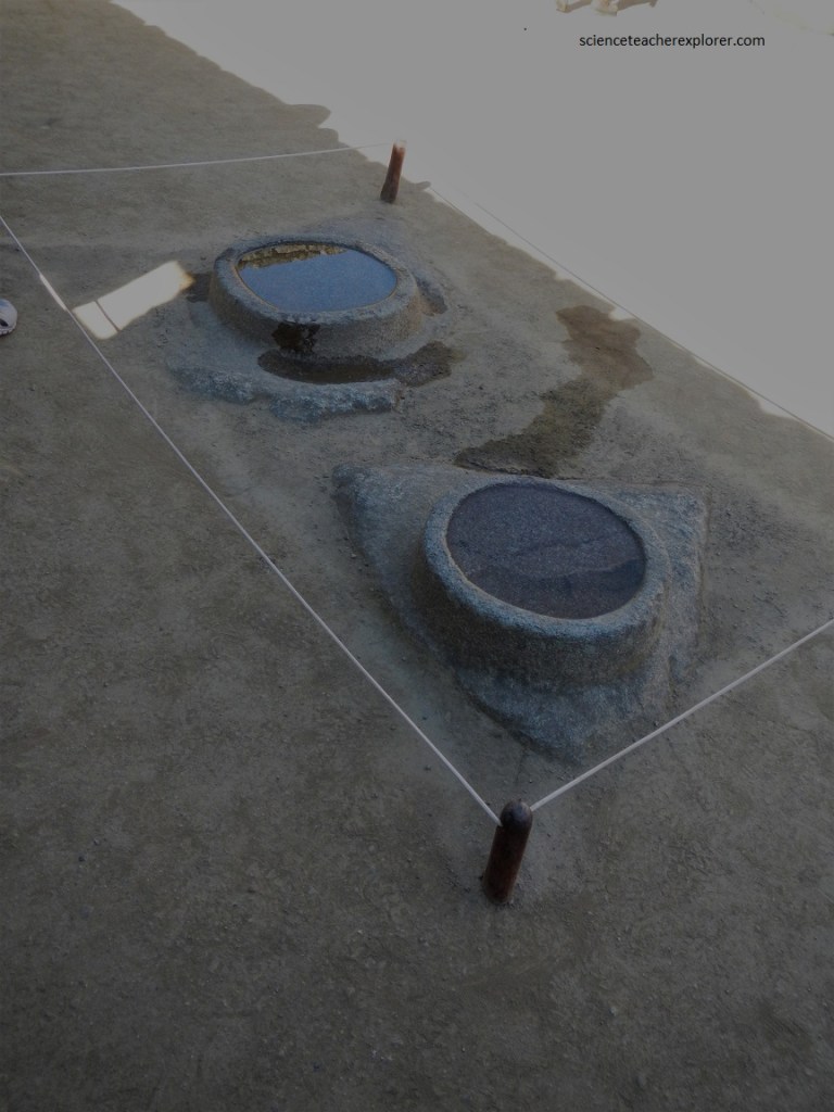
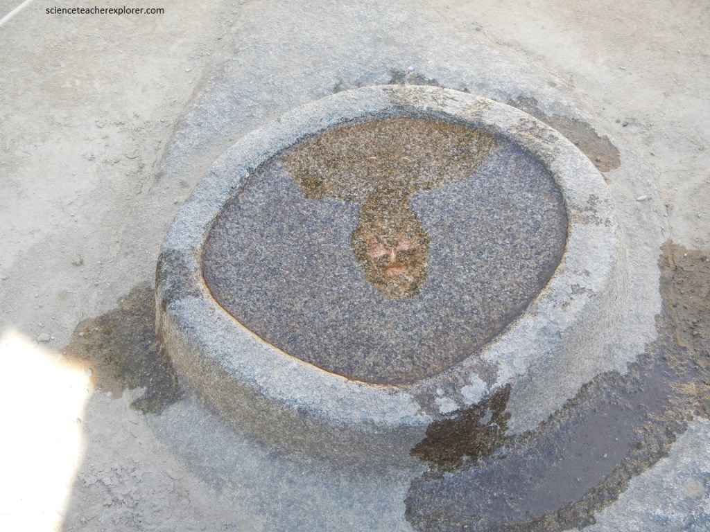
Pictured below, is the “Group of Mortars” found north of the “Temple of the Condor” and on the west side of the “Sacred Plaza”. “The Mortars”, (as in mortar and pestle for grinding grain), are carved in rocks on the floor of the building. The purpose and significance of the building and its stones are still being debated. Some have suggested an astronomical purpose because, when water is standing in the “mortars,” the sky is reflected there. This theory assumes the building had no roof. Apparently, the Inca’s were not supposed to look at the sky because this is where the gods were hanging out. This made astronomy a little difficult so they built these useful mirrors out of stone so they could look at the sky indirectly.
Pictured below, the “Sacred Rock”, north of the “Sacred Plaza”. The “Sacred Rock” with its 3 meters of height marks the north-most point inside Machu Picchu. Perhaps the most significant fact: This area is the portal towards Wayna Picchu, a mountain the Inca probably revered at this site, thinking it contained one of the higher spirits.
Notice the similar form of the carved and polished “Sacred Rock” and the Muchu Picchu Mountain to the north. It strengthens the theory of mountain worship.
Pictured below, Archaeoastronomers investigated an unusual cave near the “Mortars”, and concluded that it served as a solstice observatory. They named it Intimachay, or Cave of the Sun. The Archaeoastronomers found that the Inca had altered and embellished the cave in order to admit the rays of the rising sun, coming through a notch in the far mountain ridge, to reach the back-wall of the cave at a specific time of the year. This unique tunnel-like window was created by cutting into the natural rock to form the south wall and bottom, while the north side and top were constructed of stones. The rays of the rising sun peeking through the notch, about 6 km away, would pass through the wall only around the December solstice.
Pictured above, I’m standing on a good view of the agricultural terraces and the qolqas to the south. There are hundreds of agricultural terraces at Machu Picchu, not only in the Upper and Lower Agricultural Sectors, but also on the flanks of the Intiwatana pyramid, on both the east and west flanks down to the Urubamba River, and even on the heights of Huayna Picchu. They were carefully constructed for agriculture, drainage, and to prevent erosion of the steep hillsides. Studies have shown that all these terraces combined would have provided the nutritional requirements for a permanent population of only about 55 people.
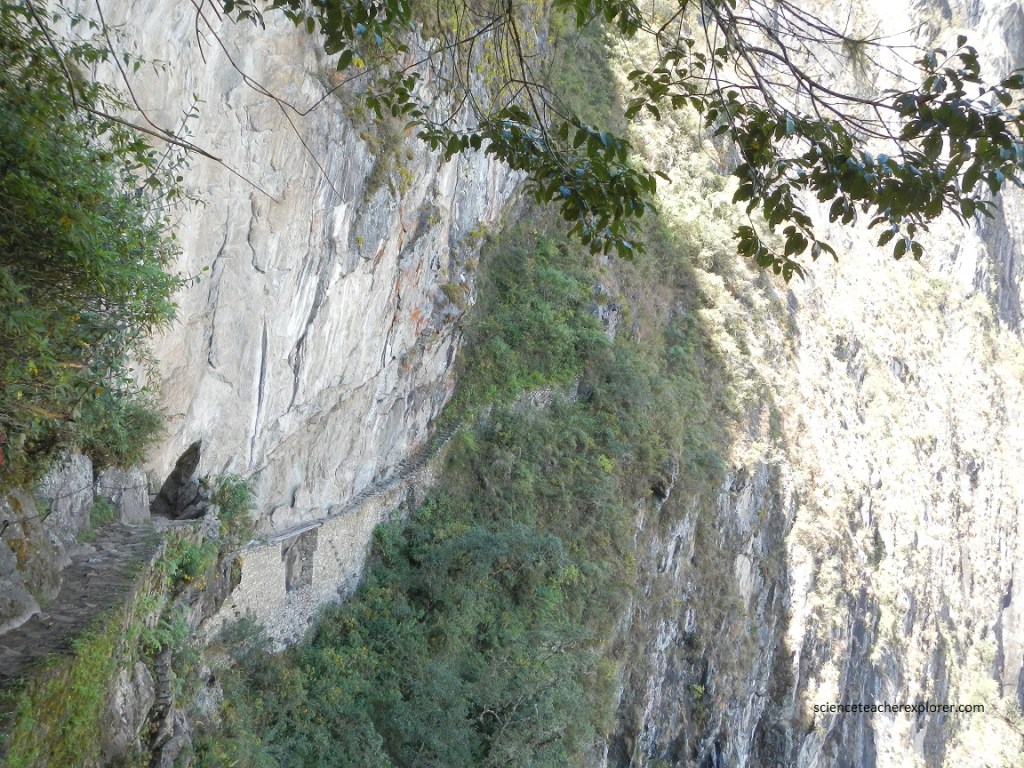
There is subsidiary Inca Trail from Machu Picchu that formerly went all the way down to the Urubamba River. Now it only leads to what is know as the Inca Drawbridge, the shortest and easiest side trip. The picture above is a good view of the “bridge”, an ingenious rock wall protruding from the face of the sheer, 400m cliff of the Machu Picchu Fault, with a strategic gap. There are timbers across the gap where Inca security-guards could simply remove them to make this route to Machu Picchu virtually inaccessible.