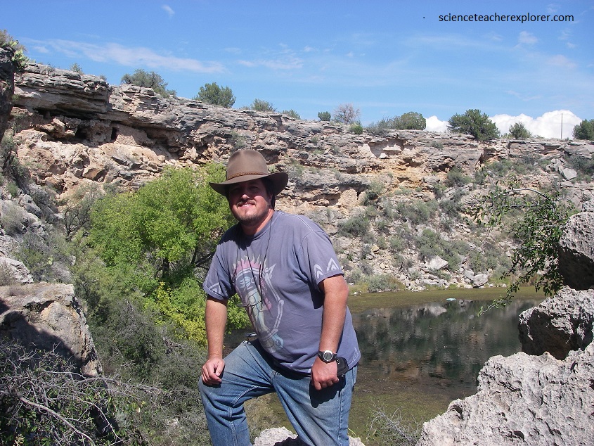
V bar V, Arizona 2011
Becky (my wife) and I went on a Thanksgiving vacation in Sedona, Arizona during 2011. While there, we visit three sites mentioned below; Montezuma’s Castle, Montezuma’s Well and V bar V “Rock Art” site.

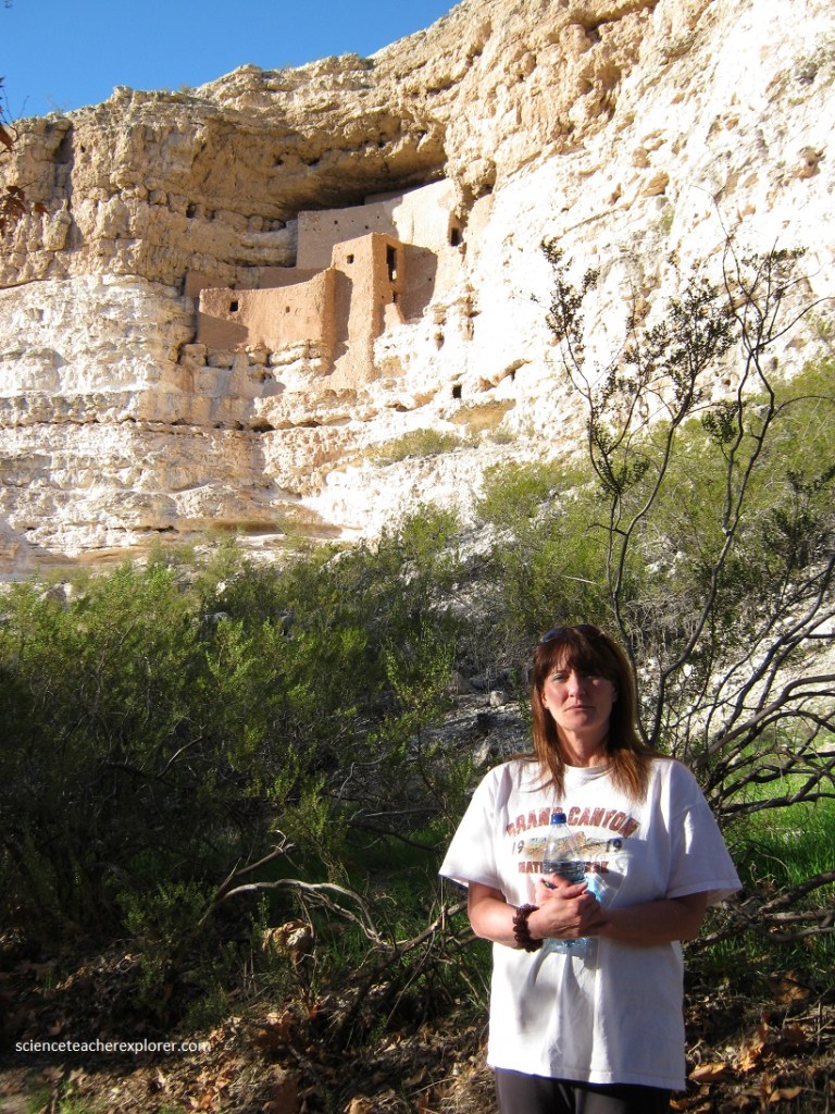
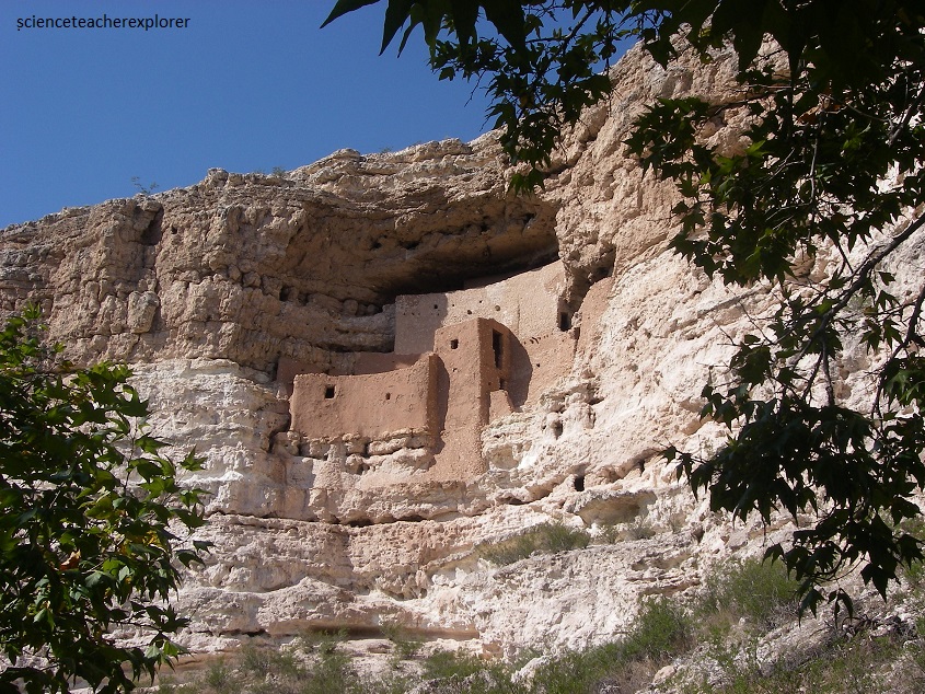
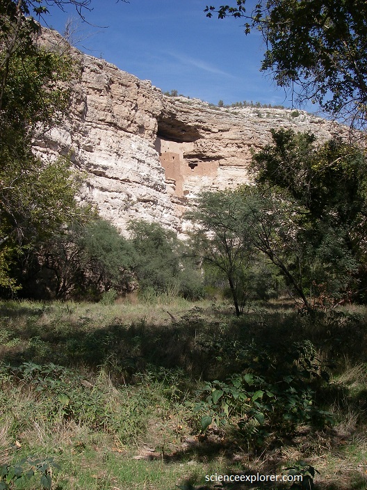
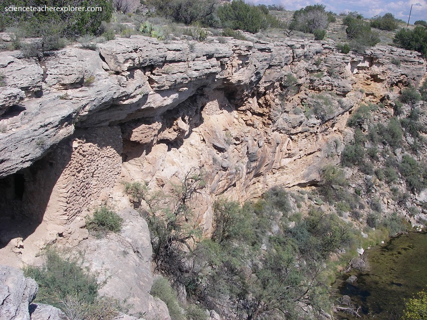
The Montezuma Castle National Monument is all we expect in a cliff dwelling and is dramatically and impregnably situated on the ledges of a 50 m limestone cliff overlooking Beaver Creek in the lush Verde Valley. It’s twenty well-preserved rooms reach up to five stories.
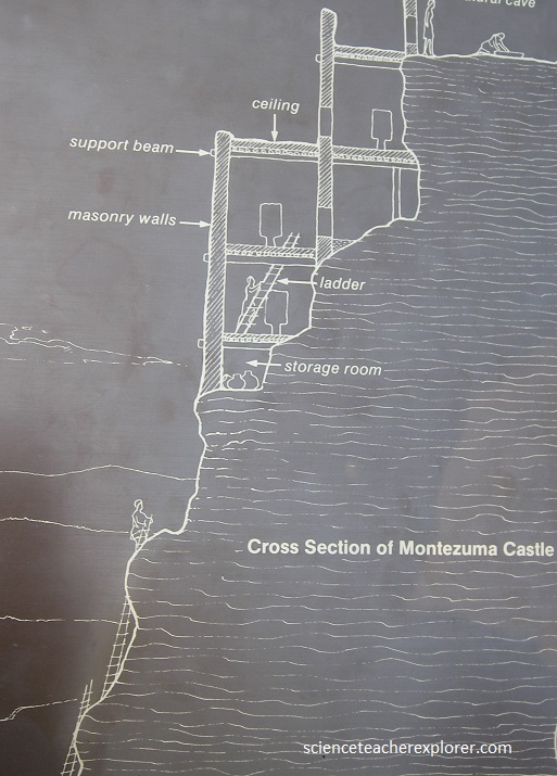
They were built of limestone blocks laid in mortar and roofed by sycamore timbers overlaid by poles, sticks, grass, and several inches of mud. The exterior ones, amazingly, are nearly flush with the cliff face and form a concave arc that conforms to the surrounding cave. The slope below is partially covered with a deep fill containing household trash, graves and remains of older house structures. The structures were built by the Sinagua.
To reach their home, the Sinagua used two access routes. One, from the valley floor, required ladders, and the other, from the side on the cliff, joined it partway up. A small smoke-blackened room at the junction is thought to have been a sentry post.
The rooms themselves are compact and have small doorways. This design made hostile entry most difficult and helped to conserve heat. The pueblo was high above the cold air that settles on the valley floor, and it’s southern orientation made for passive solar heating in winter.
An older Sinagua ruin is situated 100 m away from the cliff ruin, at ground level. Together, the two buildings housed a considerable number of people, who raised corn, beans, squash, and cotton in the nearby irrigated fields and participated in widespread trade. According to the rangers at the site, excavations turned up plant remains, such as seeds, nuts, and agave, which indicated that the Sinagua here also foraged for food.
It seems the Sinagua began building these pueblos in the early 1100s and left the Verde Valey in the early 1400s.
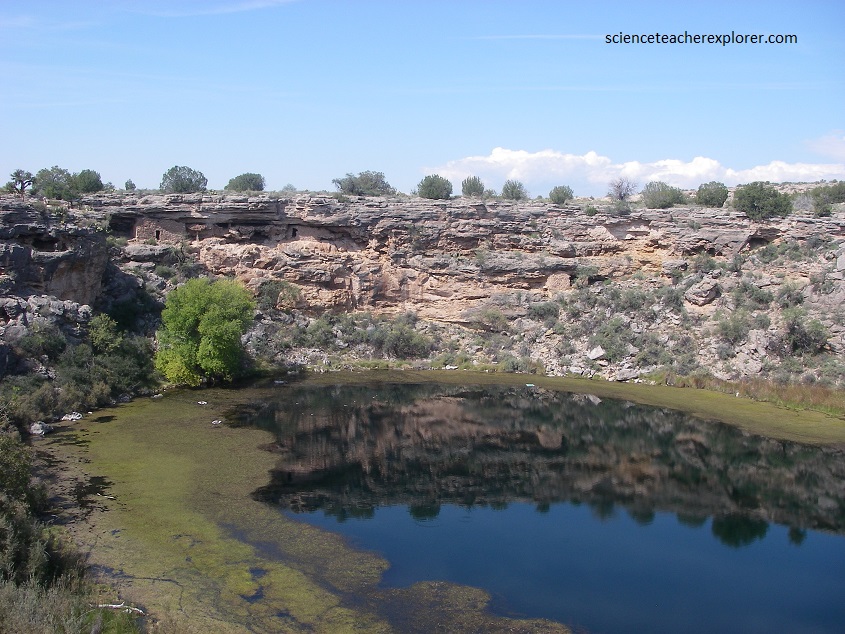
Pictured above, sunk into a hill 10 km north of Montezuma Castle is one of the most unusual geologic spots in the Southwest. The Verde Valley was filled with a lake 12 million years ago. Much of the sediment deposited there was limestone, now the Verde Formation.
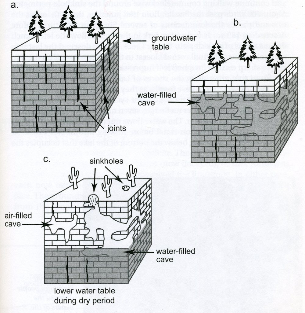
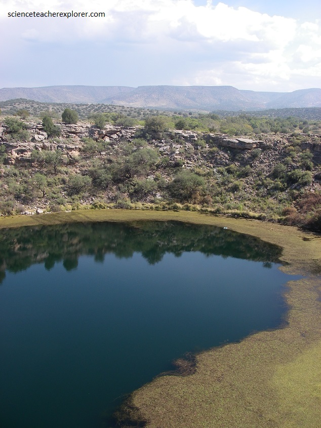
Imaged above, after the lake drained, underground streams formed caverns in the limestone. One of these collapsed about 11,000 years ago, creating Montezuma Well, (pictured below). The sinkhole is almost 130 m wide. Its lake stand 23 m below the rim and is 17 m deep.
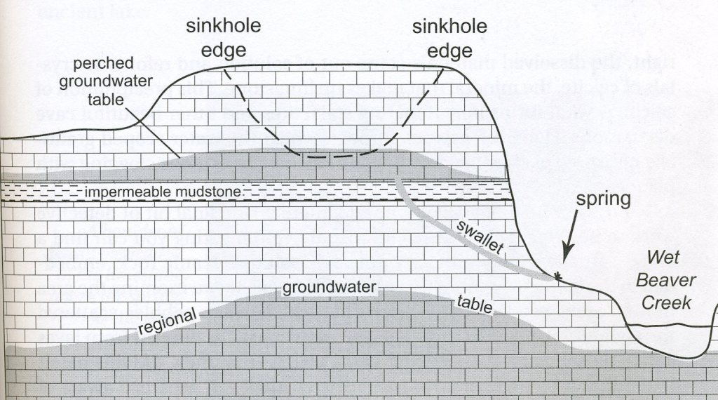
Under the sinkhole is a layer of mudstone that is composed of clays and platy minerals that overlap one another, not allowing the water to pass through. However, water passes through this shingling extremely slowly, causing water to pool above it. Mudstones deposited during a dry period in ancient Lake Verde’s history formed just such an impermeable layer here, (imaged below). The pooling of water above this mudstone creates a small, localized patch of water that hydrologists call a perched water table, because it lies above the main water table here.
Ducks and Coots swim on the surface of this small round lake. Turtles, muskrats and other animal life sometimes can be spotted as well. Carbon-dioxide infused water flows into the lake at a rate of a 1.5 million gallons per day. At 76 degrees Fahrenheit, the water has created its own lushly vegetated environment. The volume and temperature of that water is constant no matter how the climate may vary from wet to dry. The water flows out of the lake through a small pipe-like cavern more than 100 m long. Therefore, the lake is not connected to any other surface water, and its biological community has been isolated. Some species, such as shrimp-like amphipods, leaches, and water scorpions, are found only here.
A short trail leads up to the rim of the hill, where you will have a view of the lake and some cliff dwellings. The first Hohokam settlers came here in the seventh century. The Sinagua came later and stayed until the 1400s.
Being farmers, the Sinagua used the sinkole’s outflow to irrigate their fields. Population around the lake peaked around 1300 when, it seems, everyone drew together for security.
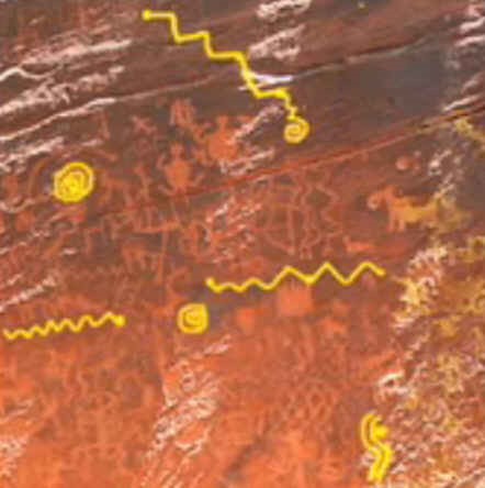
In 1994, the Coconino National Forest was able to acquire an extraordinary rock-art site, which had long been owned and protected by the V bar V Ranch.
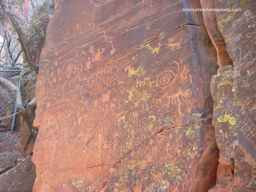
The V bar V site consists of several panels of petroglyphs that include anthropomorphic figures, animals, birds, snakes, and abstract or geometric designs. The glyphs are densely packed, frequently touching each other or linked by wandering lines. This interconnectivity suggests that the individual elements may contribute to an intended meaning of the whole, as if stories were being told.
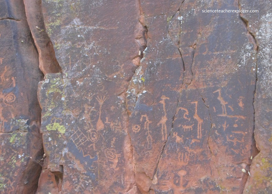
Scientists who have studied these petroglyphs classify them as the Beaver Creek Rock Art Style and date them to between 1150 – 1400 AD. They also think the petroglyphs were made at roughly the same time. Why they were made and what they meant to their makers is something that scientists today cannot decipher. The entire V Bar V Heritage Site contains around 13 panels containing more than 1,000 petroglyphs.
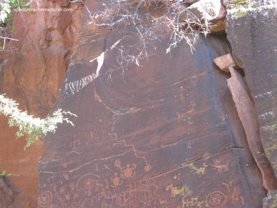
In 2005, a volunteer at the forest’s historical ranch site, detected a pattern to the shadows cast on the park’s huge rock art panels, which are covered with more than 1,000 petroglyphs. Like many of the rock art panels found across the Colorado Plateau, could this be an ancient calendar?
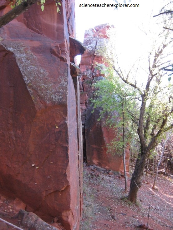
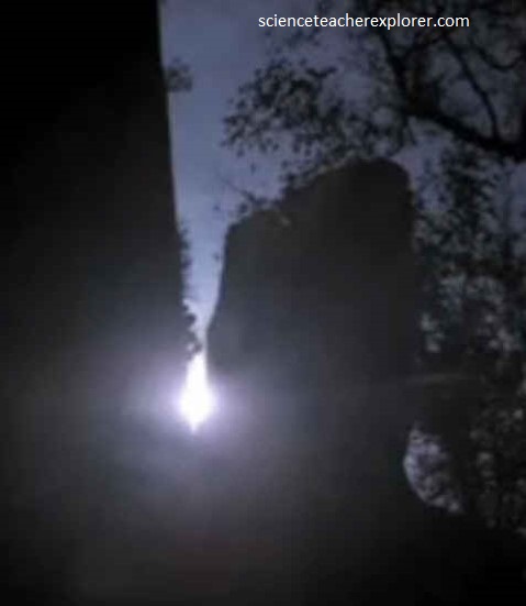
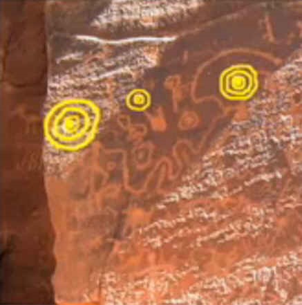
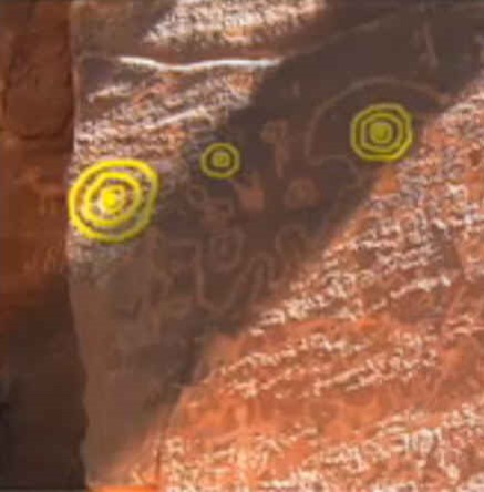
Summer Solstice shadow indicator across the panel, shows a calendar of events in a Sinagua’s life during that time.
The four images above were found at the site, in a folder near an interpretive sign. Sorry, they seem a little blurry. But, the images were found that way and I’m assuming they are Public Domain. However, they might have been taken by Kenneth J. Zoll. He seems to have used these images in his book. Becky and I were there close to the Winter Solstice. Therefore, we were able to get the Winter Solstice Photos above. Not exact, but close!
I recommend that you buy the “Sinagua Sunwatchers: An Archaeoastronomy Survey of the V Bar V Heritage Site and Sacred Mountain Basin” by Kenneth J. Zoll 2008
I’ve just given a taste to his book.
