San Salvador Is. BAMA
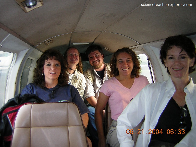
In June of 2004, I finished my Master’s Degree with Mississippi State University by participating in a scientific-expedition to San Salvador Island, Bahamas. With my experience in underground mine-mapping & slot canyoneering, this expedition was a perfect match. Our primary mission was to explore & survey the caves on San Salvador Island. I started out by flying to Fort Lauderdale, Florida and joining a scientific team to fly onto this small small island in the south-eastern portion of the Bahama Islands.
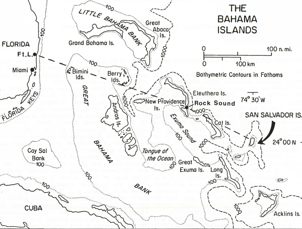
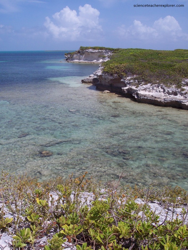
The Bahama Archipelago is a curved system of carbonate platforms, commonly capped with low islands, located to the east and south of the North American continental margin. The archipelago extends for a distance of some 1,400 km, from the Little Bahama Bank to the north (27.5° N latitude), off the coast of Florida, south to the Turks and Caicos Islands, Silver Bank, and Navidad Bank (20° N), off the island of Hispaniola. Water depths on these banks normally are less than 10 m, but the banks are separated by inter- or intra-platform, deep-water basins and troughs with depths of up to 4,000 m.
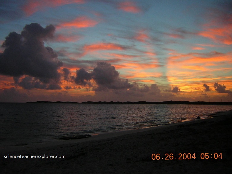
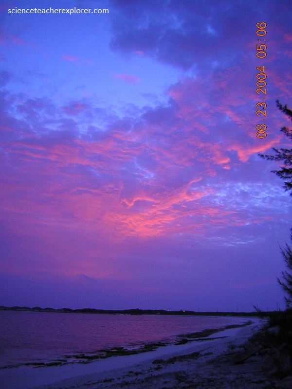
The San Salvador Island is located about 620 km East of Ft. Lauderdale, and the flight time was about 2.5 to 3 hours. It lies on a small, isolated bank at the eastern edge of the Bahamas. On the approach to the island from the west, I saw that the shelf dropped precipitously to deep water.

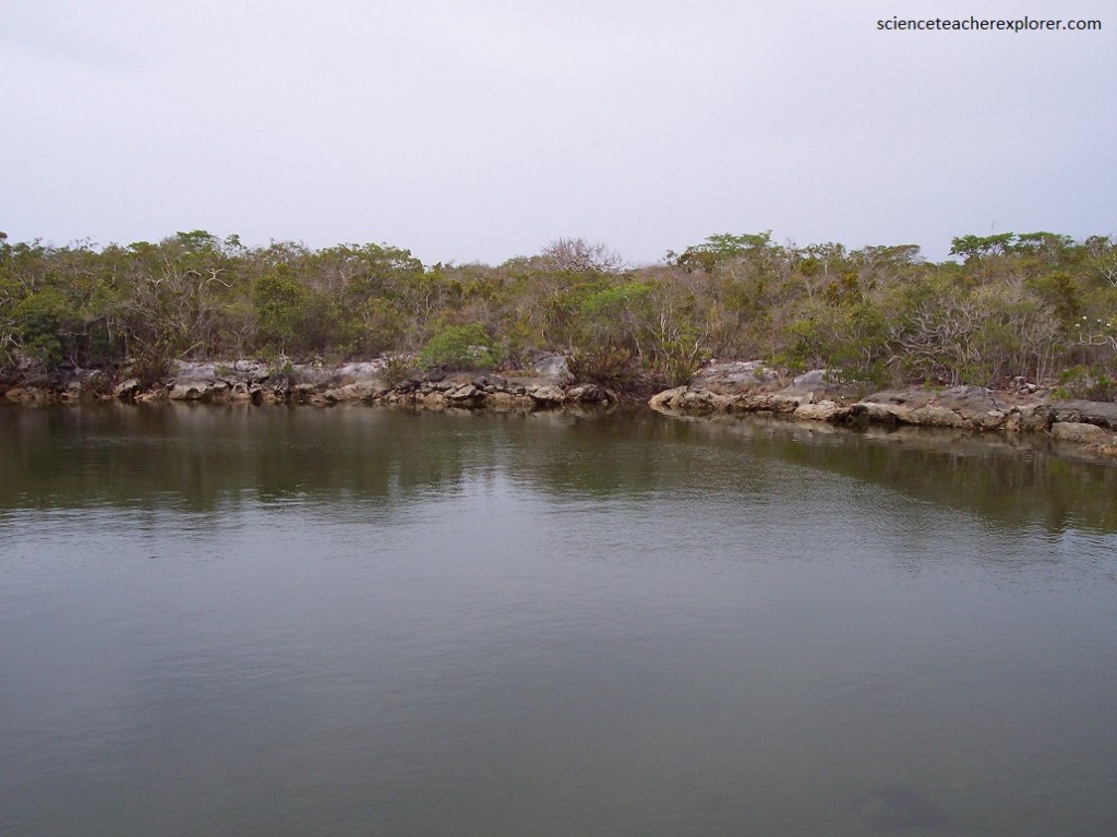
Imaged below, the interior of San Salvador Island is occupied by numerous shallow, hypersaline lakes separated by ridges.
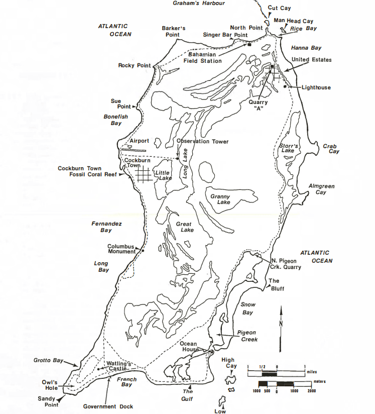
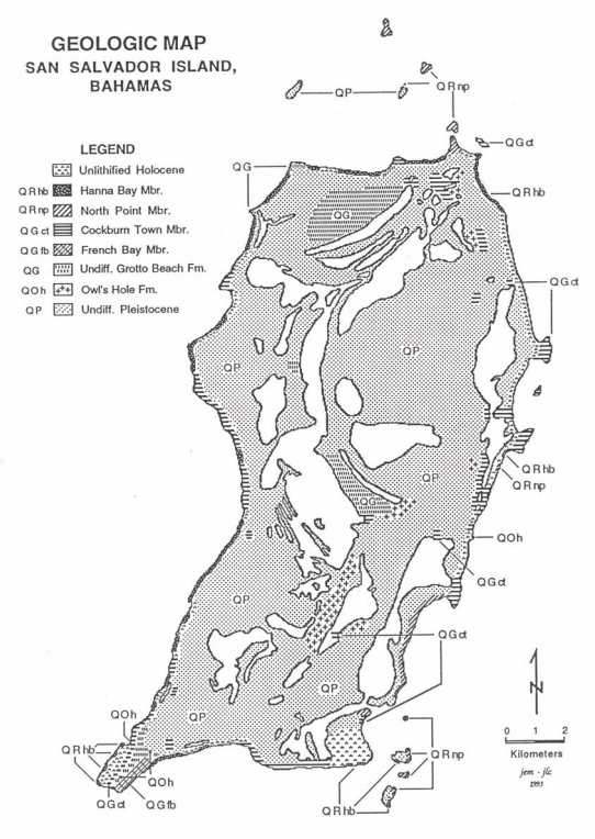
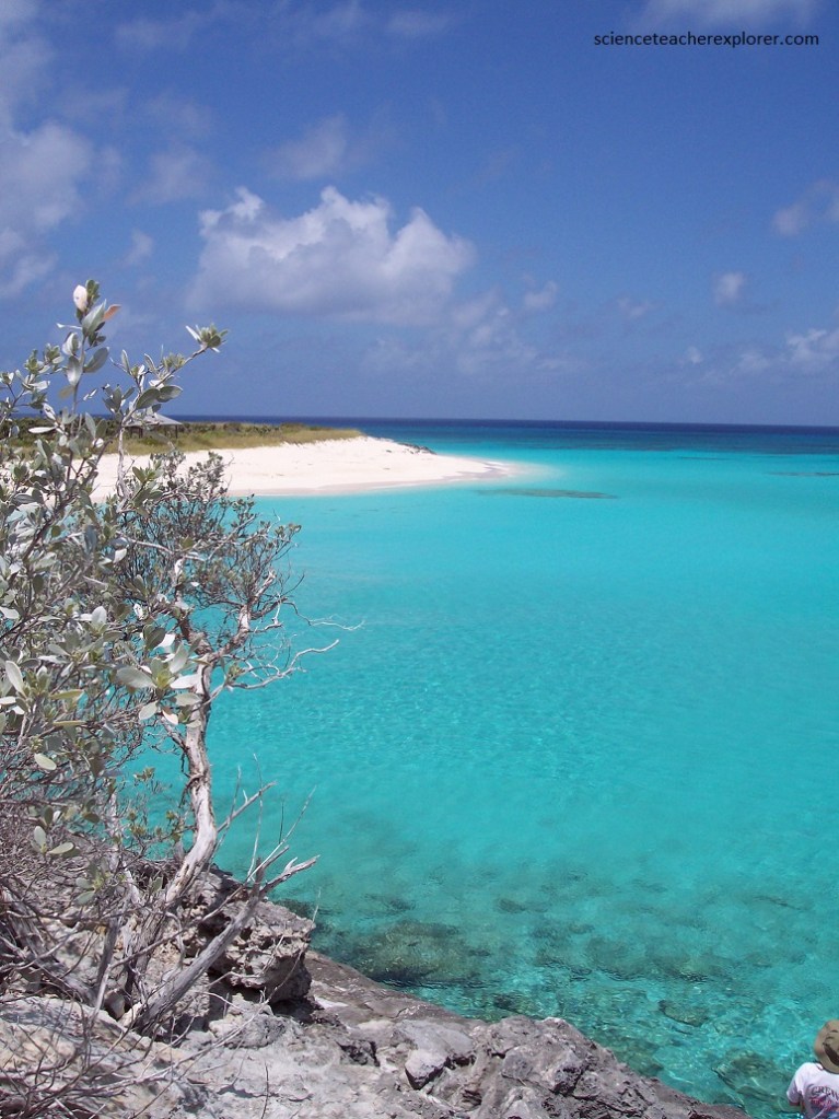
San Salvador is a small island, about 11 km wide by 19 km long, and is bordered by a narrow shelf with an abrupt shelf-edge break leading to a very steep slope. The topography of the island is dominated by curved ridges that probably represents successive stages of carbonate eolioan (or wind) accretion.
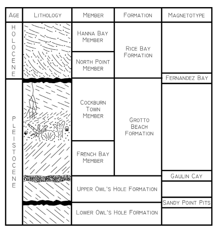
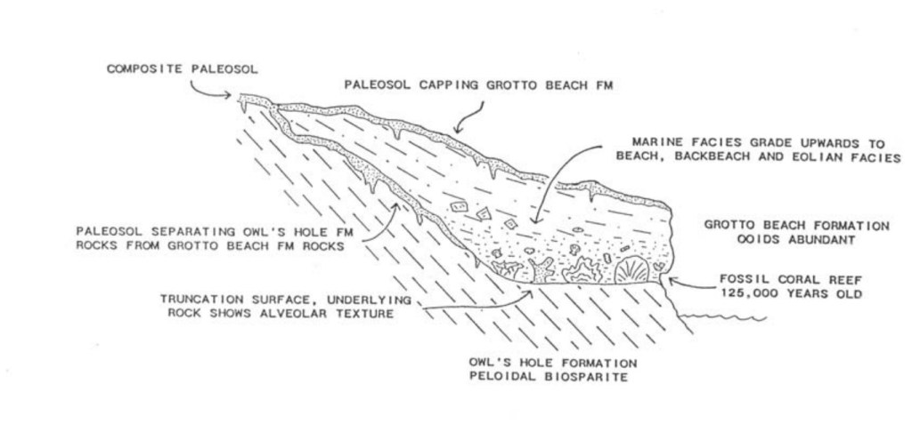
Shallow lakes occupy the low inter-dune ridge areas. The island’s shoreline is characterized by headland cliffs of eroded eolianite; fine grained carbonate sands form beaches between the headlands with Holocene beach-rock. Imaged above, the stratigraphic sequence comprises depositional units that were stacked as a result of sea level changes during the Pleistocene.
Although isolated and small in size, San Salvador Island has an all carbonates setting on a small, tectonically stable platform, surrounded by deep oceanic waters, with an historical footnote as the widely accepted first landing site of Christopher Columbus in the New World in 1492.

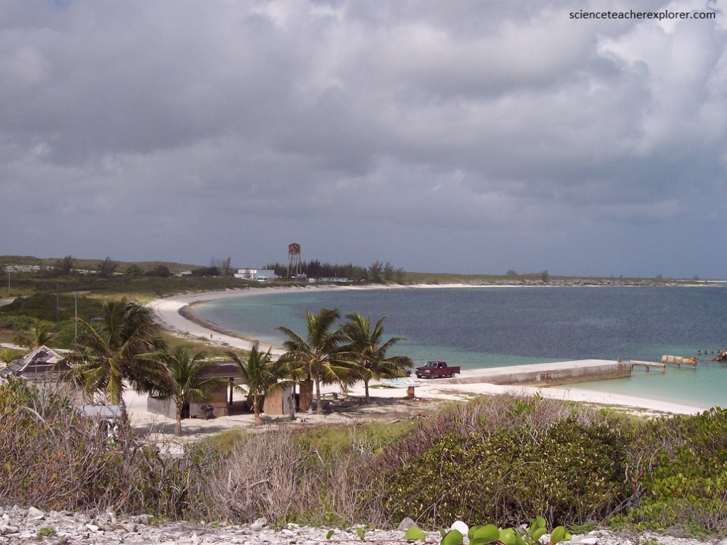
The entire time that I was there, my group centered our stay at the “Gerace Research Centre”. The “Gerace Research Centre” (formerly the Bahamian Field Station), occupies a former US Naval Base and has been in operation for over 40 years as an educational and research institution. The “Gerace Research Centre” provided accommodations, laboratory space, and logistical support for both the professors and researchers involved with the expedition. Pictured below, the “Gerace Research Centre” is located on the north end of the island on the shores of Grahams Harbour.
About 940 people reside on San Salvador Island and its principal community is Cockburn Town, the seat of local government. The town has a population of 271. Nearby is the Pleistocene Cockburn Town Fossil Reef (pictured below).
The Cockburn Town Fossil reef is one of the best-preserved and well- exposed Pleistocene fossil reefs on Earth. It consists of non-beded to poorly-bedded, poorly-sorted, very coarse-grained, aragonitic fossiliferous limestones, representing shallow marine deposition in reef facies.
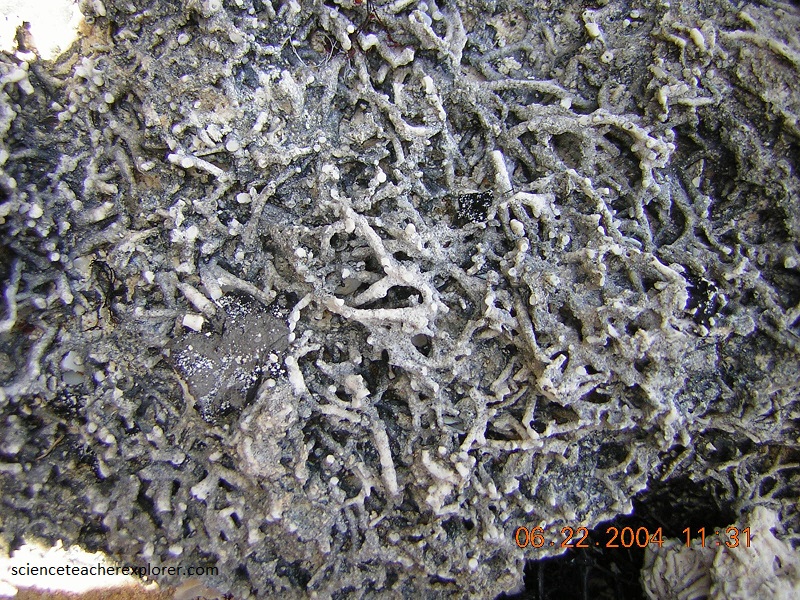
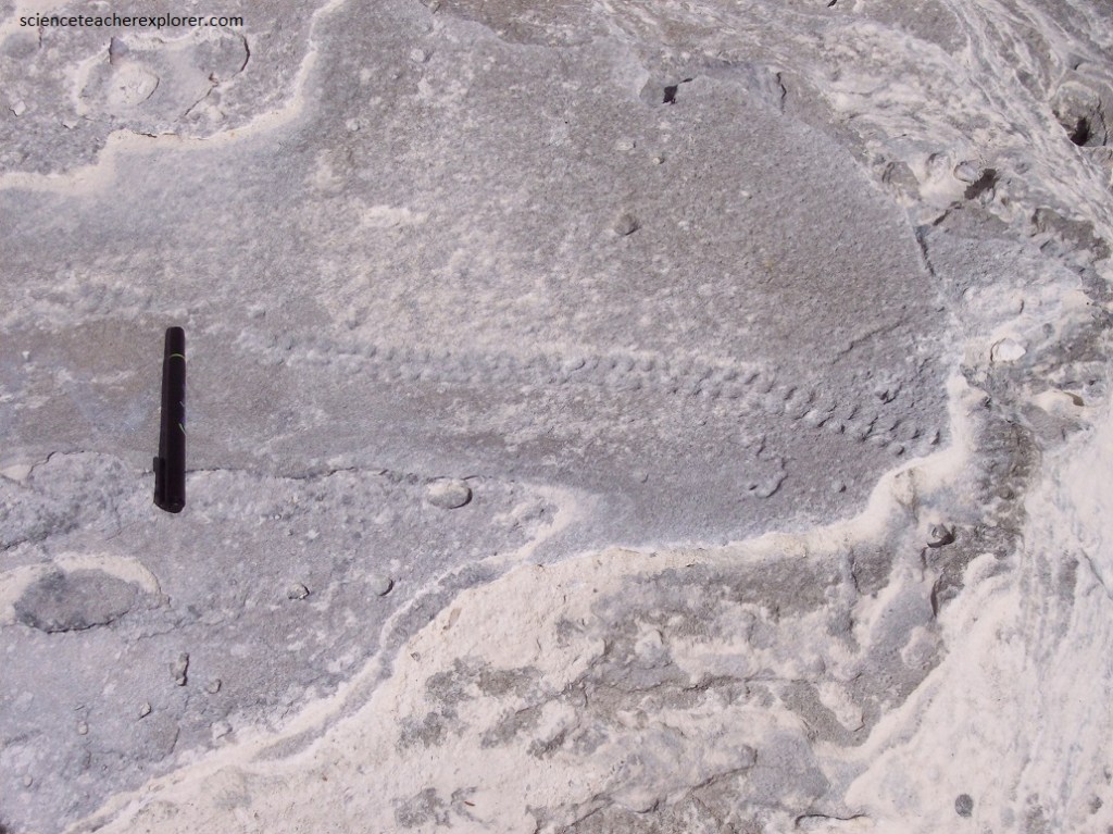
Pictured above, Acropora cervicornis rubblestone in the “Cockburn Town Fossil Reef” that is about 125,000 years old. The small branching structures are fossil, broken staghorn coral skeletons (Acropora cervicornis).
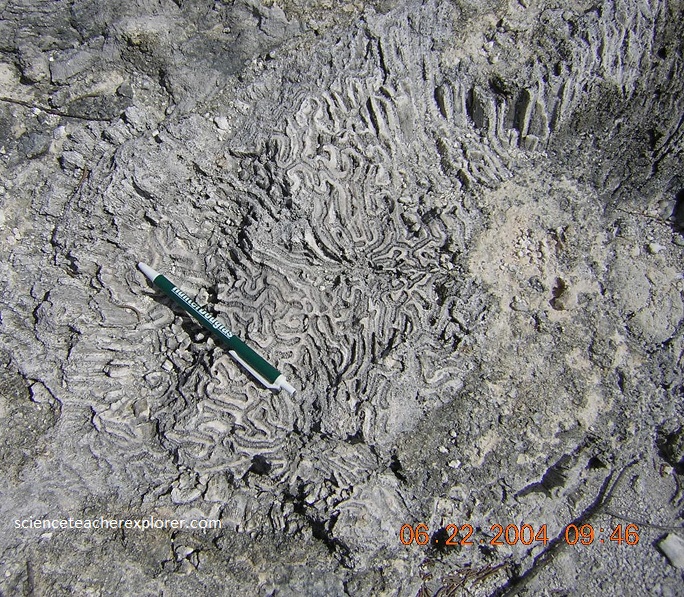
Pictured above, is a fossilized Diploria strigosa or fossil brain coral in the Cockburn Town Fossil Reef that is approximately 125,000 years old.
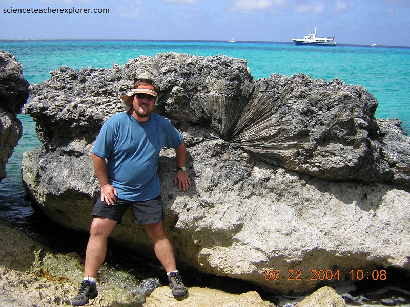
Pictured above, I’m standing next to a large fossilized brain coral colony called the “Diploria strigosa” in the Cockburn Town Fossil Reef. Notice that this fossil brain coral is crusting on an irregular surface that seems to be an unconformity. This unconformity seems traceable throughout the outcrop of the Cockburn Town Member and represents a limestone hardground surface that formed during a short-lived regression that occurred approximately 124,000 years ago. This is actually called the “Devil’s Point Event”. After the event, (at 123,000 years ago), the high sea level returned.
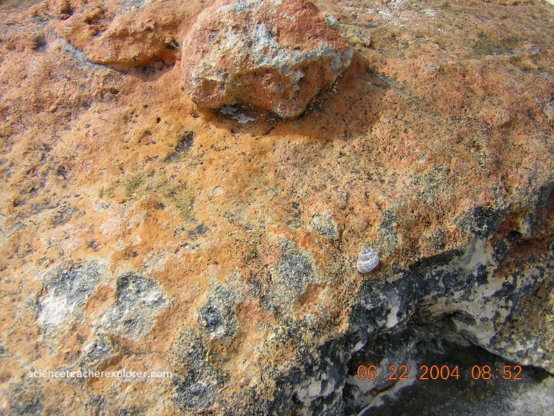
Pictured above is a hard, reddish-brown to orangish-brown colored, irregularly-sculpted crusted rock. This is dominant paleosol, (caliches or terra-rosas), on San Salvador Island. The presence of a terra rossa paleosol indicates that the rock outcrop is Pleistocene in age. In coastal locations, wave action can strip off the resistant paleosol. Because paleosols represent the weathering and erosion front on top of the carbonate rock, the paleosol commonly drapes a surface with relief of up to 1 m or more.
Pictured above, The rocks of the “Grotto Bay Cliffs” are of the Pleistocene age that have a terra rossa paleosol, and are assigned to the Cockburn Town Member of the Grotto Beach Formation. Continuing on foot along the top of the cliffs to the south (right), towards Grotto Beach, strata with coarse shell hash and rounded beach-rock pebbles are seen. Also very prominently displayed are large- to moderate-sized, angular, erratic blocks entombed within the bedrock of the cliff.
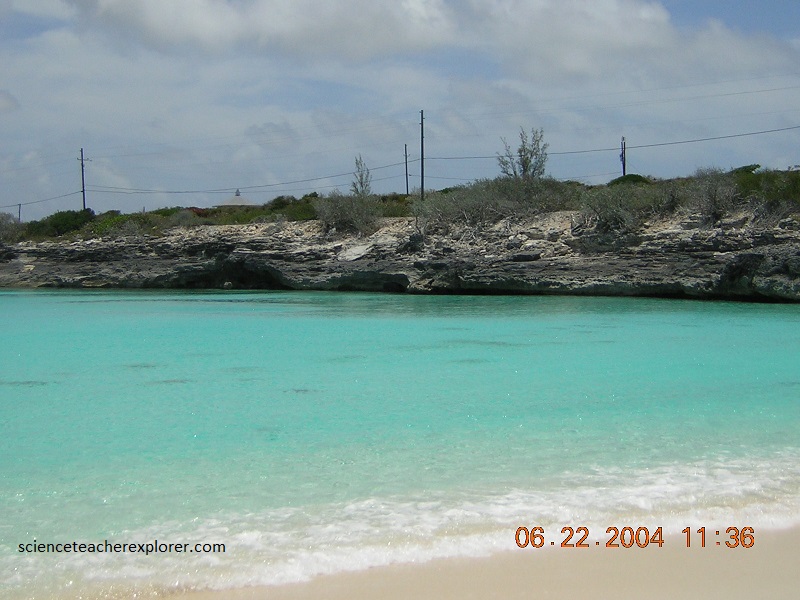
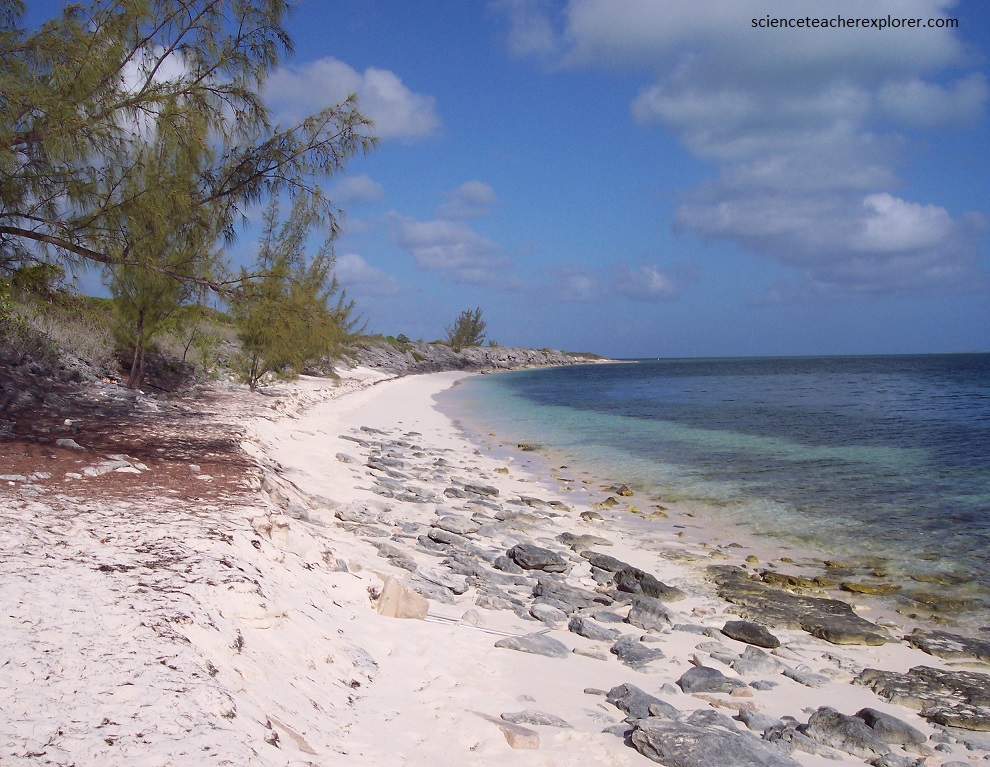
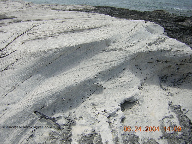
Pictured below, Grotto Beach has whitish-to cream-colored aragonite sand of Calcium Carbonate.
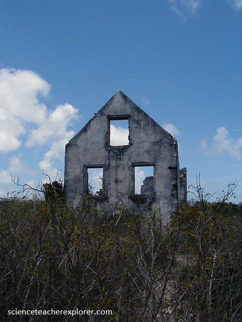
Pictured below, “Watling’s Castle” consists of the ruins of the late 1700s to early 1800s. The remnant building is called the Sandy Point plantation manor house. It was constructed during the “Loyalist or Plantation Era”, during which people loyal to Britain left American after its independence in the 1770s and headed to the Bahamas. The land was used for moderately intense agricultural purposes.
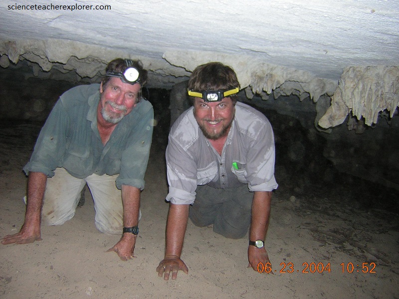
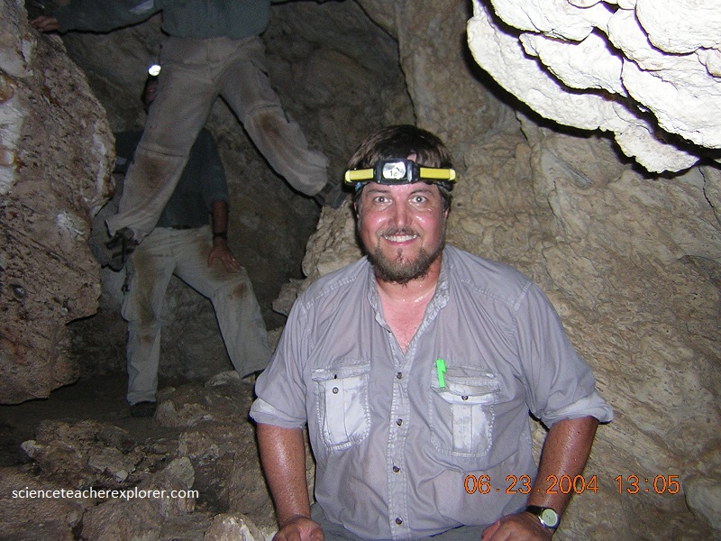
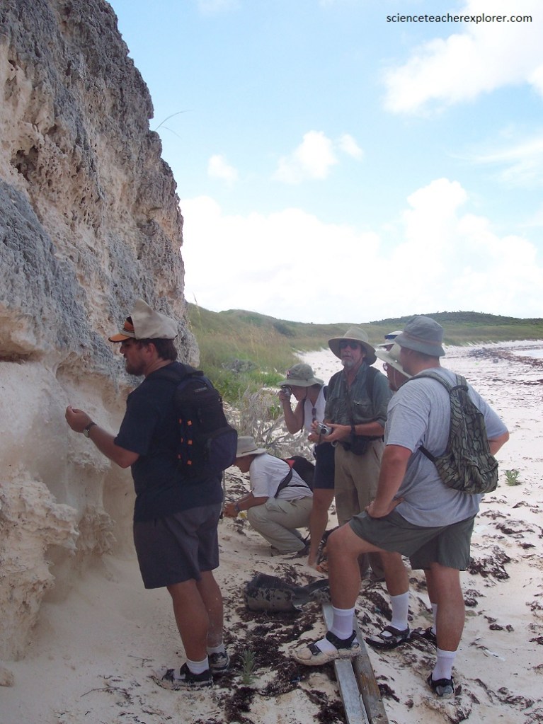
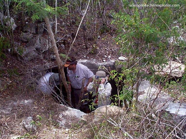
Our expedition’s main purpose for being on San Salvador Island was to explore and survey the islands caves. Leading the expedition was world’s expert on karst-landscapes formed by bedrock dissolution from Mississippi State University. His name: Dr. John E. Mylroie.
According to Dr. Mylroie, “There are four main types of caves in the Bahamas: pit caves, flank margin caves, banana holes, and lake drains. Our first exploratory mission was a “pit cave & a “flank margin cave”, on San Salvador.
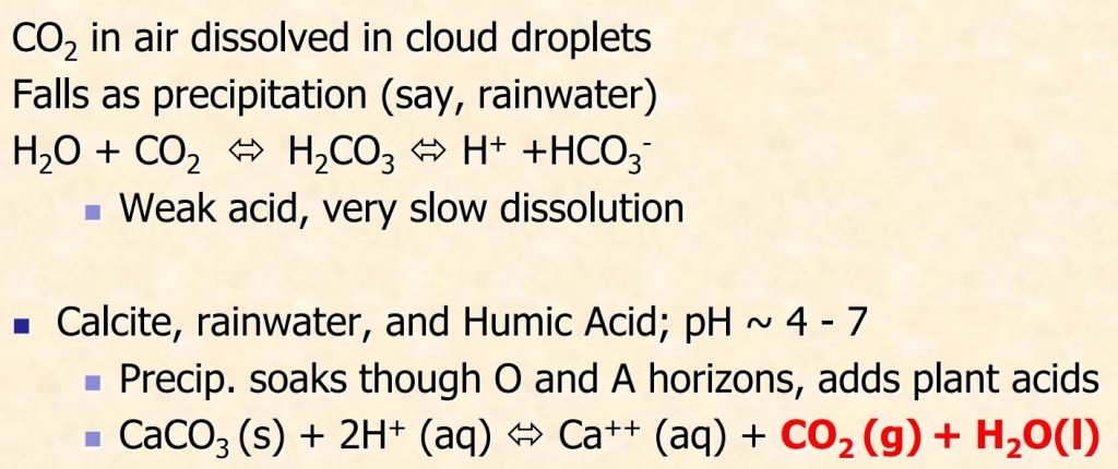
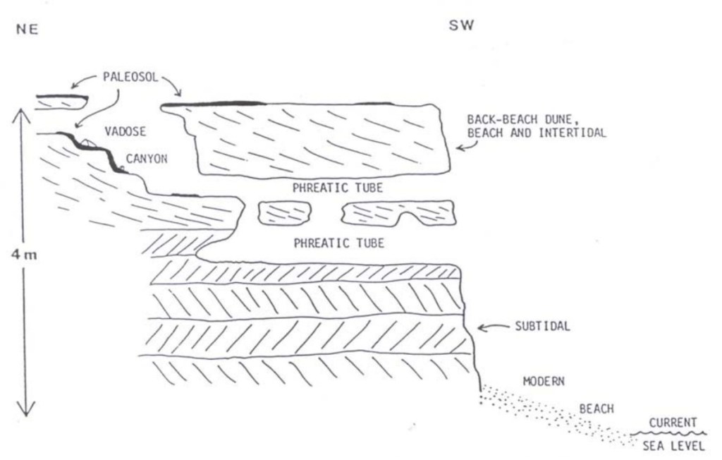
“Karst” is the general term used for cavernous areas. Most karst regions are found on carbonate rocks. The basic geomorphic process is a chemical solution. The acids produced by these chemical reaction processes are responsible for much of the dissolution in karst regions. Note, however, that temperature and the concentration of carbon dioxide in the atmosphere (including cave and soil atmospheres) control these chemical reactions. This means that it is possible to produce saturated solutions with many different calcium and carbon dioxide concentrations. When two of these solutions mix, they produce an unsaturated solution which results in more rock dissolution in the zone of mixing (imaged above). There are two distinct zones where waters with differing chemistry are mixing. The first of these is at the water table and the second is at the halocline (the fresh-salt water boundary). Because of this, dissolution tends to be concentrated here, resulting in cave formation.
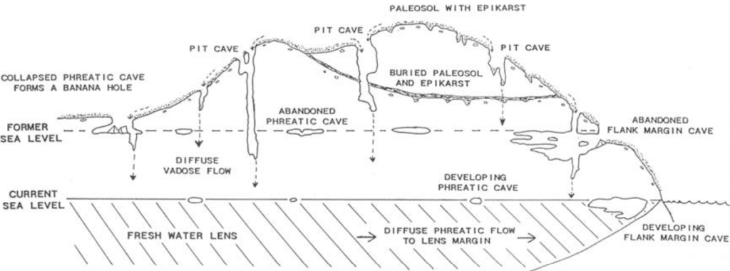
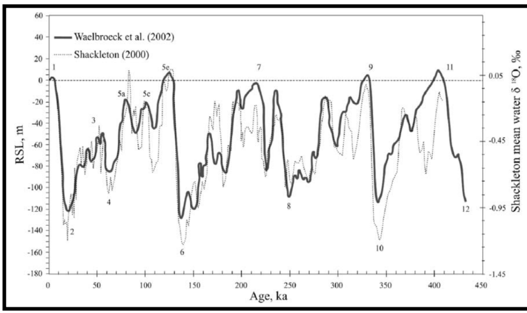
Imaged above, changing sea level changes the dissolution location resulting in caves at many different levels. During the Pleistocene glaciations, sea levels changed considerably. They have been as much as 6 m above present (about 125,000 years ago) to about 125 m below (about 70,000 years ago). These fluctuations had a considerable impact on the size of the other Bahamian islands and location of cave formation. However, because of its steep-walled, isolated platform, the size of San Salvador changed little.
Pictured below, the pitted surfaces covers much of the ground surface of San Salvador Island’s interior. Rainwater charged with carbon dioxide lands on the bare rock and collects in small depressions. Dissolution enlarges these. Because the rock surface is impermeable, water does not infiltrate.
Eventually the water reaches a spot where it can move down into the rock. Additional dissolution may produce a deep pit cave. Pictured below, Owl’s Hole cave drips down 10 m into the Middle Pleistocene. The cave originally penetrated further than that, but it is now filled with sediments. The limestones at the rim are Grotto Beach formation of the lower-upper Pleistocene, (119,000 to 131,000 years old).
The upper 8 m of the Owl’s Hole Pit Cave consisted of eolian aragonitic oolitic calcarenites of the Grotto Beach Formation. The lowest 2 m consisted of eolian aragonitic bioclastic calcarenites of the Owl’s Hole Formation of the Middle Pleistocene. A calcrete paleosol separated the two units.
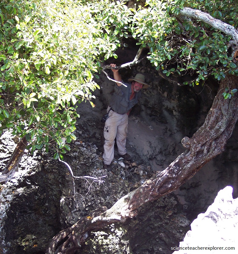
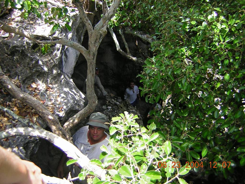
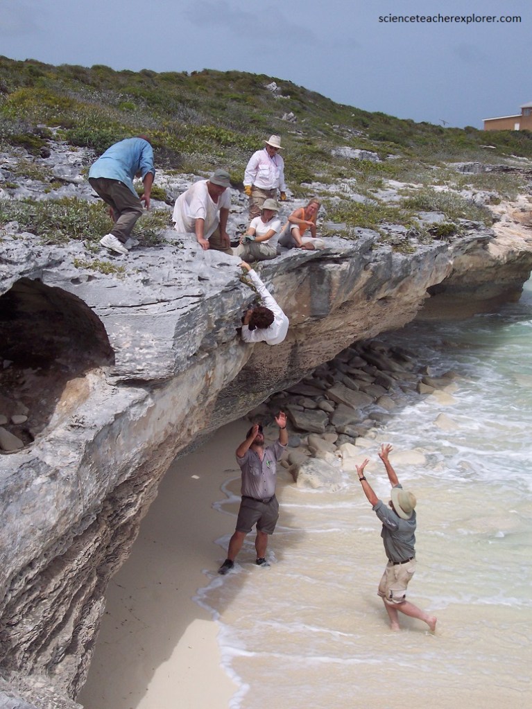
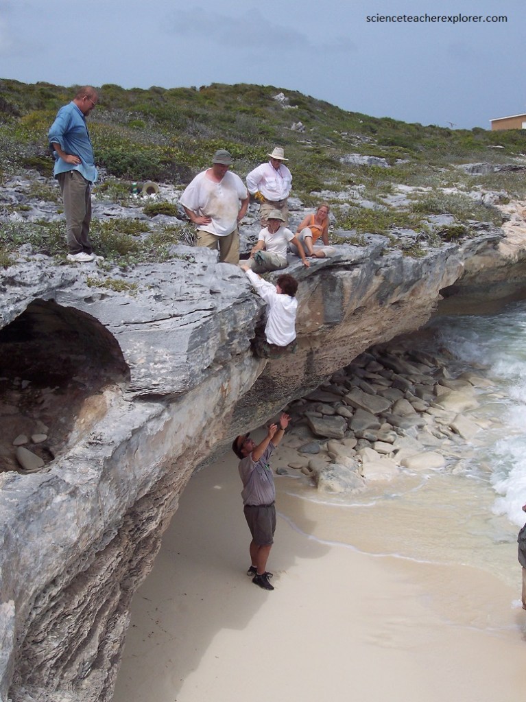
Close-by and in the afternoon we visited a flank-margin cave called “Fire Drill Cave”. The cave was entered from the small collapse entrance on top of the cliff of the nearby ocean, (pictured below).
In the inland direction of the ocean, the “Fire Drill Cave” had the form of small vadose canyons that branch and rises to the surface. In the paleo downstream portion, the floor of the cave changes from a vadose notch to a series of stacked hydraulic tubes with numerous interconnections that eventually exit to the cliff face above the ocean.
The point of transition from vadose to hydraulic-morphology is an indicator of the paleo-water table at the time of cave development. This indication of paleo-water table position is also a good measure of Pleistocene sea-level at that time.
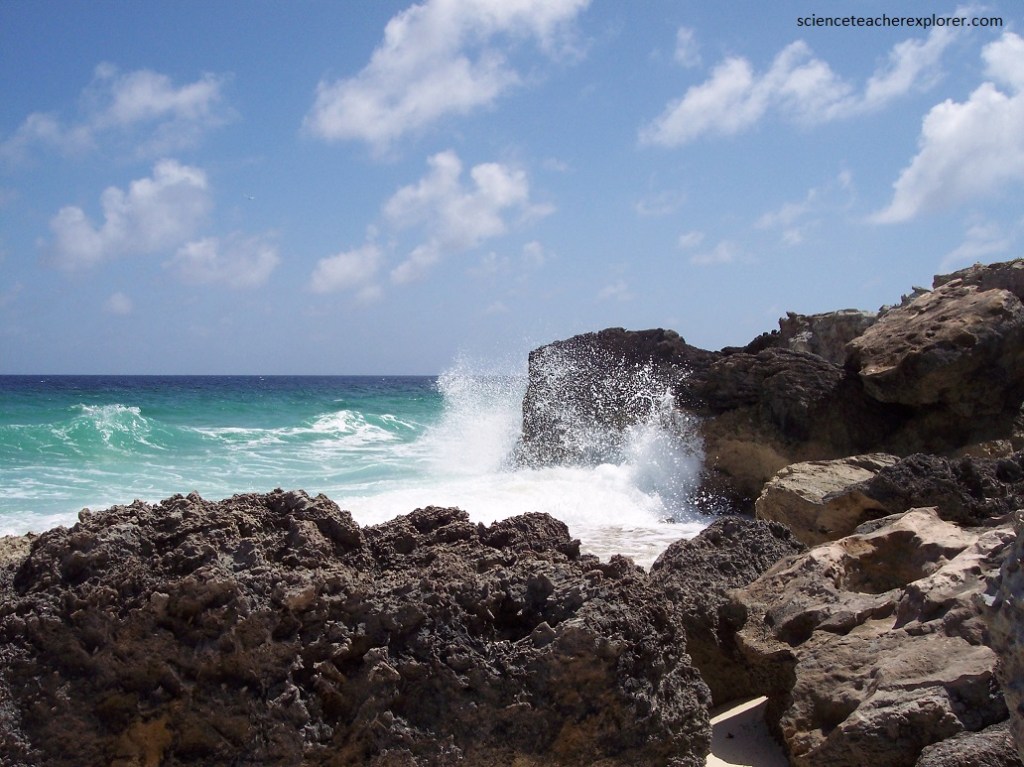
Pictured above, the coastline here was very dynamic, with large quantities of sand moving in and out depending on wave activity. Here, the waves broke against the base of the cliff about 2.5 m below. The sea-cliff rocks also record evidence of a past higher sea level, as shown by the excellent herring-bone cross bedding indicative of subtidal deposition overlain by back beach and dune facies. The rock is Cockburn Town Member of the Grotto Beach Formation. The cave formed immediately after the rock was deposited and exposed as sea level fell from the level. This cave is a good example of a breached flank margin cave.
Flank margin caves form along the margin of the island under the flank of a ridge where the halocline and the water table merge. The result is aggressive dissolution. Usually, the caves form with no opening to the surface. However, subsequent cliff retreat may expose them and the collapse of the roof may happen. We were able to explore those formed at the highest sea level stand (+6 m, 125,000 years ago).
Imaged above, access to flank margin caves occurs only after surficial erosion intercepts chambers or passages. “Fire Drill Cave” was erosionally breached by the development of a wave-cut, paleo-sea cliff during the mid-Holocene.
Pictured above, Watling’s Blue Hole is a shallow blue hole near Watling’s Castle on the southern tip of San Salvador Island. It has a fresh/brackish water lens about 3 m thick floating on an underlying salt water body. The presence of the non-marine water at the surface promotes vegetation. The collection of organic matter in the upper water layer has stained the water dark with tannin, which changes the blue color to a dark green. The surface waters have a salinity of 5.20 ppt, indicating it is about 13.7% seawater.
The next day, our scientific group decided to explore the north end of San Salvador Island. Pictured above, is just outside of the Gerace Research Centre looking toward the “Singer Bar Point”. Notice the pink aragonite sand, with the Beach Rock, along the western shoreline of south-eastern Graham’s Harbor. The pink coloration is the result of whitish aragonite sand sediments being mixed with reddish-colored fragments of the rotaliine foraminiferan, (Homotrema rubrum). Homotrema rubrum encrusts shells, dead coral, limestone clasts, or any other available hard substrate.
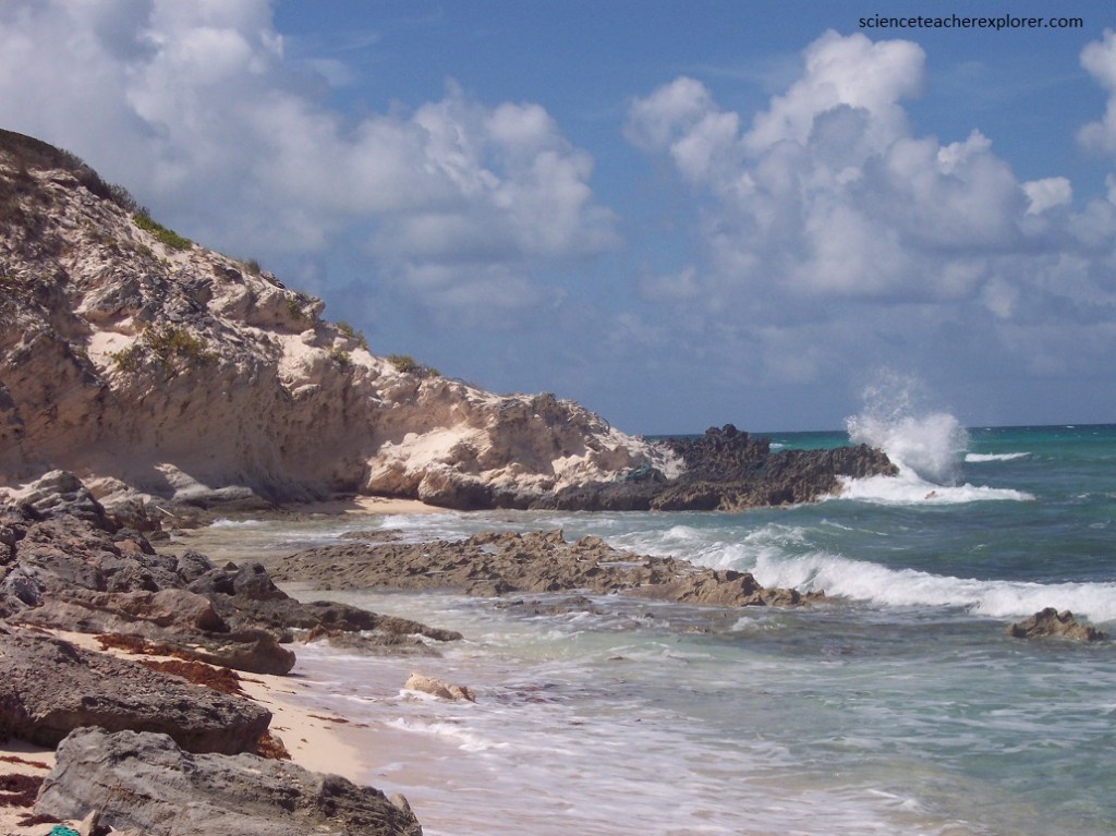
Pictured above, East Beach is located on the windward northeast coast of San Salvador Island. Tied to an unnamed, Holocene rocky headland at its north end, East Beach is one of the longest reaches of open beach on San Salvador, running south for about 4.5 km to its anchor-point terminus at Crab Cay. East beach is composed of well-sorted, fine- to medium-grained bioclastic sand. It has a medium-energy shoreline with normal wave energy somewhat dampened by the kilometer wide shelf and presence of numerous closely spaced coral patch reefs. Under fair-weather conditions, the prevailing trade winds generate waves that break almost parallel to shore, and sediment transport tends to be northward with the longshore current. The East Beach itself is broad, relative to most on San Salvador, and typically has a well-defined berm crest with a gently seaward-dipping foreshore and wide backshore.
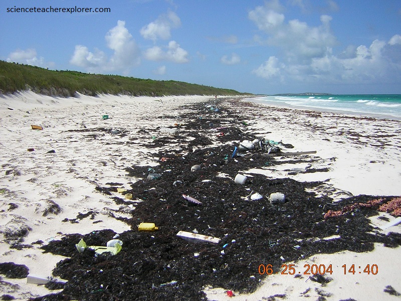
Pictured above, “strand lines” on an aragonite sand beach of “East Beach”, (northeastern San Salvador Island). These paricular strand lines are dominated by dead and desiccated “seaweed”, consisting of Sargassum (brown algae), Thalassia (turtle grass) and Syingodium (manatee grass). The brownish-colored clumps in the strand line on the right, near the water, were left “high and dry” by the most recent high tide. The blackish-colored strand lines on the left, higher up on the beach, were left by the last “Spring” tide. There seems to be an incredible range of types of anthropogenic materials and objects present (hard plastic objects are dominant).
Pictured above, I’m looking at the contact zone between to the two members of the Holocene “Rice Bay Formation”. The top layer, “Hanna Bay Member”, is the youngest bedrock unit on San Salvador Island. This well-sorted limestone consists of sand-sized grains of aragonite or calcarenites. When examined microscopically, the calcareous sand grains can be seen touching each other, (grain-supported). Here at Rice Bay, the bedding has a seaward dip. The rocks at this shoreline outcrop range from representing beach facies to back-beach dune facies. The lower white layer is the slightly older “North Point Member”. It consists of eolian, aragonitic calcarenites.
Pictured above, is the “North Point Member of the lower Rice Bay Formation at Cut Cay. It consists of well-sorted calcarenite limestones.
Pictured above, the “North Point Member” has horizontal bedding at the top and low-to-high angle cross-bedding at the bottom. The grain size and sorting and cross-bedded nature of these rocks, indicate that they are ancient sand dune deposits (wind-blown). Calcarenites deposited in ancient dune facies are called eolianites.
Pictured above, the cross-bedding extends below modern sea level at least 2 m, indicating that these dunes were originally deposited when the sea level was lower than now. This means that the “North Point Member” limestones are older than the Hanna Bay Member limestones, (consistent with the sea level rise throughout the Holocene approx. 5,300 year ago).
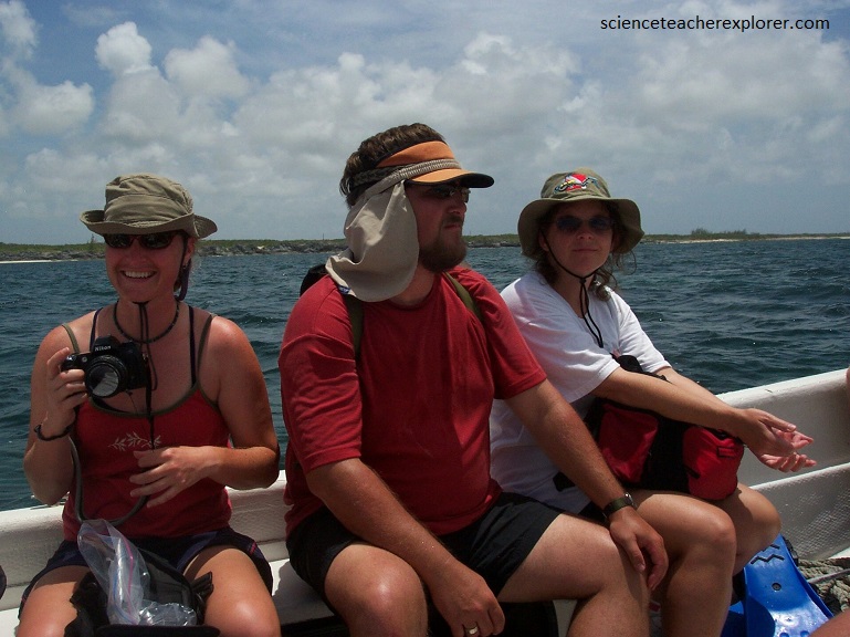
Pictured above, my scientific team is taking a day to explore the different islands and reefs north of San Salvador Island, (in Graham’s Harbour) with a small boat. In Graham’s Harbour, with its extensive seagrass and eelgrass beds as well as coral reef, serve as a very important breeding ground for conch and other marine animals.
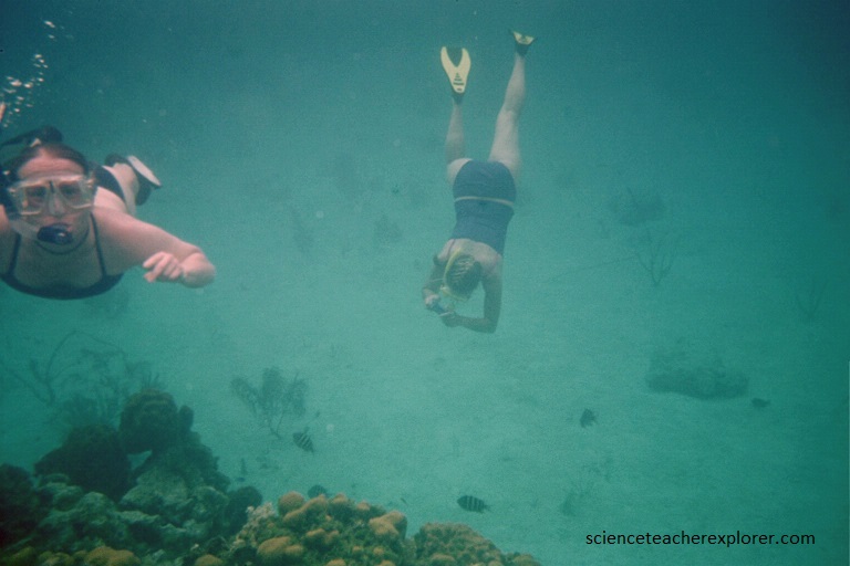
Pictured below, one of colleagues brought up a “Common Octopus” from the coral reefs of Graham’s Harbour. The most widespread species of octopus in the Bahamas is the “Common Octopus”. A Common’s arms will be about 3 to 4 times longer than their body. In addition to rapid color changes, they can alter the pattern of their skin to match their surroundings, making them marvels at the disappearing act. The “Common Octopus” prefers sea grass, sand and rubble bottoms rather than coral reefs. They also love to take up residence inside discarded conch shells, empty cans, glass jars and bottles. This highly intelligent hunter uses its morphing talent to provide protection from would-be predators and to also stalk prey undetected. In a split second, the octopus can deploy its muscular tentacles to draw the prey within reach of the sharp beak.

It also houses a number of cays, such as Green Cay, home to the largest population of San Salvador Rock Iguanas, and the Cato, Gaulin and White Rock Cay nesting sites for migrating sea birds. San Salvador has more species of sea birds nesting on and around these Cays than any other Island in The Bahamas.
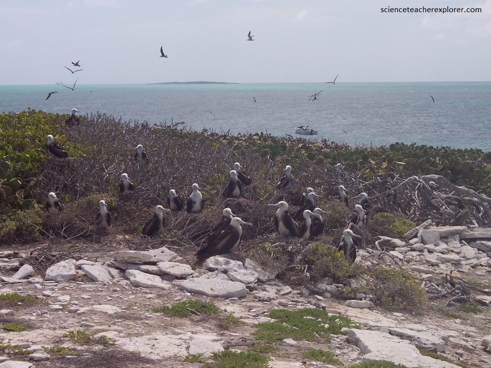
Fregata magnificens Mathews, 1914 – magnificent frigatebird nesting colony on Catto Cay in Grahams Harbour, offshore from northern shore of San Salvador Island, eastern Bahamas. The black-headed individuals are adults and the white-headed individuals are juveniles. Magnificent frigatebirds (Family Fregatidae) are moderately large, tropical to subtropical seabirds with a long, bifurcated tail and an unusually long wingspan. They seldom land at the ocean surface, but inhabit islands and marine coastlines.
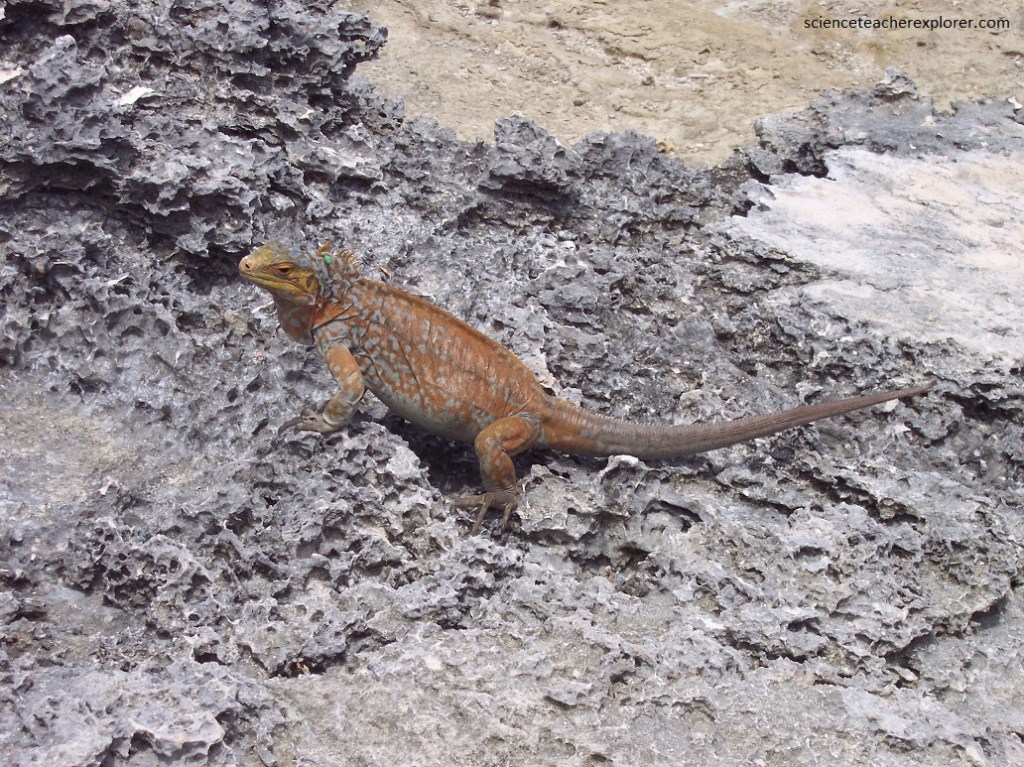
Pictured above, the “San Salvador Rock Iguanas” on Green Cay, western Graham’s Harbour, offshore from northwestern San Salvador Island. The reptile is one of the rarest reptile species on Earth. The species is sexually dimorphic and herbivores; females have a smaller body size and small dorsal crests (see above), while males are larger and have more prominent dorsal crests. Population estimates in 2004 was only a few hundred individuals that exist on earth.
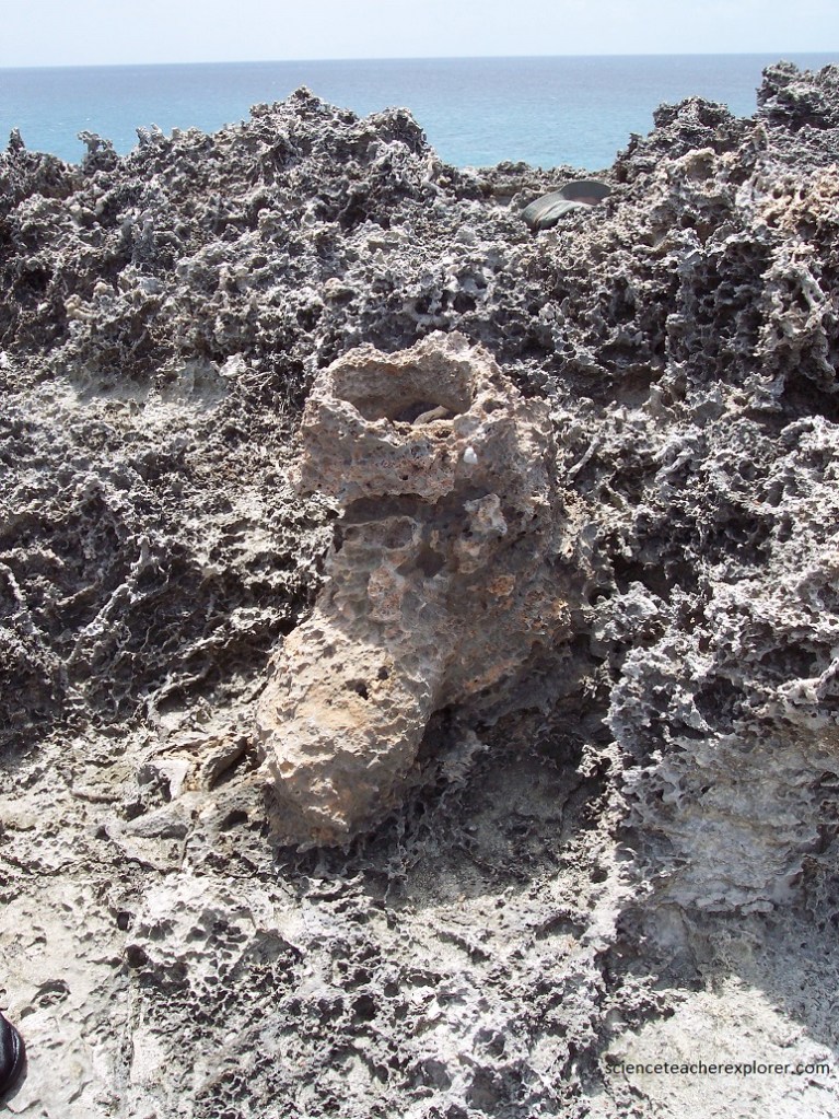
Pictured above, a “Solution Tube” is a vertically-oriented, subcylindrical, vadose dissilutional feature. This structure formed as a small scale pathways for conduit flow, likely a vegemorph (plant stump) were dissolutionally enlarged. The conduit lining was a site of calcium carbonate precipitation. Differential weathering and erosion resulted in this solution tube projecting above surrounding rocky surface, (imaged below).
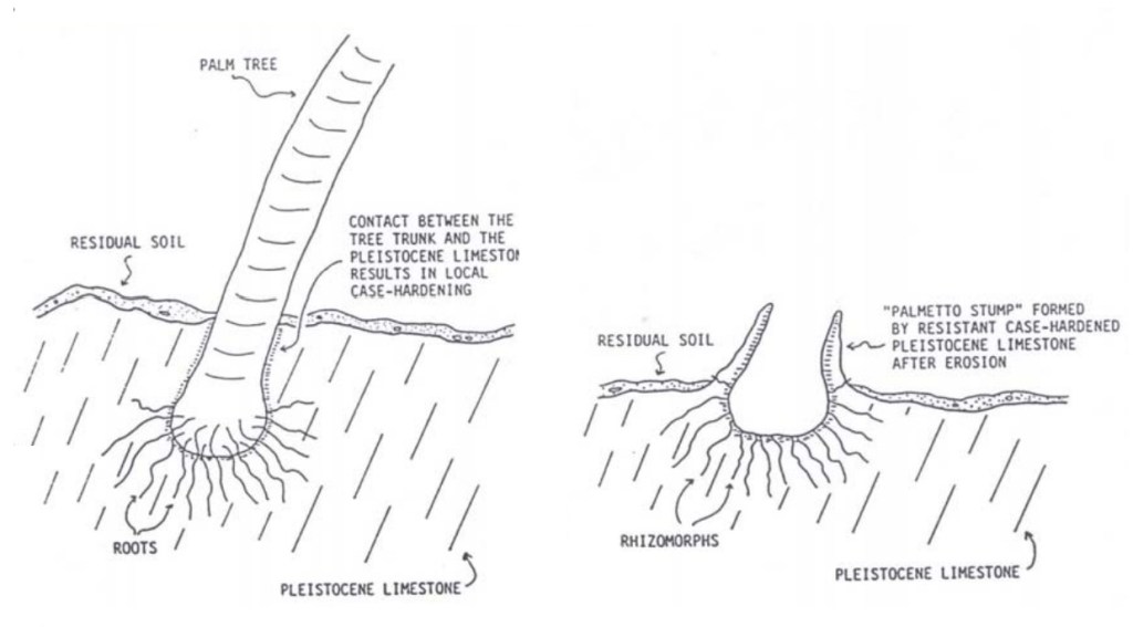
Pictured & imaged above, calcium carbonate cementation around this solution tube penetrated far into the surrounding limestone bedrock, which is rich in vegemorphs. Differential weathering and erosion resulted in a large, barrel-shaped structure called the “Palmetto Structure”.
Pictured below, the next day we explored the Dixon Hill Lighthouse area on the north-eastern part of San Salvador Island. This lighthouse was built between 1856 and 1887 on a former plantation owned by John Dixon. The lighthouse stands 54 m above sea level, with a visibility of 30 km, and has 80 steps to the top; it is one of the most visited landmarks on the Island.
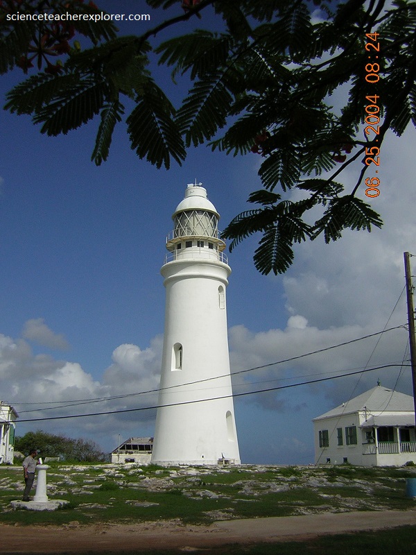
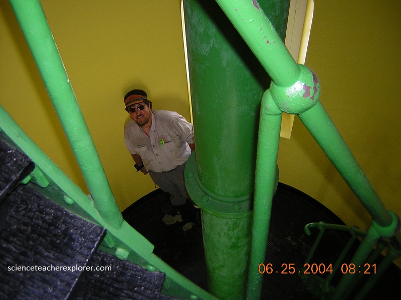
Pictured above and below, the Dixon Hill Lighthouse is one of the few remaining manually-operated lighthouses in the world. It is still occupied and operated by lighthouse keepers, living in separate houses, who tend the flame of the 400,000-candle–powered light by hand every 2 hours and 15 minutes. The lighthouse maintains four-hour watches nightly, giving a double flash every ten seconds.
Pictured below, our main goal for the day is to explore the “Lighthouse Cave”. This is another flank margin cave found near the Dixon Hill Lighthouse on the northeastern part of San Salvador Island.
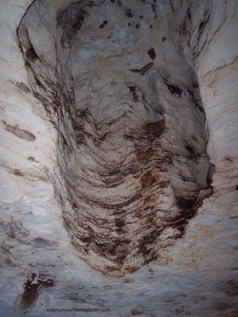
Pictured above and below, Lighthouse Cave is hosted in eolian, cross-bedded, aragonitic calcarenite limestones of the Owl’s Hole Formation of the middle Pleistocene. As mentioned above, Lighthouse Cave is a flank margin cave. In the vicinity of the seawater-freshwater mixing zone (halocline) of a groundwater lens, relatively rapid dissolution of limestone occurs. Limestone dissolution at this cave occurred during 119,000 to 131,000 years ago.
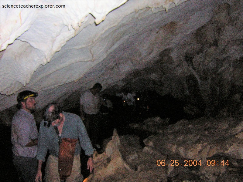
Pictured above, the lowest levels of Lighthouse Cave were partially flooded in 2004. The tidal fluctuations indicated its connection with the ocean. However, we didn’t find an opening over the ocean. Travertine dripstone speleothem were common in 2004.
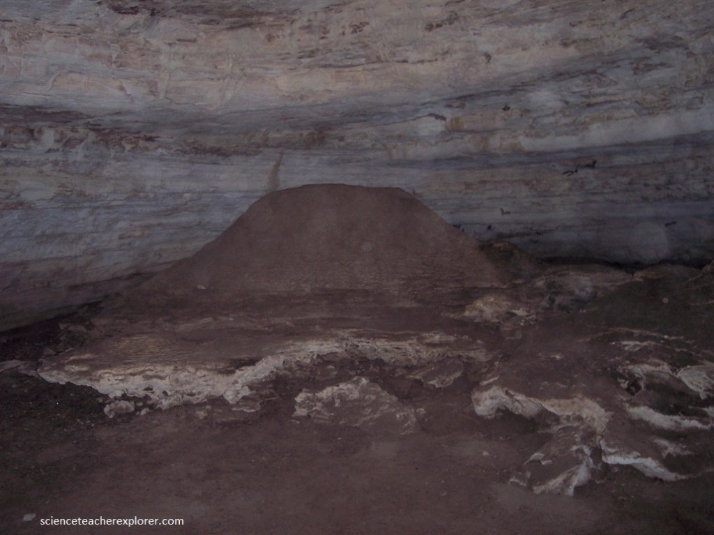
Pictured above, another flank margin cave that we explored was the “Altar Cave” on the southwestern part of San Salvador Island. Altar Cave is hosted in aragonitic, oolitic calcarenite limestones of the Cockburn Town Member of the Grotto Beach Formation of the Upper Pleistocene. This cave was nearly an intact, breached flank margin cave. Altar Cave was erosionally intercepted by the development of a wave-cut, paleo-sea cliff formed during the mid-Holocene, at about 5000 years ago. Altar Cave consisted of one main chamber. Pictured above, a large mound of travertine speleothem occurs near the northeastern corner of the main chamber and somewhat resembles a ceremonial altar. The cave entrance was low and required crawling. The entrance passage had a sand-covered floor and the bedrock floor occurred at up to 2 m below the present sediment-covered cave floor.
The cave entrance was low and required crawling. The entrance passage had a sand-covered floor and the bedrock floor occurred at up to 2 m below the present sediment-covered cave floor. This particular cave had hundreds of bats flying around. Many would land on your clothing. Additionally, there were thousands of American Cockroaches crawling all over the floor. It made the working conditions a bit challenging, psychologically, with several cockroaches and bats crawling all over you clothing. I should mention, Periplaneta americana, the American cockroach, is not native to the Bahamas or to the entire Western Hemisphere. It was introduced to the New World from Africa by humans starting in the early 1600s.
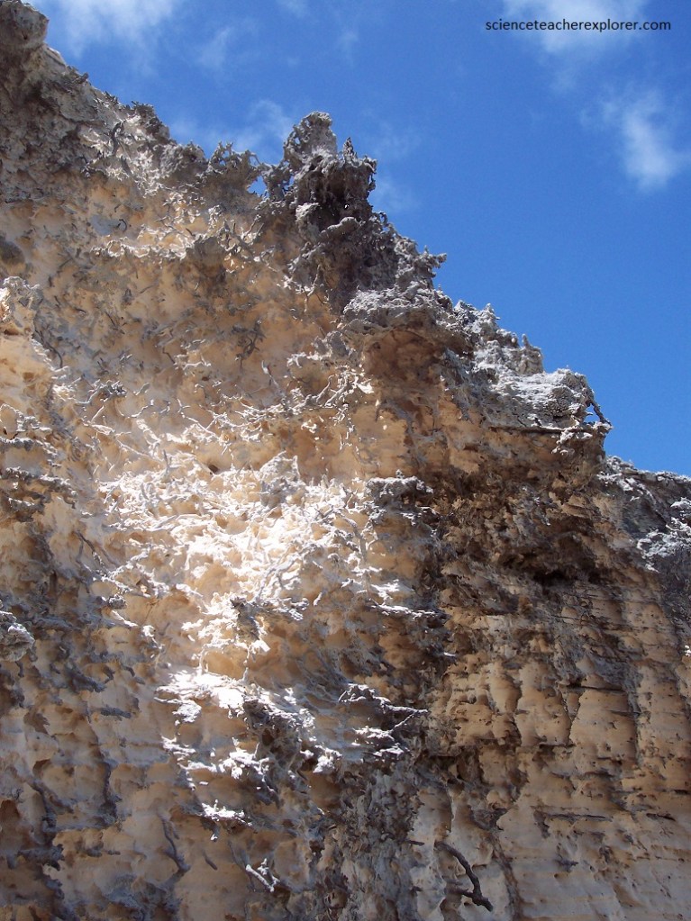
On the last few days of my scientific expedition of San Salvador Island was spent exploring the rugged phytokarst coastline. Pictured above, is one of the challenges we had exploring the shorelines of the island. Much of the Island surface was covered with a phytokarst limestone. A “phytokarst” is a irregular, sharp-edged, small-scale karst that is developed on most exposed limestone surfaces. Phytokarst is the result of several inorganic and biologic processes. These include preferential cementation of otherwise unlithified young limestones by sea spray, differential dissolution by slightly acidic rainwater, cyanobacterial & algal boring activities, and gastropod radular scraping.
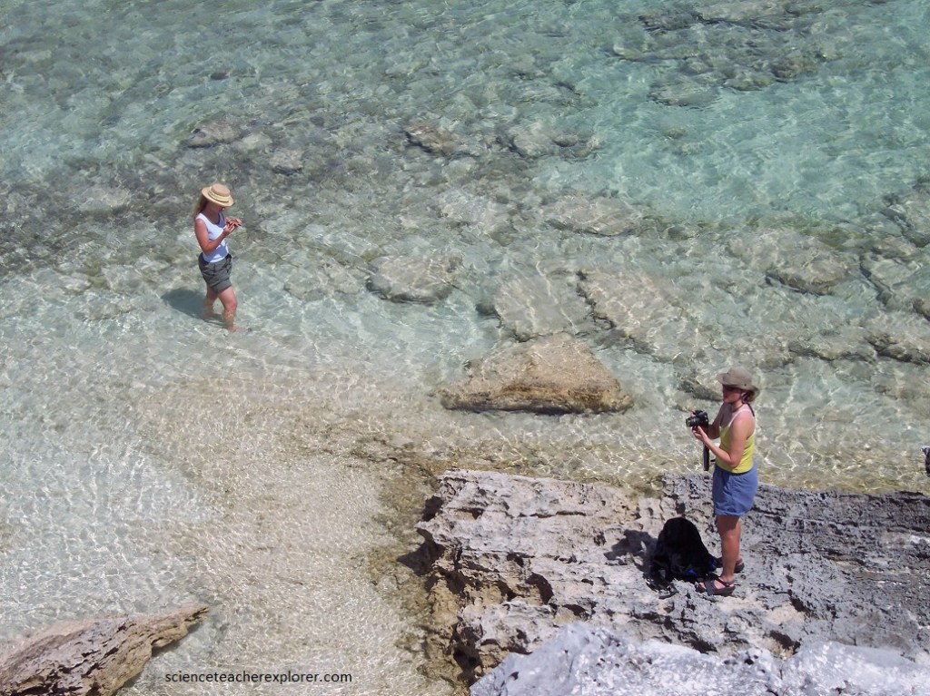
Therefore, while hiking along the rugged coast of San Salvador, I blew-out my left knee. Making it back to the “Gerace Research Centre” was a major challenge for me. This caused me to wear a knee brace throughout the rest of the expedition, (pictured below).
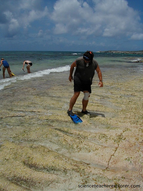
Pictured above, with a blown knee and extreme swelling, the best thing I could do, was snorkel in the cool waters of the Bahama ocean. Snorkeling kept the weight off my hurt knee and kept it relatively cool. There was no ice, on this remote island of the Bahamas. Once I made it home, in Utah, I had to have my knee rebuilt through an operation.