Salar de Surire, Chile
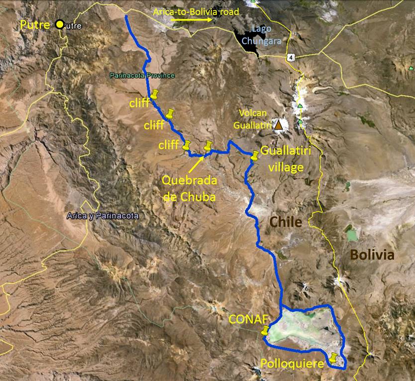
After exploring the Lauca National Park on July 14th, 2019 I spent the next two nights in Putre, Chile. There, I hired a local citizen to travel with me into the extremely remote Salar de Surire, 122 km into the desert. The man was an older gentleman that was familiar with the terrain.
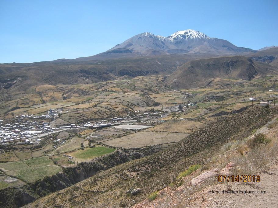
Pictured below, Putre is a Chilean town located 130 km east of Arica, at an altitude of 3,500 m (11,483 ft). The town is backdropped by Taapaca volcanic complex. Like other volcanoes of the Central Volcanic Zone, Taapaca formed from the subduction of the Nazca Plate beneath the South America Plate. It lies on the western margin of the Altiplano high plateau, on top of older volcanic and sedimentary units. Taapaca has mainly erupted dacite, in the form of numerous lava domes, although an andesitic stratovolcano is present, pictured below. It was at first assumed that activity ended during the Pleistocene, but late eruptions occurred until 2,300 years ago. It could still be active.
On morning of July 15th, 2019, my guide and I drove into the Salar de Surire with my truck rental. On the way we passed the Guallatiri Volcanoe, (pictured below).
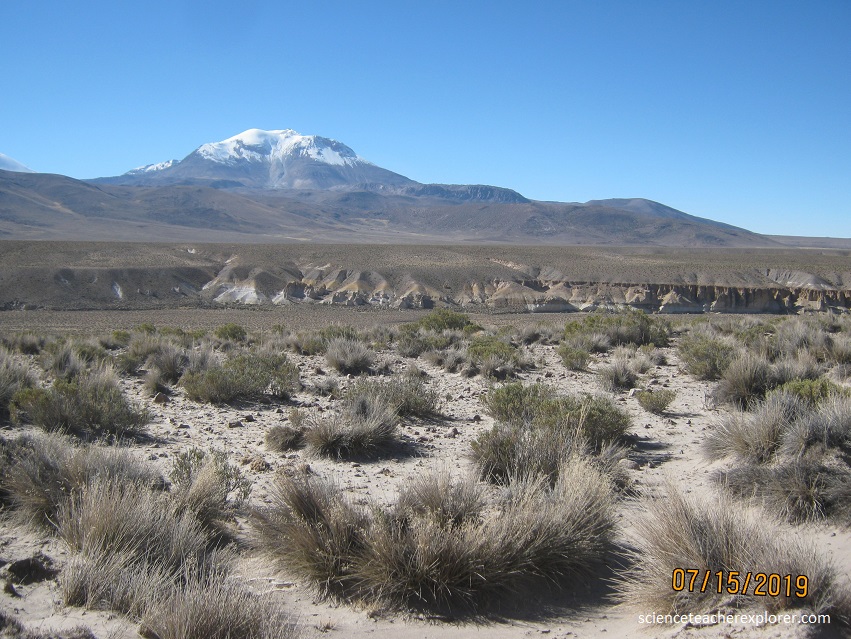
Guallatiri is a 6,071-metre (19,918 ft) high volcano in Chile. It is located southwest of the Nevados de Quimsachata volcanic group and is sometimes considered to be part of that group. It is a stratovolcano with numerous fumaroles around the summit. The summit may be composed of either a lava dome or a pyroclastic cone, while the lower flanks of the volcano are covered by lava flows and lava domes. The volcano’s eruptions have produced mostly dacite along with andesite and rhyolite.
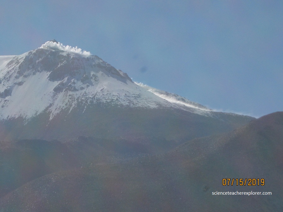
Guallatiri has been active in historical times with a number of eruptions, the latest in 1960. Fumarolic and seismic activity is ongoing and has resulted in the deposition of sulfur and other minerals on the volcano. The volcano is covered by an ice cap above 5,500 metres (18,000 ft) elevation. Guallatiri, along with several other volcanoes, is part of Lauca National Park.
Solfataric activity is ongoing. In 1985 and 1987 yellow (sulfur-bearing) steam clouds were reported, reaching heights of 500 m above the summit. The fumaroles cluster in two places, in the crater and on the southern flank where they reach over 300 m down. The fumaroles are reported to make “jet”-like noises.
When we arrived at Salar de Surire, we were required to check in at the Chilcaya Police Station. The Salar de Surire was on the Chile/Bolivia border and required a VISA check.
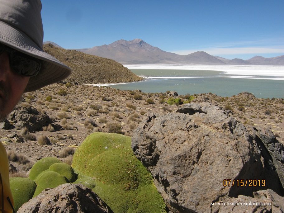
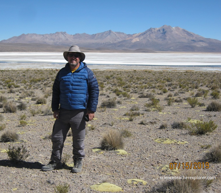
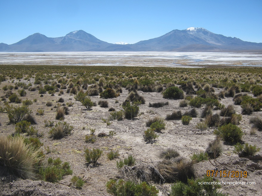
After the check-point, we continued driving around the perimeter of Salar de Surire, starting on the north-end. Salar de Surire Natural Monument is a Chilean Natural Monument that consists mainly of a salt flat and a number of small salt lakes, sheltering several Andean species of wildlife and plants. Arintica volcano towers over the salt flat on the Northern side. Pictured above, I’m standing next to a Lloreta plant on the rock, looking southwest from the foot of Arintica.
Llareta (Azorella compacta) is a flowering plant in the family Apiaceae native to South America. It grows only in the Puna grasslands of the Andes in Peru, Bolivia, northern Chile, and western Argentina at altitudes between 3,200 and 5,250 m. The plant’s leaves grow into an extremely compact, dense mat that reduces heat and water loss. This mat grows near the ground where air temperature is one or two degrees Celsius higher than the mean air temperature. This temperature difference is a result of the longwave radiation re-radiated by the soil surface, which is usually dark gray to black in the Puna. Many Llaretas are estimated to be over 3,000 years old.
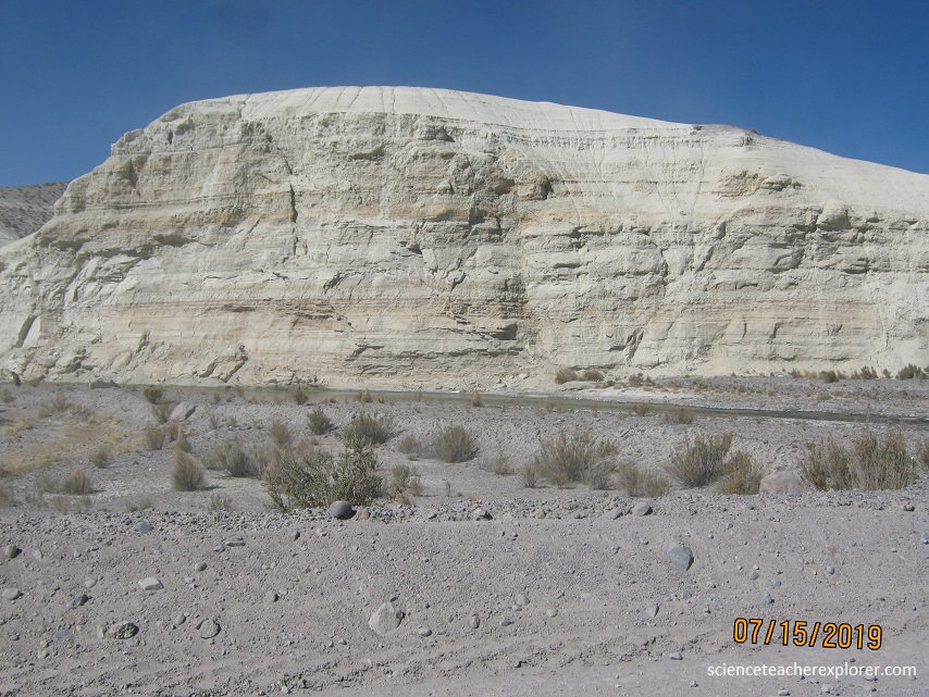
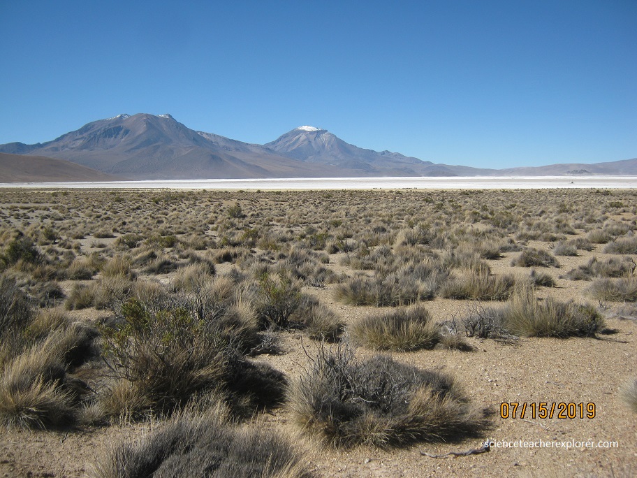
Pukintika is a volcano that is about 5,407 m (17,740 ft) high. It lies to the north of the Salar de Surire and east of Arintika volcano which is younger than Pukintika. The ghost-town of Chancacolla looked like an old mining town. But my guide new nothing about it. Pictured below is a great view of the Flamencos off of Chancacolla point looking west across the Salar de Surire.
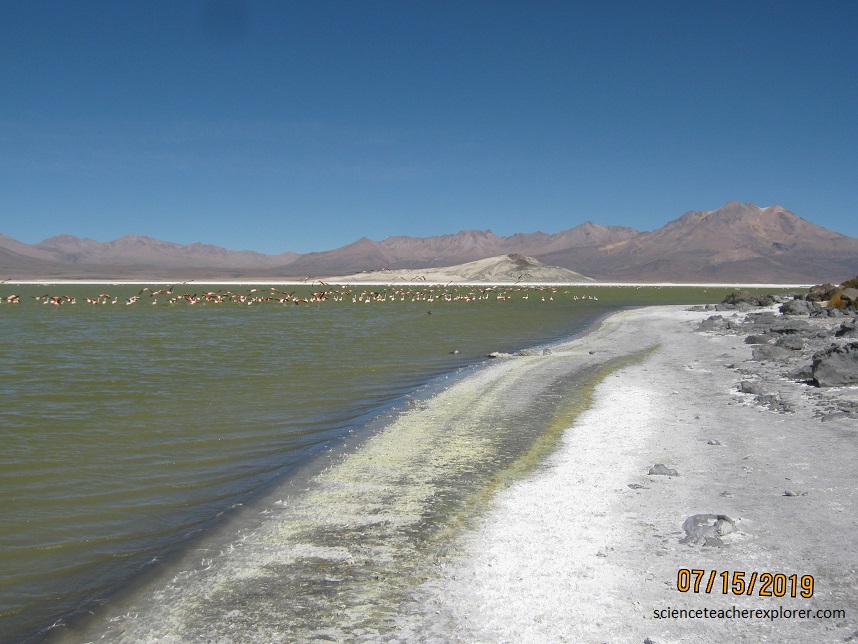
There are five species of Flamingos in the world, of which three live in Chile; the James’ flamingo (Phoenicoparrus jamesi), the Andean flamingo (Pheonicoparrus andinus) and the Chilean flamingo (Phoenicopterus chilensis), all with gregarious habits. They can be seen in large concetrations in saline lakes in the South-American High Andean mountains. Both parents sit, in twelve hour shifts and for the 29-30 days that incubation takes, on the one egg laid. In each large flamingo colony, the females lay their egg almost simultaneously, so the eggs hatch at the same time as a consequence of the collective nuptial ceremony. The ecological competition between the Chilean flamingo and the two other species is based on the tolerance to the alkalinity of the water. What we’re seeing here is the Andean flamingo with it’s black wing-tips and beak.
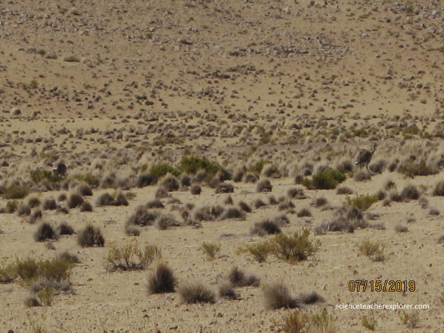
This high-altitude salt flat in northern Chile was named for the “Suri” or Rhea, the large ostrich-like bird characteristic of the high altitude plains of the region. These Rheas are large, flightless birds with grey-brown plumage, long legs and long necks, similar to an ostrich. They were quite surprising to see in the wild. They are extremely endangered.
Declared a national monument in 1983, the Salar de Surire has thermal pools, abundant wildlife, and a variety of salty and freshwater lagoons. It is surrounded by extinct volcanoes, whose leached deposits now form the salar. Las Vicuñas National Reserve is a nature reserve located in the southern portion and is contiguous to Salar de Surire Natural Monument, all of which form Lauca Biosphere Reserve.
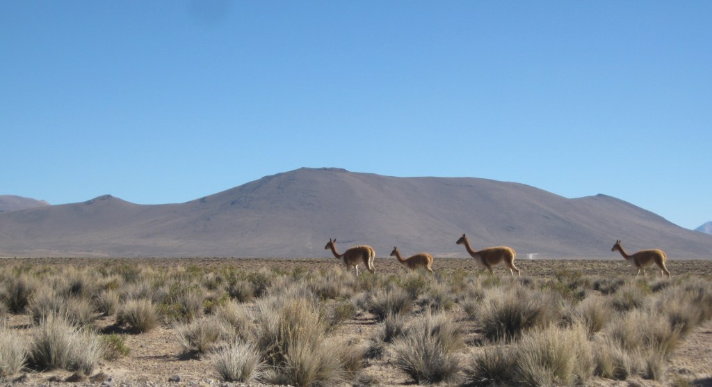
The Vicuña is one of the two wild South American camelids which live in the high alpine areas of the Andes, the other being the guanaco. Vicuñas are relatives of the llama, and are now believed to be the wild ancestor of domesticated alpacas, which are raised for their coats. Both under the rule of the Inca and today, vicuñas have been protected by law, but they were heavily hunted in the intervening period. At the time they were declared endangered in 1974, only about 6,000 animals were left. Today, the vicuña population has recovered to about 350,000.
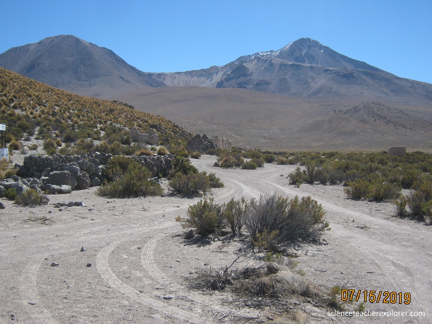
Arintica is a stratovolcano located north of the Salar de Surire. The volcano has a main summit in the north, a slightly shorter southern summit and a subsidiary peak in the west. A dacitic lava dome is found southwest of the volcano and is named Calajata.
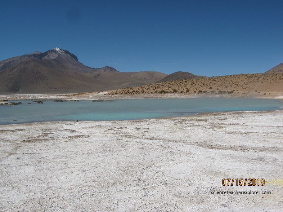
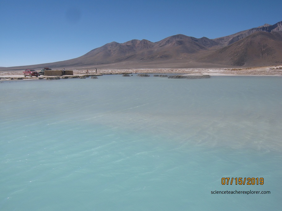
The Polloquere Hotspring on the south-western side of Salar de Surire is fresh water. It sprouts at a temperature of 66 degrees and produces a lagoon in the salt crust of the salt flat, where it is fascinating to bathe.
The Salar de Surire is mined for borax (a compound with many uses in detergents and cosmetics), but at any one time the mining operations only cover a small portion of the salar. If you look carefully, you can see the dump trucks picking up a load of borax in my images. They enter the salt flat from the western shores, near the location I took the above photograph.
At the end of the day, I drove back to Putre and returned my local guide. The next day I continued onto Iquique, Chile to stay the night along the Chilean Coast. I was trying to capture a flight out of Antogasta, Chile.
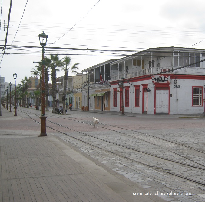
Iquique is a beautiful port city in northern Chile. The city developed during the heyday of the saltpeter mining in the Atacama Desert in the 19th century. Once a Peruvian city with a large Chilean population, it was conquered by Chile in the War of the Pacific (1879–1883). In July 1835, Charles Darwin, during his voyage on the Beagle, traveled to Iquique and described it as a town “very much in want of everyday necessities, such as water and firewood”. These necessities had to be brought in from considerable distances. Darwin also visited the saltpeter works.
