Arches N.P., Utah 2010
In June of 2010 & 2008, I took some time to trek and explore Arches National Park, with students, in Southeastern Utah. Located in the high desert, extremes of temperature, water and wind erosion have finely sculpted the region’s multi-hued sandstone into no less than 2,400 named arches, as well as a variety of unusual balanced rocks, monoliths, and pinnacles.
The World’s greatest diversity of natural arches and other geological formations ha made Arches National Park in Utah the jewel of a unique region.
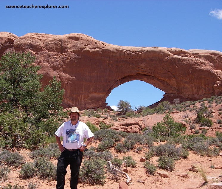
At Arches National Park, a hole in the rock has to be at least 1 meter across for it to be officially listed and mapped.
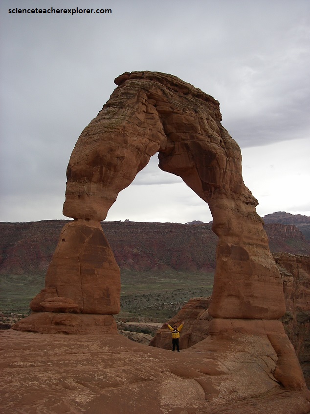
Pictured below, Delicate Arch is the symbol of the park. It is perhaps, one of the most iconic American/Utah landmarks, and has appeared in an endless array of books, films, postcards, and calendars.
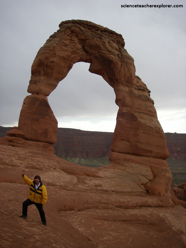
Pictured below and above, “Delicate Arch” has a span of about 10 m and is 15 m high.
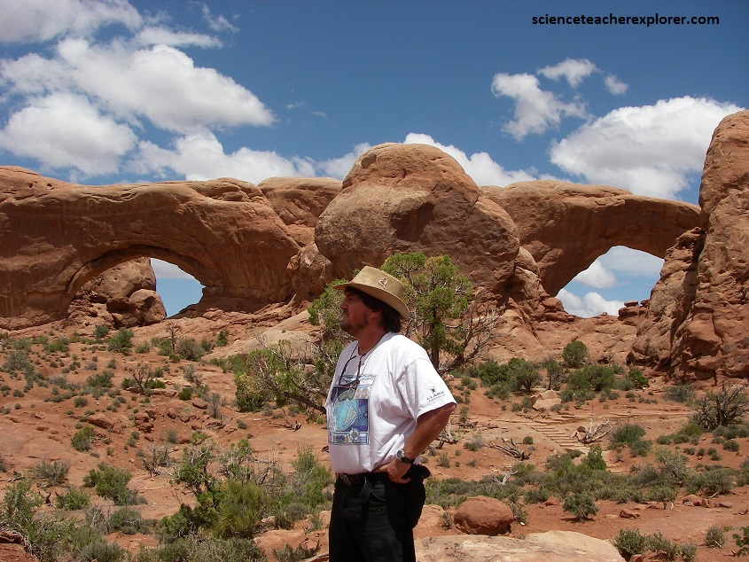
Pictured below, the twin arches of “Double Arch, seen in many western films, criss-cross a gap between two rocky outcrops at a height of 45 m.
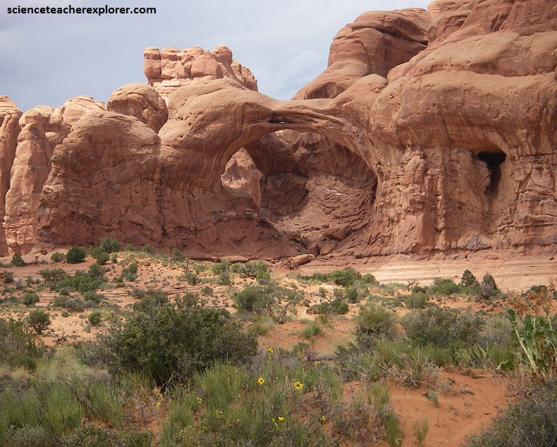
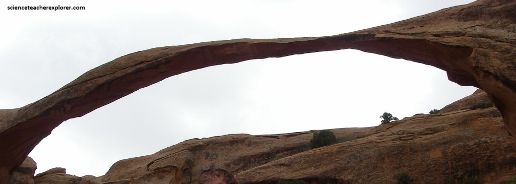
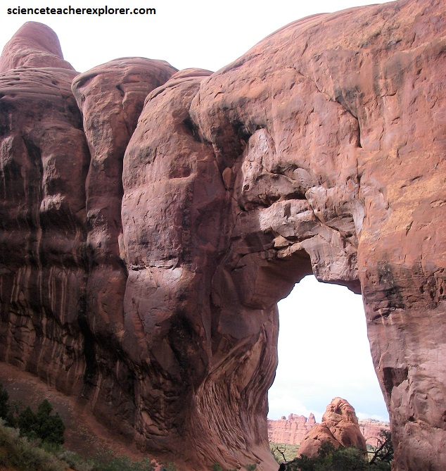
Although not as well known, (pictured below), “Landscape Arch spans an incredible 100 m. In 1991, a massive slab of rock, 20 m long, 3 m wide, and 1 m thick plummeted from the underside of the arch, leaving a relatively thin ribbon of rock to support the arch.
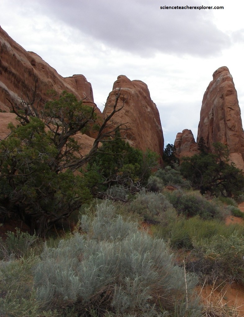
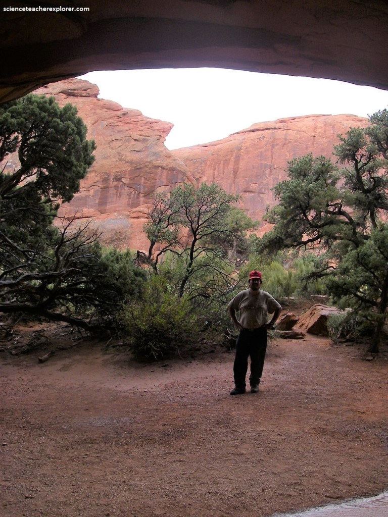
The story of Arches National Park begins roughly 65 million years ago. At that time, the area was a dry seabed spreading from horizon to horizon. If you stood in Devils Garden (pictured below) then, the striking red rock features we see today would have been buried thousands of meters below you, raw material as yet uncarved. Then the landscape slowly began to change.
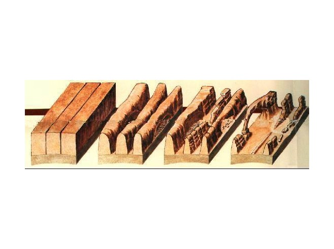
Geologic forces wrinkled and folded the buried sandstone, as if it were a giant rug and someone gathered two edges towards each other, making lumps across the middle called Anticlines and Synclines. As the sandstone warped, fractures tore through it, establishing the patterns for stress-sculptures of the future.
Eventually, the entire region began to rise during the Laramide Orogeny, climbing from sea level to thousands of meters in elevation. The forces of erosion carved layer after layer of rock away. Once exposed, deeply buried sandstone layers rebounded and expanded, like a sponge expanding after it’s squeezed (though not quite so quickly). This created even more fractures, each one a pathway for water to seep into the rock and further break it down.
Water shapes this environment more than any other force. Rain erodes the rock and carries sediment down washes and canyons to the Colorado River.
In winter, snowmelt pools in fractures and other cavities, then freezes and expands, breaking off chunks of sandstone. Small recesses develop and grow bigger with each storm. Little by little, this process turns fractured rock layers into fins, and fins into arches.
Arches also emerge when potholes near cliff edges grow deeper and deeper until they wear through the cliff wall below them.
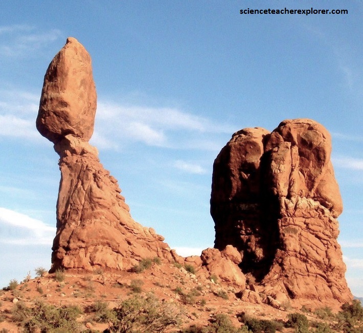
Pictured above, “Balance Rock” is one of the most iconic features in Arches National Park. It stands a staggering 39m tall. The slick rock boulder of Entrada Sandstone sits attached to its eroding pedestal of the Dewey Bridge mudstone. These two formations a extremely common in forming arches and pinnacles together throughout the park.
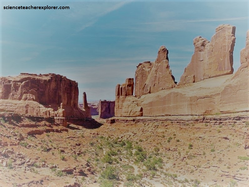
{Pictured above, the sheer walls of “Park Avenue” canyon reminds us of buildings lining a big city street. Rising majestically, these geological “skyscrapers” tell the story of three important rock layers. These layers began forming more than 150 million years ago as tidal flats, desert, and beach deposits. Over time, more layers of rock, perhaps a kilometer thick, covered these deposits. Tremendous pressure from this rock compressed the buried sand into sandstone and cracked it. As erosion removed the overlying rock, the layers now exposed began to weather. Within the past two million years, erosion of the cracks in the Entrada has left vertical slabs like the rock wall to your right. These slabs, called fins, are the first step in arch formation.} This paragraph was taken from an interpretive sign at “Park Avenue”. It is of public domain.
During the Early Jurassic (about 210 Ma) desert conditions prevailed in the region and the vast Navajo Sandstone was deposited. An additional sequence of stream laid and windblown sediments, the Entrada Sandstone (about 140 Ma), was deposited on top of the Navajo Formation. Most of the Arches are found within the Entrada Formation.