Padre Isle, TX 2021
In March of 2021, Becky (my wife) and I took a vacation trip to Padre Island National Seashore, near Corpus Cristi, Texas.
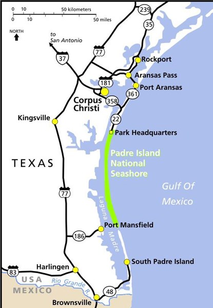
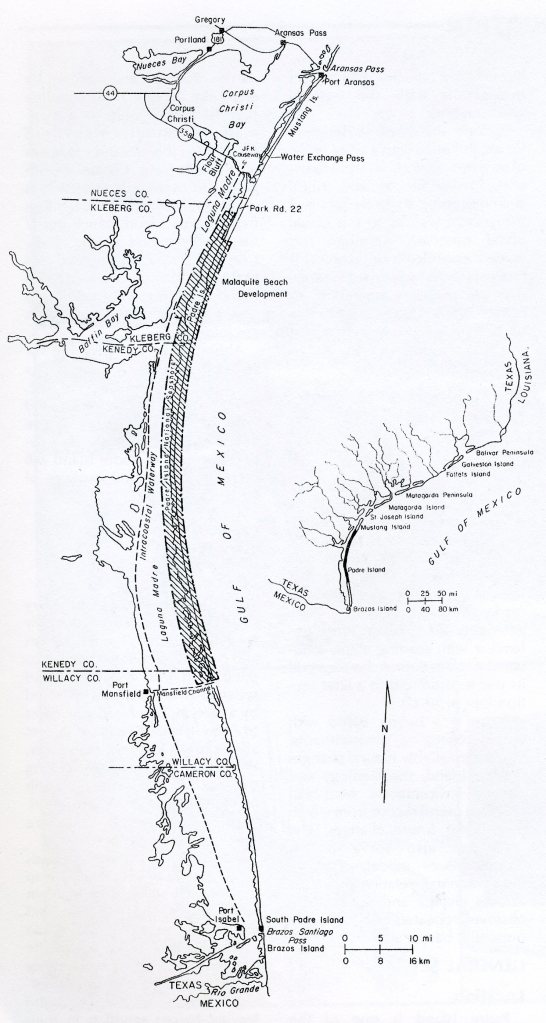
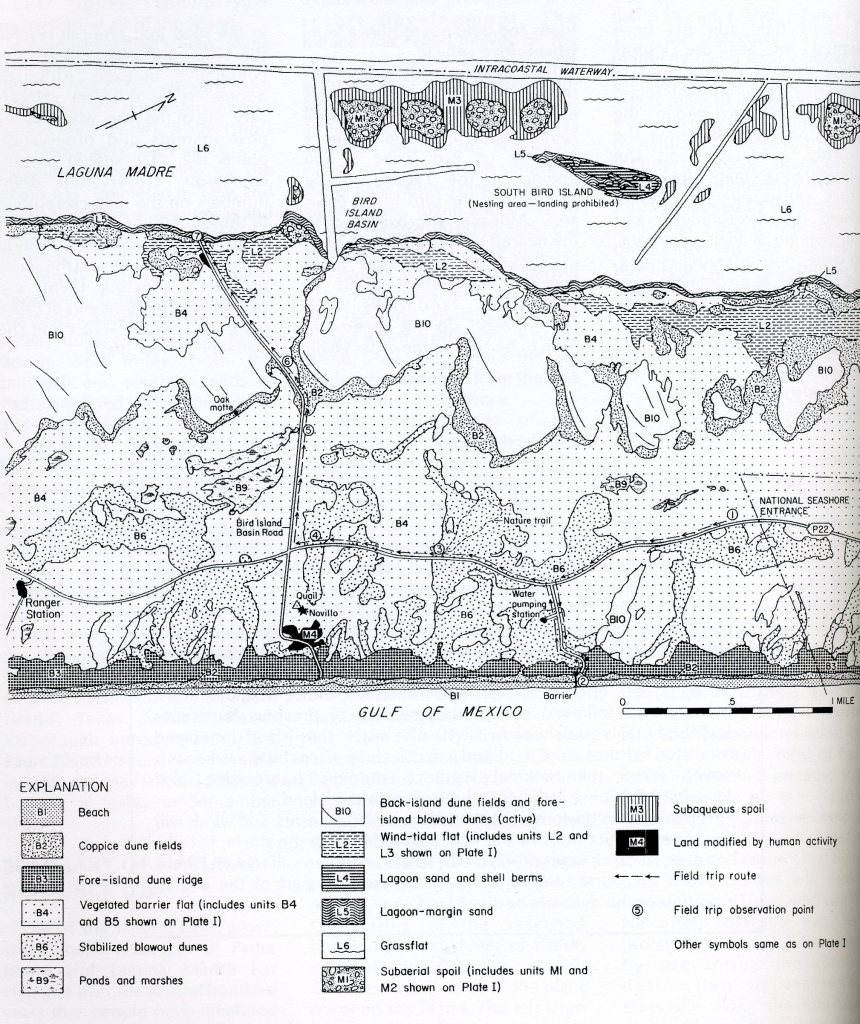
Padre Islnd is one of the southernmost links in the chain of barrier islands and peninsulas along the curving Texas coastline. (imaged below). Broken only by a manmade channel, Mansfield Channel, this island extends southward from Corpus Christi to Mexico.
Most of Padre Island has remained undeveloped. In 1962, the United States Congress passed legislation establishing Padre Island national Seashore; this 130 km segment of Padre Island will preserve the natural qualities of this pristine island.
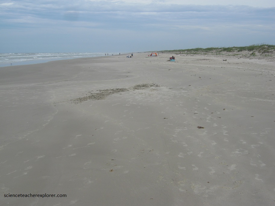
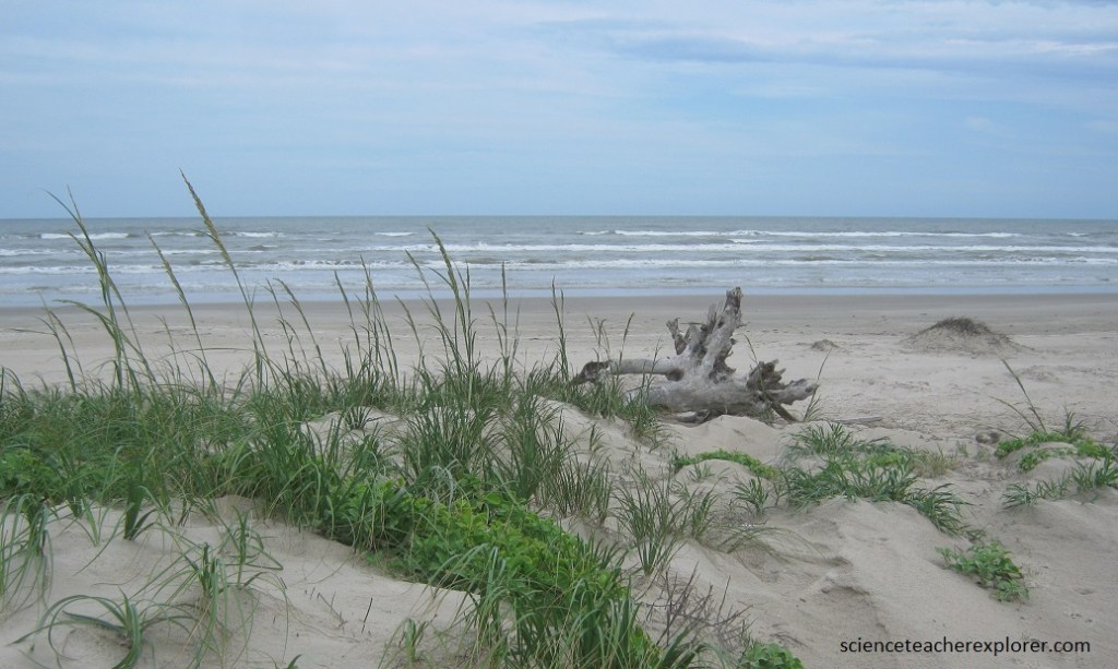
Pictured above, the Malaquite beach sediments consist of fine sand with very little shell material. The profile (slope) of Malaquite beach is quite gentle compared with the profiles of some beaches south of here. The beach berm is low, and cusps are broad and widely spaced.
Geologically, Padre Island is very young; its oldest deposits are only several thousand year old. Waves and currents in the Gulf of Mexico piled sand into a barrier island separated from the Texas mainland by a lagoon, Laguna Madre.
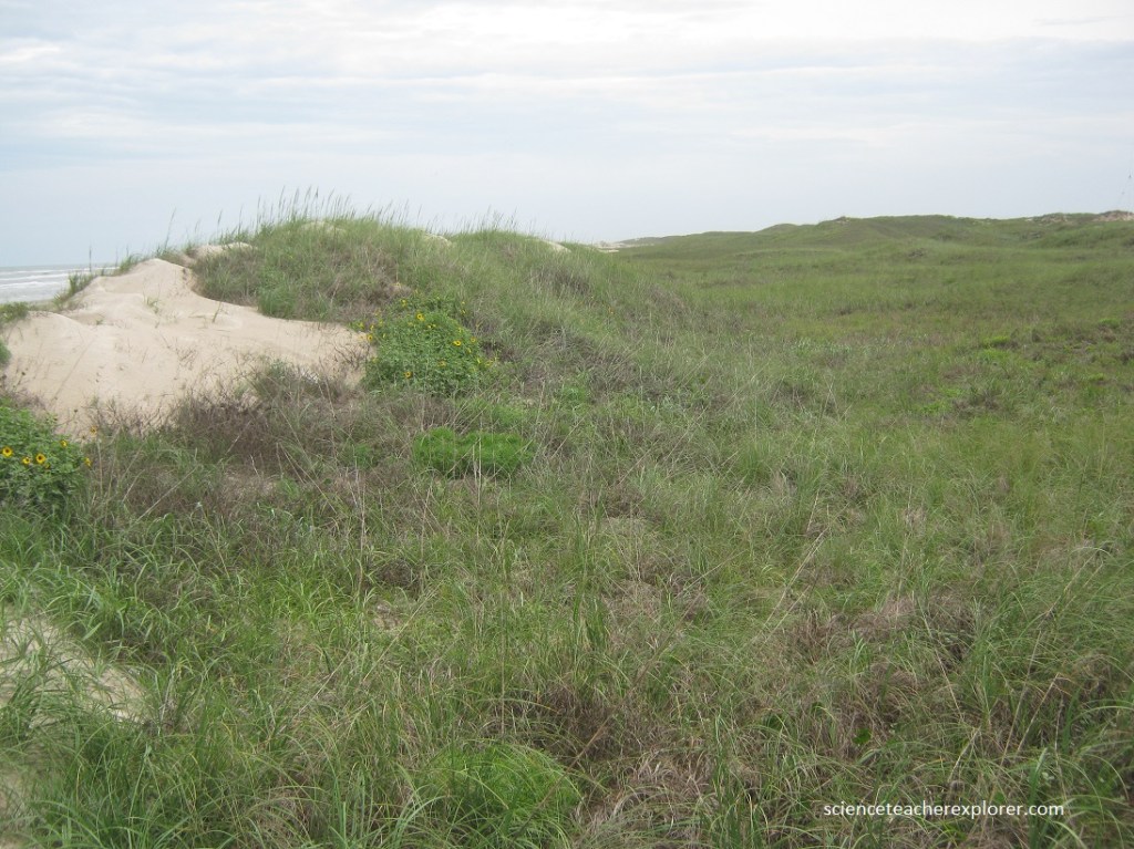
Most of Padre Island is less than 7 m above mean sea level. However, the island’s highest points, along the fore-island dune ridge, reach up to 16.5 m above sea level, (pictured above). Prevailing southeasterly winds from the Gulf of Mexico heap beach sand into high foredunes.
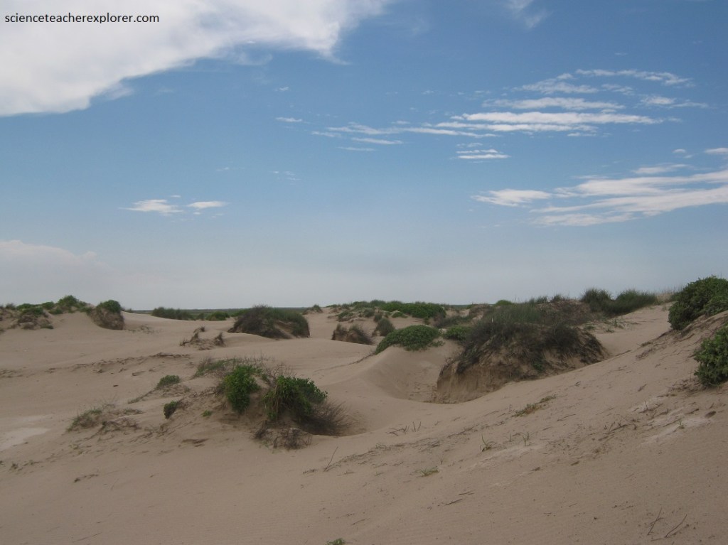
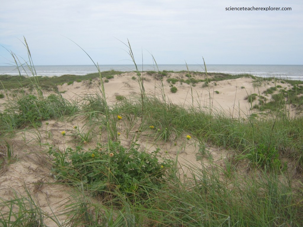
Pictured above, the onshore wind may blow loose sand from the foredunes and beach across the flats beyond. Pictured below, active sand dunes march across the island, smothering vegetation in their paths and leaving barren sandflats in their wake.
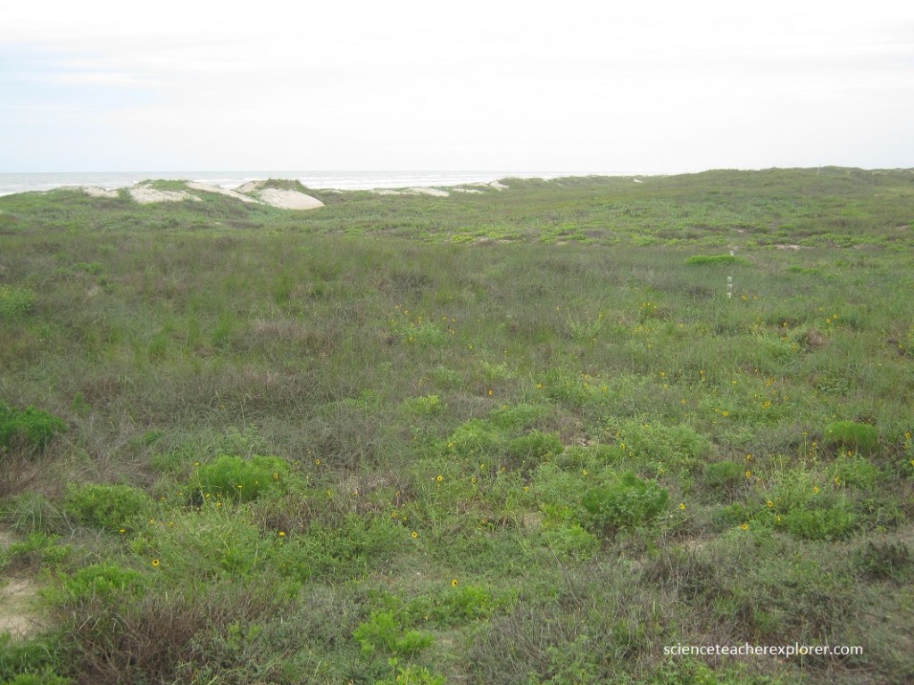
Pictured below, vegetation wins the battle of its own and stabilizes the blowing sand by binding it with roots and vines. Slower daily movements of the sand and stabilizing effects of vegetation are interrupted occasionally by the brutal force of hurricane winds, waves, and tides. During storms, beaches are eroded, vegetation is ripped up, dunes are flattened, and channels are soured across the island.
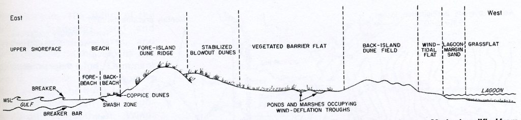
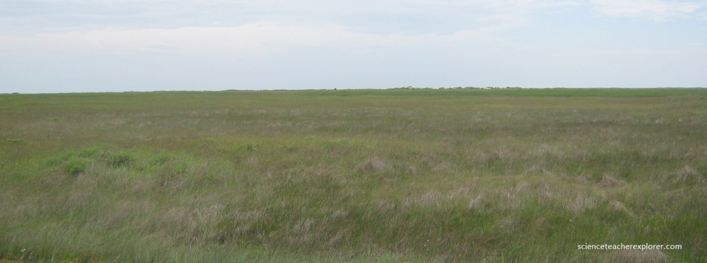
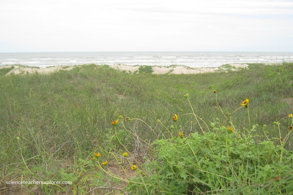
Natural processes at work on Padre Island have produced a predictable pattern of environments across the island, which varies in width from about 1-4 km. A common sequence of environments from the Gulf to Laguna Madre includes the sand and shell beach; a stable ridge of fore-island dunes, vegetated flats with scattered, stabilized, grass-covered dunes; the barren fields; and the featureless plains of wind-tidal flats.
Imaged below, Laguna Madre, separating Padre Island from the Texas mainland, is locked in by the barrier island. Consequently, circulation of seawater in and out of the lagoon is highly restricted. The combination of a high rate of evaporation under the hot Texas sun and little mixing with either fresh water or normal seawater has made Laguna Madre extremely salty.
During hurricanes, the storm surge cuts through the fore-island dune ridge at low, weak points, scouring channels generally perpendicular to the shoreline. These “Hurricane Wash-overs” generally consist of a single channels up to 200 m wide through the dune ridge. On the barrier flats behind the ridge, however, wash-over channels split into two or more smaller channels. Ponds form in the deepest parts of the inactive wash-over channels between storms, (pictured below).
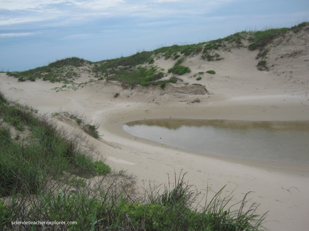
Where wash-over channels are scoured below the water table, the ponds retain brackish water and will not dry completely. Thin algal mats develop around the edges of the ponds and in other moist parts of the inactive channels.
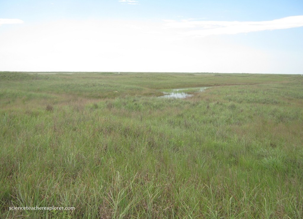
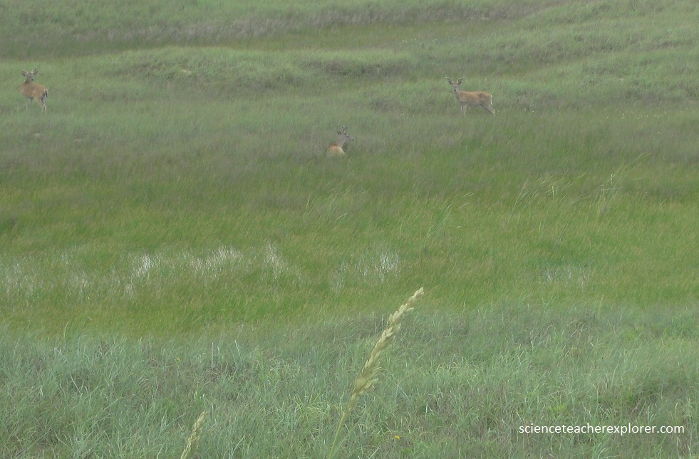
Pictured below, is a heard of deer, taking advantage of the brackish water found within the wash-over ponds and marshes. All wash-overs erode during recent hurricanes, and those most likely to be reactivated during the next large storm, occur where the dune ridge is low and segmented.
Pictured above, these troughs from back-wash originated when the wind blows sand from barren areas during dry spells, deflating (eroding) the areas down to the water-table. The system stabilizes during wetter spells. Alternating wet and dry periods cause a ridge-and-trough topography to develop as troughs are formed successively downwind. The troughs either are stabilized with vegetation or may collect water as do the ponds and marshes seen above. Although these water bodies generally have a short lifespan, some may retain water for several years. Typical marsh plants that inhabit the wet areas include common Cattail, American bulrush, and spike-rushes.
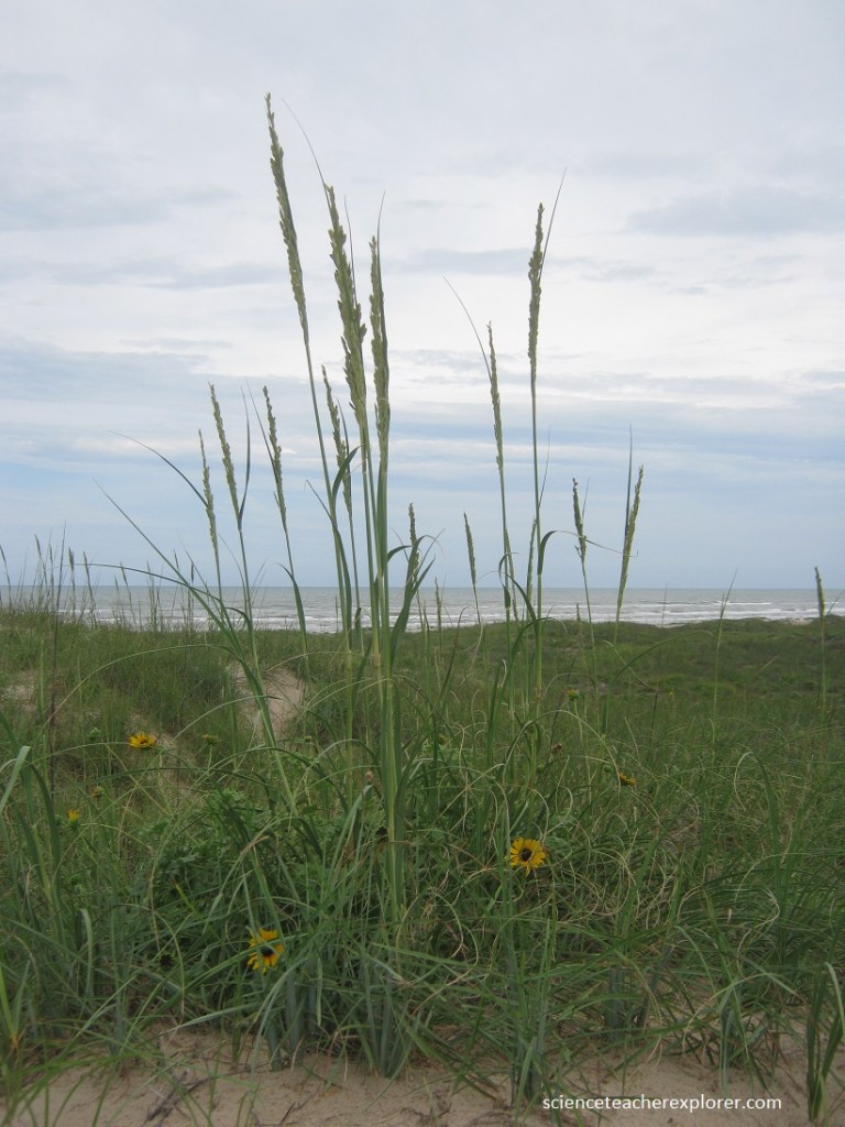
Pictured above and below, this dune ridge protects the barrier island from the full force of hurricane wins and storm surges that strike the Texas cast. Maintenance of a healthy vegetative cover on the dunes is important, as it prevents the sand from blowing inland and leaving gaps in this natural barricade.
Pictured below, I’m standing on within the hummocky, grass-covered stabilized blowout dunes. In the distance remains an active blowout dune that remains barren because of wind and trampling of vegetation by visitors. The dominant southeasterly winds cause the blowout dunes to migrate lagoonward.
Pictured below, the Malaquite beach sediments consist of fine sand with very little shell material. The profile (slope) of Malaquite beach is quite gentle compared with the profiles of some beaches south of here. The beach berm is low, and cusps are broad and widely spaced.