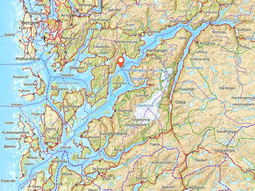
Hardangerfjord, Norway
On June 15th, 2018, I stayed the night in Stavanger, Norway. The next morning, I took a ferry to Bergen and then rented a car to explore the Hardangerfjord region.
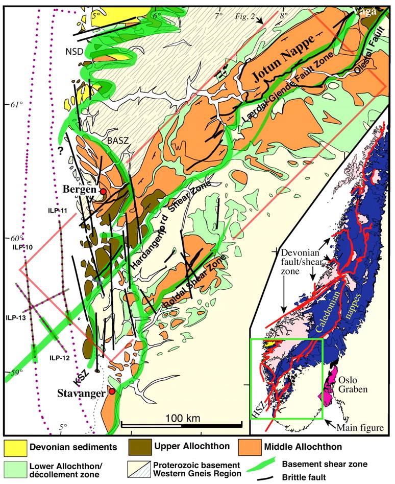
During the Caledonian mountain-building and later, along what is now the Hardangerfjord, the earth’s crust probably collapsed from top to bottom along the Hardangerfjord Shear Zone, a plane that slopes toward the northwest. On the northwest side of this zone, the ground sank down several kilometers, (imaged below).
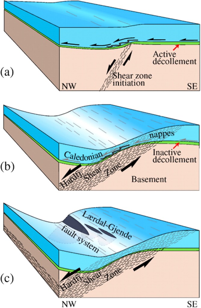
The geological map picture of Hordaland, (imaged below) reflects this movement. On the Folgefonn Peninsula the Precambrian basement was carried all the way to the top, and is even found on tops that are over 1500 meters high. On the northwest side of the Hardangerfjord, however, the basement has most places been buried deep under the Cambro-Silurian phyllite and on top of this by the thrust sheet during the Caledonian mountain building event.
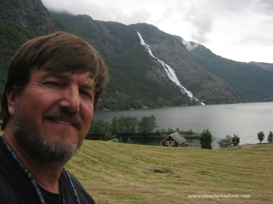
Norway has more than its fair share of highly impressive waterfalls, or fossene, as they are known locally.
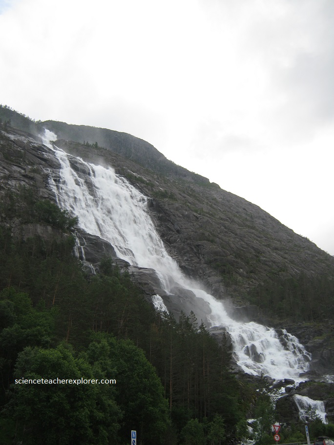
There’s the dramatic but stately Langfossen, (pictured above), and the wild tumble of Latefossen, (pictured below).
Lastly, the magnificent, pastoral elegance of Voringsfossen below the Fossili Hotel, (pictured below).
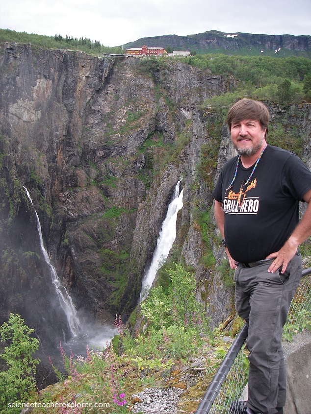
All above waterfalls were near Bergen, Norway facing the Hardanger Fjord.
.
