Canyonlands N.P.; Utah
During the Spring and Summer of 2010, 2008 & 2005, I took, groups of students into the Canyonlands National Park in Southeastern Utah. All of these trips were centered around the exploration of the northern end of Canyonlands National Park (around Island-in-the-Sky district).
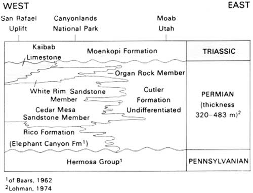
Canyonlands National Park preserves a rugged landscape of colorful sandstones eroded into a showcase of geological wonders. Rivers divide the park into four distinct areas: The Island in the Sky, the Needles, the Maze and the rivers themselves. This webpage focuses on “The Island-in-the-Sky”. “The Island-in-the-Sky” is a 2,000 foot-high mesa overlooking the Green River to the west and the Colorado River to the east. Layers of sedimentary rock are visible down the steep walls of canyons cut from the top of the mesa to the rivers far below, exposing roughly 150 million years of geologic history.
At the beginning, the Canyonlands National Park formed when material was deposited from a variety of sources over hundreds of millennia. Movements in the Earth’s crust altered surface features, and the North American continent slowly migrated north from the equator, changing the environment.
Since early-time; Utah was flooded by shallow inland seas, covered by mudflats, and buried by sand dunes, forming layers of sedimentary rocks. Movements in the Earth’s crust subsequently caused the area to rise. The Colorado and Green rivers then began to cut deep canyons which were filled with sediment, eroding the landscape into a labyrinth of tributary canyons and washes that mark the recent landscape.
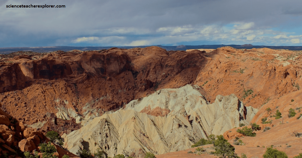
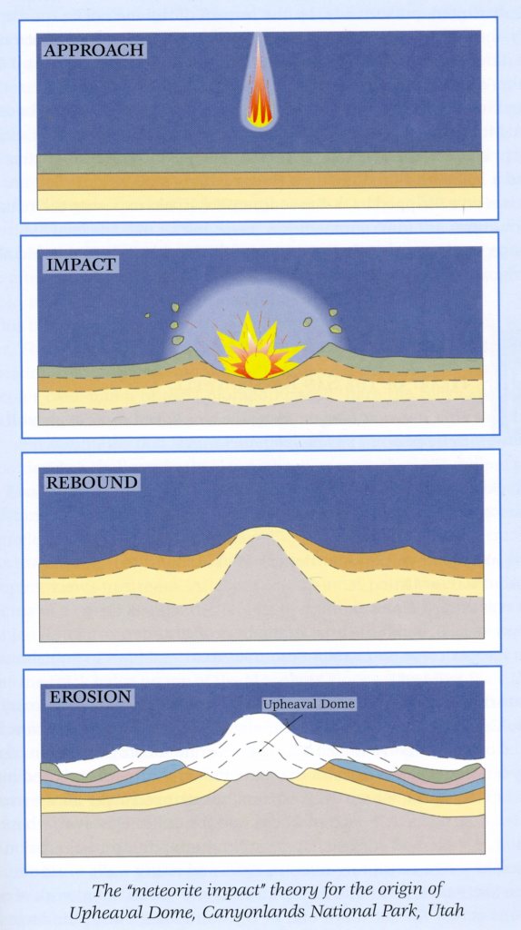
Pictured above, The “Upheaval Dome” in Canyonlands National Park, is a colorful circular “structure,” unique among the broad mesas and deep canyons of the Colorado Plateau, (it looks like a crater). The rim of Upheaval Dome is 4.5 km across and over 330 m above the core floor. The central peak in the core is 1000 m in diameter and rises 250 m from the floor. The core consists of the oldest rock formations at Upheaval Dome. The Organ Rock Shale and White Rim Sandstone of the Permian Cutler Group, and Triassic Moenkopi Formation were injected and pushed upward in a chaotic jumble. The Triassic Chinle Formation, Triassic-Jurassic Wingate Sandstone, and Jurassic Kayenta Formation and Navajo Sandstone are stacked, oldest to youngest, from the core to the rim. In 2007, German scientists Elmar Buchner and Thomas Kenkmann reported finding quartz crystals that were “shocked” by the high pressure of a meteorite impact.
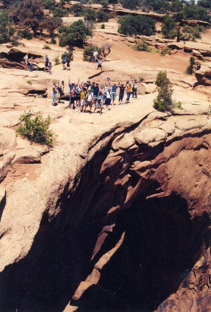
After exploring the Island-in-the-Sky district, my touring group chose to rent bikes and ride the Gemini Trails road for a couple of hours. Even though, the road is not part of the National Park, it still has many of the same scenic views.
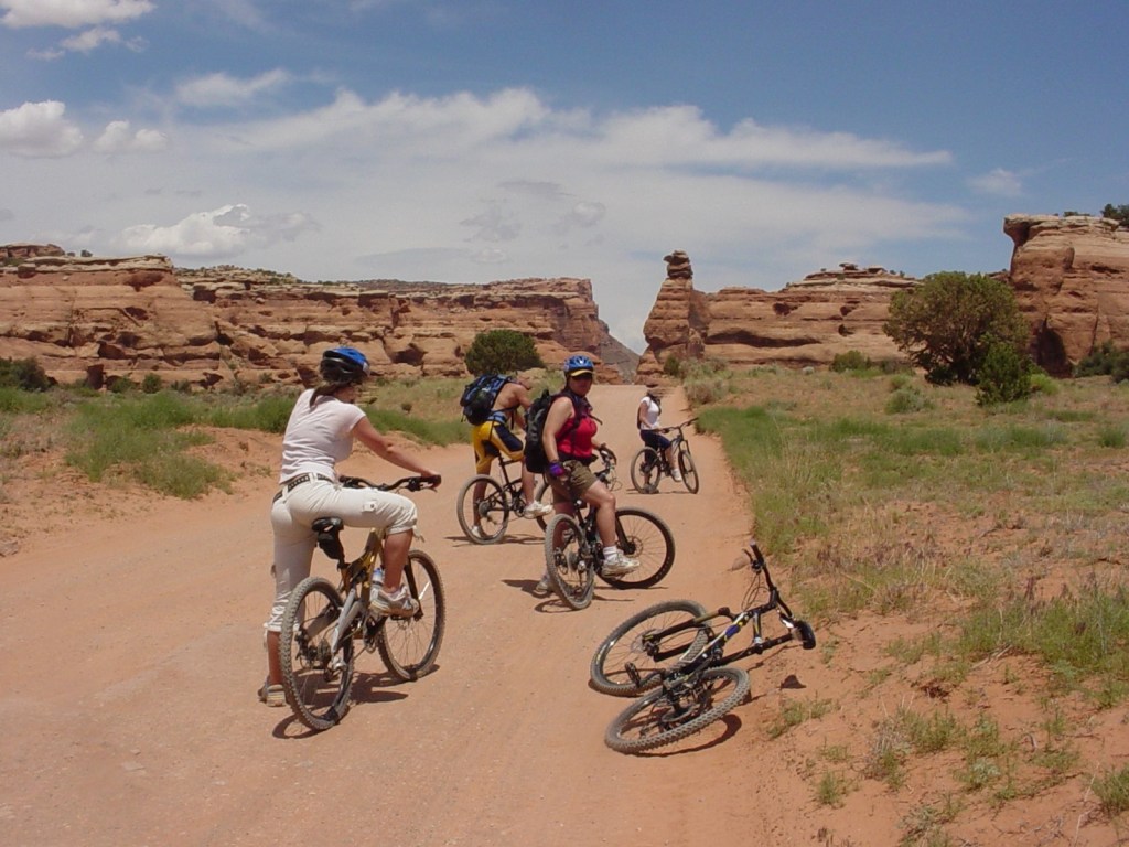
The Gemini Arches are side by side alcove stone archways that have long been one of the most popular stops amongst Moab visitors that have a passion for mountain biking.
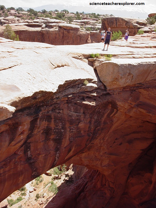
Pictured above, the dimensions of these arches make them impressive as much as their stone aesthetics. The greater arch at the Gemini bridge east measures 30 m, while the greater arch at the west bridge measures 23 meters. From the road, you can only view them from the top.
After lunch, and returning the bike rentals, I decided to take my group into the heart of Canyonlands National Park by driving the vans up Shafer’s Trail. To get there, from Moab, Utah we headed north on Highway 191. Then, we turned left on Potash Road\ Highway 279. We continued south on this road for about 25 km until the pavement ended. That is where the 4WD Shafer trail/road started. Shafer Trail Road-Shafer Canyon Road is a 26 km dangerous dirt track into the Canyonlands National Park Gate.
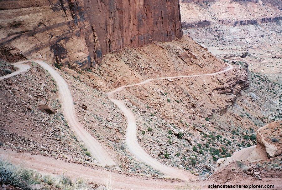
Pictured above, Tthe Shafer Trail road was originally built by uranium miners to transport ore extracted from the Triassic Chinle Formation during the middle part of the twentieth century. The mining road followed the path of a large natural rock-fall that buried part of the typically cliff-forming Wingate Sandstone.
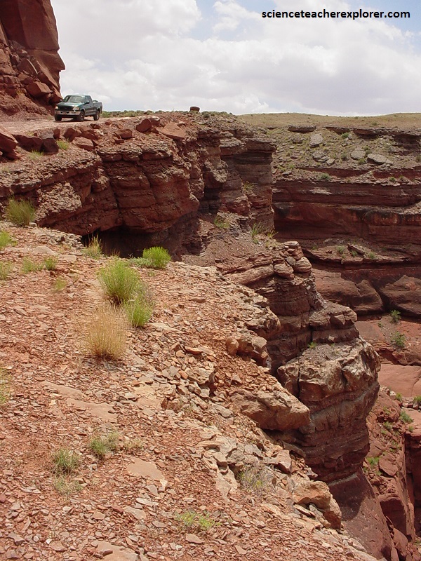
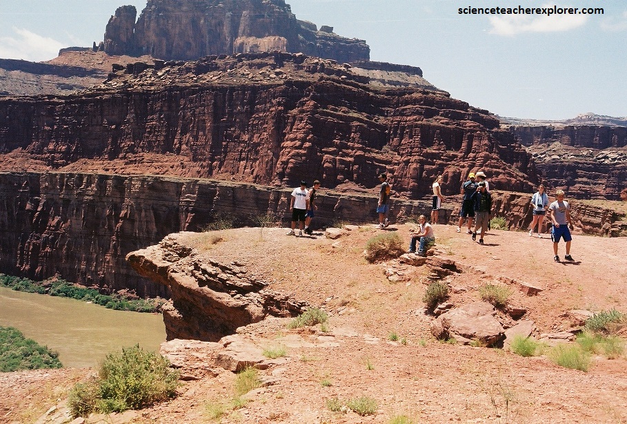
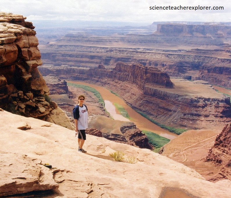
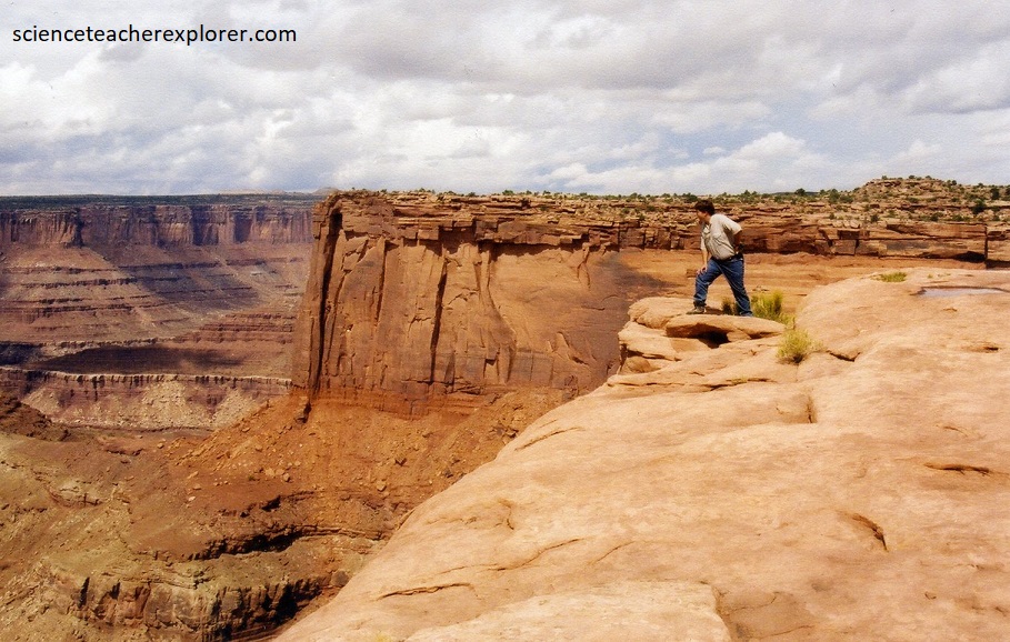
The Shafer Trail provides access to the White Rim Trail as well as other areas in the park and is perhaps one of the most challenging journeys through the park. Although the road has been greatly improved by the National Park Service, the Shafer Trail is still extremely steep and it travels along the tops of sheer cliffs, (pictured above and below).
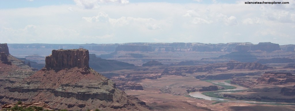
Above us looking down on the Colorado River, is the lookout point for “Dead Horse State Park”. It towers over us an additional 600 m above us and the surrounding plateau.
The legend of “Dead Horse Point” is that the local ranchers killed a large number of wild mustang horses at the top.
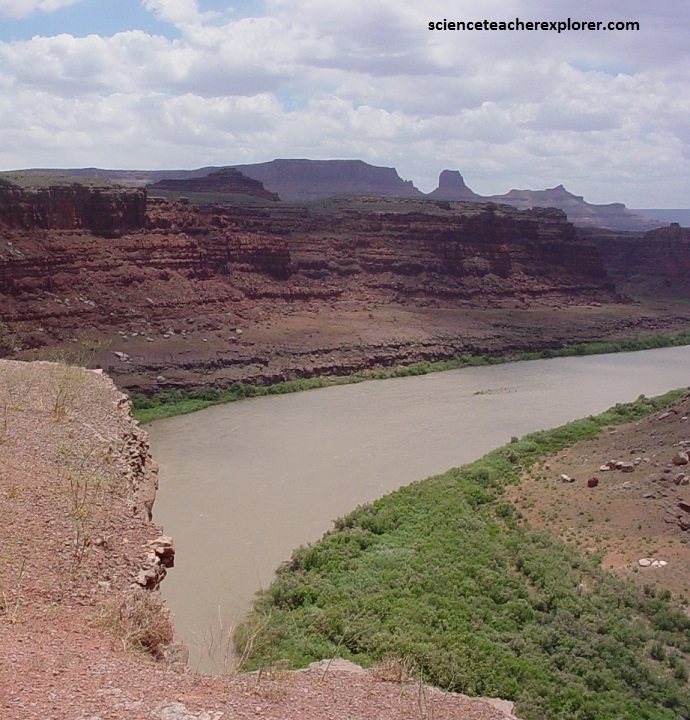
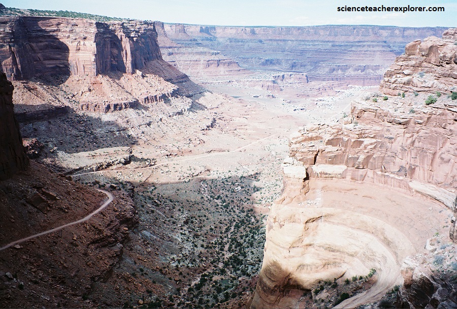
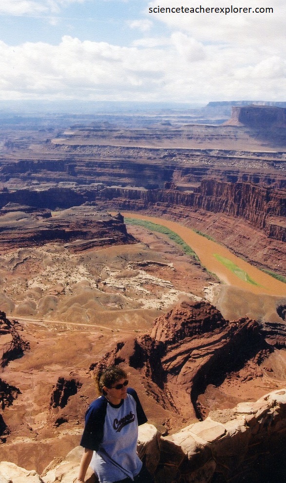
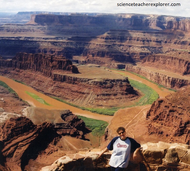
Looking south, provides a magnificent panorama of nearby Canyonlands National Park, where canyon erosion has occurred on a grand scale.
Pictured above, the spires and bluffs in the distant landscape are all the product of 150 million years of slow erosion by the Colorado River, which meanders in a big gooseneck directly below.
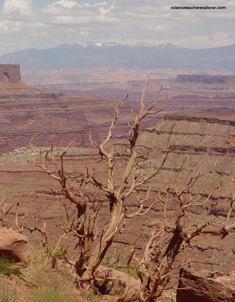
The layers of rock that is seen here, were originally deposited by wind and as sediments in streams, rivers and seas. The erosional processes that carved these intricate canyons are gravity, the river, wind, moisture, and the freezing and thawing action of water. The hardness of the layer of rock determines if it forms a cliff or slope.
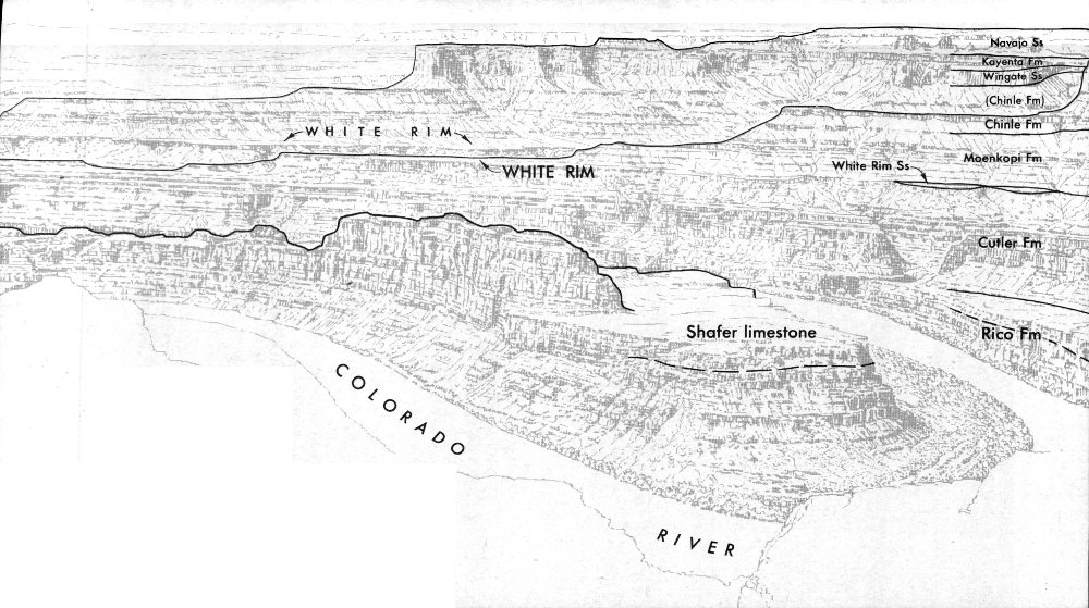
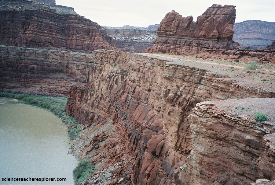
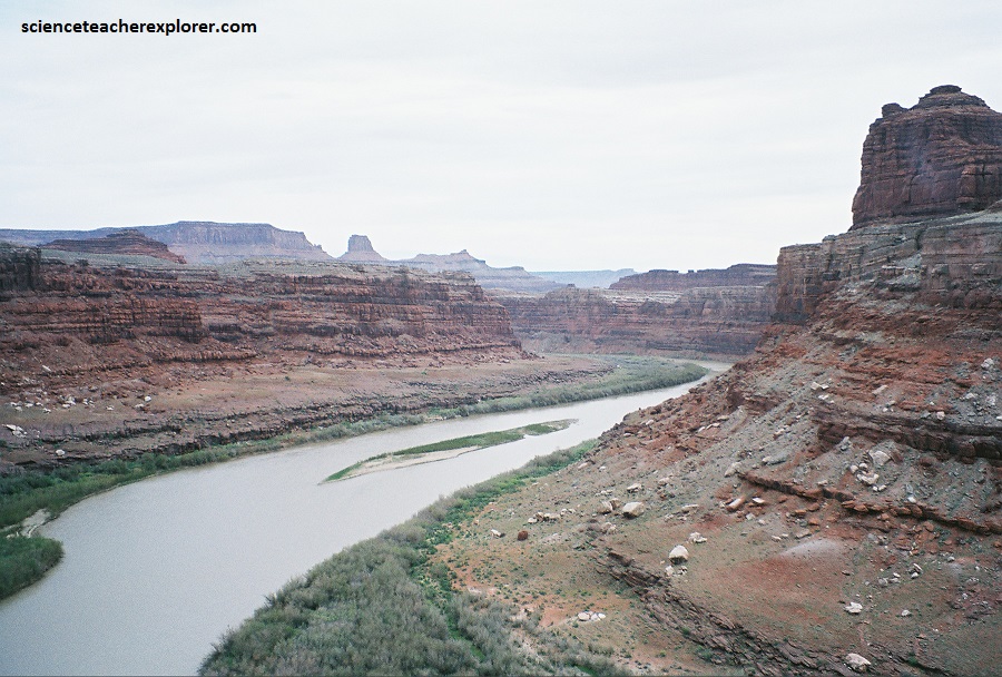
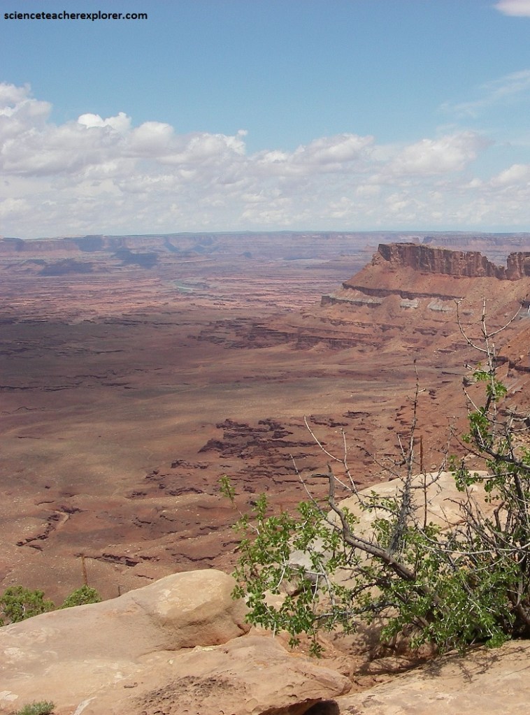
Pictured above, the Shafer Trail connects with the White Rim Trail, which, as the name suggests, is built mainly on the White Rim, after which the White Rim Sandstone was named. The White Rim Trail can be followed northeastward to join the pavement at Potash, or it can be followed southward along the Colorado River canyons to Junction Butte, thence northward along Stillwater and Labyrinth Canyons of the Green River to and beyond the northern boundary of the park.
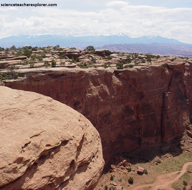
Pictured below is along the “Neck”, before we meet the new entrance to the park. Navajo Sandstone is above road at left, Kayenta Formation forms upper half of cliff below road, and Wingate Sandstone forms lower, vertical half of cliff; lower part of road is in Chinle Formation.
Cliff-walled canyon to right of The Neck, in middle, drains westward to the Green River; south fork of Shafer Canyon to left drains eastward to Colorado River. This is the narrowest part of Island in the Sky.
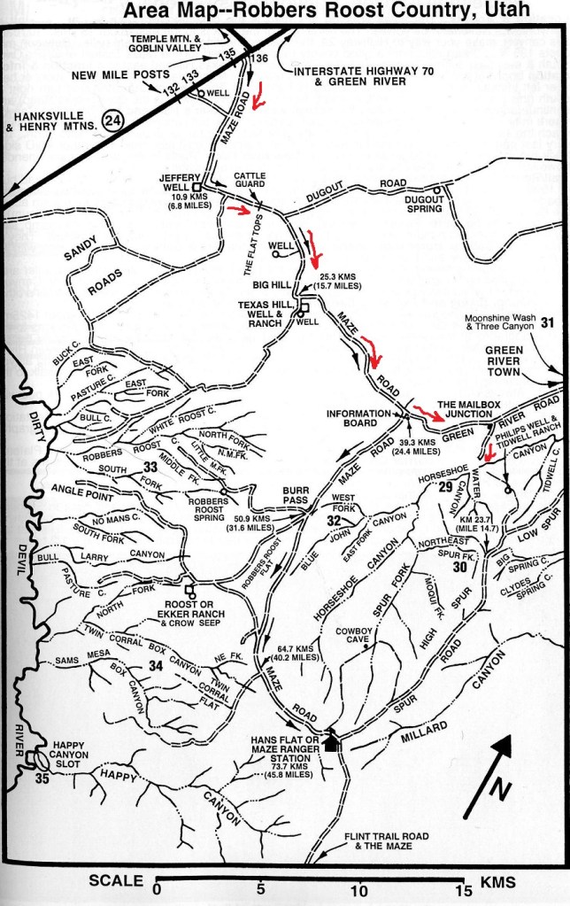
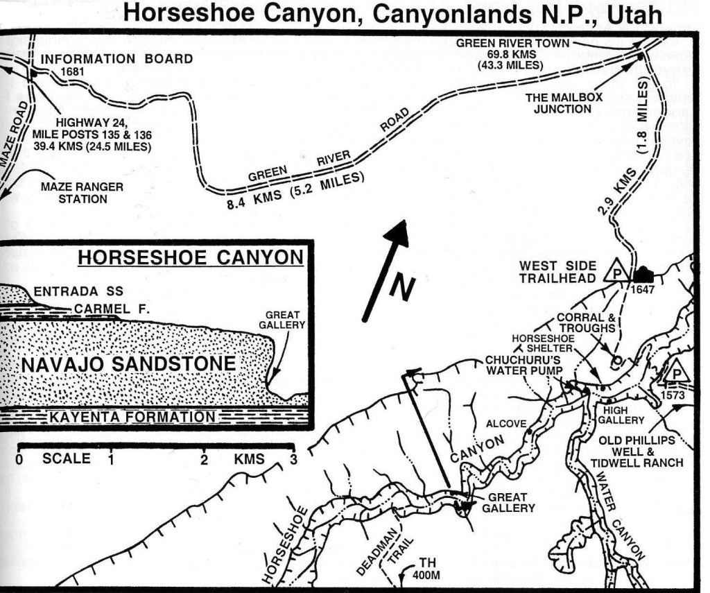
A western-offshoot of the Canyonlands National Park, is Horseshoe Canyon. I trekked it with an ex-student, (Richard Fillerup), in the Fall of 1999. To explore it from the eastern side of the park, drive north on US-191, then west on I-70 to UT-24 for 72 km. From I-70 on UT-24, drive 40 km. One kilometer beyond the turnoff to Goblin Valley State Park, turn left on a graveled road towards the east for Roost Flats and Hans Flat Ranger Station. After 39 km, turn left at the fork to Horseshoe Canyon. Another 8.2 km, is another smaller dirt road that turns right to the Horseshoe Canyon Trailhead. Follow this road for 2.9 km & park.
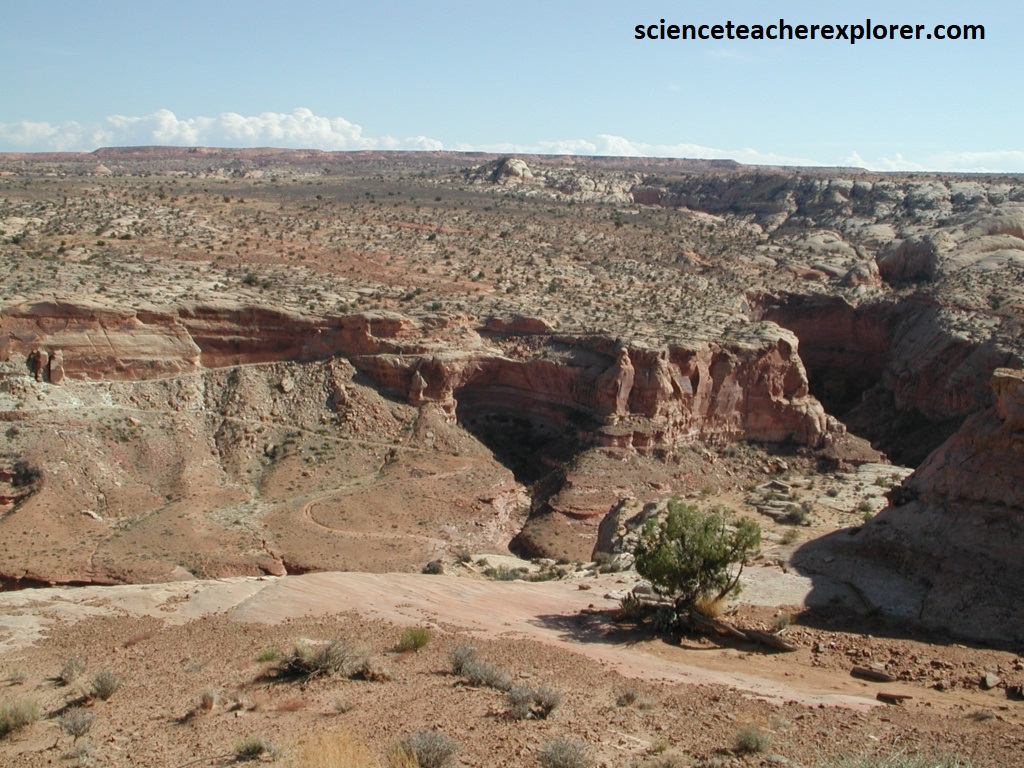
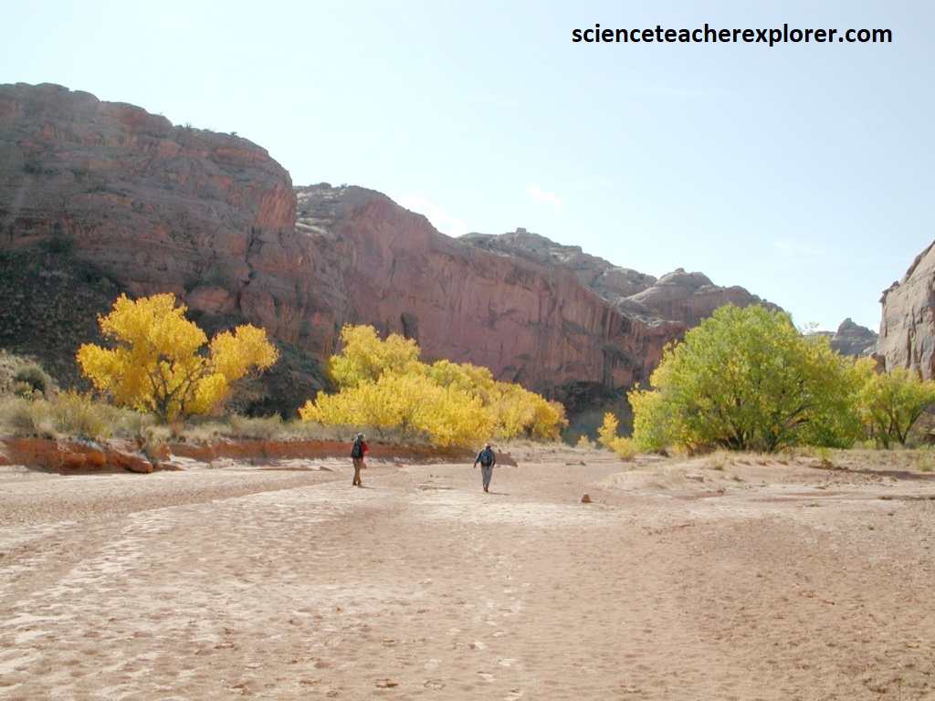
From the parking lot, trek west and descend into the canyon. The trail is made on slickrock with rock cairns. Inside the canyon, a vague trail winds along the bottom of the sandy was wash, towards the southwest. There is an intermittent water in the canyon, but it is usually stagnant.
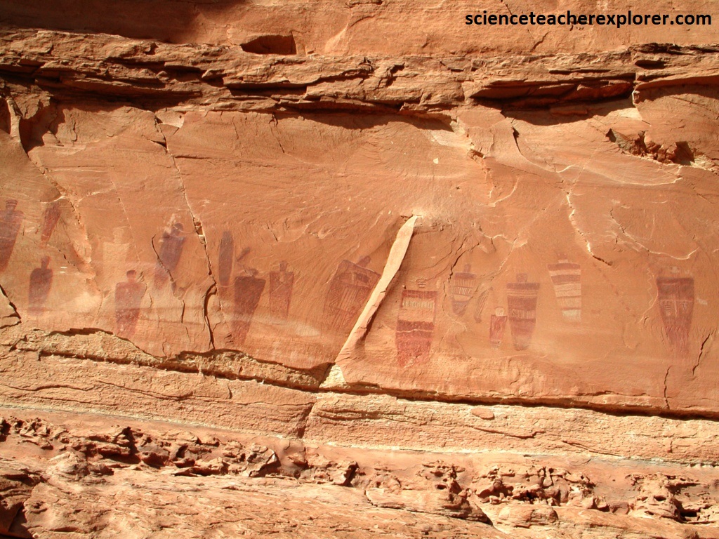
Horseshoe Canyon contains what is probably the finest display of prehistoric Native rock art in the United States. As Richard and I dropped into the canyon, we could see a jeep road descending from the opposite rim. To the right of that, Water Canyon, (pictured below).
As we approached Water Canyon on the left, we found the first two pictograph sites, one on each side of the canyon. These site were painted between 2,000 and 8,000 years ago.
Trekking up the Horseshoe Canyon for about 3 km from the bottom, we came upon the Great Gallery. This display of rock art had ben called the Louvre of the Southwest, and indeed, it is a phenomenal relic of the past. Dozens of intricate human and animal figures decorate the panel, mostly in red, with some brown and white. The pigments were made from finely ground minerals, and then mixed with a liquid base, perhaps animal tallow or vegetable juices, to form a crude paint. After thousands of years all traces of the base have disappeared, but the mineral coloring still adheres to the rock and the paintings remain preserved in astonishing detail.
The Great Gallery pictograph panel in Horseshoe Canyon of the Canyonlands National Park in 1999.
The famous Great Gallery, largest of several Horseshoe Canyon sites, is 67m long, and 5m high, and contains dozens of intriguing red, brown, and white pictographs. Rock art s notoriously difficult to date accurately, but from the style we can be reasonably certain that the work was done by the so called Archaic People who lived in the area before the arrival of the Anasazi or Ancient Pueblos and Fremont Native cultures. Archaic clay figurines that closely mimic the pictographs have been found about 14.5 km away in Spur Fork, a tributary of Horseshoe Canyon, and the figurines have been dated to about 4700 B.C.
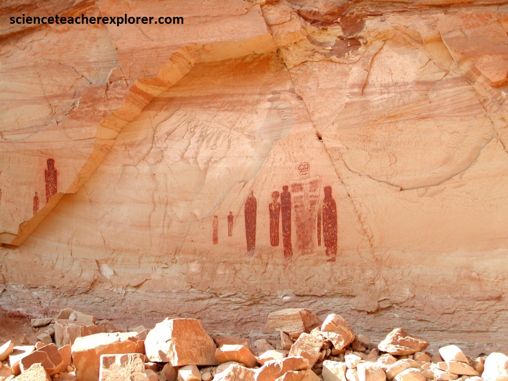
For years archaeologists have struggled to interpret the strange anthromorphs that are depicted on the Great Gallery. In addition to many smaller figures, the huge panel contains about 20 life size human shapes, all of which have a strange mummy-like appearance. They lack arms or legs, and often have huge insect-like eyes and bucket-shaped heads. Most intriguing of all is the figure known as the “Holy Ghost”. This 2.3m high painting stands out among the others because of it’s size and its ethereal appearance. Perhaps it was intended to portray a revered ancestor, or a mythical deity, (pictured above).
