Valley of Fire S.P., NV
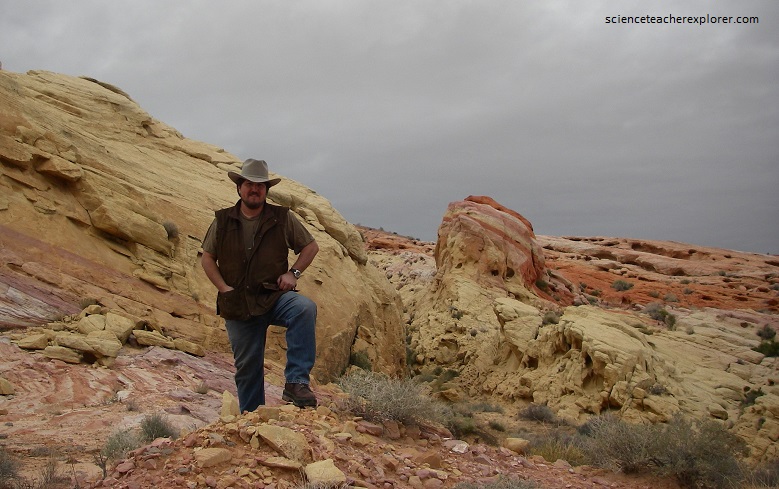
In December of 2006, I was the guide for a University of Utah Natural History Museum tour to Death Valley National Park. On our way there, we camped for the night at the Valley of Fire State Park, Nevada, (Atlatl campground).
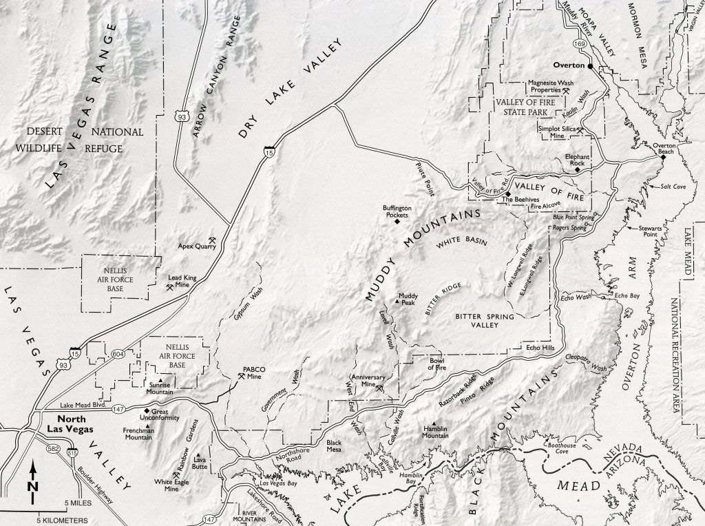
Valley of Fire State Park is 72 km northeast of Las Vegas on I-15 on exit 75. From there, the road crosses an expanse of dry desert of 11 km before crossing a slight rise that marks the California Wash Fault. After crossing the fault, the road passes into Paleozoic rocks of two different Sevier thrust sheets. From the west entry station to east of the visitors’ center, the road parallels the Valley of Fire Wash, which has carved the valley along the axis of an anticline.
Exposed in the core of the anticline are the easily eroded mudstones, siltstones and sandstones of the Triassic Moenkopi, Chinle, Moenave, and Kayenta Formations. The more resistant, younger Jurassic Aztec Sandstone is preserved on both side of the anticline, as are the very resistant limestones to the south of the valley.
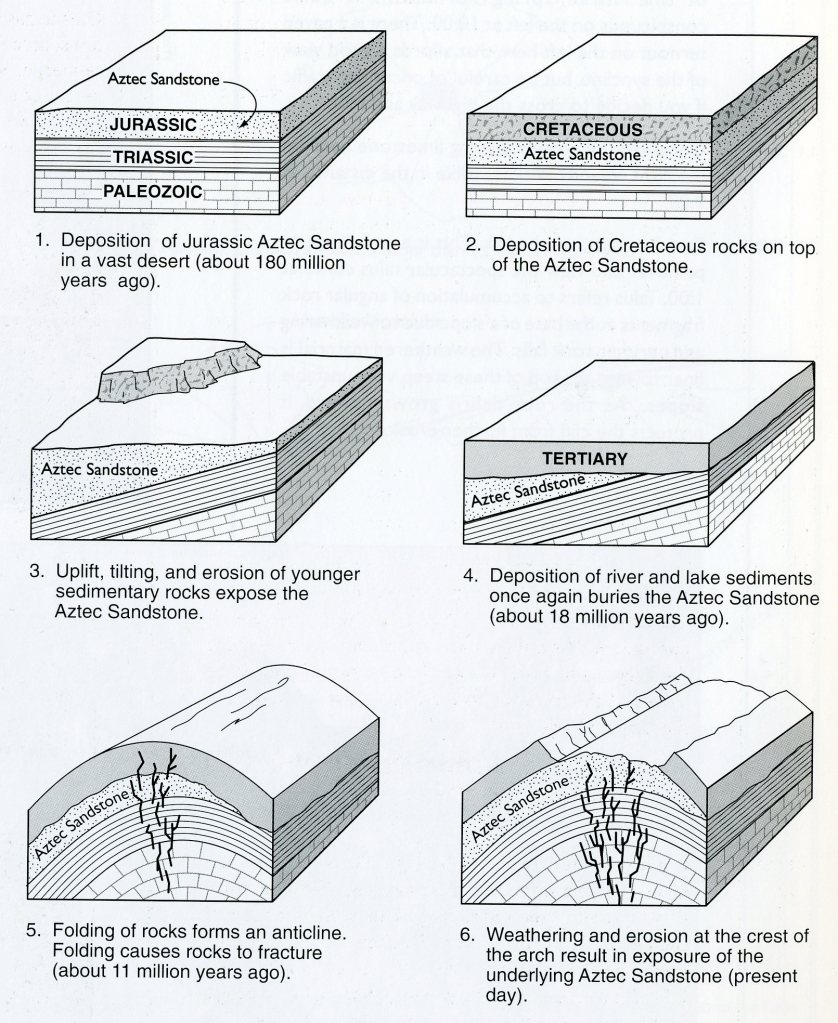
In Jurassic time, when the region lay within 10 degrees of the equator, the sand for the Aztec Sandstone was transported to its current position by extensional Basin and Range faulting. Pictured below, the Aztec Sandstone is composed of well-rounded grains of almost pure quartz sand with no clay or silt. A prominent feature of the sandstone exposures is the crossbedding, which forms when the wind shifts directions. As the dune field got buried by successive layers of sand, the grains of sand gradually cemented together into hard sandstone.
The color the the sandstone is attributed to minerals, particularly re iron oxide (hematite) and hydroxide that coated the grains during deposition and to some extent sulfides, and to the remobilization of minerals as groundwater moved through the rock during and after the sand solidified into rock.
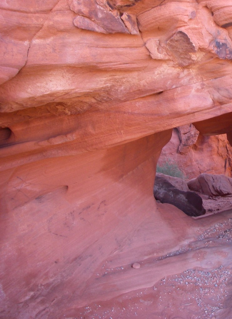
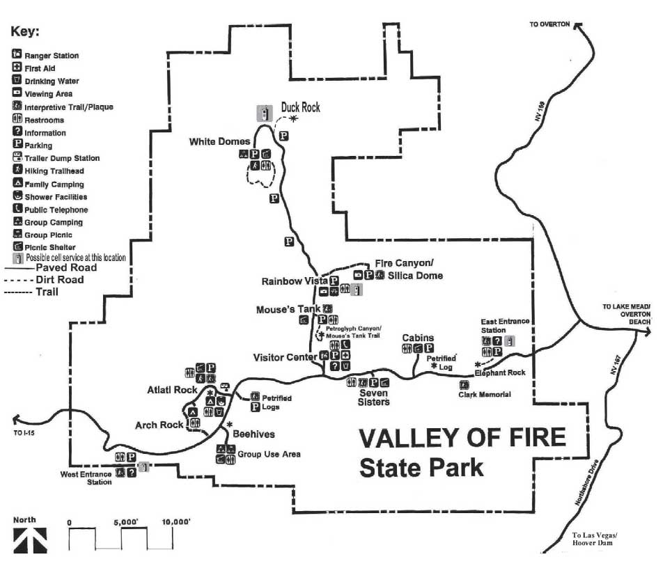
Most of the points of interest in the park are in the Aztec Sandstone to the north of the Valley of Fire Road. Pictured above, the sandstone mass is crisscrossed by joints and faults, along which erosion has created crevices, passageways, and drainages and lots of nooks and crannies.
3.2 kilometers into the park is a turnoff to the north for Atlatl rock, know for its petroglyphs, which were carved into the desert varnish on the sandstone by early peoples who lived in the area about 3,000 years ago.
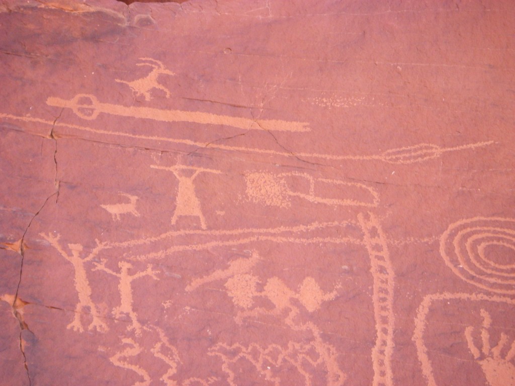
Pictured above and below, rock varnish, composed of clay minerals colored dark brown to black by oxide of manganese and iron, forms most commonly on hard, silica-rich rocks. The longer these rocks are exposed on a desert land surface, the darker they become. Pictured above and below, rock varnished surfaces provided an ideal billboard for early American Natives to scratch out messages and artistic expressions, and these rock pictures (petroglyphs) have been left for us to see on darkened rock exposures throughout the southwest.
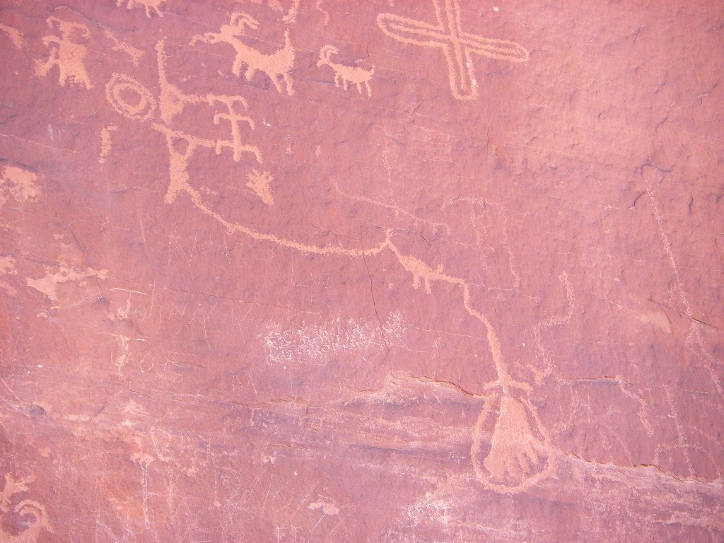
In studying this ancient rock art, researchers have found that some petroglyphs have become re-varnished in time, and new petroglyphs have been scratched over older ones. From these relationships, they have determined that it takes about 2,000 years for the darker coatings to form in a hot, arid environment.
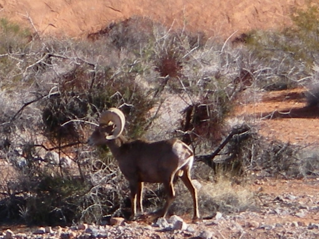
Pictured above, The desert bighorn sheep (Ovis canadensis nelsoni) is a subspecies of regular bighorn sheep. Desert bighorn sheep are stocky, heavy-bodied sheep. Weights of mature rams range from 52 to 127 kg, while ewes are somewhat smaller. Due to their unique concave elastic hooves, bighorn are able to climb the steep, rocky terrain of the desert mountains with speed and agility. The desert bighorn has become well adapted to living in the desert heat and cold and, unlike most mammals, their body temperature can safely fluctuate several degrees. They are adapted to a desert mountain environment with little or no permanent water. Some may go without visiting water for weeks or months, sustaining their body moisture from food and from rainwater collected in temporary rock pools. They may have the ability to lose up to 30% of their body weight and still survive.
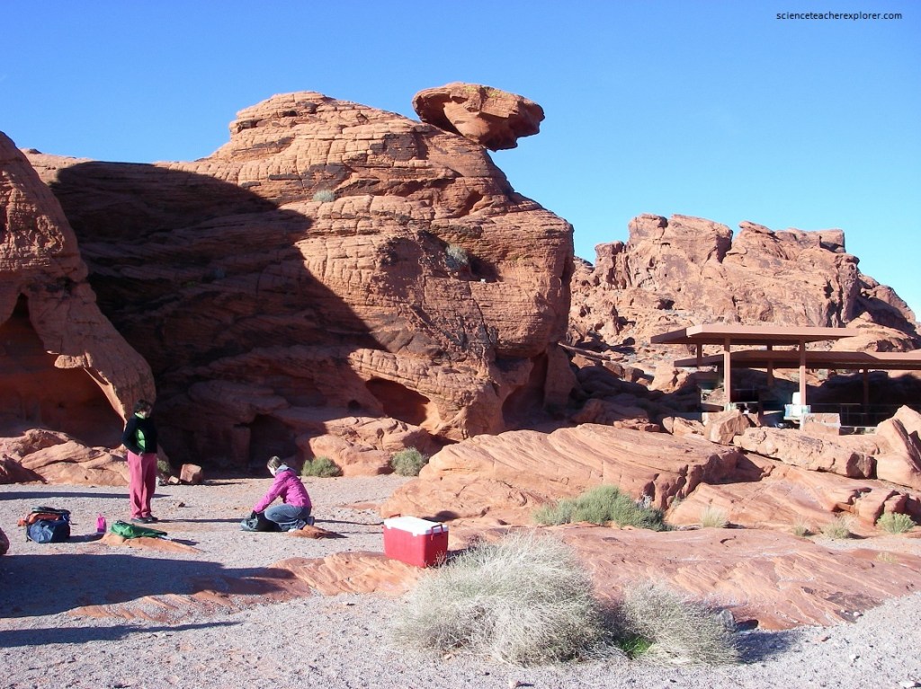
From the visitors’ center, which is constructed on the Moenave and Kayenta Formation, the Triassic age, a side road proceeds northward, through the Aztec cliffs, to an area know as the “White Domes”, (pictured above). As the road climbs out of the valley, halfway up the hill it crosses the contact between the Moenave and Kayenta rocks, which are dipping about 25 degrees to the north, and the base of the Aztec Sandstone. The offset of this coloration change is the basis for deducing that about 168 meters of left-lateral slip has occurred on the Mouse’s Tank fault.
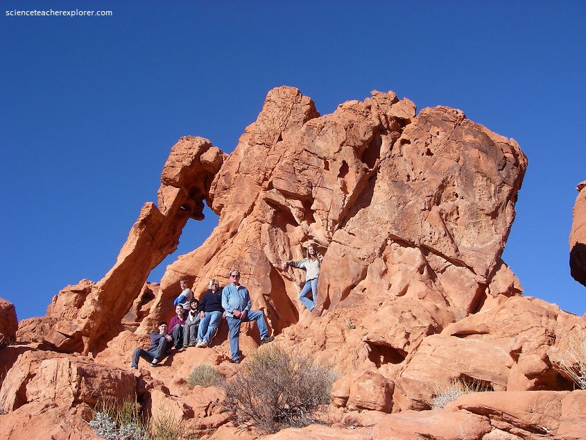
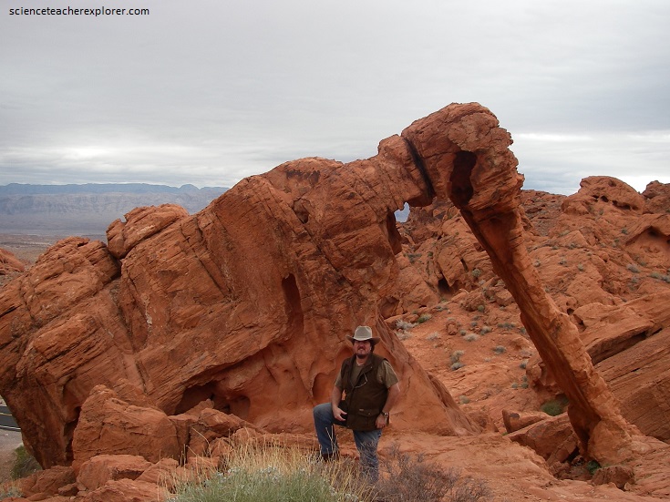
Heading east from the visitors’ center on the main road, the sandstone cliffs to the north of the road in the vicinity of the Cabins recede sharply to the northeast, reflecting offset along a fault, and the road continues through Triassic Moenkopi, overlain by the Chinle, and then the Moenave and Kayenta, up to the bas of the Aztec Sandstone at “Elephant Rock”, (pictured below).
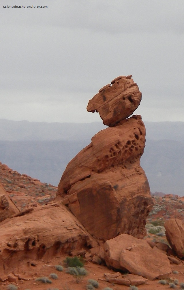
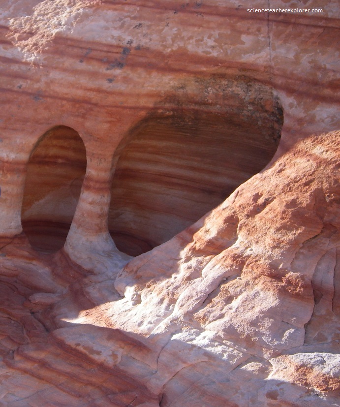
The entry station on the east side of Elephant Rock is in the Moenave and Kayenta, which is in fault contact with the sandstone to the west. A characteristic of Aztec Sandstone outcrops is the occurrence of numerous holes in the rock that impart an appearance of Swiss cheese. Some parts of the rocks are more tightly and completely cemented. These parts are more resistant to weathering and erosion than other parts. The incompletely or poorly cemented areas are more vulnerable to weathering and erosion processes and therefore wear away more readily creating the conspicuous holes in the sandstone. This process is called differential weathering.
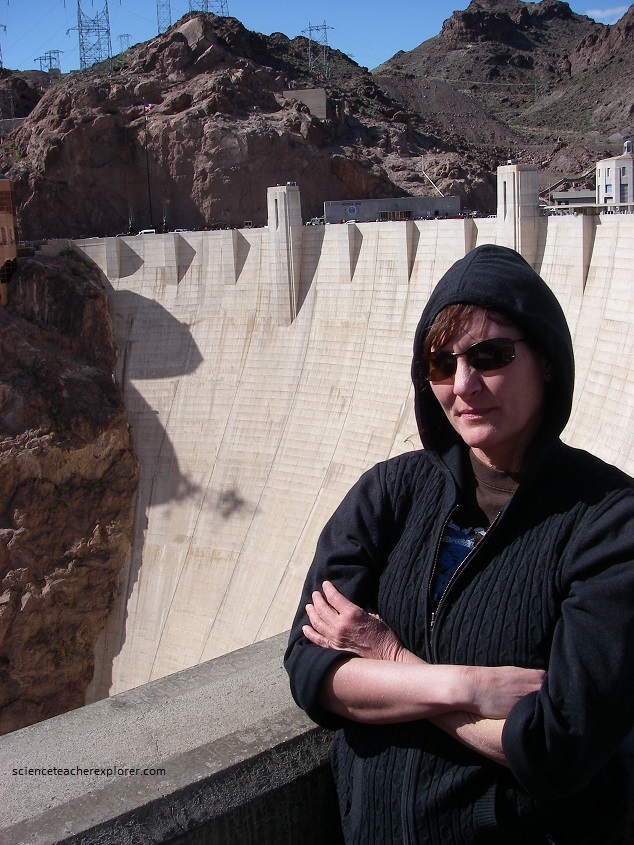
While in the area, I took the group to Hoover Dam on SR 147, Northshore Road, Lakeshore Road, and US 93 (pictured below).
Meanwhile we made a stop at the bridge over Las Vegas Wash (pictured below). Lower Las Vegas Wash drains the entire Las Vegas Valley and has done so since early Pleistocene time (about 1.8 million years ago). Looking upstream, the exposed sediments reveal a complex story of deposition and erosion extending back in time several million years. The most conspicuous unit exposed in the wash is the coarse gravel name the conglomerate of Las Vegas Wash. It was deposited in a fast-moving stream with a steeper gradient that today as indicated by the size of the cobbles and the layering of the beds. [About 8,000 years ago, the SW United Sates experienced a great change in climate, and winter precipitation was drastically reduced. The wet climate of the late Pleistocene began changing from the wet deposition climate to the arid erosive climate that exists today.]
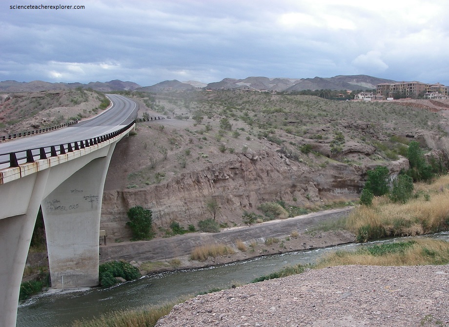
Pictured above, since the 1960s, the stream has been out of equilibrium. With every major flood, the stream deepens and lengthens its channel upstream toward Las Vegas. This is called head-ward erosion. The destruction of manmade structures and natural habitats could occur and cost millions of dollars, repairing bridges and culverts.
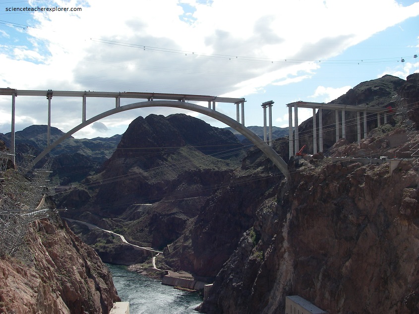
Hoover Dam, constructed across the Black Canyon of the Colorado River in the early 1930s, impounds Lake Mead, the largest reservoir in the United States. US 93 used to cross over the dam, but it now spans the Black Canyon 1 kilometer downstream on a bridge completed in 2012. The old US 93 provides public access to the dam and to the walkway on the new bridge from the Nevada side.
Pictured above, the dam access road winds along the base of dacite cliffs, oxidized to reddish brown, along a fault that separates the dacite from the Boulder City pluton to the south of the road. The craggy cliffs between the overlook and the dam are the Tuff of Hoover Dam and other units of the Black Canyon volcanic assemblage. The massive, 13.9 million year old Tuff of Hoover Dam, (a poorly to moderately welded ash-flow tuff with abundant rock fragments), is exposed throughout the area of the picture. The tuff is 200 m thick at the dam and thins quickly in all directions, leading to the conclusion that the source of the tuff is in the immediate vicinity of the dam.
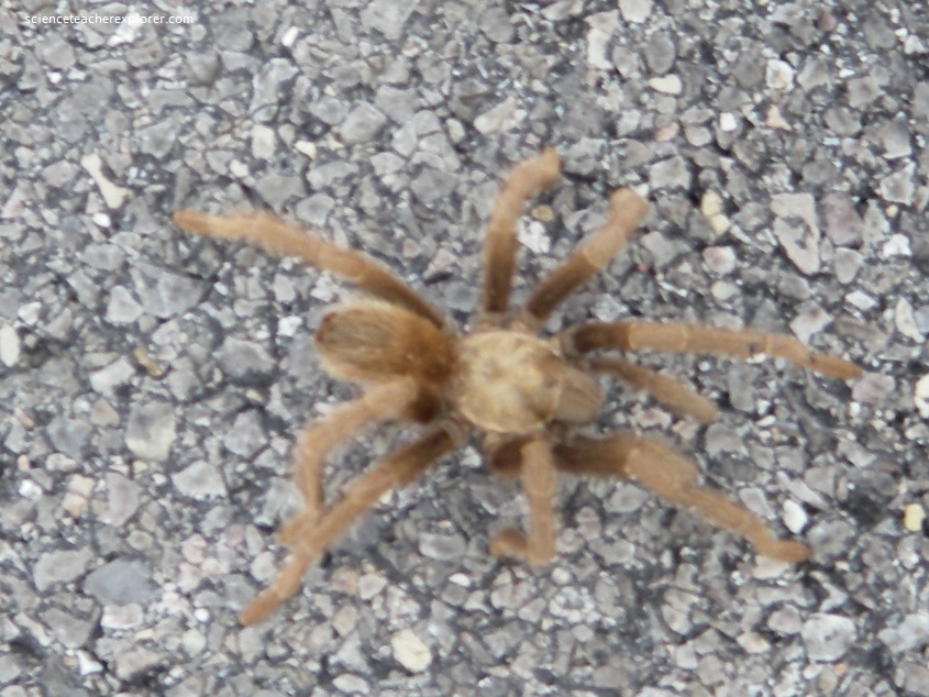
Pictured above, we found a Desert Tarantulas (Aphonopelma iodius; Family Theraphasidae) on the road near Hoover Dam. They are large, interesting spiders that are common in the desert around Las Vegas. They eat insects, other spiders, small lizards, and probably anything else they can catch. Desert Tarantulas live to an age of about 3 years. Females are uniformly tan in color. Males have black legs, a brownish cephalothorax with a dark triangle around the eyes, and a reddish abdomen. Both sexes are covered with hairs. This one looks like a female. Females are more sedentary and wait in their burrows a suitable male to arrive. Females can live for about 20 years.
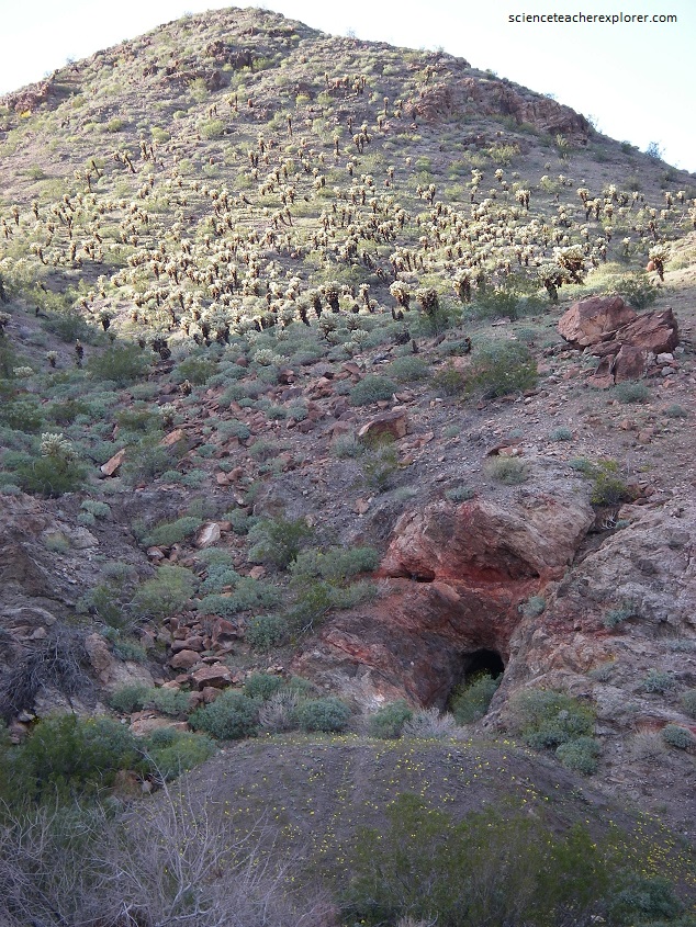
After visiting Hoover dam, we decided to take a side trip to Nelson, Nevada. To get there from Hoover dam was to go west on US 93 (30 km), then south on US 95 (20 km) and finally southwest on SR 165 for 20 km. Nelson is the center of the Eldorado mining district, one of the oldest mining districts in Nevada. Pictured above, the Techatticup Mine was discovered in 1861. The mine was responsible for over half of the total production of the Eldorado district. Most of the 4.8 km of underground workings are along the Techatticup and Savage vein, which crop out near the top of the rugged hills to the south. Further down the road (SR165), we crossed the Eldorado fault, passing from volcanic rocks (to the west) into Precambrian metamorphic rocks to the east. The Precambrian rocks were fairly easy to distinguish because they are greenish and weather to form rounded, subdued outcrops, and because here they are fairly uniformly dotted with teddy bear cholla.
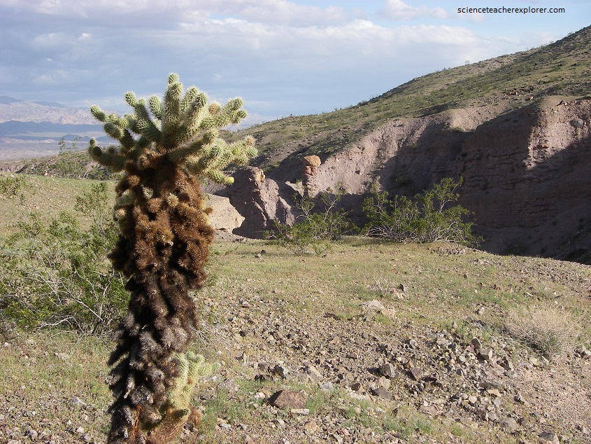
Pictured above, from a distance the teddy-bear cholla (Opuntia bigelovil) resembles its namesake. A closer look reveals that its jointed stems are densely covered with backward-hooked spines 2.5 cm long. At the slightest encounter the stems detach and embed themselves in the passerby. The spines provide both protection and a means of propagation for the cholla. When the offending stems are eventually dislodged and fall to the ground, they easily root and produce a new plant.
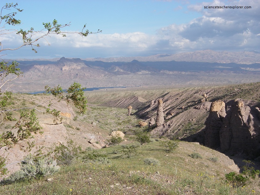
Pictured above, conglomerates representing debris shed in alluvial fans from the Eldorado Mountains are banked against Precambrian bedrock to the south of the road. For perhaps tens of thousands of years during the wetter Pleistocene epoch (1.8 million to 10,000 years before present), boulders, gravel, and sand were deposited here as muddy debris flow. Note the beautifully developed erosional spires (known as “hoodoos”) in the gravels of Techatticup Wash. Actually, flash floods and accompanying mud and debris flows are common in desert regions, and Nelson’s Landing was destroyed by such an occurrence in October 1974. Nine people died. The floodwater reached a maximum depth of 10 meters at the narrowest point in the channel (about 13 meter wide) and carried mostly gravel-sized debris and a few boulders up to a meter in diameter. This rock debris formed deposits at least 4 meters thick at the of the canyon. Most of the town Nelson’s Landing was carried into Lake Mohave.
After exploring the Lake Mead National Recreation Area, Becky and I returned to Las Vegas to stay the night. The next morning, we had an appointment to try out the new “Indoor Skydiving” wind-tunnel. This was an opportunity to show my students on video on how to create an equilibrium state of forces with air resistance. I was able to participate with a small girl, to compare our weights with the force of air pushing us up into a levitation. Notice the difference in the fan speeds with the little girl at 80 lbs and me at 220 lbs. The higher the fan-motor pitch, the faster the wind speed. Enjoy the video below:
