Nasca, Peru 2014
At the end of June, 2014; Kathy Stoker (an educator & trekking buddy) and I was exploring & driving across Peru. We made a stop at Nasca, Peru.
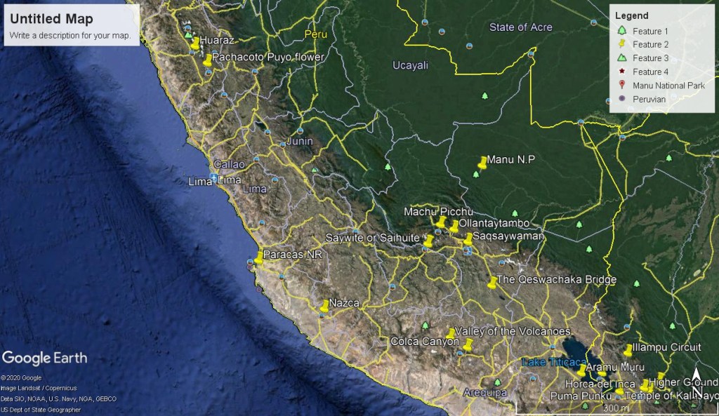
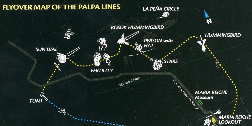
The main reason we decided to stop in Nasca was to investigate and explore the infamous “Nasca Lines”. The Nazca Lines are a group of very large geoglyphs formed by depressions or shallow incisions made in the soil of the Nazca Desert in southern Peru. Most lines run straight across the landscape, but there are also figurative designs of animals and plants, made up of lines.
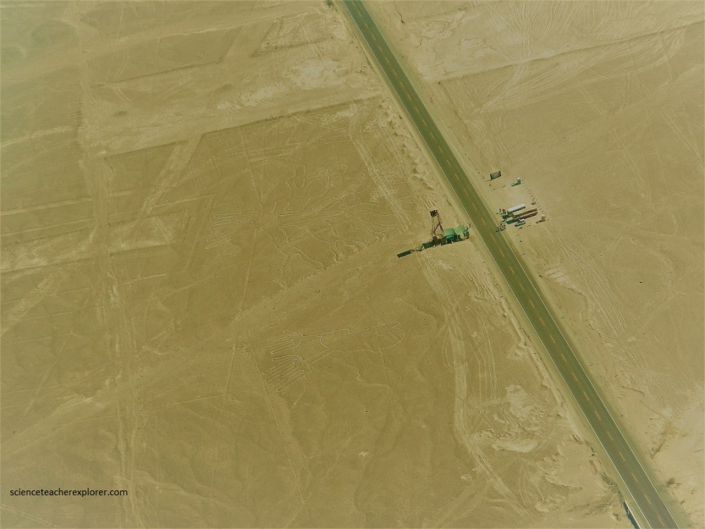
Many of the Nazca lines form shapes that are best seen from the air (500 m), though they are visible from the surrounding foothills and other high places. So, Kathy and I booked an airplane, (pictured below).

Because of its isolation and the dry, windless, stable climate of the plateau, the lines have mostly been preserved naturally. Extremely rare changes in weather may temporarily alter the general designs. However, modern humans may do the greatest damage.
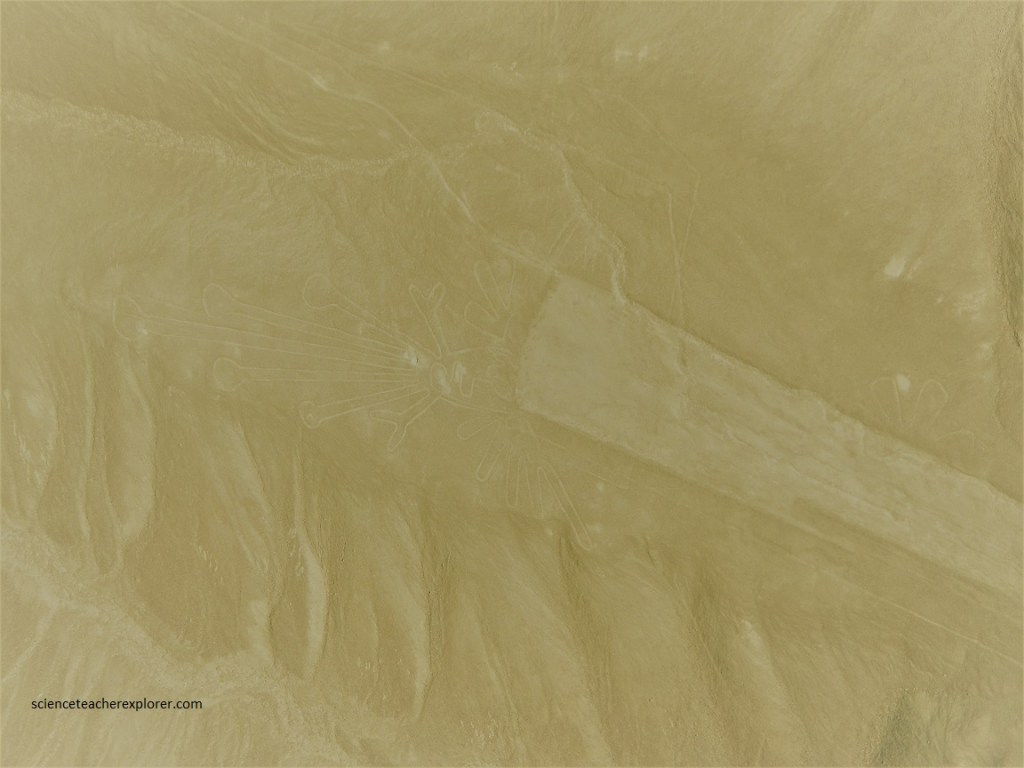
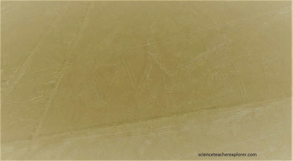
While in the airplane, I used a brown-tinted filter to allow easier viewing of the figures. Otherwise seeing the Nasca figures amongst camouflage of the surrounding desert was a challenge. It should be mentioned the image above; Phyllis Pitluga, senior astronomer at the Adler Planetarium performed computer-aided studies of star alignments. She asserted the giant spider figure is an anamorphic diagram of the constellation Orion. She further suggested that three of the straight lines leading to the figure were used to track the changing declinations of the three stars of Orion’s Belt. However, this remains controversial. Additionally, for Andean farmers, the Spider is the symbol of “fertility and wealth” and the appearance of these spiders is a sign that the sowing season is near.
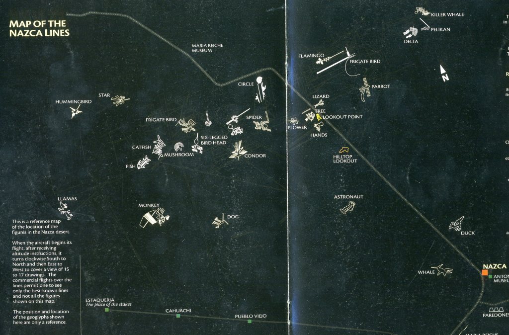
Stretching across nearly 350 square kilometers of high arid plateau, these drawings of hundreds of figures range from giant spiders to vast geometric shapes, to enormous monkeys as large as 300 m. The figures vary in complexity. Hundreds are simple lines and geometric shapes; more than 70 are zoomorphic designs of animals such as a hummingbird, spider, fish, condor, heron, monkey, lizard, dog, and a human. Other shapes include trees and flowers. They were designated as a UNESCO World Heritage Site in 1994. I’ve only chosen a few here to depict.
Pictured above, the Kosok Bird. This hummingbird located in Llipata is of a more primitive design. It is drawn from the left side, with the tail pointing towards the right of the body, modified and blurred by a trapeze which was made by the ancient inhabitants themselves in the following generation.
Pictured mid-center above; “Person with a Hat”. This figure appears often on Paracas pottery. It is 20 m tall and is located some 7 kms south of the town of Palpa. In his right hand, the figure could be holding a whip, and an owl stands above his head.
Due to the mystery surrounding their exact purpose and the fact that they can only be fully seen from the sky, the lines are of particular attraction to new-agers, ancient astronaut theorists, and alien enthusiasts (much to the frustration of the anthropologists, archaeologists, and astronomers who have studied the lines and hope to provide credible answers to their purpose and creation).
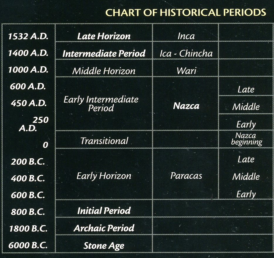
The glyphs were made between 200 BC and 600 AD, the time of the technologically sophisticated Nazca people, who are believed to have created the lines. Over time this great culture reached it’s decline and was conquered by a group of people who came from the south-east, “The Wari”. This civilization dominated the region, changing and imposing it’s own way of life and religion.

Pictured above, the “Owl Man”. Known worldwide as the Astronaut, but it would be more accurate to say it is the Owl Man because of it’s anthropomorphic shape. This figure is 35 m tall, drawn into the hillside of a chain of dark-colored hills.
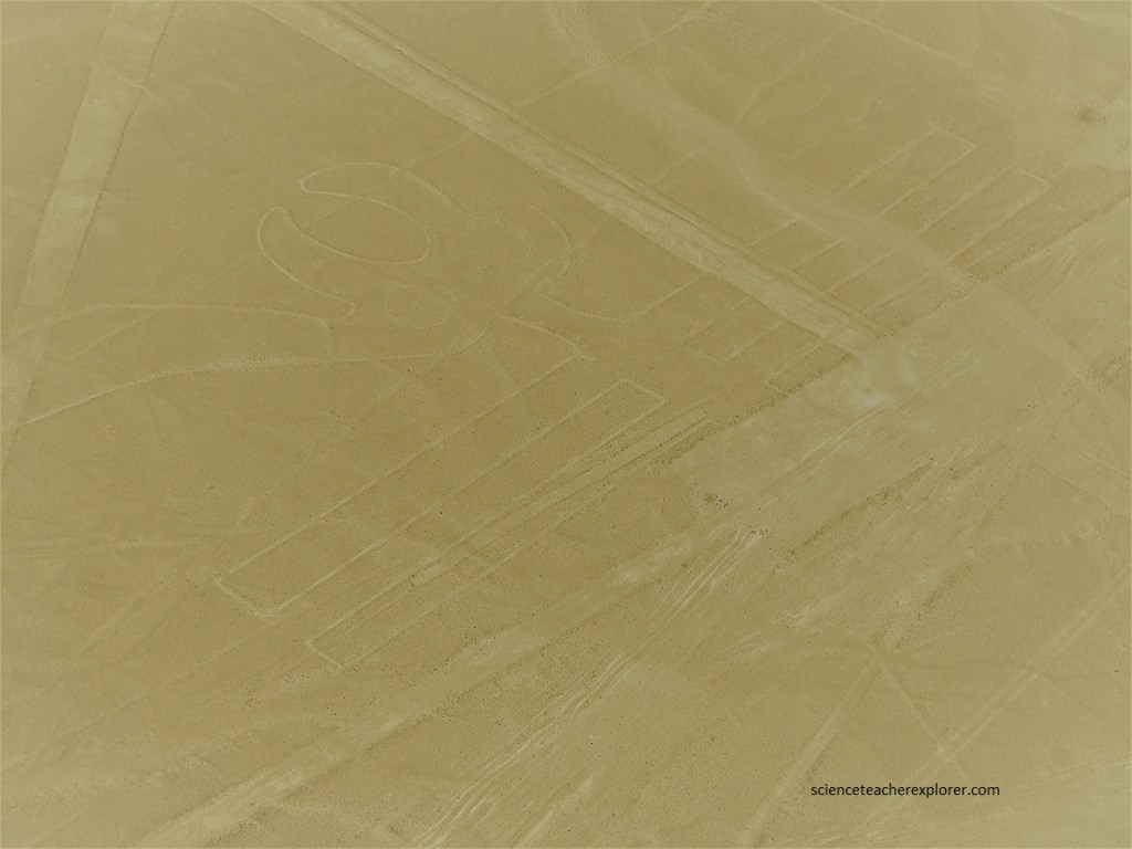
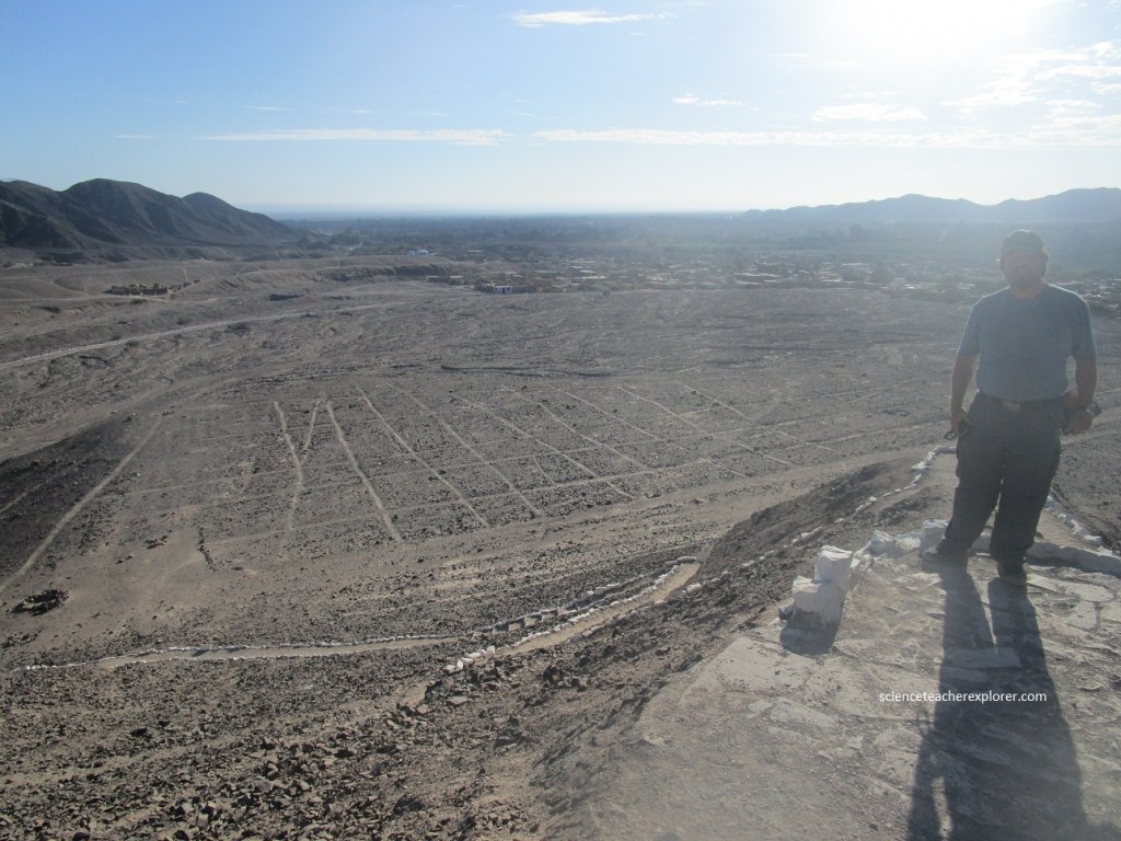
Pictured above, is the Maria Reiche Lookout. The tower is located beside the Pan American Highway on the edge of the Nazca desert. It was built to protect the lines, since, by the 1970s many people were entering the area. The construction was financed by Maria and her sister Renate. Beside the lookout tour, a panoramic view of the “Tree” figure, which is 70 m long. There are three figures in this area—the “Tree in the middle” and the “Hands” to the right. The lizard figure was destroyed in 1937 when the Pan American highway was being built. The “Hands” have nine fingers, just as the Monkey figure does, (seen below). Maria Reiche said that this figure could be a stylized monkey, because of the similarity of its head to the “Monkey”.
Notice that the shapes are usually made from one continuous line. Pictured above in the lower left corner, the “Monkey”. This figure was discovered by Maria Reiche-Grosse in 1954. It is 110 m long in total, it’s body is 80 m and it’s tail is 30 m approximately. The “Monkey” surrounded by lines is an example of a figure incorporated into a straight line scheme. One end extends over 1.5 km. It goes through the small bird at 60 m of distance. This figure has been identified as a constellation, and it represents the Great Bear, (Ursa Major) and it’s surroundings. It has 9 fingers and a tail in a spiral form. Also, it could be considered as it were, “The God of Water”, since the line of outline continues in a zigzag. The “zigzag” line is the symbol of water.
Pictured above, the “Flamingo”. Also known as the Parihuana, it’s name in Quechua spoken by the Andean peoples, this figure is 300 m long and 54 m wide, making it the second largest figure in Nazca. The “Flamingo” is very stylized, with an exaggerated beak and a neck in the shape of a serpent. The figure is located towards the north of several trapezes. The “Flamingo” points in the direction of the rising sun. It is considered the “Announcing Bird of the Inti Raymi”, (Festivity for worshiping sun on June 24th). “If in mornings from June 20th and 30th, we place ourselves on the head of the figure and follow with eyes in direction of it’s neck, we could see sunrise, exactly in the point indicated by this direction”, said Paul Kosok. “This figure, like the Spider, was constructed next to a trapezium of big size, in which the diagonal line goes through another bird 2 km away.”
A viable suggestion is that the figures were intended to be seen by the gods; suggesting a “We are here! You, in the sky, are you out there?” Others believe that the lines were a giant astronomical calendar pointing to the locations where celestial bodies would align themselves. (This is still quite controversial). Paul Kosok and Maria Reiche advanced a purpose related to astronomy and cosmology: The lines were intended to act as a kind of observatory, to point to the places on the distant horizon where the sun and other celestial bodies rose or set in the solstices. Maria Reiche asserted that some or all of the figures represented constellations. She had concluded that the animal figures were “representations of heavenly shapes.” She added that they are not shapes of constellations, but of what might be called counter constellations, the irregularly-shaped dark patches within the twinkling expanse of the Milky Way.
The real mystery comes not in the how, but the why. The explanation most in keeping with what is known about the Nazca culture is that the lines were made to be walked upon as a sort of ceremonial procession that led to a sacred area where the Nazca prayed to various gods involving agriculture and water. The shapes, then, were never meant to be seen at all, and it was only with the advent of modern aircraft that they were.
Pictured above, the “Parrot” or “Dragonfly”. This figure could also represent the figure of a dragonfly. It is of approx. 20 km northwest of Nasca and 200 m long approximately. Head of the giant bird is made up of segments of circles, radii of which vary between 10 and 20 m. It is considered a stylized figure because of the harmony of its lines. This figure is located in a place where two parallels join, becoming one line. The Eye is 10.20 m of diameter.
Pictured above, the “Condor”. This well-known figure is known as “The Condor”, but analyzing the details of it’s design shows clearly that it is not a condor. Notice the design of the beak and the tail. These details are not of a condor, whose beak is thick and curved. However, the details of the drawing are identical to those of the “long-tailed mocking bird”, or “chaucato”, a small bird that inhabits the coast. Maria Reiche discovered that this figure has a parallel line across it’s wingspan and it’s purpose is astronomical. The figure measures 135 m long by 68 m wide.
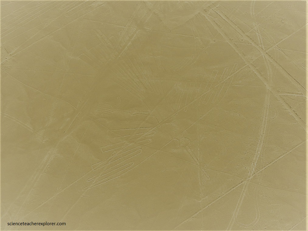
The video below is without the filter and of the most popular of the Zoomorphic Designs called the “Hummingbird” . One of the most beautifully designed figures, the “Hummingbird” has survived almost 2000 years and is still intact. This figure is located on the plains of San Jose and measures 97 m long. At the beak there is a group of vertical lines, one of which is 500 m long. Maria Reiche believed that the last of the lines marks a date which in our calendar today is December 21st.
The real mystery comes not in the how, but the why. The explanation most in keeping with what is known about the Nazca culture is that the lines were made to be walked upon as a sort of ceremonial procession that led to a sacred area where the Nazca prayed to various gods involving agriculture and water. The shapes, then, were never meant to be seen at all, and it was only with the advent of modern aircraft that they were.
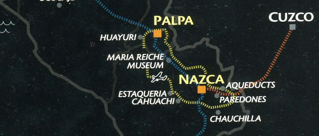
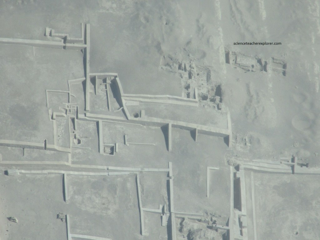
Pictured below, Kathy and I flew over an infamous ruin in the Nasca desert called Cahuachi. Cahuachi was once one of the most important and largest ceremonial centers for the Nazca culture in Peru. Containing over 40 mounds providing a base to adobe structures, the area is thought to have been a pilgrimage site, its population ebbing and flowing in relation to ceremonial events. Cahuachi is located in the valley of the Nasca river. The complex includes several pyramids, with urban centers and cemeteries. It extends over an area of 24 square kilometers, with six walled architectural complexes and a 1,500 square meter esplanade.
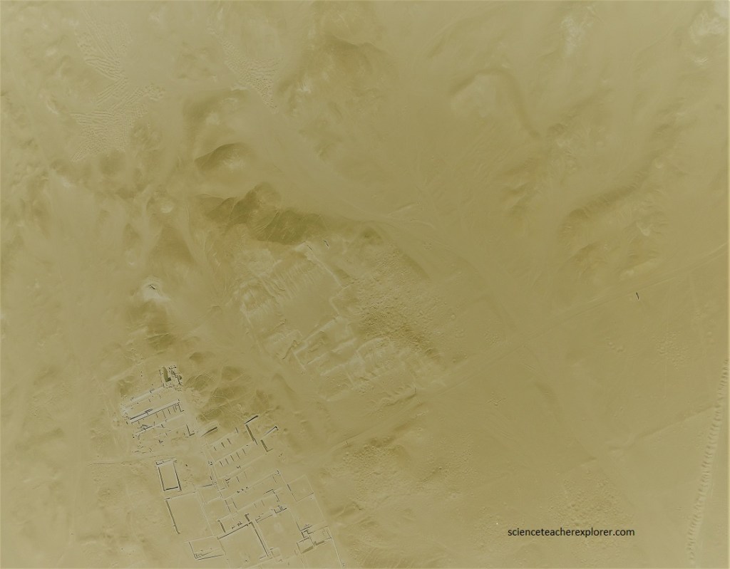
While it may have been a sacred place in ancient times, it now often falls prey to looters (seen in the middle of the above picture), who find the burial site rich with artifacts too tempting to ignore. Cahuachi overlooks some of the Nazca Lines and may hold the key to the mysteries.
Additionally, while flying around Nasca, Peru, Kathy and I got a good look at the Cerro Blanco. (Pictured below), Cerro Blanco has a legitimate claim to being one of the tallest dunes on the planet. It is also known as Duna Grande and rises up in the deserts to the southeast of the city of Nazca.
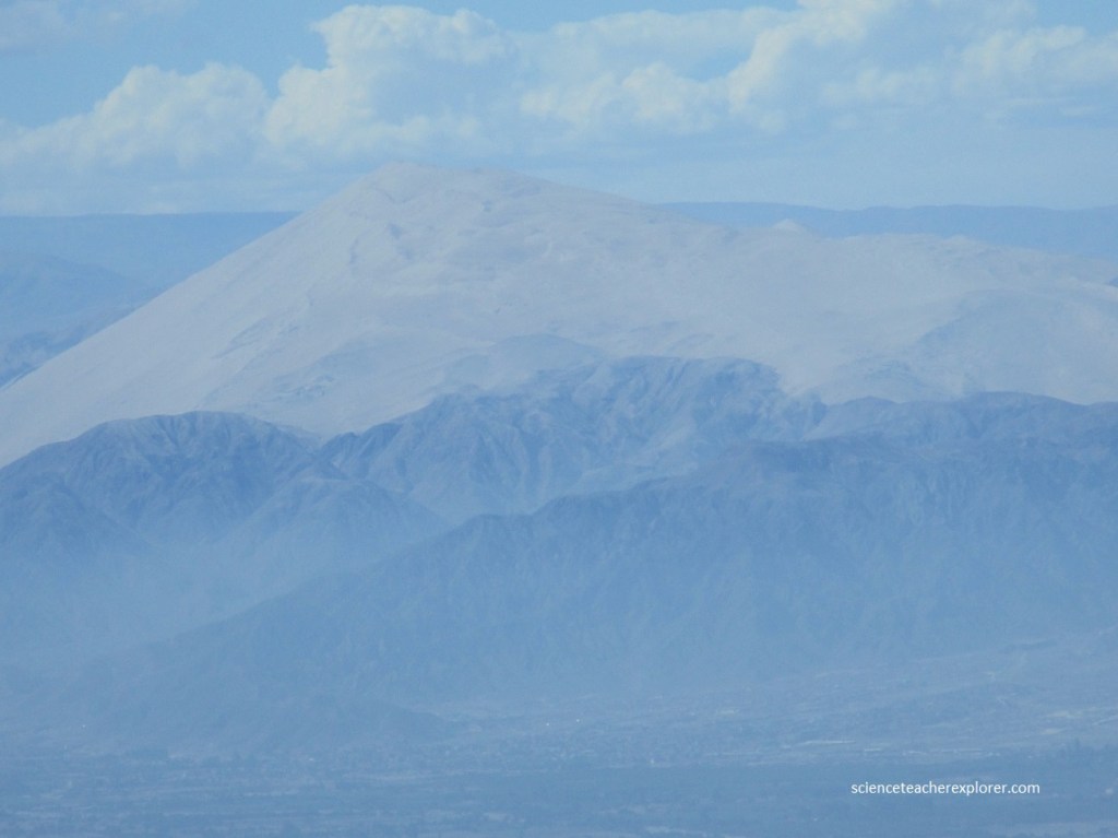
The Nazca civilization once believed the giant dune to be a source of water, even believing some kind of lake or reservoir lay at its center. Some locals still believe this legend and walk up to the top of the dune to leave offerings, in much the same way as the Nazca before them. In 1985, archaeologist Johan Reinhard published archaeological, ethnographic, and historical data demonstrating that worship of mountains and other water sources predominated in Nazca religion and economy from ancient to recent times. He theorized that the Nasca lines and figures were part of religious practices involving the worship of deities associated with the availability of water, which directly related to the success and productivity of crops. He interpreted the lines as sacred paths leading to places where these deities could be worshiped. The figures were symbols representing animals and objects meant to invoke the aid of the deities in supplying water. Based on the results of geophysical investigations and the observation of geological faults of recent studies indicate that some geoglyphs followed the paths of aquifers from which aqueducts (or Puquios) collected water. Pictured below are some of Puquios from the air.
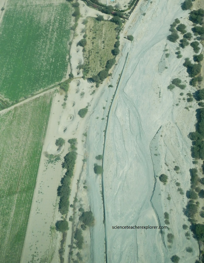
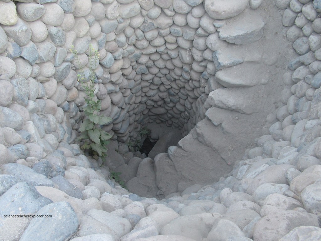
After landing, Kathy and I explored some these Puquios. (Pictured above and below), While the lines are theorized to have been created for religious purposes, the Nascas’ intricate engineering of subterranean aqueducts was the life force that supported their entire civilization. The system tapped into naturally occurring underground reservoirs at the base of the Nasca mountains, using a series of horizontal trenches to funnel the water on its way to the sea. Dotting the surface of these underground aqueducts were dozens, perhaps even hundreds, of spiral-shaped wells known as Puquios.
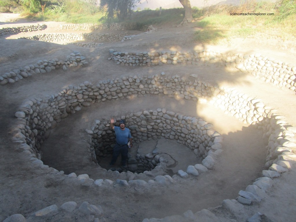
While the Puquios have long been theorized as dual-purpose shafts for both cleaning debris from the tunnels and accessing water, their unique spiral design has remained something of a puzzle.
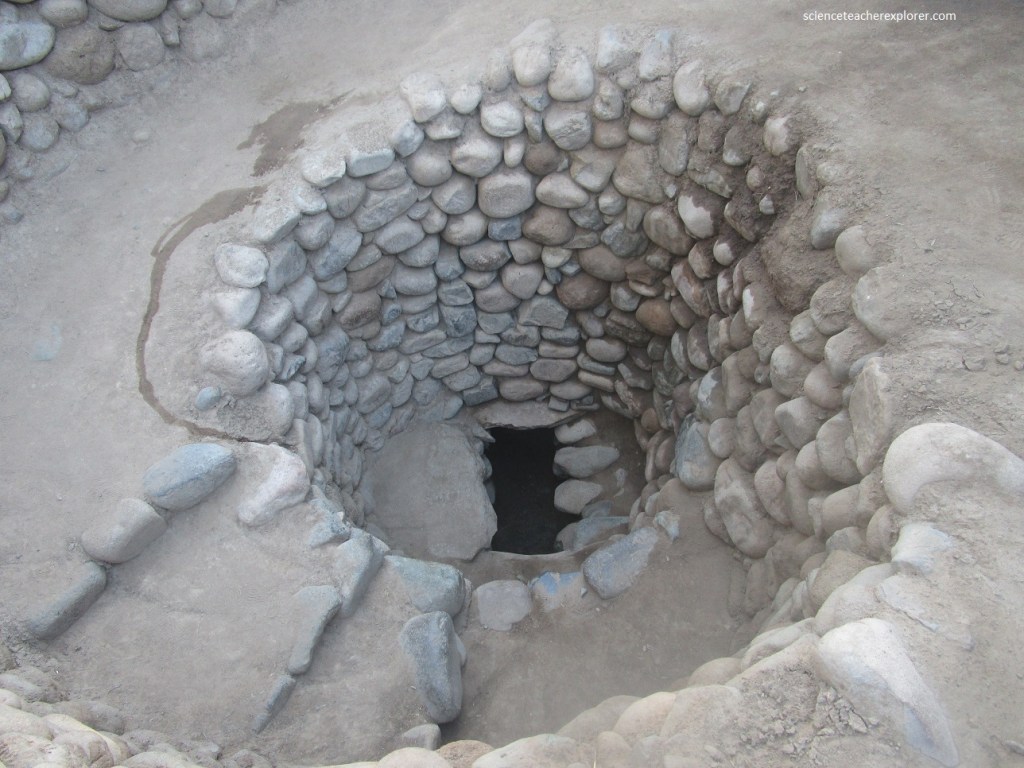
Pictured above, the corkscrew vertical shafts aren’t just wells, but a sophisticated hydraulic system. Their structure pulled air down into the underground aqueduct system. The wind actually helps to push the water through the system, which meant they served as ancient pumps.
Exploiting an inexhaustible water supply throughout the year the Puquio system contributes domestically and to an intensive agriculture of the valleys in one of the most arid places in the world. What is really impressive is the great efforts, organization and cooperation required for their construction and regular maintenance.
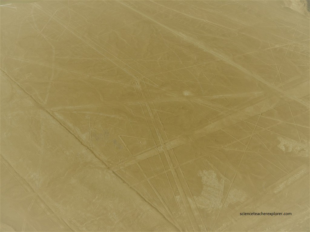
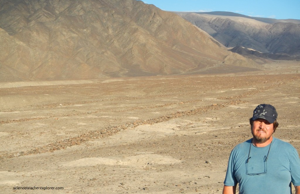
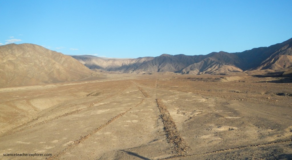
Later, Kathy and I explored some of the Nasca lines on the ground, (pictured below).
(Pictured above and below), The lines are typically 10 to 15 cm deep. They were made by removing the top layer of reddish-brown iron oxide-coated pebbles to reveal a yellow-grey subsoil. The width of the lines varies considerably, but over half are slightly over one-third meter wide. In some places they may be only 30 cm wide, and in others reach 1.8 m wide.
The most likely construction method involves putting stakes in the ground, tying a rope between them, and scraping the dirt off along the rope. This would explain the geometric shape of many of the lines, as well as how the Nazca would have kept the measurements for the drawings in ratio to each other, by simply multiplying the measurements of a drawing into rope lengths. Wooden stakes found in the ground at the end of some lines support this theory of creation.
Pictured above, the “Needles” are seen from the top of a hill. One of them points towards Cerro Blanco. The surrounding hills are red in color because of the iron ore content close to the surface. These figures are called the “Needles” because they would represent the spinning activity and their lines in a zigzag form would suggest the result of that process. They are 500 m long and are located 6 km from Nasca, towards Cantalloc aqueducts.
Pictured below, the “Loom” lines are similar to garments resulting from the textile activity. It is 350 m long.
(Pictured below), the Paredones (“The Walls”) archaeological site, built just outside of modern-day Nazca, was an Inca administrative center built in the 1400s, likely as a link between the coastal and inland settlements.
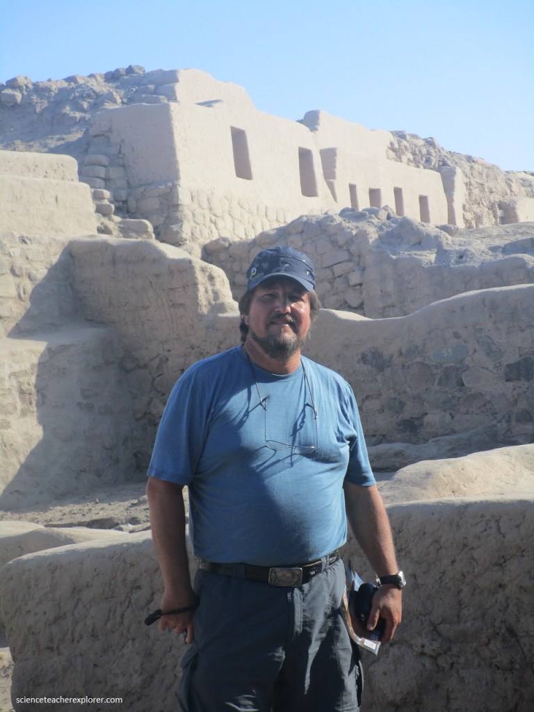
The thick walls of Paredones are essentially a set of compressed mud walls built atop a series of terraces. These ruins are crumbling in places. They haven’t been fully restored, but it also doesn’t take much imagination to envision their original form. A trail leads up and around a small hill past administrative buildings, warehouses, barracks, an observation tower, and a ceremonial area. The ruins gave Kathy and I a glimpse of the Inca Empire’s highly organized expansion, which saw it establish amazing cities and administrative centers throughout western South America.
