The Eiger, Switzerland
On July 18th, 2017; I had the opportunity to explore the famous Eiger in Switzerland.
The Eiger is a 13,015 ft. mountain of the Alps, overlooking Grindelwald and Lauterbrunnen in the Bernese Oberland of Switzerland, just north of the main watershed and border with Valais.
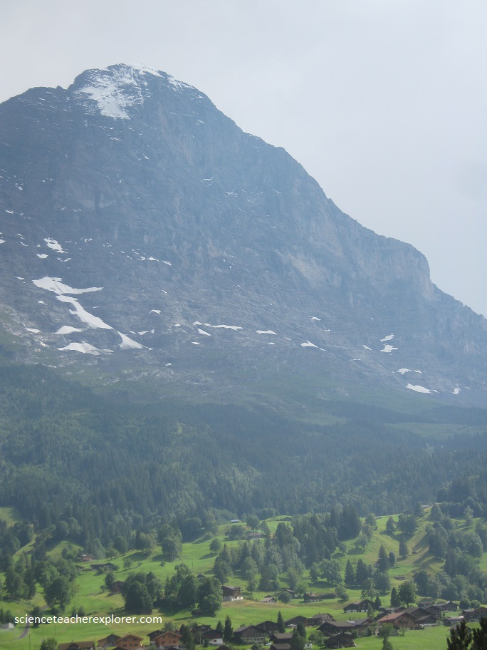
The most notable feature of the Eiger is its 5,900 ft. north face of rock and ice, (pictured above), named Eiger-Nordwand, Eigerwand or just Nordwand, which is the biggest north face in the Alps.
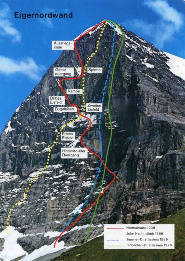
The relatively low mountain Eiger (3970m) in the Swiss Alps is one of the most famous in the world. For a long time its north wall was considered to be absolutely inaccessible and even had been named “the Death Wall” due to tragic events that took place there. From 100m below the summit of the mountain it falls abruptly for 1800m. But, in 1938 the wall was achieved by the united efforts of two Germans, A.Heckmayer and L.Vörg, and two Austrians, F.Casparek and G.Harrer (July 27, 1938). The climbers were awarded with Olympic Gold Medals for their ascent of the Death Wall – an extraordinary event in the history of mountaineering! Being concave and exposed to the North it is shaded and cold even in summer but in winter it practically never feels the Sun, which makes the climb extremely dangerous.
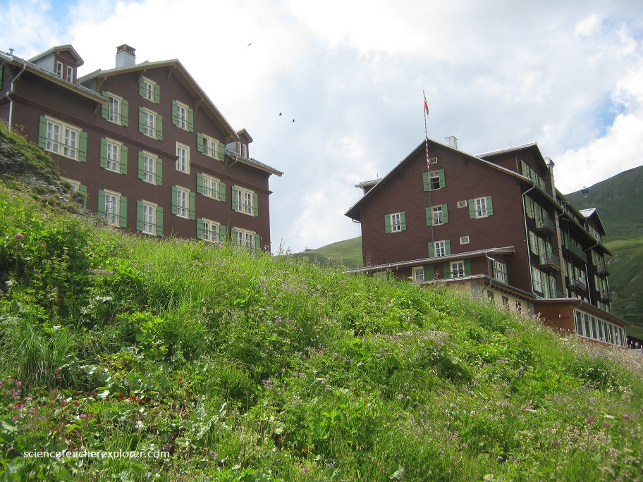
This huge face towers over the resort of Kleine Scheidegg, (pictured below) at its base, on the homonymous pass connecting the two valleys.
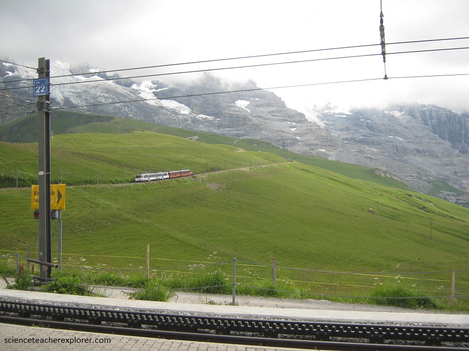
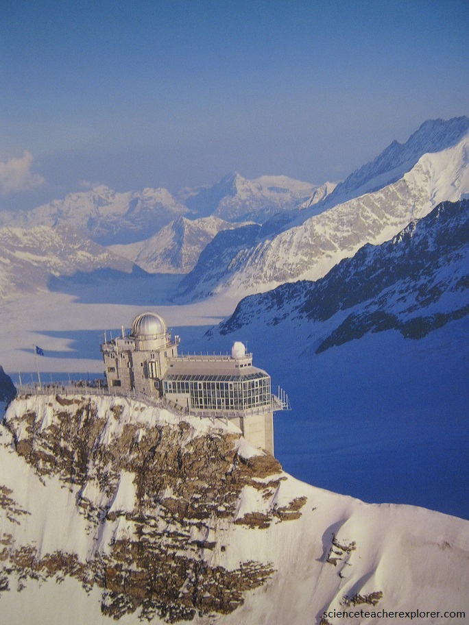
The Jungfrau-Aletsch-Bietschorn region, location in the south-central Swiss Alps, is a stunningly beautiful region. A rich coalition of geological and glacial processes have combined to produce this extraordinary landscape. The complex rock formations here, are the result of over-thrusting and folding rock layers between 20-40 million years ago, and have subsequently been exposed by the action of large glaciers. The region covers 133,400 acres and boast heights ranging between 3000 ft. and 14,000 ft. A total of nine peaks exceed 13,100 ft. in height. I took a train that tunneled through to Eiger, to get to the top, (pictured below).
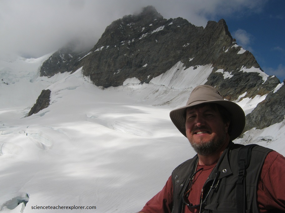
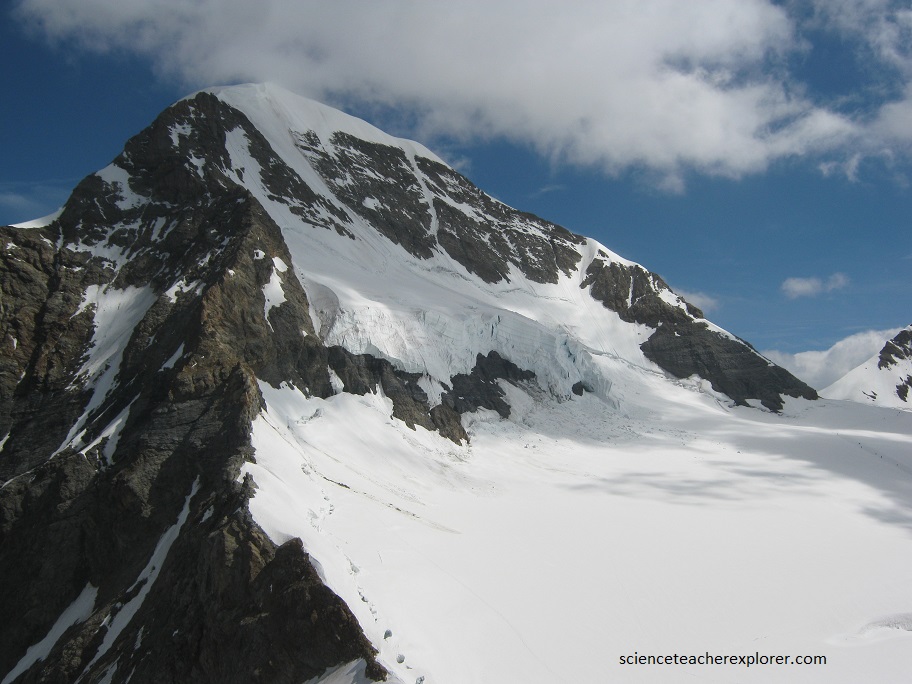
Once on top of the Eiger, I get a good look at two peaks called Jungfrau and Monch. I also get a great look of the beginnings of the Aletsch Glacier. Pictured below, I’m standing in front of Jungfrau peak at the Jungfrau Meteorological/Climatological Research Station.
The research station was completed in 1931 and the Sphinx Observatory in 1937. This infrastructure serves to carry out experiments that require high altitude and alpine conditions.
In the first decades the research subjects were meteorology, astronomy, physiology, glaciology and radiation research. In addition, cosmic ray research contributed to two Nobel Prizes.
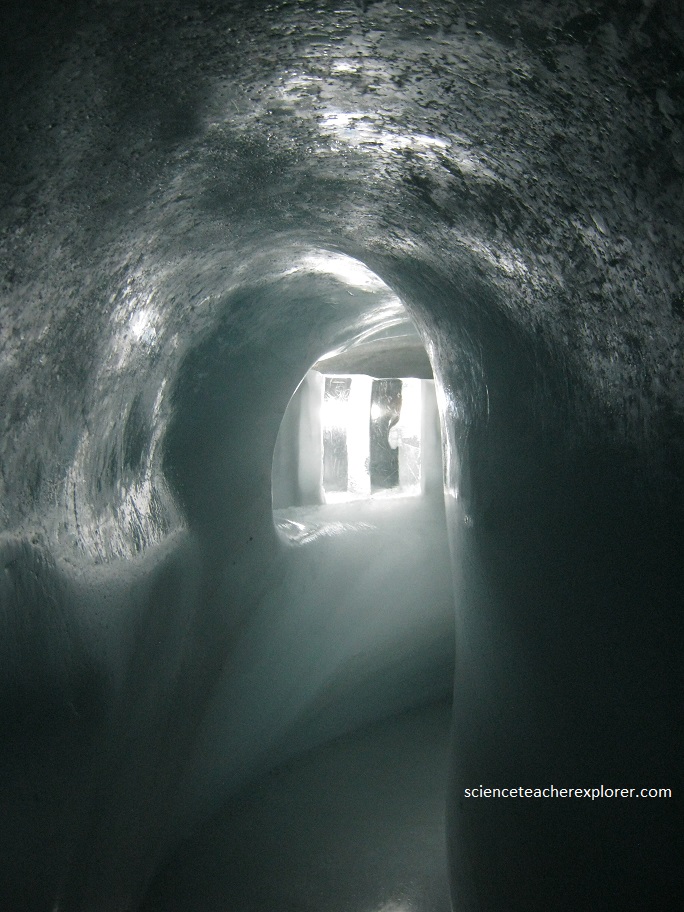
Today’s research focuses on environmental and climate science, meteorology, radiation balance, glaciology and cosmic rays. Pictured is a tunnel that goes through the glacier to get from building to building.
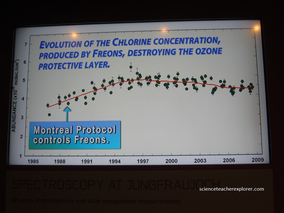
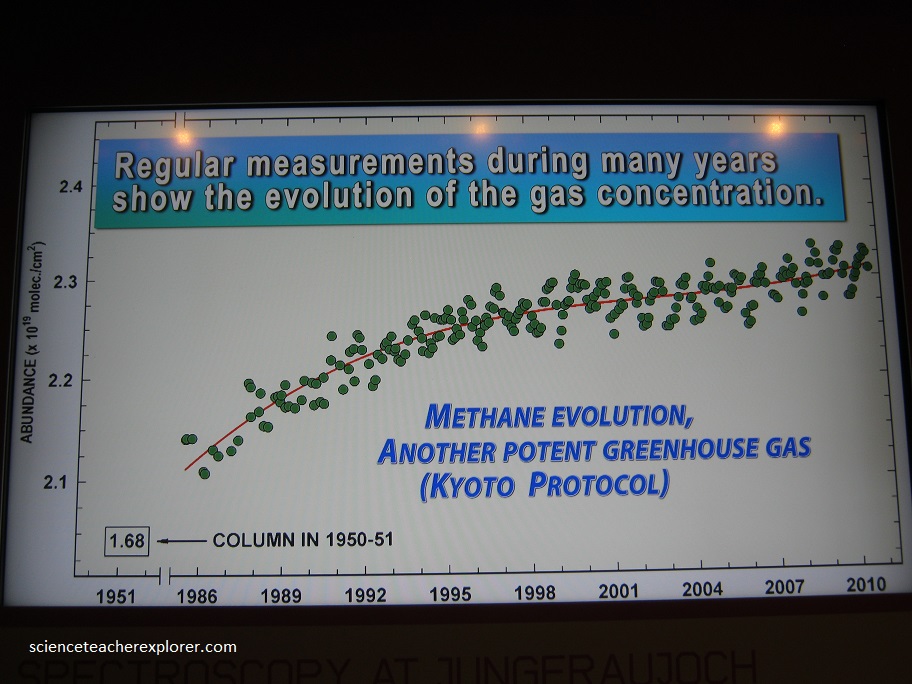
The air on Jungfraujoch–far above and far away from local air polluters- contains greenhouse gases and other pollutants in concentration that reflect the current general state of the atmosphere over Central Europe.
Therefore long-term continuous measurements on Jungfraujoch allow to: 1) Detect changes in the composition of the air. 2) Assess trends in air pollution. 3) Investigate the long-range transport of trace gases. 3) Verify European greenhouse gas emissions.
Below are some of the results reported at the station.
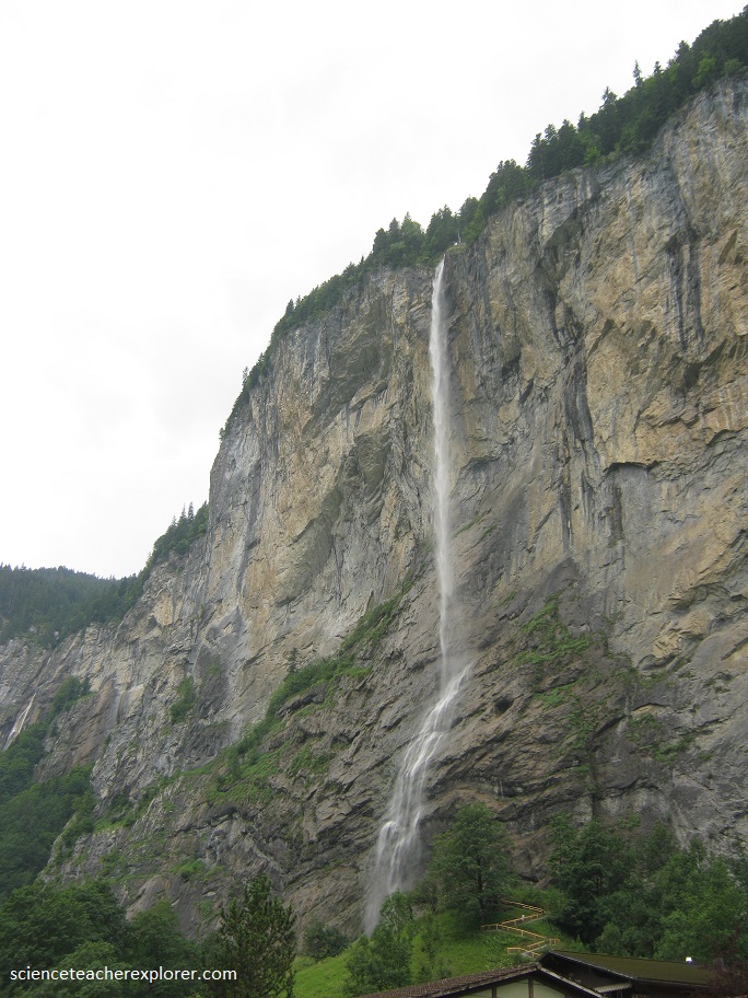
From Grindelwald, I continued my trek to the Staubback Fall, (pictured below). The Staubback Fall is a waterfall, located just west above Lauterbrunnen. The waterfall drops 974 ft. from a hanging valley that ends in overhanging cliffs above the Weisse Lütschine. The stream, on reaching the verge of the rocky walls of the valley, forms a cascade so high that it is almost lost in spray before it reaches the level of the valley. After rain, and early in the season when fed by the melting snows, the Staubbach Fall is a very striking object. The force of the stream above the fall at such times is sufficient to carry the water clear of the precipice, and the whole mass descends in a condition of liquid dust, between spray and cloud, that sways to-and-fro with the gentlest breeze. In a dry summer, when the supply of water is much reduced, the effect is comparatively insignificant.