Lyme Regis, England
On August 1st, 2016; I explored the Lyme Regis region in England.
This area is a paleontology hot spot, and provides a complete record of every stage of the Jurassic. The fossils of new species are still being found there today.

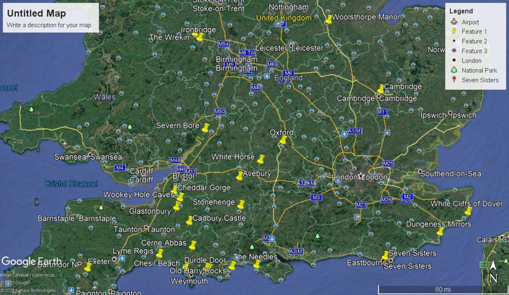
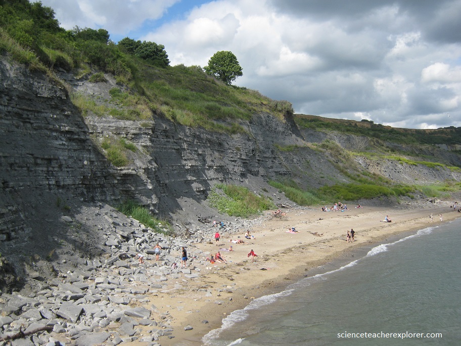
Lyme Regis is located on the Dorset coast, and represents a significant part of the Jurassic Coast – World Heritage Site. The rocks date predominantly from the Early Jurassic epoch, approximately 199-189 million years ago, during which time a warm sea spread across much of the UK. The famous coastline has yielded a range of spectacular fossils, including: giant marine reptiles, intricate crinoids, ammonites and even dinosaur remains. The volume and quality of finds over the past two centuries in particular, have made Lyme Regis one of the most famous fossil locations in the world.
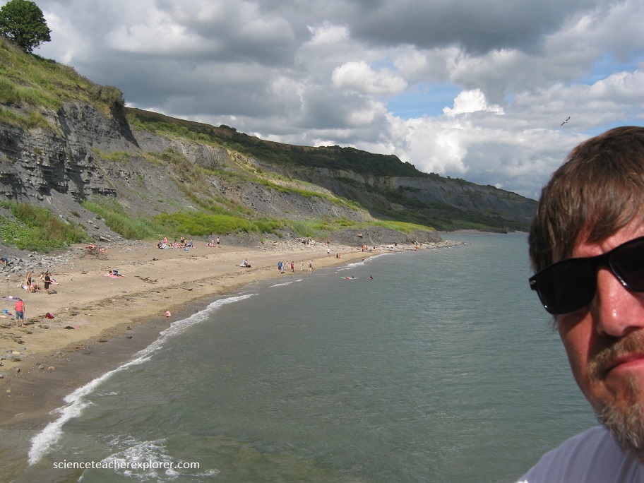
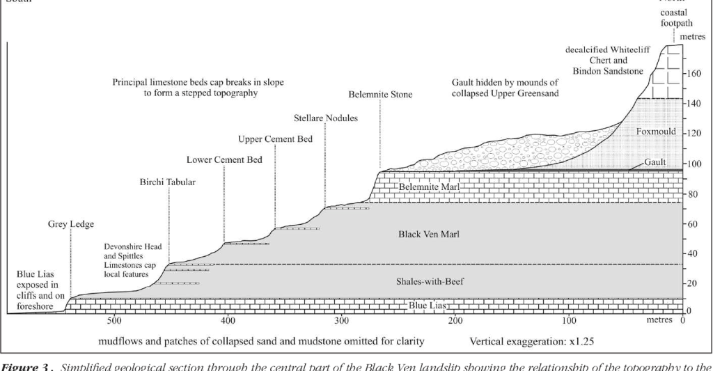
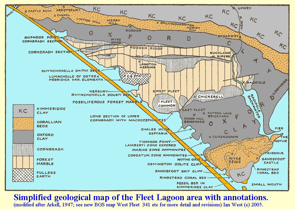
The cliffs and foreshore between Lyme Regis and Charmouth, (the Spittles), represent three stages within the Early Jurassic. During this time a shallow epicontinental sea (less than 100m deep), was present across much of Europe, including most of England, Wales and Ireland, and laid down alternating layers of clay and limestone. At that time, Lyme Regis (as it’s now known), lay closer to the equator, roughly at the latitude North Africa is today. Overlying the Jurassic sediments are younger Cretaceous deposits, comprising the Gault and the golden colored Upper Greensand (green when freshly split) – deposited around 106-102 million years ago. There are two important Jurassic formations present in the cliffs beneath Black Ven -the Blue Lias Formation and Charmouth Mudstone Formation, the latter of which is subdivided into a number of sections: Shales-with-Beef, Black Ven Marls, Belemnite Marls and an isolated exposure of the Green Ammonite Mudstone Member.
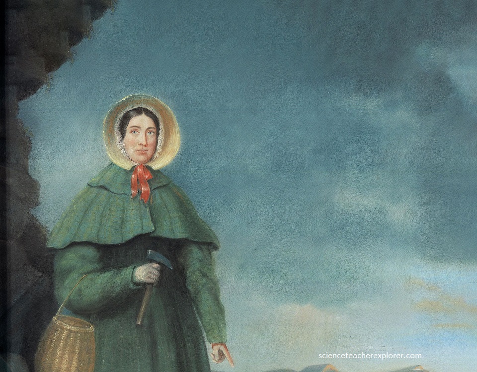
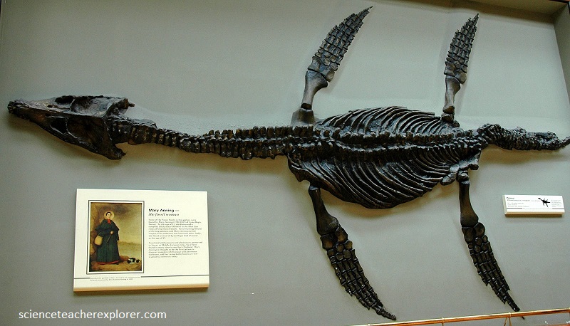
Lyme Regis was thrust into the limelight in 1811, when a number of significant marine reptile remains were discovered by local fossil collectors Mary Anning and her brother Joseph Anning. Among their finds include the first recognised complete ichthyosaur skeleton, the skull of which was found by Joseph, and the rest of the skeleton by Mary soon after.
Fossils can be found throughout the Jurassic and Cretaceous exposures at Lyme Regis, however it’s the Jurassic rocks in particular that attract fossil hunters to Lyme Regis. Life was abundant during the Jurassic period, giant marine reptiles inhabited the seas.
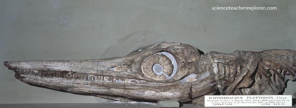
In addition to her discoveries of at least three ichthyosaur skeletons, Mary Anning found fossils of two plesiosaurs and a pterodactyl, as well as numerous fish, ammonites (spiral-shelled mollusks that are ancient relatives of the chambered nautilus), brittle stars, and other marine animals, including many belemnites. Like squid, belemnites had ink sacs. One of the belemnites she found was complete with its fossil ink!
To the west of Lyme Regis the cliffs expose horizontal layers of limestone and shales belonging to the Blue Lias Formation. At low-tide the sea weathered foreshore, known as Monmouth Beach, is exposed and contains abundant ammonites, some of which are approaching a meter in diameter! This main species of dinner-sized ammonites are called ‘Coroniceras’.

This incredible stretch, (just west of Lyme Regis), of foreshore accommodates dozens, perhaps even hundreds of large ammonites among the boulders and in situ on exposed bedrock. These particular ammonites can’t be collected, but their size and abundance makes them worth seeing all the same.
Just down the coast of Lyme Regis, (east), is Chesil Beach. Chesil Beach is a shingle barrier ridge, with sheltered lagoons behind, stretching 30 km from Bridport Harbor to Chesil Bay in the Isle of Portland. Chesil is one of the finest barrier beaches in the world. It is made up of pebbles and shingle and has stood up to the full force of the Atlantic for thousands of years. It protects the Fleet, which is the largest tidal lagoon in Britain and a place of International importance for it’s birds and wildlife. The beach is over 28 km long and increases in height towards the east, reaching a maximum of over 15 m near Portland. The pebbles also increase in size towards the east.

At the Portland end, the pebbles are the size of hens’ eggs, yet 24km away at West Bay, the pebbles are the size of peas.

In between, the pebbles decrease steadily in size so perfectly that fisherman beaching at night can tell where they have landed just by the grade of stones underfoot. 98.5 percent of the rocks are chert pebbles, while the remainder is quartzite, quartz, granite, porphyry, metamorphics and limestones. Pebbles move east along the beach driven by the action of the wind and waves. The grading of the pebbles may be because the larger pebbles move faster than smaller ones as the waves work on them.
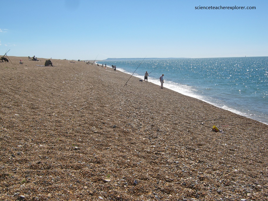
In the last interglacial period, about 125,000 years ago, sea levels were slightly higher than today and the landslides of West Dorset and East Devon were active. During the last Ice Age, sea levels dropped. The cliffs decayed into vast debris slopes that spilled across the exposed sea floor. With the end of the Ice Age about 10,000 years ago, rising sea levels reached these huge landslides, releasing a vast amount of chert and flint onto the shoreline. Longshore drift then carried the pebbles east, covering the beach that had been brought in by the rising sea and creating the massive structure we now see.
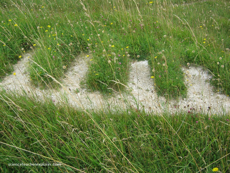
Nearby, north of Chesil Beach, I visited that evening, the largest and best preserved of England’s hillside figures carved into the green turf near the village of Cerne Abbas. “The Cerne Giant”.
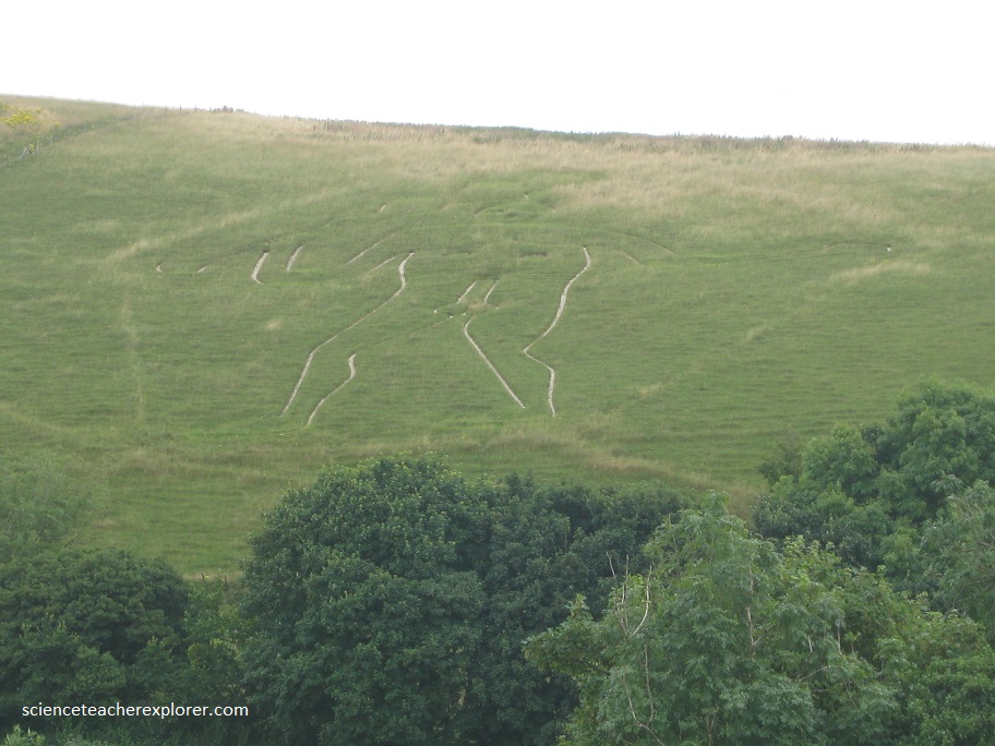
He is uncompromisingly pagan; 60 m tall, brazenly naked with an erect phallus, his ribs and nipples delineated. In his raised hand he wields a knobbed club 40 m long; his left arm is outstretched and he may once have held an object in his left hand.