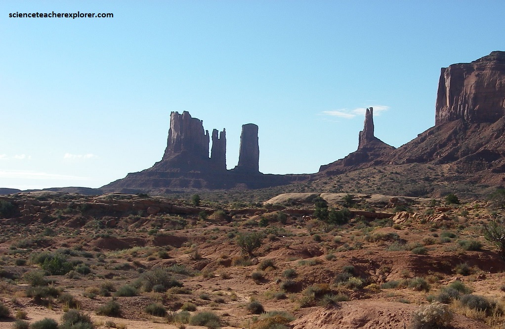
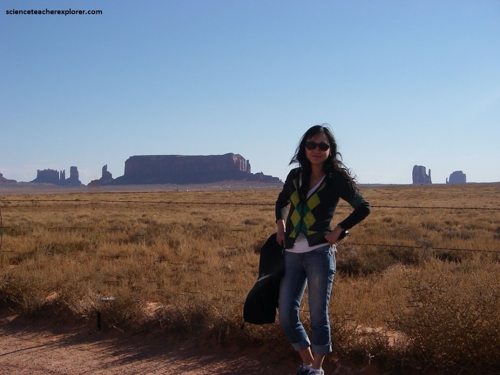
Monument Valley, AZ
Coming back from a multi-day exploration of Arizona, my trekking buddies and I made a brief stop at Monument Valley, near the border of Utah and Arizona border. Our trek started a day after Christmas and ended at the 2010 New Years Eve.
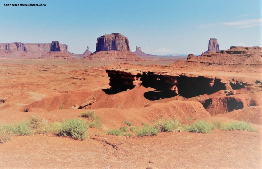
Through Monument Valley you can see buttes rising sometimes 330 meters from the ground. The rocks found there are mainly sedimentary, ranging from the Permian to the mid-Jurassic. The four main formations that form the buttes are the Organ Rock Formation (the apron), De Chelly Formation (the cliff face), the Moenkopi Formation (the cap) and the Shinarump (above the cap) .
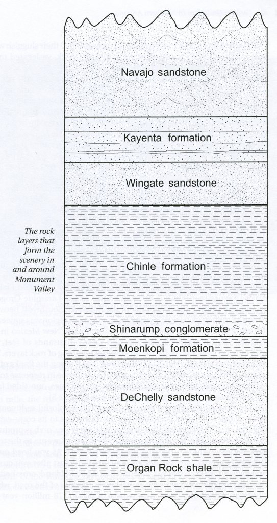
The base of the Buttes (or Monuments) themselves are composed of Permian Organ Rock Shale. It is nearly 230 m thick. This Permian shale layer was deposited by marine environments such as streams and tidal flats. This time of deposition led to the creation of dark brown and red mudstones and siltstones. Since this a shale layer, it erodes into a low, eastward, sloping angles (which is seen as the apron).
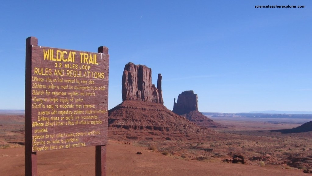
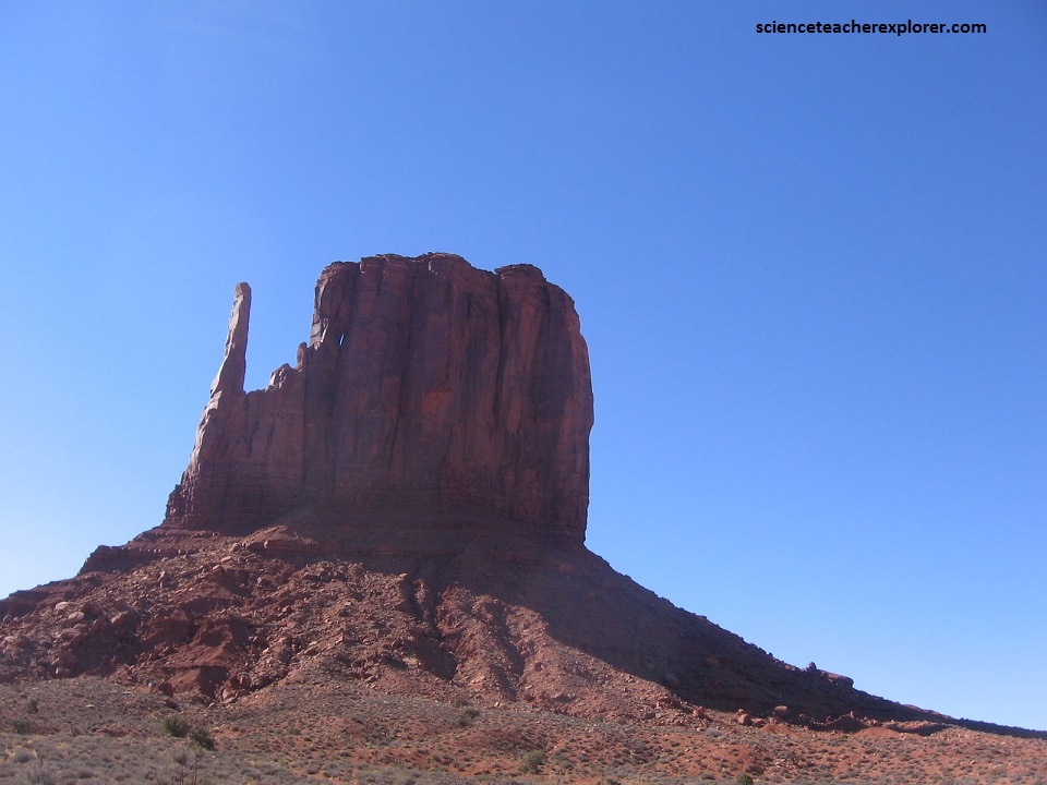
The next layer on top of the Organ Rock Shale Formation is the Upper Permian De Chelly Sandstone. This Formation is around 130 m thick in most areas. This quartz-sandstone was created in an aeolian depositional time period, such as a desert. It was large enough to create large dunes which are represented by the cross stratification with the mesas and buttes. The De Chelly Formation has been in erosional environment for nearly 50 million years and has caused the buttes and spires that are present today.
Throughout the park there are also less resistant layer on top of the De Chelly Formation. This is the Lower-Triassic Moenkopi Formation. It isn’t always visible in the park, since it is easily eroded and it is a red sandstone but stratigraphically younger. The Moenkopi Formation is a shallow marine formation and ripple marks are regularly found within formation.
At the tippy top of the buttes is the highly resistant white cap called the Shinarump Conglomerate. Quartz, quartzite, and chert predominate both in the pebbles and the matrix. Pebbles composing the conglomerate facies are commonly well rounded, with smooth, unbroken surfaces and ellipsoidal shapes. This resistant cap is probably what caused the buttes formation. Everything around it was eroded away.
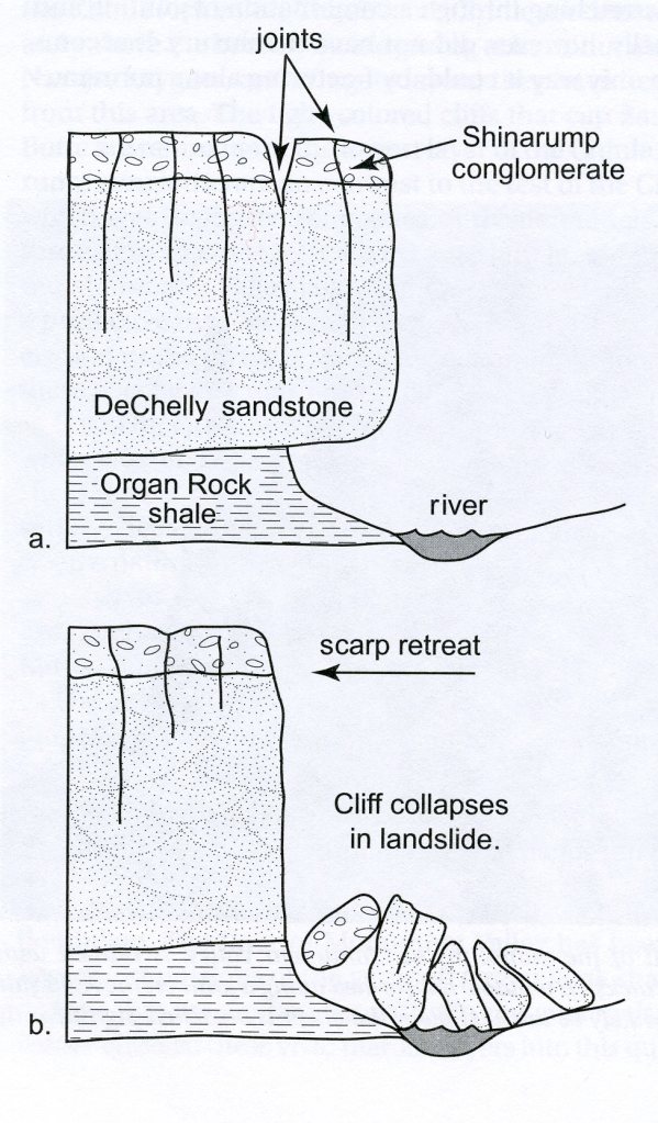
Imaged above, as the Monument up-warp grew, the rock units here were all split by vertical cracks or joints. Although joints are present in all four of the layers that comprise the towers, they are most apparent and abundant in the DeChelly sandstone. These closely spaced, vertical joints later governed the pattern of erosion when weathering processes at last began to carve into the DeChelly sandstone. As soon as the water entering the joints from above, encountered the soft Organ Rock shale, erosion took place in the extreme. The towering sandstone cliffs were repeatedly undercut as the Organ Rock shale was literally quarried out from under the DeChelly sandstone. When the space beneath a sandstone overhang cut back far enough to intersect with the next vertical joint, all support for the hanging section of cliff was lost, and it collapsed to the ground in a spectacular rockfall.
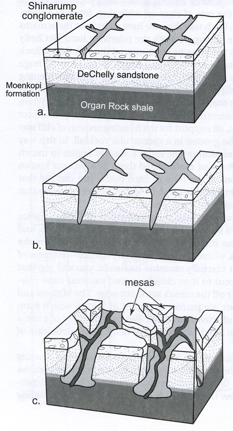
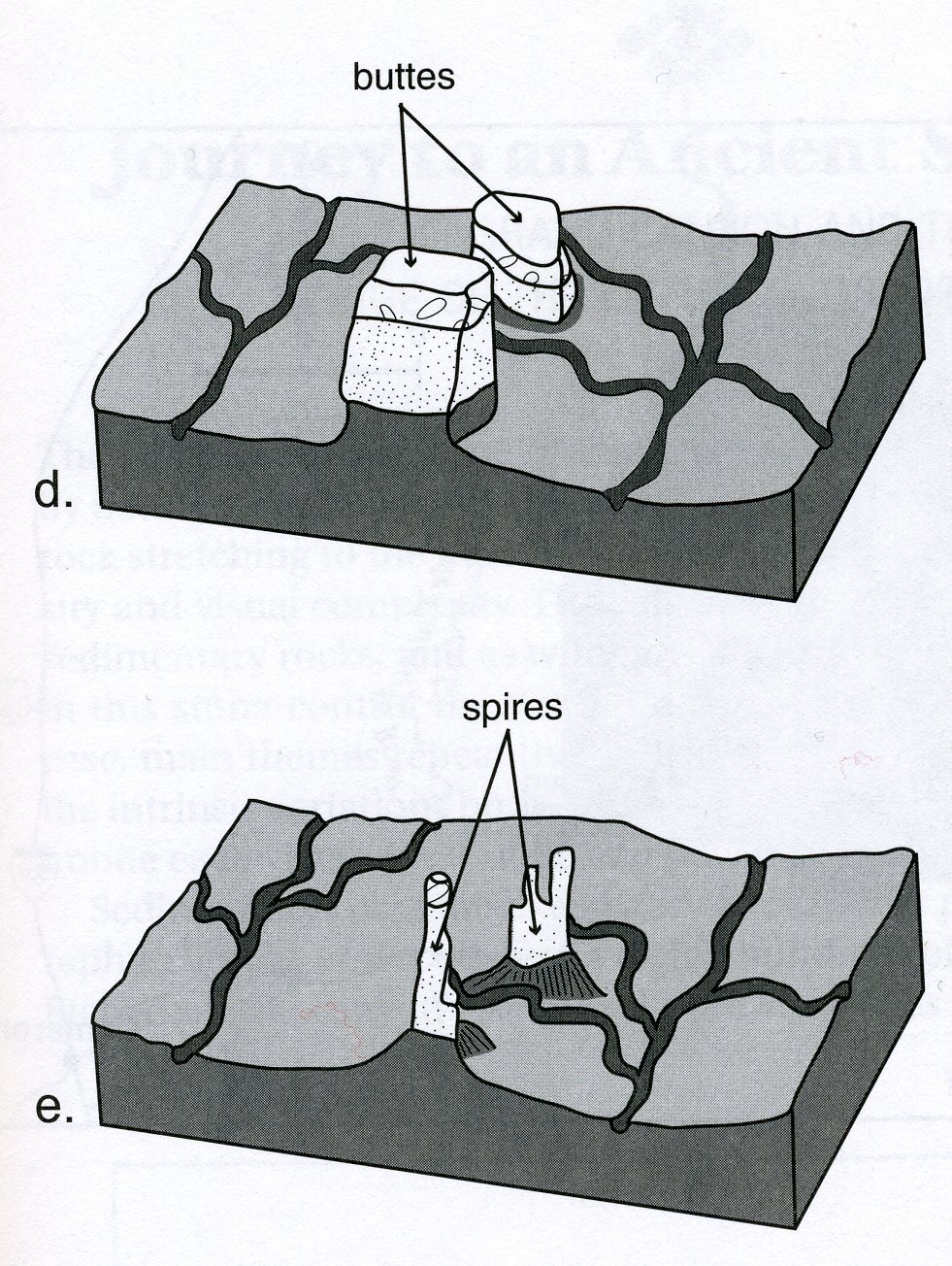
Image above taken from (“Geology Underfoot in Northern Arizona” Abbot & Cook 2007).
a) Stream courses form along joints in the hard Shinarump conglomerate. b) Those streams entrench themselves in deep gorges carved through the DeChelly sandstone.
c) As the streams cut down into the softer Organ Rock shale, they widen their floodplains, chopping the overlying layers into separate mesas.
d) Scarp retreat caused the mesas to shrink into buttes.
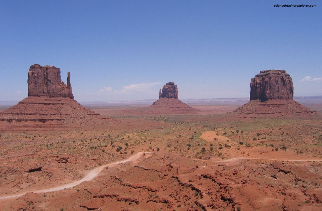
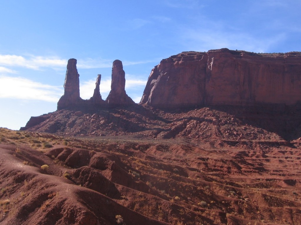
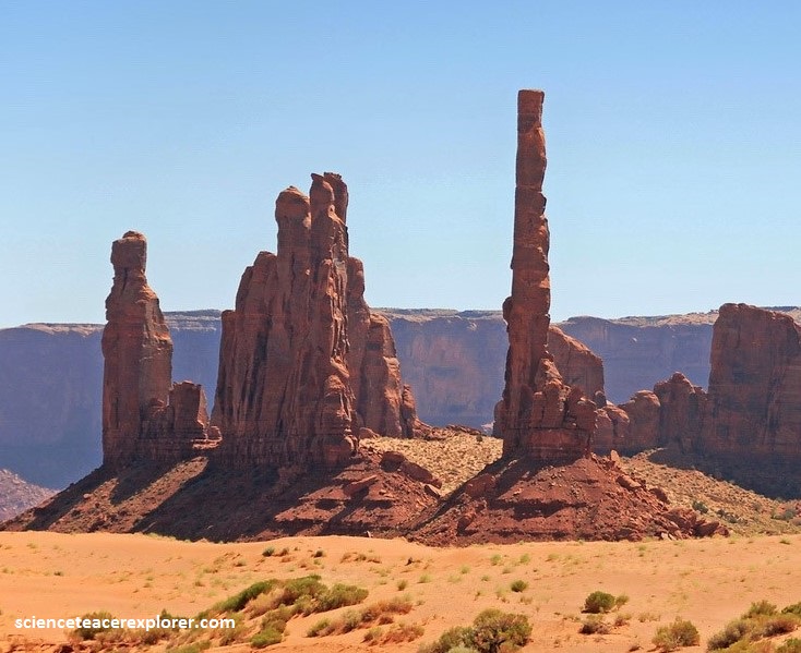
e) Continued erosion carve the buttes into spectacularly slender spires such as the Totem Pole or or the Three Sisters, (pictured below).
Chosen as a unique, picturesque background especially in old western movies, Monument Valley has had scenes from several memorable movies filmed on location. Many famous actors are affiliated with the location such as Clint Eastwood and John Wayne. John Ford was hollywood’s most director for western movies.
Between the red-rock buttes and the sandstone towers, Monument valley contains evidence of eons of nature’s constructive and destructive power. During the Permian Period, this patch of land once formed part of a seafloor where sediments and sandstone piled up in layers for millions of years. Tectonic forces raised the slab above the ocean line and created a plateau. Then water and wind chipped away at the sedimentary rock and removed the softer materials, eventually giving us the towering structures that we view today.
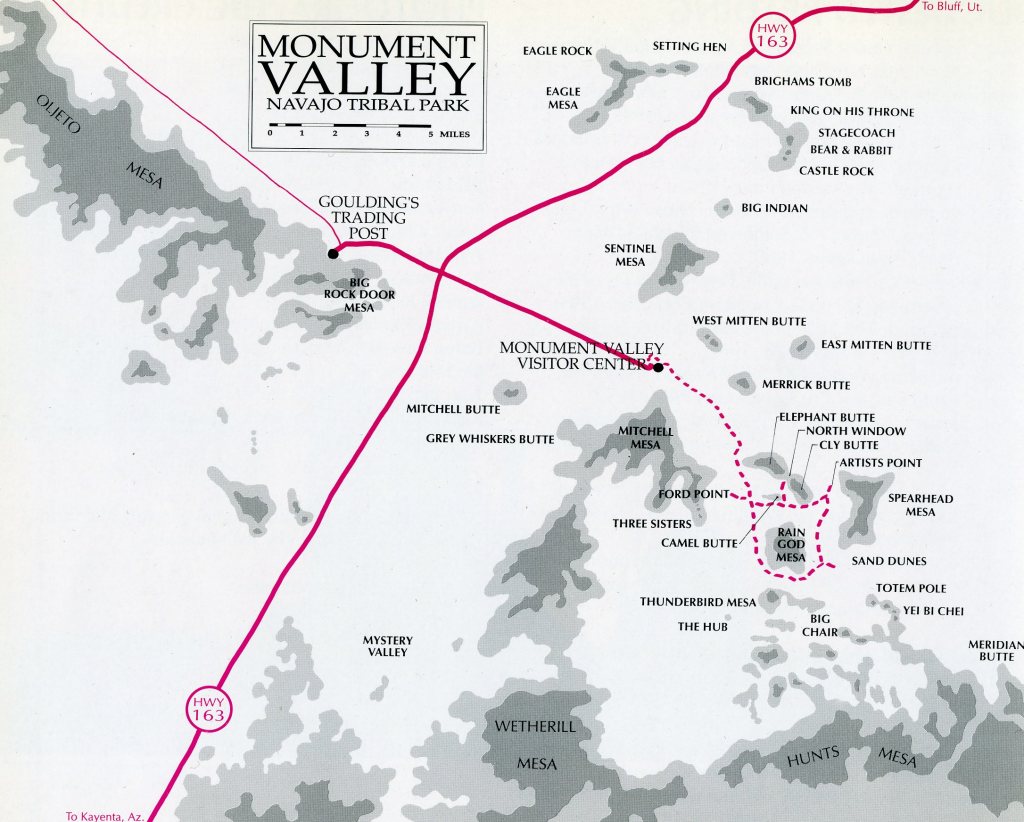
Monument Valley is now home to the Navajo Nation, one of the largest American Indian tribes. Called “Tsé Bii’ Ndzisgaii” (“Valley of the Rocks”) by the Navajo, Monument Valley is not technically a national park. It is managed by the Navajo Parks & Recreation Department.
My trekking group and I continued driving north towards our home in Utah. We planned to stay the night in “Mexican Hat, Utah”, (pictured below).
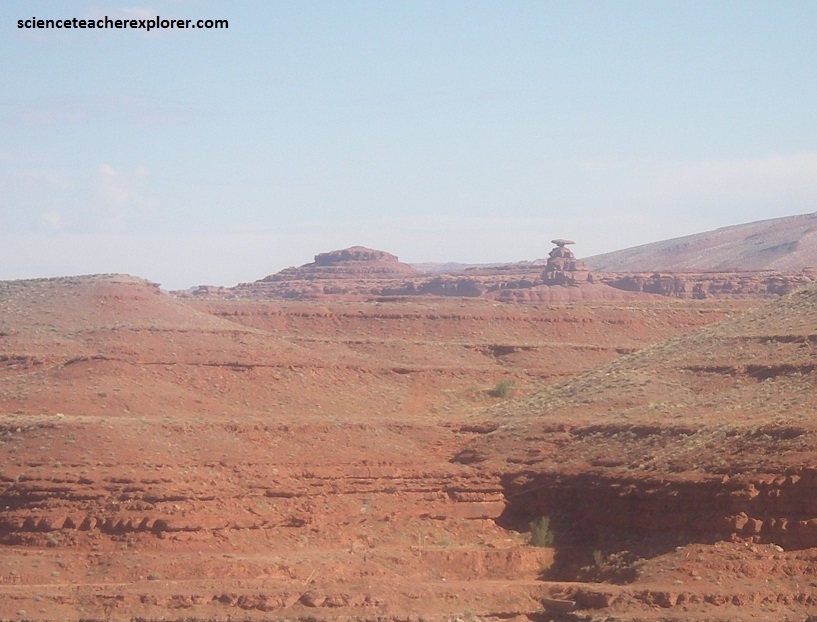
Mexican Hat’s 18.3 m diameter cap-rock is comprised of Cedar Mesa sandstone — the base is red siltstone and shale of the Halgaito Formation. It’s location is a few kilometers north of the small village of Mexican Hat (named after the sombrero-looking formation) and about 40 km north of the Utah/Arizona border. The parallel rock layers in this region belong to the expansive Permian “Cutler Formation”, which were laid down by the recurring rising and falling sea levels of an ancient marine environment. This flat terrain was then uplifted during the Laramide Uplift (an intense mountain-building event occurring between 35 to 80 million years ago).
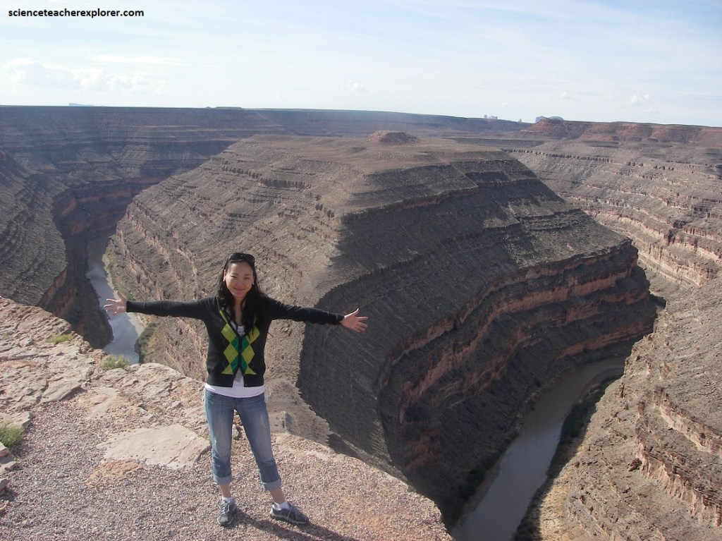
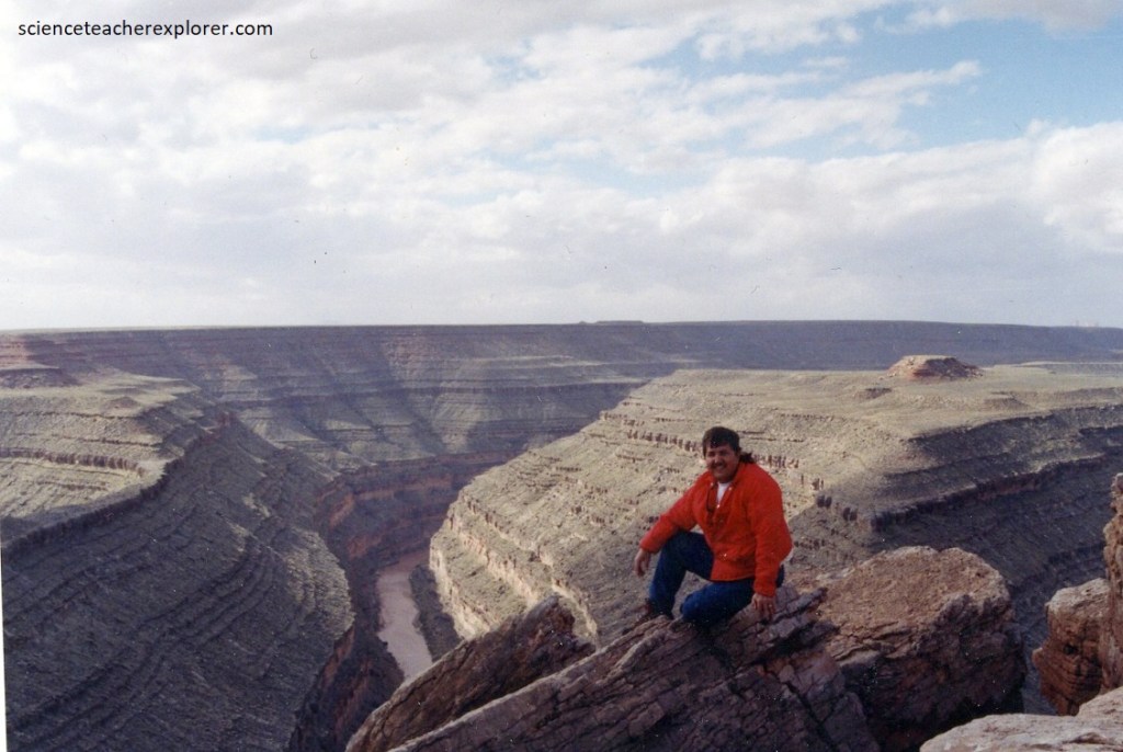
Also, nearby Mexican Hat, Utah, we made a quick stop at the “Gooseneck” State Park. On the edge of a deep canyon above the sinuous river meander known as a ‘gooseneck’ this small park affords a view of one of the most striking and impressive examples of an entrenched river meander on the North American continent.
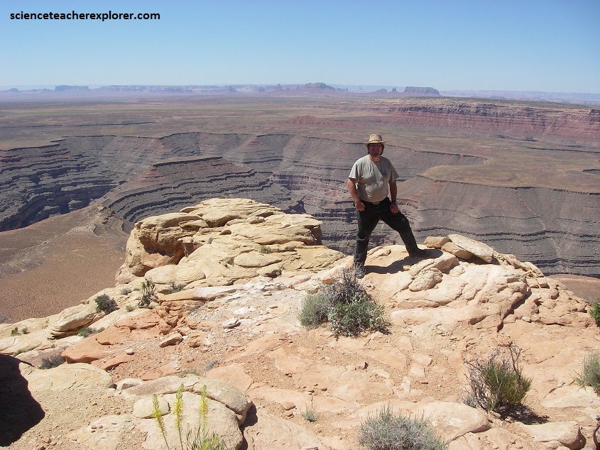
The San Juan River twists and turns through the meander below, flowing a distance of over 10km while advancing a few kilometers west toward Lake Powell. Pictured above is the result of over 300 million years of geologic activity. The oldest rocks are found at the bottom of the canyon, (310 million years old) and the youngest are all around you on the mesa top, (270 million years old). Actually, there are two formations visible from the overlook: the underlying Paradox formation (middle Pennsylvanian) and the overlying Honaker Trail formation (late Pennsylvanian), upon which we stood on.
The Paradox formation was deposited within a marine basin that covered about 44,000 square kilometer in the late Paleozoic time. Cycles of inundation and dessication produced a alternating sequence of limestone, which formed in oceans, and evaporites such as salt, which crystallized as large bodies of water that dried up. Reeflike deposits within some of the limestone layers indicate ancient ocean-shelf environments. The Honaker Trail formation, on the other hand, contains cycles of limestone alternating with sandstone, siltstone, and shale. these alternating layers reflect water level fluctuations, regional uplift, and eventual transition from marine to a terrestrial setting.
Pictured above, the “Goosenecks” sit in the central Colorado Plateau, a physiographic province characterized by regional uplift during the Cenozoic time, (the previously mentioned Laramide Orogeny). The looping meanders in the San Juan River are characteristic of streams that flow across broad, flat surfaces; although the modern topography here is obviously much different, this stream pattern is preserved, now entrenched deeply within solid rock. This entrenchment is the result of a rapid drop in base level, the lowest level to which any stream can erode. However, in the past 6 million years, the response of the plateau to massive erosion from the top, the lithosphere rose and elevated the stream channel relative to base level. So the San Juan River incised more deeply in response to this disparity and cutting this deep canyon.
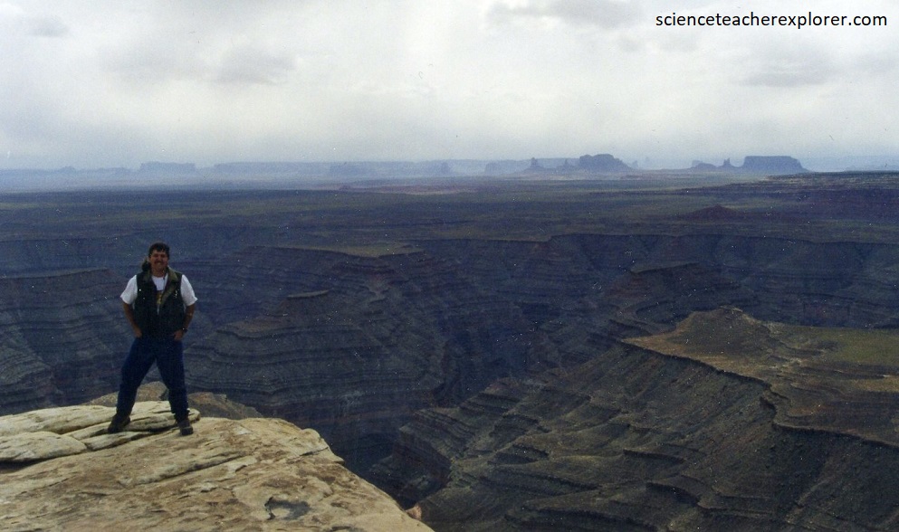
Pictured above is a view above the “Valley of the Gods”, (northeast of Monument Valley. However, in the “Valley of the Gods”, the resistant Permian Cedar Mesa sandstone lies atop the weaker Permian Halgaito shale. Recall, in Monument Valley, the Permian steep-sided Permian Chelly sandstone rested on a sloping base of the Permian Organ Rock shale. Like Monument Valley, “Valley of the Gods” offer intimate glimpses into a landscape of mesas, buttes, and spires. These isolated structures leaves behind the eroding southern margin of Cedar Mesa.

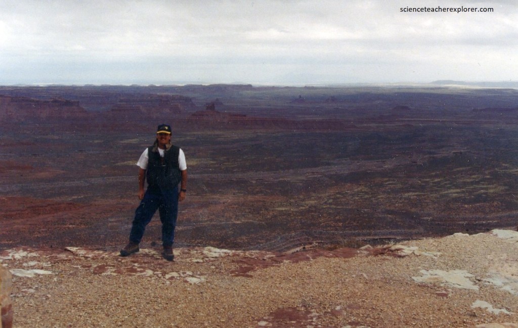
Pictured above, my educational group is posing on-top of the Cedar Mesa Plateau. We’re standing on the Permian unit of the Cedar Mesa Sandstone. It was formed from sand dunes with interbedded, or alternating, layers of stream and floodplain deposits. This is a sturdy, well-cemented unit.
