Piton-Fournaise, Reunion 2023
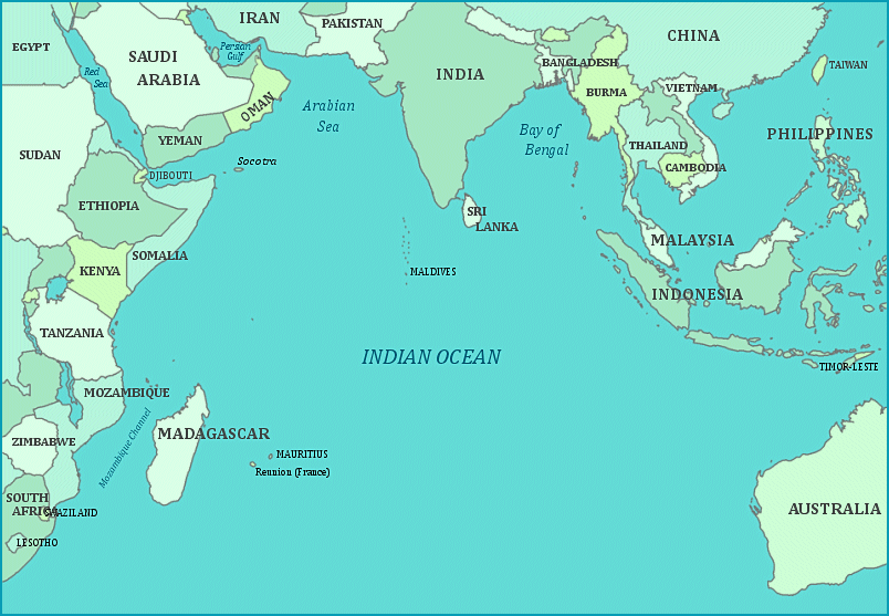
In April of 2023, I had the opportunity to trek the Piton de la Fournaise on Reunion Island, located in the Indian Ocean. It is situated approximately 690km east of Madagascar, (image below).
Pictured below, Reunion Island is approximately 72km long and 52km wide with an area of 2,512km2. The capital of Reunion Island is the twon of St. Denis with a population just over 103,500. Other principal towns on Reunion Island are St. Paul, St. Pierre, St. Louis, and St. Joseph. I stayed in a nice B&B in St. Joseph, (on the southern tip), for 4 days.
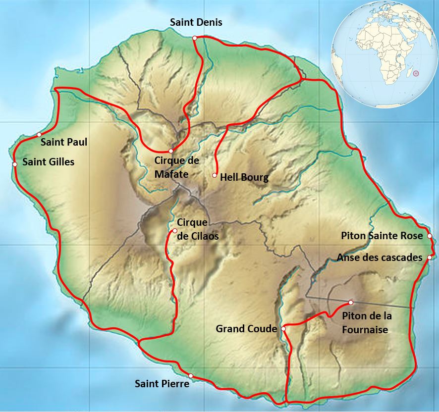
Pictured below, the island of Reunion, located in the Indian Ocean, constituting an overseas department of France, and is the most westerly of the Mascarene Islands that also includes the islands of Mauritius and Seychelles.
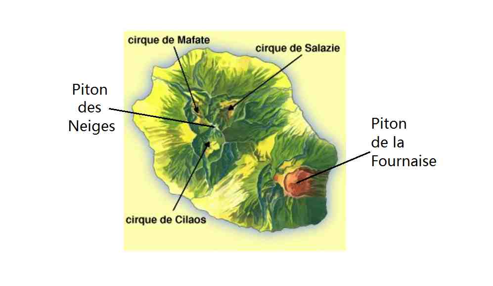
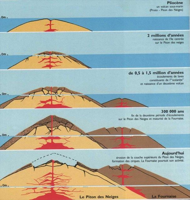
Imaged above, Reunion Island is totally of volcanic origin and consists largely of rugged mountains and high plateaus enclosed by a narrow coastal plain. The highest peak on the island is the extinct volcano, Piton des Neiges, 3,070m. The current active volcano is Piton de la Fournaise, (Furnace Peak) at 2,625m and is located in the southeast volcanic region of the island.
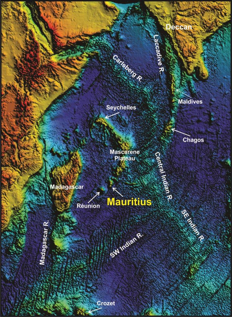
Including the submarine data, the general shape of Reunion Island is that of a flattened cone with a base diameter of 220km and a height of 7km. Piton de la Fournaise was built on the southeastern slopes of Piton de Neiges, since more than half a million years. Its slopes are already cut by deep valleys.
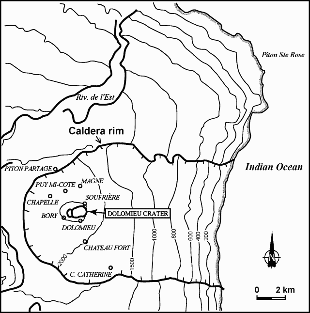
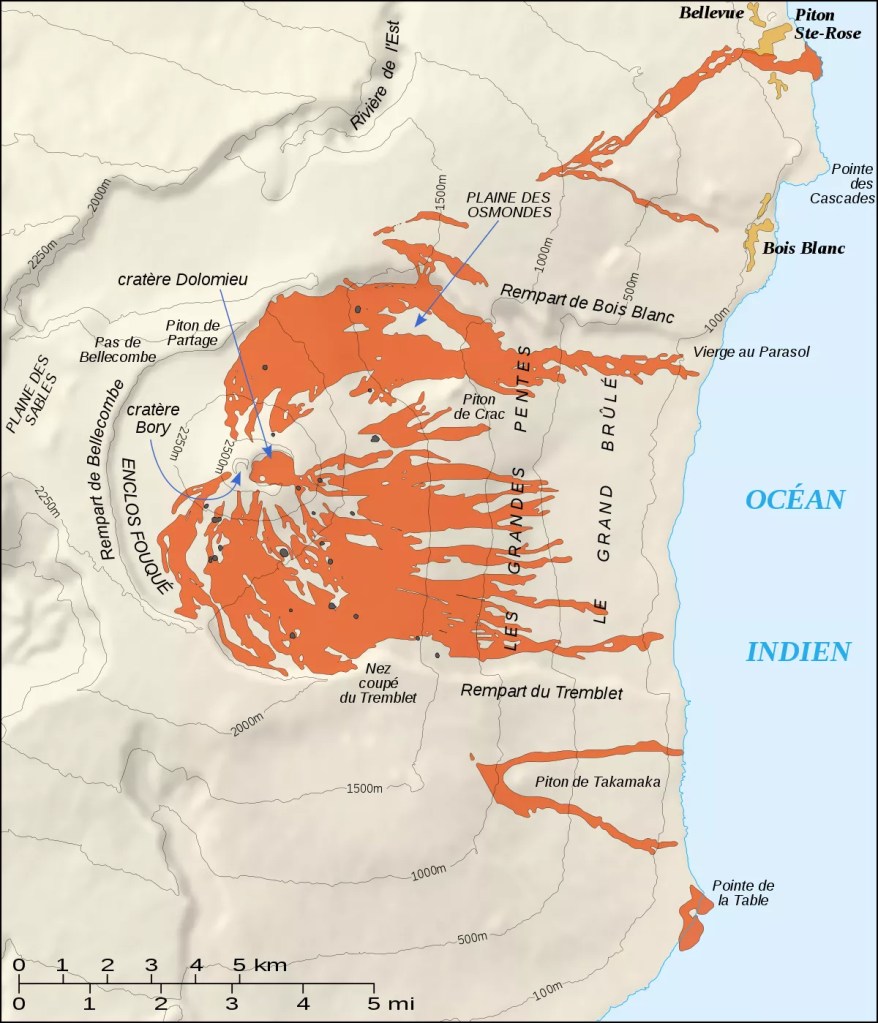
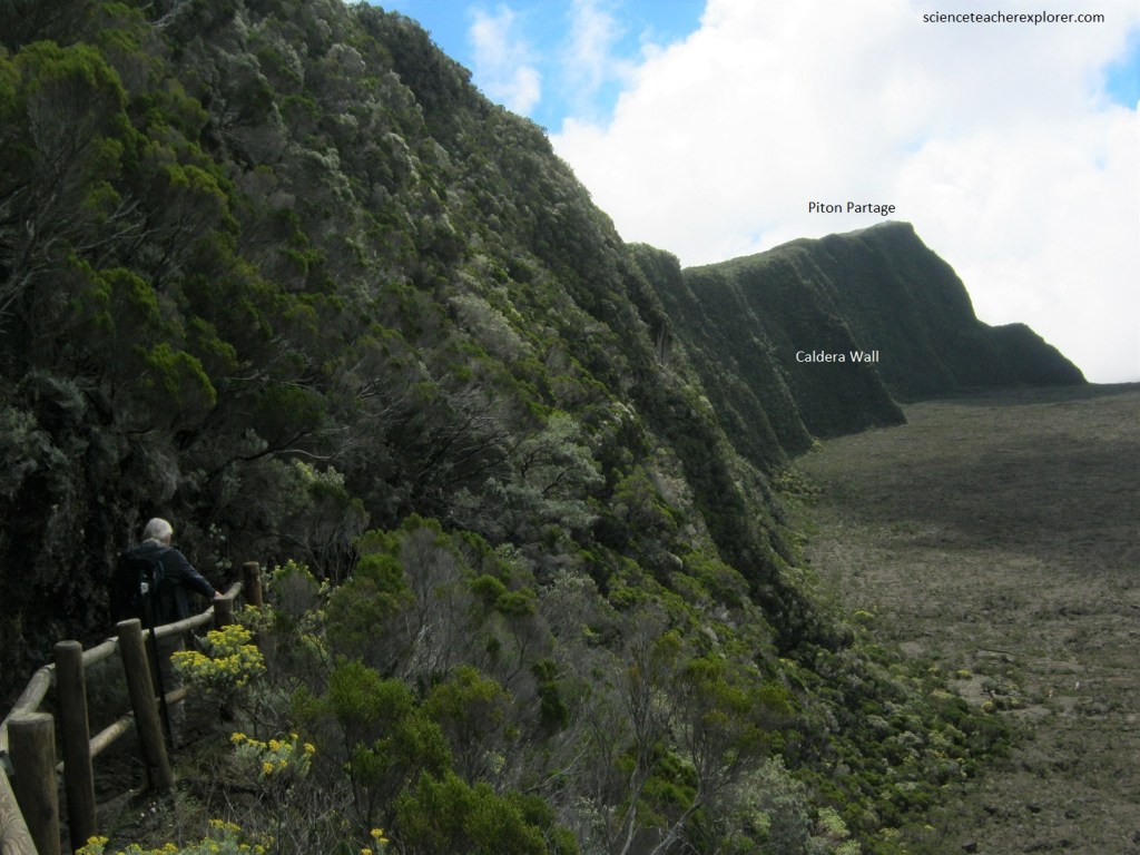
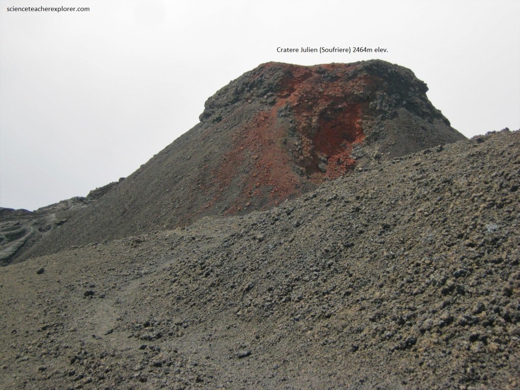
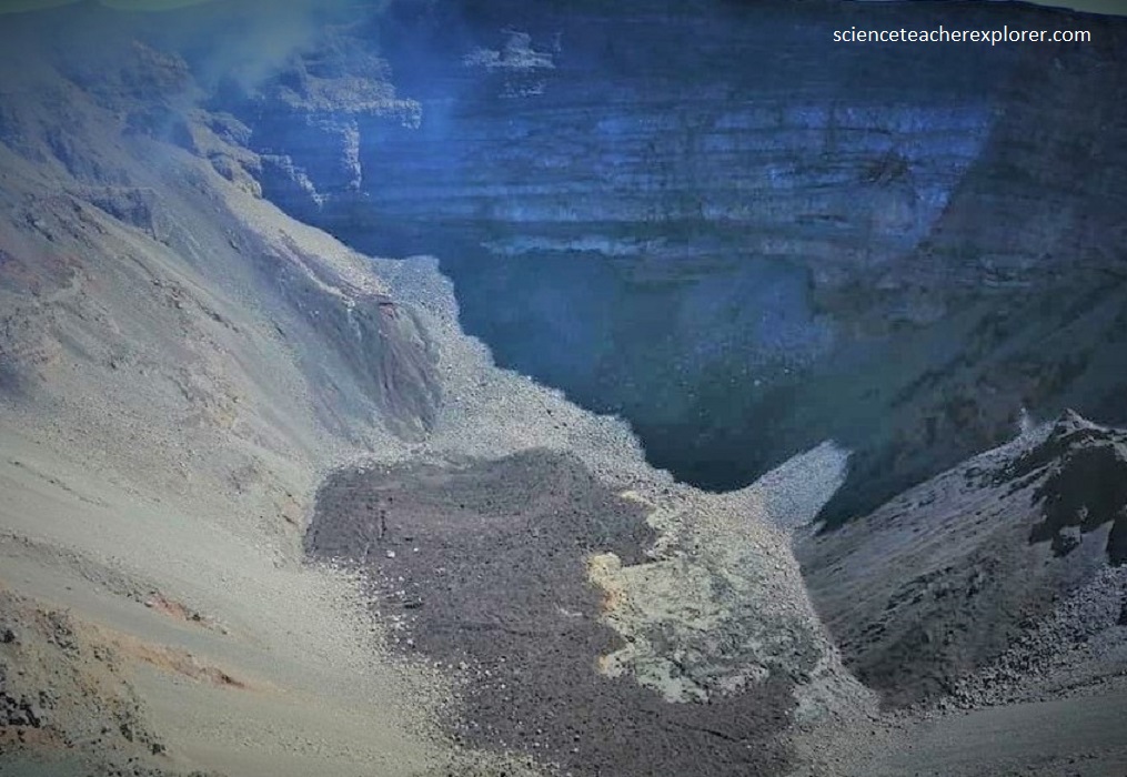
The Piton de la Fournaise summit areas show a noteworthy fitting of calderas, whose last is the Enclos in the middle of which stands the present terminal cone. It’s eastern slopes were affected by landslides, and constituting a morphostructural “U-shape” opening towards the Indian Ocean. The terminal cone is topped by a 1km wide crater complex (Bory and Dolomieu Craters), in continual evolution, (imaged below).
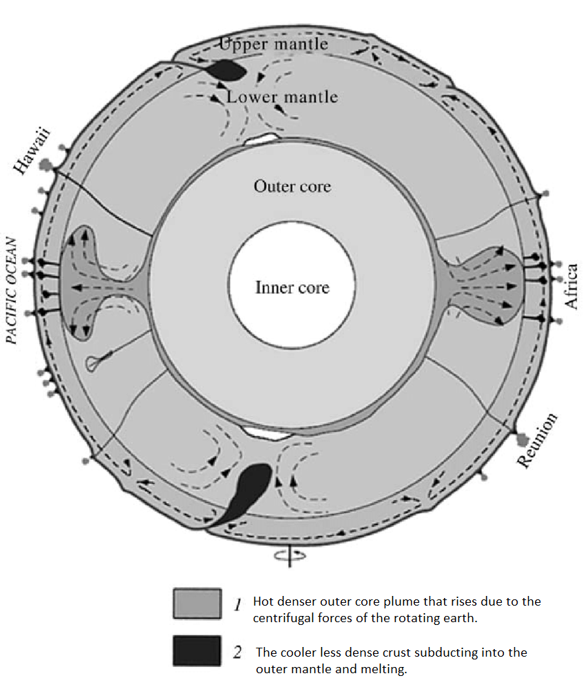
Imaged below, Reunion Island suggests to researchers a recent “hot-spot” origin for the volcanism 3-5 million years ago. The evolution of the rigidity and thus the age of the lithosphere at loading time along the ridges is within the concept frame the “hot-spot” theory, (image below).
Piton de la Fournaise attained its current form after an explosive eruption some 4,700 years ago, when a large area collapsed forming what now is known as the inner caldera. Traces from this explosive event, known as Bellecombe ashes, can be found up to 10 km from the volcano. After this, subsequent eruptions have built up the dome in the middle of this inner caldera.
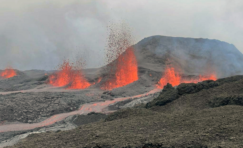
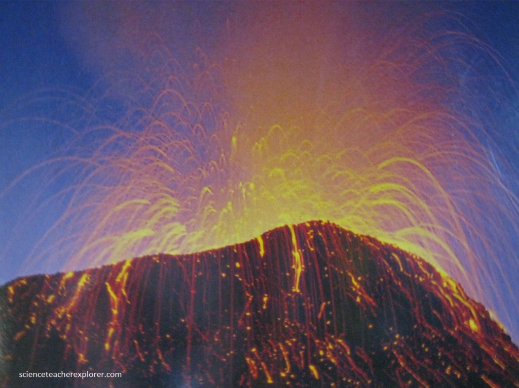
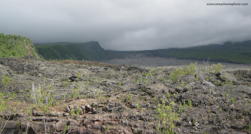
As mentioned, Piton de la Fournaise is an active shield volcano. It is one of the most regularly active volcanoes in the world, averaging one event every 10 months. Its mean effusion rate has been calculated at 0.3 m/s during the last 60 years. Imaged below is the cumulated lava flows from 1972-2000.
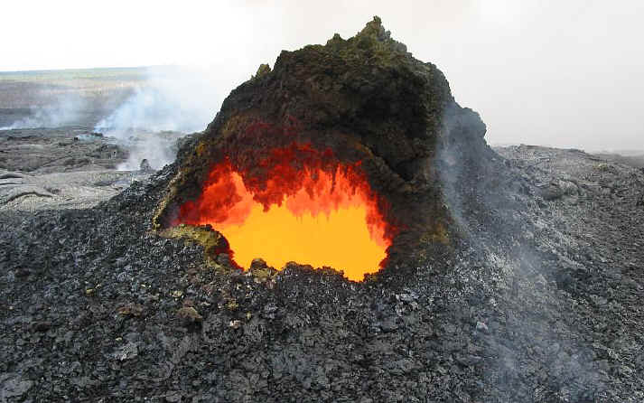
Along with Kilauea in Hawaii, Piton de la Fournaise is one of the world’s most active volcanoes. It has erupted at least 163 times since 1640, most of which have been explosive and produced spectacular lava flows. The fact that the lava is runny makes the eruptions (compared to volcanic eruptions around the world in general) less violent and hence safer to watch, (pictured below).
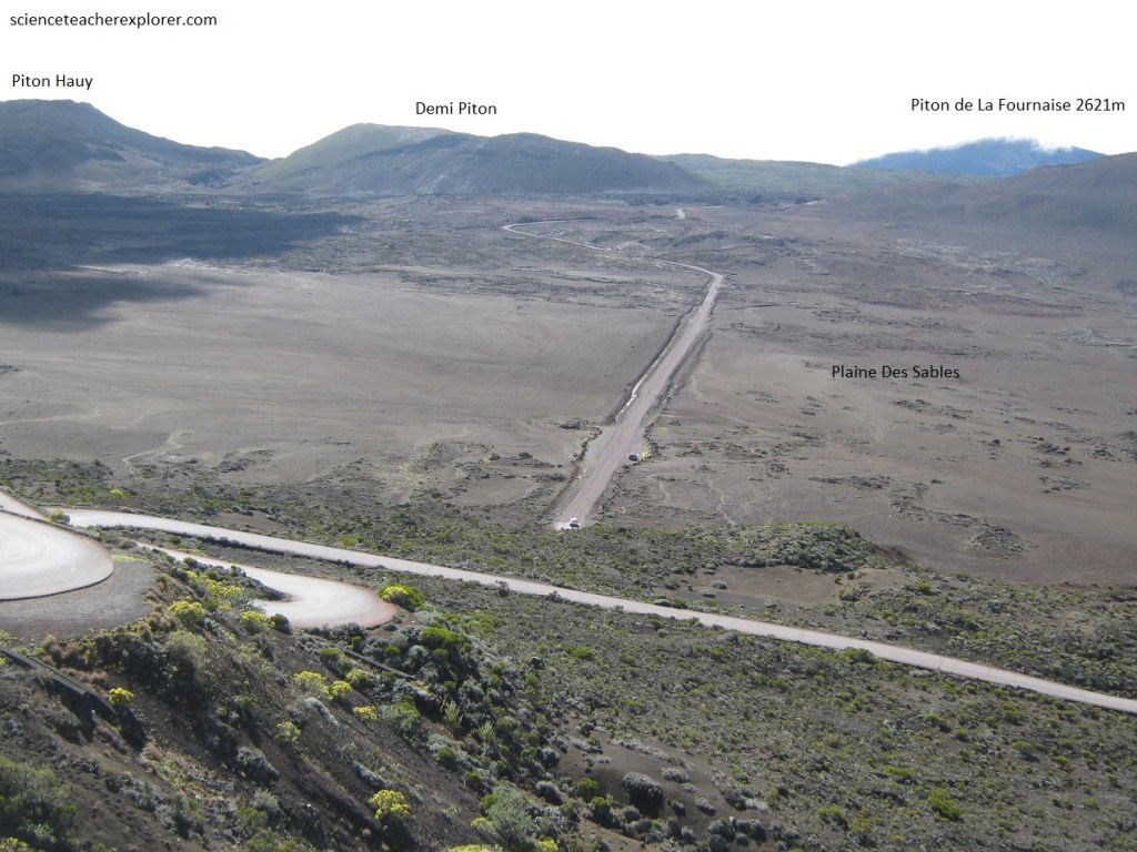
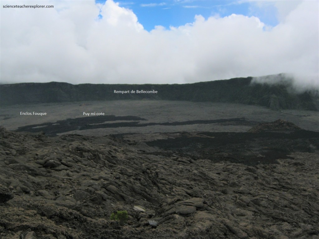
Pictured below, The outer caldera is named Rempart and is about 5,000 years old. From St. Joseph, we took the road up to the Piton de la Fournaise Volcano. The biggest and physically largest attraction we saw was the Plain des Sables, a black plain of volcanic rock that the road to the volcano crossed.
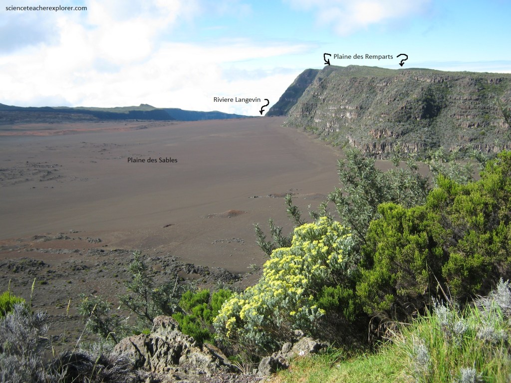
Pictured below, at an average altitude of 2,260 meters, the Plaine des Sables is bounded to the west by the rempart of Les Sables and to the east by the rampart of Pa de Bellecombe.
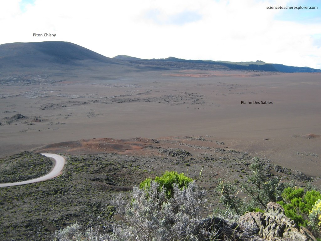
Pictured below, completely bare, covered with slag and volcanic rocks, the Plaine des Sables suddenly came into view for us when we reached the view of Pas des Sables, 2,350 meters above sea level. Ahead, towards the north, we admired the imposing Piton Chisny, on the opposite side and the famous Dolomieu crater of the Piton de la Fournaise rose straight in front of us.
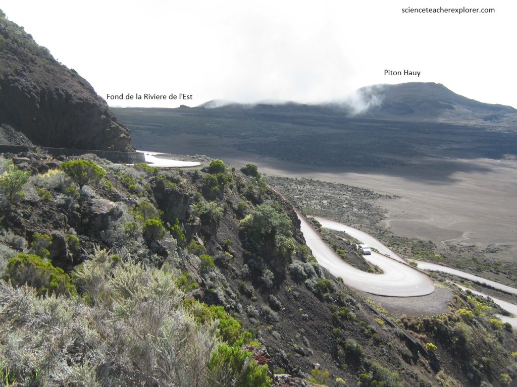
Pictured below, on the left (west) facing the plain, we could see towards the Sainte-Thérèse Oratory and its view of the impressive Casse de la Riviere de l’ East.
As we continued along the Piton de la Fournaise road, we came upon the parking lot at the “Pas de Bellecombe” to hike into the inner crater. Delimited by cliffs ranging from 100 to 400 m in height, is the inner caldera, Enclose Fouque.
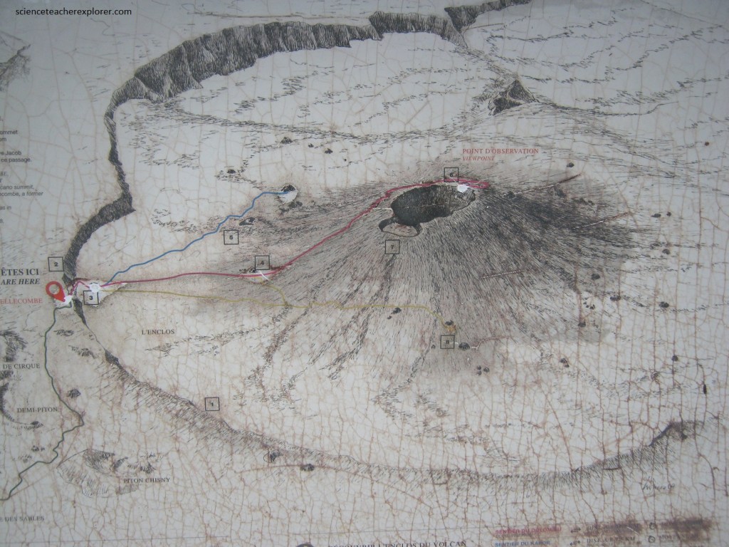
Pictured below, the flat plain of the “inner crater”, about 2,200 m above sea level, is almost completely devoid of vegetation and is dominated by volcanic rock and ashes from recent eruptions.
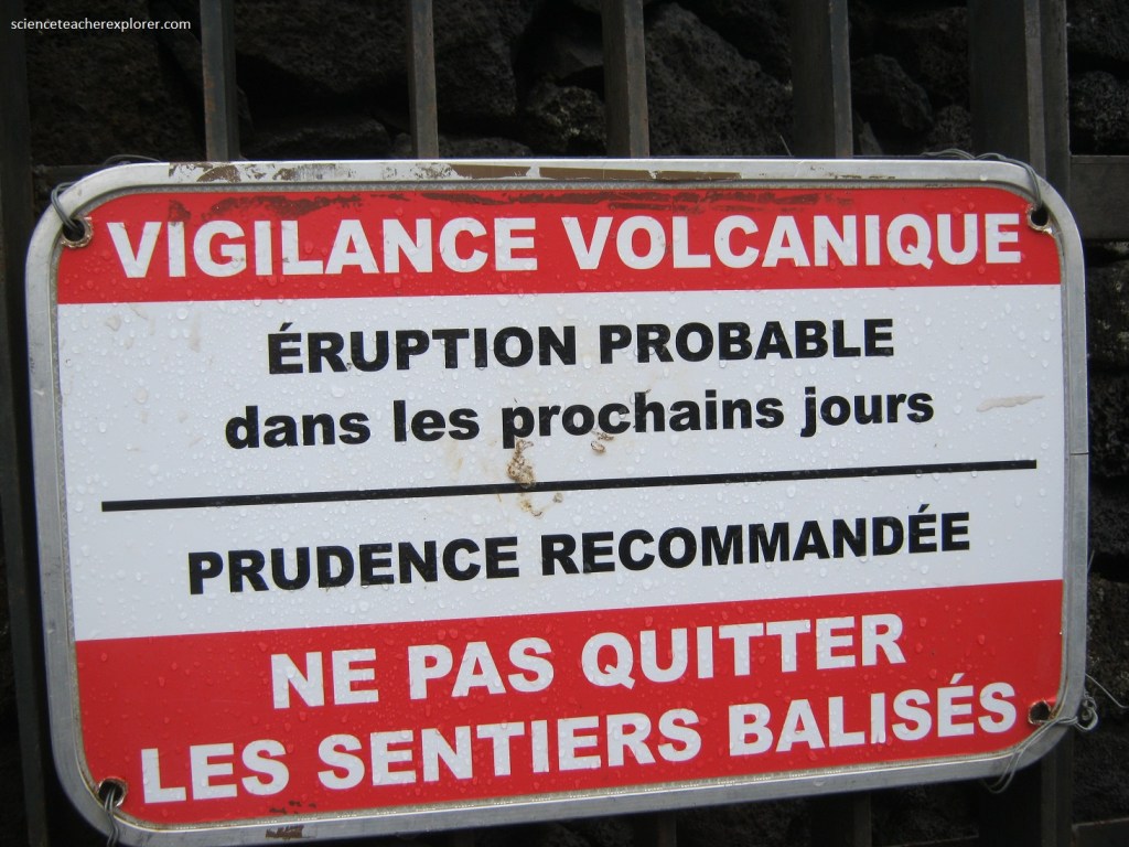
Pictured above and below, a stairway path descended from the pass to the caldera floor. This path would of been closed for safety reasons during seismic events that may have preceded eruptions and/or during eruptions.
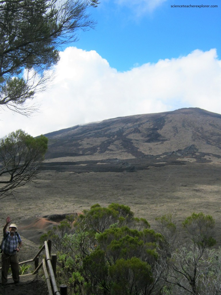
Pictured below, in the middle of this moon landscape is the dome of the volcano, rising 400 m above the caldera floor and forming the summit of the volcano. The dome has a diameter of about 3 km and comprises two craters, Bory and Dolomieu.
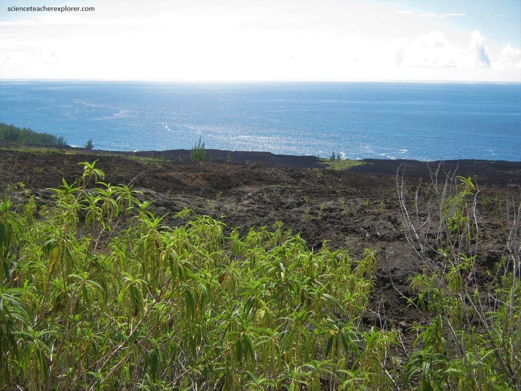
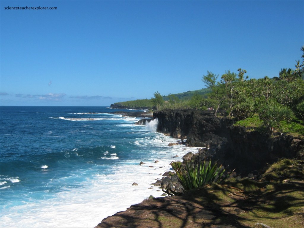
Pictured below, high cliffs, known as remparts in French, form the caldera’s rim. The caldera is breached to the southeast towards the sea. The eastern flank of the volcano is unstable and is in the initial stages of failure. It will eventually collapse into the Indian Ocean.
Pictured below, many craters and spatter cones can be found inside the caldera and on the higher flanks of the volcano. Lavas with high concentrations of Iridium are routinely ejected through these vents.
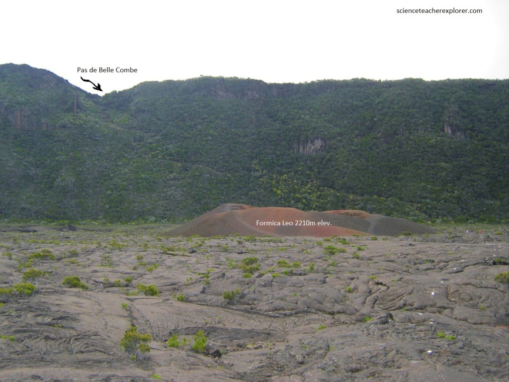
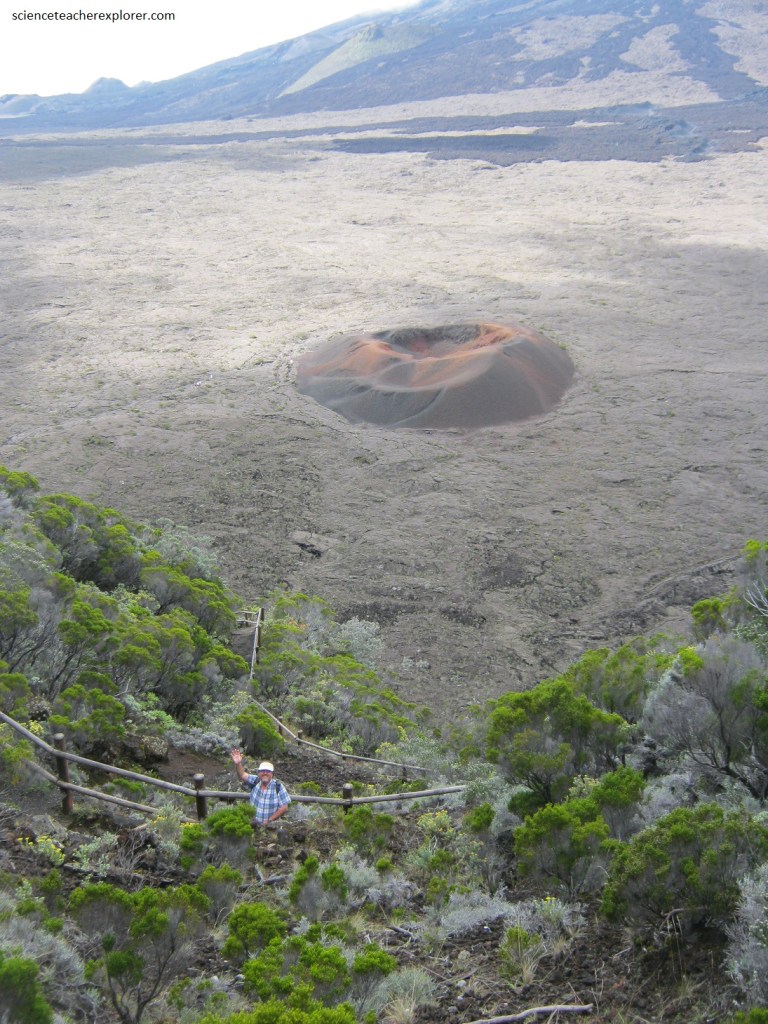
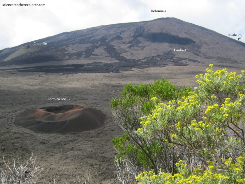
Pictured below and above, near the caldera wall, lies a small noteworthy crater called “Formica Leo”, named for its resemblance to the sand pit trap of an antlion. It is made out of millions of small basalt pebbles of different tints, from glossy black to rocky red. Formica Leo’s color tends to change as the pebbles shift under the strong winds.
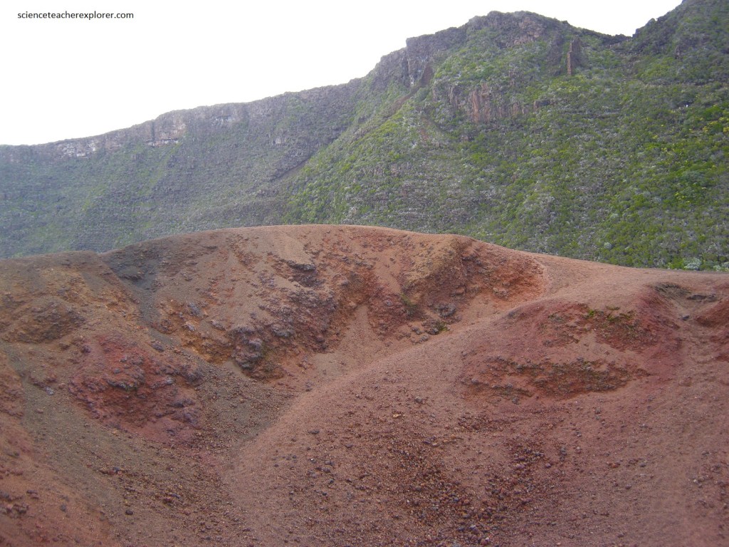
Pictured above, Formica Leo is made up of two overlapping craters: the crater to the southeast is larger and deeper, measuring 40m in diameter and 15m deep, while the northwest crater is smaller and shallower at 22m in diameter and 5m deep. The earliest records of Formica Leo dates back to the 18th century.
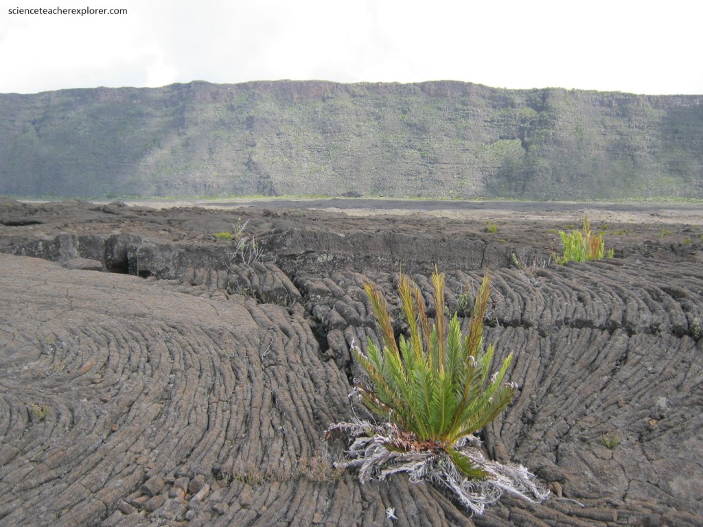
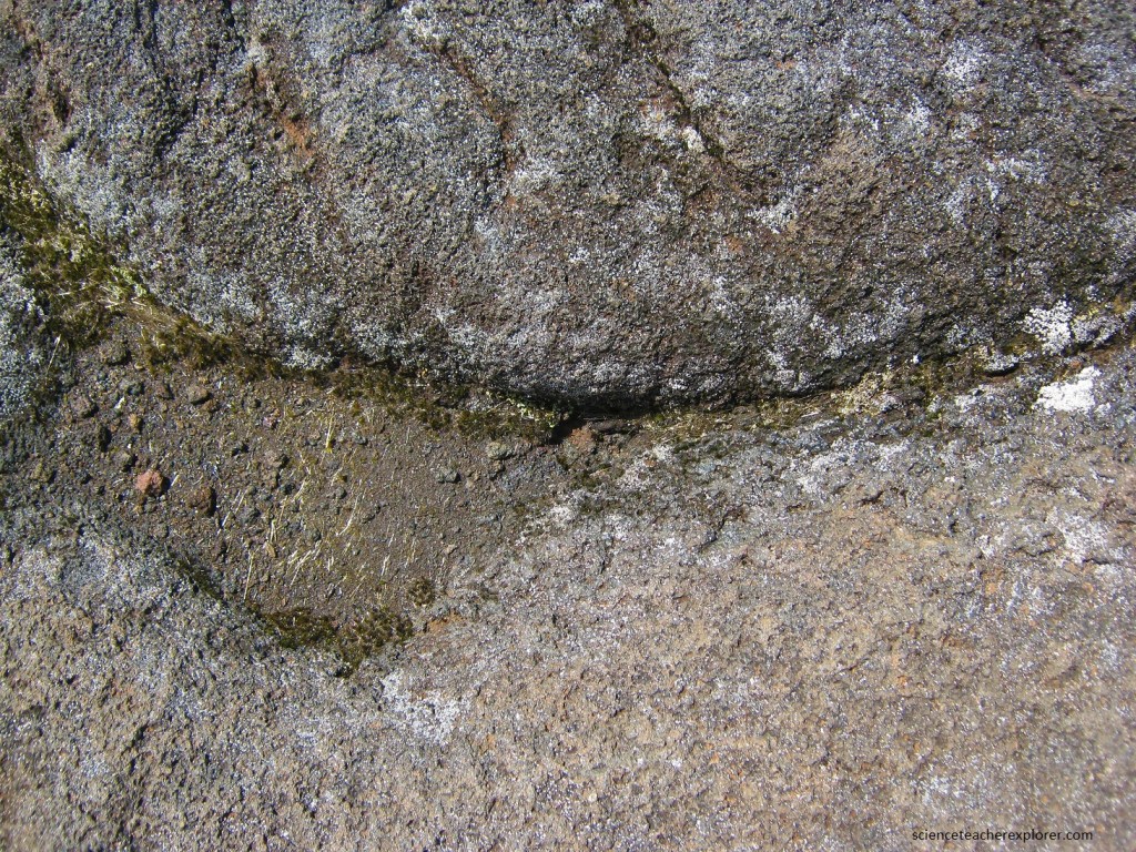
Pictured above, Piton de la Fournaise and the surrounding area are continuously remodeled by the eruptions, and this naturally also goes for the flora. But as soon as the lava has completely cooled down, plants start growing on the slopes again. The lichens are the first to emerge, followed by ferns, shrubs and small-trees.
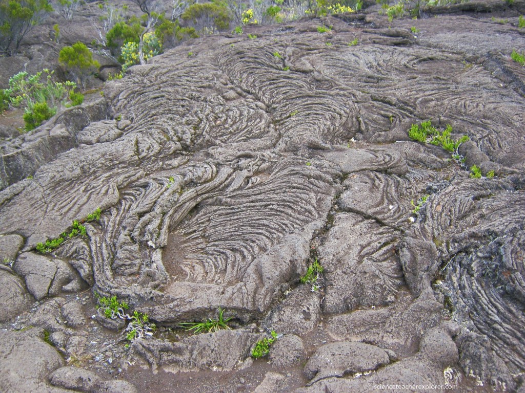
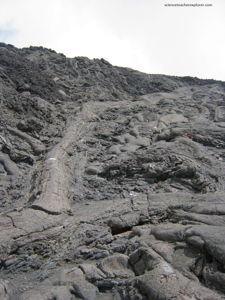
As mentioned above, the type of volcanism, hotspot volcanism, creates several different types of lava. Their names come from Hawaii. The majority of the Enclouse Fouque consists of Pahoehoe lava rock. Pahoehoe lava rock (Lave cordée) is the hottest type (1,100-1,200°C), and hence runny and with an almost glossy surface.
Pictured above, the temperature and name of Pahoehoe lava rock translates to “smooth flow”. When the lava has cooled down, it gets a glitzy, satin-like surface.
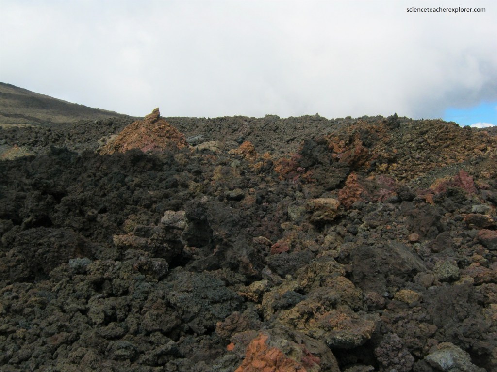
As we trekked across the Enclouse Fouque, towards the Dolomieu dome, the Pahoehoe lava rock turned to Aa lava rock. “Aa” lava rock (Lave en gratons) is cooler (around 1,000°C), less runny, and flows slower, (pictured above & below).
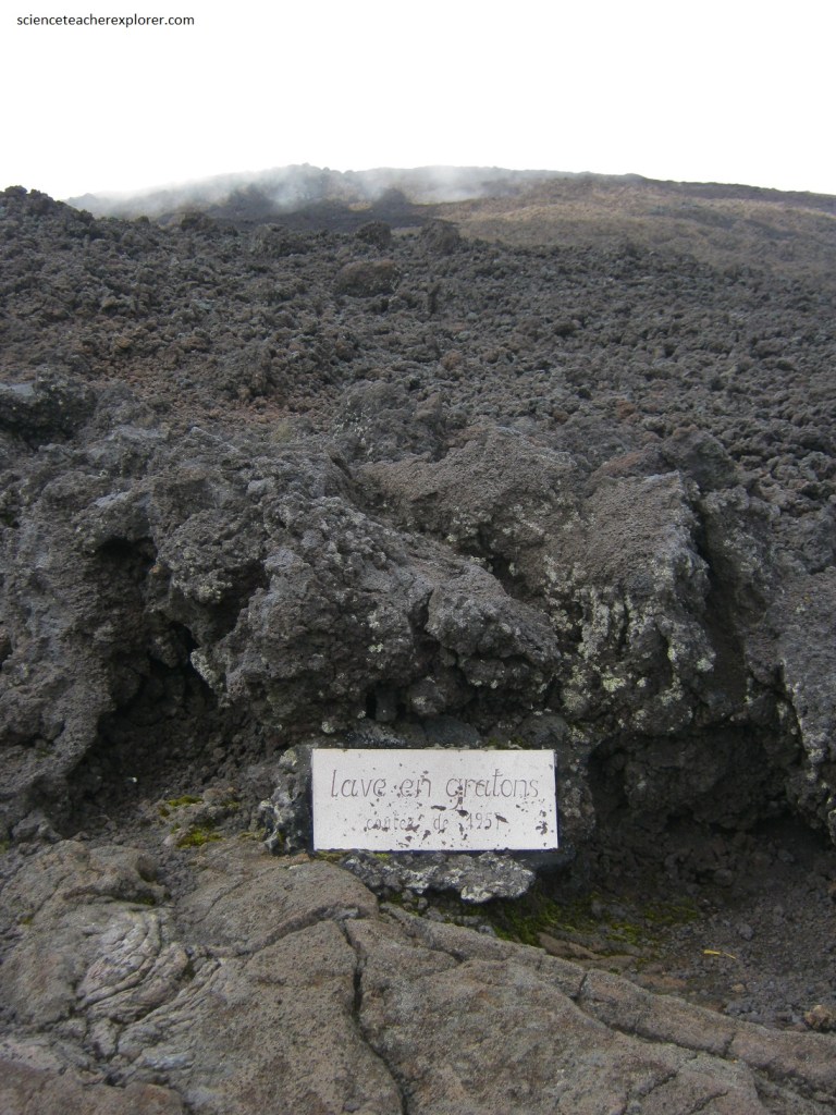
Pictured above, “Aa” type of lava often catches loose rocks along the way, and therefore looks like a plowed field. This name of the lava mimics the exclamation of someone walking barefoot over the cooled lava (with sharp edges). It made trekking across it difficult and hard on your boots.
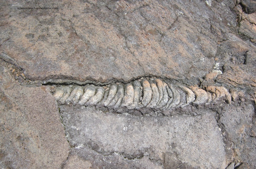
Pictured above, Pele’s hair found on the Pahoehoe lava rock. Pele’s hair (Cheveux de Pélé) is named after the Hawaiian volcano goddess Pele and is volcanic glass fiber that looks like hair and is certainly sharp enough to penetrate skin. It is ejected through lava fountains or lava cascades and can be carried by the wind for several kilometers.
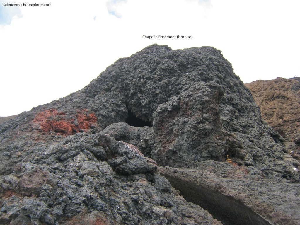
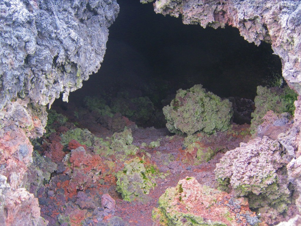
While trekking up the northern side of the Dolomieu dome, I came across the “Chapelle Rosemont”. The Chapell Rosemont is a Hornito. Pictured above, hornitos are conical, or pipe-like, structures built up by lava spattering or being ejected through an opening in the crust of a lava flow. Hornitos are similar to spatter cones but are rootless, meaning they were once a source of lava but that source was not directly associated with a true vent or magma source.
Hornitos are usually created by the slow upwelling of fluid lava through the roof of a lava tube, and are often associated with pahoehoe lavas of basaltic composition. High pressure causes lava to ooze and spatter out. The lava builds up on the surface and solidifies creating the initial structure. Hornitos can grow and exceed 10 meters in height.
Pictured above and below, the volcanic activity of Piton de la Fournaise is mostly concentrated on the central cone. The analysis of all the available geological data lead to the evidence and to describe a shallow reservoir complex beneath the summit area.
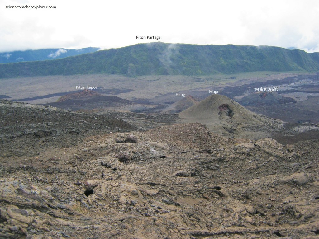
95% of the historical activity occurred inside the caldera of Enclos, which collapsed 2300 years ago; in the last 3.5 centuries, only 8 eruptions or 5% of the activity occurred outside the Enclos, (the latest occurred in 1977 then again in 1986). Most eruptions begin with lava fissures several hundred meters long emerging, from which lava flows evenly like waterfalls. Minutes to hours later the eruption starts concentrating in a few exit points, where lava is shot out at a more uneven pace. Lava that is propelled out with less force often spreads around a large area, but lava that is ejected high up in the air congeals and falls down forming cones known as “pitons”. Eruptions may involve multiple cycles of fissures and exit points, (pictured above and below).
Pictured above and below, the lava flow surfaces range from shiny jet black to waxy battleship gray to dull yellow-brown. The freshness of the iridescent glassy surface and the cooling time of the rock determine the luster and color.
Pictured above, when molten lava chills quickly, a thin, glassy rind forms on the exposed surfaces because crystallization of the minerals in the melt could not take place in such a short time. This layer of glass provides the iridescent luster to the rock. When crystallization occurs, the first minerals to crystallize are mafic minerals, which are dark-colored and contain abundant iron and magnesium. Rocks that cool quickly, especially the outer layers of a flow, are primarily composed of glass particles and tiny mafic minerals. This is why the outer surface of a flow-rock is black.
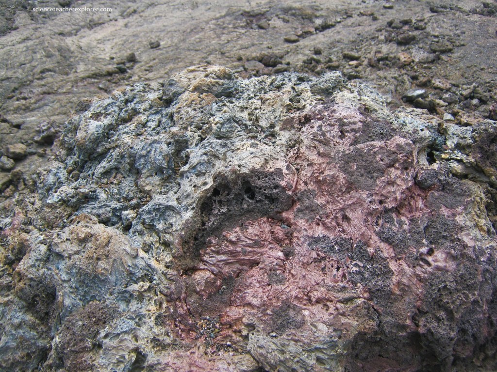
As older lava flows weather, the minerals in the rocks oxidize and often turn to clay minerals. The once shiny rock becomes dull and cloudy, or the glassy surface breaks and falls away to expose the dull interior. One of the most common minerals found in the decomposed rock is hematite, an iron oxide that is usually yellow-brown or rust colored. The abundance of this mineral in the exposed weathered surfaces gives the older flows their distinctive yellow-brown appearance.
Pictured above, in April 2007, the volcano erupted and produced an estimated 3,000,000 m3 of lava per day. During this eruption of 2007 an incremental caldera collapse of Dolomieu occurred at the volcano over more than nine days. The collapse displacing 0.8 x 1.1 km floor downward by 330m, with a volume of 120 million m3. The caldera collapse accompanied one of the largest eruptions of lava at the volcano in the past 100 years.
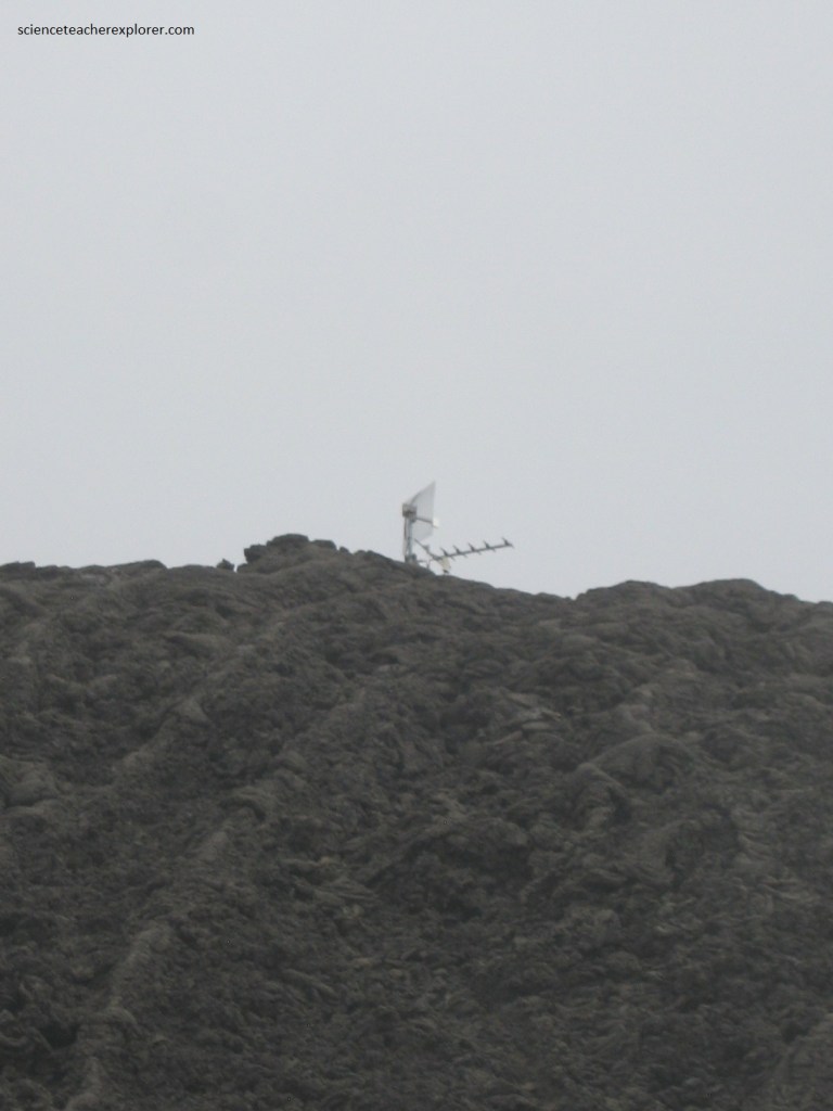
Volcanic activity is constantly monitored by geophysical sensors (tiltmeters, extensometers, differential GPS receivers, etc.). Pictured below, the data from those various sensors is sent to the Piton de la Fournaise Volcano Observatory.
Pictured below, lava flows have been known to cross the N2 highway; areas where the road was destroyed by the eruption are signposted with the year of eruption after the road is rebuilt. In the 2000s, the highway was destroyed one or more times a year; road engineering services then wait for the lava to cool off and build another stretch of road.
Pictured above, while driving along the coastal highway on the southeastern side of Piton-Fournaise, we could see the volcano from a different angle, including eruptions that took place on the eastern side in 2007.
I should mention that the Piton-Fournaise became active again, after we left Reunion in July of 2023.
