St. Kitts, Caribbean 2016
At the end of March 2016, Becky (my wife) and I had the opportunity to rent a car and drive the perimeter of St. Kitts Island and Nevis in the Caribbean. We started in the capital of Basseterre and headed north-west.
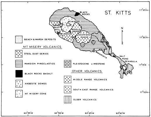
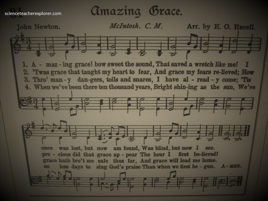
The islands of St. Kitts and Nevis are situated in the northern region of the Lesser Antilles. St. Kitts is 176 square km in size with a population of ~36,000. The main part of the island has a mountain range that runs northwest through the center of the island. One of the first interesting things that we came upon is the small museum of John Newton.
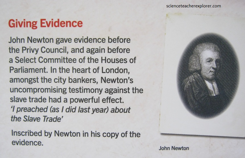
John Newton was a strong political critic of the slave trade of the 18th and 19th Centuries. However, he really become famous for creating the well known song; “Amazing Grace”. This interested Becky a great deal, since her number one talent is singing.
The higher mountain slopes are densely vegetated by rainforest. The foothills gently slope from the base of the mountain range to the coast and are largely covered by sugar cane. Mt. Liamuiga, (commonly known as Mt. Misery) is the northwestern-most mountain and is the highest peak on the island at 1155 m.
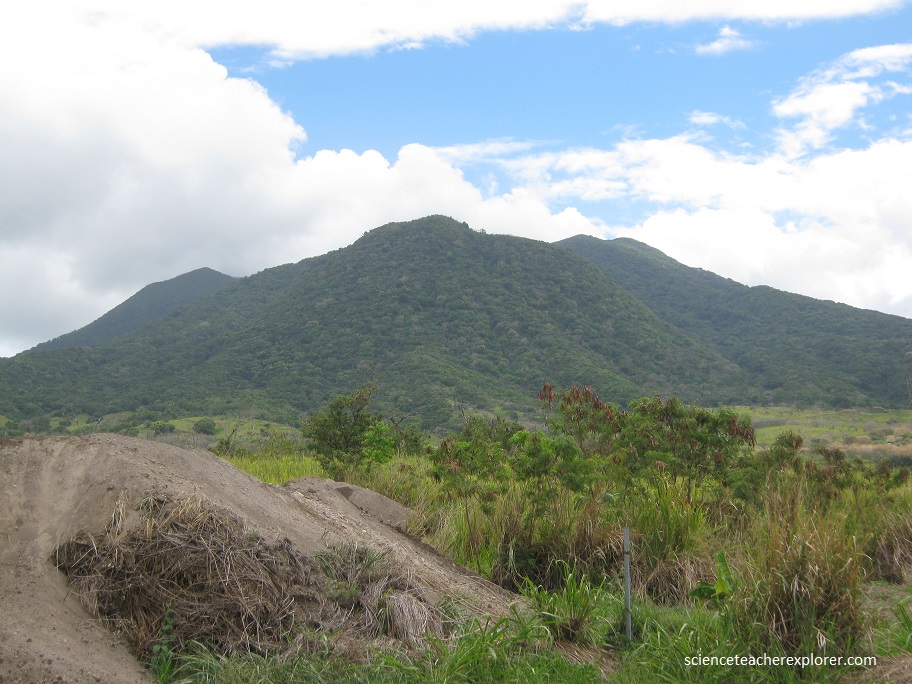
Mt. Misery has a summit crater ~900 m wide and 244 m deep. The summit of Mt. Misery exposes remnant lava flows or domes but the most common deposits identified on the lower flanks of Mt. Misery are pyroclastic deposits. Cliff exposures along the coastline reveal 10-15 m thick successions of pyroclastic deposits (fall, flow and surge deposits), debris avalanche deposits and lahar deposits. Lava domes are prominent on the flanks of the volcano at Brimstone Hill near John Newton’s house/museum. Active fumaroles occur in the crater of Mt. Misery, along the coast below Brimstone Hill and along the base of Brimstone Hill. I was unable to visit these fumaroles.
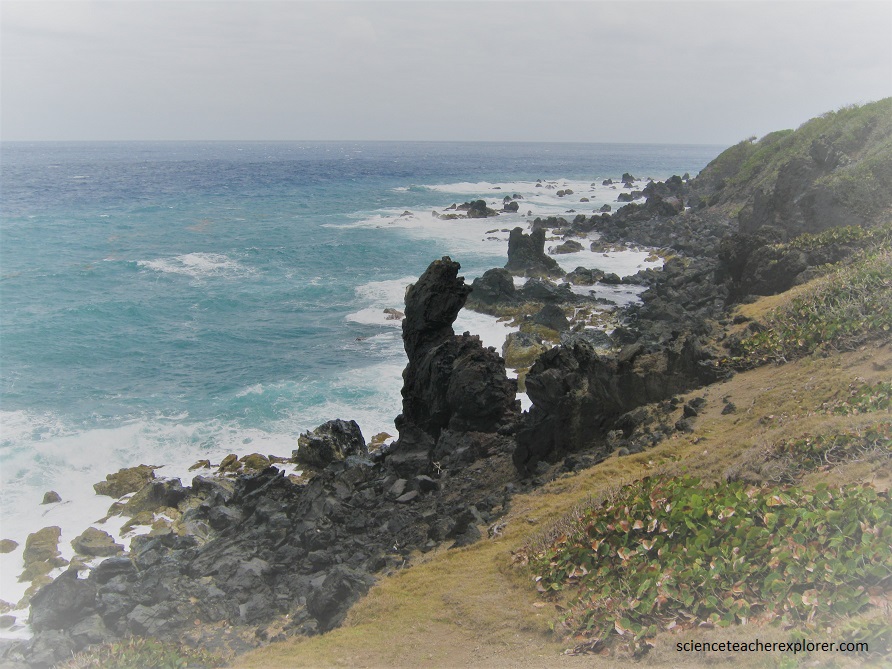
If a lava dome developed in the crater of Mt. Misery it would stay within the confines of the crater until it reached the height of the crater walls and then either collapse to form pyroclastic flows or it may continue to passively erupt lava that would flow down the flanks of the volcano towards the sea to form lava flows like the one we see at the “Black Rocks” (pictured above) on the north-east of the Mount Misery crater.
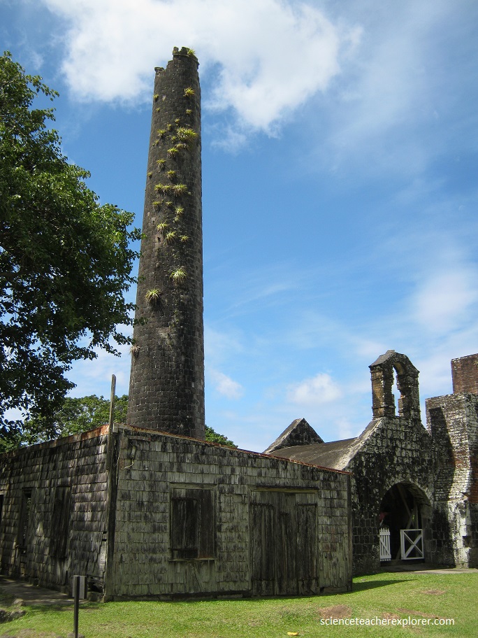
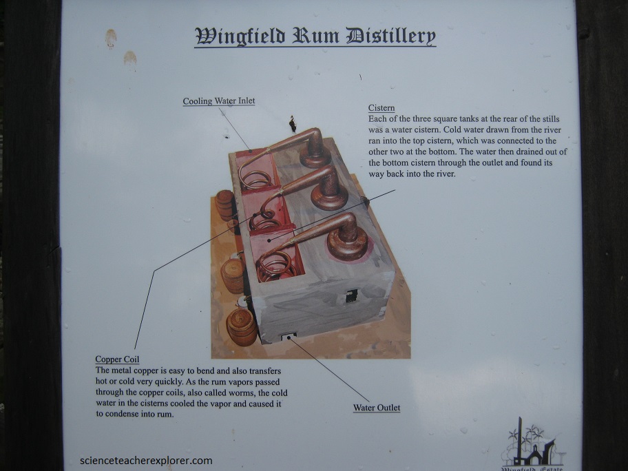
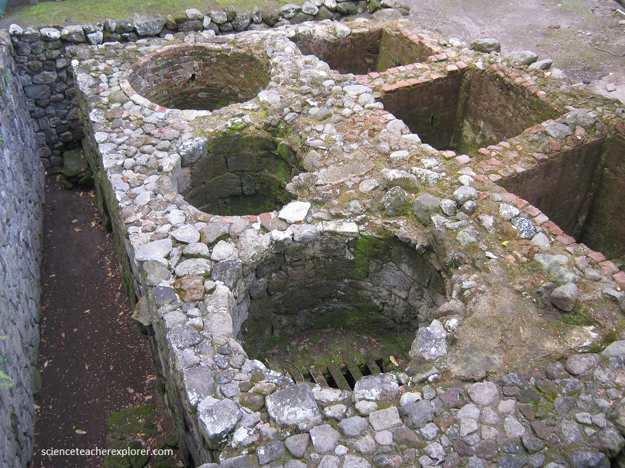
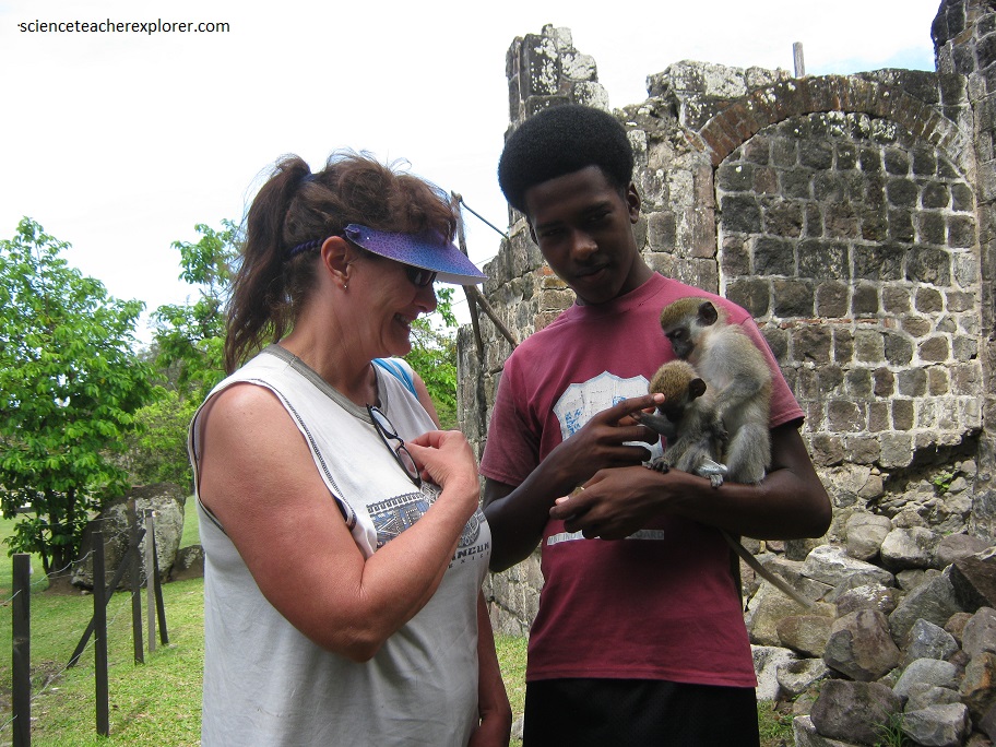
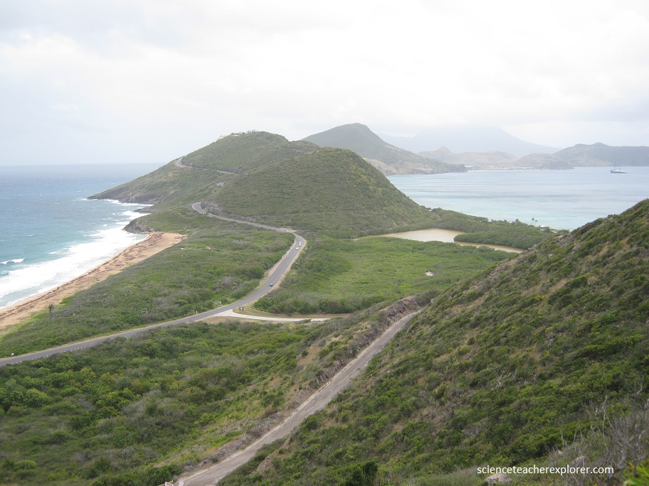
As we drove back towards Basseterre, on the north-east shore of St. Kitts, the topography and vegetation of the Southern Peninsula was dramatically different. It consisted of numerous low, round hills that reach a maximum height of 319 m, but were generally much lower and are separated by flat, low-lying areas and salt ponds. Vegetation was sparse with dryland grasses, low shrubs, cacti and yucca. There we came across the old ruins of a rum factory (pictured above). It was set up like a Museum.
The sharp contrast in both the topography and the vegetation from the north of the island is probably due in part due to the older age of the rocks and the lower annual rainfall in the south. The capital of St. Kitts is Basseterre and it is located 12 km south-east of the summit of Mt. Misery.
Nevis is 93 square km in size and has a population of ~9,000. It is an approximately circular island with a central mountain peak, Nevis Peak, which rises to 984 m. The higher slopes were covered by rainforest and the low-lying and coastal areas were covered by dry scrub. The capital, Charlestown, is situated at the base of the volcano in the southwest of the island.
