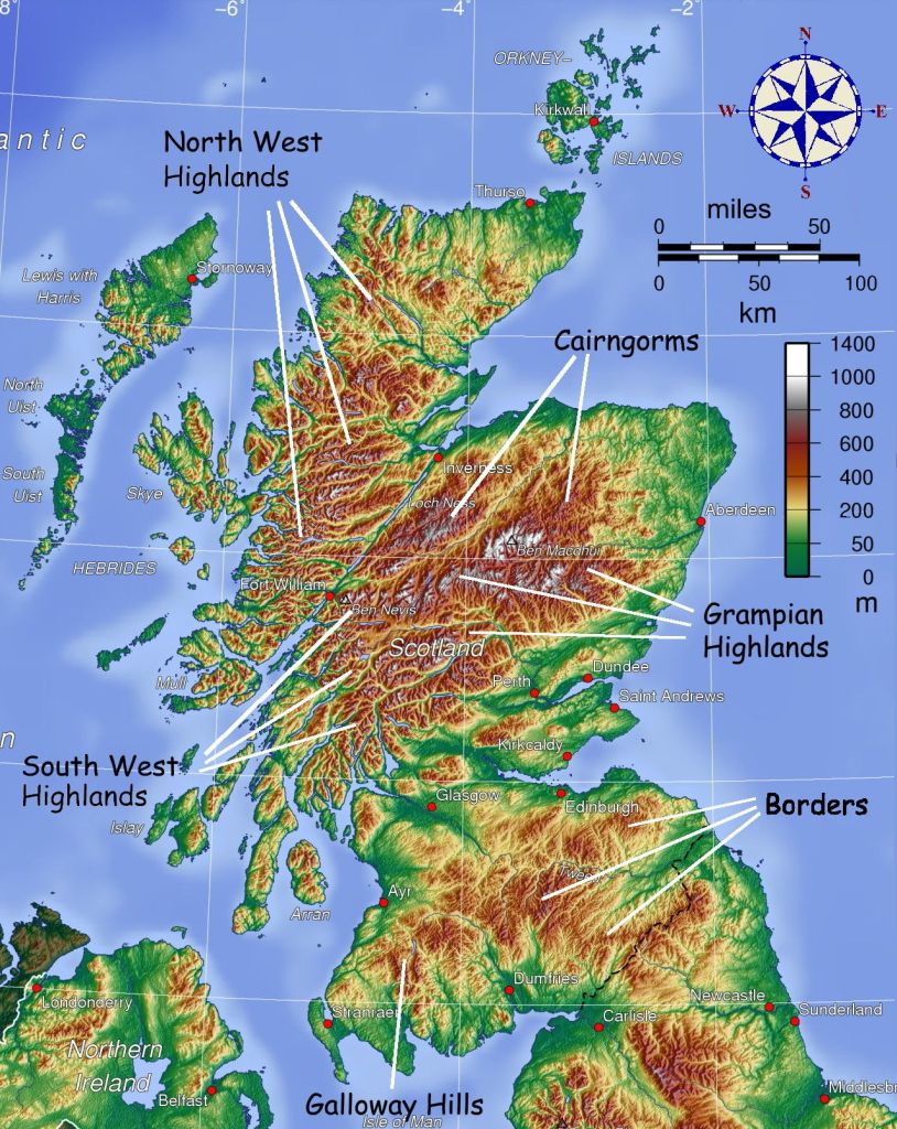
SW Highlands, Scotland
Upon the return from Africa in 2001, I took the opportunity to spend a week in Great Britain.
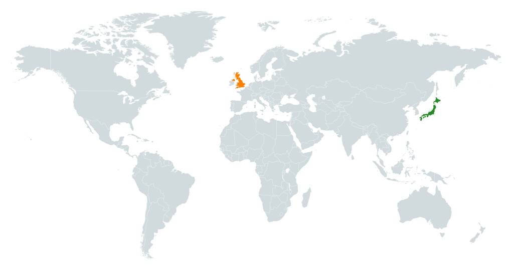
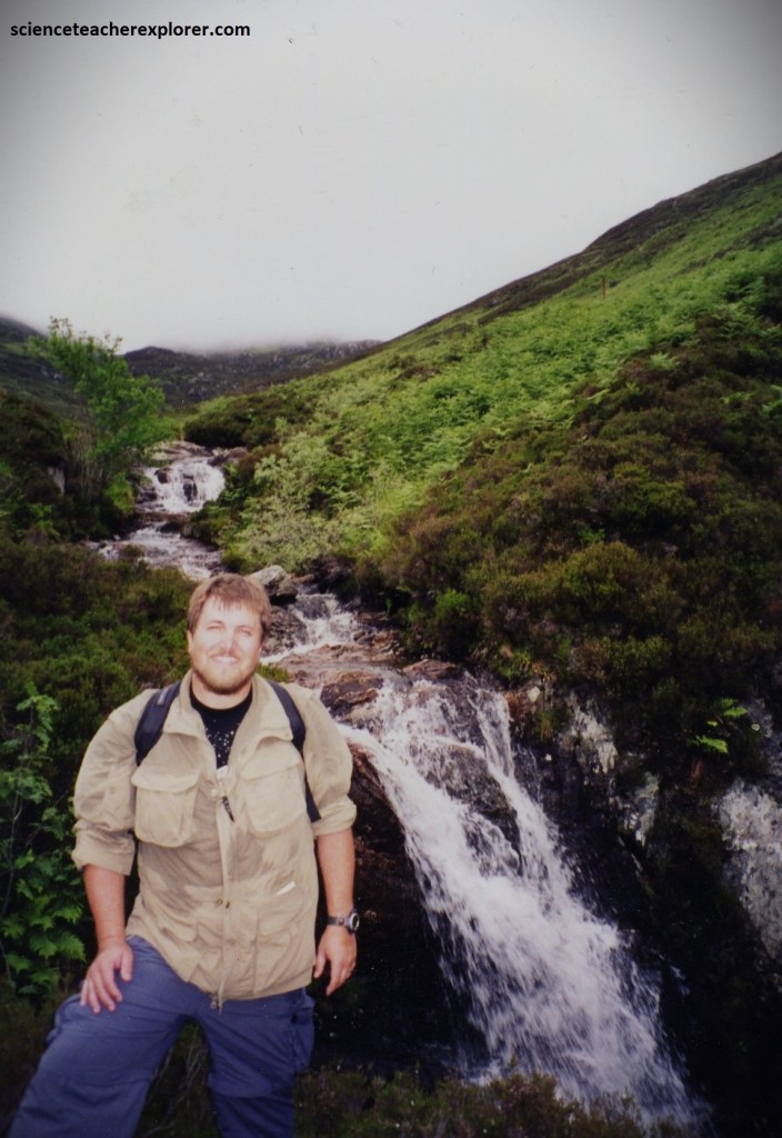
My focus, at this time was to hike a few treks in the Southwestern Highlands of Scotland. This area has a high density of steep and rugged Munros (Scottish mountains over 1000 meters) including the highest mountain in the British Isles, Ben Nevis (1,344 meters).
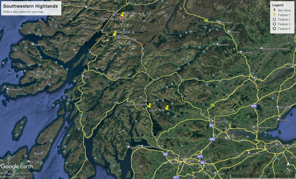
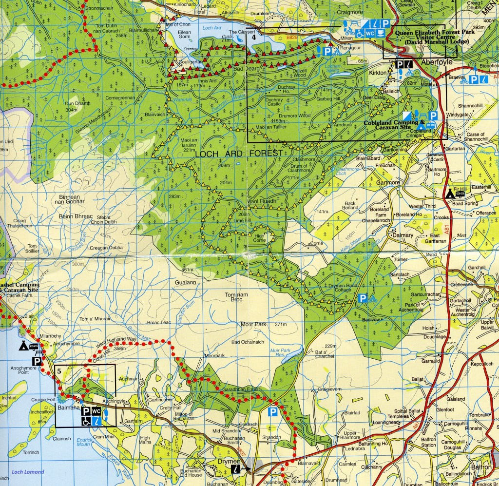
My trekking group had made plans to stay at a Hotel in the Queen Elizabeth Forest Park on the shores of Loch Ard near Aberfoyle, Scotland. Aberfoyle is 42 km north of Glasgow.
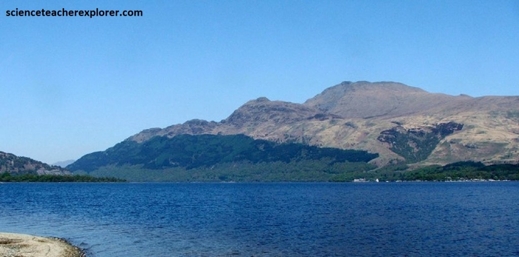
Lying 5km west of Aberfoyle, Loch Ard is considered to be the source of the River Forth, which flows from its eastern end, although the river’s true source is the confluence of its outflow, the Avondhu River, and Duchray Water. Home to various wildlife and popular recreational activities, the loch is part of the 22-loch network within the Loch Lomond & The Trossachs National Park. Notably, the cherished Scottish author and poet, Sir Walter Scott, found inspiration in the moody, picturesque landscapes surrounding Loch Ard.
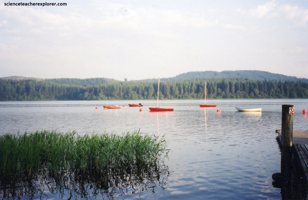
The landscape surrounding Loch Ard was characterized by rolling hills and dense forests, managed by Forestry and Land Scotland. The area offered a rich, biodiverse environment with various walking trails for me to explore. The geological features of the region had been shaped by the forces of erosion and glaciation over time, with Loch Ard itself formed by glacial action during the last ice age, 17,000 years ago.
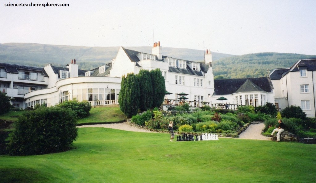
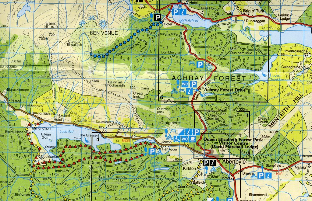
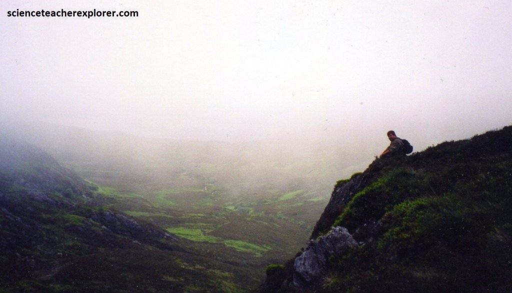
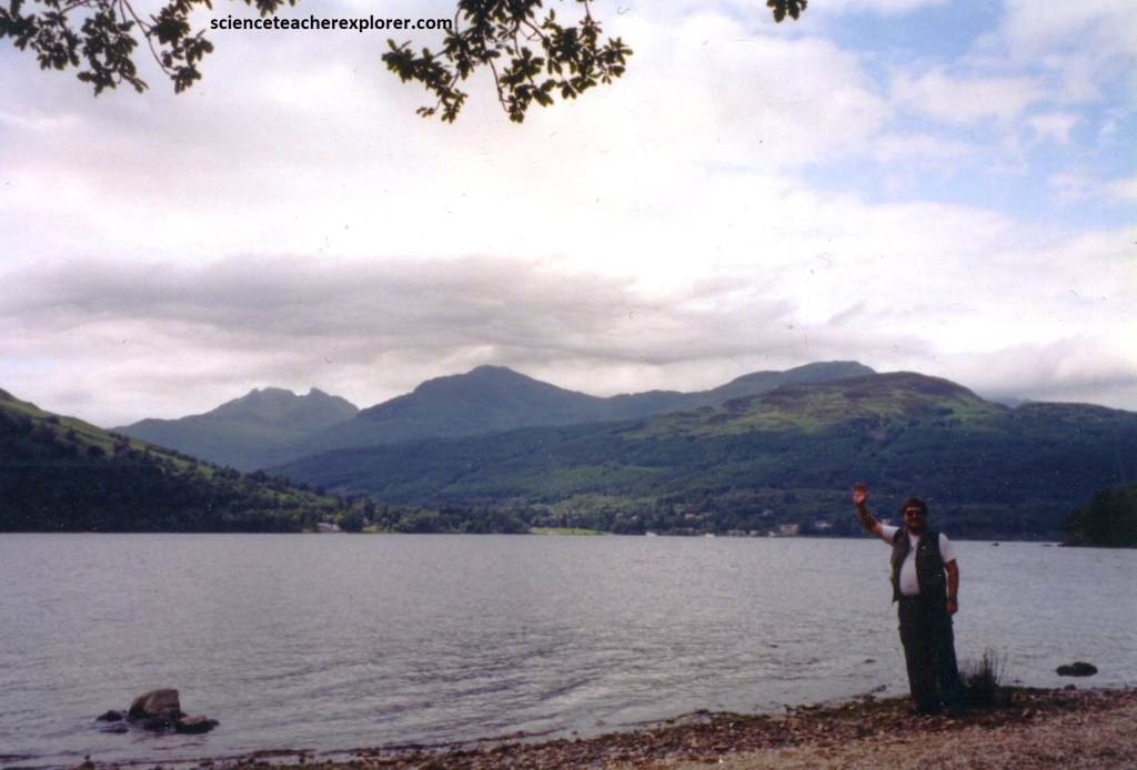
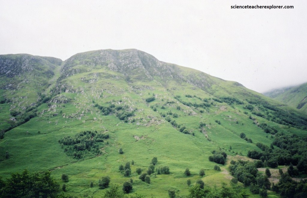
Pictured above, our trekking group stayed at the beautiful Forest Hills Hotel on the shores of Loch Ard. The village of Aberfoyle lies 3 km to its east, with the summit of Craigmore behind it, while the mountain of Ben Lomond sits to its west. The northern shores of Loch Ard (and behind the Forest Hills Hotel) are dominated by the mountain ridge of the 616-meter tall Beinn an Fhogharaidh. My plan was to hike up the face of Beinn an Fhogharaidh and down the Ben Venue (795m) trail.
Loch Ard’s geology consists primarily of the metamorphosed neo-proterozoic-sedimentary rocks called the Southern Highland Group, (sandstone and shale), which have been gradually shaped and sculpted by the tectonic-forces of nature. It forms the uppermost/youngest part of the Dalradian Supergroup.
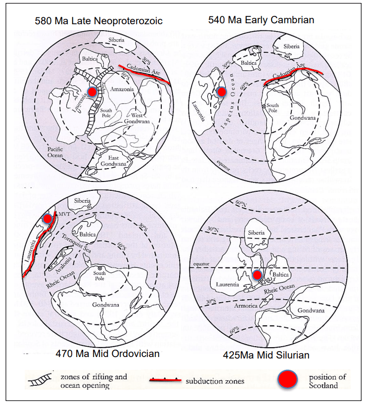
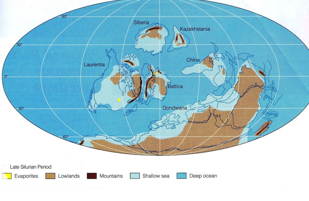
The geological history of the Loch Ard and the and nearby Trossachs National Park began around 700 million years ago, in the Precambrian era. At that time, Scotland lay within a major supercontinent, which was positioned close to the South Pole. However, then as now, continents could move gradually across the Earth’s surface through the process of plate tectonics. Such tectonic processes led to the crust of the supercontinent being gradually stretched and thinned, until eventually it split, and a new ocean began to grow. This is known as the Iapetus Ocean, and it separated Laurentia (a continent containing Scotland, Greenland and parts of North America) from the continent of Gondwana to the south. The continent of Laurentia moved northwards as the Iapetus Ocean widened. Around the margins of the continent, sediments were laid down on the ocean floor; these sediments would eventually become the rocks of the Southwestern Highlands.
In Scotland, the rocks that were originally deposited in the developing Iapetus Ocean are known as the Dalradian Supergroup. They underlie the southern and central Highlands, extending from the Great Glen in the north to the Highland Border in the south. As the Iapetus Ocean began to widen, deep offshore basins developed. Mud, sand and rock fragments eroded from the continent were carried into the ocean, and cascaded down the continental slope to be laid down in these basins. At times, distant volcanic eruptions produced volcanic ash that was deposited along with the other sediments, forming distinctive rock units that are now known as the Green Beds. All these rocks make up the Southern Highland Group, the youngest part of the Dalradian Supergroup, and they underlie much of the area.
Deposition of sediments along the edge of the Iapetus Ocean continued through the Cambrian period and into the early part of the Ordovician period, around 480 million years ago. By now, the continental margin was more stable, and muds, sands, and lime-rich deposits were laid down in shallower waters.
Around 490 to 475 million years ago, the continuing deposition of oceanic sediments was violently disrupted by tectonic processes. A chain of volcanic islands, which had developed in the Iapetus Ocean, had been slowly moving towards the continental margin. Finally the island chain collided with the continent, causing a geological event known as the Grampian Orogeny. Large fragments of ocean floor were scraped up and thrust onto the continental margin, and remnants of this oceanic material can still be seen along the Highland Border today. The combination of pressures from above and below meant that the sediments described above were buried and compressed, being squeezed into large-scale folds. At depth, the pressures and temperatures affecting the sediments increased, and so new minerals grew, in the process known as metamorphism.
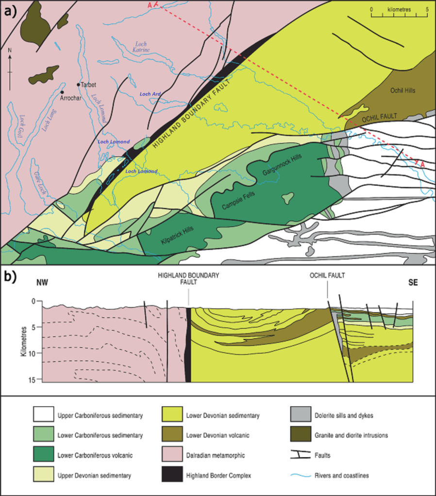
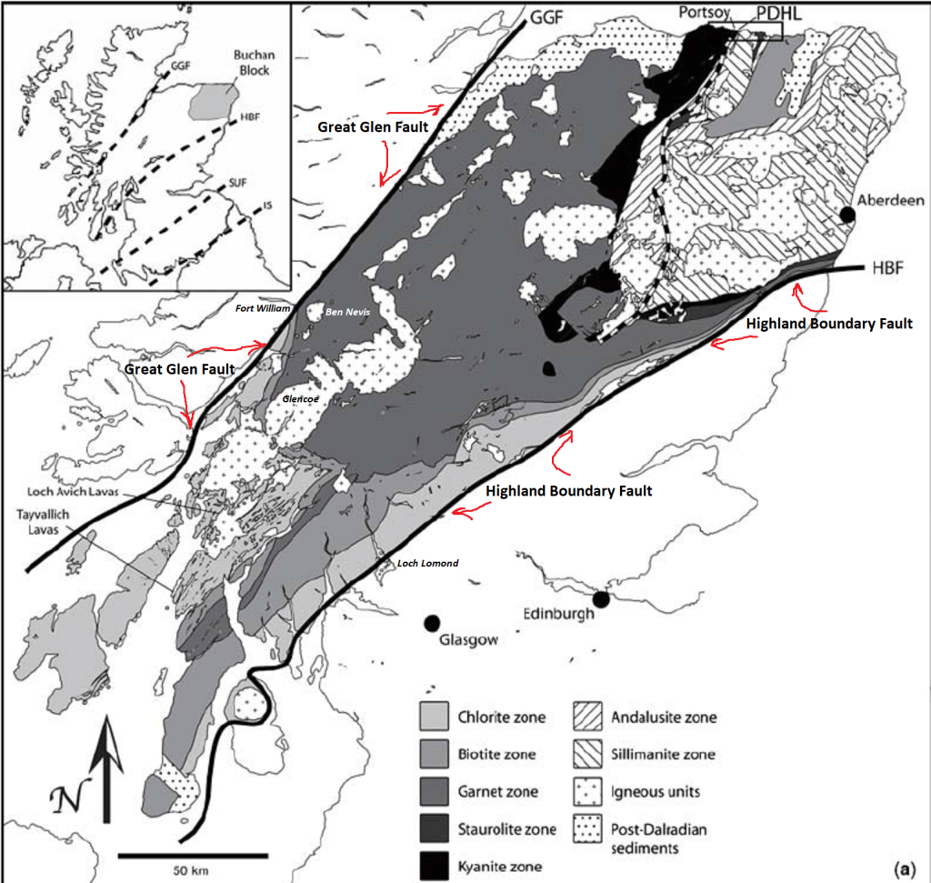
The compression, during the Grampian Orogeny caused all the rocks around the area thickened the continental crust, leading to uplift and the formation of a mountain chain, which was then rapidly eroded. Meanwhile, the Iapetus Ocean was gradually closing, as the ocean floor sank beneath the margin of the Laurentian continent at a subduction zone to the south of the previous collision zone. Eventually, around 430 million years ago (Silurian), Laurentia collided with two other continental masses: Avalonia (England) and Baltica (Scandinavia). In the area of the Loch Lomond, deformation of the rocks around this time was largely restricted to displacement of blocks of rock along major fractures (faults) in the Earth’s crust. The most prominent of these structures is the Highland Boundary fault zone, which separates the older rocks of the Dalradian Supergroup from younger rocks to the south, and also forms a prominent landscape feature, (imaged above).
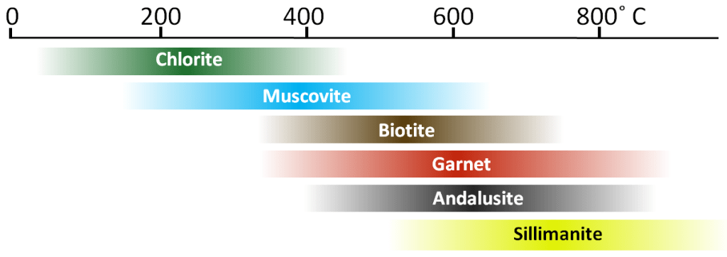
It should be noted that regional metamorphism occurs when rocks are buried deep in the crust. This is commonly associated with convergent plate boundaries and the formation of mountain ranges, (such as the Grampian Mountain Range) . Because burial to 10 to 20 kilometers is required, the areas affected tend to be large—thousands of square kilometers. Rather than focusing on metamorphic rock textures (slate, schist, gneiss, etc.), geologists tend to look at specific minerals within the rocks that are indicative of different grades of metamorphism. Some common minerals in metamorphic rocks are shown in figure below, arranged in order of the temperature ranges over which they tend to be stable.
As mentioned above, the southwestern parts of the Scottish Highlands were regionally metamorphosed during the Grampian Orogeny (around 470-430 Ma), when the two small continental-blocks of Avalonia (England) and Baltica (Scandinavia) was pushed up against the existing eastern margin of Laurentia. As shown in image below, clastic sedimentary rocks within this terrane were variably metamorphosed, with the strongest metamorphism in the northeast (the sillimanite zone), and progressively weaker metamorphism toward the west and south. The rocks of the sillimanite zone were likely heated to over 700°C, and therefore must have buried to depths between 20 and 25 kilometers. The surrounding lower-grade rocks were not buried as deep, and the rocks within the peripheral chlorite zone were likely not buried to more than about 5 kilometers.
A probable explanation for the above pattern is that the area with the highest-grade rocks were buried beneath the central part of a mountain range formed by the collision of Avalonia (England) and Baltica (Scandinavia) with North America. As is the case with all mountain ranges, the crust became thickened as the mountains grew, and it was pushed farther down into the mantle than the surrounding crust. This happens because Earth’s crust is floating on the underlying mantle—and that is known as an isostatic relationship. As the formation of mountains adds weight, the crust in that area sinks farther down into the mantle to compensate for the added weight. The likely pattern of metamorphism in this situation is shown in cross-section in the left image below. The mountains were eventually eroded (over tens of millions of years), allowing the crust to rebound upward, thus exposing the metamorphic rock (right image below).
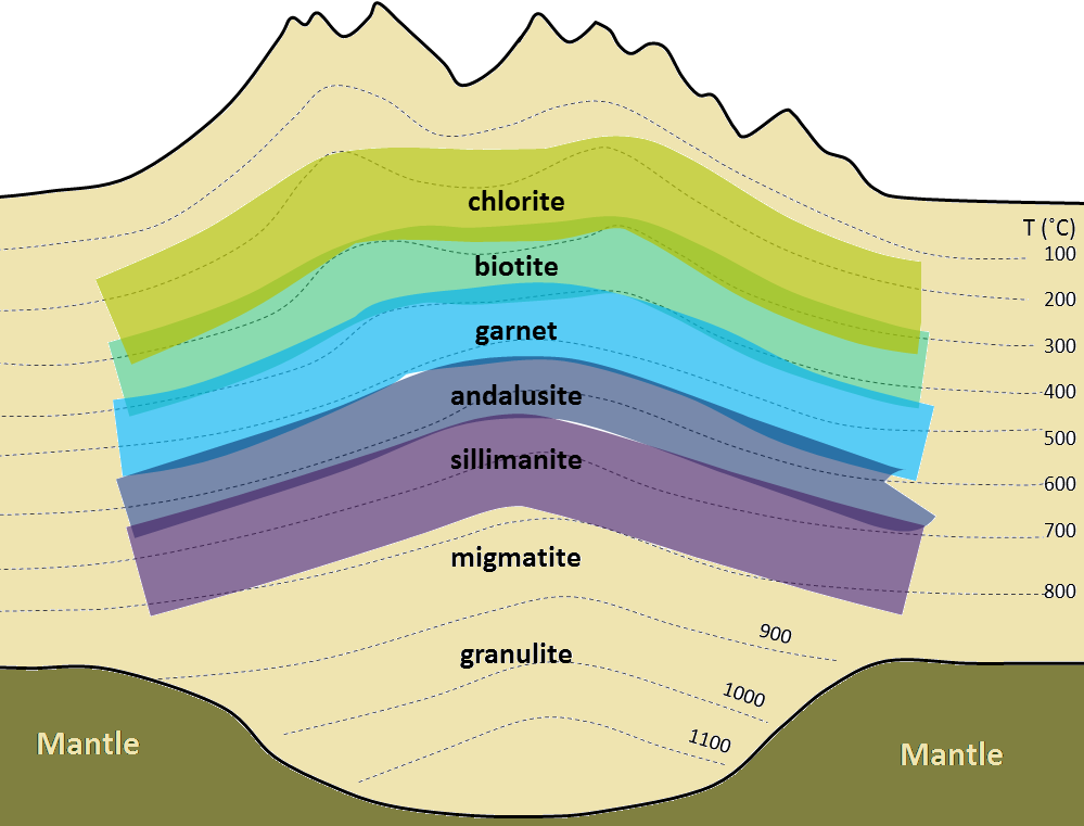
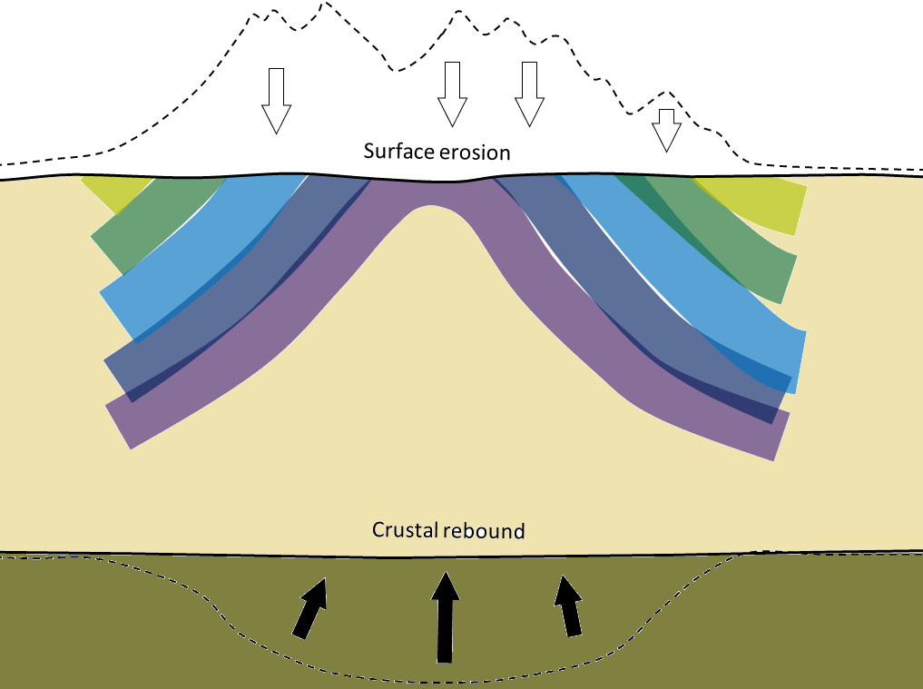
The figure on the left is the thickened crust underneath the mountain range to compensate for the added weight of the mountains above and has sunk into the mantle. The image on the right is when the mountains have been eroded. As they lost mass the base of the crust gradually rebounded, pushing up the core of the metamorphosed region so that the once deeply buried metamorphic zones are now exposed at surface. (image taken from “Physical Geology, 2nd Edition” Earle)
During the late Silurian into the Devonian period, from about 420 million years ago, Scotland lay to the south of the equator and was relatively arid. The Highland Boundary formed the dividing line between a chain of mountains to the north and an area of low-lying ground to the south. Seasonal rivers flowed down off the mountains, carrying with them sand and pebbles, which were then deposited on the lower-lying plains. Over time, this accumulated material became the red-colored sandstones, mudstones and conglomerates that can be seen in the south-eastern part
of the Loch Lomond area.
To summarize: The natural beauty and striking landscapes of the Loch Lomond are a direct product of its geological history. A major landscape feature within the area was the Highland Border, which separates the rugged peaks and deep glens of the Highlands from the lower, rolling hills and broad straths of the Lowlands. This landscape feature follows a geological structure known as the Highland Boundary fault zone, which separates ancient Precambrian metamorphic rocks in the Highlands from younger, softer, sedimentary rocks to the south, (image above). These geological differences have been exploited over time by the erosive power of wind, water and ice to produce the present-day landscape of the Loch Lomond area.
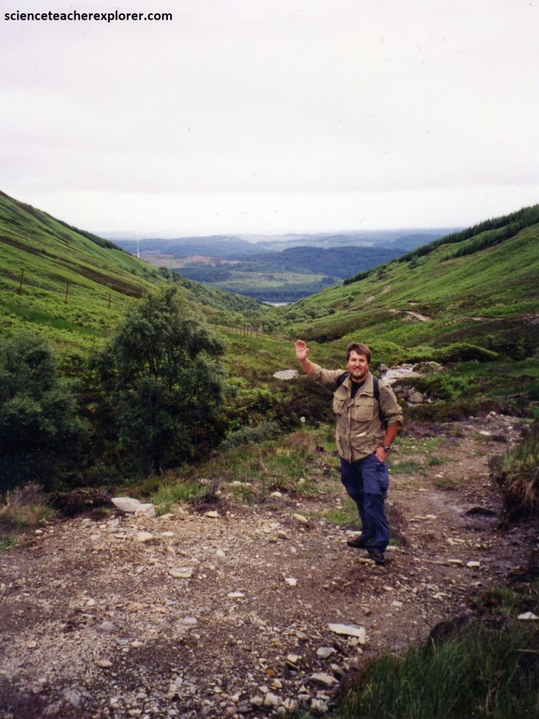
Imaged above, I drove south around the Loch Ard Forest to trek part of the West Highland Trail on the eastern shores of Loch Lomond. The West Highland Way stretches 154 Km from Milngavie to Fort William, taking in a huge variety of scenery along the way, from countryside parks to loch-shores and open moorlands to steep mountains. I started my trek of the trail at Rowardennan, and finish at the Beinglas Campsite near Inverarnan. This would be a trek of 34 km in one day. Alot of it was done on a jog, (this actually made a long 20 hour day).
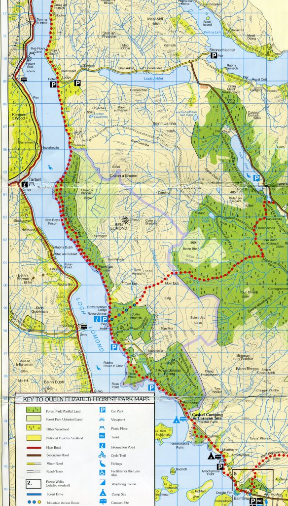
Loch Lomond traces the geological boundary between Highland and Lowland Scotland, formed when the Dalradian rocks, once a mountain range higher than the Himalayas, collided with the Devonian lowlands to the south. The Highland Border Complex, a mixture of marine sediments, completes the geology of the Highland Boundary Fault. From the highest point along the loch, the 1,005m summit of Conic Hill, the fault can be clearly observed running across southern areas of the Loch.
The 38 km long body of freshwater for Loch Lomond was punctuated by numerous unspoiled islands, each a microcosm of Scottish natural history. On this trek, along the eastern side of Loch Lomond, over a quarter of all British plant species could be found.
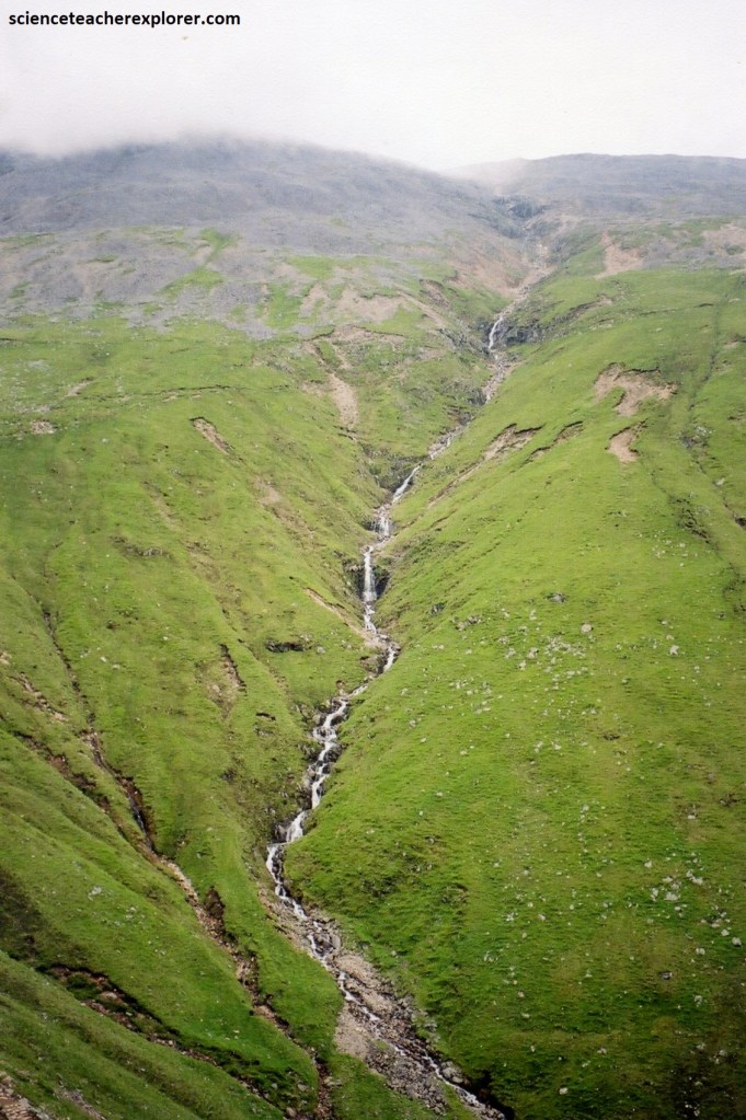
The West Highland rRoute from Rowardennan was very scenic with some beautiful native woodland as well as short, less attractive forestry sections, and good views over Loch Lomond for much of the way. Some of the way to Inversnaid were forest tracks, but also much rugged walking and ascent/descent on the loch-side path which is very rocky and rough at times, (pictured below). I took the Lower route that closely followed the waters edge of Loch Lomond, but was quite hard going, often requiring the need to scramble over large boulders and has steep dips in the pathway with lots of rocks and tree roots, (pictured below).
Pictured below, Rowchoish Bothy was formerly the byre of Rowchoish Cottage, which was inhabited until the late 1930s. Apparently there were nine families living in the area in 1759, and at least three settlements between Rowchoish and Inversnaid, about 5 km north.
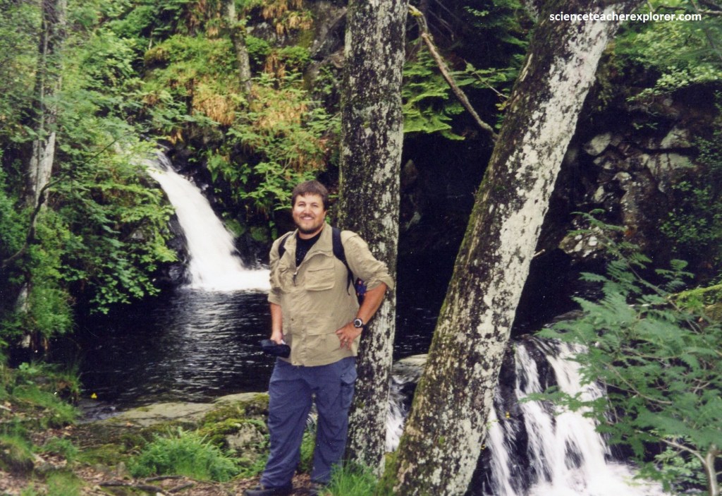
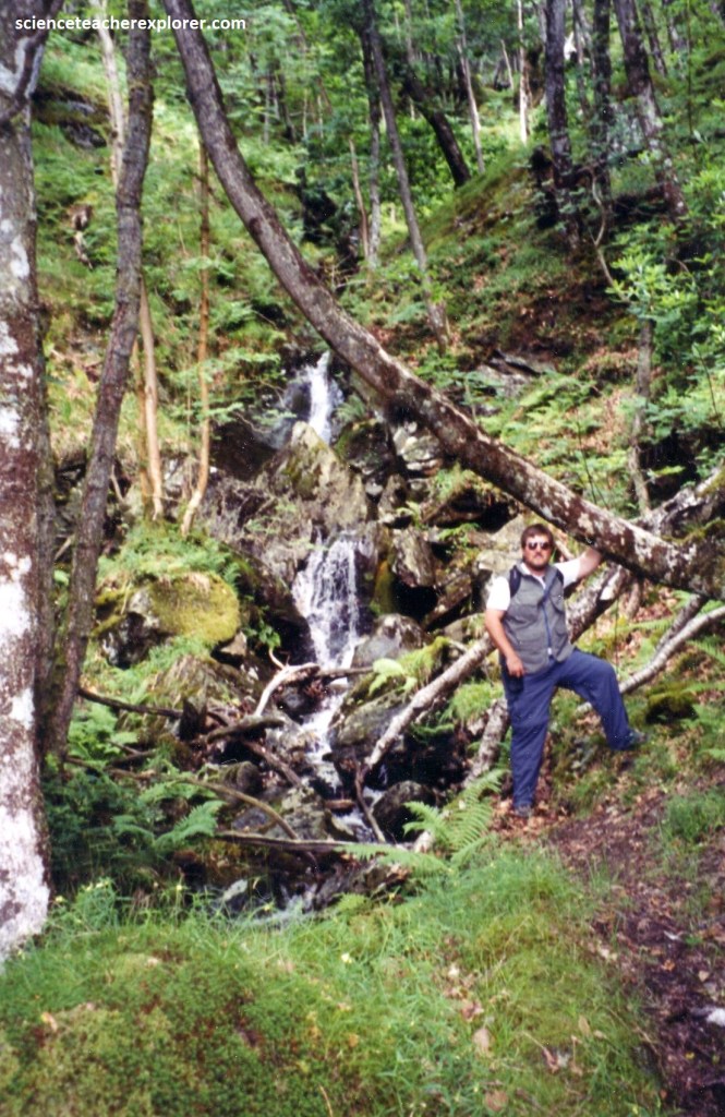
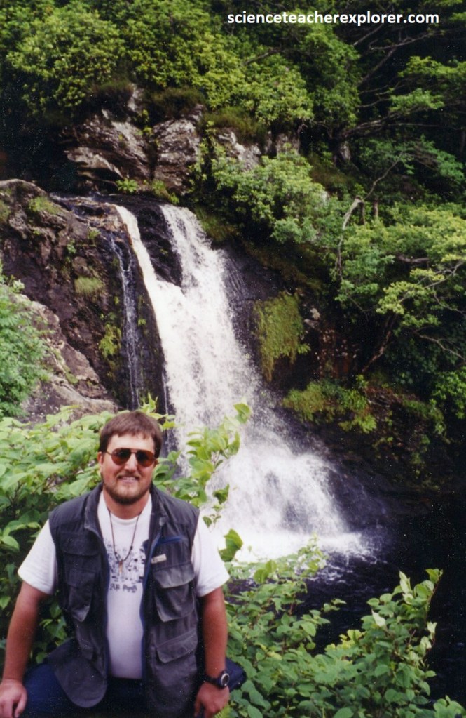
The next leg of the trek took me to Inversnaid Falls. The Inversnaid Falls were located in a beautiful clearing close to the path edge on the approach close to the Inversnaid Hotel and are a succession of stunning cascades over large boulders before becoming one large fall down into Loch Lomond. The clearing made a wonderful spot to stop and eat lunch especially on a warm summers day. There were beautiful flowers and woodland plants here at this location and with the path edge and clearing being high up above the loch, there are clear views to be had of the waterfall all around.
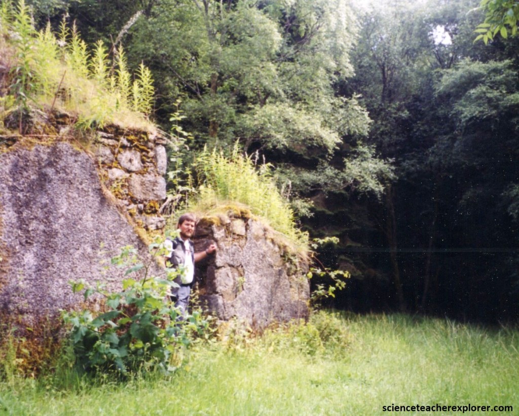
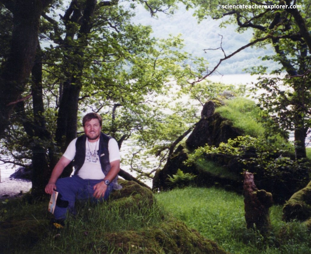
Not far from the Inversnaid Falls, was Rob Roy’s Cave, (pictured below). The roughest section of the route was now encountered with many up and down sections over stones and tree roots. However the setting is beautiful in fine native oak woodland. The path climbed steeply and then descended a flight of rough stone steps, at the bottom of which is a signed detour on the left to the cave. This is where the famous outlaw, (Rob Roy MacGregor), allegedly held his captives, although for fans of caves it is very unimpressive and not really worth the slippery scramble over and between the huge boulders that block the entrance.
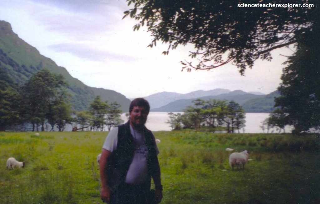
After Rob Roy’s Cave, the path continued to twist along the loch-side, passing a small beach with a good view of Island I Vow. After the end of the Inversnaid Reserve a bridge lead me to another short rough section with a high flight of wooden steps. Pictured below, was a view of the lake towards the south and the wild goats whom I could smell before spotting them.
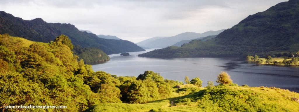
Soon the path climbed away from the loch over easier, grassy terrain east of Creag a’ Mhadaidh. After another footbridge and stile a short detour path on the left linked to the jetty at Ardleish Pier. Here a flag was hoisted to summon the ferry to Ardlui for my worn-out trekking buddy, (Kathy Stoker). On the far side there was a shop & pub for here to wait for me. On the short climb just north-east of Cnap Mòr, I took the picture below for the last view back over Loch Lomond or the river Falloch from the top.
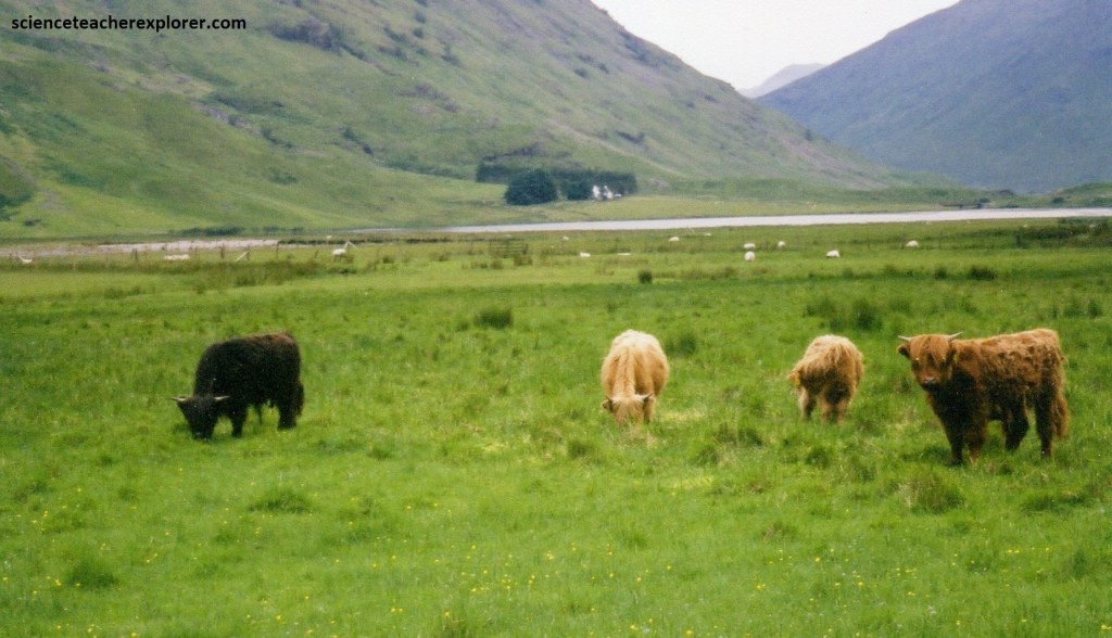
The next section had lovely views to the mountains in the north. The path continued past the ruins at Blarstainge, descending gently through woodland to eventually reach the footbridge and Beinglas Farm, (near Inverarnan), just beyond where the Highland cattle were a common site. Pictured below, the Highland Cattle had an extremely distinctive long, wavy, shaggy red coat and long horns. They were a hardy breed perfectly adapted for all Scottish climates.
Further north on the West Highland Trail, the “Glen of Weeping” bears witness to a violent past. Most recently it witnessed scenes of treachery and terror, brought by the infamous 1692 Glencoe massacre of the MacDonalds at the hands of the Campbells. But beneath this human history lie the remains of an ancient volcanic caldera that collapsed around 400 million years ago. I passed through this area; on my way to climbing Ben Nevis, the following day that I returned from Loch Lomond.
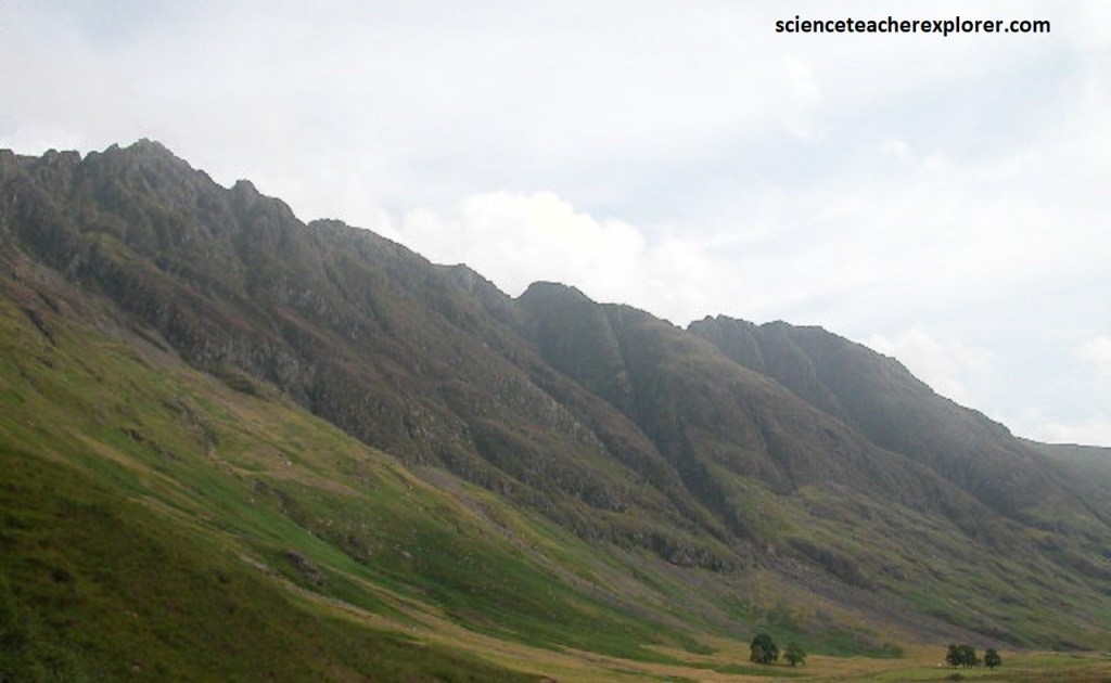
Pictured above, the Clachaig Gully provides arguably the world’s best example of a ring fault, (Great Glen Fault), evidence of the ancient volcanic activity that brought Glencoe’s complex geology into existence. More recent glacial activity shaped the glen into its present form. The tumbling screes that line the glen are the shattered spoils of long-melted ice fields, which now host important plant species.
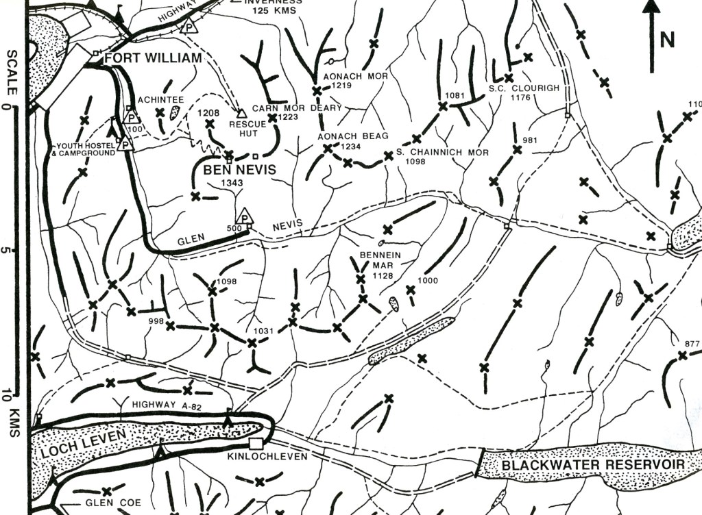
Pictured above, we drove by Aonach Eagach of the Glencoe on A82. Aonach Eagach, the 915m high jagged northern edge of the glen, justifiably one of the most photographed mountain scenes in Britain. This is the “Lochaber” region in Scotland that covers and area of 2,419 square kilometers and is renowned for its rugged landscape, including the mountains of Glencoe and the Ben Nevis area. My goal was to climb Ben Nevis, (the highest point in the United Kingdom), on the 4th of July.
The climate in the Lochaber region was damp, (most of the upland region experiences annual rainfall of some 500 cm). A good portion of this falls as snow in the winter months, some of which remains on the higher northern slopes throughout the year. The generous deposition of snow allows the area to play host to some of the rarest mosses, liverworts, lichens, and fungi to be found in Britain.
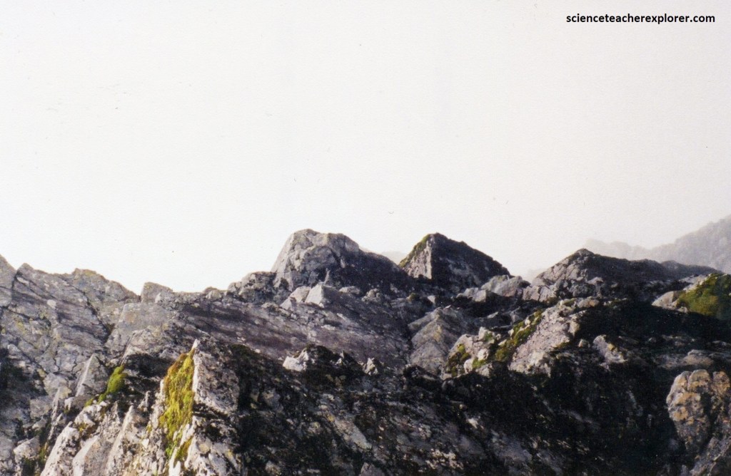
Pictured above, Ben Nevis first erupted into existence around 350 million years ago, and the rocks that today lie exposed along the slopes of allt a’ Mhuilinn, (the “Mill Burn”) form concentric ring dikes, (2 of granite and 2 of diorite). On the lower reaches are glorious native pine, oak, and birch woodlands that higher up yield to peat and heather moorland scattered with bilberries, mosses, thyme, and milkwort.
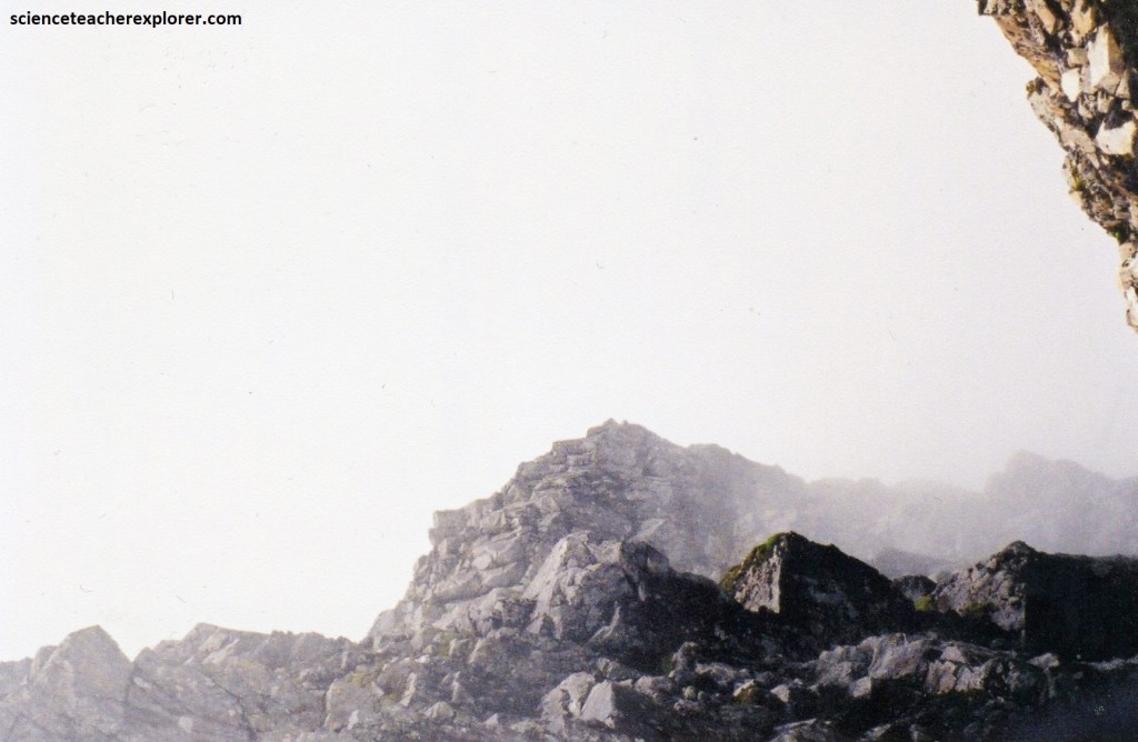
Pictured above, nearer to the summit of Ben Nevis, the flora takes on a alpine habit, where only the hardiest lichens and mosses can mosses can tolerate the harsh “Lochaber” winter. The slopes of Ben Nevis also play host to most of Scotland’s indigenous mammals, among them the rare and elusive wildcat, mountain hare, and red deer, which run below the majestic golden eagles circling the land for prey overhead.
Pictured above, Ben Nevis is one of the most impressive, (a majestic colossus that demands the utmost respect from climbers and trekkers like me), on any of the routes to its barren summit. It is the highest mountain in the British Isles.
The Ben Nevis volcanic-plutonic Complex was intruded into garnet grade Precambrian meta-sediments in the Southwest Highlands of Scotland towards the end of the Caledonian Orogeny. Ben Nevis is all that remains of this Devonian volcano that met a cataclysmic end in the Carboniferous period around 350 million years ago. Evidence near the summit shows light-colored granite (which had cooled in subterranean chambers several kilometers beneath the surface) lies among dark basaltic lavas (that form only on the surface). The plutonic rocks of the Ben Nevis Complex are subdivided into the Fine Quartz Diorite, Sgurr Finnisg-aig Quartz Diorite, Coarse Quartz Diorite, Porphyritic Outer Granite and Inner Granite. Each of the above units was intruded as a series of pulses.
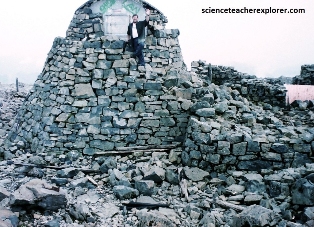
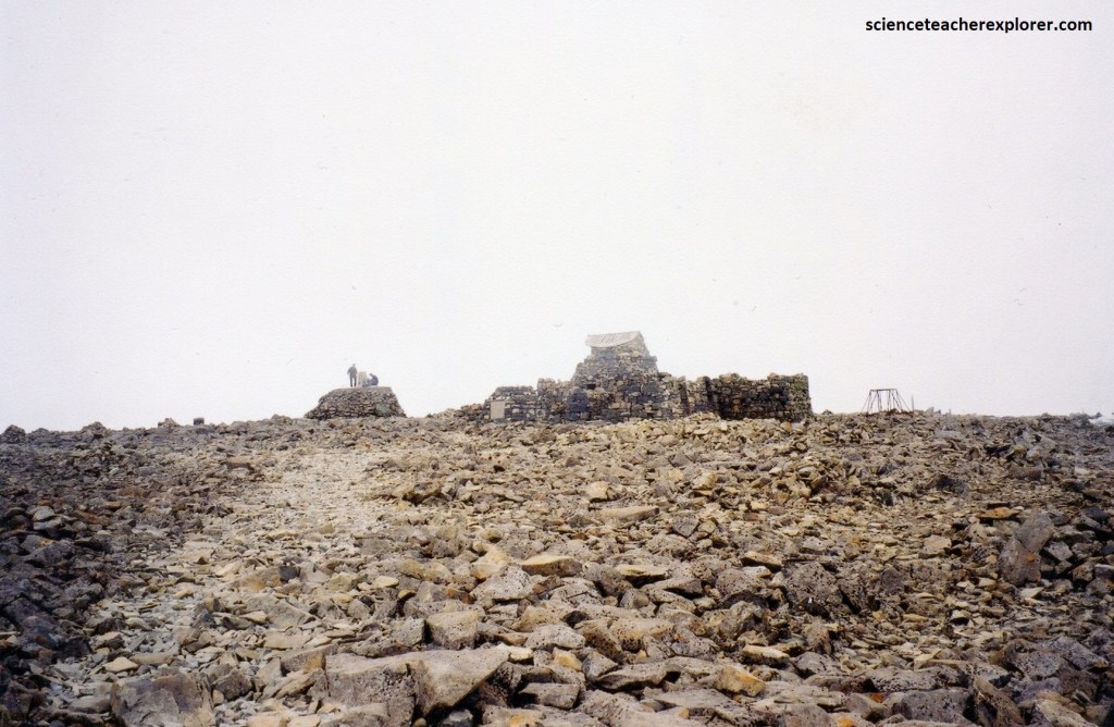
Pictured above, the summit of Ben Nevis, which is the collapsed dome of an ancient volcano, featured the ruins of an observatory, which was continuously staffed between 1883 and 1904. The meteorological data collected during this period is still important for understanding Scottish mountain weather.
