Tongariro N.P., N.Z. 2012
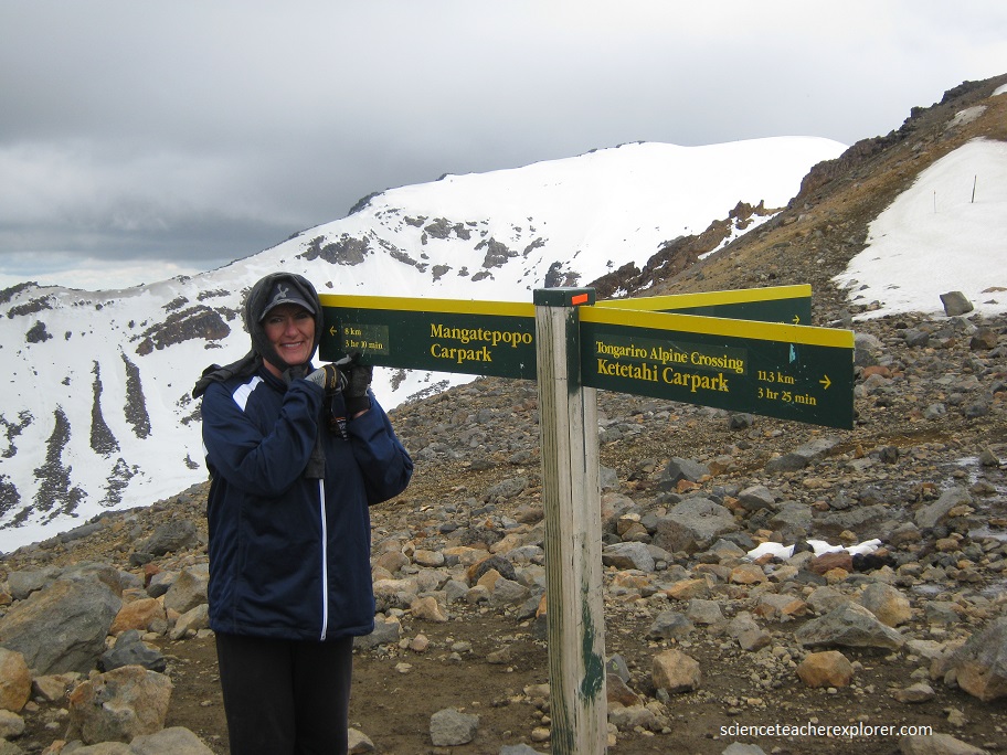
While visiting relatives in New Zealand on the North Island, Becky (my wife) and I trekked the Tongariro Alpine Crossing on November 21st, 2012.
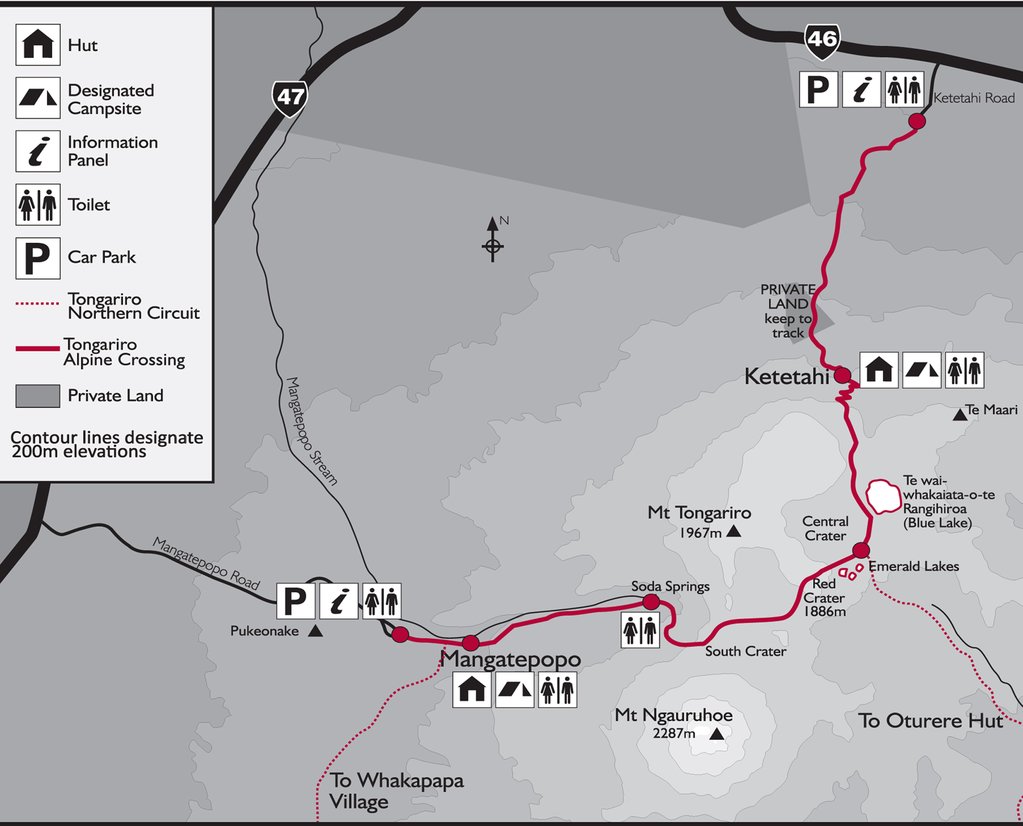
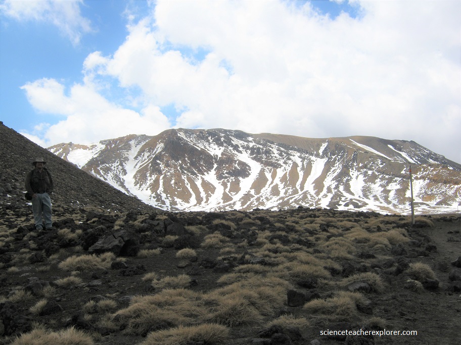
The Tongariro Alpine Crossing in Tongariro National Park is a hiking trail in the center of the north island of New Zealand, and is among the most popular day hikes in the country, (pictured above).
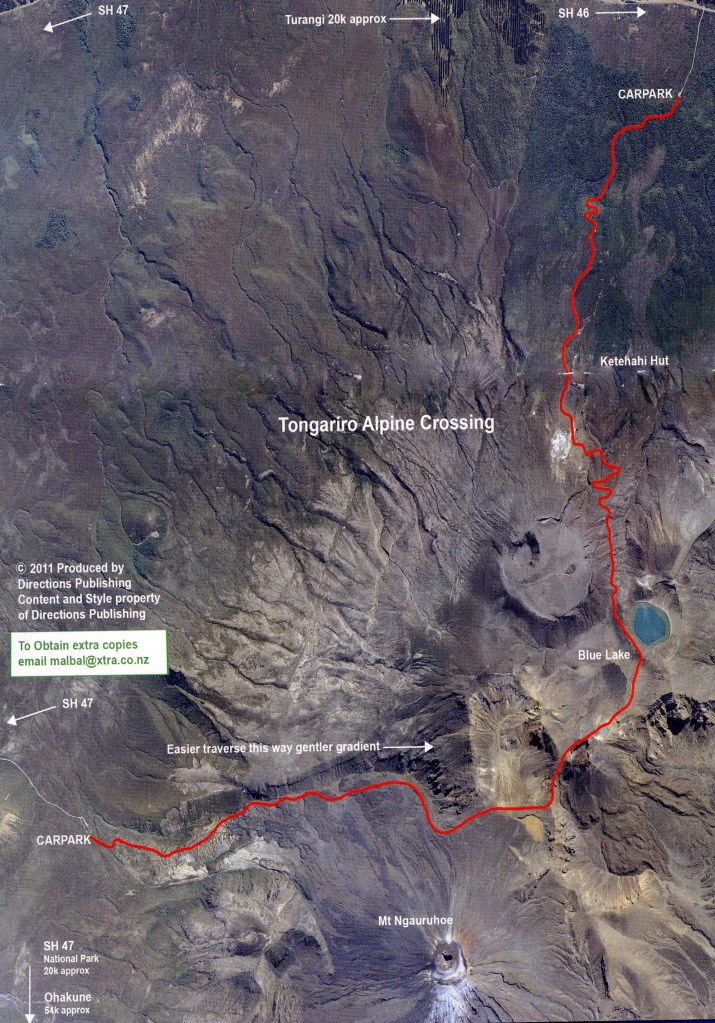
Becky and I, trekked from Mangatepopo in the Ruapehu region to Ketetahi Hot Springs, due to the Mangatepopo end being higher in altitude (1,120 m) than the Ketetahi Hot Springs end (760 m), therefore requiring less climbing.
Our trek passed over the volcanic terrain of the multi-cratered active volcano Mount Tongariro and the eastern base of Mount Ngauruhoe. The full distance of the track was supposed to be 19.4-km.
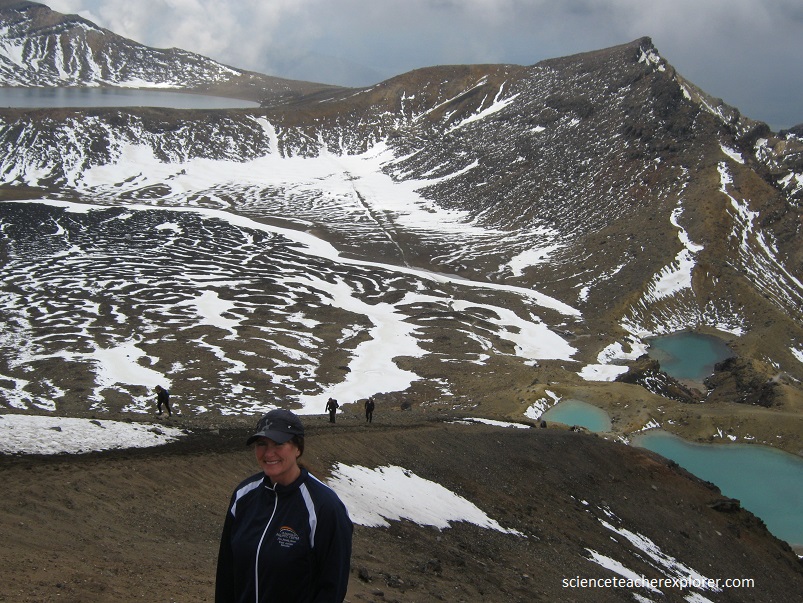
Pictured above, the track begins at the western end near the Mangatepopo Hut with a low gradient until the foot of the steep Tongariro saddle. Almost the entire length of the crossing is in volcanic terrain with no vegetation and fully exposed to weather – at moderate altitude.
Most of our trek was through raw volcanic terrain. The three volcanoes in the area are all highly active and the terrain reflects this. Solidified lava flows, loose tephra, and solidified volcanic lava bombs abounded. Large amounts of minerals are brought to the surface and are highly visible in the colors of rocks and ridges. Active fumaroles abounded on several sections of the trek, constantly emitting steam and sulfur dioxide gas into the air and depositing yellow sulfur specks around their edges.
The lakes and pools on the trek were deeply colored by the volcanic minerals dissolved in them. Some areas featured large springs emitting near-boiling water and torrents of steam. The terrain underfoot for most of the trek was either sharp edged new volcanic rock or loose and shifting tephra, mainly ash and lapilli. In some crater areas it was finer ash that has became moist and compacted.
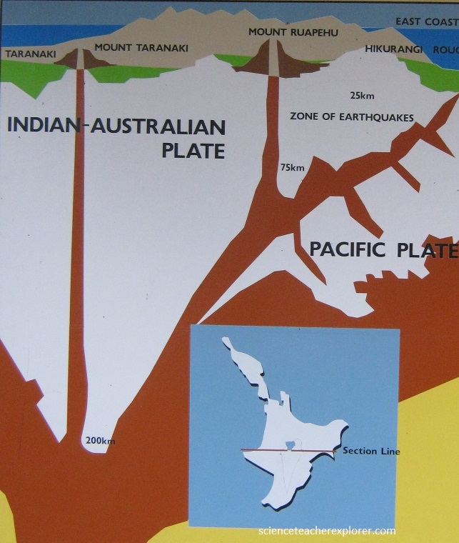
The verdant tranquility of our trek above ground belies the molten chaos more than 100 km below. The Tongariro National Park is best known for its trio of andesitic volcanoes, (Tongariro, Ngauruhoe, and Ruapehu), the latter two ranking among the most active composite volcanoes in the world. The Tongariro National Park has had a violent past and was formed by multitude of eruptions from at least six different cones. The oldest lava started flowing about 275,000 years ago, near what is now the Tama Lakes on the southern flanks of Mt Ngauruhoe. The eruptions continued until the Ice Age, as the ice retreated, it carved out valleys clearly visible in the lower Mangatepopo valley, on the Tongariro Alpine Crossing.
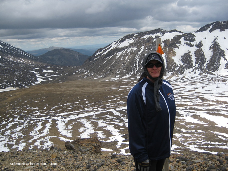
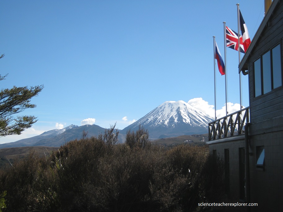
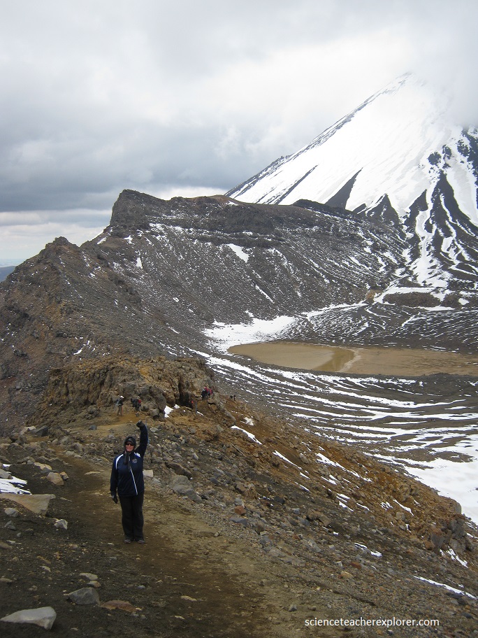
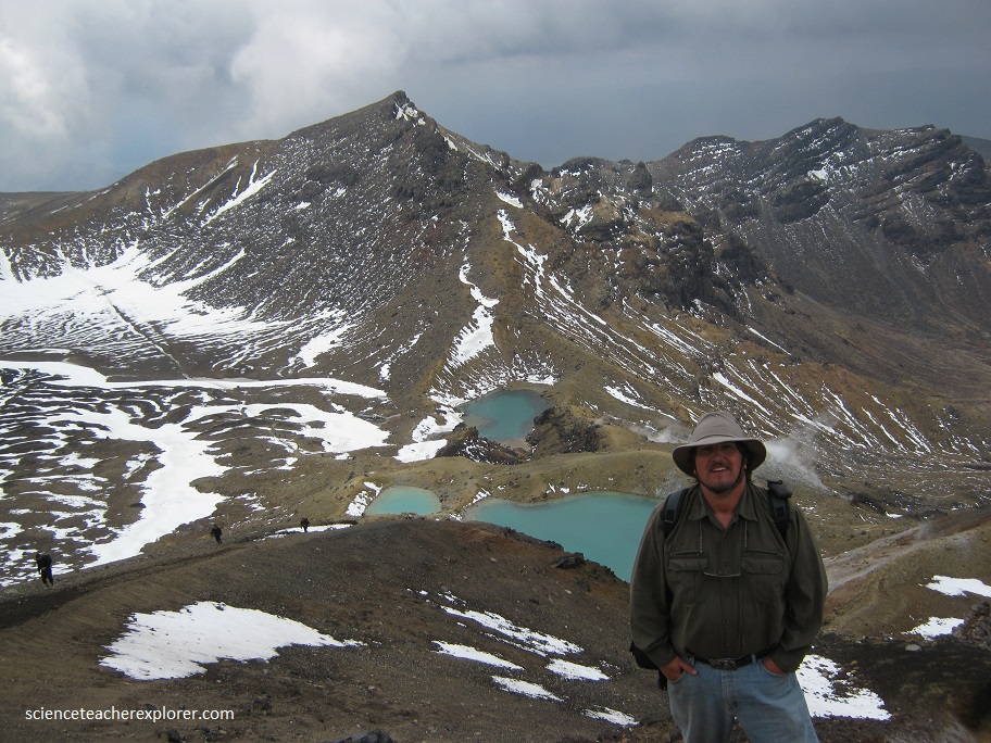
Pictured below, Tongariro, at 1,968m, is a large andesite volcanic massif comprised of more than a dozen cones. Tongariro is composed of layers of both lava and tephra.
Pictured below, the youngest volcano in the park, Ngauruhoe, has grown to 2,291 m since it’s birth about 2,500 years ago, and still remains a perfect conical shape. It produced spectacular lava flow in 1949 and 1954, followed by ash eruptions in the mid-1970s.
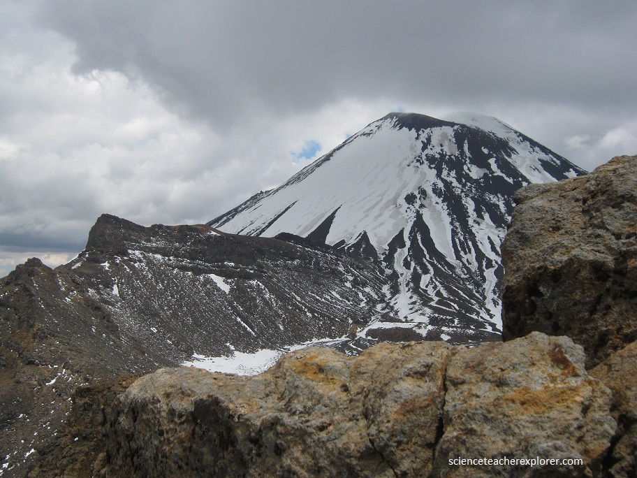
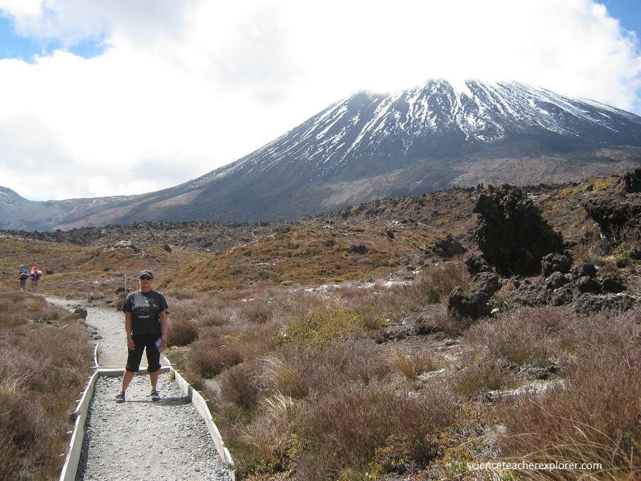
Many are unaware that Mount Ngauruhoe is geologically a cone of Mount Tongariro. Mount Ngauruhoe has made several appearances on screen. The first was in 1974 for an advertisement for Moet and Chandon where champion skier Jean-Claude skied the eastern slope. The second was as Mount Doom in the Lord of the Rings trilogy which put Mount Ngauruhoe on the world stage. As a matter-of-fact, we met some of the film crew while we were there.
Rising above its neighboring volcanoes, Mount Ngauruhoe is a striking figure in the Tongariro National Park and looks just as you would imagine a volcano to look – a perfectly-formed peak.
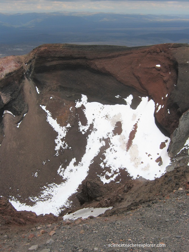
Red Crater was formed about 3000 years ago. It lies within a scoria cone which rests on top of the older Tongariro lava flows. The red colour is due to the presence of oxidised iron in the rock.
The most recent confirmed volcanic lava flow from Red Crater was reported between 1855 and 1890. The dike on the Southern Wall has been exposed by erosion. Lava would have flowed through this dike and poured into the Oturere Valley.
Red Crater erupted ash in 1926 and contains active fumaroles. There are many explosion craters on the massif; water has filled some of these to form the Blue Lake and the Emerald Lakes.
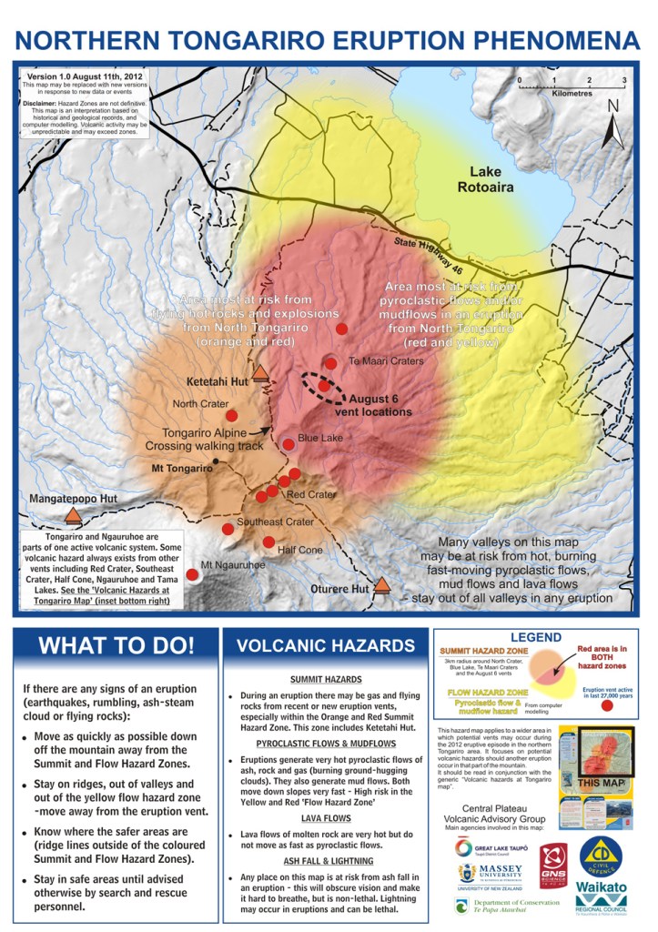
Pictured above was the moment that we were forced to turn around and go back on the Tongariro Alpine Crossing. Becky and I were enjoying our day on the Tongariro Alpine Crossing, taking photos of the Emerald lakes and Blue lake, when we entered the area to view the Te Maari Crater (which was still steaming from the August eruption). Five minutes later Te Maari erupted steam and then ash for two minutes at 1:20 PM on November 21st.
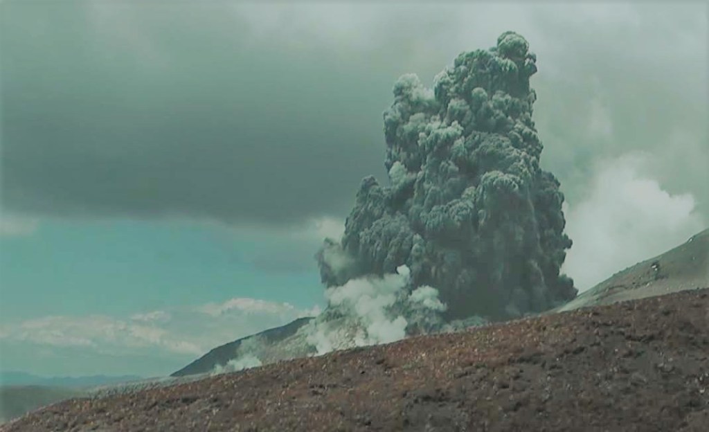
All hikers were safely evacuated off the mountain, so we were required to turn around and go back to the Mangatepopo Hut. The eruption spewed ash that was restricted to within the 1km exclusion zone and did not affect us on the Tongariro Alpine Crossing.
