Walnut Canyon N.P., AZ
At the end of December of 2010, I was exploring Northern Arizona. My base camp was Flagstaff and I had the opportunity to trek two major Sinagua Ruins nearby. They were called Elden and Walnut Canyon. My morning exploration was Elden.
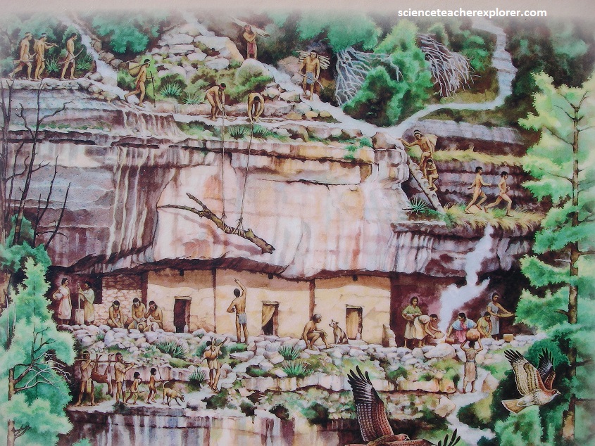
For thousands of years, people living in or passing through the Sinagua region were mobile hunters and gatherers. Then, in the late 600s, some began planting crops in the fertile alluvial soils of basins along the flanks of the San Francisco Peaks, where pinyon pines and junipers interface with the higher ponderosa forest. By 900 AD, these Sinagua peoples, who lived in rustic pithouses, were trading with Kayenta settlements to the north and Hohokam communities to the south.
After around 1150 AD, the northern Sinagua reached their highest cultural expression, (Elden Phase), which is apparent in technological achievements such as monumental architecture, more complex social organization, and population growth.
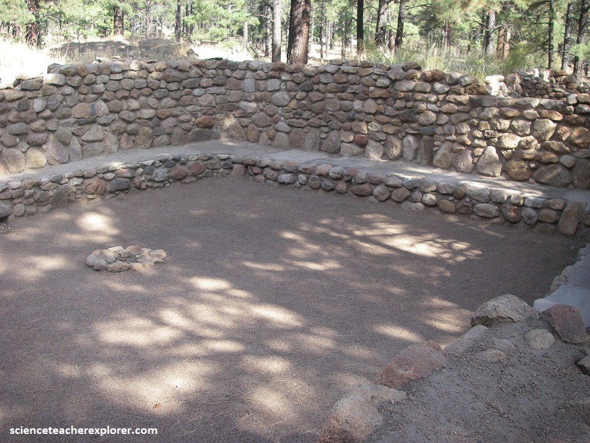
The Elden Pueblo Archaeological Site is located on the west side of US 89 North, and 2 km north of this highway’s interchange with I 40. Pictured above, Elden Pueblo is a 65 room, 2 story, northern pueblo among ponderosa pines on the outskirts of Flagstaff. People settled here around 1070 AD, however, the community flourished from 1150 -1275 AD.
When environmental conditions deteriorated in the mid-1200s, the pueblo’s population swelled briefly, but then everyone left and the site became vacant around 1275 AD.
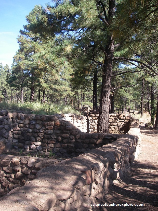
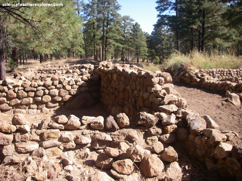
Pictured above, the builders of Elgen used rocks eroding from the base of nearby Mount Elden for construction material. As a community, they were well situated; building stone and wood were close at hand as was a spring, and not far away were open areas with arable soil.
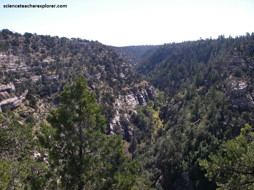
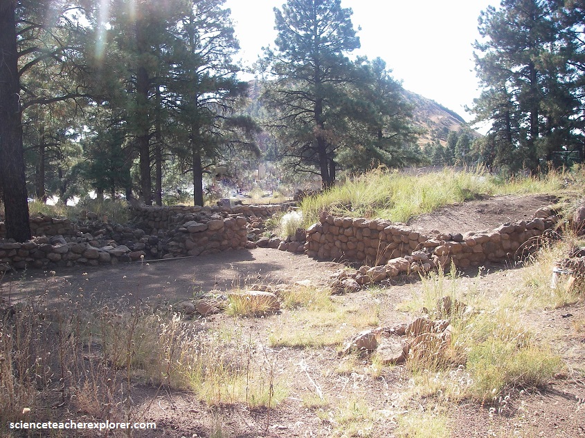
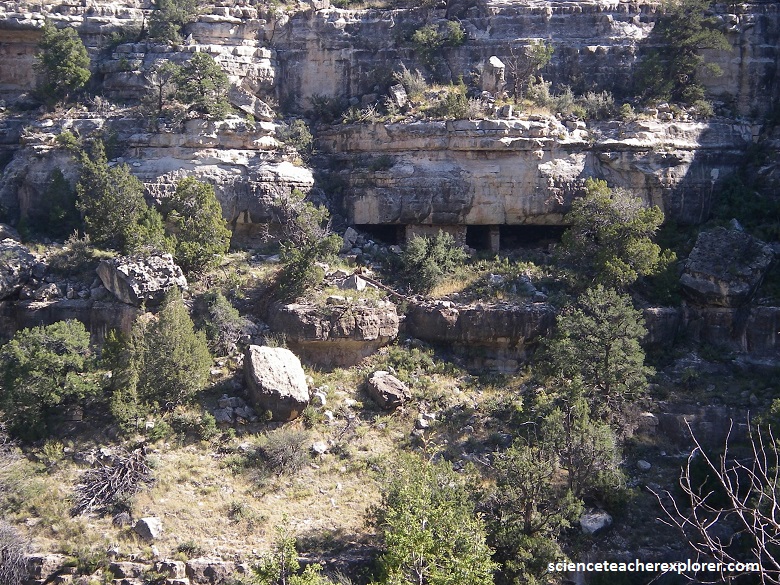
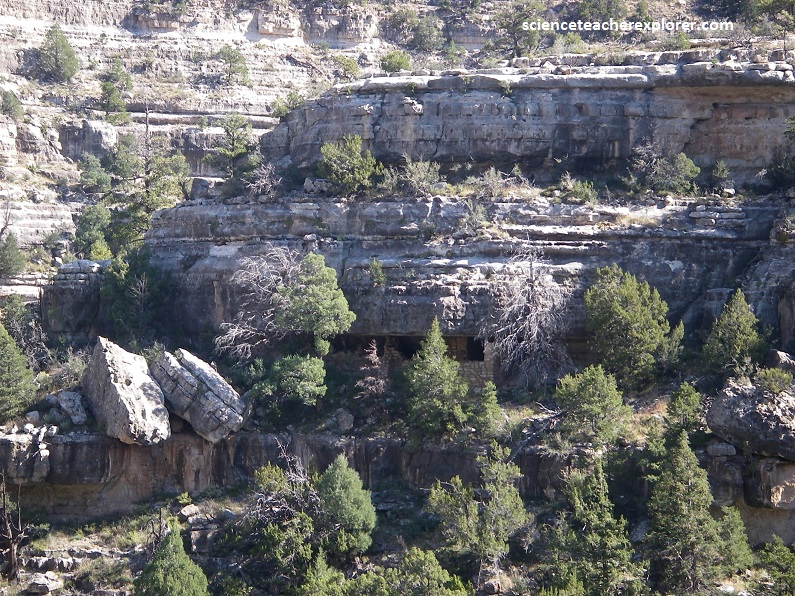
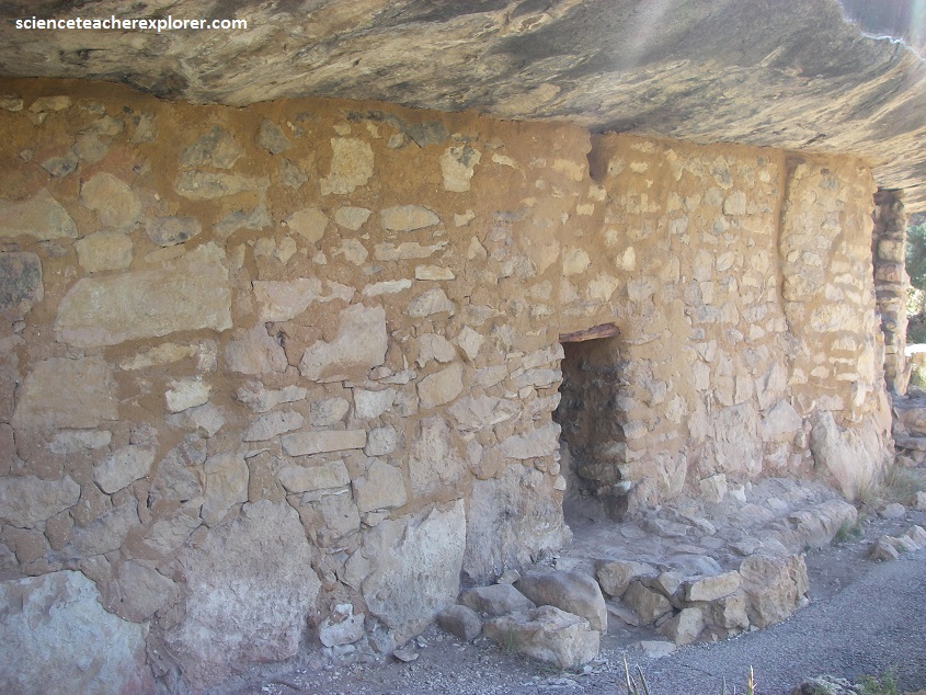
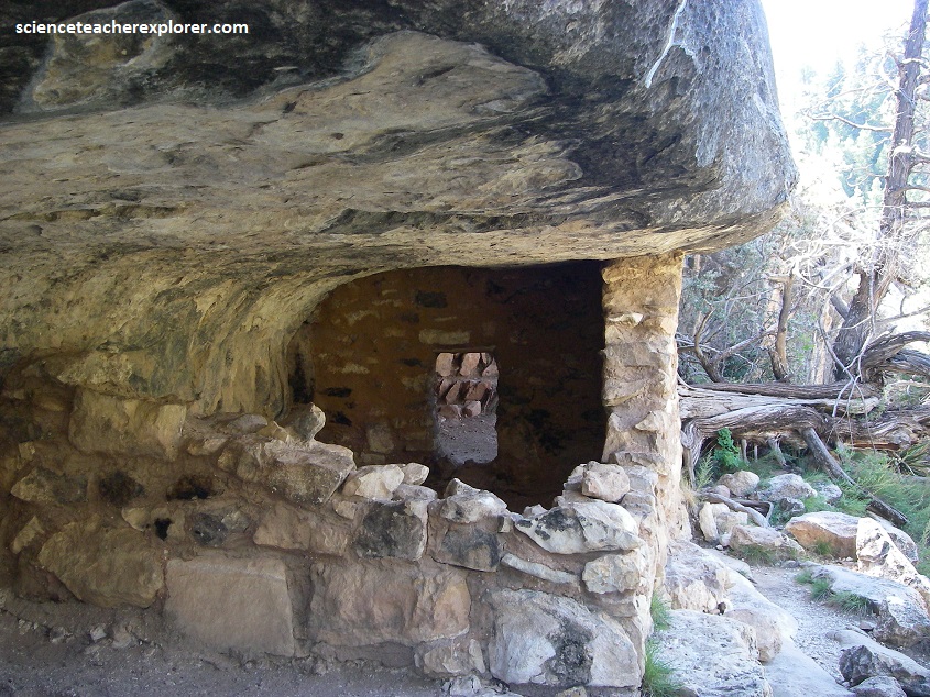
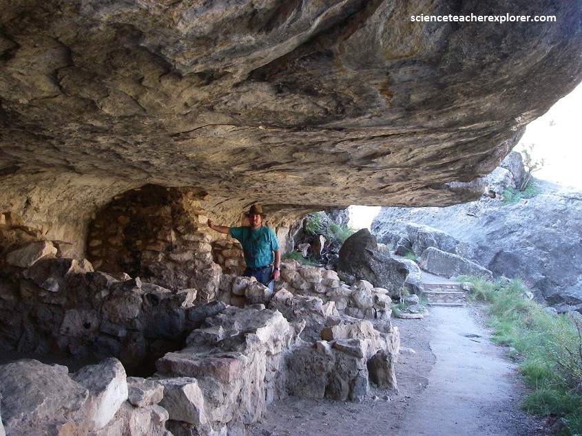
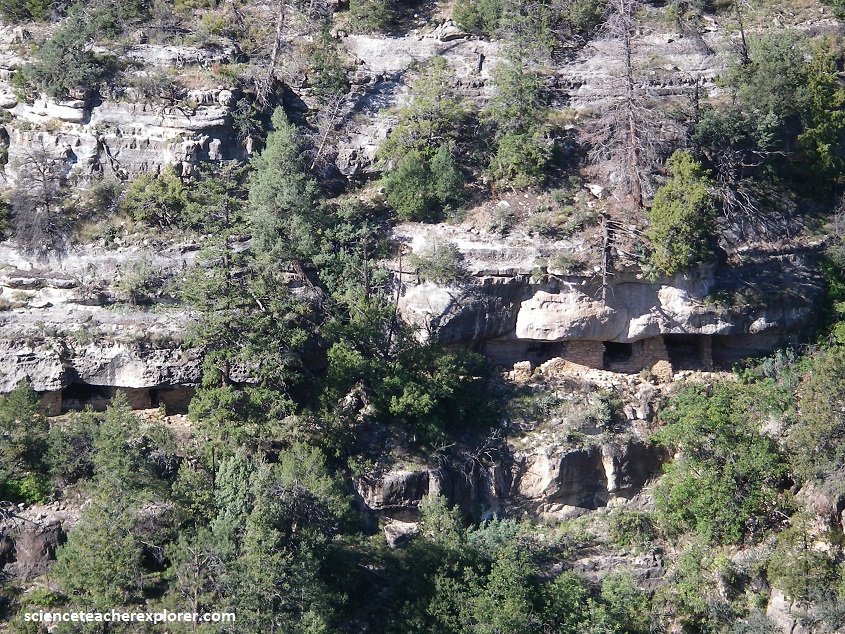
Pictured above, I later trekked into Walnut Canyon. Walnut Canyon National Monument has its own exit #204 off of I-40, 10 km east of Flagstaff. Deeply cut through layers of limestone laid down millions of years ago on sea beds, it contains cliffs with scores of shallow caves under ledges. It was here that Sinagua people made their homes in the 1100s & 1200s.
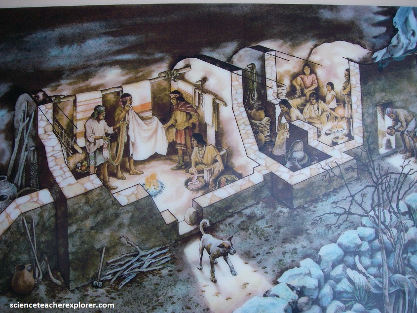
During 1125-1225, some Sinagua families made their homes in the cliffs, others in pueblos on the rims, where they farmed, hunted, and collected pine nuts and other plant foods. They clustered their homes near several unusual large stone rooms constructed on peninsulas at bends in the canyon.
Pictured above, those who chose to live in the cliffs built small, cozy, extended-family dwellings scattered within eroded earshot of each other.
The deep, winding canyon contains numerous microenvironments with a diversity of plant life. Add to this an abundance of mule deer, wild turkeys, and other animals and it is easy to see why the Sinagua liked this place.
In the mid-1200s, the Sinagua left. It is thought that many went south to the Verde Valley, while others drifted eastward toward present-day Winslow and the Hopi country.
After the building of the railroad in the 1880s, European-American settlers began coming to the Flagstaff area in large numbers and recreational outings to Walnut Canyon became a popular pastime. So did pot hunting and looting.
Many of the ancient houses were damaged and their contents vanished, before they could be studied by Archeologists.
When civic leaders of Flagstaff finally realized the city was losing a valuable tourist attraction, they too measures to safeguard the ruins. In 1915, President Woodrow Wilson set aside Walnut Canyon as a national monument.
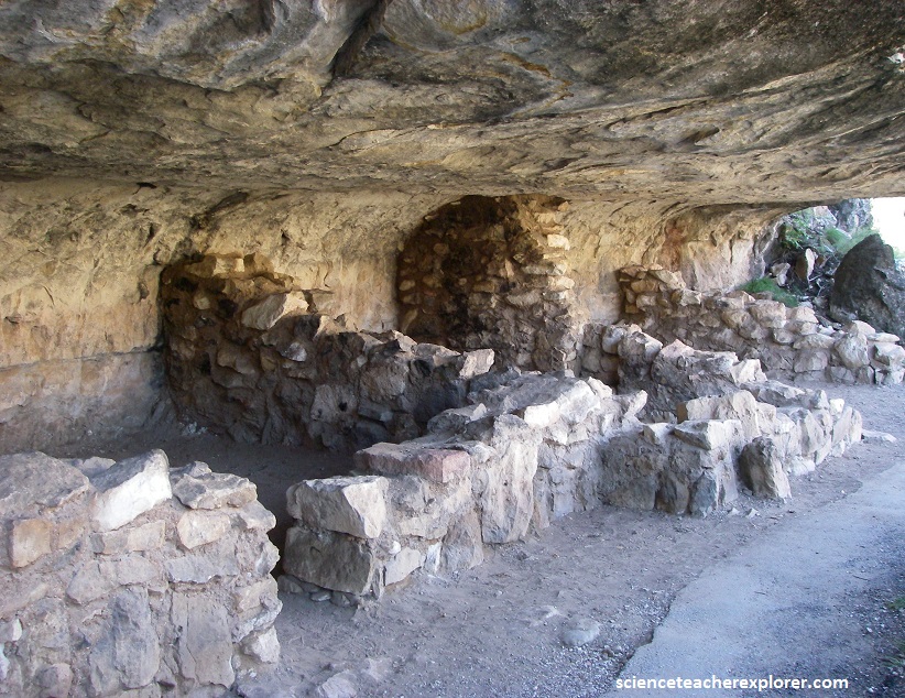
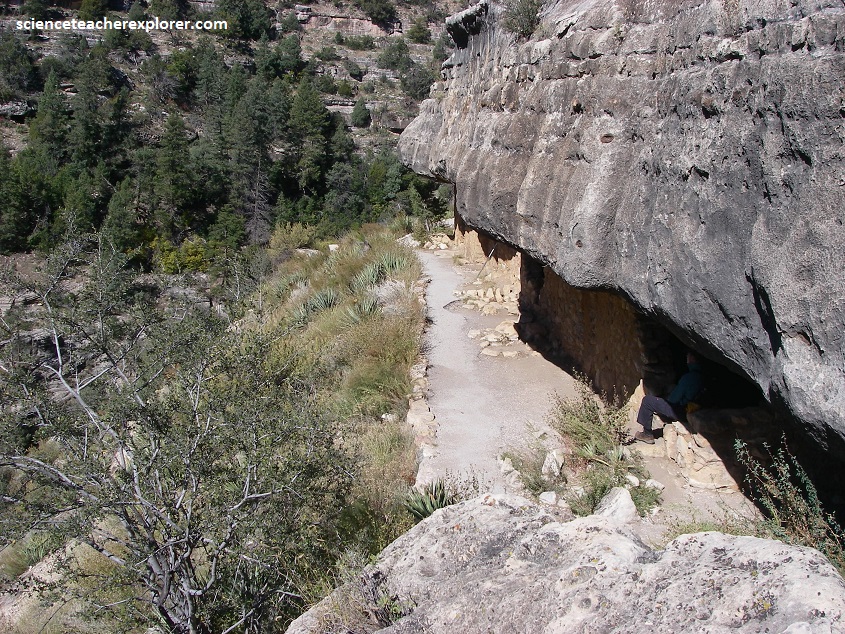
Pictured above, a typical room might have been the dwelling of a single family, and might measure approximately two meters high by six meters long by three meters deep.
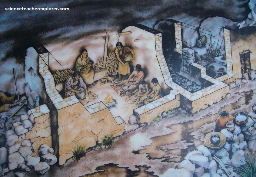
Sinagua is Spanish for “without water”, an acknowledgement that the Sinagua people were able to live in such a dry region. By living in such a region the Sinagua became experts at conserving water and dealing with droughts.
The dwellings themselves were small, but large enough for the inhabitants to cook and sleep.
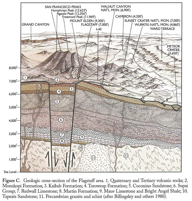
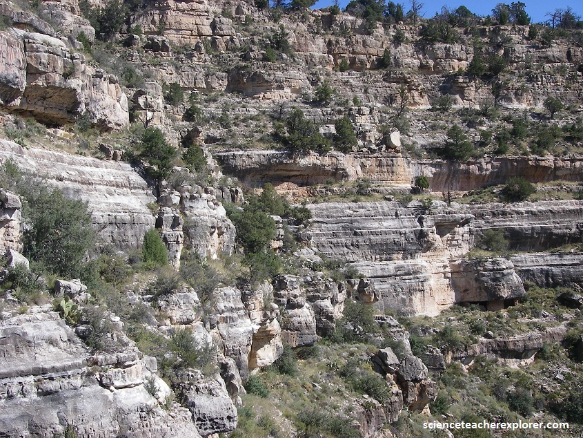
Walnut Canyon lies on the Colorado Plateau and cuts through the Permian-Kiabab Limestone, which exposes the Toroweap Formation and Coconino Sandstone.
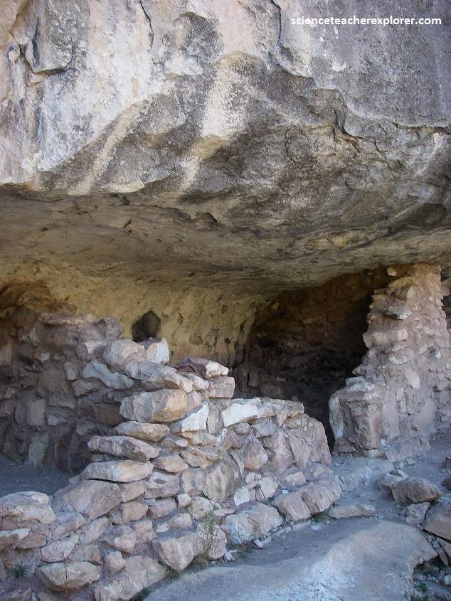
The rocks in the canyon walls are formed of three distinct layers – the upper third of Walnut Canyon’s walls contain Kaibab Limestone that varies in layers and hardness, where the cliff dwellings are found, which overlies steep, scrub covered slopes of the Toroweap Formation, while the lowest third is the sheer-walled, cross-bedded Coconino Sandstone. Many layers of the limestone eroded, creating alcoves that the Sinagua Indians used as cave-dwellings.
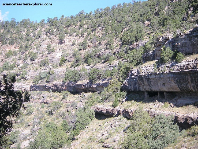
The Walnut Canyon site contains Walnut Creek, which carved a 200 meter deep canyon that flows east. The creek joins into the Little Colorado River en-route to the Grand Canyon.
The creek has also created a varied and abundant array of vegetation. The shaded, north- facing walls are covered in fir and ponderosa pine trees. The sunny, south facing slopes have agaves and several species of cactus including opuntia, echnocereus and cholla. The floor of the canyon is home to several species of walnut trees, for which the canyon is named.
