Glastonbury, England
On August 4th, I found myself in the area of Glastonbury, England. That morning I visited an Archaeological location called the Cadbury Castle Site just southwest of the South Cadbury village .
From the Neolithic Age (3,000 BC) to the early 11th century, the fortress of Cadbury Castle was in turn military stronghold, center of trade and probably focus of a religious cult; by the early 16th century folklore identified it with Camelot of Arthurian Romance.
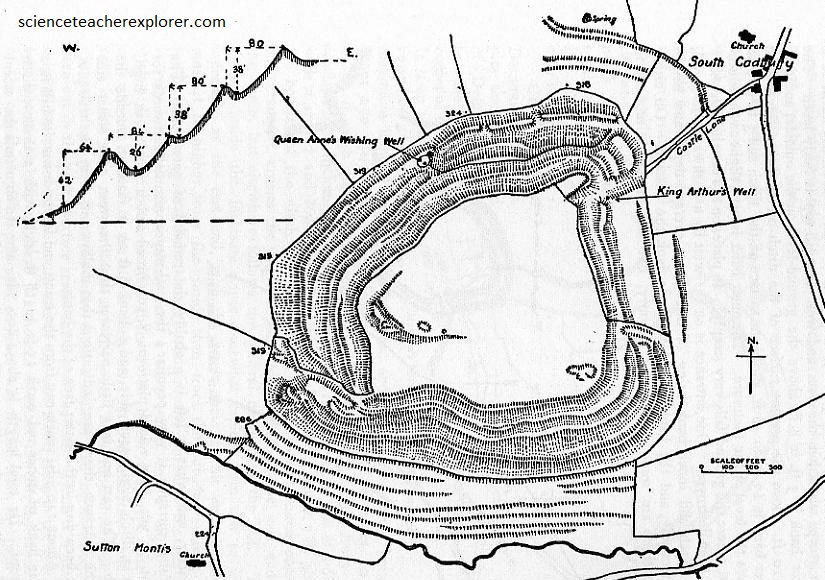
Imaged above, the plan of Cadbury Castle shows it’s complex defences, four sets of ditches and three entrances. The two main entrances had gate houses and breastworks to outflank attackers. As mentioned above, the hill was first occupied in the Neolithic period. A modest Bronze Age settlement flourished on the summit and grew during the Iron Age into a large and spectacular hill fort town, (a center of craft, trade and religious worship). The place was probably a ‘capital’ of the Durotriges whose territory included central and southern Somerset and Dorset. Dwellings within ramparts were of wood, wattle and thatch.
At first left alone by the Roman government, the town was forcibly cleared around 70 AD by the Romans, an action which left some inhabitants dead and which removed others to settlements in the surrounding countryside. The British abandoned Cadbury during the Roman period and then strongly rebuilt it during the Dark Ages.
People returned to the site towards the end of the Roman period and by 500 AD there was massive refortification of the hill top.
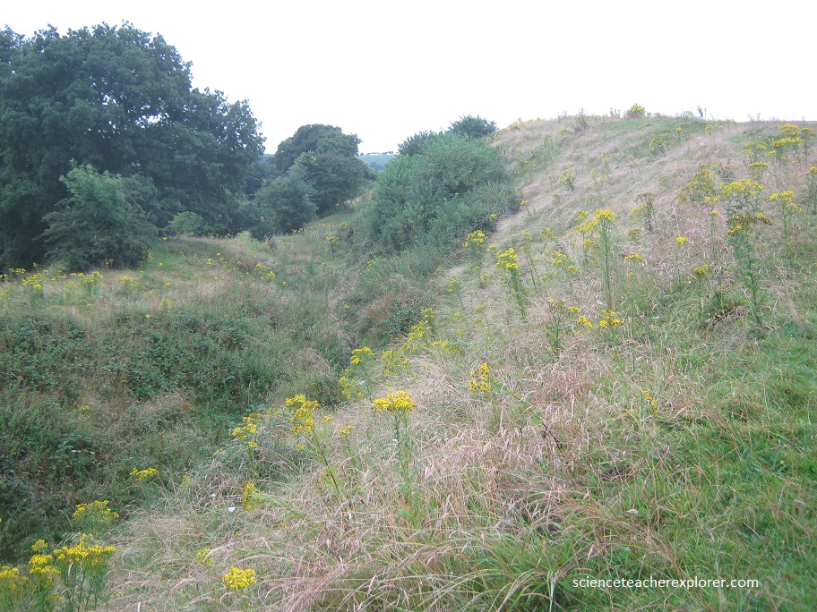
Defenses of timber and dry-stone walling replaced the earlier banks, and the posts of a new southwest gate were embedded in solid rock. Within the defenses stood a large, ailed timber hall. (The scale of the work and precious pottery found from the eastern Mediterranean imply a wealthy, sophisticated and highly organized military society).
The only surviving written record of the 5th century shows Britain divided into tribal ‘kingdoms’, and later Celtic tradition tells of a series of battles against the invading Saxons under the command of a figure called Arthur. Here, the Britons, led by a ‘King Arthur,’ maintained a vital center from which to resist the Saxons. But the Saxon victory at Deorham in 577 A.D. drove a wedge between the Britons of Wales and those of the Southwest. Cadbury and outlying posts like Glastonbury Tor were on or near the front line of this confrontation. After 600 A.D. Saxons appeared in the area and the British abandoned Cadbury.
Cadbury, strategically placed to defend south-west Britain, could well have been the base from which Arthur led his troops to the final victory of Mons Badonis, whether that was fought in Dorset, near Bath, or in north Wiltshire. Cadbury was first linked to Arthur by the writings of Leland in 1542.
Later that day, I drove to a few kilometers north west of the Cadbury Castle to Glastonbury, England.
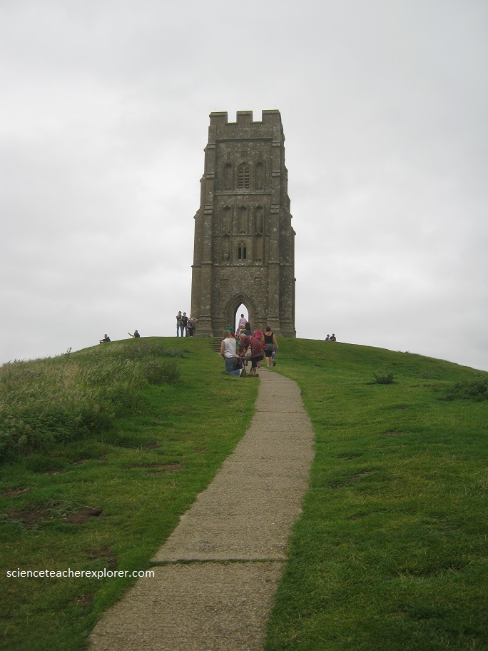
The Glastonbury Tor is a natural hill whose prominent shape has been determined by both geological and human activities. Sitting upon the low hills that form the fabled Isle of Avalon, Glastonbury Tor rises 158 m above the surrounding Somerset Levels. Viewed from north and south, with it’s long, whale-backed ridge sloping away to the southwest, the Tor has a streamlined shape; but when viewed from east and west, along it’s axis, it appears as a steep conical hill, while the church tower at it’s summit is described by pilots as a nipple. Huge, artificial and unusual terraces that cast deep shadows are cut into every flank of the Tor, creating the impression of a stepped pyramid.
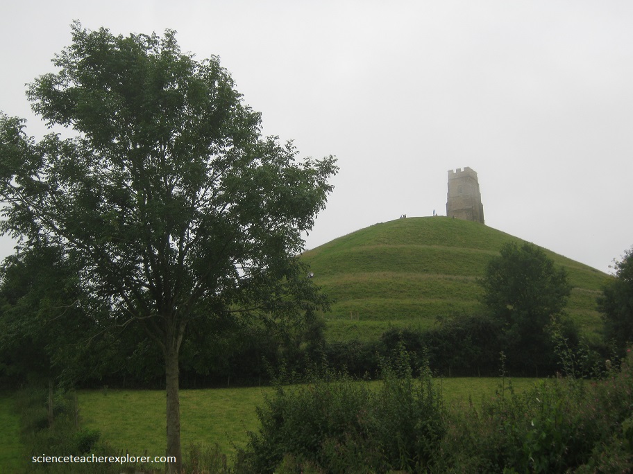
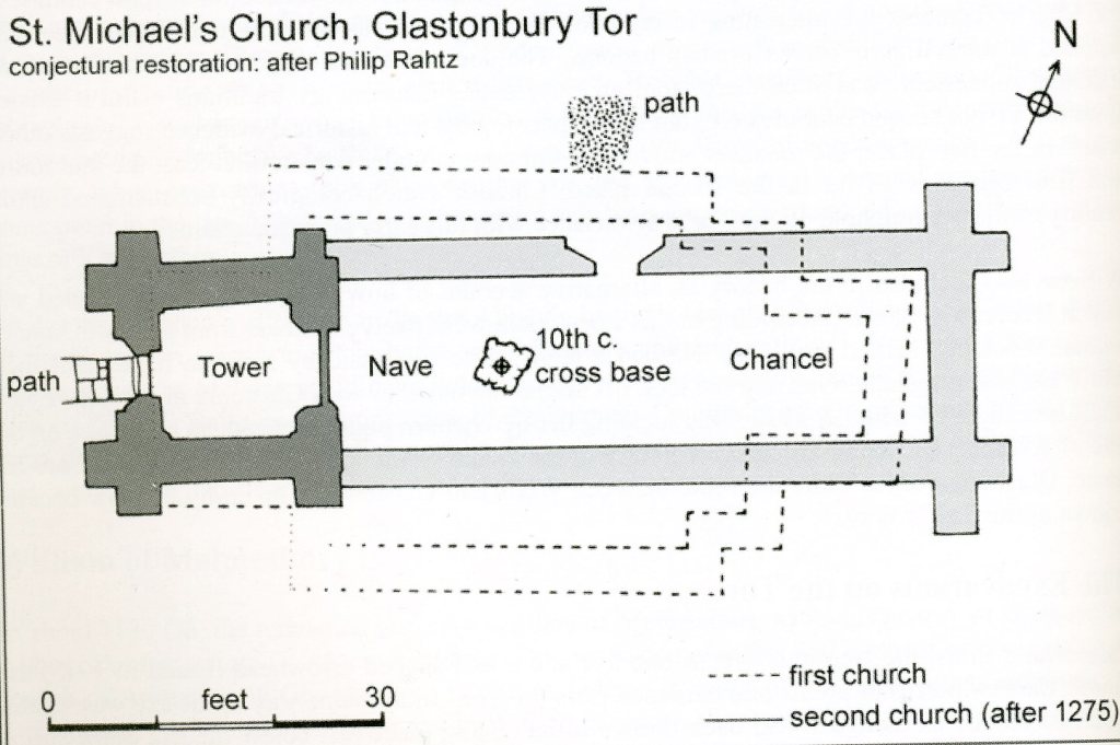
Imaged below, on the summit once stood a cluster of medieval buildings that formed the monastery of St. Michael on the Tor. Possibly founded as early as 600 A.D., but more likely by 800 A.D., this structure existed until Henry VIII dissolved the monasteries in 1539. Now all that remains is the fourteenth-century church tower. Judging from the earlier archaeological record, with evidence of iron-working and copious meat-eating, the summit of the Tor was once occupied for military purposes. The history and legends around this Dark Age “fortress” have been associated with King Arthur.
Glastonbury is linked with the beginning of Christianity in England, the Holy Grail, and King Arthur. The story goes that Joseph of Arimathea, who took Christ’s body down from the cross, came to England with eleven companions. They made their way to Glastonbury Tor on the Isle of Avalon, deep among the marshes, and there founded the first Christian church in the British Isles. He was said to have brought the Holy Grail, the cup used at the last supper, and possibly concealed it in the Chalice Well near the Tor.
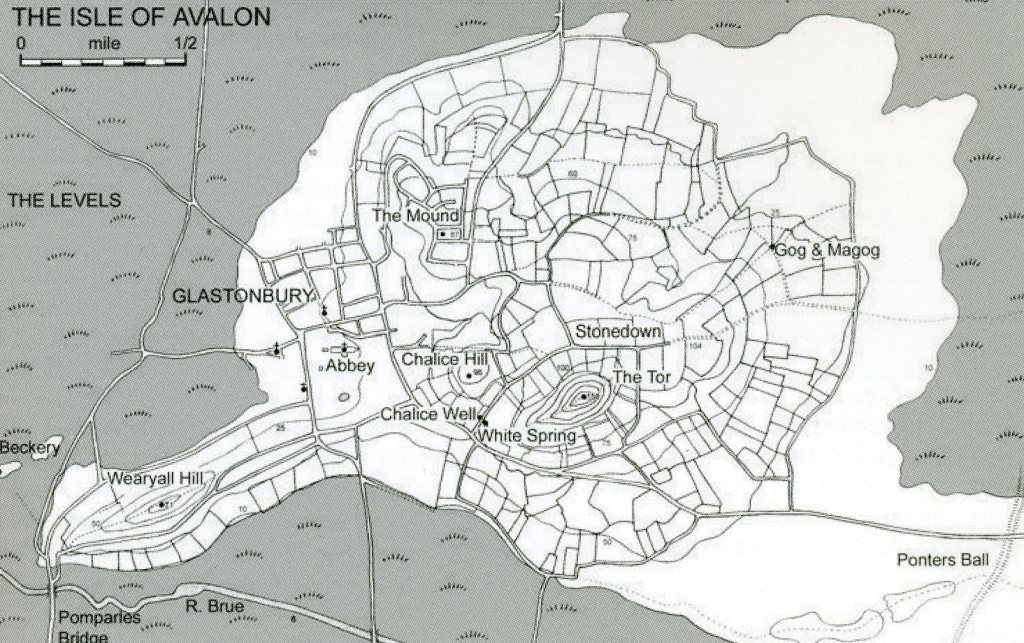
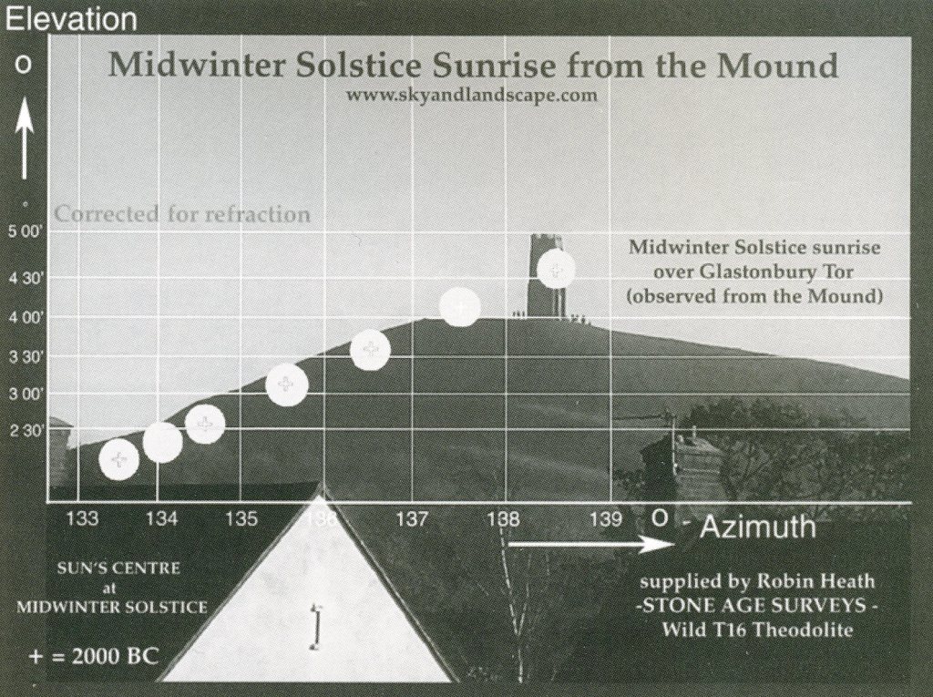
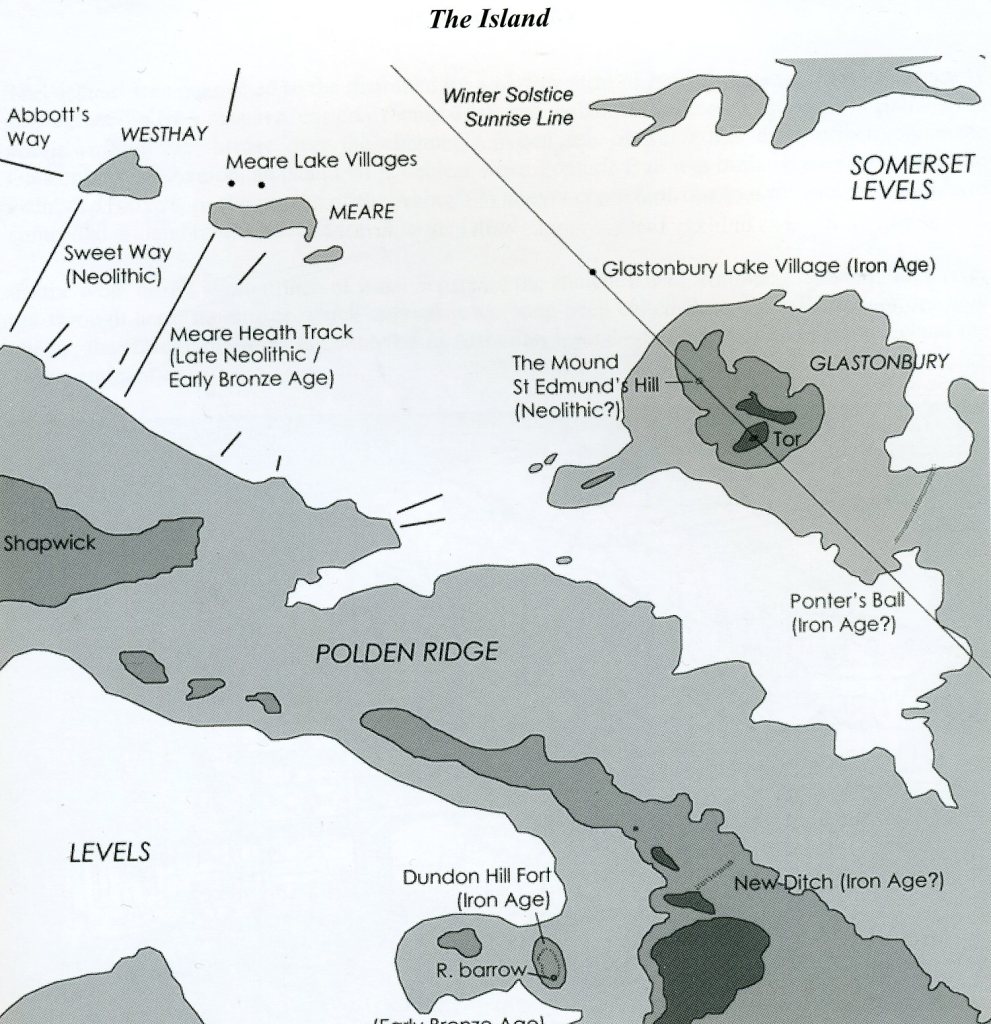
If a special aura has long been attached to Glastonbury, it is this Tor, a hill that rears up with dramatic suddenness from the flat landscape of the Somerset Levels. Recent research has revealed a curious phenomenon. When Glastonbury Tor is viewed at sunrise on December 21st, (Winter Solstice), from a mound on the summit of St. Edmund’s Hill, situated just over 1 km to the northwest, the sun rises at it’s foot and rolls up its steep northern flank. The angle of the sun’s ascent at 26 degrees is precisely marked by the angle of the slope of the Tor. This spectacular winter solstice event lasts over half an hour. Before 1600 B.C., however, the sun would have risen just below the northern flank, allowing the top rim of the rising sun to flash in any terrace carved into it. The terraces high upon the agriculturally least valuable side of the Tor may therefore have been cut for astronomical purposes at the same date as the mound, that is, before 1600 B.C. All that can be said at present is that the Tor’s uniquely dramatic form has been shaped over the millennia by a combination of geological, agricultural, astronomical, symbolic and spiritual activities, (imaged below).
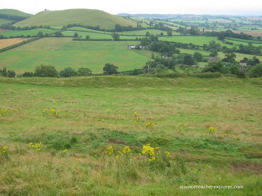
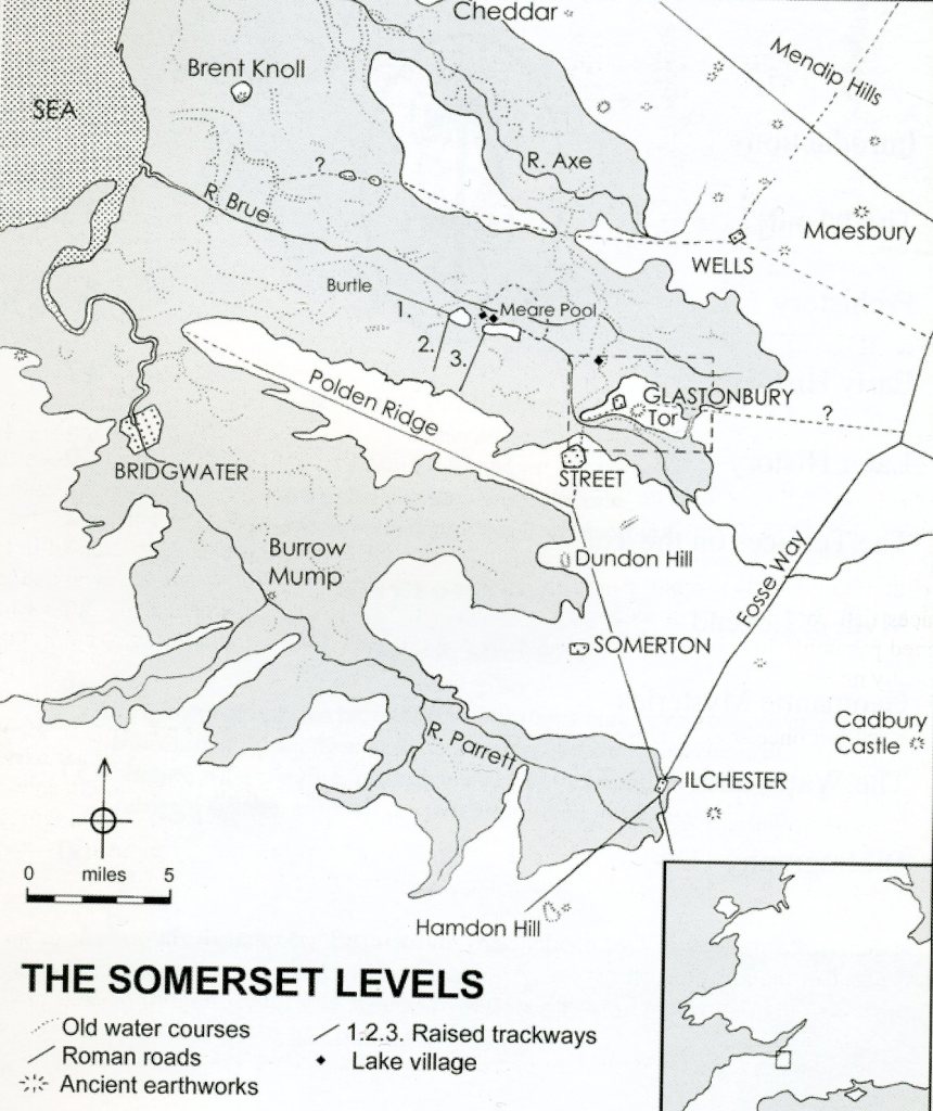
Imaged above and below, it is striking that the Glastonbury Lake Village is located precisely so it’s occupants could enjoy the sight of the midwinter sun rolling up the steep northern flank of the Tor. Their Lake Village would have been located anywhere in the large expanse of water and reed beds, but these Iron Age lake-dwellers chose to position it to see the Winter Solstice sun rise over St. Edmund’s Hill and beyond it the Tor. It should be noted that Glastonbury lies about 19 km from the sea on the eastern edge of the Somerset Levels in southwest Britain. The Somerset Levels were once a great marsh and before that, when sea levels rose after the last ice Age, a shallow inland sea. This is now low, flat, peaty, farming country, subject to frequent flooding. For thousands of years Glastonbury was therefore a virtual island surrounded on three sides by the watery Levels, (imaged below).
The land around Glastonbury is composed of Lias beds laid down in the Jurassic age. At the base is a layer of impervious Keuper marl beneath a stratum of ‘Blue Lias’ or limestone; above this are softer marlstones and clays. Midford Sandstone forms the highest ground, including that of the Tor. Once this sandstone, rich in fossils, completely covered the area. As a matter of fact, ammonites laid down under the sea more than a hundred million years ago are plentiful on the Tor summit.
Glastonbury has been a religious center since pre-Christian times and it’s atmosphere has encouraged many mysteries and legends. St. Dunstan (Abbot 940-957 A.D.) built a new Abbey around the wattle church. Through his work he revived the Monasteries in England, and Glastonbury became the burial place of Saxon kings.
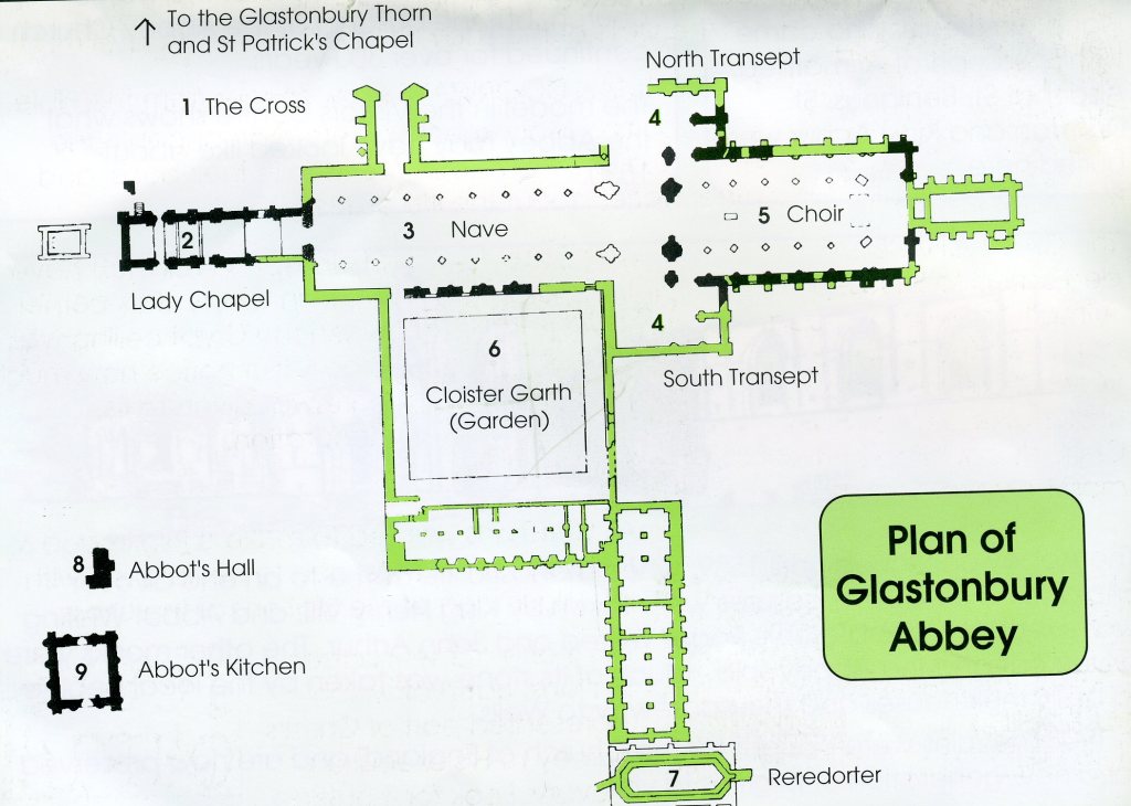
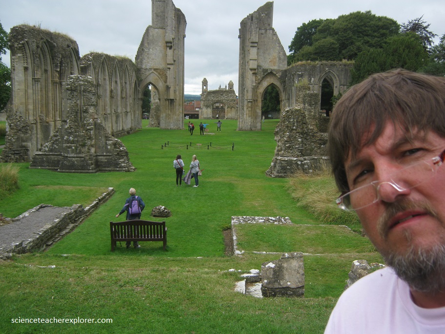
Under the Normans, the Abbey was rebuilt, but in 1184 A.D. a great fire almost completely destroyed it. The Lady Chapel was immediately built on the site of the wattle church, but the building of the Abbey Church continued for over 300 years. Pictured below, this large opening was once an archway leading to the Choir. Here the Monks attended services eight times a day, starting at 2 A.M. when they would enter in procession from their dormitory above the Cloisters.
It is thought that the Tor resisted erosion because iron that had been carried into the sandstone either from an artesian well or from once even higher deposits, had the effect of hardening it. The Tor successfully resisted the erosion that carried the top layers of elsewhere.
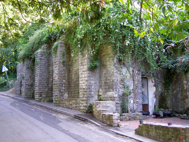
Imaged below, several Springs emerge from the Tor and at least one, the ‘White Spring’, has cut tunnels and caverns into the soft limestone. The source of the water is most likely to be rainfall, but the nature of this spring and it’s sister spring, the minerally very different ‘Chalice Well, suggests the water takes a highly unusual course below ground.
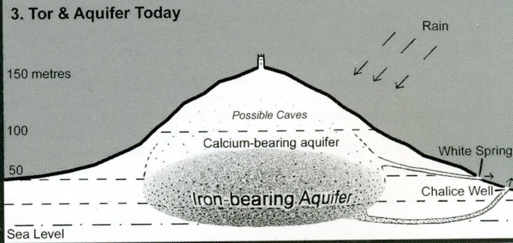
The ‘White Spring’ rises at the bottom of Well House Lane behind a large stone reservoir. It’s water is full of calcium and is perennial, although it’s rate of flow varies considerably. Records show that this spring water originally emerged from the mouth of a cave, below which once lay deep accumulation of white tufa or flowstone deposits. The spring was capped and diverted into the reservoir in the 1870s, destroying a lovely and well know landmark.
50 meters away from the White Spring, rises the water of the ‘Chalice Well’. This spring, also perennial, is quite different from the ‘White Spring’. It’s flow does not fluctuate as much and it has a high chalybeated or iron content that leaves a coat of rust red deposit on every surface it contacts. This ‘Blood Spring’ flows through a grove of yew trees.
According to legend, the grail is supposed to be hidden in the ‘Chalice Well’, which lies between the Tor and the Abbey.
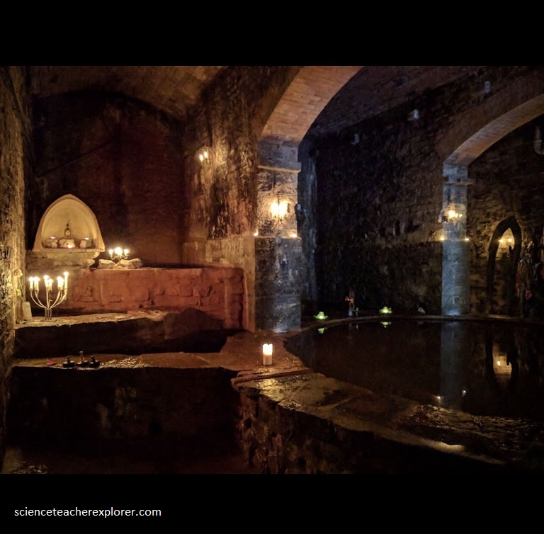
The waters in the Challis Well are rust-colored due to their iron content, but tradition asserts that the redness comes from the blood seeping from the sacred vessel. I only visited the other Well/Spring that is full of Calcium Carbonate that deposits on the surrounding structures, leaving a White depositional color. The Red Spring was privately owned and I was unable to get a picture of it.
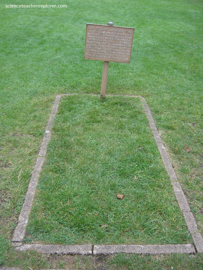
King Arthur and Guinevere has also been claimed to be buried here in the Abbey. Supposedly, in 1278 the two bodies were reburied here in front of the high alter in the presence of King Edward I and Queen Eleanor.
The abbey was closed down in Henry VIII’s time and the abbot. Richard Whiting, was hanged, beheaded and quartered on the Tor in 1539.
