Bruneau Dunes, ID 2021
During the summer of 2021, I visited the Bruneau Dunes State Park. Bruneau Dunes State Park is located about 29 km south of Mountain Home. From the intersection of state road 51 and state road 78, just south of the Snake River, drive east on SR 78 for 2.7 km and turn south on the Bruneau Dunes State Park Road.
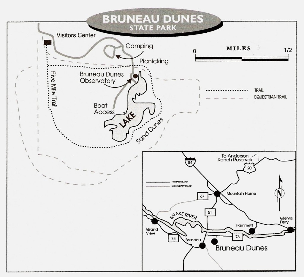
Bruneau Dunes State Park is a 19 square kilometer tract of desert set aside to protect these remarkable dunes. The park features a visitor center, several camp grounds, and an astronomical observatory.
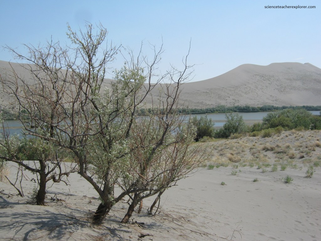
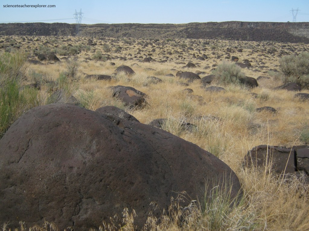
The dunes here are recognized as the tallest single structured dune (a dune not braced against other dunes) in North America. The Bruneau Dunes lie in a 5.6 km semicircular basin called Eagle Cove, a former meander of the Snake River that was, over time, cut off from the river’s course due to erosion along it’s outer banks.
Unlike other dunes that are formed by one dominant wind direction, the Bruneau Dunes are reversing dunes, formed from two dominant wind directions, (northwest an southeast). The reversing wind patterns deposits sand atop itself, piling up to form the lofty dunes.
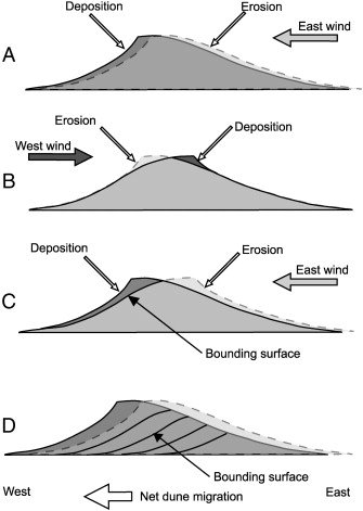
Another striking feature of the Bruneau Dunes is the composition of it’s sand. Most dunes are dominated by quartz, (a hard and common mineral). At Bruneau, the sand is much darker, and close inspection shows that it is a salt and pepper mixture of dark basalt grains and quartz.
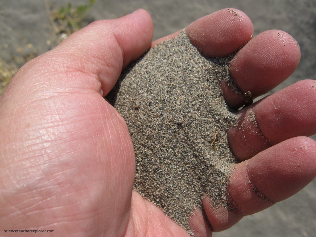
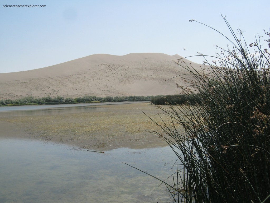
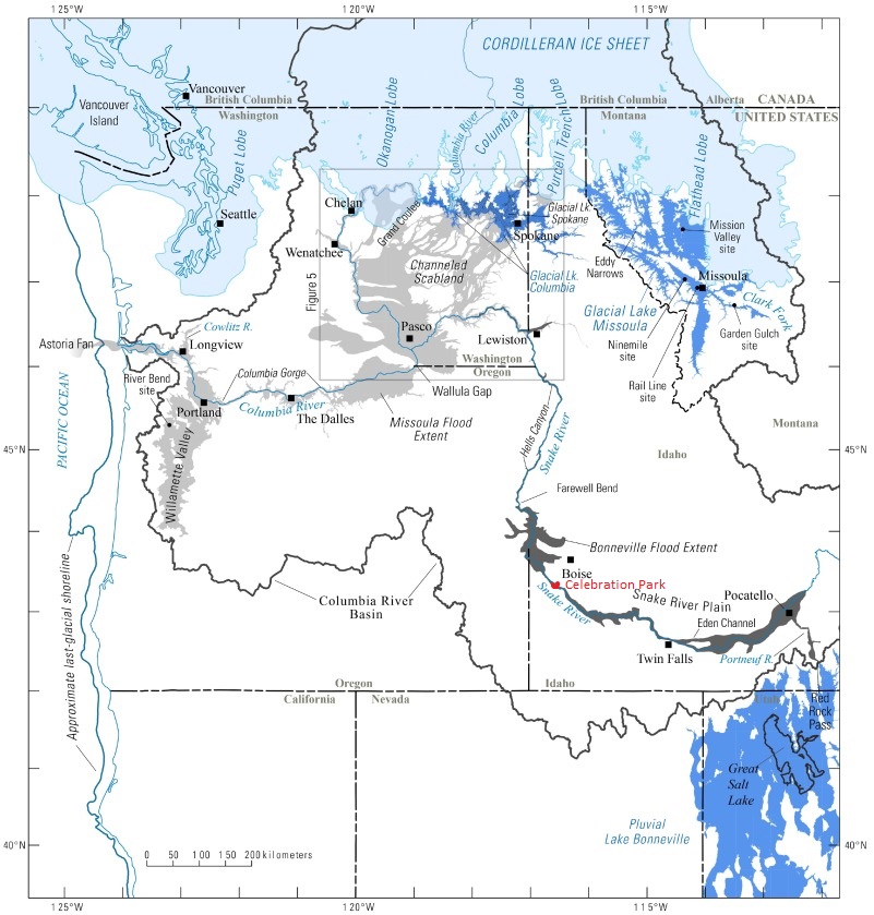
Pictured below, the lakes are a consequence of human activity. The nearby CJ Strike Dam, constructed in the 1950s, impounded the Snake River and formed a reservoir upstream of the dam. As the river level behind the dam rose, the subsurface water table followed suit, rising high enough to flood low areas, such as these small basins near the dunes.
Pictured below, ripples are essentially miniature dunes that form perpendicular to the wind direction. The distance between ripple crests is determined by the size of the grains and the wind speed, (with stronger winds and smaller grains the crests are farther apart).
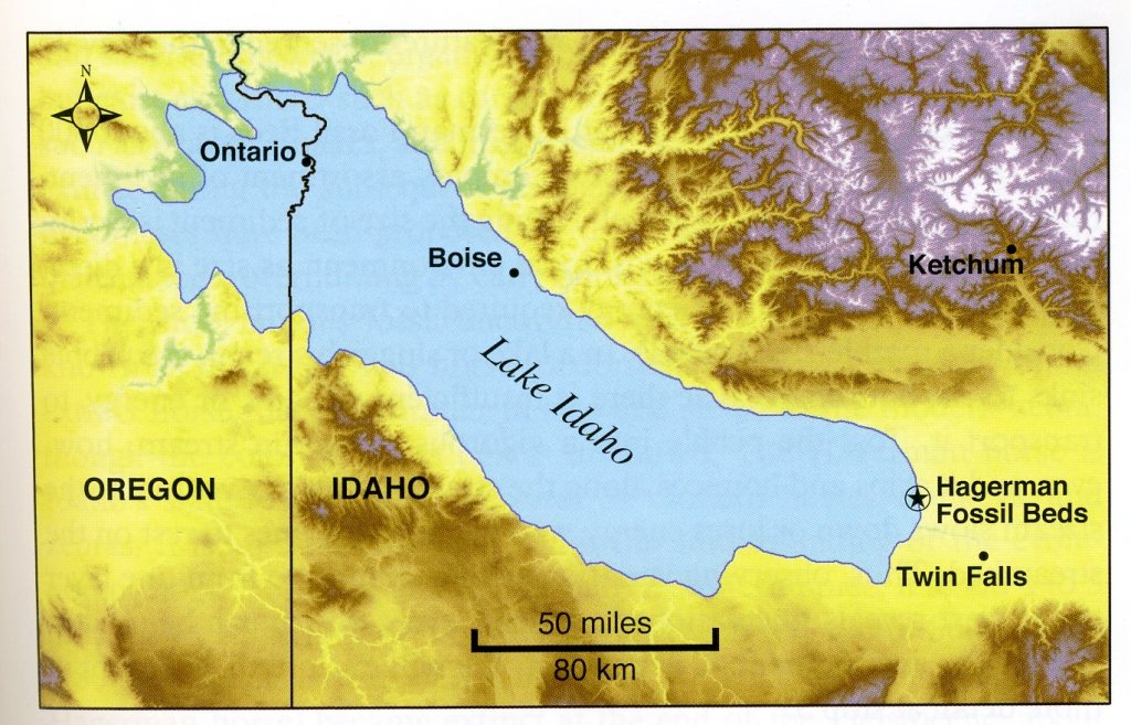
This part of Idaho has an abundance of sandy sediment from the Glenns Ferry and Bruneau Formations, originally deposited in Lake Idaho, (a Pliocene lake 4-3 million years ago). Wind has efficiently blown away finer dust-sized particles in Eagle Cove, leaving the coarser sand behind.
Further down SR 78 in 10 km, (west), you reach a small town called Bruneau. From Bruneau, head 13.3 kilometers south on Hot Springs Road and then continue 12 kilometers on Clover 3 Creek Road to the “Bruneau Canyon Overlook Road”. Turn west and drive 5 kilometers to the overlook, (pictured below).
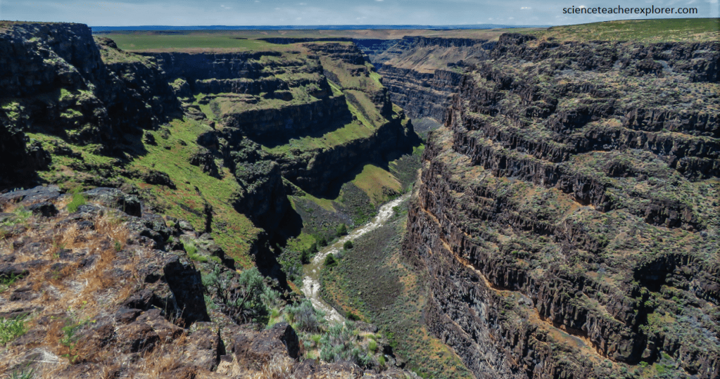
Pictured above, the stack of lavas consists of between 10-13 individual basalt flows erupted from a variety of nearby sources such as small shield volcanoes of Miocene to Pliocene age. Each of the flows in the lower part of the canyon is separated by distinct, tin red sediment layers that formed during prolonged surface exposure and weathering of the iron-rich basalt in the centuries between eruptions. Durable layers of basalt tend to form vertical cliffs on steep hillsides, while layers of soft sediment tend to break down into slopes, resulting in a stair-step profile.
Imaged above, as “Lake Idaho” began to drain, (2 million years ago), northward and enlarge Hells Canyon, the base level of the ancestral Bruneau River dropped with the lowering lake, and the gradient of the river steepened dramatically. Geologically rapid downcutting into the bedrock basalt layers left a narrow, deep youthful scar as the river sawed the impressive gorge.
Pictured above, the immense power and magnitude of the Bonneville Flood are on display at “Celebration Park”. Lake Bonneville, the enormous precursor to modern Great Salt Lake in Utah, overflowed into Idaho about 17,500 years ago. Picture above, the boulders are polished by countless collisions during tumbling in the floodwaters of the Bonneville event.
Over 1,000 cubic miles of water poured into Idaho, down the length of the Snake River drainage from the Utah border to the Columbia River, and out to the Pacific Ocean as a single flood that lasted for a few weeks. The river channel was scoured, widened, and permanently modified by the flood.
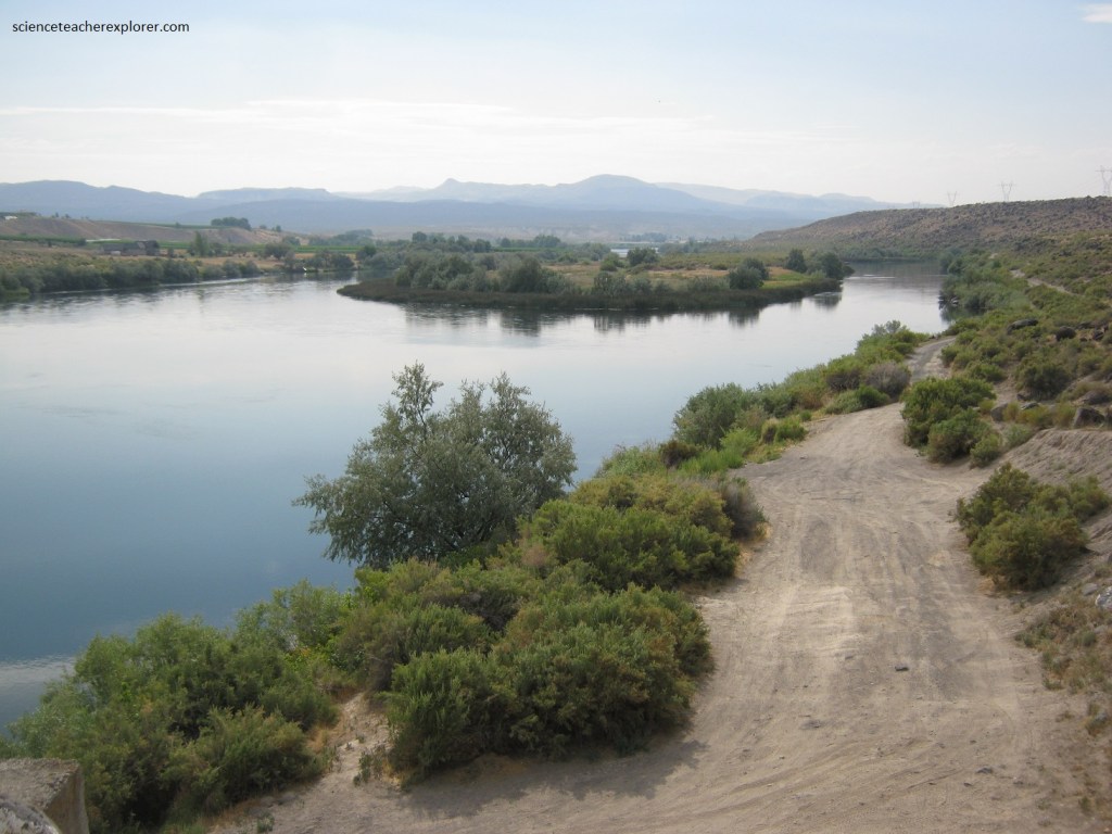
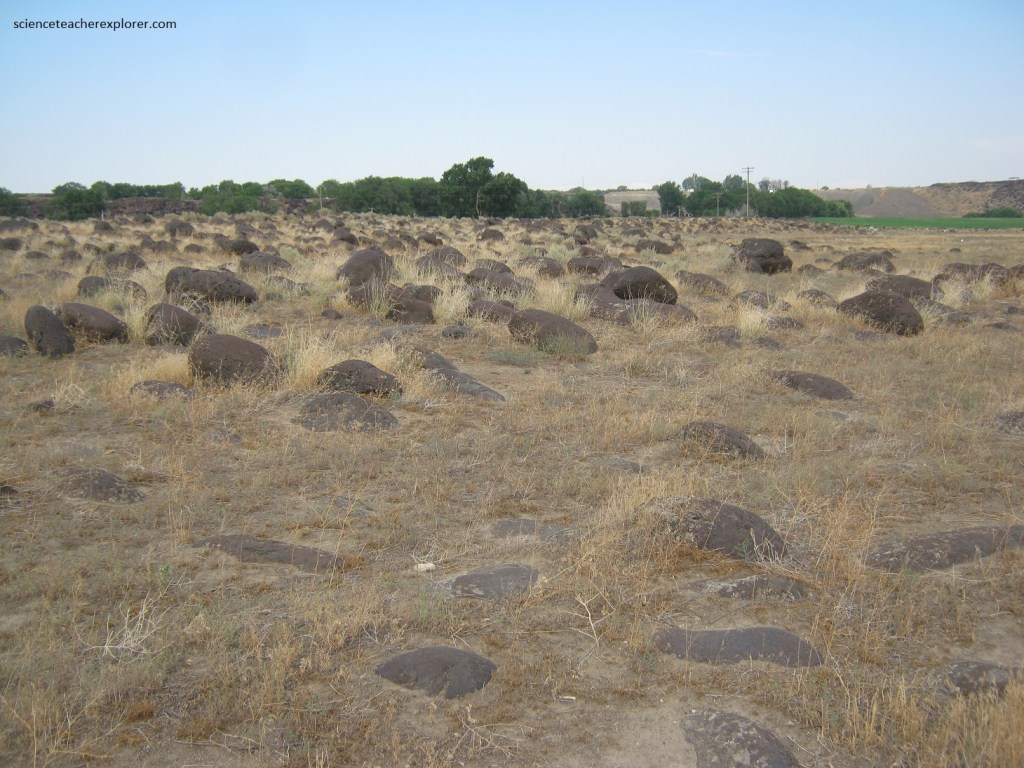
Pictured below, enormous boulder bars with tumbled and polished rocks up to 3 meters in diameter are deposited throughout the flat field. The sheer force required to bounce and batter such large chunks of rock into rounded shapes is amazing. Their rounded shapes suggests tumbling. Frequent collisions during floods break off the rocks’ sharp edges and angular corners.
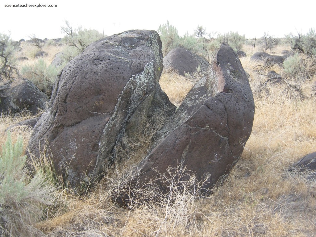
Picture below, sheer cracks split several of the boulders. Some of these fractures resulted from powerful collisions between boulders, but many have developed since the flood ended. Water infiltrating existing cracks in the rocks freezes and expands, prying the cracks open. Repeated freeze-thaw cycles allow fractures to widen, cleaving rocks in half in some instances.
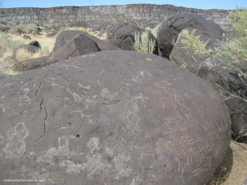
Pictured below, thousands of years ago, Native Americans hunted, fished, and camped along the Snake River, leaving a record of their passage by carving thousands of petroglyphs on Melon Gravels boulders. The images on this boulder were made particularly visible because the inscribing penetrated the thin, dark surface of the rock, revealing the lighter color of the rock’s interior. The hard, dark coating is known as desert varnish, (an ultrathin deposit of tiny clay minerals cemented by manganese and iron oxides).