Isabela Isle., Ecuador
In March of 2022, I took a cruise, with a friend (Mike Stevens), to the western part of the Galapagos Islands. We left from the Guayaquil and flew to the Baltra Airport on the Santa Cruz Island. From there we shuttled across the island to Puerto Ayora, where we caught a boat to explore the Isabela Island.
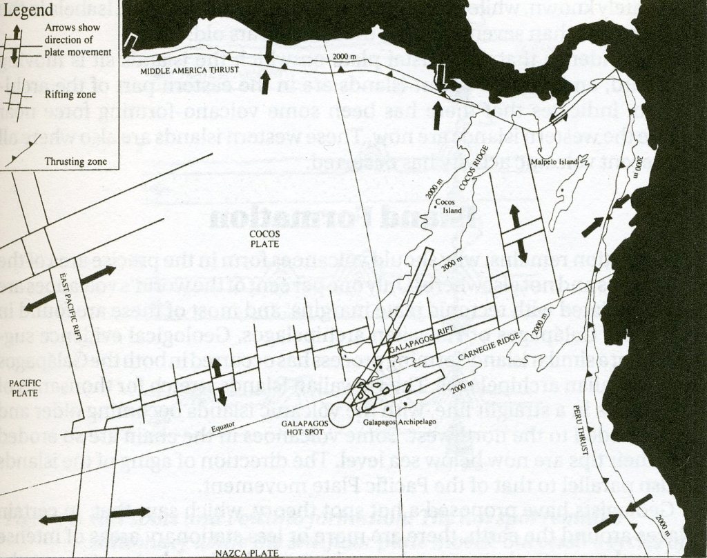
Imaged above, the Galapagos lie in the eastern Pacific Ocean 1,000 km west of the mainland of South America and astride the Equator. Geologically, they lie at the meeting point of two submarine rides, the Carnegie Ridge running westward from South America and the Cocos Ridge running south from Central America. The meeting point of these two ridges is known as the Galapagos Hot Spot. The islands lie at the northern edge of the Nazca Plate which is moving eastward at a rate of 2 cm/yr.. This movement is responsible for the building of the Andes mtn. range and for the continuing earthquake and volcanic activity along the western edge of South America. As the plate moves and the hot spot stays stationary, so a series of volcanic islands formed. This explains why the youngest islands, Isabela & Fernandina at 0.7 million years, lie to the west of the oldest, Plazas at 4.2 m.y. and San Cristobal at 2.4 m.y..
Before we left the Puerto Ayora, we visited the Charles Darwin Research Station. The main interest here was the Tortoise Breeding Centre. This is the only place where you have the opportunity to compare the different shapes of carapace of the various Galapagos Tortoise. Here we could see displays illustrating different aspects of the Galapagos ecosystem, the conservation problems and the programmes that the Charles Darwin Research Station have in place to combat them.
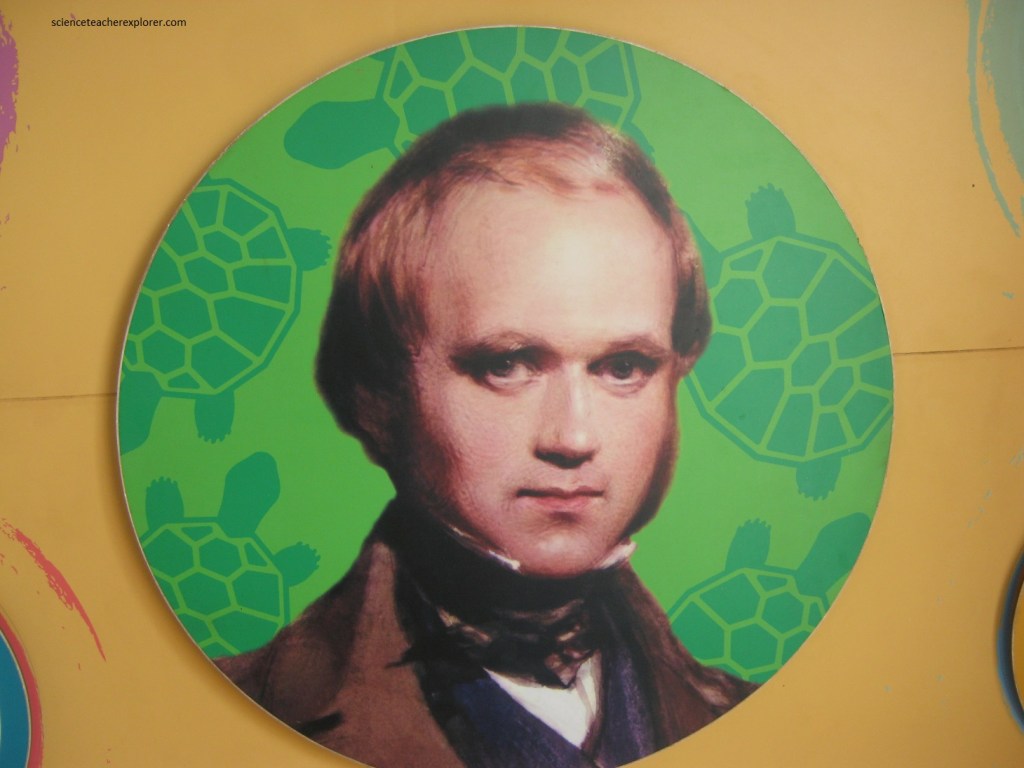
Charles Darwin’s visit to the Galapagos in 1835 was the catalyst that ensured that he would be remembered, not only as the pre-eminent scientist of his time, but as one of the truly great scientists of all time. It was 1831 when Charles Darwin was invited by Captain Robert FitzRoy to be the naturalist on board “HMS Beagle” which was soon to depart on a 5 yr. voyage, surveying the water around the southern tip of South America. The voyage was without doubt the turning point in Darwin’s life, and the visit to the Galapagos was the most significant single episode on that voyage.
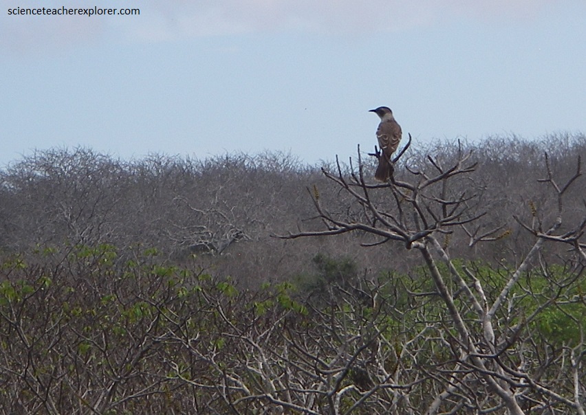
On Charles Darwin’s return to England, he published “The Voyage of the Beagle”, which established him as an important figure in the scientific community of his day with “Natural Selection” and “Evolution”. His powers of observation were acute and he is credited with developing two new sciences quite apart from his work on evolution. These were ethology and ecology. Charles Darwin collected samples from many places and would later notice their differences and similarities. The Galapagos mocking birds intrigued him. A colleague later confirmed that each was a unique species. Could their difference influence their chance of survival?
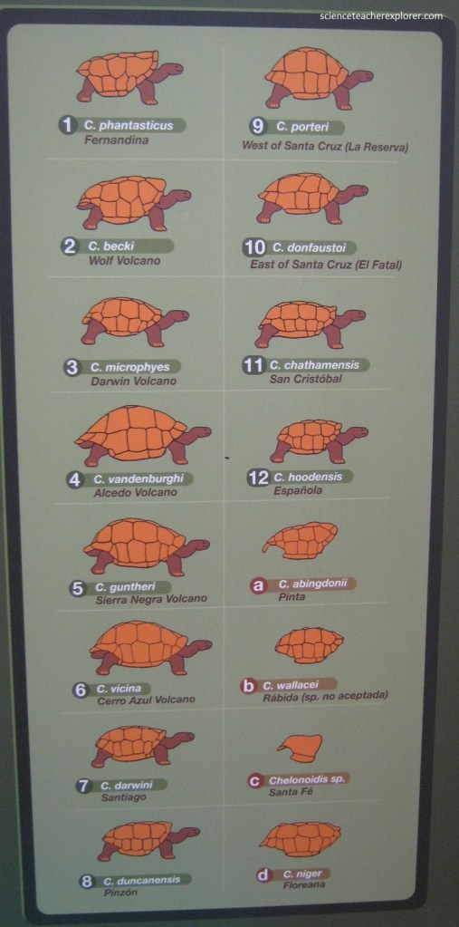
One of the most significant features of the wildlife of Galapagos is that the land animals are predominantly reptiles whereas in most of the rest of the world, mammals are dominant. Reptiles are dominant in Galapagos owing to the isolation of the islands. As a matter-of-fact, the islands are named after the tortoises. Galapago is an old Spanish word for ‘saddle’ and several of the species, especially on the low-lying islands, have carapaces (shells) shaped very much like a Spanish saddle.
When Charles Darwin visited the islands in 1835, the Vice Governor, told him that he was able to tell which island a tortoise cam from by the shape of its shell. This is largely true and was a factor that helped Darwin in developing his theory of evolution. The Galapagos tortoise populations are a good example of ‘adaptive radiation’. The tortoises can be divided into two groups: “Saddleback” and “Dome-shaped”.
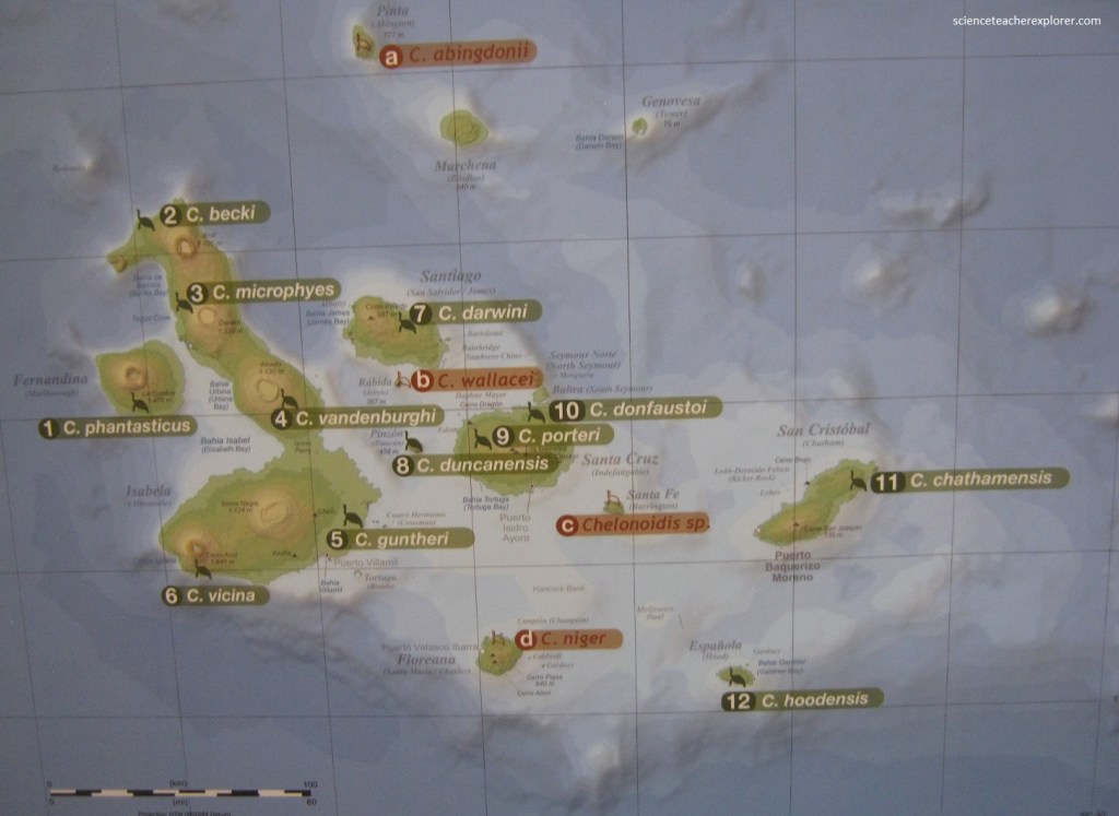
It is generally accepted that the saddleback shell evelved in species needing to reach high up into the vegetation to feed, while the dome-shaped tortoises evolved by remaining at or near ground level where there was plenty of suitable.
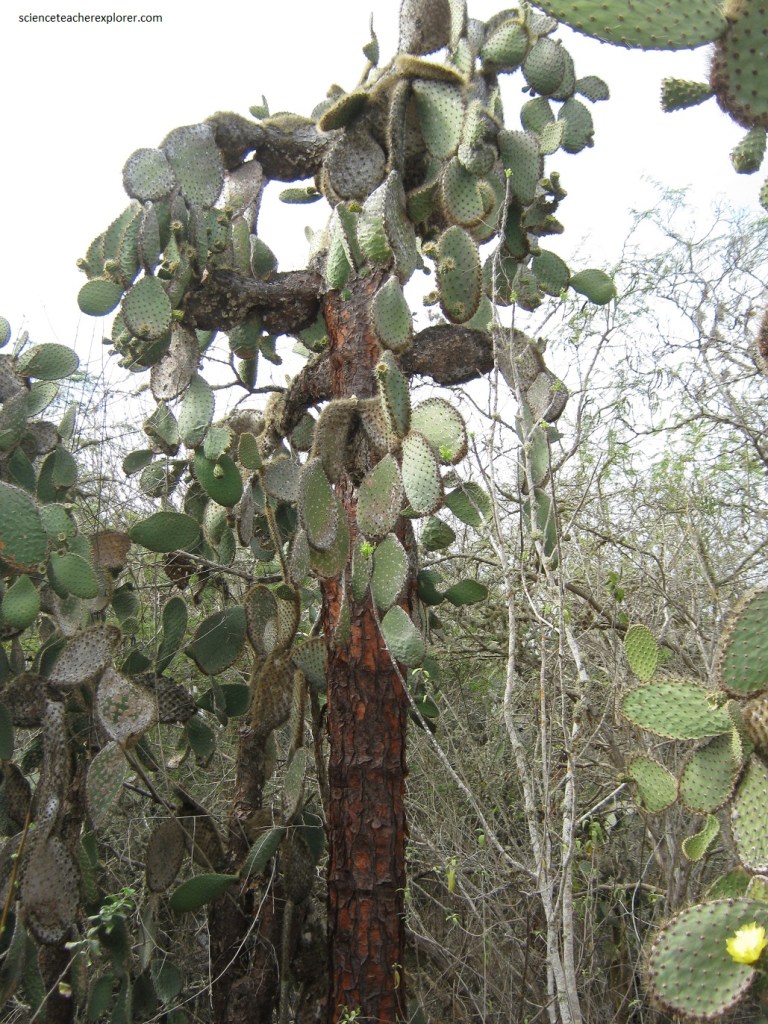
Pictured above, it seems reasonable to suppose that the large, trunked specie of the “Giant Prickly Pear Cactus” evolved in response to competition for light, and also as a protection from predators, mainly saddle-back tortoises with their long neck.
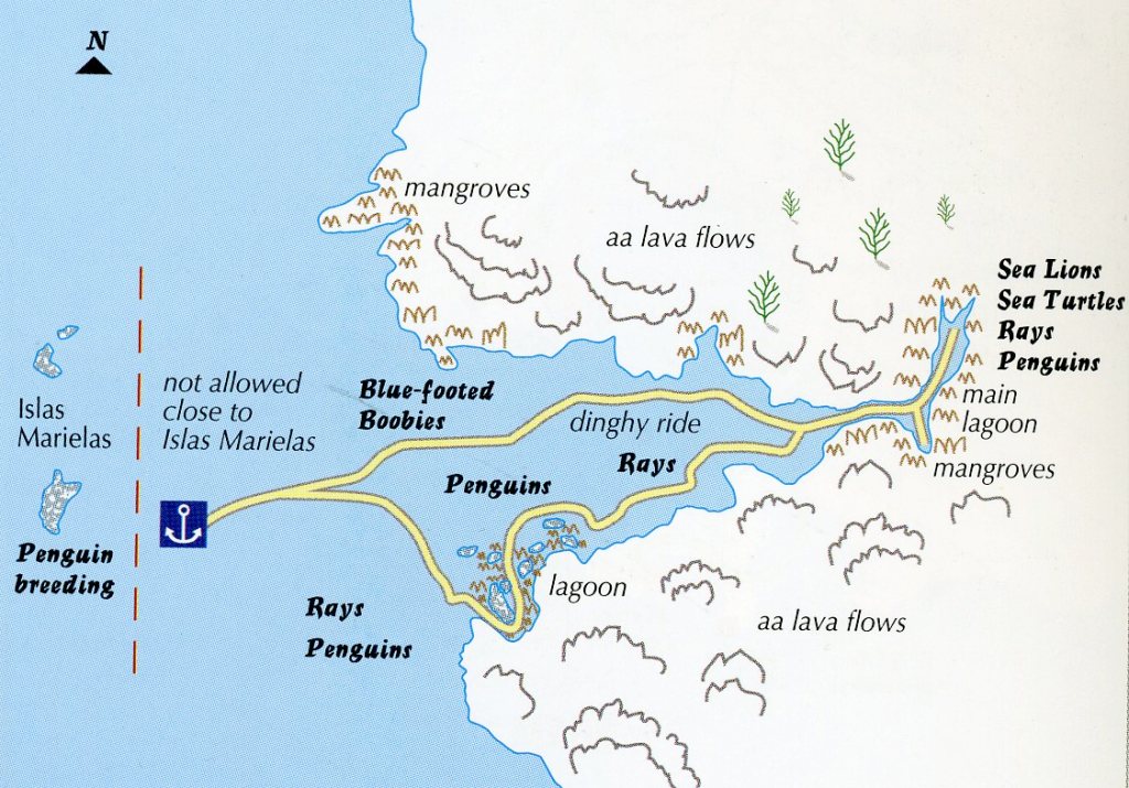
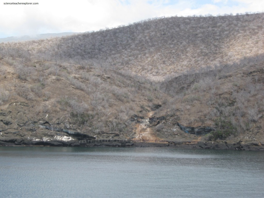
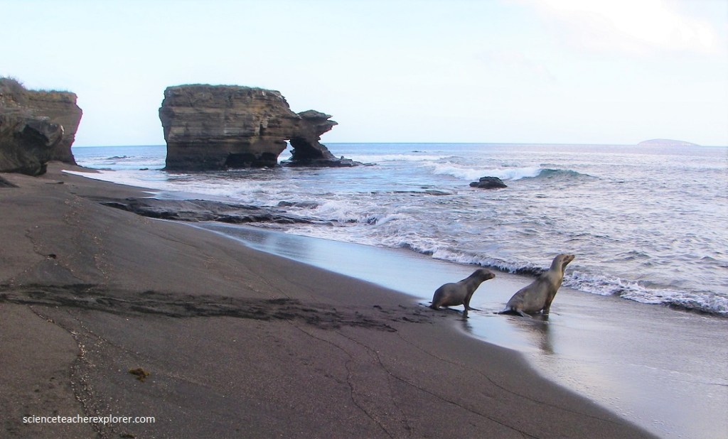
After leaving the Puerto Ayora on a boat, our first place of exploration was “Punta Moreno” on the south-western side of Isabela Island in the Galapagos. Our tour began with a panga ride along the beautiful rocky shores where penguins and shore birds were spotted, (pictured below).
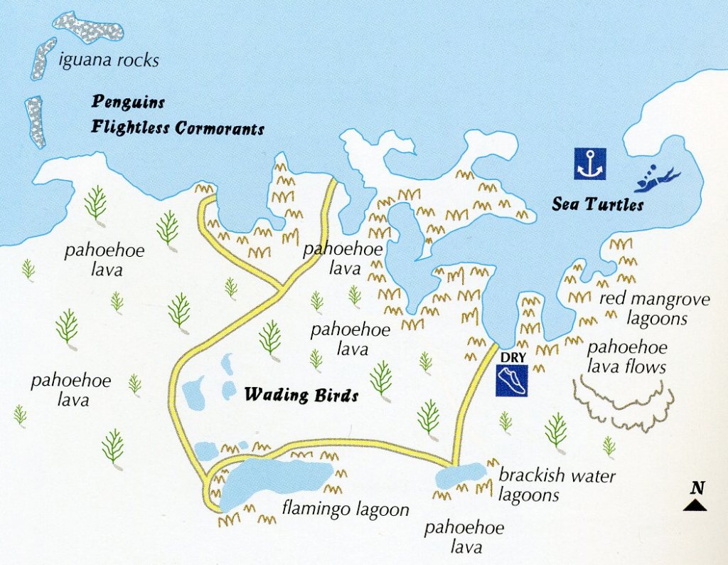
The west coast of Isabela Island receives nutrient-rich, cool waters from both the Humboldt and Cromwell Currents. This is why the marine-life is so abundant, with large populations of whales, dolphins, and Blue-Footed Boobies, which dive down into the cool waters in search of fish (pictured below). Isabela also has the largest population of Galapagos penguins, (pictured above).
Pictured below & above, the Galapagos Penguin is one of the smallest penguins in the world, it is some 50 cm tall when standing. It is the only penguin to breed entirely within the tropics, and the only one to be found in the northern hemisphere. The current population is thought to be in the region of 2,000 individuals but was seriously affected by the 1982/83 and 1997/98 El Nino. Pictured above is a couple of dozen of them.
After our dry landing, we traversed through some of the sharpest basalt-rocks (pahoehoe lava) in the Galapagos Islands. The environment was enigmatic; the driest lava fields I’ve ever seen, was interspersed with lagoons and small ponds containing abundant wildlife, including a few pintail ducks, (pictured below). The pahoehoe lava surface has collapsed into the lava tubes beneath, creating the brackish water ponds.
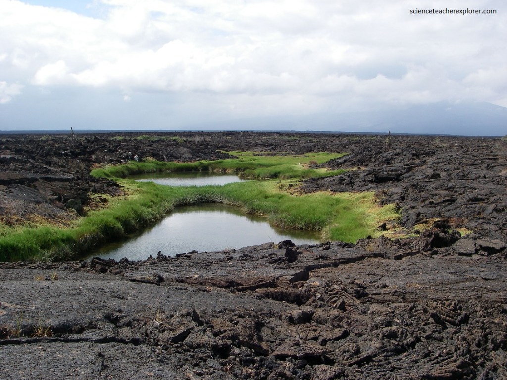
There are several clumps of lava cactus and other pioneering plants here, but a species of “Scalesia is also seen. There is a wealth of animal and plant life, including flamingos and other waders.
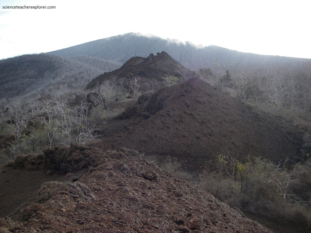
There is verification at every vantage point that the advanced forms wee here first and were partially displaced by subsequent eruptions of the Sierra Negra Volcano, (pictured below).
Isabela is by far the largest island in the Galapagos and , at nearly 4,600 square kilometers accounts for half the archipelago’s total landmass. One of the Galapagos’s youngest islands, Isabela boast a dramatic landscape dominated by 6 intermittently active volcanoes. From north to south, thes are Wolf (1,646m) and Ecuador (610m), which both straddle the equator. Darwin (1,280m), Alcedo (1,097m), Sierra Negra (1,490m) and Cerro Azul (1,250 m).
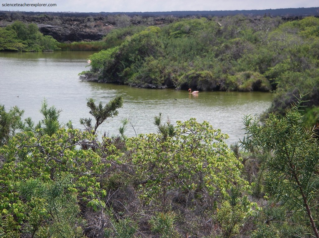
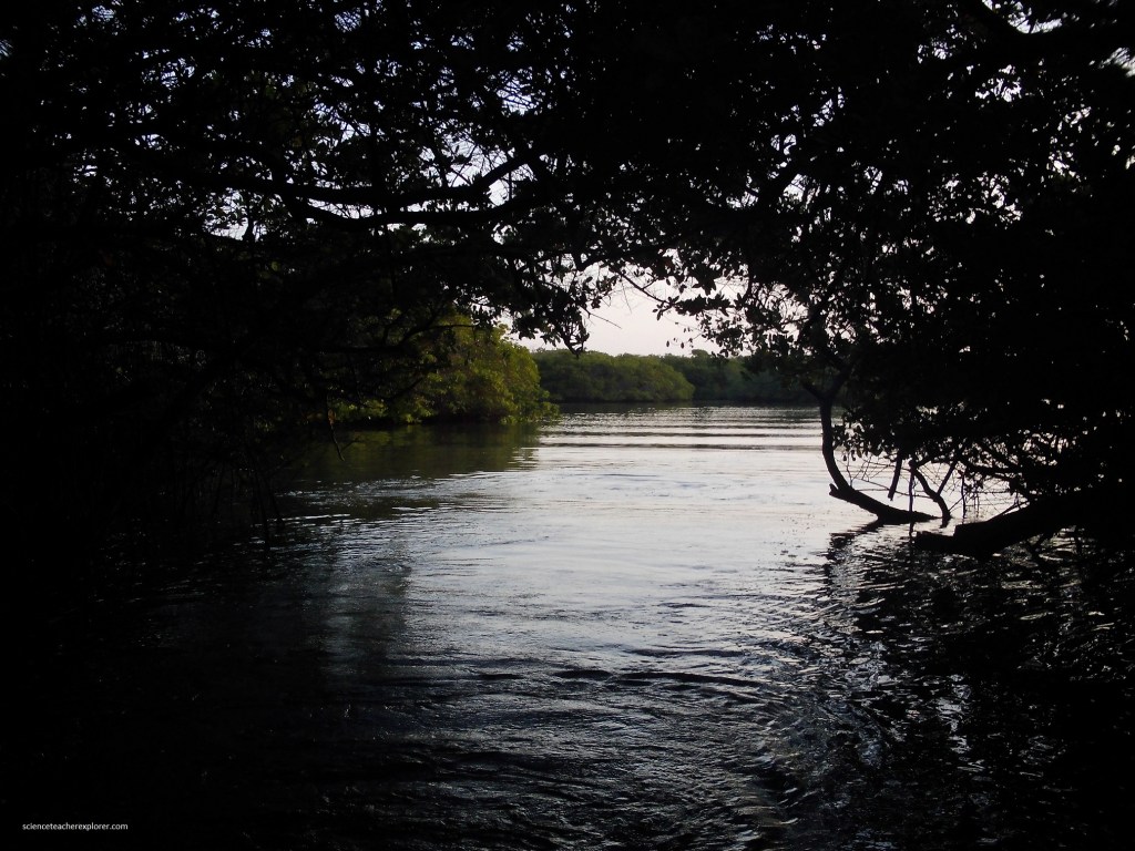
Our next stop was just down the coast to Elizabeth Bay. Elizabeth Bay is also situated on the west coast of Isabela, about a third of the way up at the narrow Perry Isthmas (9.6 km wide). Dry landing was not permitted and a panda ride began with a visit to a secluded cove, lined with large red mangrove trees. This large west-facing by nestles between southern Volcan Sierra Negra and Volcan Alcedo at the western end of the Perry Isthmas.
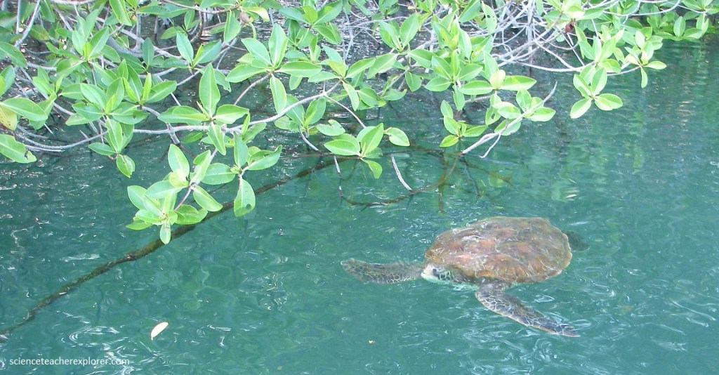
Pictured above, the commonest species of turtle found in the Galapagos and the one to breed in the islands. It is a subspecies of the Pacific Green or Black Turtle. They spend most of their lives in shallow lagoons like the one at Elizabeth Bay. The shell is generally dark green to black, but it does vary and can be an attractive yellow tortoiseshell color.
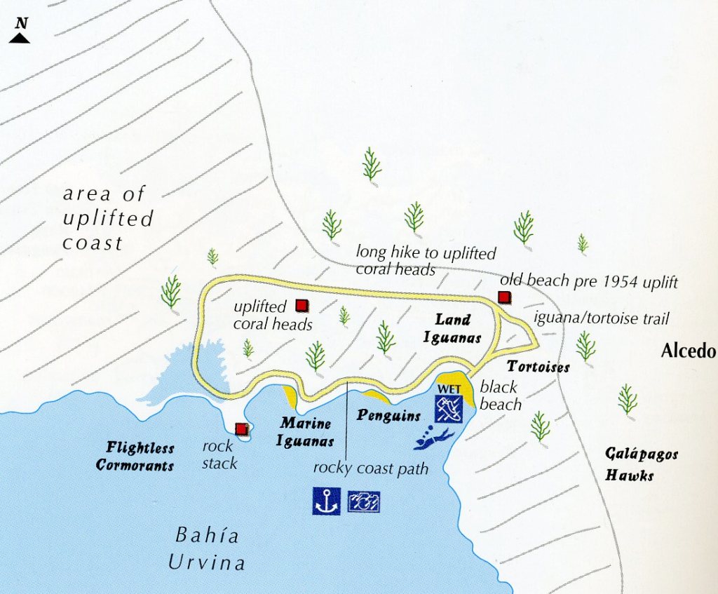
The next morning, we did a dry landing on a small beach within Urvina Bay or Urbina Bay. Urbina Bay is situated on the west coast of Isabela at the base of the Alcedo Volcano. In 1954, almost 6.5 km of its coastal seabed, marine life and all, were dramatically and suddenly uplifted about 5 meters. This event is associated with a eruption of the nearby Alcedo Volcano. The coastline was driven 1 kilometer further out to sea, forever exposing giant coral heads and stranding marine organisms on what was now the new shore. The marine remnants and coral skeletons are visited after a wet landing on the beach.
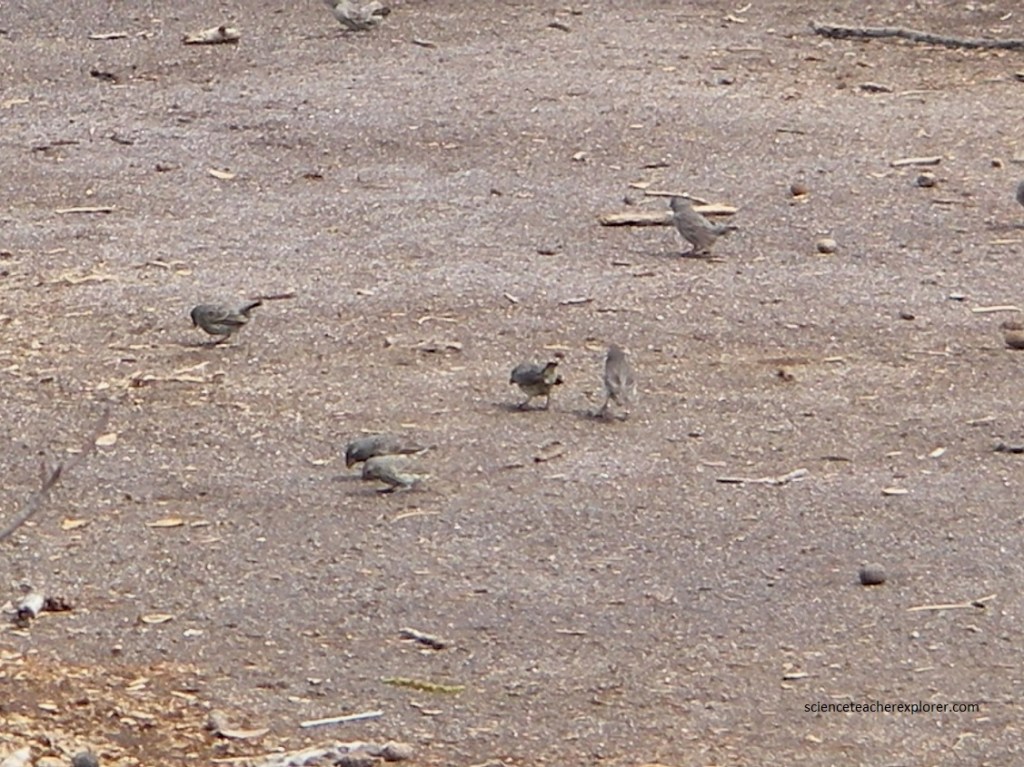
Once on land of Urbina Bay, we came to what looked like just another scrubby plain stretching out beyond towards Alcedo Volcano. Walking around on the trail, we ran into a large flock of “Ground Finches” (pitchered above). There are 14 species of finch in the Galapagos, collectively know as Darwin’s finches. The finches are mostly identifiable by beak size and shape, and location. The finches we encountered here are the “Large Ground Finch”. It is easily identified by its disproportionately large beak, which is as deep as it is long, and is ideally adapted for cracking large, hard seeds fallen to the ground.
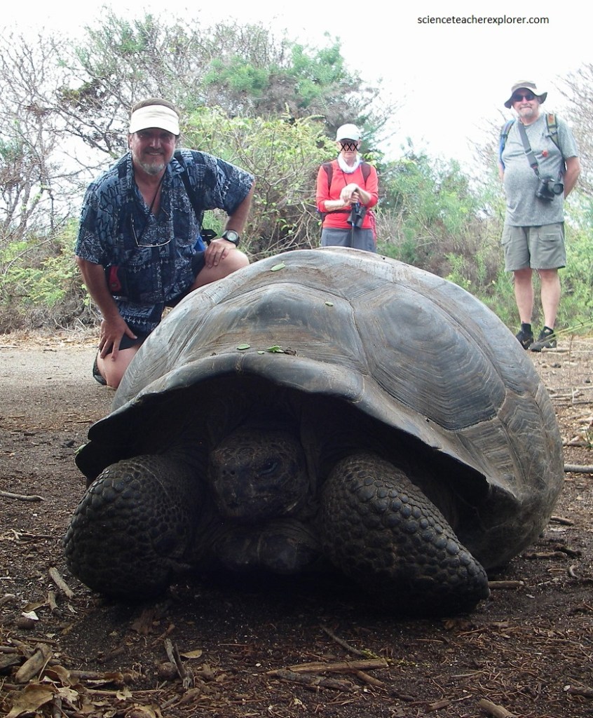
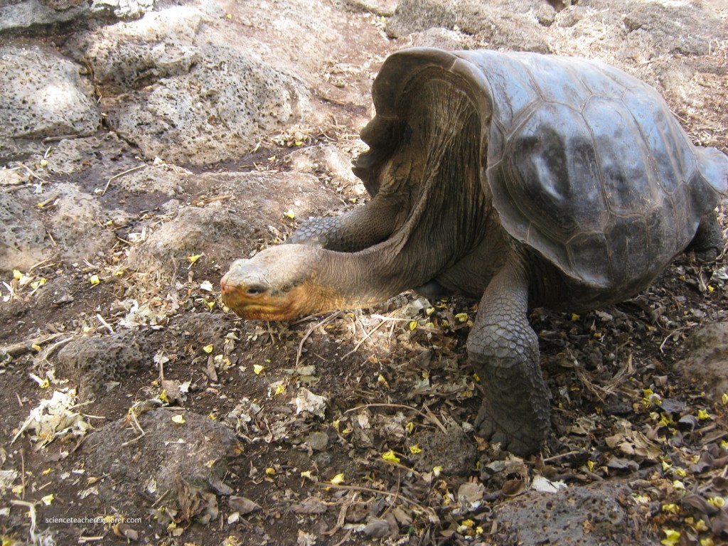
Situated at the foot of Volcan Alcedo, we encountered about a dozen of the Giant Tortoises (C. Vandenburghi) in the wild and near the trails, (pictured above and below). It was uncommon to see this many at this site. Maybe it was because of the rain from the upcoming El Nino. The tortoises that we encountered were dome-shaped. On the Alcedo Volcano, is the largest single population of tortoises in the island, with over 5,000 individuals.
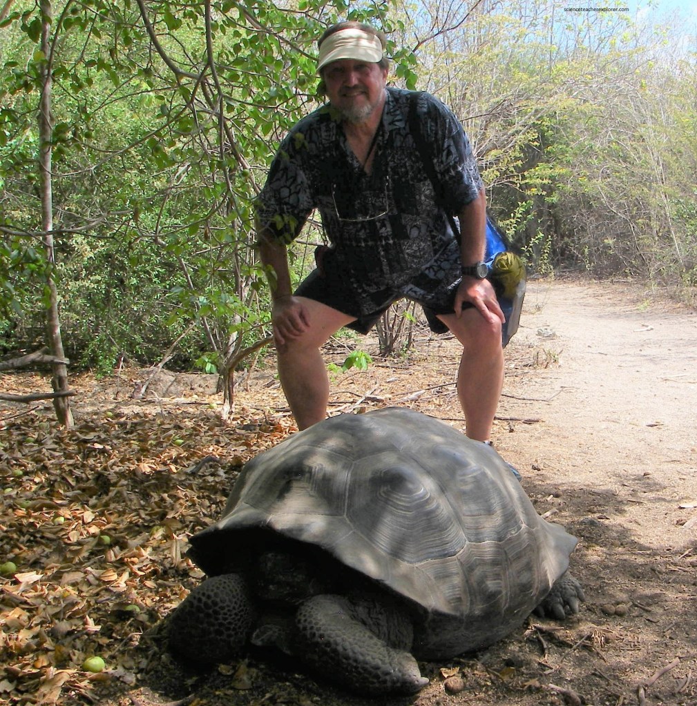
There are five distinct species on the island of Isabela each restricted to one of the five large-shield volcanoes. Each volcano is separated from the next by a lava flow, impassable to tortoises. This is an excellent example of species variation owing to topographical isolation. Since the volcanoes on Isabela have extensive moist areas, all the tortoises are essentially dome-shaped.
Notice, in the photo above, the apples on the ground to the left. Maybe, it is these apples on the ground that brought the dozen Giant tortoises off of the Alcedo Volcano. The apples are from the Manchinel. The Manchinel is a large evergreen tree growing up to 10 m in height with small very shiny elliptical leaves. Not widespread in the islands, but locally common. They produce small, highly alkaline, green apple-like fruit about 5 cm in diameter. The tree gets its English name from the milky sap which is poisonous for the human and can burn the skin. But, maybe not the Giant Tortoise.
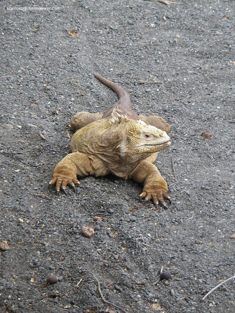
Pictured above, this is the most widespread of the land iguanas, numbering between 5,000 and 10,000 individuals and measuring up to 1 m in length and 13 kg in weight. Populations have been significantly reduced due to the predation by man and introduced predators such as dogs, pigs, cats and rats. Land iguanas vary in size and coloration but are generally a pale to dark yellow, occasionally coming clos to ochre.
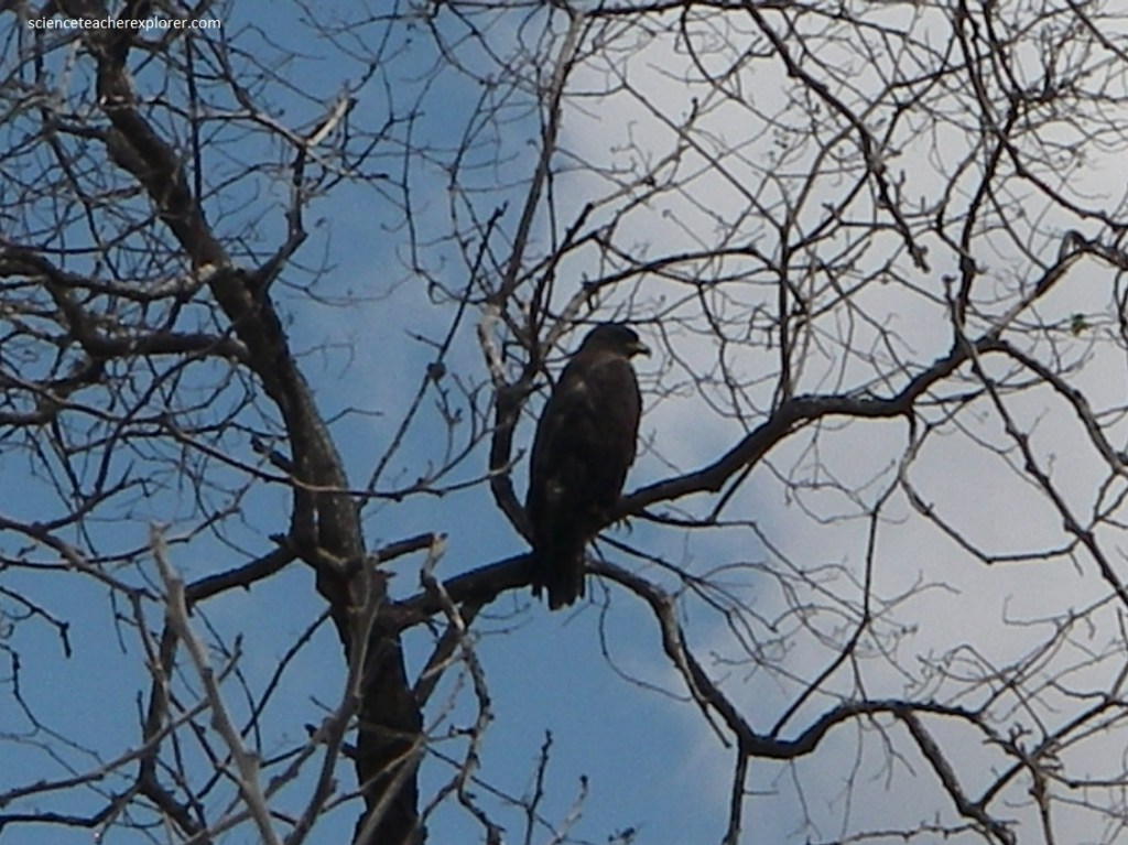
Pictured above, the only resident hawk, the Galapagos Hawk is a large (56 cm) brown buzzard. The adult is dark brown with dark-banded tail. The bill is yellow with, dark, strongly hooked tip. Both predator and a scavenger, they will feed on virtually anything, especially young iguana, lizards, birds, rats, centipedes, locusts and on dead animals.
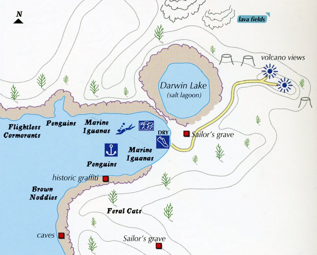
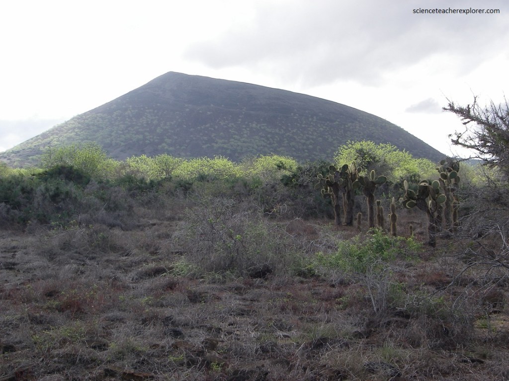
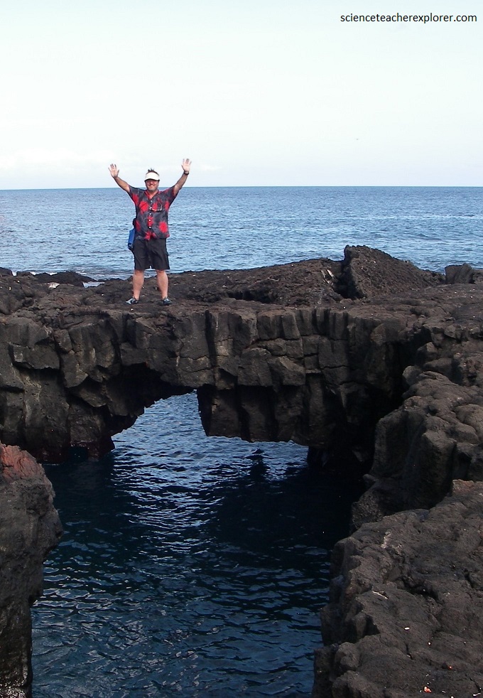
Our next stop was Tagus Cove; An anchorage long used by pirates, whalers and other early visitors, Tagus Cove is a flooded valley between two large tuff volcanic cones, with the flooded crater of a third at the head of the anchorage.
An historic location which still bears the inscriptions from visitors in the nineteenth century, the area has a good selection of Arid Zone plants as well as some interesting volcanic features. In the last century, whaling ships would anchor here to supplement their provisions with tortoises. Tortoises were particularly favored because they could be kept alive in the holds of ships for months without water or food. The Beagle anchored there in 1835 and Darwin spent considerable time exploring the area.
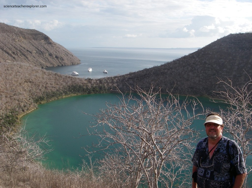
The land trip was a short climb to Darwin Lake, which is a saltwater lagoon that is actually above sea level. The chief draws of the visit are a good selection of birds, getting a good view of a crater lake, and views of Darwin and Wolf volcanoes. Pictured above, this eroded crater is 12 meters deep, and the waters have a high salt content, so it’s largely lifeless. Scientists have concluded that seawater seeped in through the porous lava rocks beneath the surface.
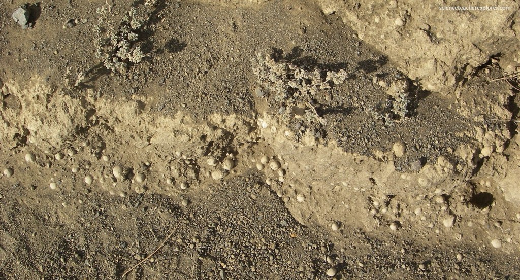
Pictured above, the small round pebbles covering the trails began as raindrops that collected airborne volcanic ash and hardened before hitting the ground. Darwin was the first to recognize that pyroclastic cones formed when basaltic magma comes in contact with seawater. When this occurs, the water is flashed to steam, and the magma fragments in to small ash particles that react with the steam to form palagonite, the light colored material of which the cones are composed. The entire process is quite explosive, and the ash is thrown into the air. It settles back to build a cone around the vent. The small round pebbles around these cones verify his hypothesis.
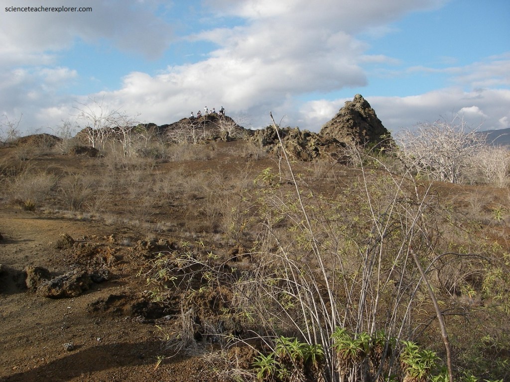
Our trail at Tagus Cove, sloped up to the base of the Darwin Volcano, providing a great view of the fragile lava fields, the volcanic formations, and the ocean as well. Two young pyroclastic cones, Tagus Cone and Beagle Cone, are located here on the west flank of the Darwin volcano.
Pictured above, the trail leads us to the lower lava slopes of Volcan Darwin. Volcan Darwin is nearly perfectly symmetrical and rises to an elevation of 1325 m and is the fifth highest volcano in the Galapagos. Like the other western volcanos, it has a large central caldera, nearly 5 kilometers in diameter and 200 m deep.
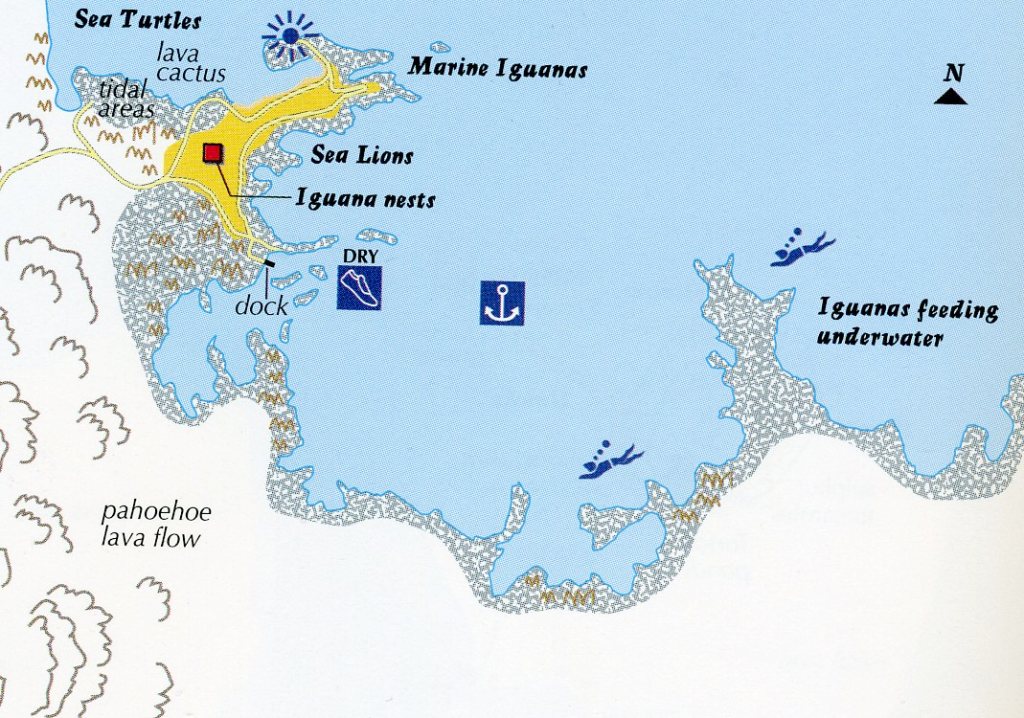
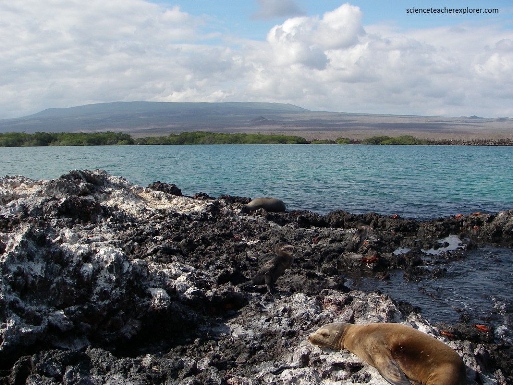
Our next morning, we explored the Fernandina Island by walking around the Espinosa Point area. Punta Espinosa is one of the most impressive and varied visiting sites in the islands, surrounded on all sides by the huge shield volcanoes of Fernandina and Isabela. It is a low point jutting out into the Canal de Bolivar. In 1994 the whole point was raised by movements of the Earth between 50-90 cm, leaving the landing dock inaccessible except at high tide.
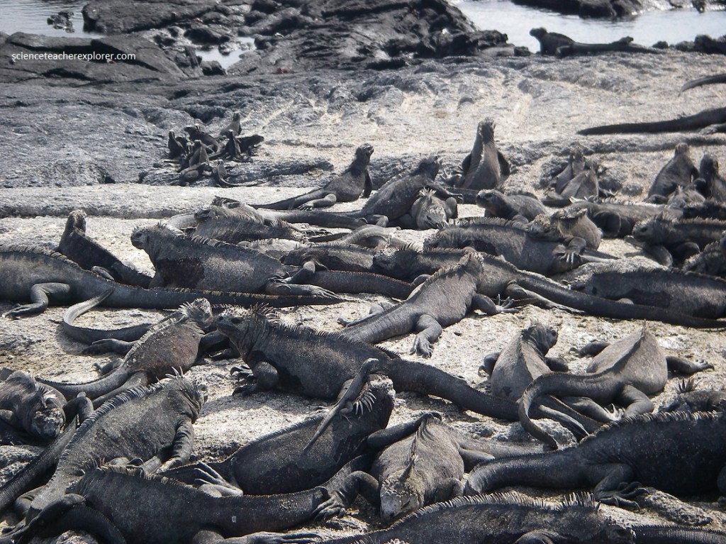
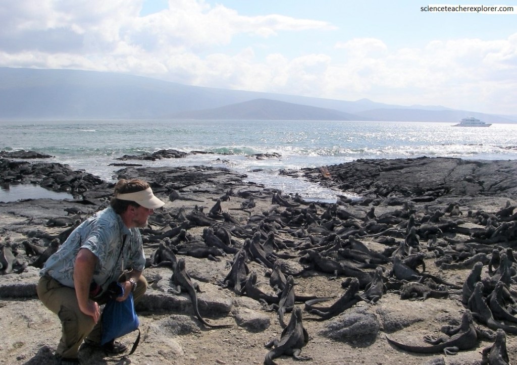
For observing the marine environment of Galapagos, Punta Espinosa is unrivalled, with large colonies of Marine Iguanas, often basking impassively in the sun. Once the iguanas have warmed up after they have been feeding in the ocean water, they will face into the sun to avoid overheating.
The Galapagos Marine Iguana is the world’s only sea-going lizard. It lives largely on land but feeds inshore and in the intertidal zone at depths of up to about 10 m. It feeds almost entirely on red and green algae. This diet results in a high intake of salt. To eliminated this excess of salt, they spit out brine through their nostrils. This snorting is the only noise that they make. Additionally, the Marine Iguana can remain submerged for 10 minutes or more. during a strong El Nino, when its food supply is severely affected, the population can suffer a very severe drop.
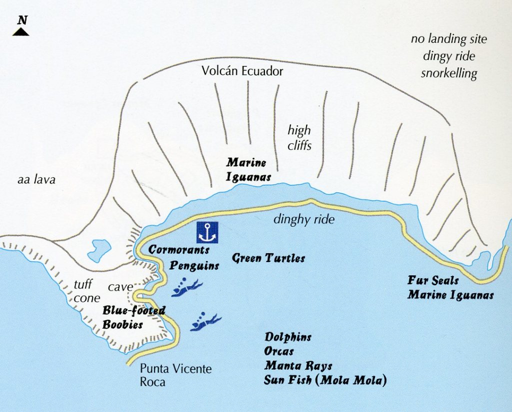
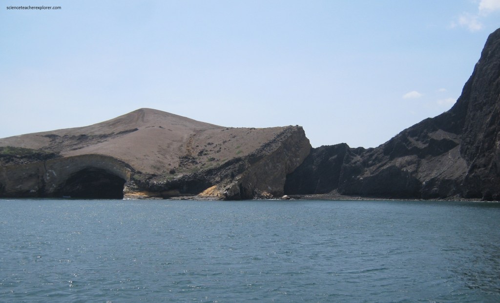
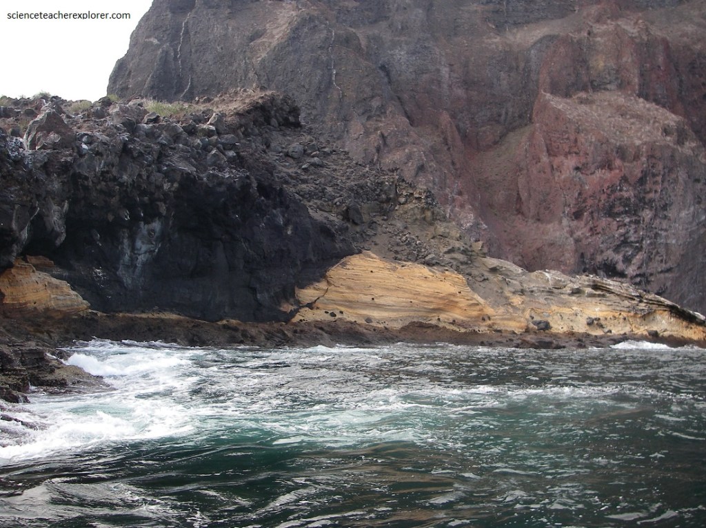
Our next stop was “Punta Vicente Roca”. Further north, at the northern tip of Bahia Banks, is Punta Vicente Roca, a very dramatic cliffscape with a tuff cone perched on the edge of Volcan Ecuador, (pictured below).
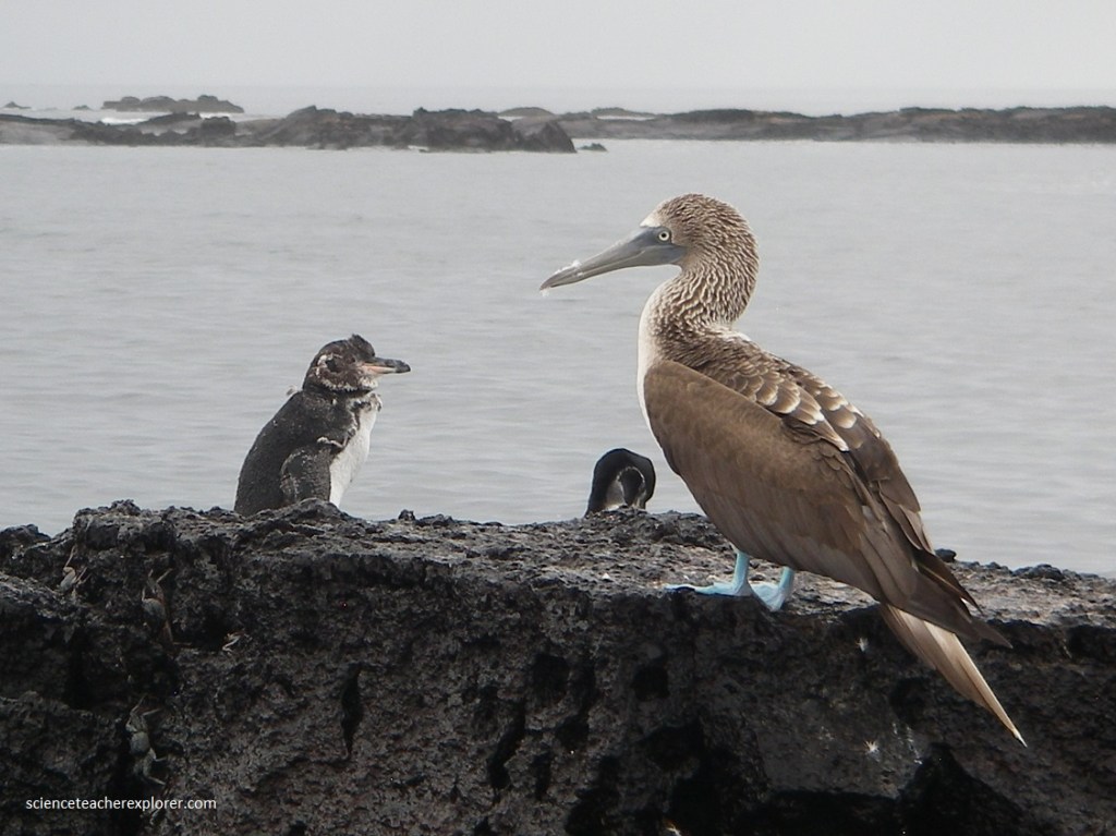
Pictured above, we couldn’t go ashore, but a dinghy ride was fascinating, with Galapagos Penguins and Flightless Cormorants.
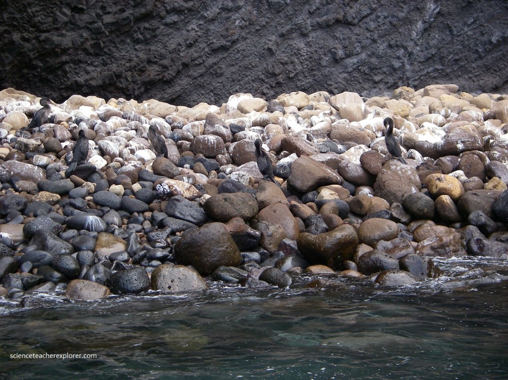
Pictured above, the “Flightless Cormorant is a large (93 cm, 3-4 kg) dark brown-to-black bird. Aptly named owing to the complete inability to fly,, its wings are no more than vestigial appendages that appear to serve no useful purpose. When in the water, the body is almost entirely submerged with just the snake-like head neck visible. It feeds on small fish, eels, and octopus, which it catches close inshore. It dives from the surface with a jack-knife movement and uses only its large and powerful webbed feet to pursue its prey.
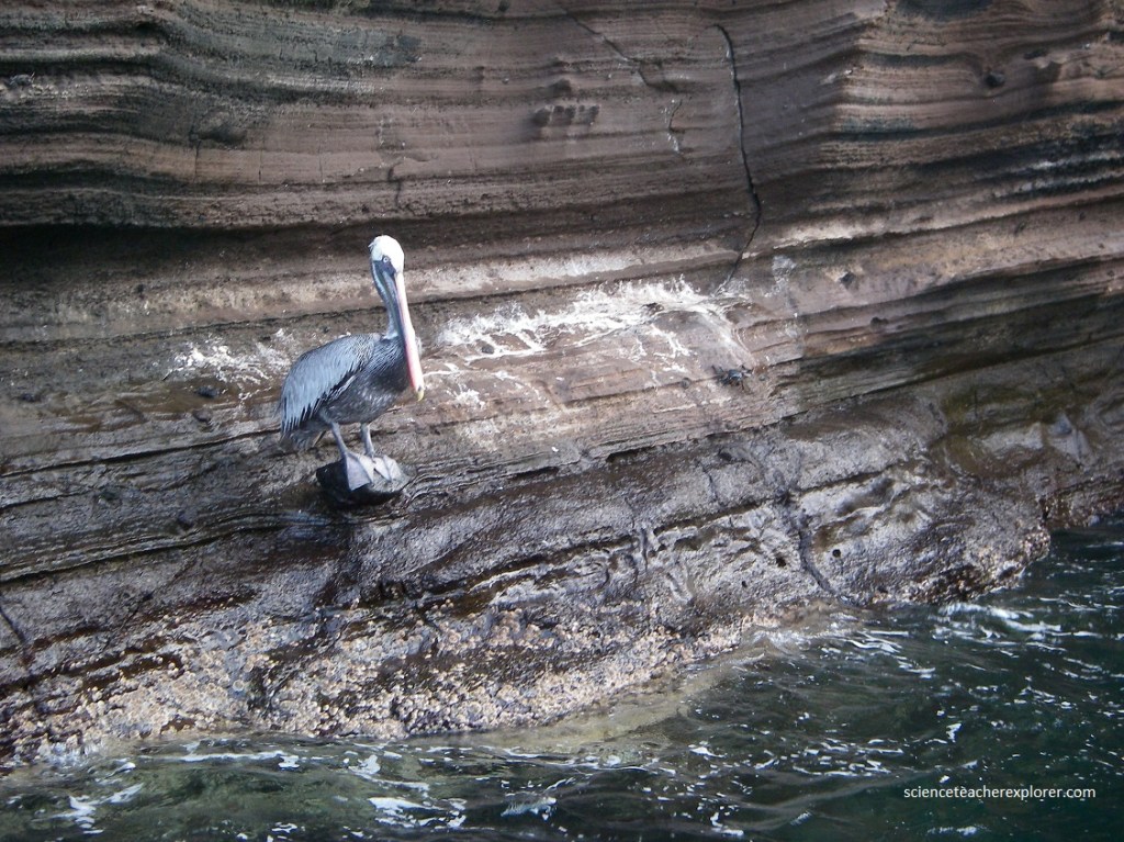
Pictured above, an un-mistakeable, large Brown Pelican (length 110 cm, wingspan 230 cm), poses for his picture. It has a long neck and an even longer bill, the lower mandible of which is partly make up of a large pouch, which enables it to catch fish up to 35 cm in length. They fish by what looks to be an entirely graceless, though actually very effective, plunge dive, filling their pouch with a large amount of seawater and then filtering out small fish and crustaceans.
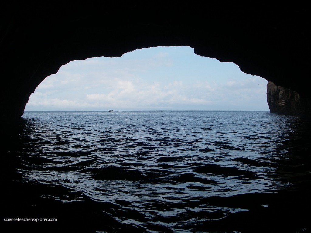
Pictured above, Punta Vicente Roca is easily the best spot for snorkeling with sea turtles. Snorkeling was followed by a panga ride along the spectacular cliffs and a cave formed out of tuff (compacted ash), and to a rocky area for the Flightless Cormorants to hang out. We snorkeled around dozens of Green Sea-Turtle and a family of sting rays. However, we were looking for the Mola mola, (giant sun-fish) and didn’t see any.
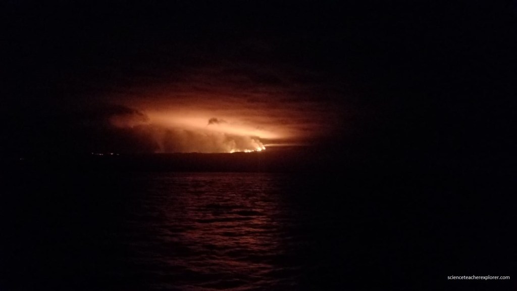
A cloud of gas and ash from Wolf Volcano rose to 3,793 meters above sea level following the eruption that began shortly in the first few days of January 2022. This new eruption on Isabela Island, the largest in the Galapagos chain, didn’t represent a risk to humans or to native local species. The 1,701-meter volcano is one of numerous active volcanos in the Galapagos, which are nearly 1,000 kilometers from mainland South America.
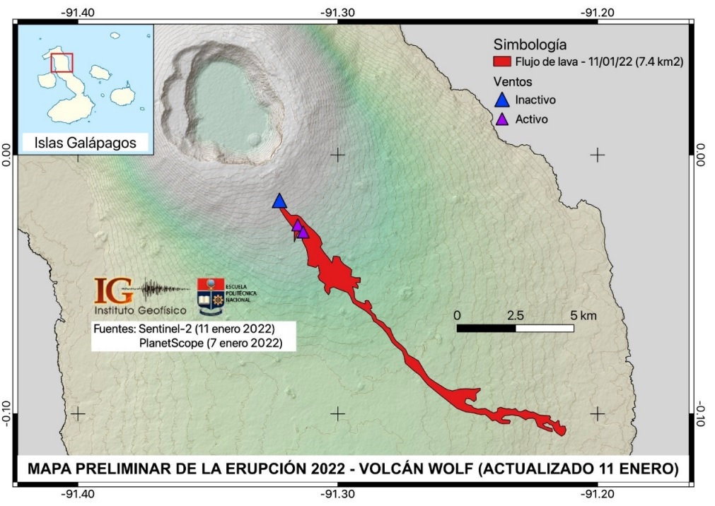
At this point, our scientists believe that the habitat of the Pink Land Iguana remains unaffected by the volcanic activity, and as of now no additional actions are needed to protect this species. However, they will not be able to confirm this hope until they can safely conduct return expeditions to Wolf to fully assess the impacts of the eruption.
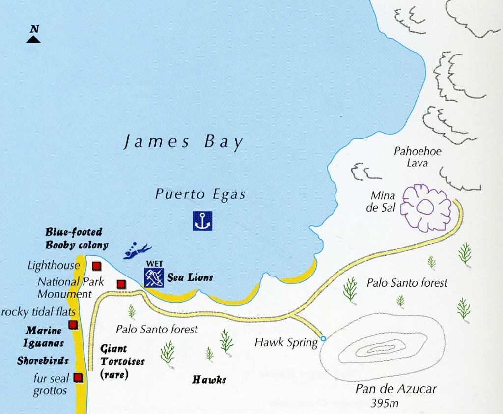
Our next morning exploration, was on the Santiago Island of Egas Port. The most prominent physical feature here is the large tuff cone to the south, Pan de Azucar (Sugarloaf), climbed by Darwin in 1835 (pictured below).
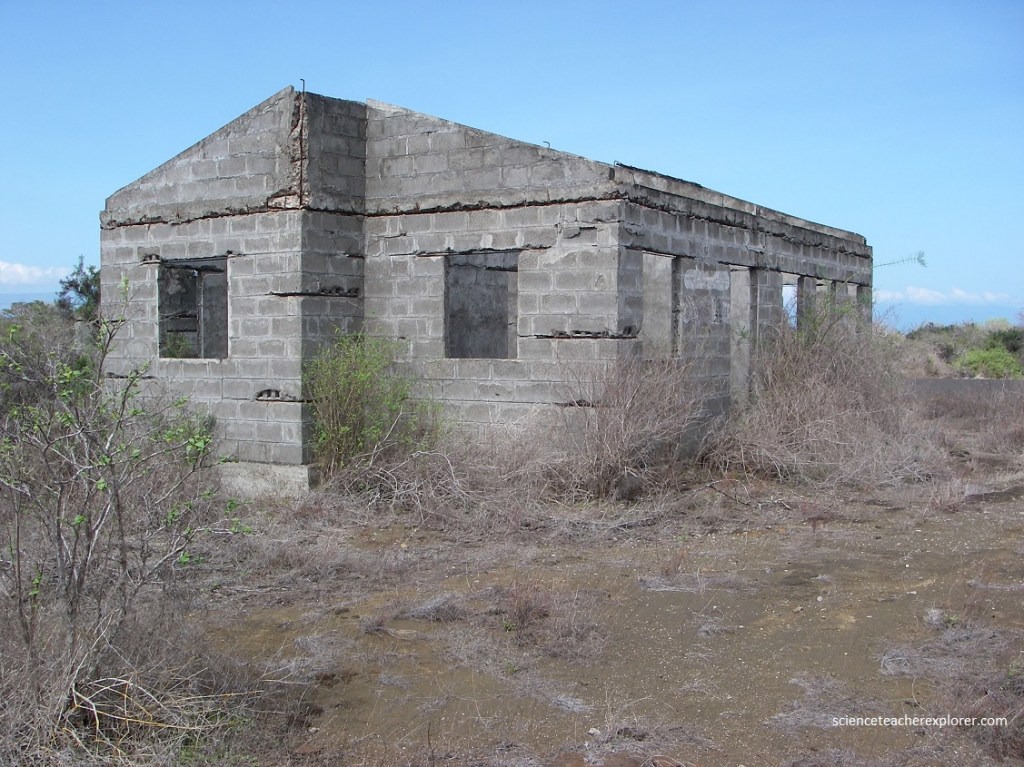
Our wet landing at the Egas Port enabled us to study the Galapagos dry zone vegetation. We walked a few dozen meters around the area that was once used until the 1960s as a port for a salt extraction operation, restarted decades ago by a Senor Egas. From this area the view was rather bleak; a collection of rusted hulks of old machinery and the remains of posts from defunct sheds. Notice in the picture above, the “Lava Cactus”, the “Giant Pear Cactus” and the abundant Palo Santo tree. Also known as Incense Tree, the most abundant and clearly identifiable tree of the Arid and Transitional Zones, Palo Santo trees form sparse forest over much of the lowlands of Santiago and all the other islands.
After the wet landing at Puerto Egas, we walked on a trail that took us to the Fur Seal Grotto where there is a colony of fur seals which live in a series of caves and grotto-like formations formed when the lava flowed into the sea (pictured below).
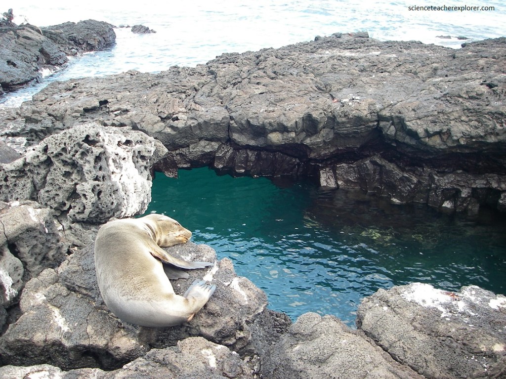
Pictured above, the Galapagos Fur Seal, is not a true seal. It is technically a ‘fur sea lion’. The fur seal is easily distinguished from the sea lion by its smaller size, large prominent eyes and much shorter snout, giving their head a rather bear like appearance. Fur seals feed on fish and squid, diving to depths of up to 100 m. Fur seals were hunted almost to extinction during eh nineteenth century because of their valuable fur.
The “Fur Seal Grotto” is pocked by three aquamarine potholes. These holes are formed in the same way as all lava tubes are formed, only these are not land-locked.
Videod above, the lava flow went out to the open sea and now the water rushes in and out of the tubes with the tides. The tops have carved in here and there, making the open pothole that you look down into. At one time, visitors could swim in these grottoes, but the combination of risks to swimmers of surging tides and of disturbing the wildlife has closed this option.
The main two pools are a wonderful sight, however, connected as they are to each other, with a bridge of black basalt arching over them near the middle of their length. The exit of the pool to the open sea also has an arch over it, where it’s great just to take a picture, (pictured above).
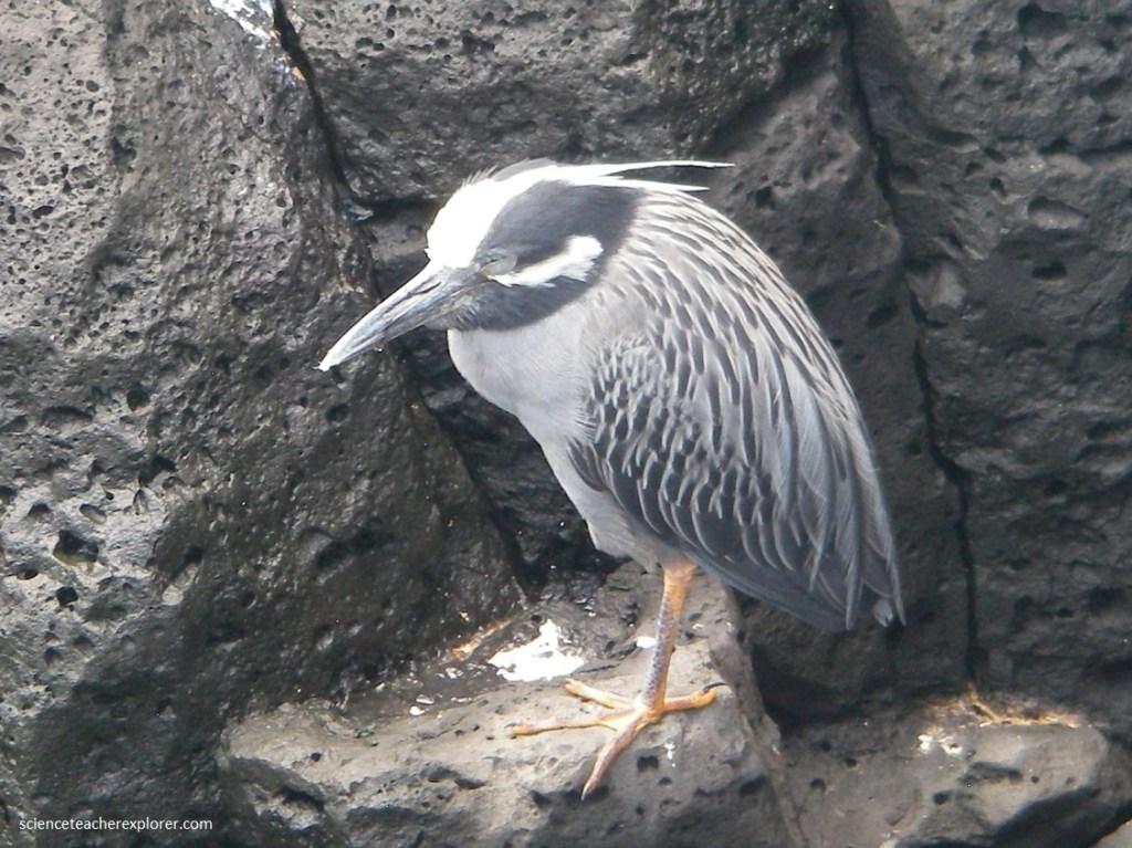
The grottos are only about 15 m long, but for sheer beauty and ease of access, few places on the island can compete with their balck rocks, crystal clear blue water, fur seals, and tropical birds. Pictured above is a Yellow-Crowned Night Heron watching the water come in and out of the lava tube.
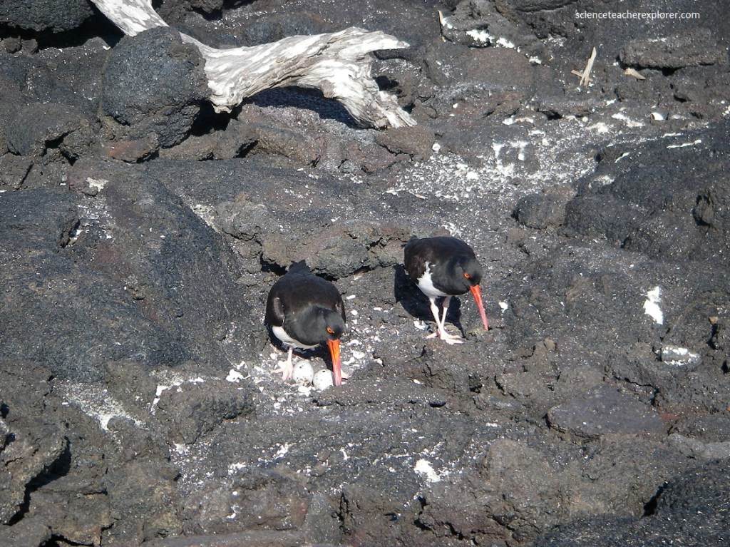
While exploring near the Fur Seal Grotto, I encountered these oystercatchers (Haematopus ostralegus) tending a nest with their black and white plumage, red bill, yellow-tinged eye, and ugly pink feet.
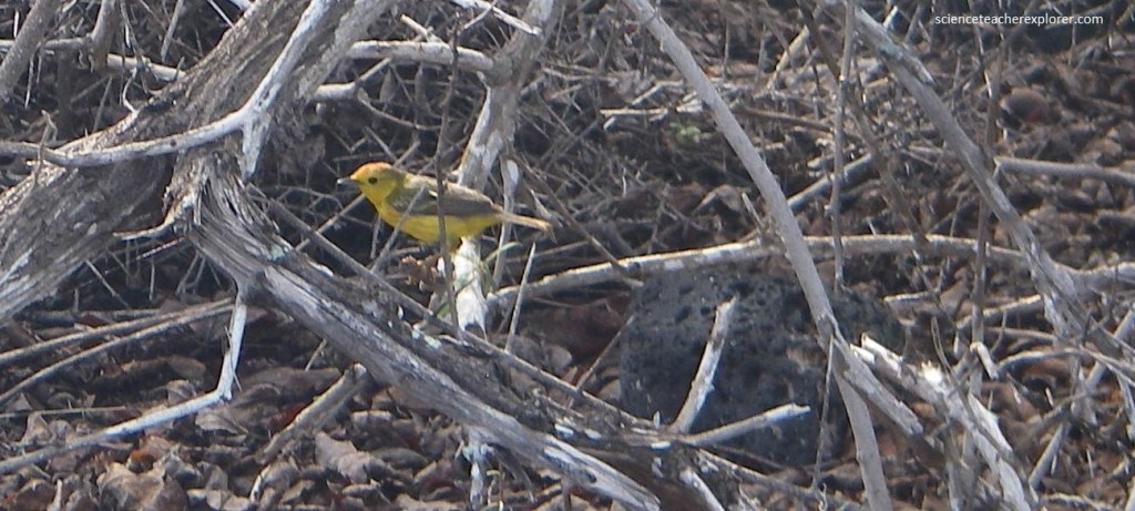
Pictured above, looking through the dry bush around the Fur Seal Grotto, I encountered this “Yellow Warbler” feeding there. It’s yellow showing up clearly against the green of the damp vegetation.
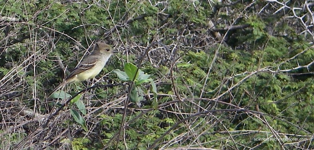
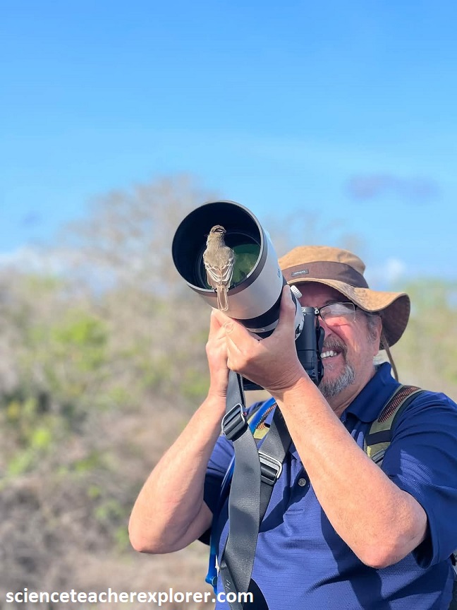
On the trail back to Egas Point, I encountered this vermilion flycatcher (Pyrocephalus rubinus). Standing out in the dark greenery of vegetation, this bird makes a stark and beautiful contrast here with the gray Palo Santo trees that clothe the slopes of Santiago. It was sitting on a branch, head and chest buff beyond imagining, and then launched itself out into the air to snap at an insect too small and too fast for my human eye to see. The click of it’s bill made by the catch, is how I knew she succeeded. Then the bird circled back to it’s original perch, having completed perhaps a meter in diameter. The “Flycatcher” seemed friendlier to humans than other birds. One of them harassed my buddy Mike. I believe that the bird thought that his tele-photo lens was a bird-house with food.
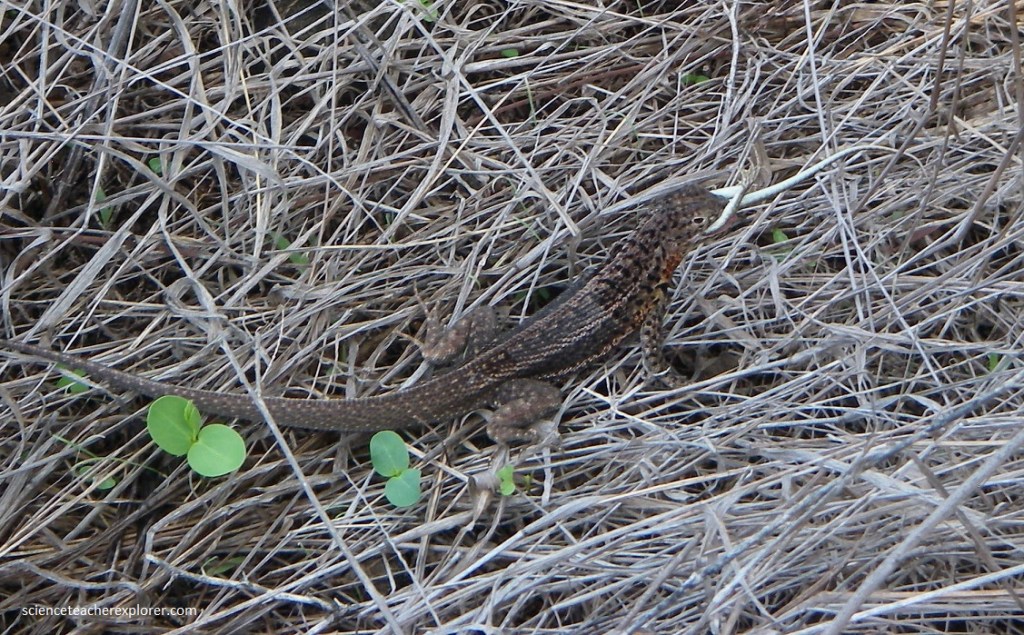
Pictured above, Lava Lizards are omnivorous, eating mainly insects and some plant food, especially in the dry season. Cannibalism in not unknown, (pictured above). Their chief predators are hawks, snakes, herons, centipedes and mockngbirds.
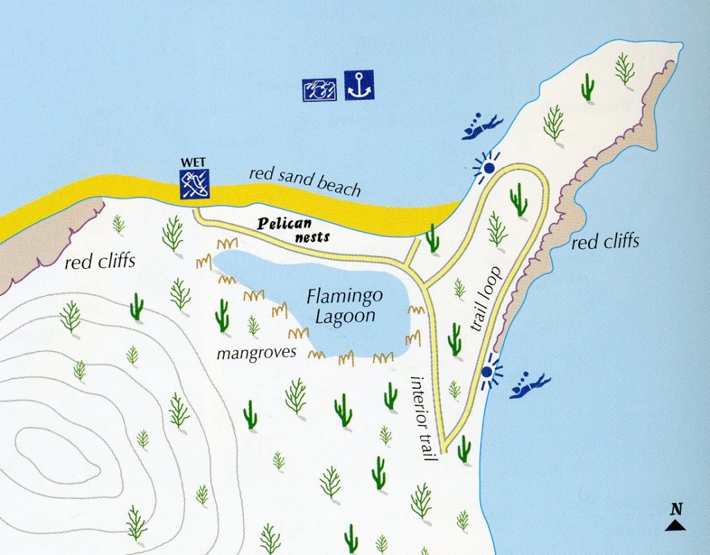
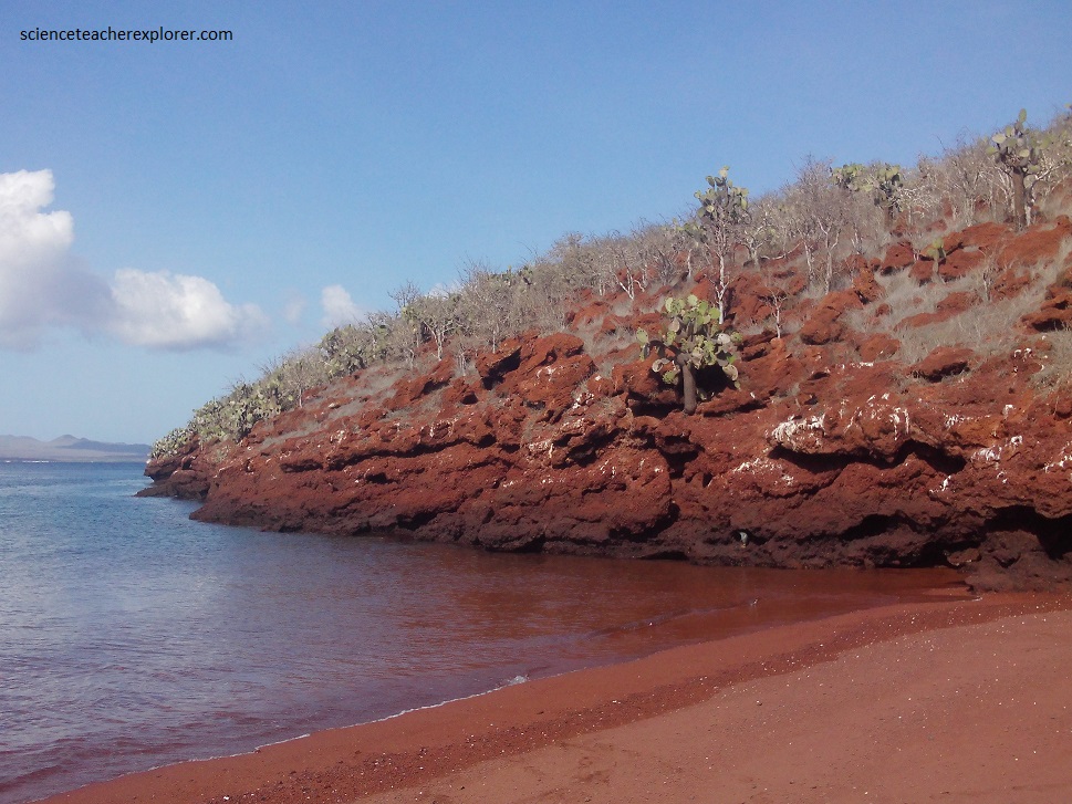
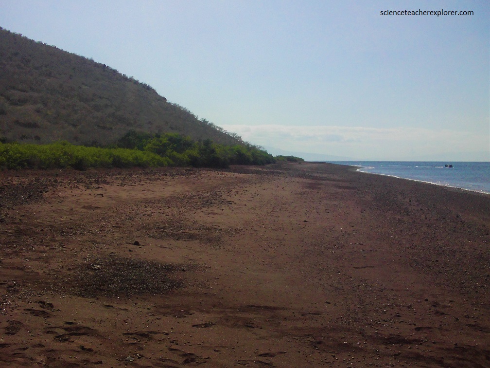
The next morning, we made a wet-landing on the small island of Rabida, just of Santiago Island. At first glance, Rabida was another typical beach-plus-mangrove lagoon site. But what makes it very different and very memorable is the color of the beach and island soil, (a rich russet that gleams in the sun and gives everything on it a special quality of soft beauty. The reddish hue comes from the oxidation of the iron-rich lava that is the basis of it’s soil.
Rabida Island is small, just a little over 2 km across at its widest point. It is steep and rugged and rises to more the 400 m at its highest point, although we stayed at the lowest levels.
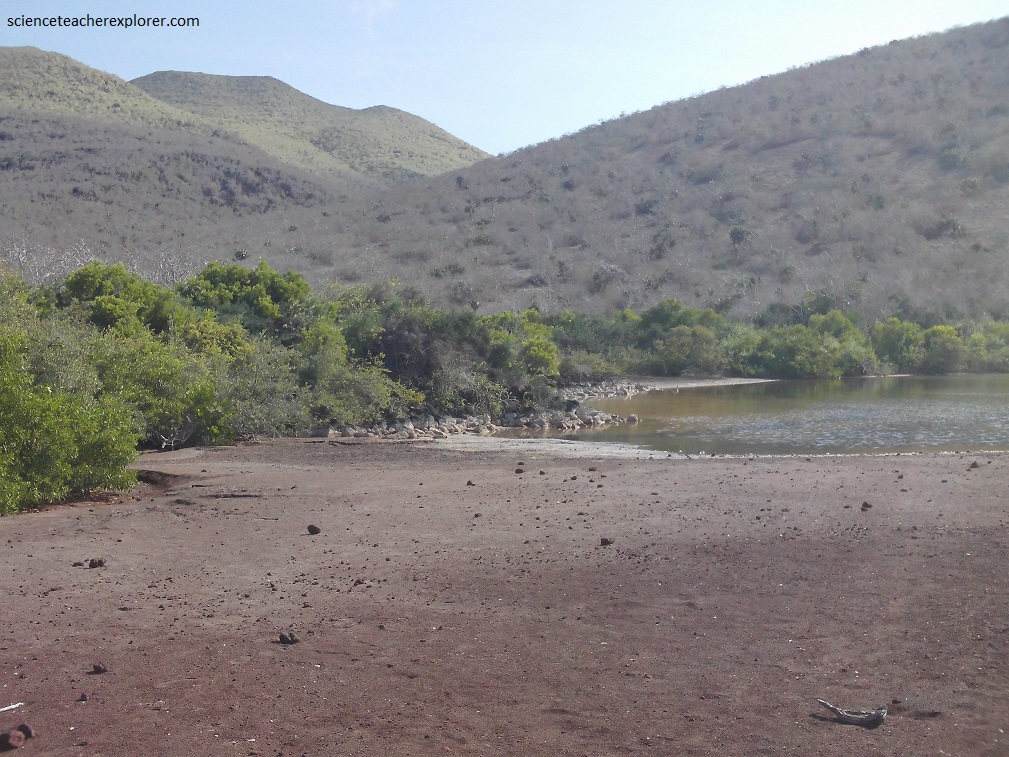
The chief vegetation on the slopes is opuntia cactus, Palo Santo trees and other scrubby bushes. Right at the shoreline is the band of mangrove that separates the beach from the saltwater lagoon inland just a few meters.
The landing was a wet one onto the narrow strip of red beach. We found a number of sea lions on the beach or in the small caves that have been formed in the cliffs at the water’s edge (pictured above).
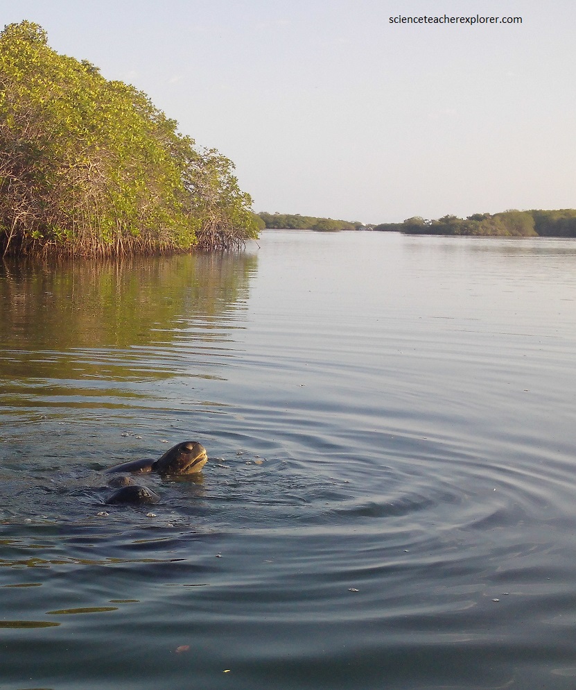
Our last stop was the “Black Turtle Cove” on Santa Cruz island. Here we just explored the Mangrove area with a dingy. Much of the Mangrove was a mixture of Red and White Mangrove. An of course, as the name suggested, there were alot of “Green Turtles” have sex, (pictured below).