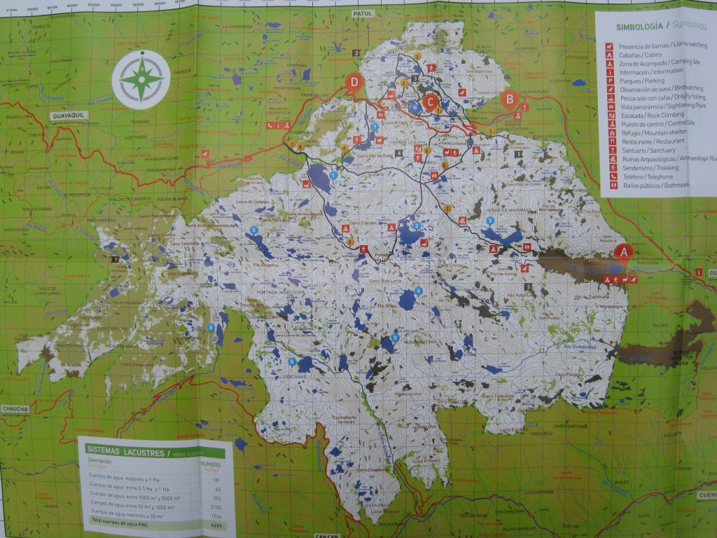
Cajas N.P., Ecuador
In March of 2022, I was trekking central Ecuador with a friend, Mike Stevens. While staying at Cuenca, Ecuador, we explored two amazing locations nearby. They were named Ingapirca Archaeological Ruins and the Cajas National Park.

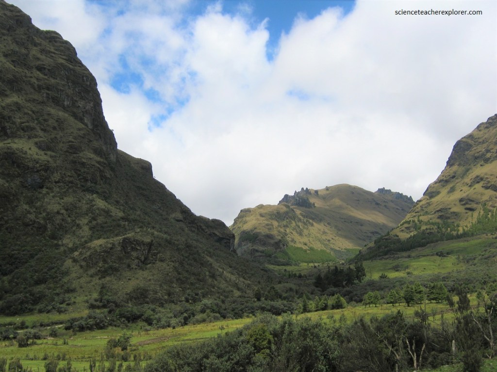
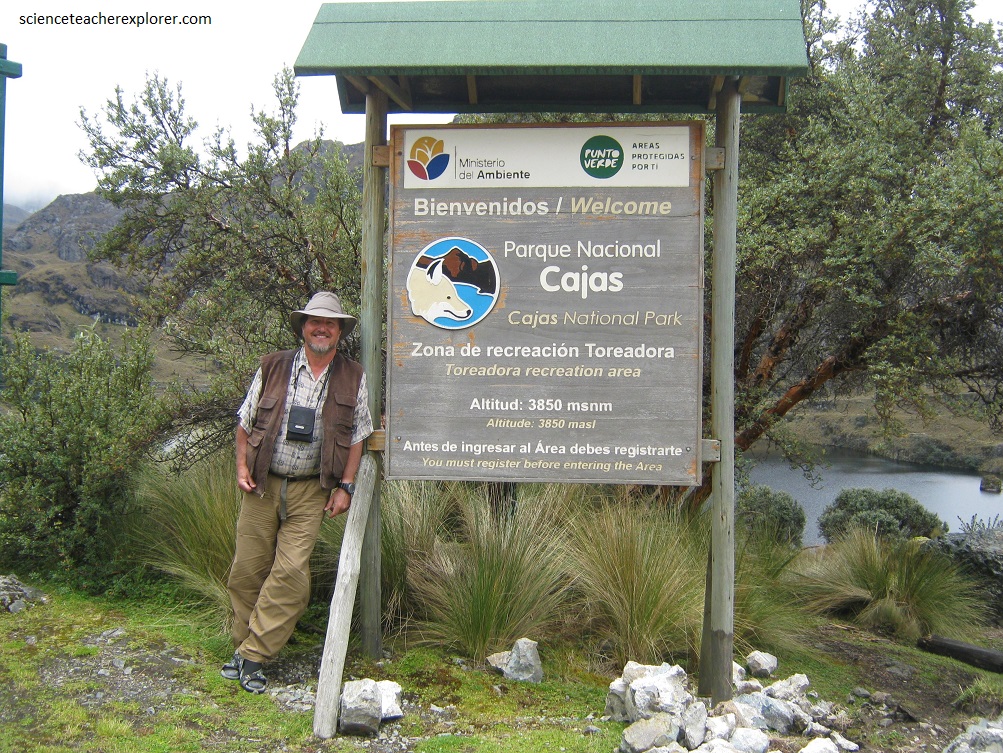
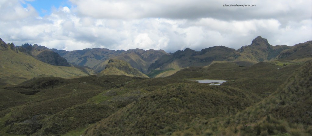
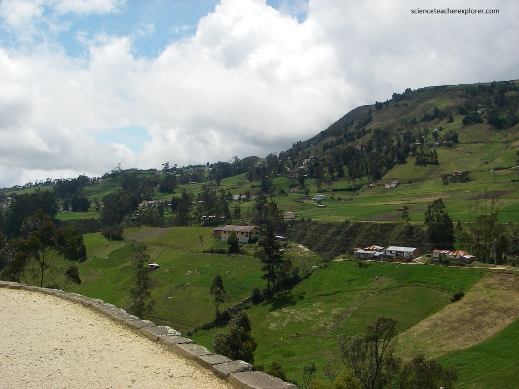
Imaged above, Cajas National Park is located between 3150 – 4445 meters above sea level in the narrowest part of the Andes. We approached the park in a rented vehicle by way of the main entrance and by the road that connects Cuenca with the coast: Cuenca – Molleturo – Naranjal. This road crosses the Park and is the most visited area of the park, where one also finds a small but well-done modern visiter center, at a short distance from Lake Toreadora, which is visible from the road, (pictured below). It was only located about 30 km west from Cuenca, the capital of the province of Azuay.
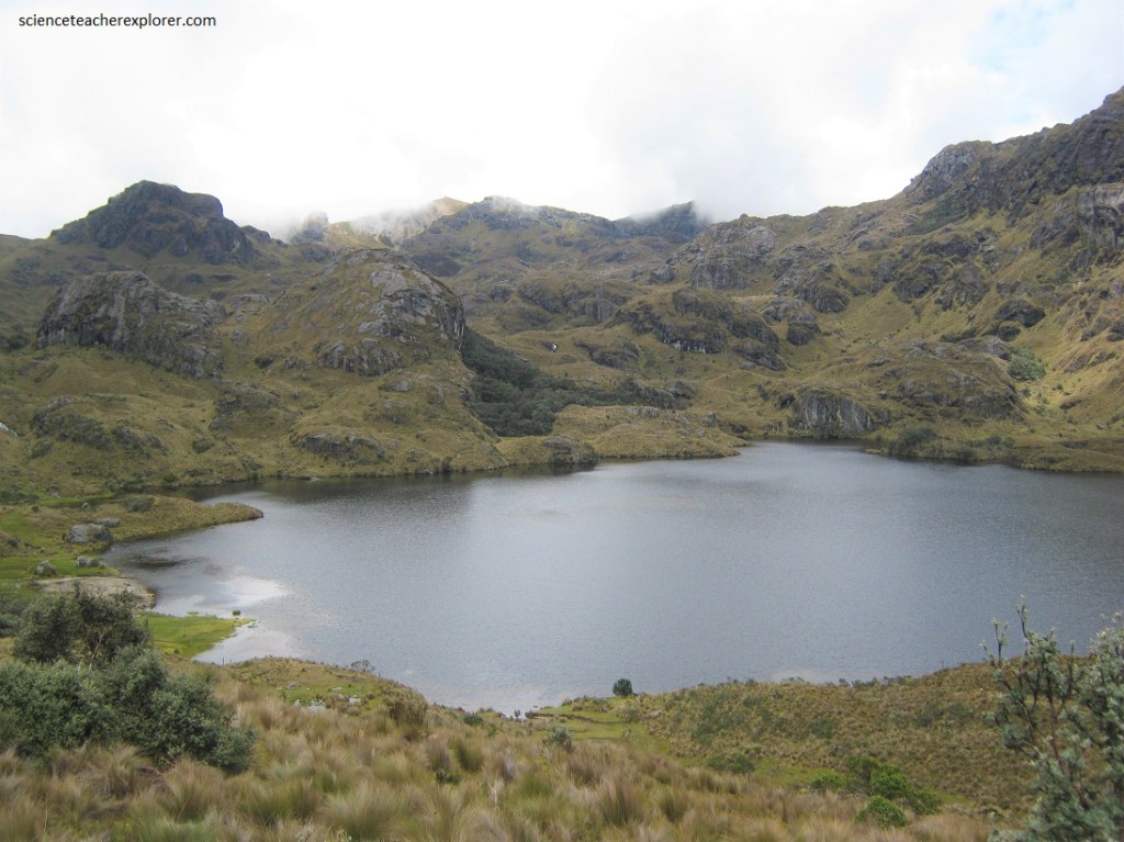
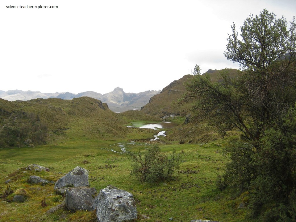
There are multiple ways to visit Cajas National Park, either independently or with an organized tour. The most popular entrance is at Laguna Toreadora, but there is another visitor center at Laguna Llaviucu that has a loop trail around the lake. At first, we chose to explore the Laguna Llaviucu, (pictured below).
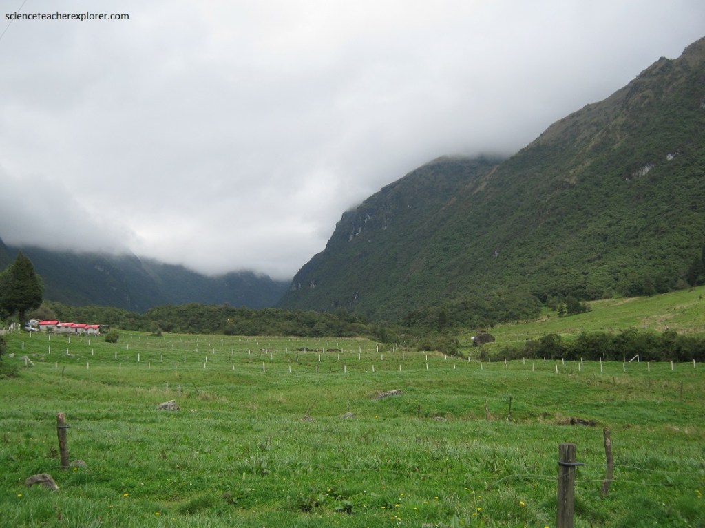
Since we rented a automobile to explore with and the road into the Laguna Llaviucu was of 4WD quality, we were unable to complete our destination to Laguna Llaviucu. So we turned around. Besides we forgot to get gas in Cuenca. We went back and then returned to the most popular entrance and paved road to Laguna Toreadora.
The climate of the Park is unique, as humid air coming from the coast collides with the cold air that ascends from the east. There is no particular weather pattern and frequent frosts, drizzles and fog may be followed by days of intense sun during most of the year.
With temperatures ranging from -2 to 18° C and precipitation fluctuating between 1000-2000 mm per year, the area is very wet, which is why it serves as a drinking water supply area for the city of Cuenca. On the day we were there, it was very humid indeed, especially on the western side of the continental divide.
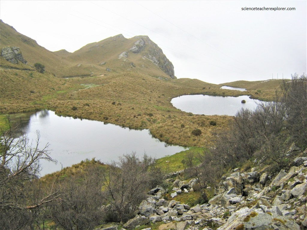
Cajas National Park is a place of water. A network of 786 lakes and lagoons connected by a network of streams. A carpet of sponge-like plants that absorb water, releasing it slowly over weeks and months. Frequent rains and moist clouds ensure the cycle continues.
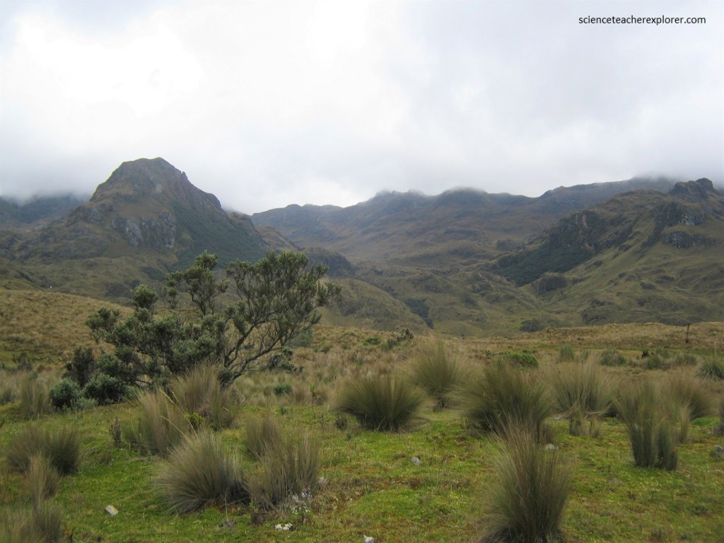
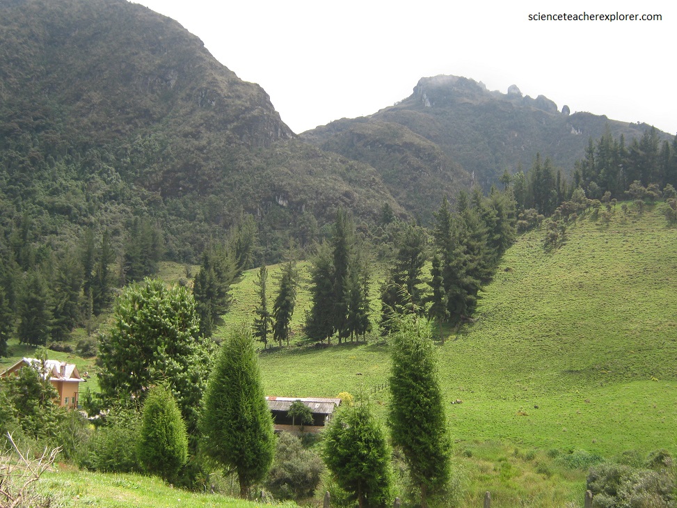
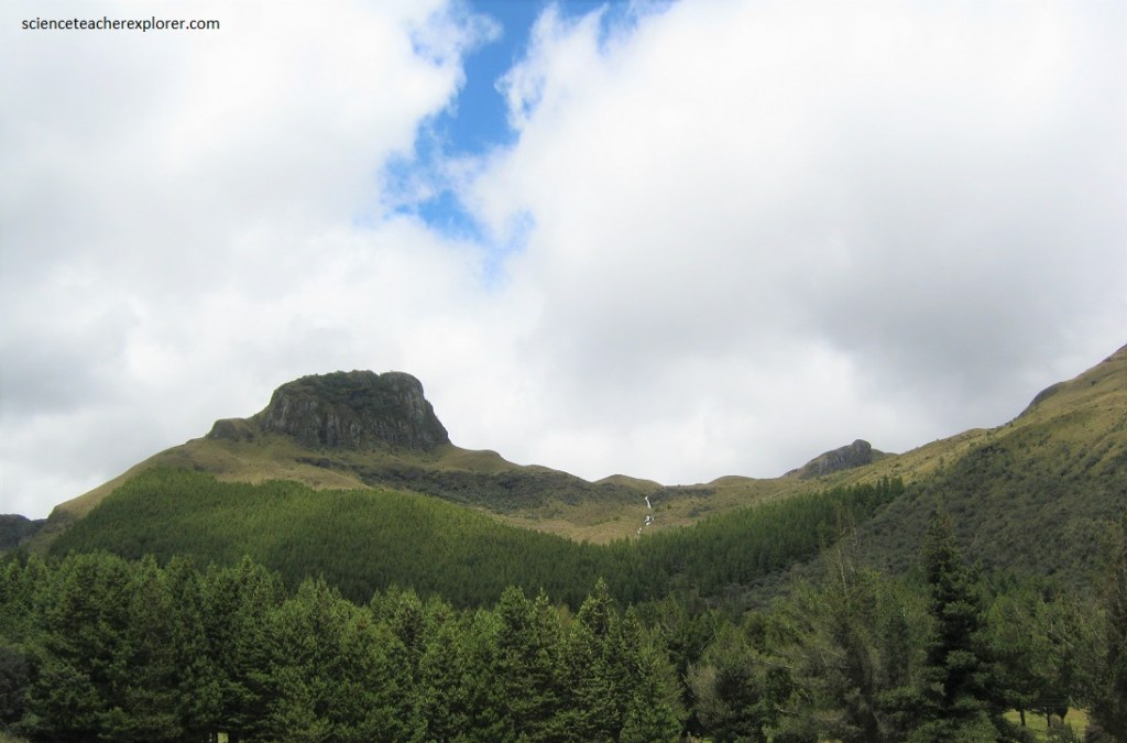
In Cajas National Park we found two striking ecosystems. The higher altitudes consisted of a tundra-like Andean Paramo, (rolling moors of grassland and low shrub). Lower down, cloud forest and perennial high mountain forest follows the ravines near streams.
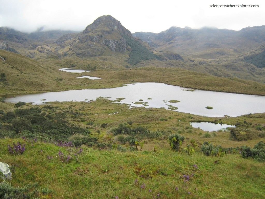
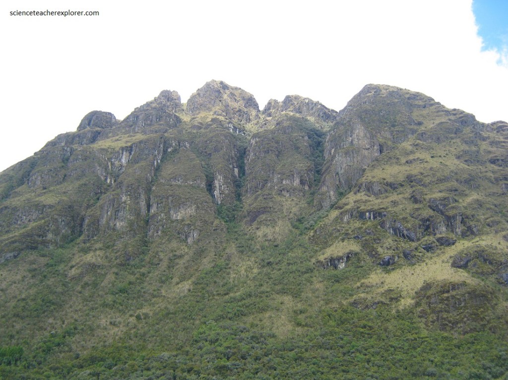
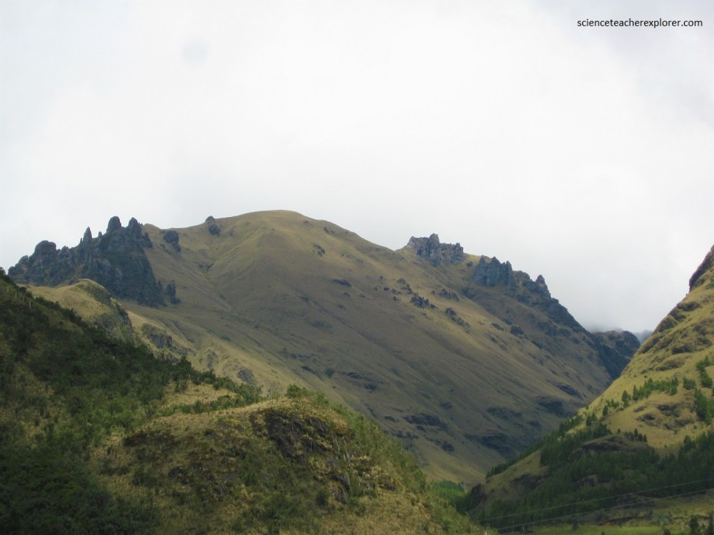
El Cajas National Park encompasses over 28,000 hectares of protected land. The breathtaking scenery was sculpted by ancient glacial activity, leaving behind a landscape of U-shaped valleys, hills, moraines and glacial lakes. This stretch of the Andes is older and less volcanically active than the “Avenue of the Volcanoes” further north.
We found that the dominant plant is a sturdy straw grass which grew pretty much everywhere, inluding yareta and pajonal. Also, we saw an abundance of the “cushion plants”, (their spongey consistency is perfect to absorb and store water, which is then slowly released). These plants play a vital role in maintaining humidity in the local ecosystem, and ensure a steady water supply for Cuenca’s rivers. The tiny high altitude flowers added colorful yellows, reds and purples to the green cushion carpet. This includes tiny gentians, orchids, lupins, ad daisies with puyas dotting the landsape.
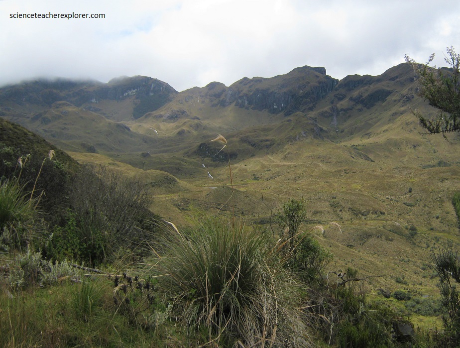
The Cajas National Park extends across the continental divide, which means two rivers flow west toward the Pacific Ocean and two flowing east toward and into the Amazon River. The park is situated among the mountain range creating the continental divide. It actually represents the furthest western point of the divide. Driving through the park is filled with abundant remarkable views of the striking landscapes and sculpted mountains.
The Tres Cruces viewpoint is situated at the lookout of the continental divide. This point represents the marker from where the drainage basin on the west flows to the Pacific Ocean, and the drainage basin flows east on the other side. This viewpoint also provides views of lakes and mountain landscapes as far as the eye can see. The panoramic view is spectacular.
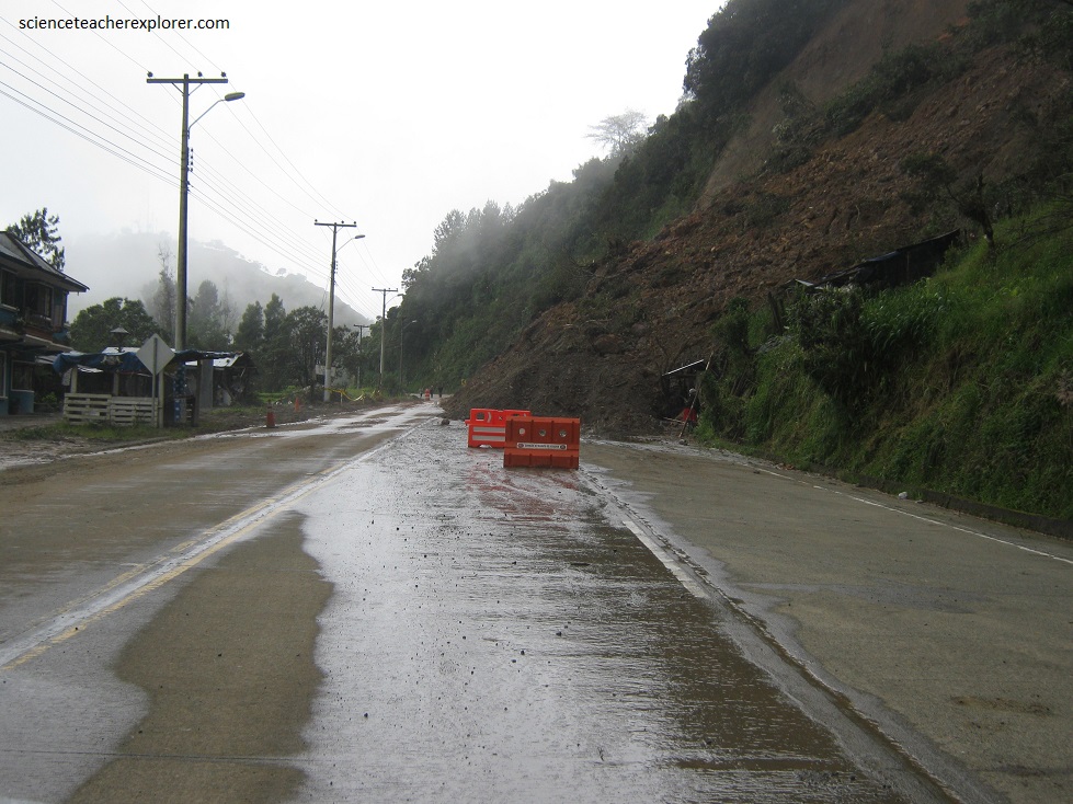
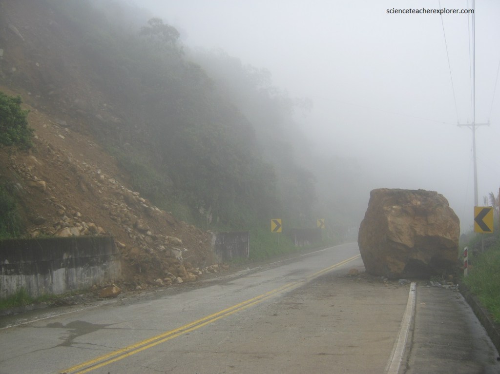
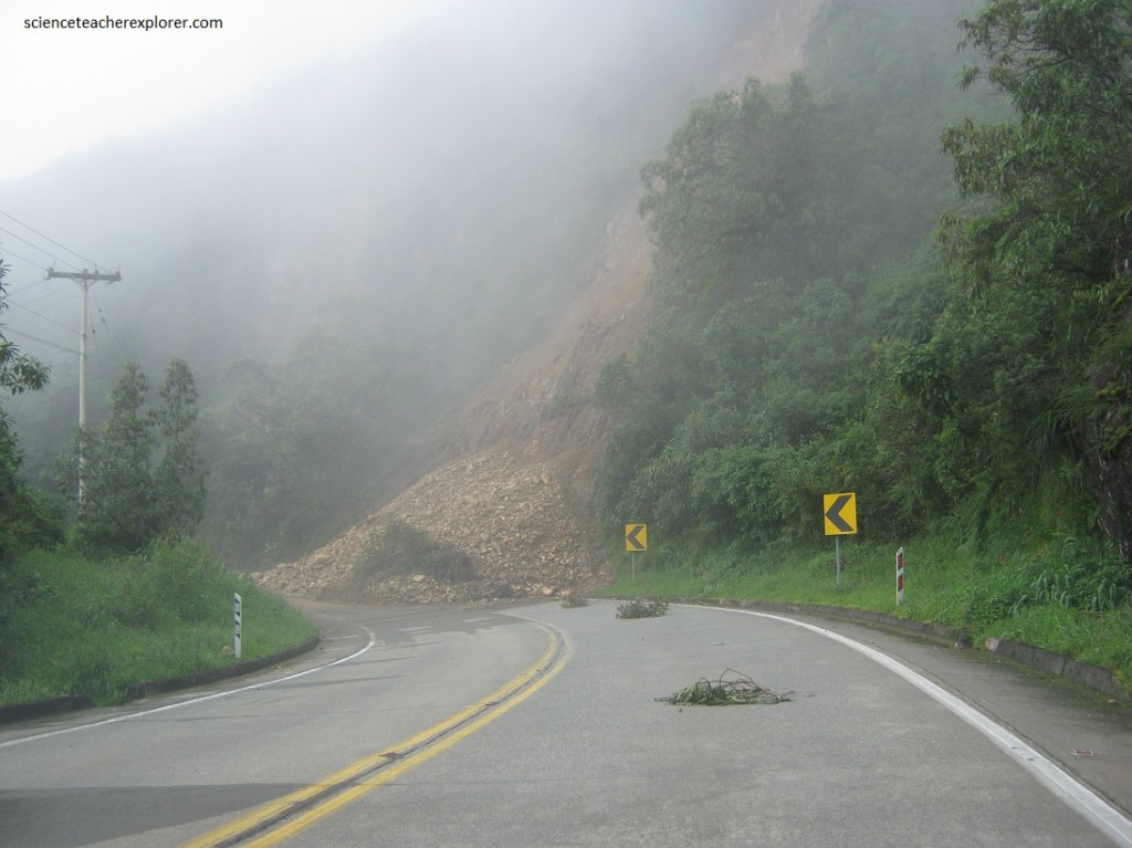
After we passed the Tres Cruces of the continental divide, the rain started. Since the elevation dropped into the “cloud forest”, then the landslides became abundant across the coastal highway. As a matter of fact, once a landslide covered road, we had no choice but to turn back towards Cuenca, (pictured below).
After our day at the Cajas National Park in Ecuador, we drove north 40 km from Cuenca to the Incapirca Achaeological Complex. With the name of Incapirca, (Kichwa word meaning Inca Wall), the location is designated to a diverse pre-hispanic ruin of the southern Ecuadorian Andean culture.
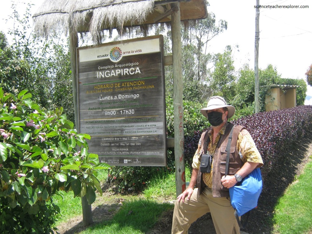
The Ingapirca Archaeological Complex is located in the upper Canar river basin, in the province and canton of the same name, from southern Ecuador; it is part of the territory of the Ingapirca Parish. The average elevation is 3160 m, characterized by being in a cold weather pit, with an average annual temperature of 10 to 12 degrees Celsius.
Ingapirca is considered as an important religious, political, scientific and administrative center of the Canari and Inca cultures, (integration period 500 to 1480 A.D.). Ingapirca is considered a site occupied by various groups that made up of the Canari nation, whose pre-Hispanic inhabitants occupied large territories that currently correspond to the provinces of Canar and Azuay and a southern part of the province of the province of Chimborazo.
The occupation of the Incas in Ingapirca lasted approximately 30 years, (a period culminating in 1531 with the fratricidal war between Atahualpa the Inca of the north and Huascar the Inca of the South). [Both sons of Huayna Capac, the last Inca ruler]. Later in 1533 with the arrival of the Spaniards and the death of Atahualpa, the site of Ingapirca was abandoned.
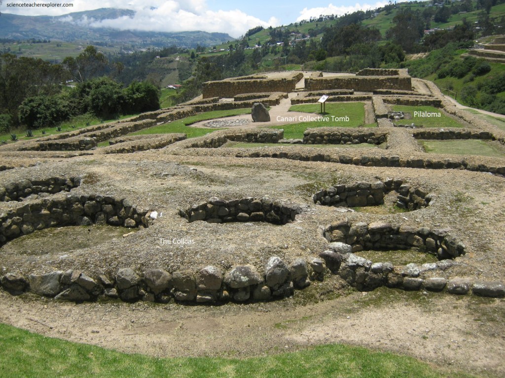
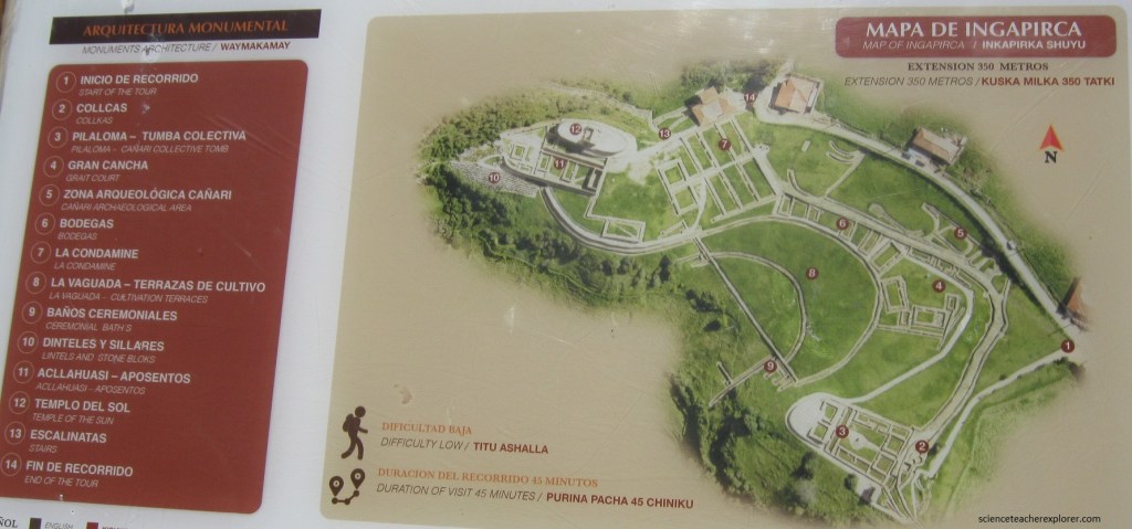
Pictured above, within a society with over production, these circular structures were made to store tubers and Andean grains like corn, quinoa, and amaranth. The “Pilaloma” is the oldest residential building in the complex, (1000 A.D.). Built on the foundations of the Canaris structures, the “Pilaloma” consists of eight rectangular rooms of Inca architecture and arranged around a large trapezoidal courtyard. It was a Canari social and ceremonial center, and then occupied by the Incas after their arrival.
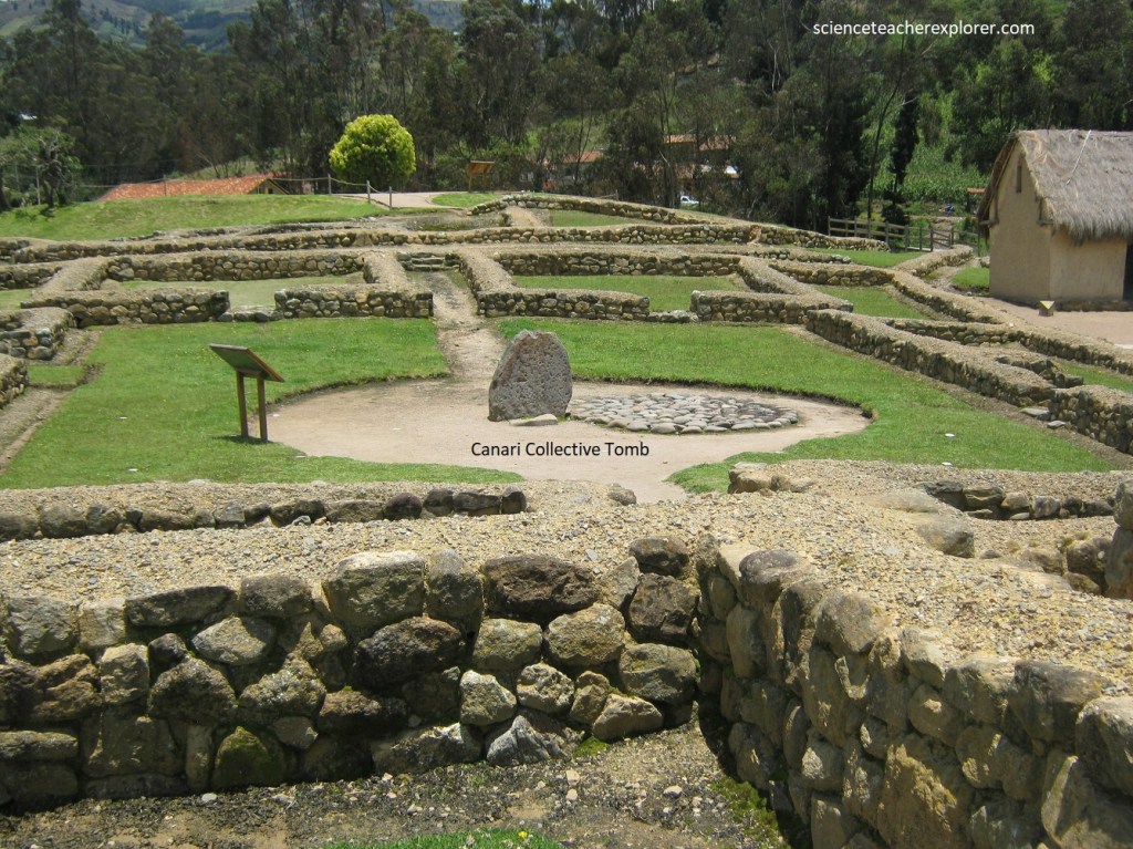
Pictured above, under the Wanka or monolith, was found to be a collective tomb of Canari origin. It had eleven individual corpses with abundant offerings like ceramic, copper pins, and spondylus shell beads.
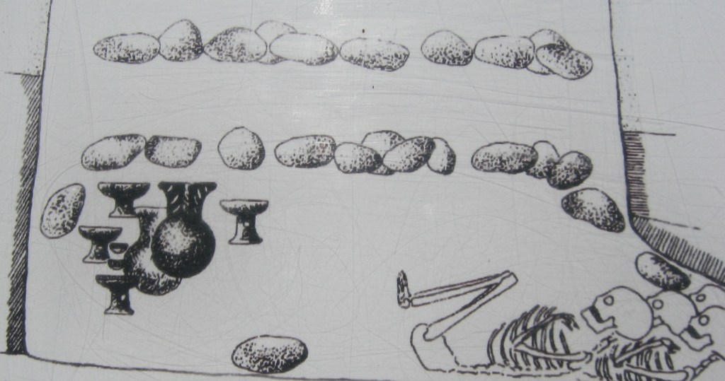
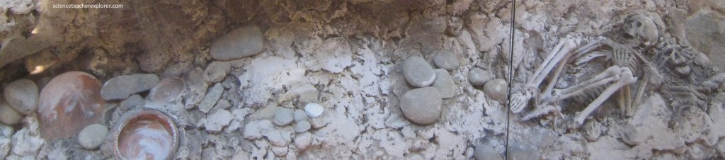
The main body of the tomb is a woman of high status, (probably a Canari priestess). The tomb dates back from 1100 A.D. to 1500 A.D.
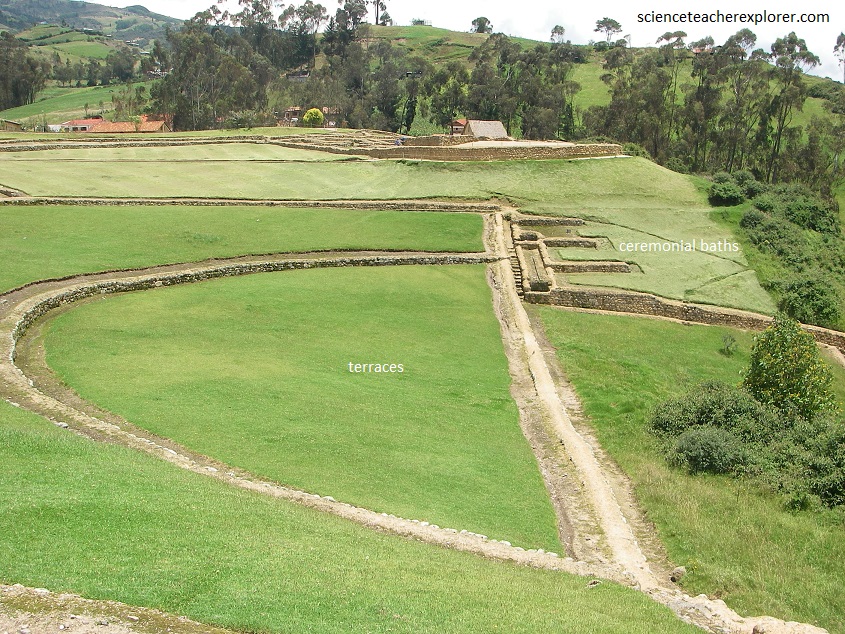
Pictured above, the “Ceremonial Baths” is a place made for the purpose of a “bathroom” or “water source” with its respective channels as water pipes. [It was built for ceremonial purposes]. The “Terraces” are walls that, following the curves and topography of the land, are areas for agricultural use.
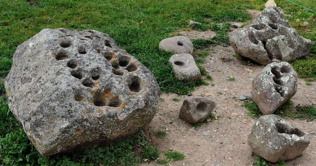
Pictured above, on the eastern side of the complex, a few stones seem to have holes drilled into them. The belief by some modern archeologists is that these stones were used as a type of agricultural calendar. The holes would be filled with water that would reflect the night sky. When certain astronomical objects, like the moon, or a planet, or a particularly bright star, matched a certain depression in the stone, it would be a sign of a change in seasons. Some of these stones are huge, with multiple depressions, as many as 20 or so, while others are small with only a couple of depressions.
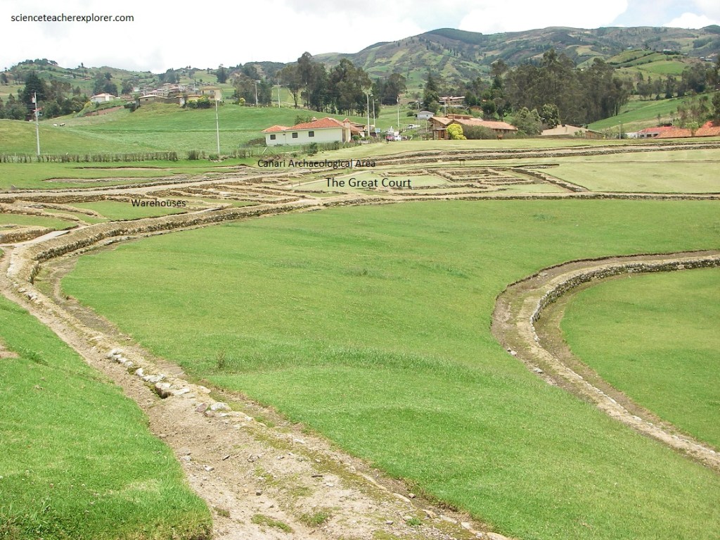
Pictured above, the “Great Court” is a wide field where a great number of believers met to participate in religious ceremonies of the temple. Because of the ceramic remains found in the place, (mainly storage containers), it is probable that this area was employed for different workshops.
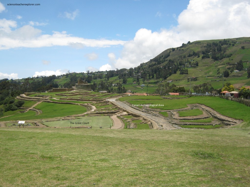
The “Warehouses” is an area dedicated for the supply of victuals on the part of the complex resident in the Inca era. The “Canari Archaeological Area were architectural structures with the proper Canari style. [This is because of the curved line walls].
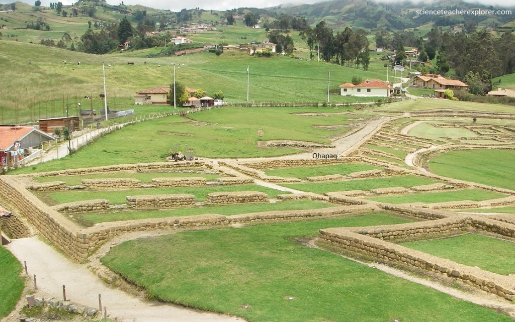
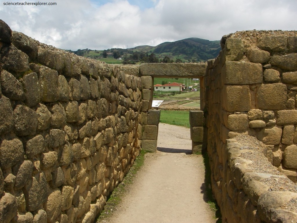
Pictured above, the “Qhapaq Nan” is a segment of a paved road, one of the many that the Inca empire built, to connect religious and administrative centers of the Inca.
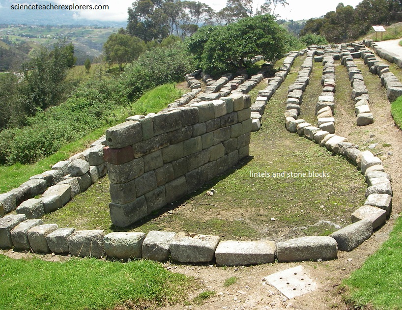
Pictured above, the “Lintels and Stone Blocks” are carved stones that were part of the buildings that were used as lintels or cushioned ashlars of the walls, channels, and other architectural elements. The raw material was brought from a field called Ato de la Virgen, located one kilometer away from the Archeological complex, next to de Silante River. [For its extraction, cutting, and carving; many techniques were used as the heating and cooling of the stone block, the friction and polishing, and the use of tools as stone chisels, and wooden mallets.]
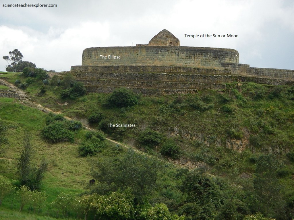
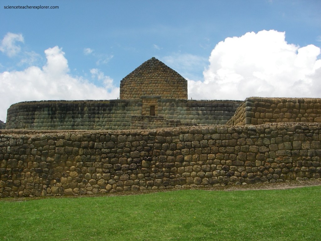
Pictured above, “the Ellipse or Temple of the Sun” is a superimposed and attached to a ceremonial Canari rock called Pacarina. It is a strcture of an elliptical tower, the only one in the Tahuantinsuyo (the name of the four regions of the Inca Empire). It is considered as the ultimate expression to the Inca’s architecture in Ecuador. This is because of the perfect fit for the pill-shaped blocks, as well as the trapezoidal ornaments known as niches.
Additionally, the “Scalinates” next to the “Ellipse”, around the ravine, is 117 stone steps of Canari origin. It was probably part of the Qhapaq Nan, (mentioned above).
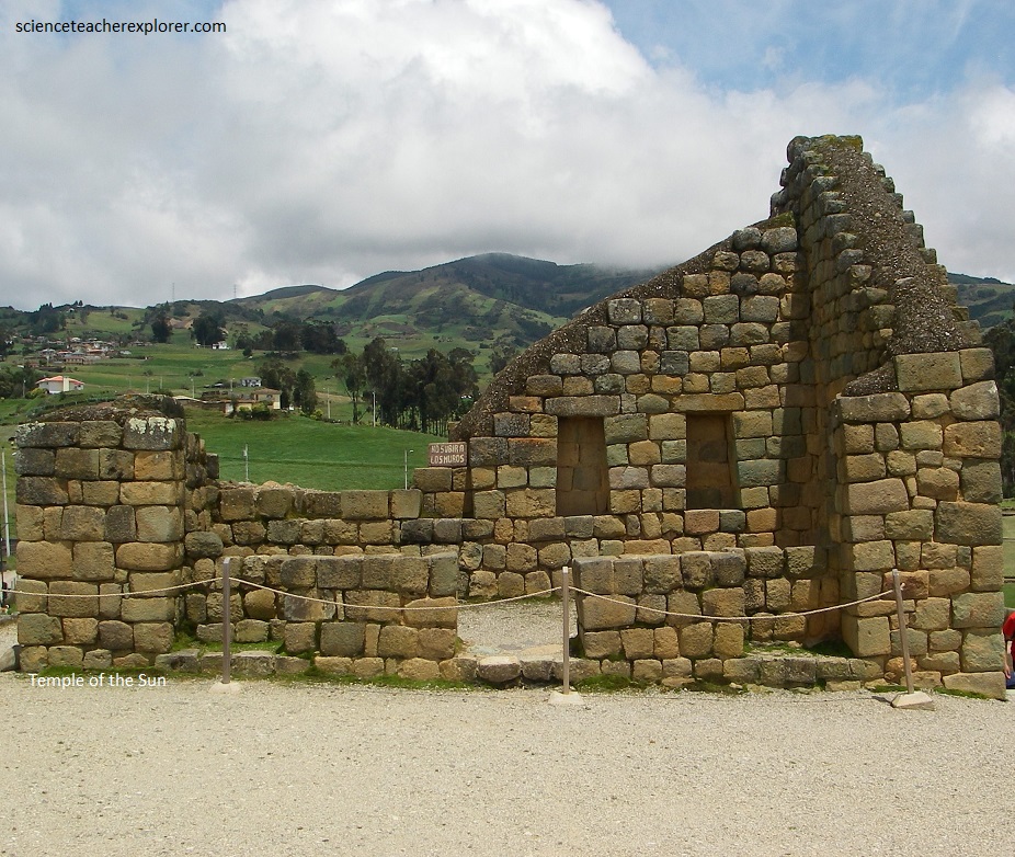
The temple was positioned in keeping with the Inca beliefs and knowledge of the cosmos. Researchers have learned by observation, that the Temple of the Sun was positioned so that on the solstices, at exactly the right time of day, sunlight would fall through the center of the doorway of the small chamber at the top of the temple (pictured below).
Pictured above, the differences in the construction of the “Ellipse” and the base of this building makes a compelling example of how a sacred space was built very differently from a non-sacred one. The wall in the foreground is made from cut stone but uses mortar to help hold the wall together. It was not considered sacred. But as your eye travels upward you’ll notice that extreme care was taken to cut the stones placed in those walls and that no mortar whatsoever was used.
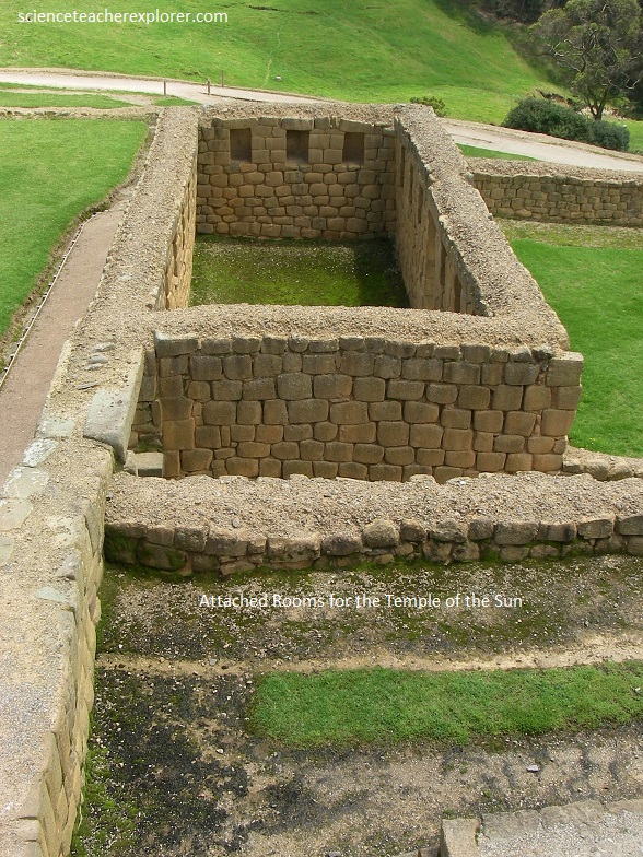
Pictured above, “Attached Romos” is a residential complex, directly related with the “Temple of the Sun”. It is a group of rectangular rooms, arranged around several internal courtyards. These spaces were probably dedicated to the Virgins of the Sun, and administrative and religious activities developed in this residential complex.
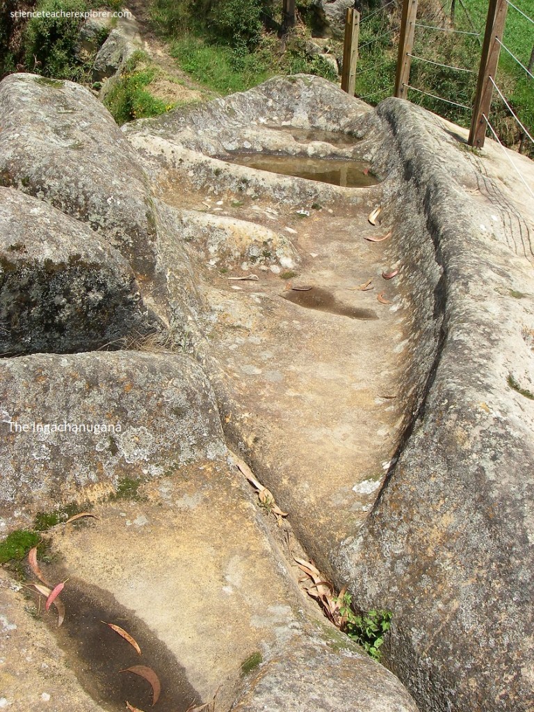
Pictured above, “Ingachungana”, northeast of the Temple, (a natural rock outcrop), is a deposit of two flat bottom cavities carved in the rock, whose edges are of two stylized snakes that are intertwined with other. This makes the place a site of ritual characteristics. The locals commonly call it an “Inca game”.
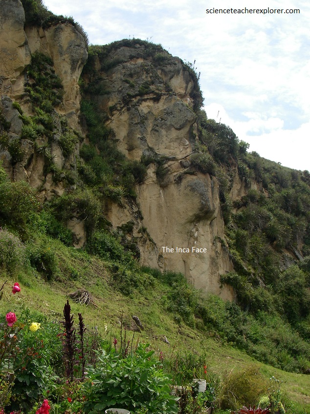
Pictured above, the “Inca Face” is located in the gorge of the Intihuayco. It is west from the ruins of Ingapirca, and rises towards the sky on a rocky cliff. This large outcrop of rock, is observed evoking the strokes of a human face and is known to the locals as the “Inganahui” face of an ancestor.
