Joshua Tree NP, CA
During the Thanksgiving of 2015, Becky (my wife) and I spent a week in Indio, California. While there, we spent a day at the Joshua Tree National Park just east of Indio, California. Overall, The park is located about 220 km east of Los Angeles and is accessible by highway from the north and from the south. More than 3,000 square kilometers of geologically and ecologically unique land were designated as a national park in 1994, an upgrade in status after 58 years as a national monument.
The Joshua Tree National Park encompasses some of the most interesting desert geomorphic features in California. Rugged mountains, prominently exposed granitic monoliths, and exposed fault scarps reveal how geologic processes shaped, and continue to shape, the stark desert landscape. Much of the Monument is above 1,300 m and steep mountain escarpments border this region to the north and south.
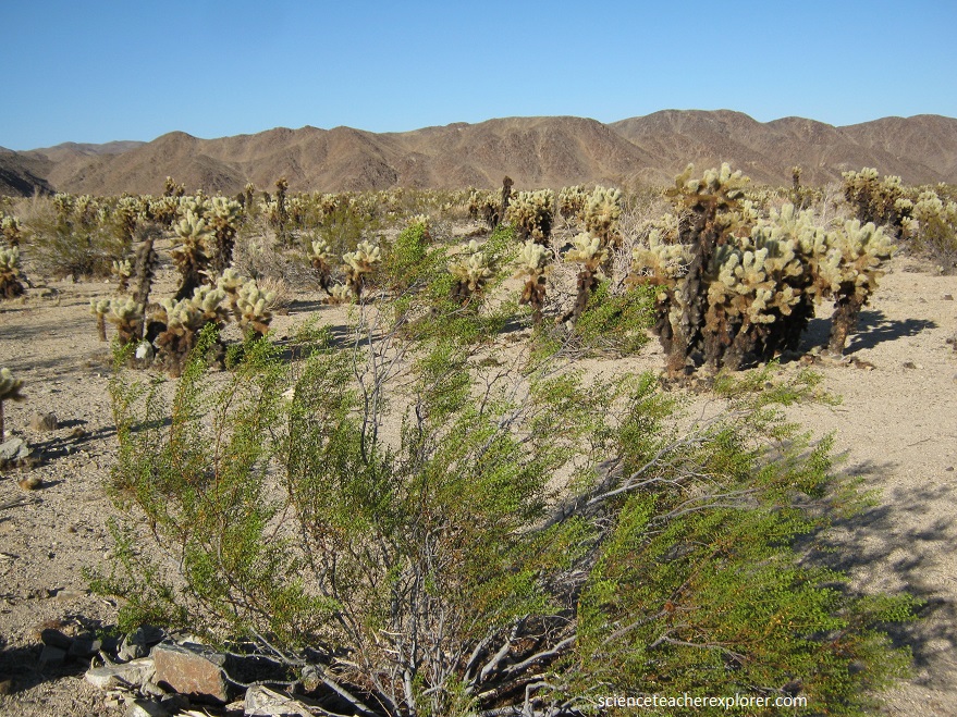
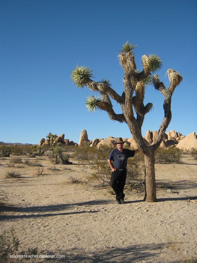
Joshua Tree National Park embraces two desert types: the Colorado and the Mojave Desert. The Colorado has creosote bush, ocotillo, and cholla cactus, (pictured above). The Mojave has Joshua Tree forests, (pictured below). Joshua trees grow at elevations of 650 m to 2,000 m and have keenly pointed bayonet-like leaves that bristle at the end of large club-like branches. Until young Joshua trees attain a height of two meters, their trunks have leaves that reach the ground. As the plant ages and grows in height, these first leaves droop, die, and become closely pressed into a thatch-like mat that covers the trunk and limbs. Some trees have reached heights of 18 m.
The known geologic history of the Monument spans about 1.5 billion years and includes extensive periods of sedimentary deposition, igneous intrusions, metamorphism, and erosion. The oldest rocks in the Monument, the Pinto Gneiss, have been dated at about 1.5 billion years old and contain deformed sediments. Since these early sediments were deposited, this region has undergone several periods of both tectonic uplift and submergence beneath the sea. At least four separate large igneous intrusions, called “plutons,” later invaded the Pinto Gneiss. The oldest intrusion occurred during the Jurassic Period, and the three youngest intrusions occurred during the Cretaceous Period.
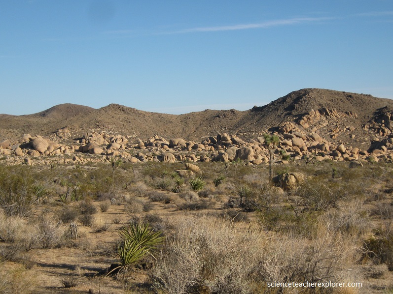
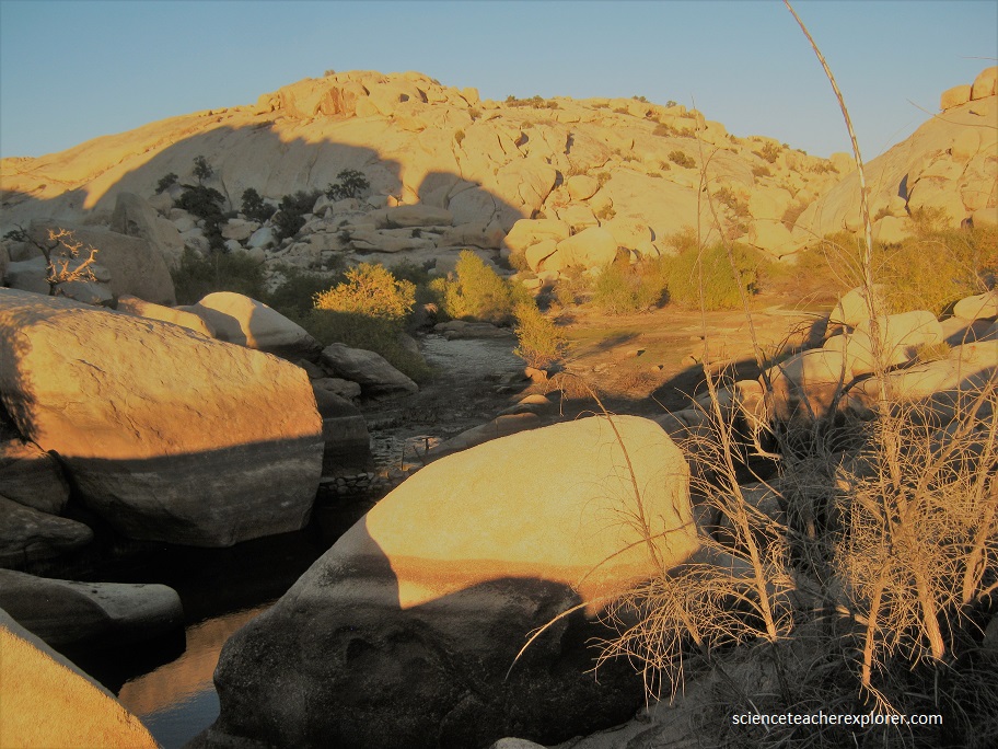
Pictured above, in the distance, are the bold White Tank monzonite boulders found near Jumbo Rocks Campground. These conspicuous outcrops provide an arresting landscape panorama. The rounded and eroded rock outcrops in the western region of the park were formed by erosive agents along joint planes (subparallel fractures) in this White Tank monzonite. This granitic unit is feldspar-rich and quartz-rich igneous rock that has characteristic joint sets that intersect at nearly right angles. Joints are fissures in rocks and commonly occur in recognizable patterns. Within the Park, joints have often formed parallel sets, and joints with two or more parallel sets, called “joint systems,” also occur. Joint patterns are easily observed in the White Tank monzonite.
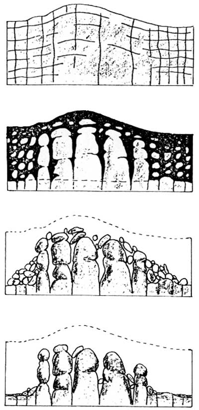
Three dominant joint sets produced spectacular rock forms in this unit (imaged above). One joint set is oriented horizontally and was caused by the release of pressure when the thick layer of original overlying rocks was removed by extensive erosion. Another set of joints in the White Tank monzonite occurs vertically and roughly parallels the contact of this unit with surrounding rock units. The third joint set in the White Tank monzonite is also vertical but is approximately perpendicular to the other vertical set. This system of joint sets results in the rectangular-shaped blocks that can be observed around Jumbo Rocks Campground and Squaw Tank.
Archaeological investigations reveal that nomadic Indians inhabited Squaw tank area, (pictured above) from about 1000 A.D. until the early 1900s. Squaw Tank is a favorite campsite because of the natural water catch-basin. Close by, Bowl-like mortars were hollowed into the quartz monzonite and were used to grind seeds and other bits of food into meal.

