The Escarpment, S. Afr.
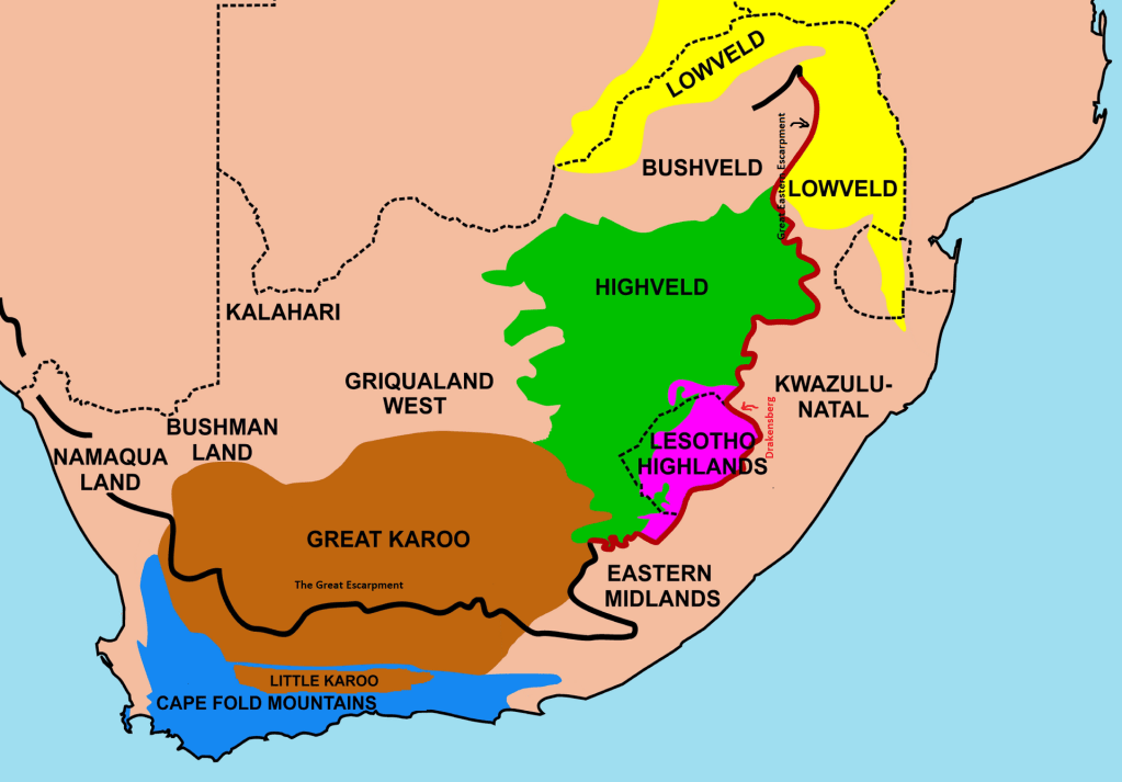
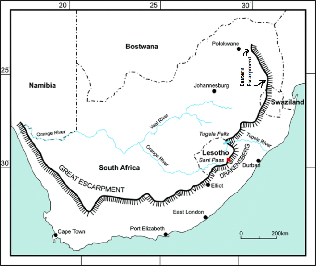
The “Great Escarpment” is a narrow, irregular and rugged strip completely surrounding the elevated interior plateau and separating it from the lower coastal margin of the subcontinent. It can be traced continuously from the Richtersveld and Namaqua Highlands in the northwest of South Africa, around the Southern Escarpment, to the northern Drakensburg in the northeast of South Africa. Its maximum development is where it meets precipitously with the Lesotho Highlands, in places higher than 3,000m.
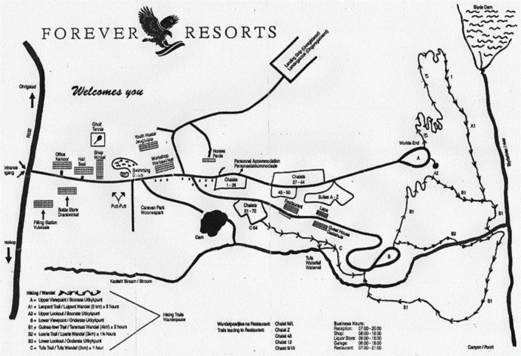
In March of 2023, I had the opportunity to trek and explore the “Panorama Route” of South Africa. The “Panorama Route” in South Africa is a 160 km stretch of road that lies in the province of Mpumalanga and is surrounded by the Drakensberg Mountain Range.
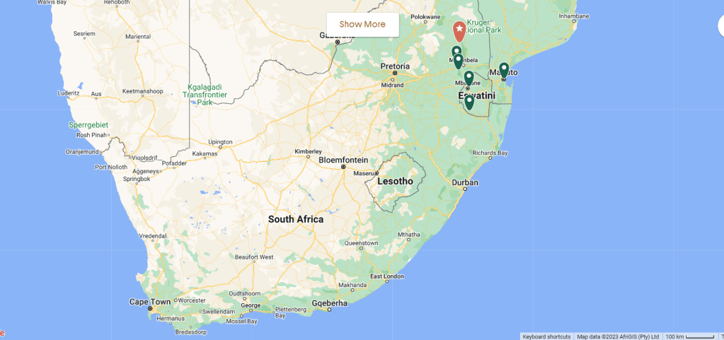
The most popular stretch of the route is the R532 that winds its way from the town of Sabie (370 km east from Johannesburg) via the “Three Rodavels, Bourke’s Luck Potholes and the Blyde River Canyon.
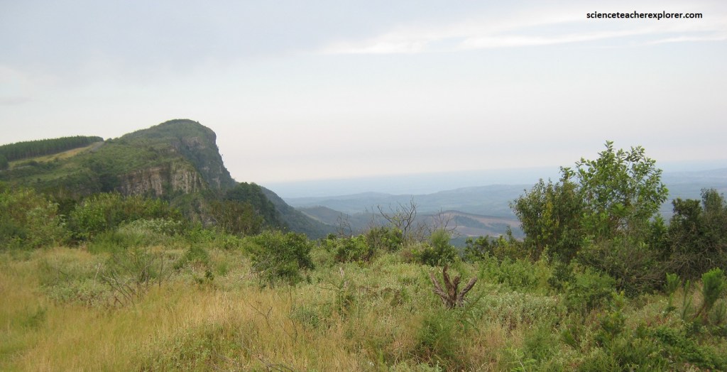
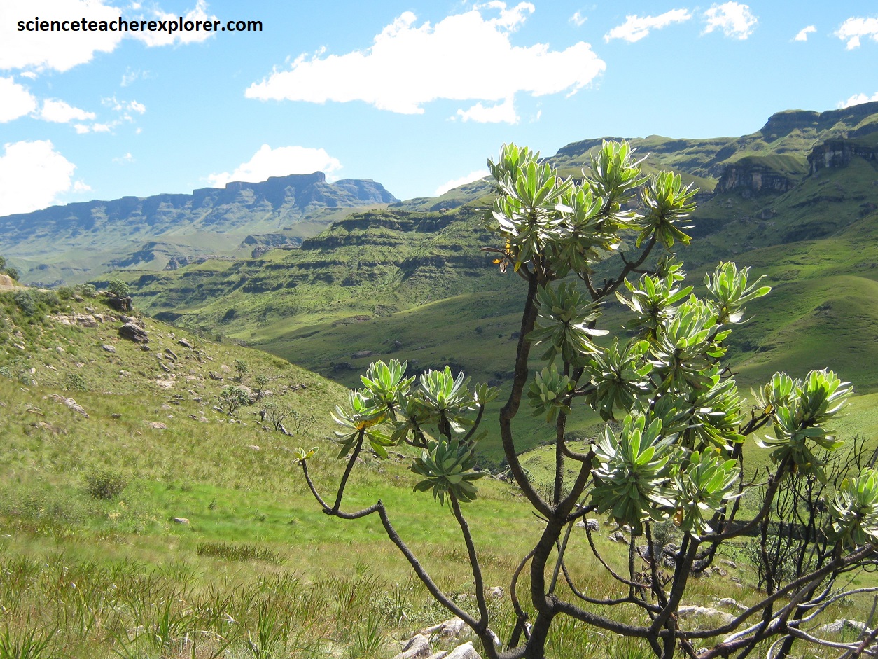
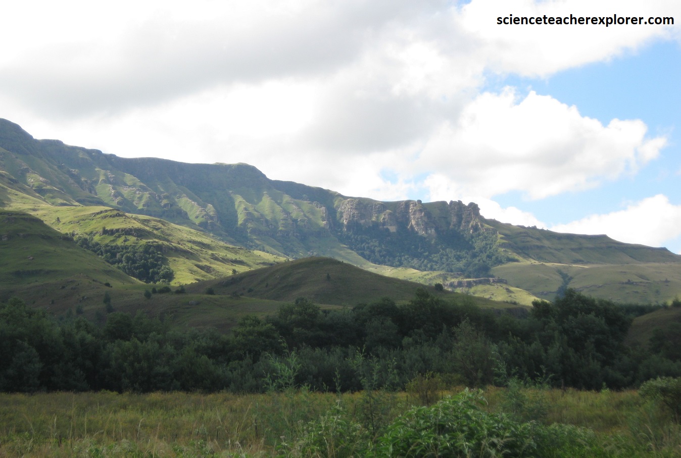
One of the country’s most scenic self-drives, the “Panorama Route”, explores the north-eastern section of “The Great Escarpment”. In these rugged mountains (the Drakensburg) the “Bushveld Plateau” comes to an abrupt and dramatic halt, falling steeply away into the Lowveld accompanied by incredible views out over the grasslands and Kruger National Park of Africa.
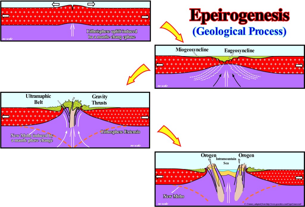
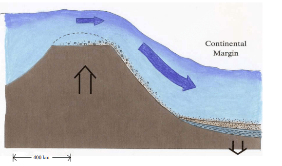
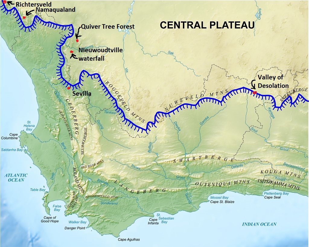
South Africa is renowned for its magnificent landscapes and much of the spectacular scenery can be traced back to the break-up of the Gondwana supercontinent, which started more than 140 million years ago. This resulted in large-scale rifting of the continental margins, the creation of new oceans, uplift of southern Africa, down-cutting by coastal rivers and massive denudation. The uplift is due to large-scale vertical uplift (or epeirogenesis) that has for millions of years buoyed up the subcontinent, the cause of which is thought to be from anomalously hot conditions deep within the underlying mantle (imaged below). This phenomenon is known as the Africa Super Swell, which is essentially a massive long-lived mantle plume (imaged below).
Following marginal rifting, the break-up of Gondwana and the creation of new coastlines, erosion on a vast scale resulted in the formation of new coastal plans that were separated from the high, slightly westward-sloping interior plateau by the rugged Great Escarpment that wraps right around southern Africa.
Some 20-5 million years ago southern Africa again experienced periods of considerable continental uplift, up to 1,200m in the east, but much less in the west. These uplifts increased the elevation of the “Great Eastern Escarpment”, which led to large-scale marginal erosion and cut down deep valleys and gorges along the eastern and southern coastal plains.
The coastal Great Escarpment of Southeastern Africa likely was rapidly eroded from near the coast toward the interior, as the Floodwater was running more perpendicular off the uplifting large dome and towards the oceans. The erosion of the “Great Escarpment” caused the erosion of the African Surface from near the coast to its present location and formed a coastal plain, (imaged below).
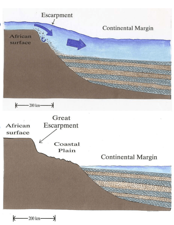
The escarpment erodes to the left as sediments continue to pile up on the continental margin. Eventually, the “Great Escarpment” separates the high African Surface from a coastal plain.
During the Cretaceous, the wetter tropical climate created the ideal situation for weathering, erosion and removal of material by many youthful, eastward-flowing rivers that cut back into the newly formed coastal scarp. The result was the geologically rapid retreat of the scarp across the coastal plain, a forerunner of today’s Great Eastern Escarpment. The earlier coverings of Karoo and Transvall sequences have long since been removed by erosion.
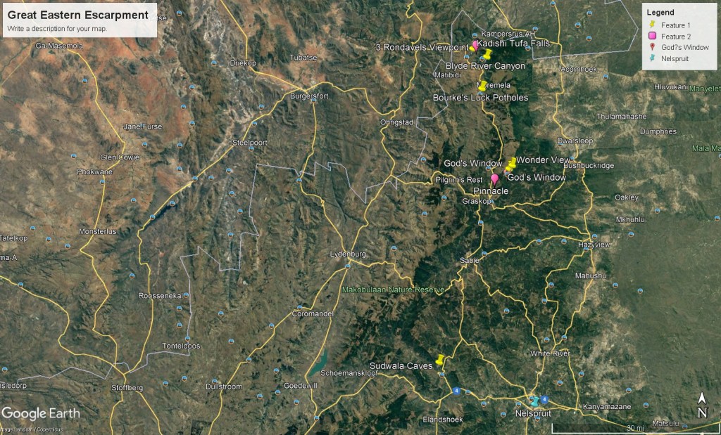
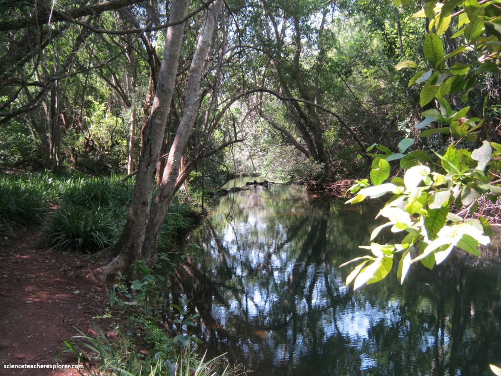
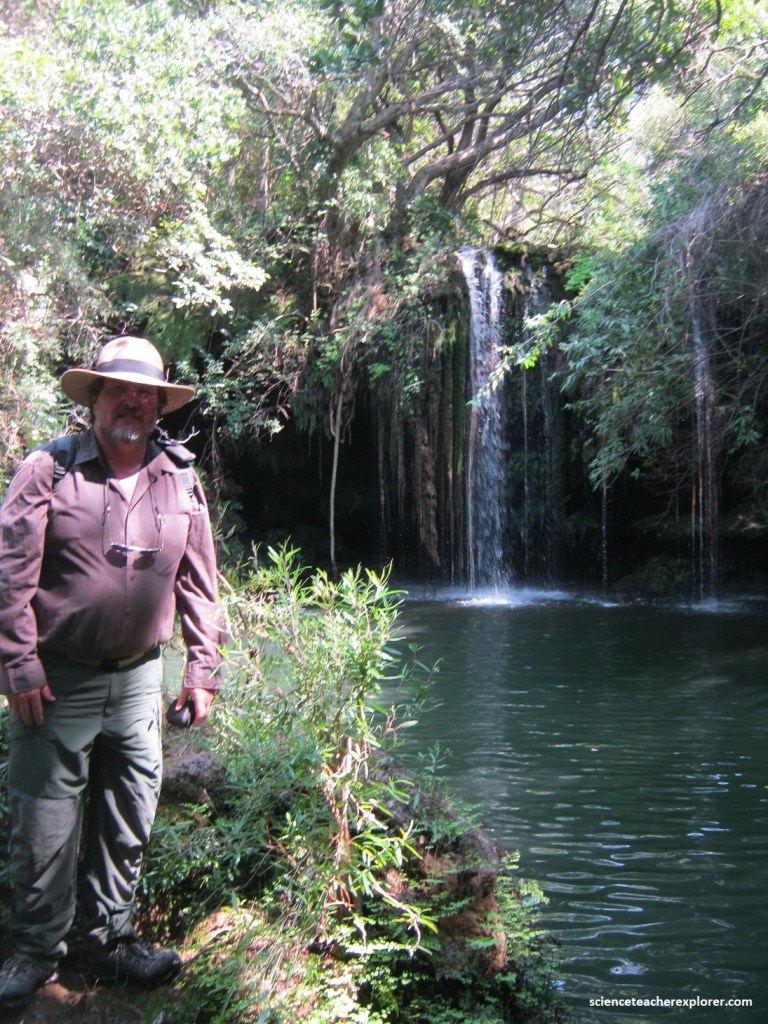
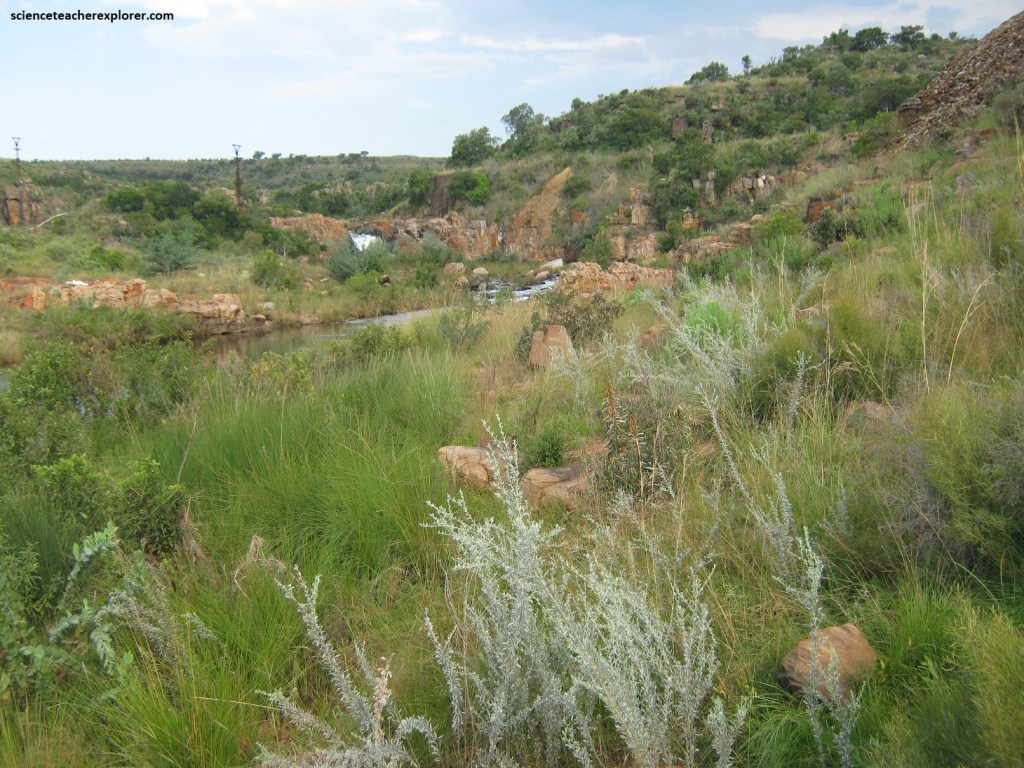
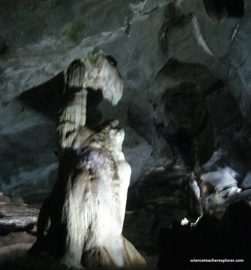
On our way from Tzaneen to Nelspruit, our first walking-trek was to explore the Kadishi Tufa Falls within northern end the “Great Eastern Escarpment” on R36. The Kadishi Tufa Falls was near the Blyde Dam and considered one of the largest tufa falls in the world. Once we passed the Abel Erasmuspas pass on R36, we turned off onto the Forever Resort road. The Kadishi Tufa Falls is on the Forever Resort property, (pictured below).
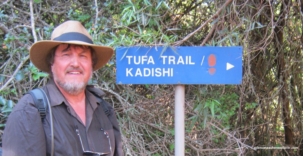
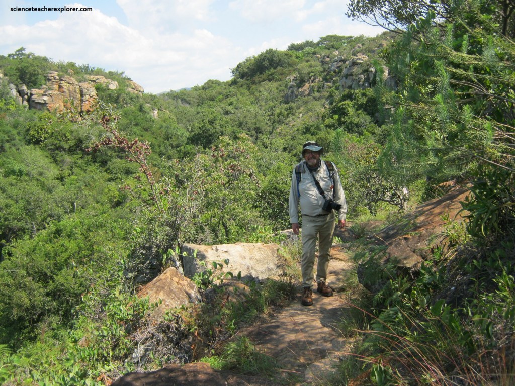
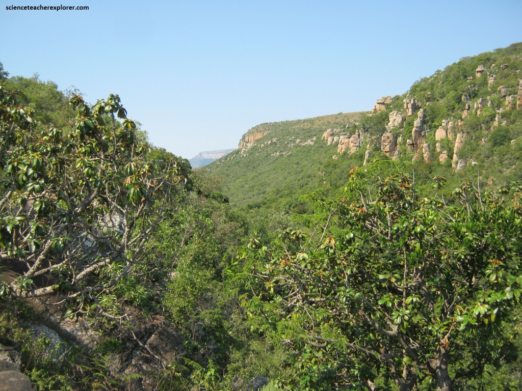
The “Kadishi Tufa Falls” trail winds itself through a forested, lively canyon through quartz arenite cliffs of the Black Reef Quartzite Formation and Wolkberg Group – some 2.5 – 2.6 billion years old rocks, (pictured below).
A Tufa Waterfall is/was created when water running over dolomite rock absorbs calcium, and becomes supersaturated with calcite. Supersaturation typically occurs at a waterfall, when the water is highly aerated, has an accelerated flow velocity, and an enlargement of the air/water interface area. This accelerates the release of carbon dioxide, which promotes calcite precipitation. It is believed that algae and mosses, which grow abundantly on the porous tufa deposits, assist with the removal of carbon dioxide, and also create the necessary substrate to trap the calcite precipitation.
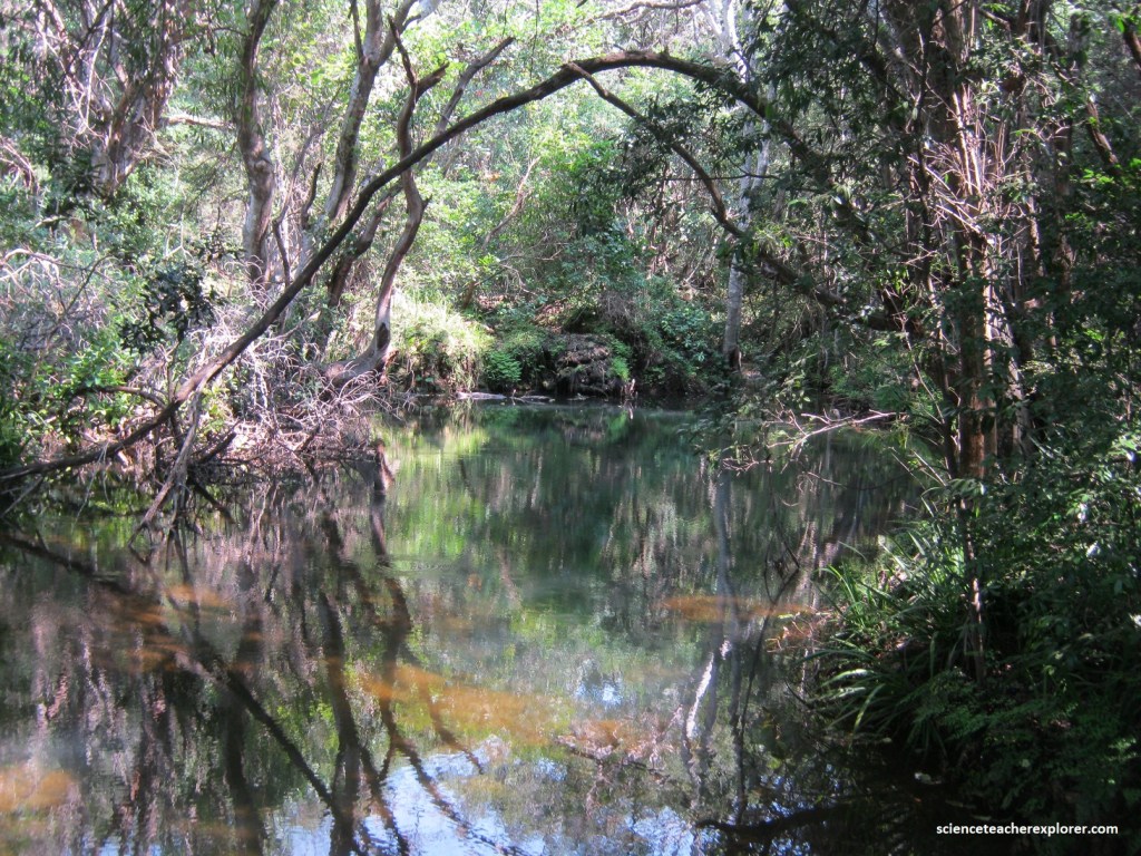
Pictured above, the Kadishi River, before its fall into Blyde (Motlatse) Canyon, flows through dolomite layers above. Over many thousands of years, the water of Kadishi dissolved the lime in the dolomite. When the water with lime reached the rim of the canyon and fell through the air, the lime was deposited over thousands of years and had formed a weird tufa cliff and dam.
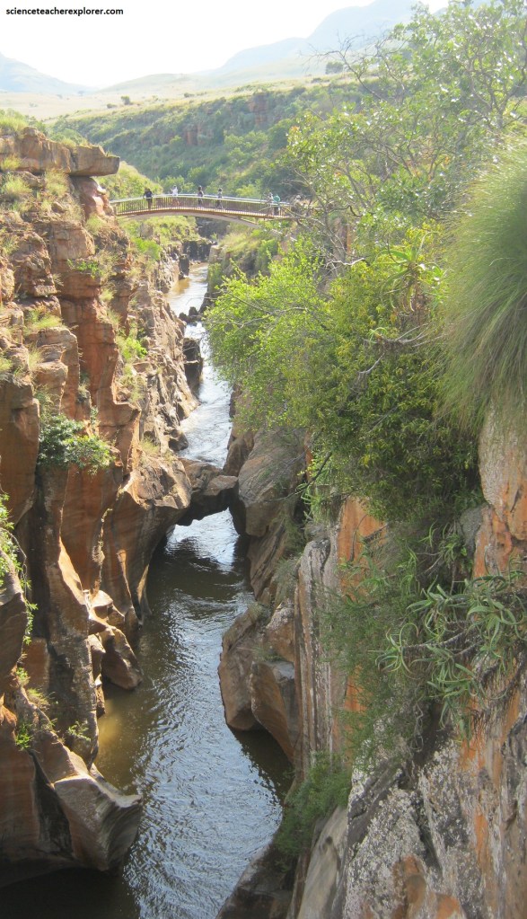
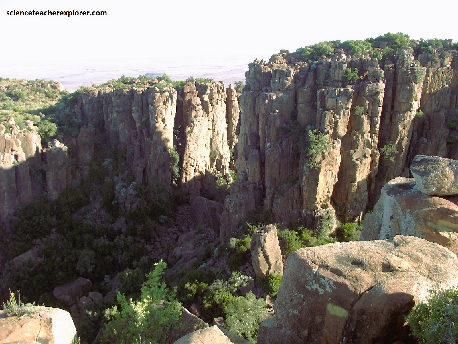
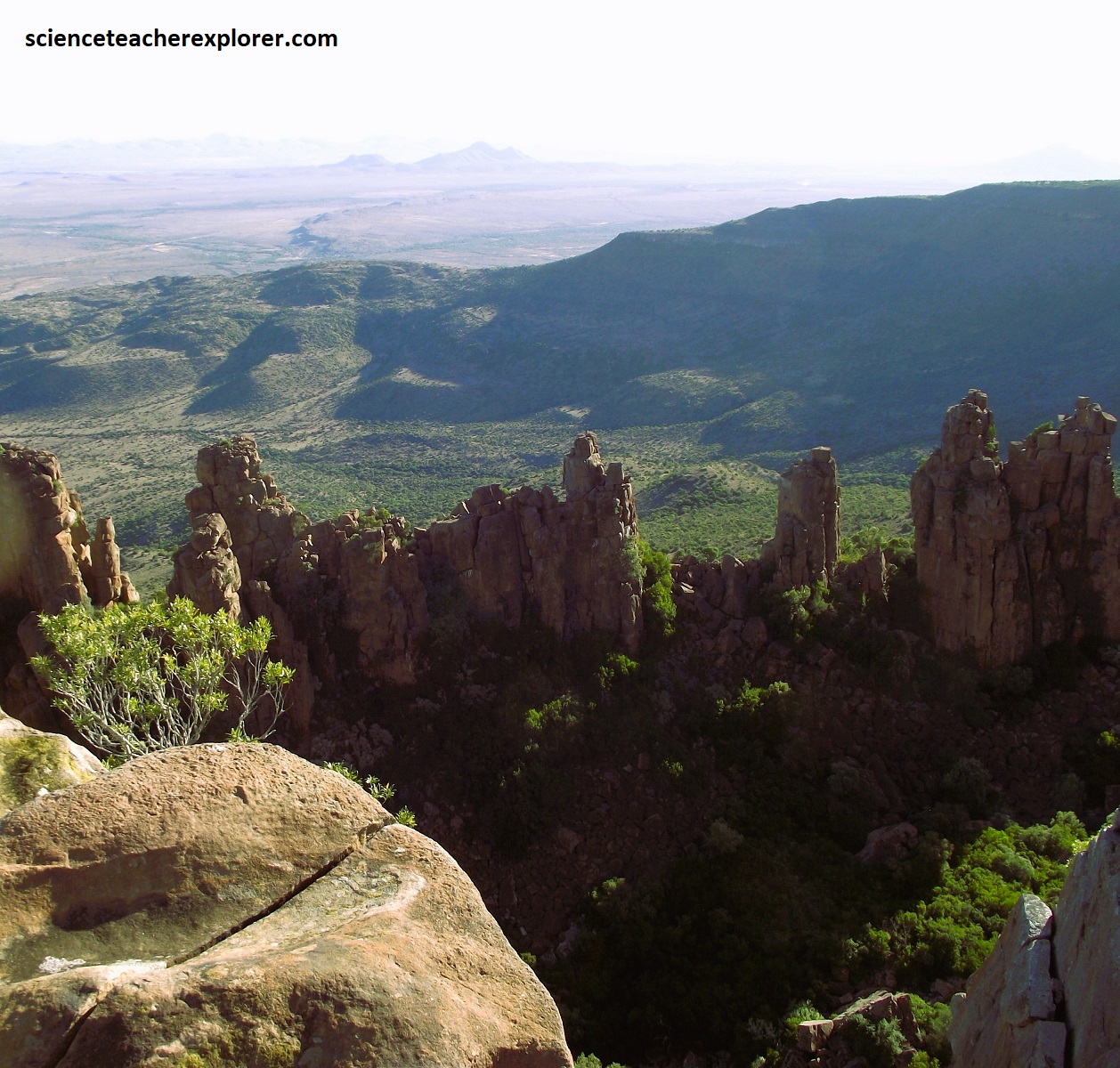
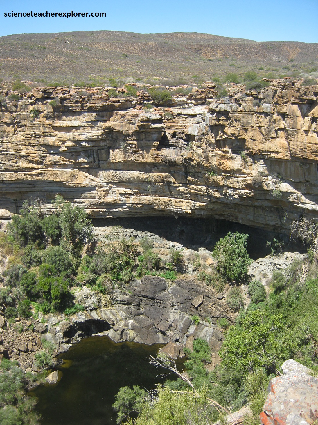
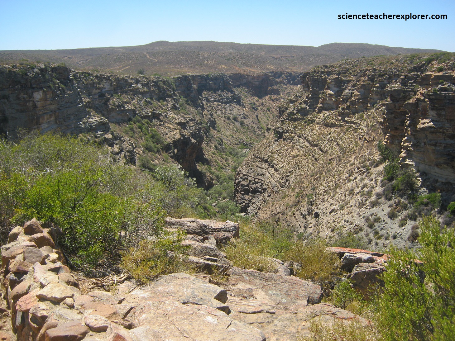
Dominated by dramatic granite ridges, the 24 km long Blyde (Motlatse) River Canyon cuts through the “Great Eastern Escarpment”, and winds its way to the Blydepoort Dam at Swadini. At one time the waters of the Blyde (Motlatse) River blasted through the rock, carving a 800 meter deep canyon, (the third largest in the world), and one of the most beautiful landscapes in Africa.
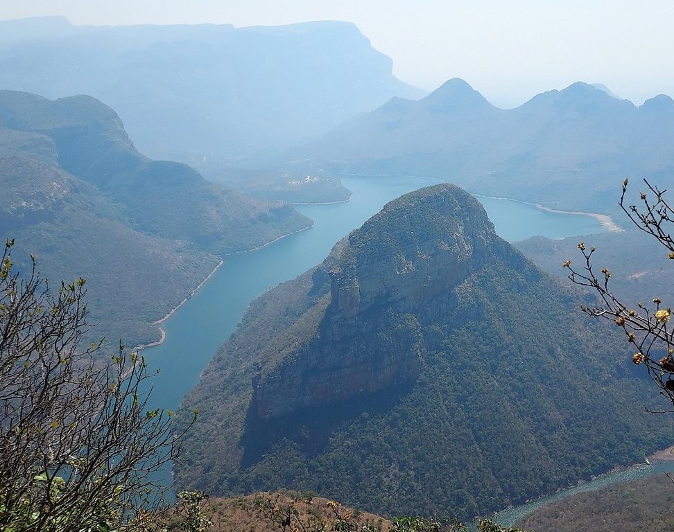
Pictured above, today the Blyde (Motlatse) River threads through canyon-sides cloaked in temperate rainforest and evergreen shrub-like plants known as fynbos. On one side stands the Three Rondavels, three enormous spirals of dolomite rock, that rise out of the canyon walls like giant space rockets. Their tops are iced with the green of vegetation and their sides stained with the orange of lichens. [They get their local name from a similarity to the circular thatched huts common to indigenous peoples.] (Pictured below).
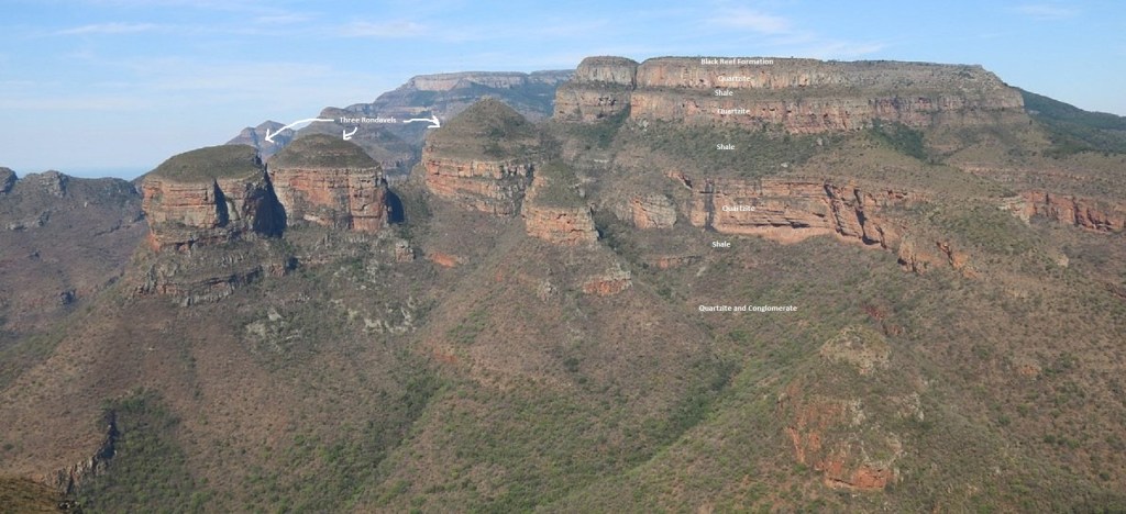
Pictured above, this is the easternmost part of the Transvaal Basin, a depository that started to form around 2.7 billion years ago. At the top of the dissected plateau the formation immediately underlying the surface is mostly mapped as the 2.65 billion year old Black Reef Formation, deposited blanket-like on the sedimentary formations stratigraphically underlying and preceding the Transvaal Supergroup. The older, underlying strata are of the precursor basin of the Wolkberg Group, comprising mostly alternating layers of quartzite and shale, here at their thickest and magnificently exposed in the walls of the canyon. [All formations dip very slightly to the west, as can be seen on the flat-topped mountains across the canyon].
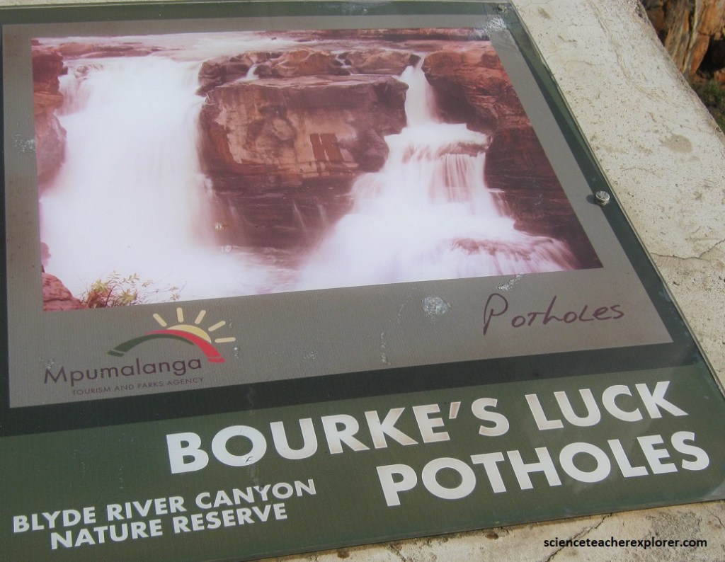
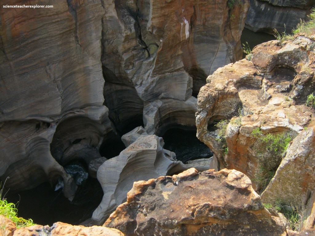
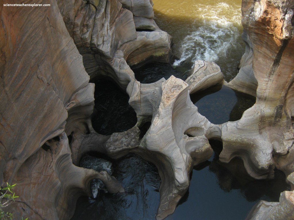
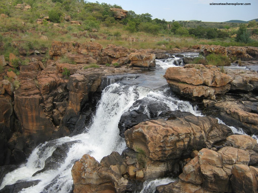
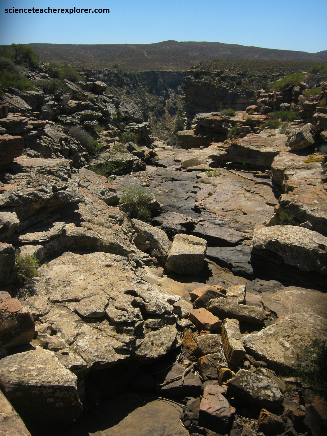
The Blyde (Motlatse) River and the Treur River meet at Bourke’s Luck Potholes. Here the Treur is channeled into a narrow cataract that turns almost 900 into the Blyde (Motlatse) River.
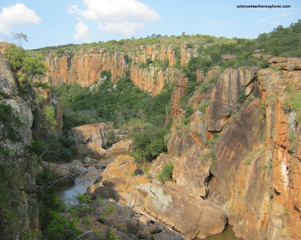
Pictured below, there is good evidence that here the north-northeast direction of the Blyde (Motlatse) River is controlled by a probable fault zone in the flat-lying rock strata.
Pictured above, the abrupt change of direction in the Treur River causes the swirling water, and the boulders it carries from the hills upstream, to carve out a series of huge, bowl-shaped depressions or “potholes” up to 6 meters deep in the soft red and yellow colored dolomite rock.
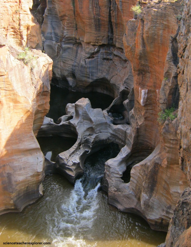
Under precisely the right-conditions, potholes can form in rivers when the debris, (small boulders pebbles and sand), being transported by the current wears away the rocky river floor in a process of abrasion. Loose material becomes trapped temporarily in bedrock-hollows and is rapidly swirled around by eddies in the fast-flowing water. The hollows gradually grow wider and deeper, and the loose rocks can drill down several meters to produce large cylindrical potholes. Adjacent potholes eventually overlap and merge, (pictured below).
At one time a farmer called Tom Bourke owned the site. He speculated that as prospectors upstream were successfully panning for gold, he should find gold nuggets in his potholes. He was right, and the feature became known as Bourke’s Luck. Gold was later found in sulfide-rich secondary-hydrothermal veins within fractures in the quartzite, close to a north-trending dyke. Nearby Bourke’s Luck gold mine closed down only in 1955, having produced 4.5 tons of gold from a number of spread-out workings, plus as a by-product copper.
The setting here at Bourke’s Luck Potholes is part of the “Great Eastern Escarpment”, showing the eastern part of the large Transvaal Basin. Here, the underlying formation is the Black Reef Formation, which does not exceed a thickness of a few meters. It forms the basal unit of the Transvaal Supergroup and was around 2.65 billion years old. The Black Reef itself lies upon a much thicker quartzite, of the upper part of the slight older Wolkberg Group, which formed under similar depositional conditions.
In 1840, a party of Boer pioneers explored the area, looking for places to settle. The men struck out to the east leaving their women and children encamped beside a river. When they failed to return on the arranged date the women thought their men had died and they called the river Treur, meaning “river of sorrow”. Later, however, husbands and families were reunited at a second river and they called it Blyde, meaning “river of joy”. However, the Blyde has been renamed the Motlatse River because of the 300 km2 surrounding nature reserve that was proclaimed in 1965 called the “Motlatse Canyon Provincial Nature Reserve.
This landscape of weirdly eroded pillars of quartzite is not uncommon in the area. It was created by preferential rock weathering and different rates of erosion, and was certainly influenced by the pattern of rock jointing and by the higher rainfall along the escarpment edge.
Around 2.65 billion years ago, rifting and stretching of the Kaapvaal Craton, followed by subsidence, resulted in the development of the Transvaal Basin, (a major elongated depository), which can now be traced for over 500 km east-west and some 200 km north-south. This basin filled with the large shallow Transvaal Sea and sedimentation on the submerged continent, took place under fairly stable conditions until around 2.1 billion years ago.
Pictured above, this thin, hard quartzite Black Reef formation, almost horizontal in attitude, blankets the landscape of the “Great Eastern Escarpment” . It was deposited on the floor of the inland Transvaal Sea, as a clean, pebbly sandstone less than 2.65 billion years ago. It formed a covering that resisted strong erosion, which protected the underlying softer basement of granite-gneiss and Wolkberg rocks.
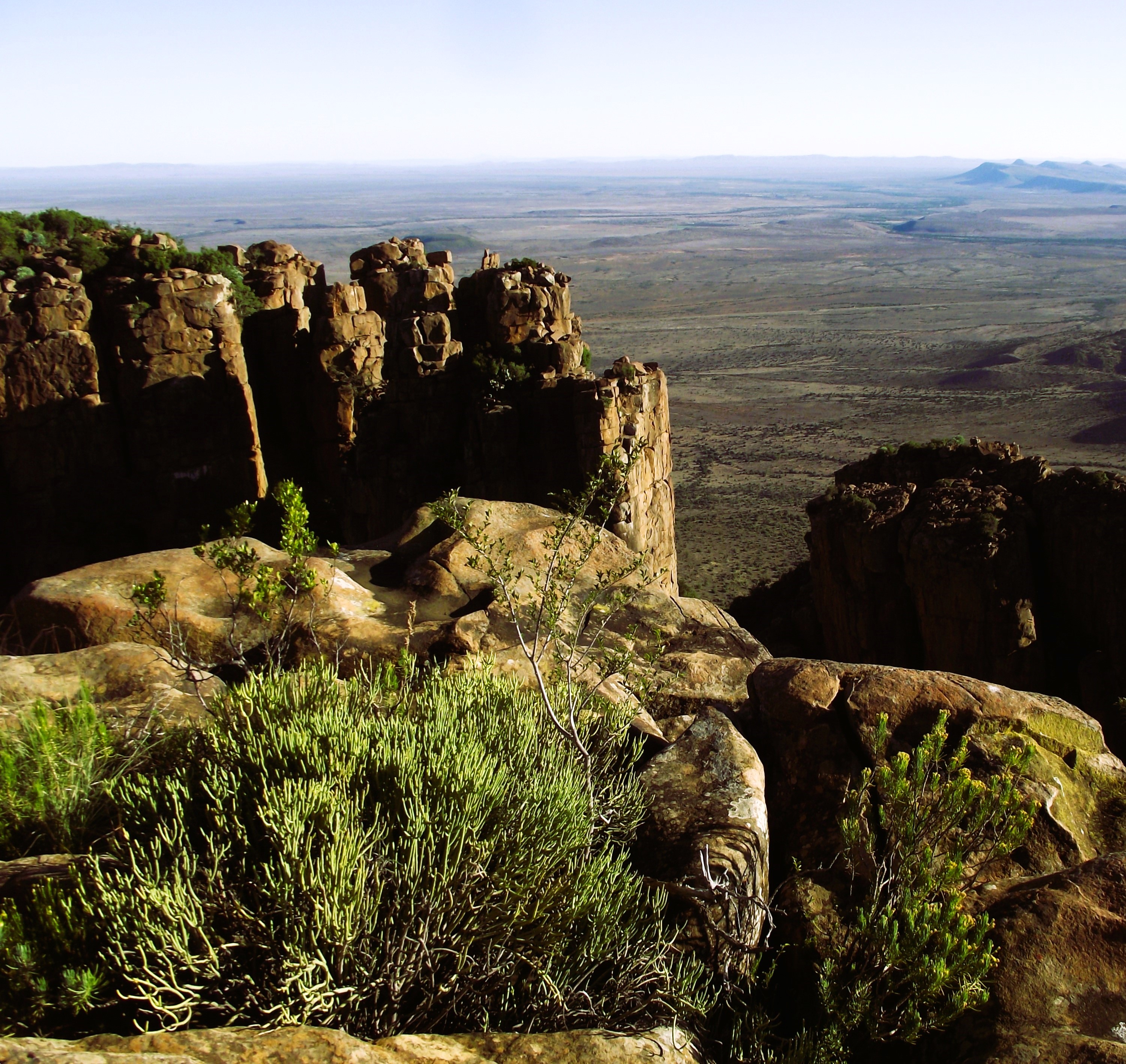
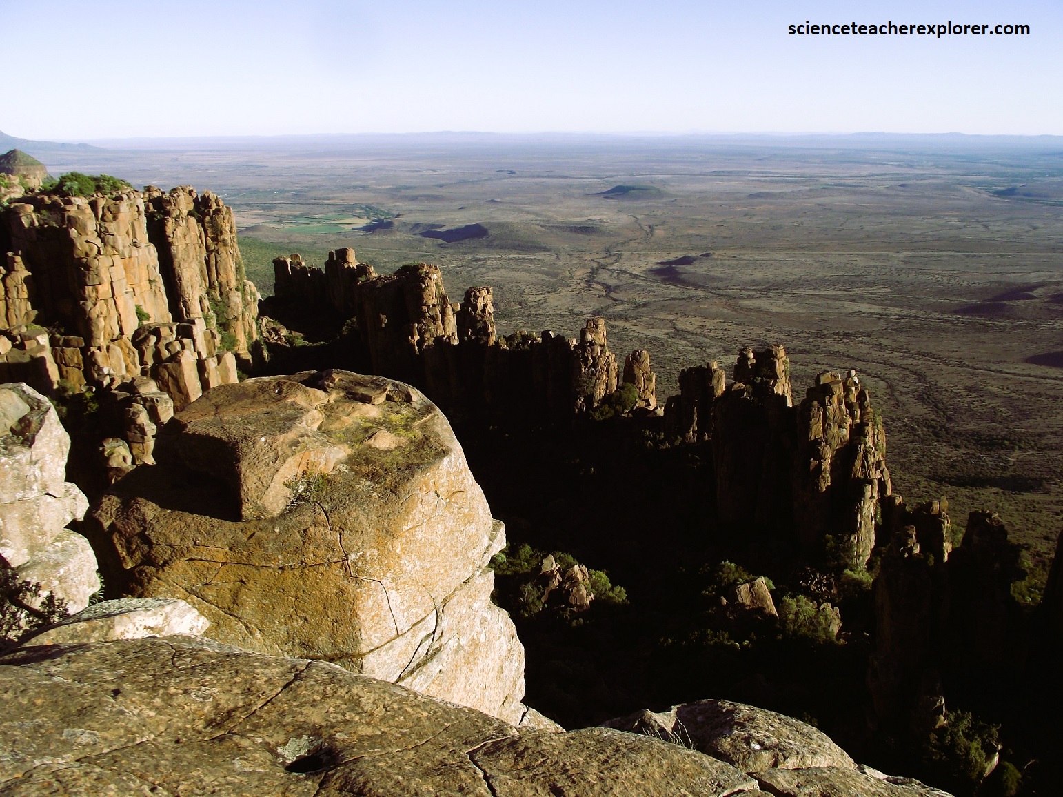
Later, we drove further south on R36 along the “Great Eastern Escarpment” to the R532 turnoff. Pictured above, we stopped at the “Wonder Viewpoint” to look across the “Lowveld” towards Kruger National Park. This is almost an unrivalled view-site that reaches 1,700 m elevation. The total drop to the Eastern Lowveld is around 800 m.
Pictured above, the “Great Eastern Escarpment” is one of the world’s most impressive landscapes, and God’s Window is one of its highest points, (1,730 meters). The underlying, almost horizontal and well-bedded quartzite, is geologically mapped as being the upper Wolkberg Formation. This sequence was the first to form of the Transvaal Supergroup, deposited within a smaller proto-basin (2.7 billion years ago). It is exceptionally well show-cased at the God’s Window, under the Black Reef Formation.
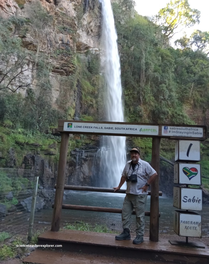
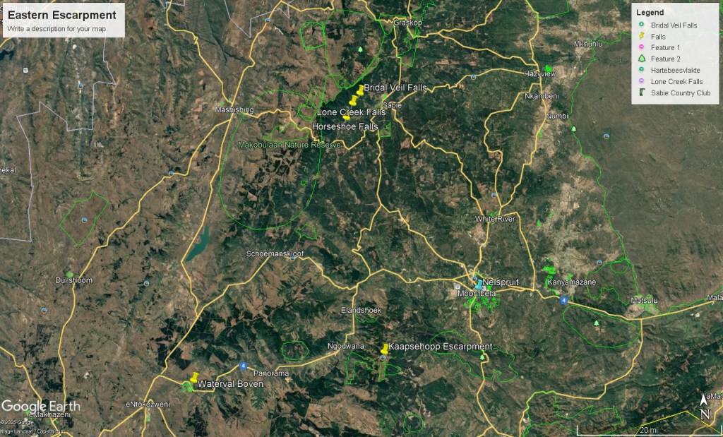
The next stop, (shown below), was done in 2025, in the region around Sabie and Graskop, where it is well known for it’s many waterfalls. The town of Sabie lies a little more than 60km northwest of Nelspruit, (Mbombela).
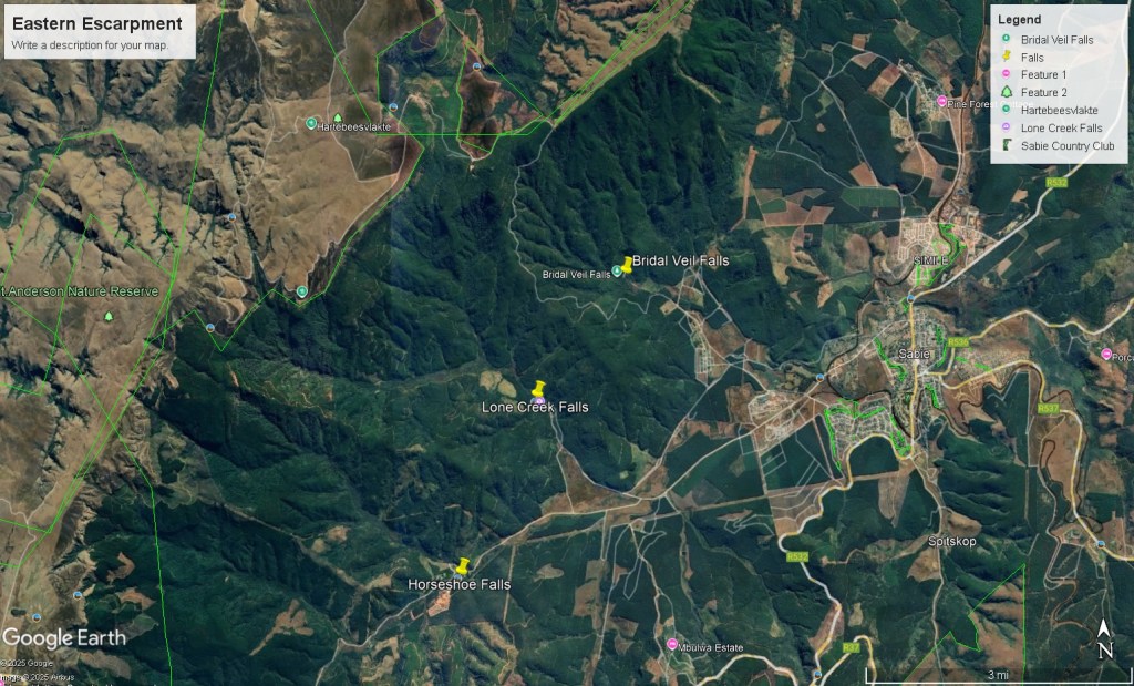
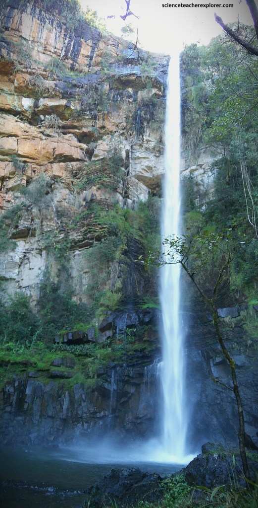
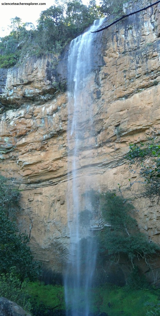
The small town of Sabie is situated in a deep valley close to the edge of the “Great Eastern Escarpment”. There are many spectacular waterfalls around Sabie, and one of the most popular is where the Lone Creek stream, (a headwater tributary of the Sabie River), plunges over a 68m-high cliff into a pool below.
The landscape around Sabie is part of the broader “Great Eastern Escarpment”. The Sabie River has cut deeply into the Black Reef-covered plateau west of the main escarpment edge, and above this, with several tributaries have dissected the Malmani dolomite and the overlying Pretoria Group.
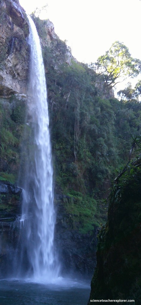
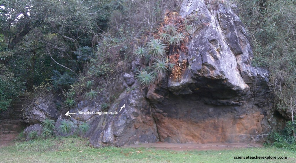
After the Malmani dolomite had became an exposed hard rock, a long period of weathering and erosion followed, resulting in the formation of a paleo-surface. On this ancient surface a thick deposit of almost insoluble chert fragments formed, (a residue from thin chert layers with in the dolostone), resulting in a very resistant, chert-rich unit known as the Bevets conglomerate. This is now the cause of several waterfalls in the area, (e.g. Lone Creek Falls seen above).
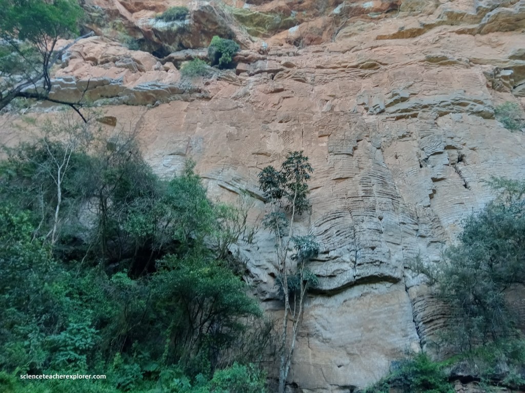
The light brown banded Malmani dolomite, seen at the lower part of the Lone Creek waterfall cliff, consists of pale dolomite layers alternating with thin whitish chert bands. Here the very characteristic giant domal stromatolitic structures are at the top of the Malmani dolomite sequence, (pictured above and below).
The upper part of the above waterfall cliffs forms a resistant overhang, (Bevets conglomerate), that is made of a chert fragment breccia recemented by secondary silica, (pictured below).
The video below is of Horseshoe Falls, and is so named as the stream splits into two. Here hard silicified Bevets conglomerate is the main rock formation and lies stratigraphically above the Malmani dolomite.
It should be noted that in 1871, prospectors Tom McLachlan, George Parsons and others were working in the mountainous region around Sabie and Graskop. By 1872, encouraging alluvial finds had been made and diggers flooded into the area, heralding the start of the first major gold rush in South Africa. By mid-1873 the diggings were proclaimed and more than 1,000 diggers were active in what became known as the Mac-Mac goldfield.
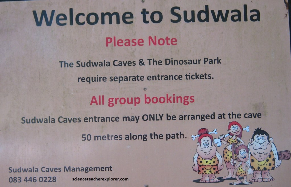
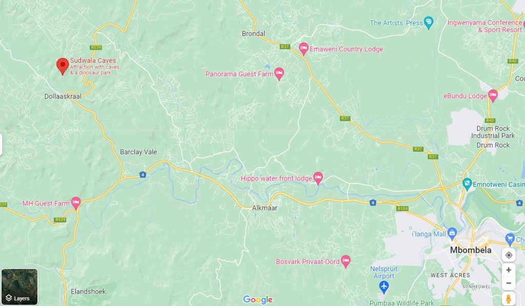
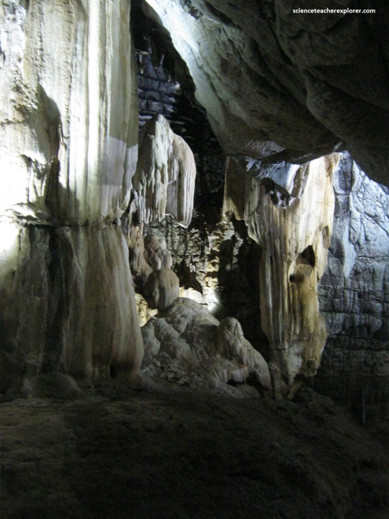
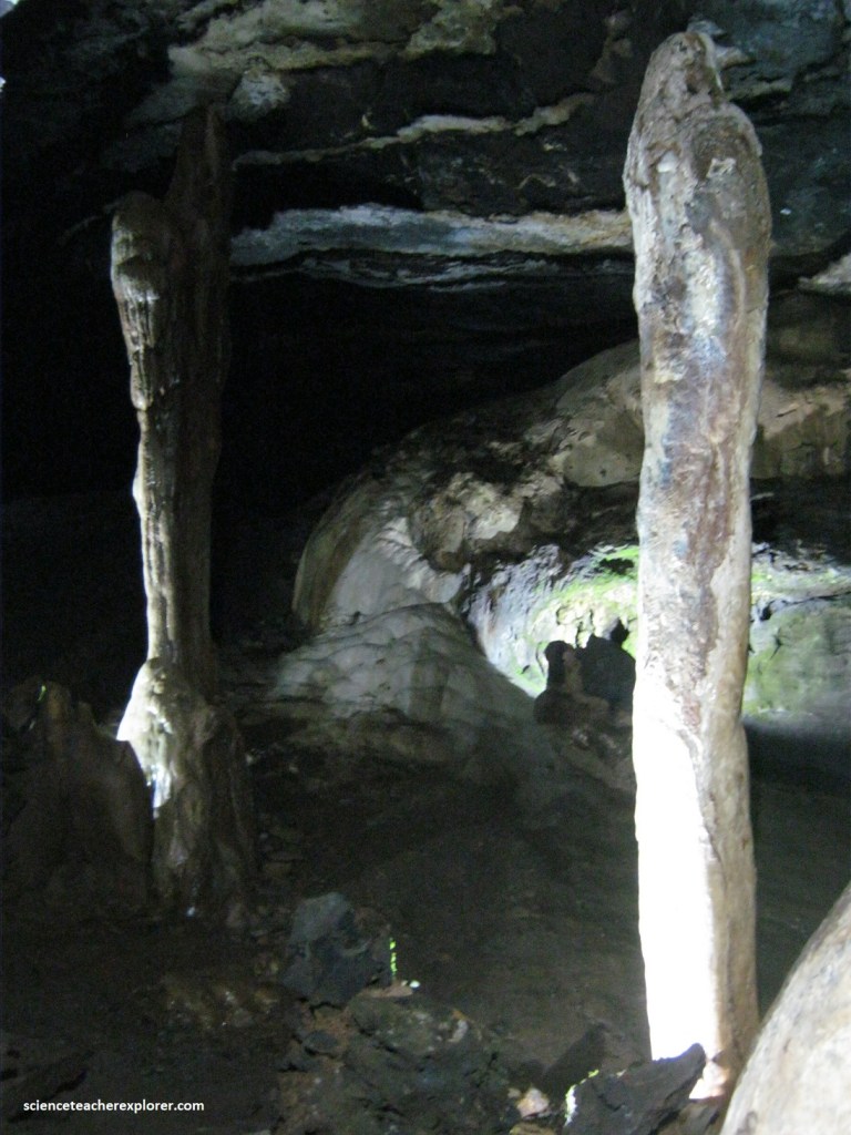
As we approach Nelspruit (34 km) from the north on R539, we stopped and explored the Sudwala Caves, (in 2023). The caves are found within a rugged dolomite hillside known as Mankelexele. The caves are located on the farm Sudwalaskraal, hidden by dense woodland in the valley of the Houtbosloop, (a tributary of the Crocodile River).
The cave system has developed within the Oaktree Formation, the lowermost dolomite formation of the Malmani Subgroup, which lies immediately above the Black Reef Formation. The Malmani dolomite (or dolostone), deposited around 2.5 billion years ago, is within the lower part of the Transvaal Supergroup, a thick sequence of mostly sedimentary rocks that were deposited within the Transvaal Sea on the continental basement.
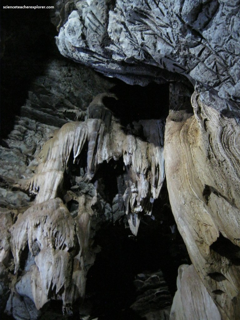
As mentioned, the predominant rock in the area is dolomite which formed in the bed of a shallow sea 2.5 billion years ago. [Dolomite, (a variety of limestone), consists mainly of calcium-magnesium carbonate (CaMg(CO3)2). Another name for this is ‘dolostone’]. The Sudwala Caves, aragonite crystal chambers were about 2 km from the cave entrance and were formed about 450 million years ago, while the caves were still filled with water and remained undisturbed for millions of years. Around 400 million years ago due to movements in the earth’s crust, the ancient sea-beds were tilted, and the sea water swept away. The main section of the Sudwala Caves was created by slightly acidic groundwater, seeping down, and dissolving the dolomite to form cavities beneath the water table. Around 250 million years ago, the water table dropped and the caves became air-filled in which stalactites and stalagmites could form.
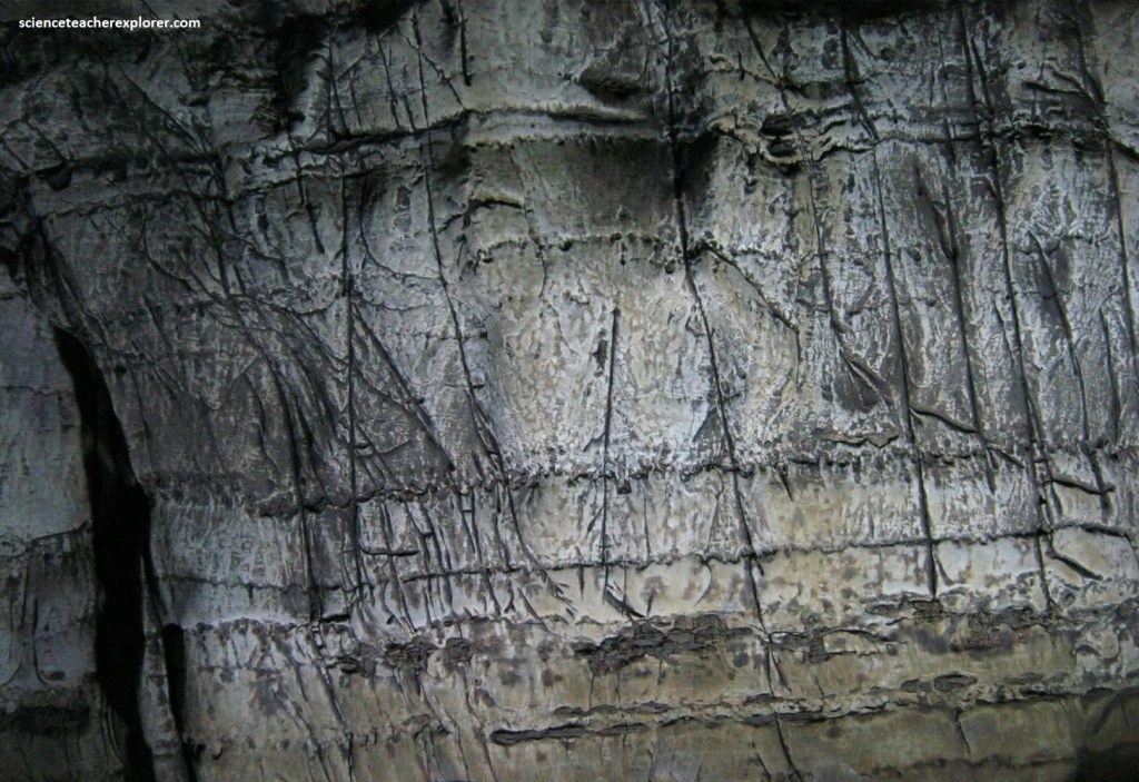
The local name for this ‘Dolomite’ rock in the Sudwala Caves is “Elephant-skin” rock as it has the light grey wrinkled texture of an elephants skin. As mentioned above, this dolomite is a sedimentary rock formed 2.5 billion years ago in the Pre-Cambrian time period when the lowveld area was covered by warm shallow inland seas. At that time the only life that existed on earth were primitive algae plants. Fossilized remains of these plants are called stromatolites, and can be seen throughout the caves.
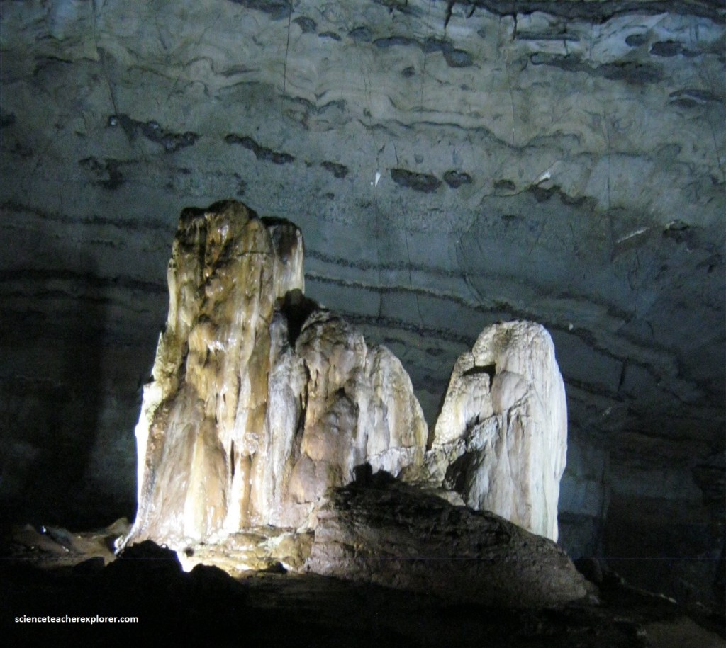
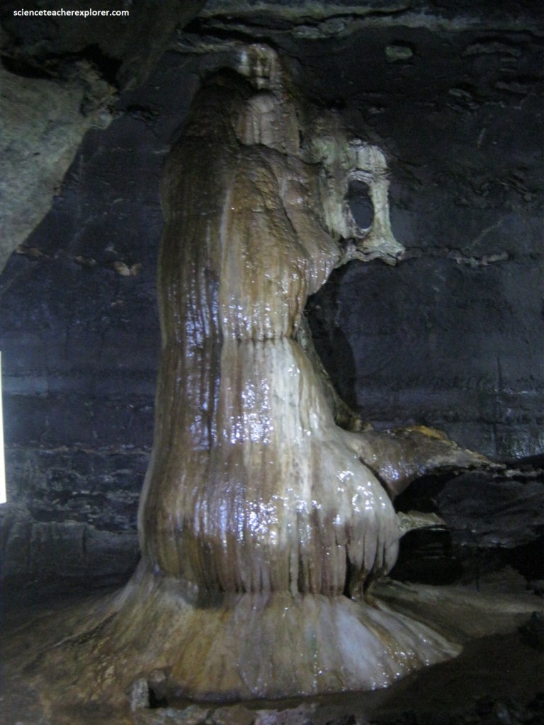
Pictured above, the “Lowveld Rocket is 14 m high and 2.5 meters in diameter. It is approximately 150 million years old. This calcium formation is a pillar. A stalactite from above and a stalagmite from below. Once the two dripstones met, they were called a pillar and water runs down on the outside without dripping. It is still active during the wet seasons. At the top, you could see the black soot marks remaining from the attempts by Mswati, the rightful heir to the Swazi throne, to smoke out his half brother Somcuba and his followers in the 1800’s. These attempts were futile because the natural fresh airflow in the caves blew the smoke out.
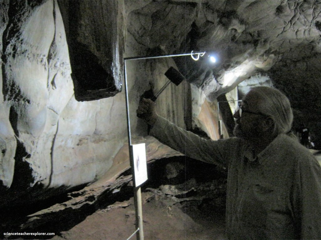
Pictured above, Somcuba’s Gong is a flowstone formation named after Chief Somcuba of the Swazi people, who together with his followers used the caves as a refuge in the 1800’s. This formation is porous and when hit produces a hollow sound which can be heard throughout the cave.
Pictured above, on the ceiling of the cave, you can see the magnum ice-cream formation. This flowstone has a chocolate brown color on it, caused by staining from the mineral, manganese. Bat Guano is a very valuable fertilizer which the prospectors excavated about 2000 tons from the Sudwala Caves throughout the 1900’s and sold to farmers in the Crocodile Valley.
Pictured above, the “Three Praying Nuns” formation is only a stalagmite. The water drips too fast for a stalactite to form on the ceiling. For a stalactite to form, the drop of water must remain for several hours before it drops, giving the water time to evaporate leaving behind calcium. These three nuns have been praying for about 40 million years.
Pictured above, the “Screaming Monster” formations are also called speleothems taken from the Greek for cave deposit. The formation consists of a combination of Stalactite, (pointed pendant growing from the ceiling), Stalagmite, (counterpart of a stalactite growing from the ground up), and Flowstone, (sheet like layering). To age the formation, scientists drill a small diameter core near the base of the stalagmite. These samples are then dated using uranium-thorium dating.
Pictured above, these two stalagmites are known as “Lot and Lot’s wife. Lot is an active formation in winter when water drips slowly enough to deposit calcium. In summer, during the rainy season the water flows too quickly and “Lot” is slowly eroded away. Lot’s wife on the other hand is like a pillar of salt and has not been active for a long time.
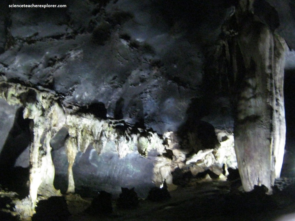
Pictured above, the “Dental Care Corner” are a group of stalactites and stalagmites that look like teeth. A natural airflow circulates through the cave, keeping the temperature at a constant 17-18 degrees Celsius, all year round. Although the Sudwala Caves are not the biggest caves in the world, they are thought to be the oldest known dolomite caves in the world. Additionally, the Sudwala Caves have approximately 6 km of explored passages, (explored and mapped in the 1970’s).
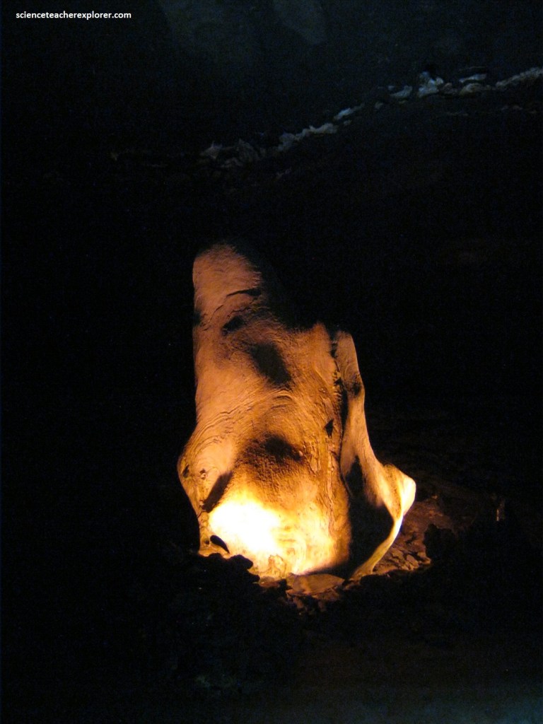
Pictured above, this area is called the “Devils Workshop” because it is warmer than the rest of the cave as all the hot air rises up here. It is about 24 degrees Celsius. The humidity is 100%. This formation with the red light is known as “Old Nick”, the cave Devil. Nick is a fallen stalactite. He fell a very long time ago and when he fell he tumbled and landed upside down. He is still active and growing, depending on the amount of rain we receive. {You are looking just at his head upside down. The dark spot in the center is his eye. His ear is to the left and his long nose to the right. His mouth is the dark area at the top and at the very top is his point chin}.
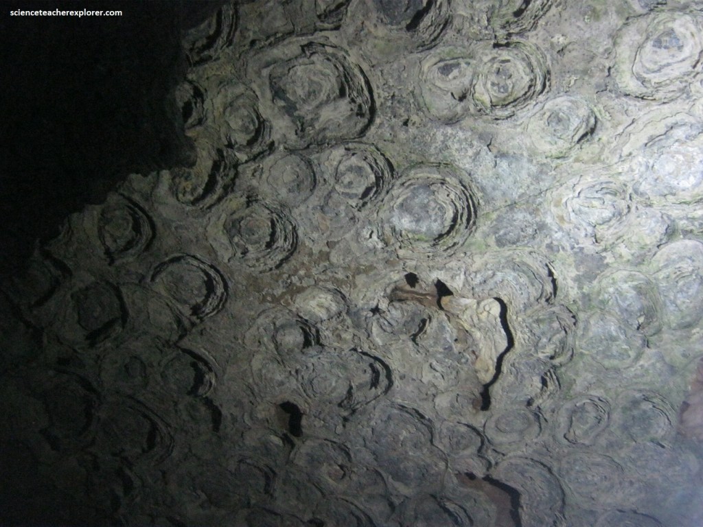
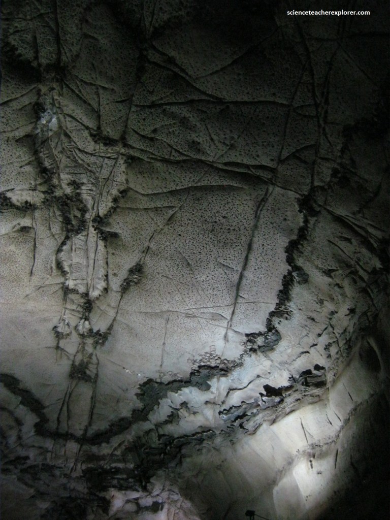
Pictured above, on the roof, we could see the round shapes of fossilized stromatolites. These are fossils of the first oxygen-producing plants on the earth. Fossilized stromatolites are the oldest evidence for life on Earth and grew in the Lowveld area around 2.5 billion years ago when the Lowveld was covered by warm shallow seas. These cyanobacteria or blue green algae were the first oxygen producing plants which helped to create the atmosphere we have today. It is calculated that one centimeter of stromatolite takes around 25 years to form.
Pictured above, the “Weeping Madonna” is a flowstone formation. Flowstones are formed from a build-up of calcium deposits as a result of slow flowing water. This is different to drip formations. If the waterflow is too fast, the calcium is eroded away instead of being deposited. This continuous erosion could mean a formation like the “Weeping Madonna” could eventually disappear completely.
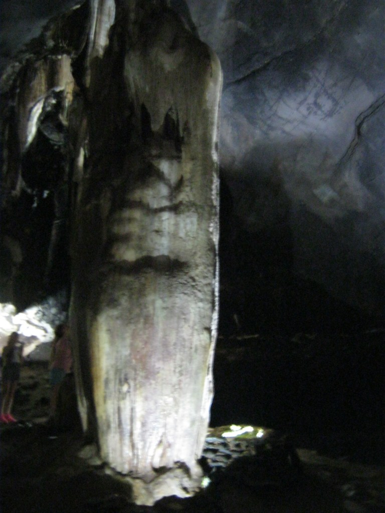
Pictured above, Samson’s Pillar is the highest point in the cave, approximately 60 m below the surface. “Samson’s Pillar” is the oldest formation in the cave. It is about 180 million years old. It is made up of a large stalagmite and only a small stalactite.
Sudwala Caves is a dissected remnant of that which existed before the break-up of Gondwana. The once overlying Pretoria Group rocks have been removed and valleys have cut down through the Malmani dolomite and Black Reef quartzite, exposing the underlying Archaean granitic basement nearby. The residual massif of dolomite is crossed by north-trending linear structures, probably faults and dikes, which have allowed surface water to penetrate and erode along points and fractures.
This surrounding landscape of the Sudwala Caves, reflect dissected terrain of the Crocodile River catchment, eroding back strongly along the “Great Eastern Escarpment”, and separating Mpumalanga’s Lowveld from the Highveld plains.
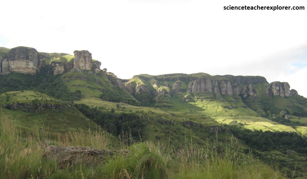
Onto Kaapsehoop! This small village of Kaapsehoop, lies on the narrow Godwan Plateau, (an almost isolated, spur-like remnant of Highveld preserve between the Elands River Valley and the escarpment). I approached it from Nelspruit with a very scenic drive of 30km up the escarpment.
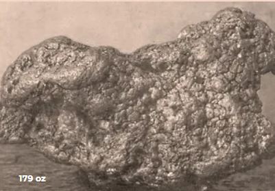
In 1881, with the granting of a mining concession for the Pilgrim’s Rest Gold Field, (near Sabie), many of these prospectors moved south along the “Great Eastern Escarpment where small gold finds continued. Along the edge of the Godwan Plateau alluvial gold was discovered in creeks on the farm Berlyn in early 1882. In 1882 the largest nugget found weighed nearly 300g and in 1883 this was presented by the South African republic to the King of the Netherlands for his support during the 1st Anglo-Boer War. In 1912 the Peacock Nugget weighing a massive 179 ounces was found 1 km from Kaapsehoop, (seen below in these public domain images). The Peacock nugget, (on the right) was found by H.W. Peacock and called the “Pom Pom”.
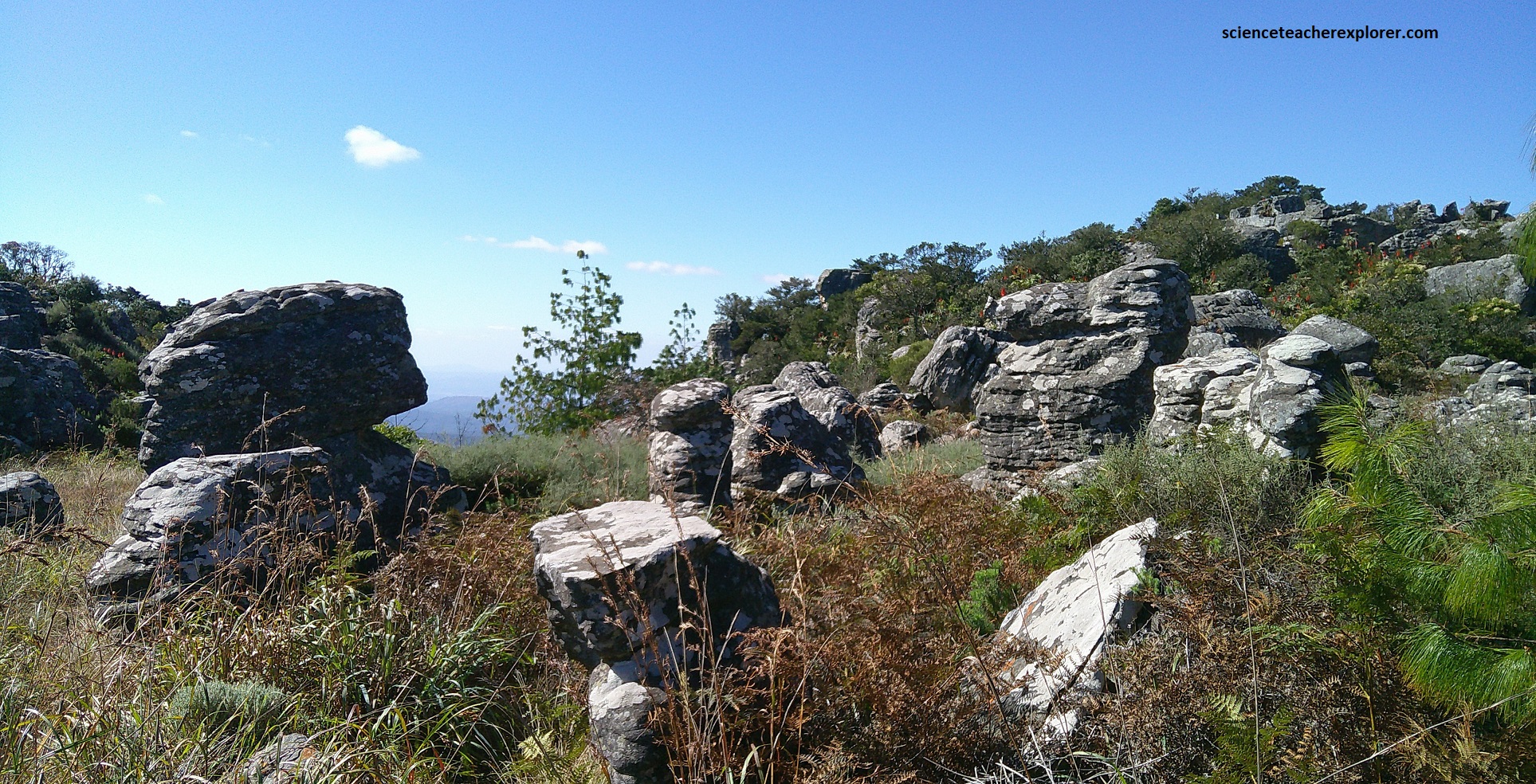
At Kaapsehoop, the strange shaped rock formations are weathered exposures of the Black reef formation, (pictured below). The Black Reef Formation is about 30m thick and comprises a zone of basal conglomerate and a thicker sequence of clean, well-bedded quartzite, including some thin shaley and pebbly layers.
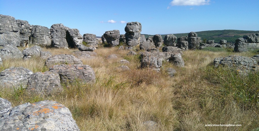
A good look at the exposed rock pillars showed planar bedding and cross-bedding, indicating the deposition of clean quartz sand and pebbles on a river flood or in shallow water along the margin of the early Transvaal Sea 2.65 billion years ago.
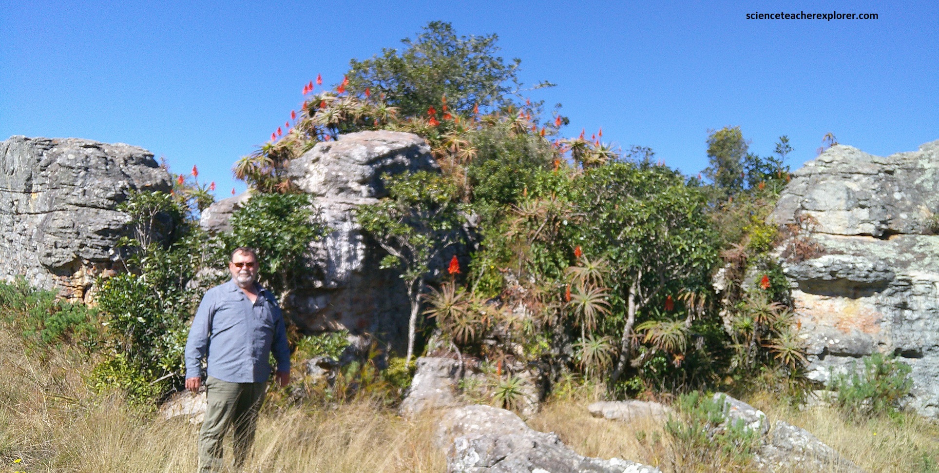
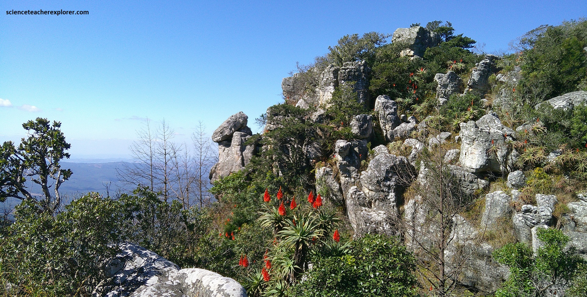
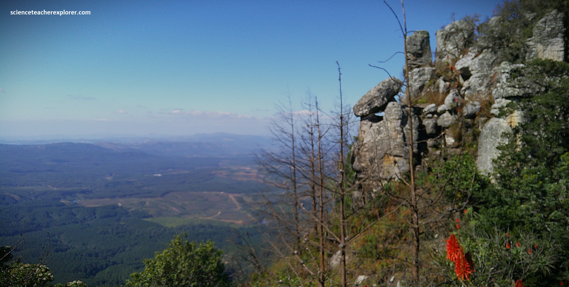
Here at the top of the escarpment edge, it overlies the Archaean Kaap Valley tonalite (a granite), or over the small Godwan Basin, (a precursor to the Tansvaal Basin. Pictured above, is an eroded gap in the Black Reef Formation quartzite on the edge of the Kaapsehoop Escarpment, seen as one faces northwards. Timber plantations mostly cover the Kaap Valley tonalite below, and the hills in the middle distance are the extreme western end of the Jamestown Schist Belt. My traveling buddy of 2025, (Tracy Davis), is posing in front of the Black Reef sandstone, before we peer off the edge of the “The Great Eastern Escarpment” of Africa.
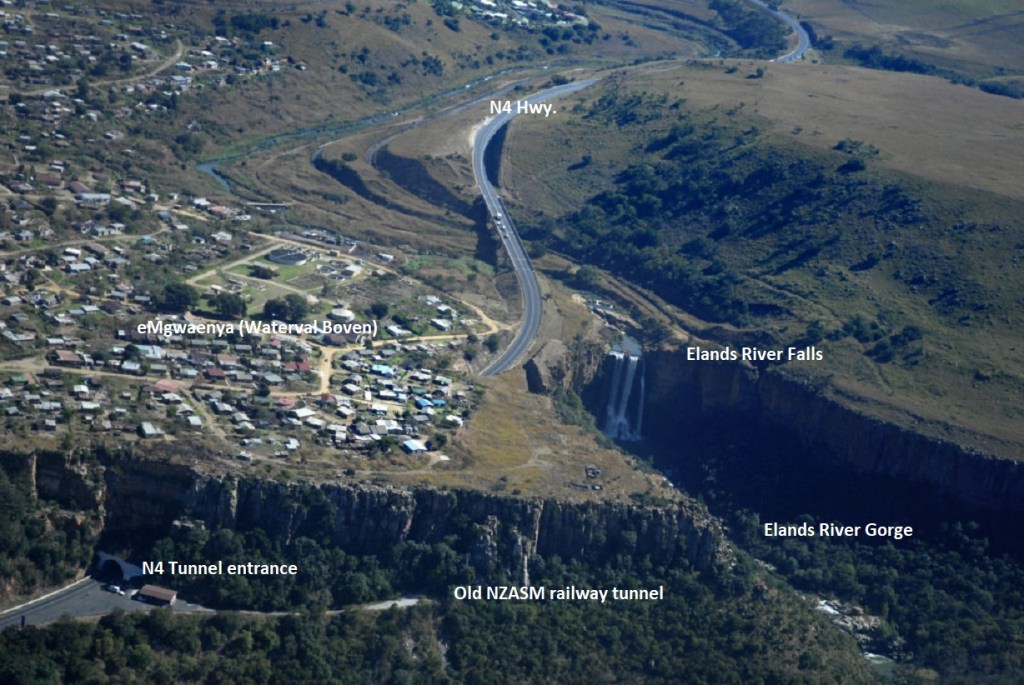
My next site to visit was one of South Africa’s foremost historic railway towns, Waterval Boven. It was established as a rail depot for the Nederlandsche Zuid-Afrikaanshe Spoorwegmaatschappij (NZASM) on the edge of the “Great Eastern Escarpment” in about 1893. The town’s new official name is eMgwenya. The twon is located adjacent to the N$, about 250km from Johannesburg and 110km from Nelspruit, (Mbombela). The impressive Elands waterfall is close to the western end of the old railway tunnel but not easily seen from N4, (pictured below).
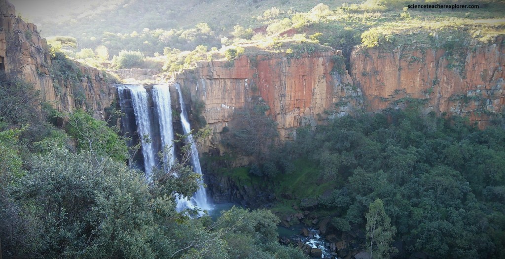
This part of the Great Eastern Escarpment forms a broad zone of strong head-ward erosion, characterized by scarps of deeply incising boulder-filled valleys. Various faults have certainly enhance the progress of the eroding rivers, (e.g. Elands River). The Eland Waterfall marks the position of an important nick in the escarpment, essentially where the Lowveld rapidly changed to Highveld, (pictured above).
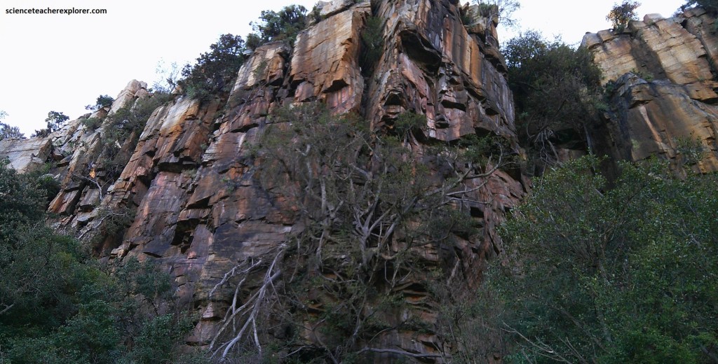
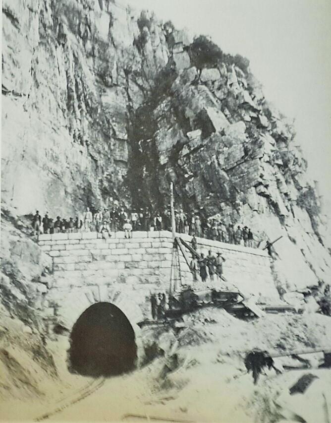
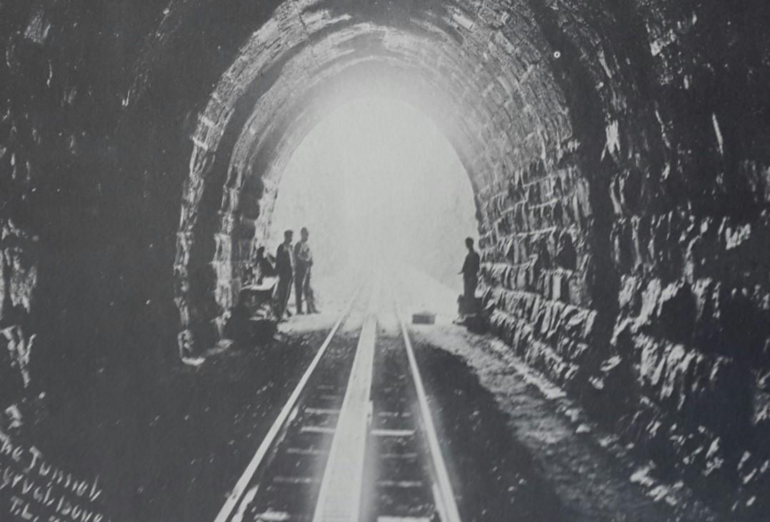
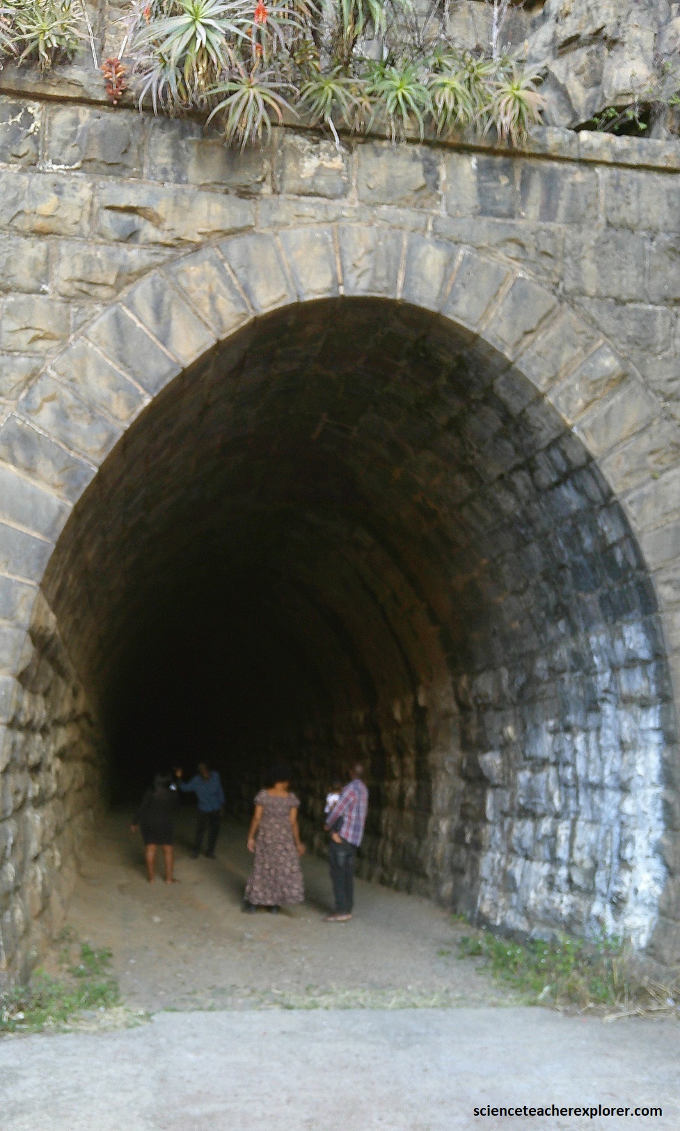
In this Waterval Boven area, the rock succession is dominated by horizontal layers of hard, resistant quartzite and numerous diabase sills, where the softer, shaley layers have eroded away more easily. The Daspoort Formation makes a prominent cliff-forming quartzite and was once a well-sorted sheet sandstone formation deposited and reworked in the shallow Transvaal Sea, (2.65 billion years ago). Eventually the sandstone became hardened quartzite, and an orthogonal system of rock-jointing was strongly developed. [The historical images below were taken from the “Heritage Portal” website. The modern photo was taken to show the dressed stonework entrance at the western end of the 211m NZASM tunnel, which was completed in 1893 and indicated from the historical photos. We entered the tunnel from the other side and walked through it to get here and see the falls]. This tunnel was the NZASM way through the “Great Eastern Escarpment”.
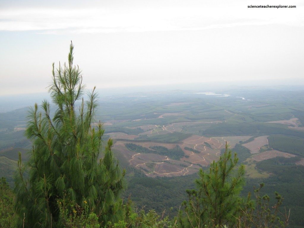
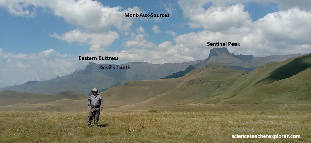
Our next stop exploring the Great Escarpment, was to drive south on R36 & N11 to Ladysmith. Then we drove west from on R616 to Bergville, and then R74 and then southwest to visit the Mont-Aux-Sources, (Royal Natal National Park) and the “Amphitheater”, with its awe-inspiring basalt face above the valley of the Tugela River. Pictured above, this giant rock face of the Great Escarpment is 8km long and has precipitous cliffs rising approximately 1,220 m along its entire length. The bottom of the valley floor, from where my photograph of the mountain structure was taken, is over 1,830m below the highest point of the amphitheater (the summit being over 3,050m above sea level.
The underlying rock structure of the Tugela River area is primarily made up of sandstone, shale, and basaltic lava flows. These rocks have been heavily folded and faulted due to tectonic movements, creating the rugged and mountainous terrain through which the Tugela River flows. Additionally, the area is known for its impressive cliffs and gorges, which have been carved out by the erosive action of the river over millions of years.
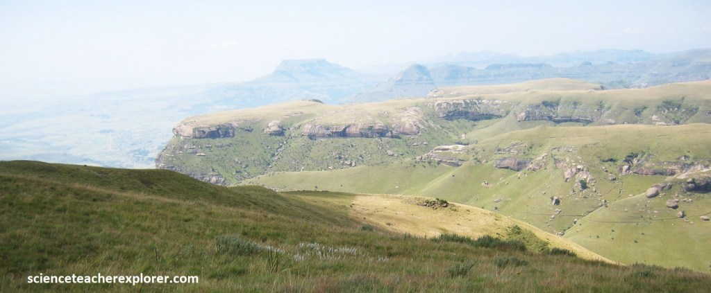
We continued on exploring the Great Eastern Escarpment by returning on R74, (southeast), to the Highmoor road of the Drakensberg Mountain Range. This took us into the Moloti-Drakensberg Park where we could get a view of the Giant’s Castle. The Drakensberg Plateau owed its existence to extensive basaltic lavas laid down at the end of the Karoo period 190 million years ago. Erosion by rivers rising on this wet plateau has resulted in a massive line of cliffs capped by horizontal lava beds. This is best shown in the Giants Castle Reserve; the rolling foothills abruptly change to steep slopes; these become massive cliffs rising over 3,000m into the sky.
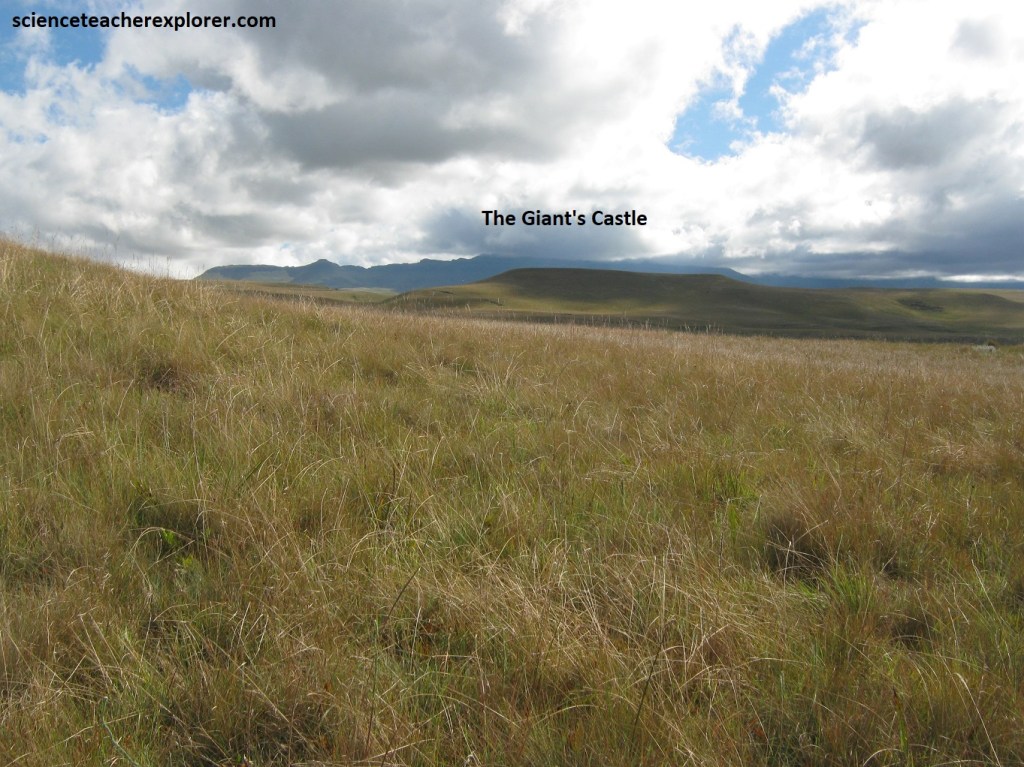
Pictured above, the ‘San’ people believe that dragons lurk there and this gave the Drakensberg its name, (explorers may also see the serrated peaks resembling the back of a dragon). The Zulu name for Giants Castle is “iNtabayikonjwa”, (the mountain at which one must not point). Pointing at the mountain is said to be disrespectful and will result in bad weather, (apparently we met some bad weather the day we were there and was unable to see it) I think it was Mike that pointed at it.
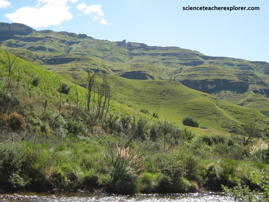
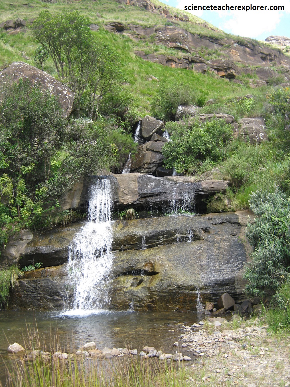
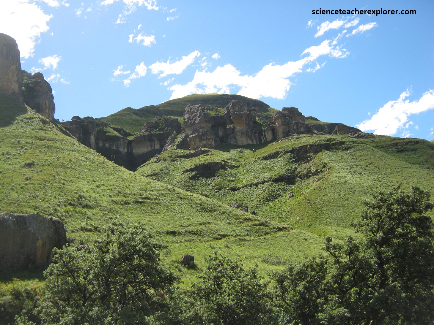
We continued driving south on graveled roads, to the Sani Pass Road in the Mkhomazana River Valley. The Mkhomazona River Valley is a demonstration of aggressive erosion along the escarpment, progressively cutting back ever since the break-up of Gondwana.
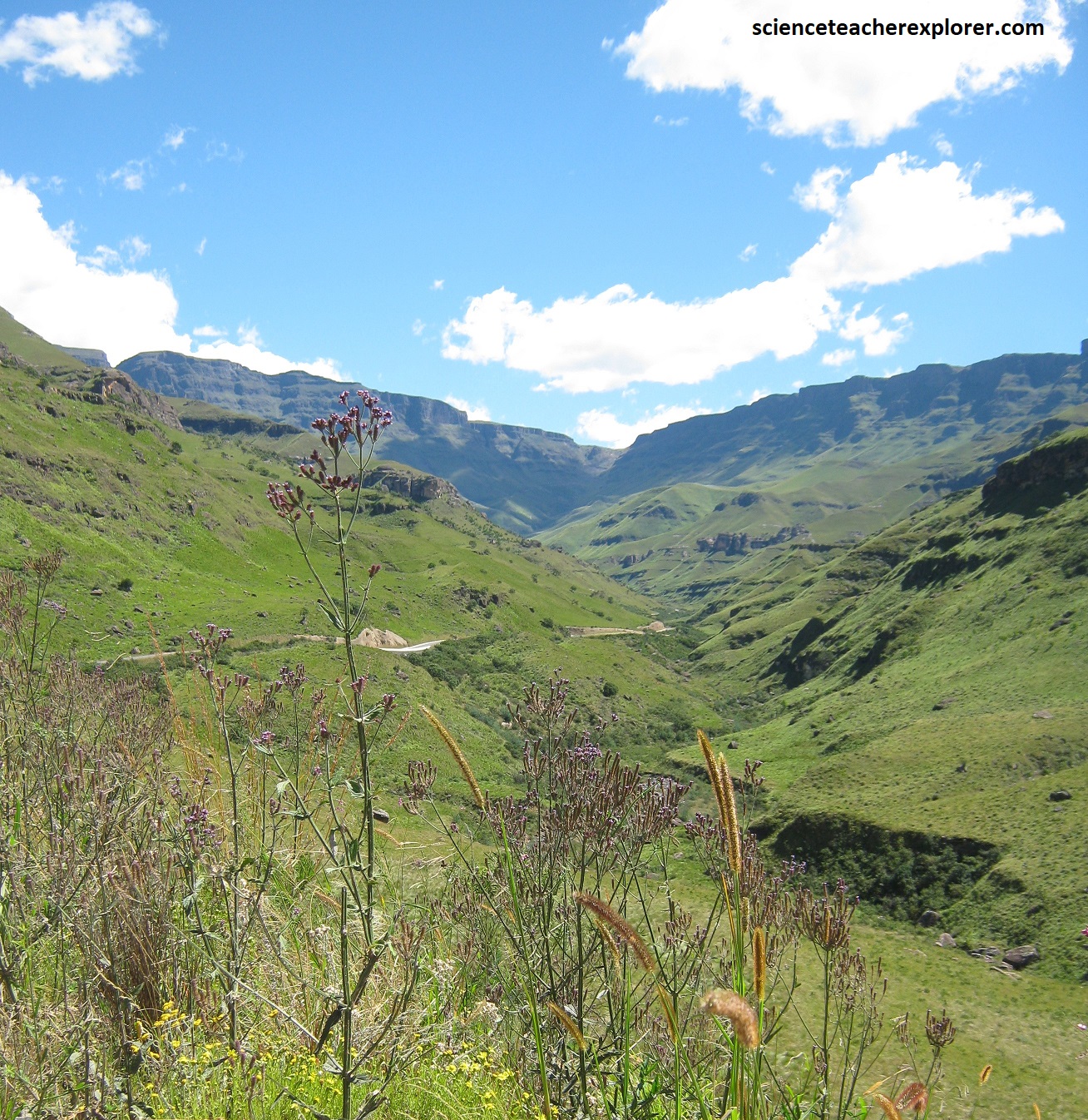
Pictured above, from Himeville the route ascends Sani Pass, the only road into eastern Lesotho from KwaZulu-Natal. Once a footpath used by the San, Sani Pass became a pack mule route in 1931. However, it was not until 1948 that the route was attempted by a vehicle.
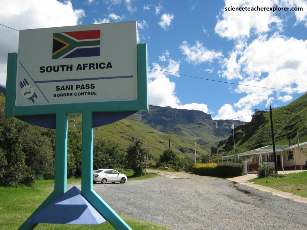
Pictured above, with its summit at 2,874m, Sani Pass is the highest mountain road in Southern Africa. Well-bedded sedimentary rocks, mainly alternating sandstones, siltstones and mudstones of the informal Stormberg Group and upper Beaufort Group, underlie the Clarens sandstone in the incised Mkhomazana River. The Drakensberg lava is approximately 800m-thick basalt sequence consists of countless stacked lava flows, varying from 30 cm-20m in thickness. The lava flows in the upper part are remarkably similar, constituting he so-called Lesotho Formation, but there is a more variable lava zone at the base. The magma formed in southern Gondwana is known as the “Karoo Igneous Province”. This event coincided with the start of the break-up of the Gondwana Supercontinent.
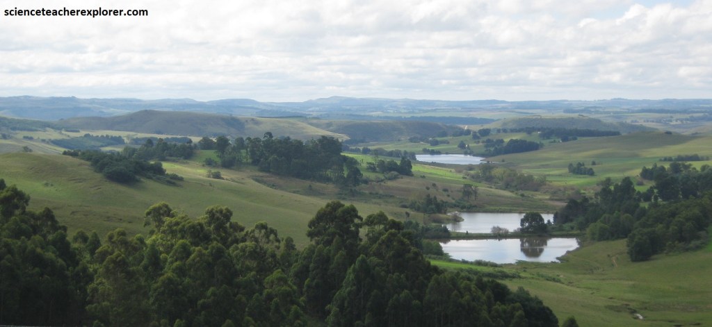
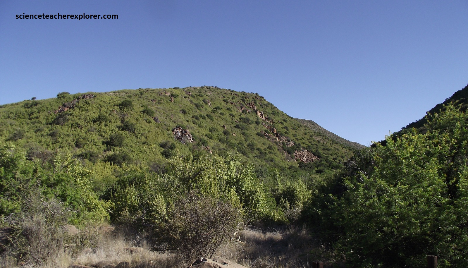
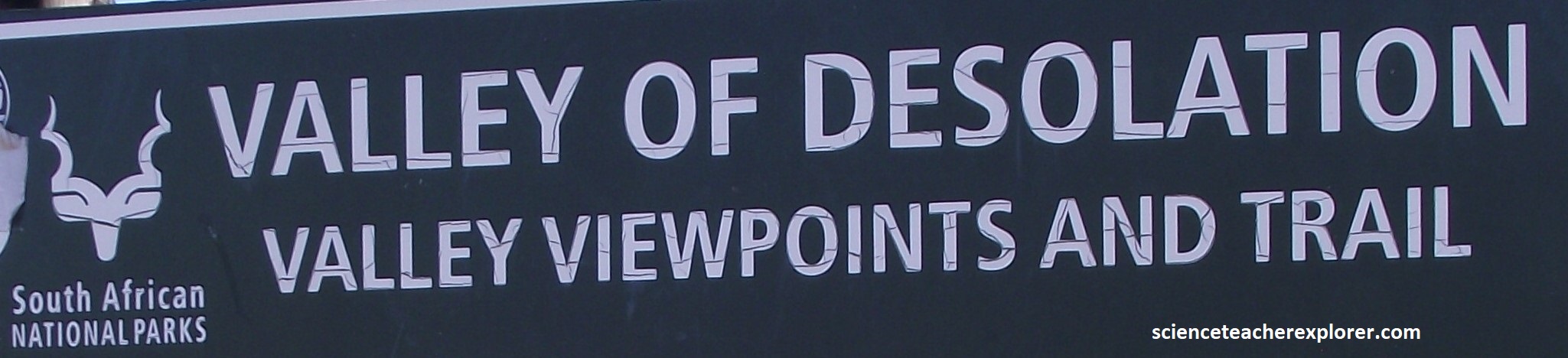
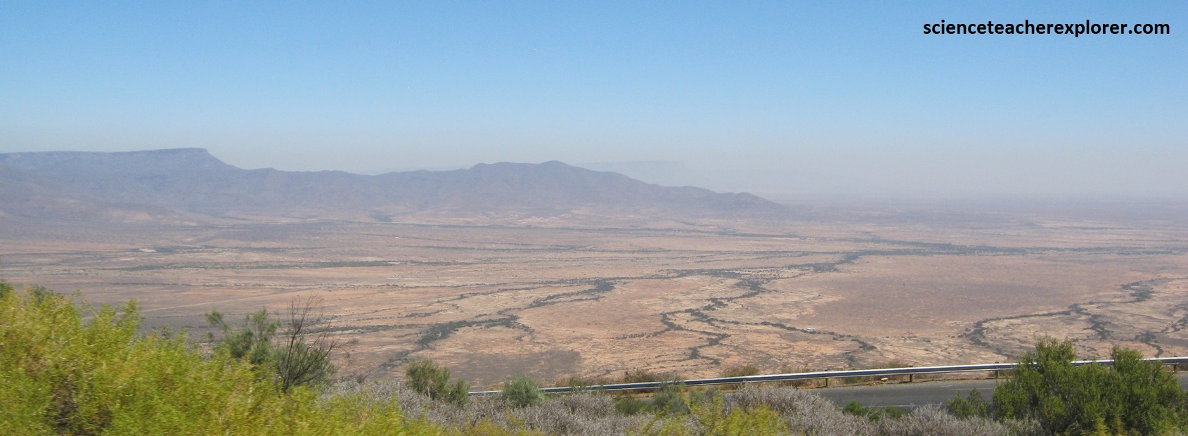
After visiting and exploring the Drakensburg Mountain Range of the Great Eastern Escarpment in 2023, we took a break. From the Drakensburg Mountains, the Great Escarpment continues southwest, until it turns west across South Africa and parallels the coast, (imaged below). Mike and I returned in February of 2024 to explore the southern and eastern portions of the Great Escarpment. Our first destination of that year was the “Valley of Desolation”, near Graaff-Reinet. We approached Graaf-Reinet from Port Elizabeth, South Africa by driving north on R75, through Kleinpoort & Jansenville.
Imaged below, from Graaff-Reinet, Mike and I drove northwest on R63 for 3 km to the entrance of the “Valley of Desolation”. Established in 1786, Graaff-Reinet is the fourth oldest town in South Africa and has more national monuments than any other town in the country. Lining the streets are over 200 historic buildings. Complementing the town’s fine architecture is the magnificent scenery of the 16,500ha Camdeboo National Park, which virtually surrounds the town. The Karoo Nature Reserve was established here in 1979 and expanded in size and proclaimed a National Park in 2005.
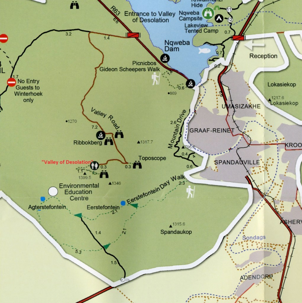
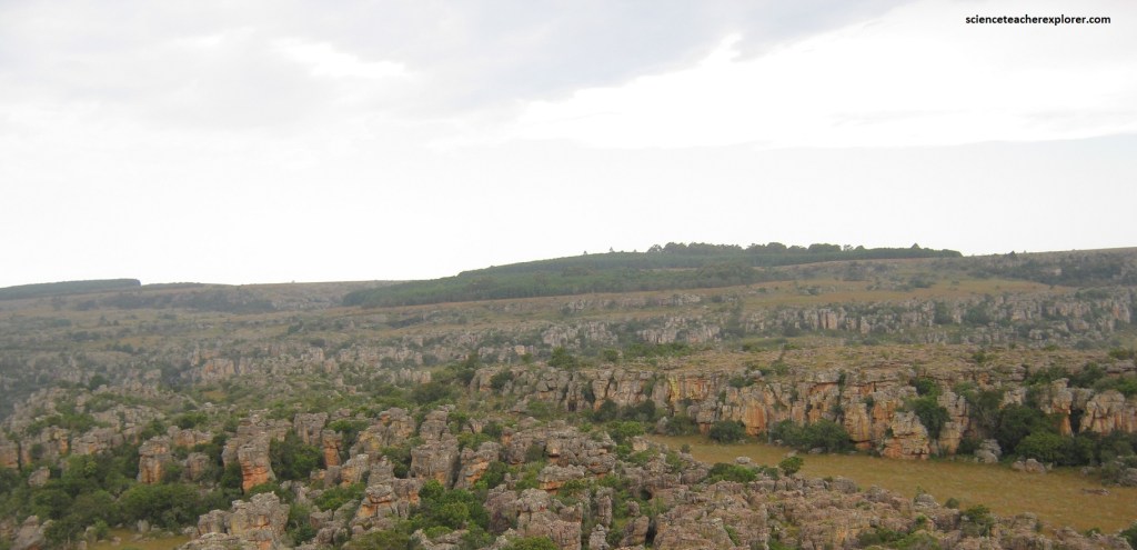
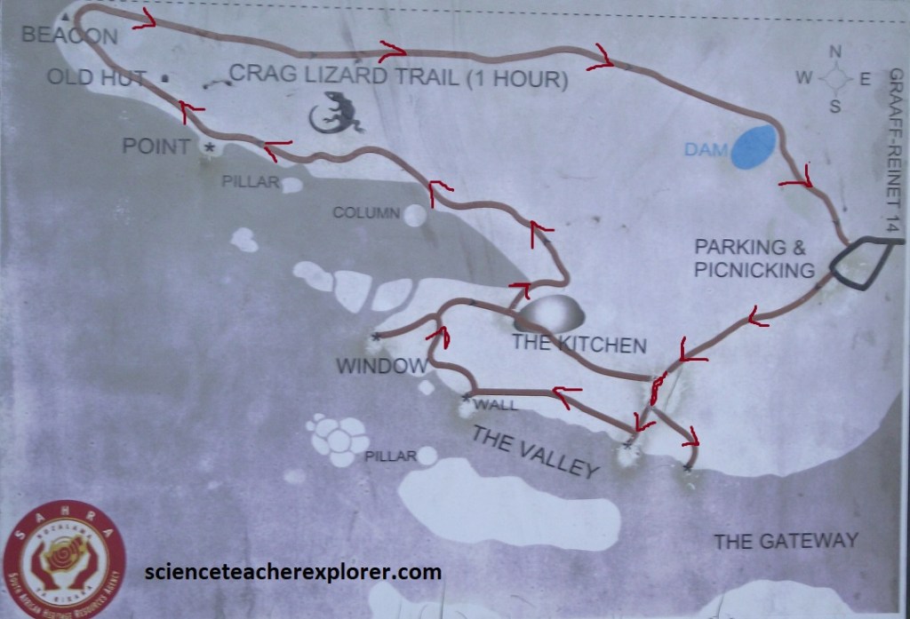
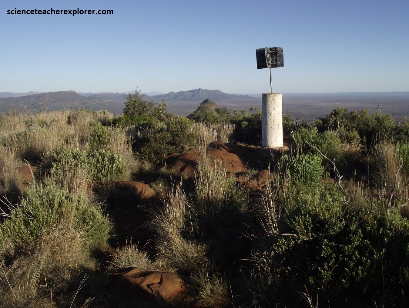
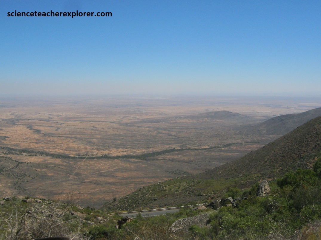
One of the more unusual aspects of the “Valley of Desolation” is that it is accessed from the top of a mountain. Pictured below, are views from the Ribbokberg and the Toposcope of the Sneeuberg Range, Graaf-Reinet and the “Valley of Desolation”.
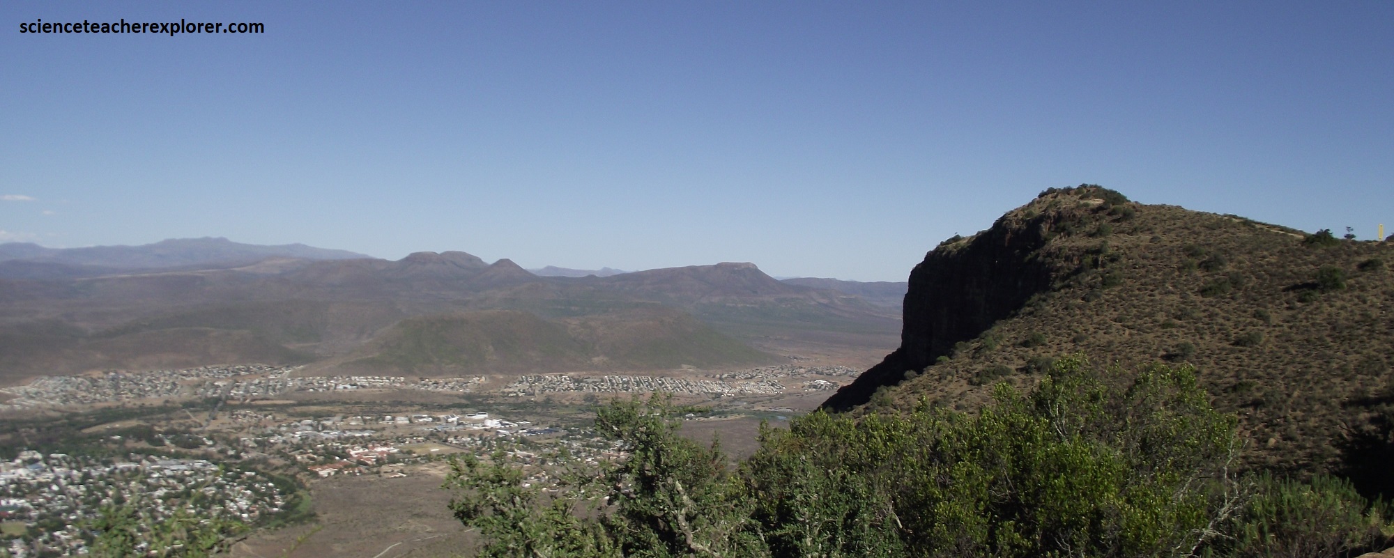
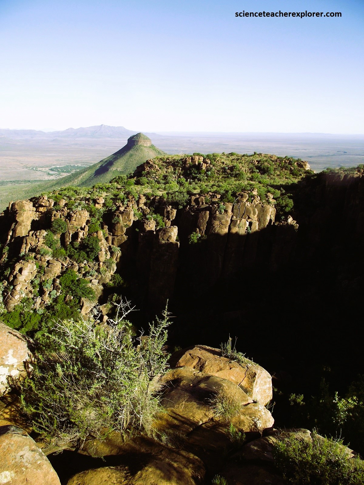
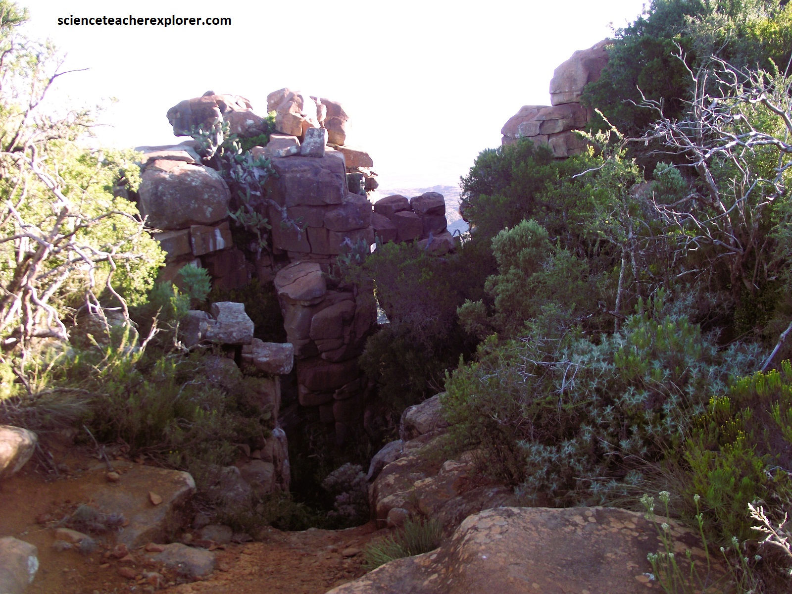
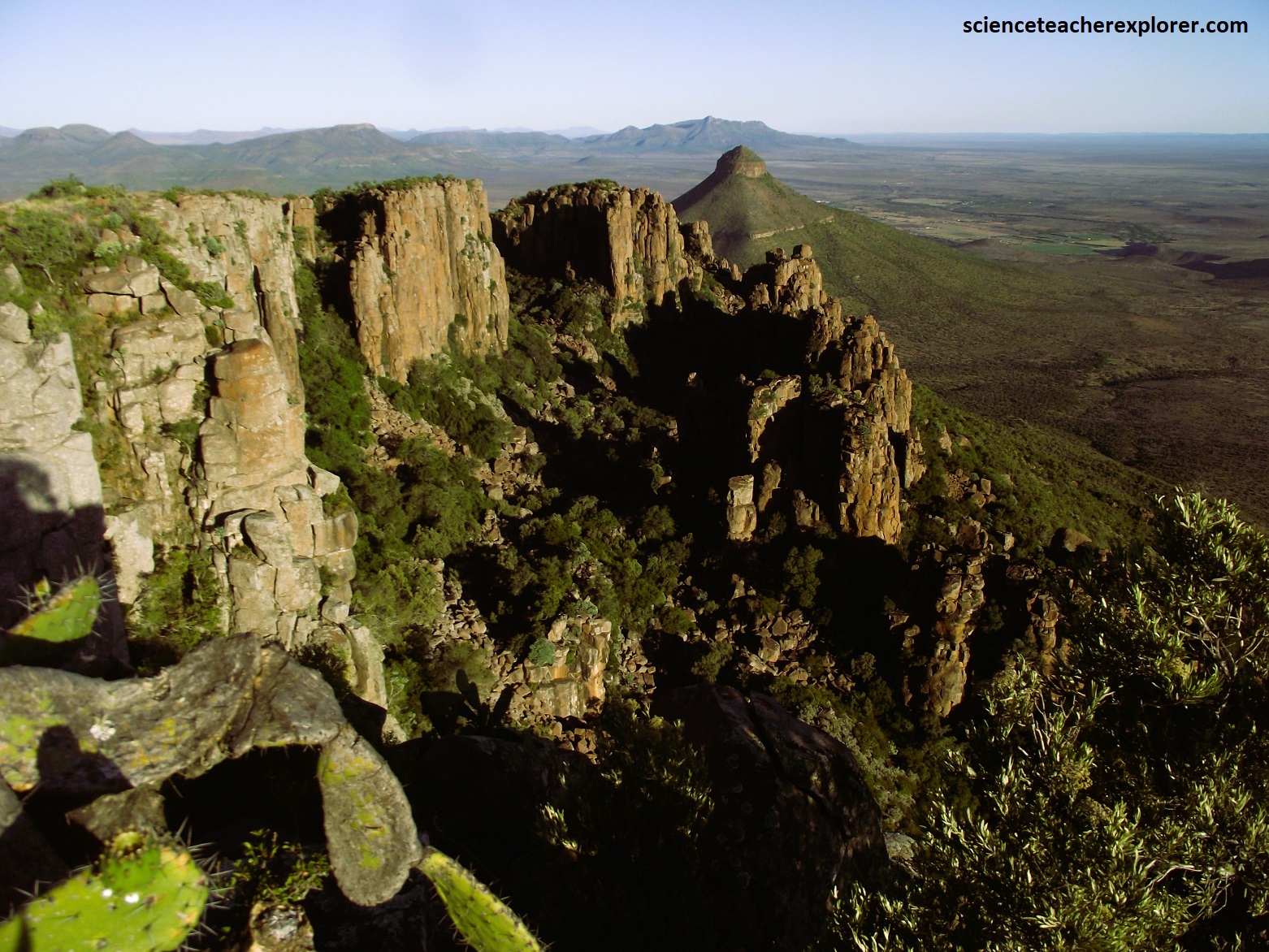
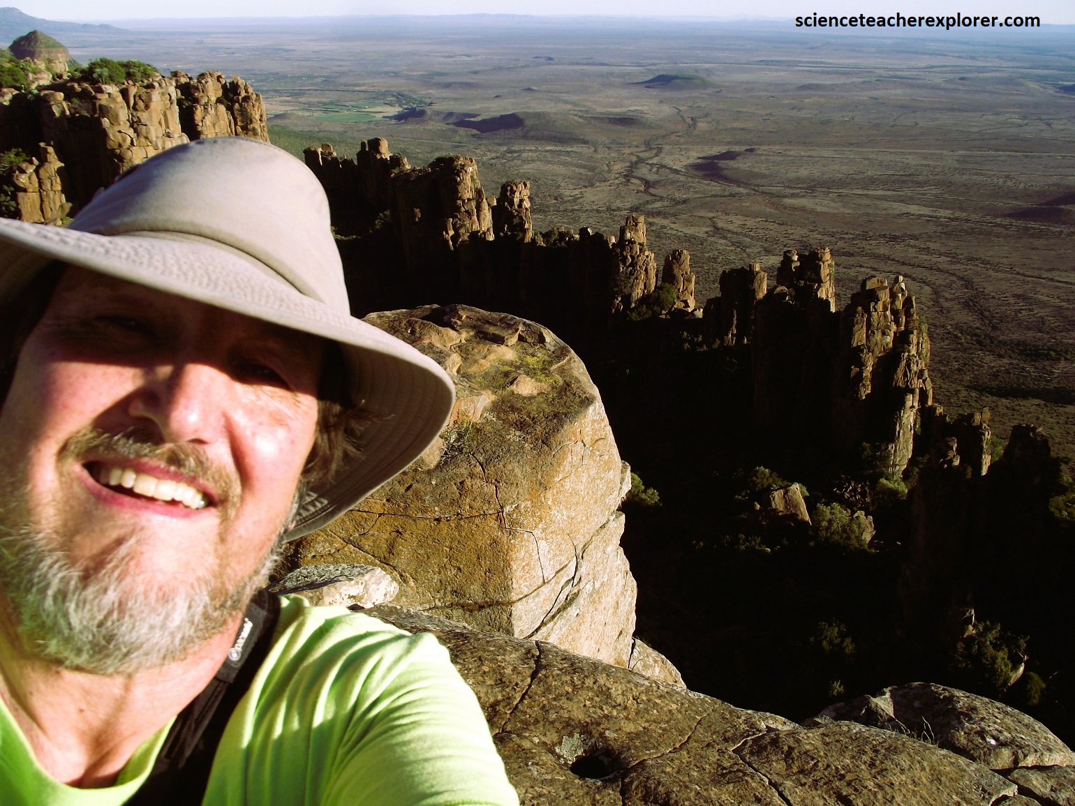
Situated in the Camdeboo National Park (formerly the Karoo Nature Reserve) is the awe-inspiring “Valley of Desolation”, a conglomeration of buttresses and rock-pillars rising up to 120m above the valley floor.
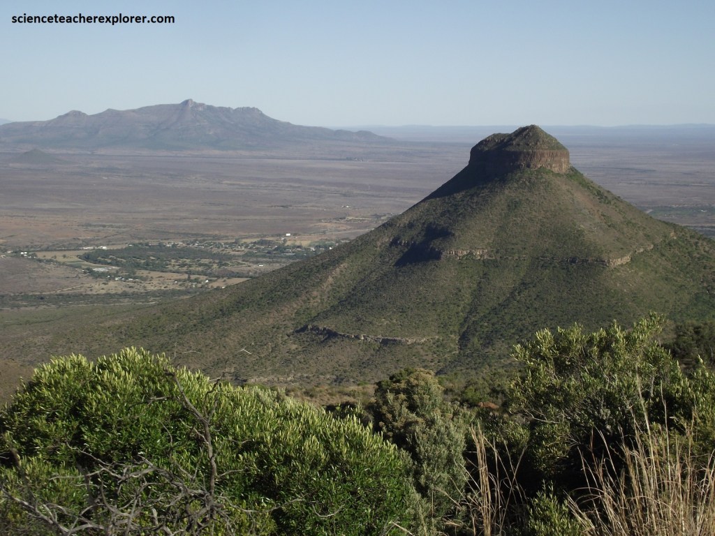
Pictured above, we enjoyed the viewpoints in the vicinity that gave us panoramic vistas of Graaff-Reinet in the horseshoe-bend of the Sunday’s River and the cone-shaped Spandau-kop (3.5km southeast of the Valley of Desolation).
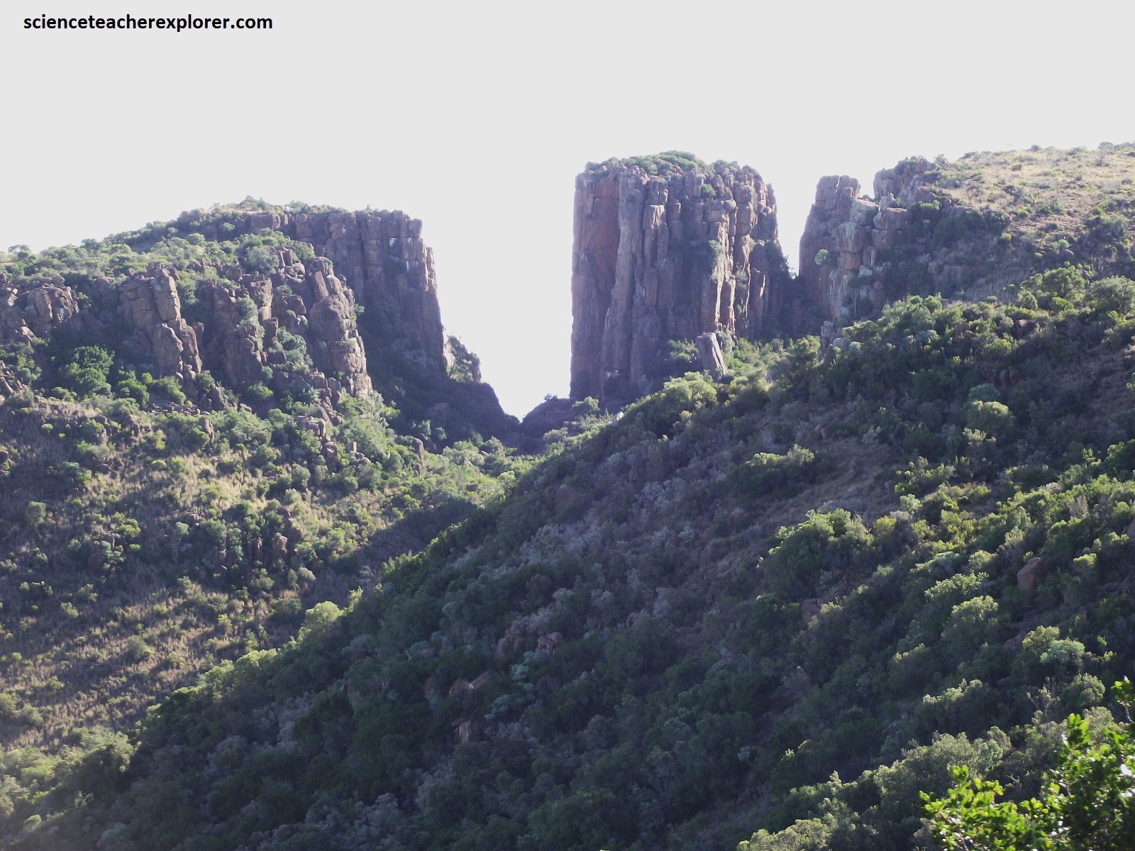
Situated in the Sneeuberg Range (part of the southern Great Escarpment), the “Valley of Desolation” was formed by the erosion of sedimentary rocks millions of years ago. As a result of erosion, the landscape consists of dramatic cliffs and jointed towers of hard dolerite, (igneous) rock which were left standing as the softer sediments crumbled and washed away. That not all the dolerite stood so firm is obvious from the confused jumble of boulders strewn across the valley floor below, (pictured below).
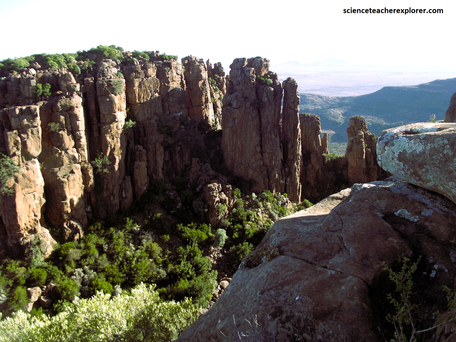

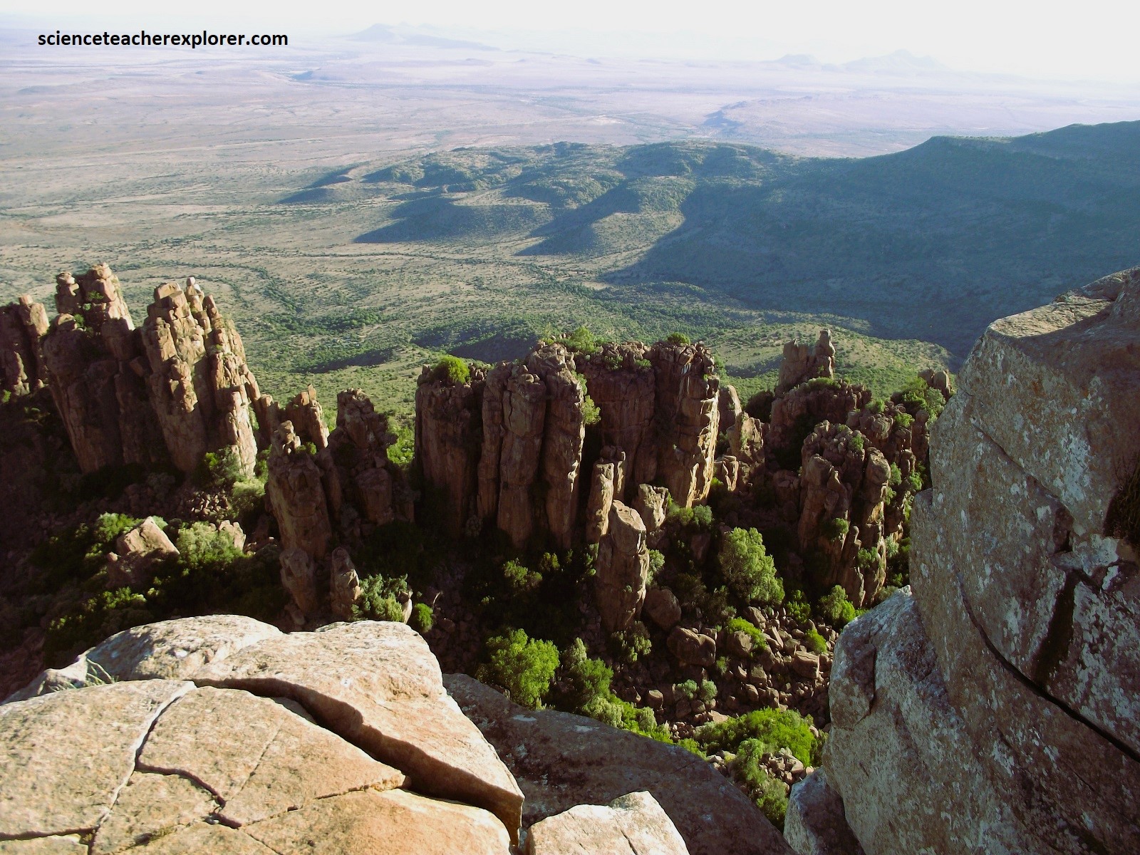
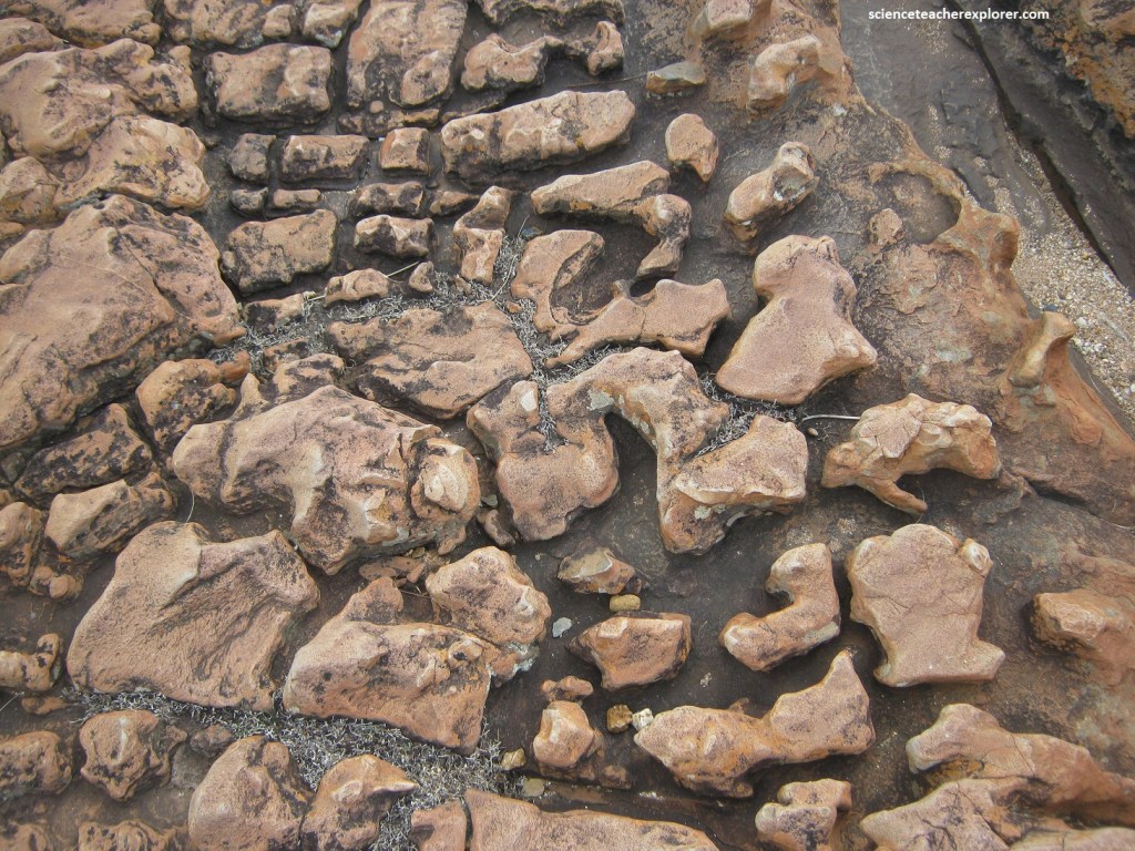
Part of the Karoo Supergroup, the formations here are comprised of flat-lying sedimentary rocks of the Beaufort Group, making them about 250 million years in age. [Was formed by mud that was deposited on the vast alluvial flood plains then]. At a later stage, around 180 million years ago, these horizontally layered sedimentary rocks were intruded by Karoo dolerite magma, which solidified and slowly cooled to form thick and widespread sills, and dikes, (pictured below). Around 183 million years ago, before the break-up of Gondwana, an enormous amount of basaltic magma found its way to the surface where it erupted as the thick pile of Drakensberg Group lavas, and it also intruded these flat-lying Karoo sediments. The impressive southern Great Escarpment formed here, is largely a product of head-ward erosion meeting resistant dolerite sills.
The peculiar column-like walls of the dolerite sill is called ‘columnar jointing’, a feature that is often seen in Karoo sills. After intrusion deep underground, the sill cooled and solidified very slowly; and as it cooled it contracted slightly and developed an internal network of shrinkage cracks or joints. Predominantly vertical, these joints produce large, roughly polygonal to squarish vertical structures, as well as horizontal joints. And of course, this produces the impressive stacked columns and vertical walls of eroded dolerite & Beaufort Group sediments underneath, which are about 35m high, (pictured below from atop of the “Crag Lizard Trail and the Beacon”).
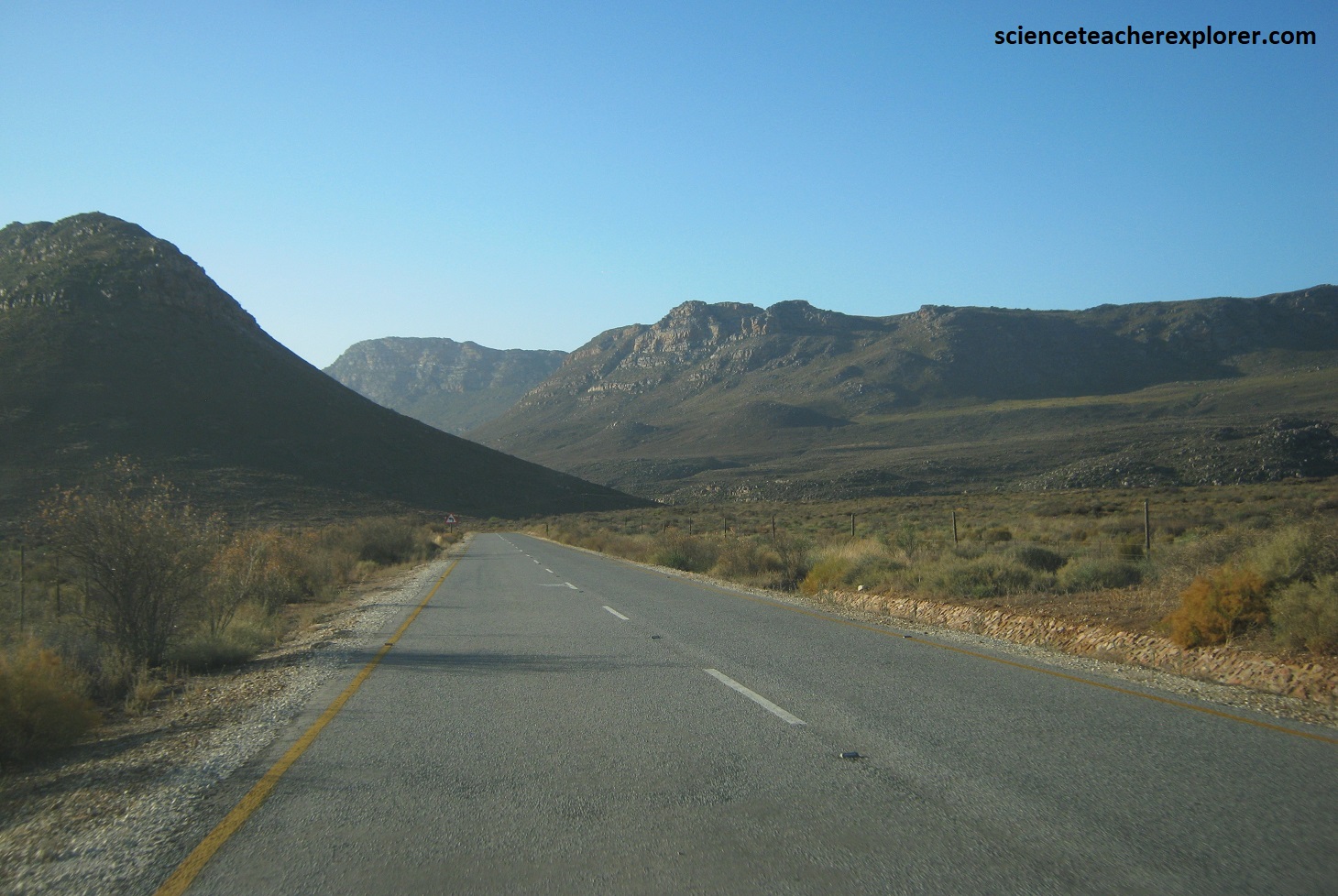
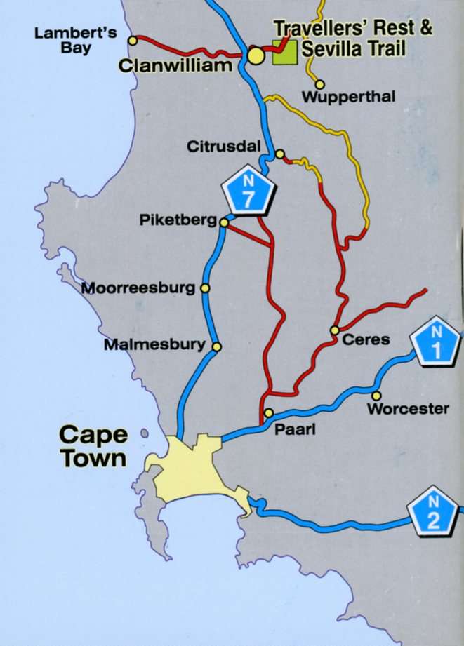
Our next point of interest on the southern portion of the “Great Escarpment” was the northern end of the Cederberg Range. Situated about 230km north of Cape Town on N7, (near Clanwilliam), the Cedarberg Range rivals the Drakensberg as South Africa’s best-known mountain area, (pictured below).
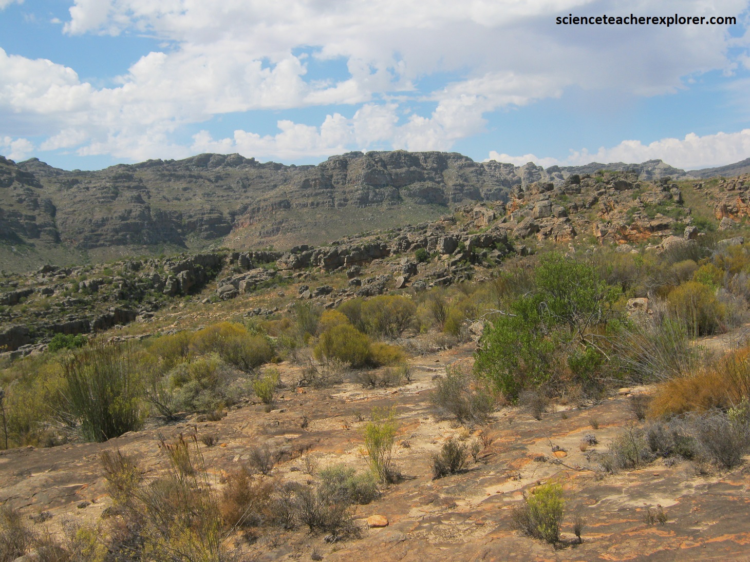
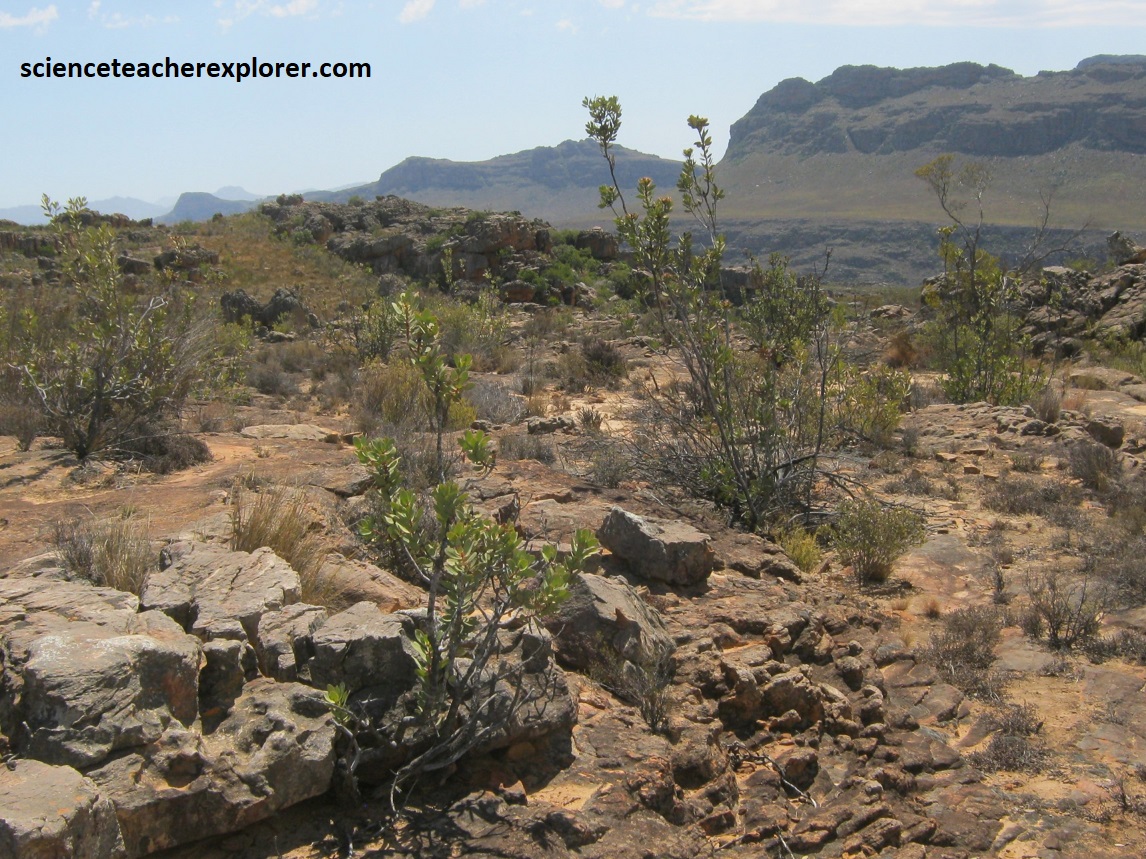
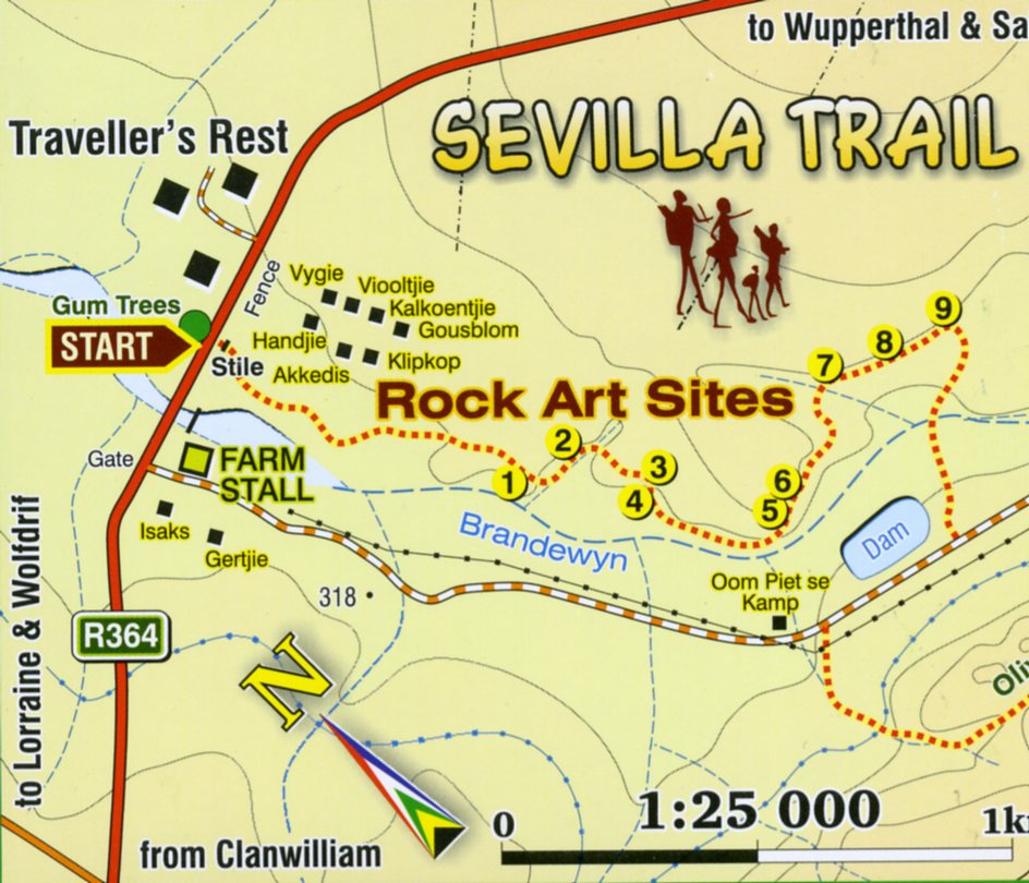
With several peaks around 2,000m in height, the range famous for its climbing and hiking opportunities, as well as a remarkable wealth of rock art, (upward of 2,000 sites contain painting which may be more than 5,000 years old, making it one of the richest areas of rock painting in the world. We decided to focus on the Sevilla Rock Art Trail. {Images below were taken from the free-pamphlet given at the Traveller’s Rest at the trailhead). [The San were directly descended from the first true Homo sapien inhabitants of Southern Africa. Increasing evidence suggest that Homo sapiens arose in Southern Africa, and there is a growing number of scientists who feel that the San were the branch of humanity who “stayed behind” while the rest of our Negroid, Caucasoid or Mongoloid ancestors migrated away and colonized the Earth. Small and finely built, they evolved a gatherer-hunter existence which co-existed in close harmony with the natural environment. Their stunning legacy is these wonderful paintings]..
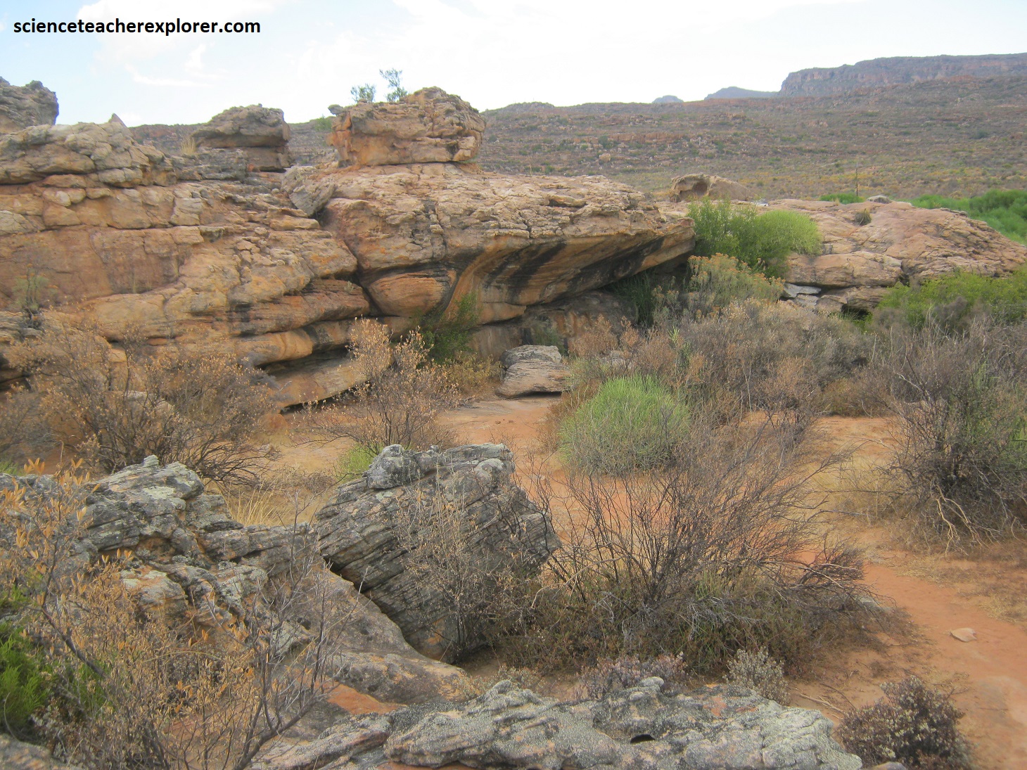
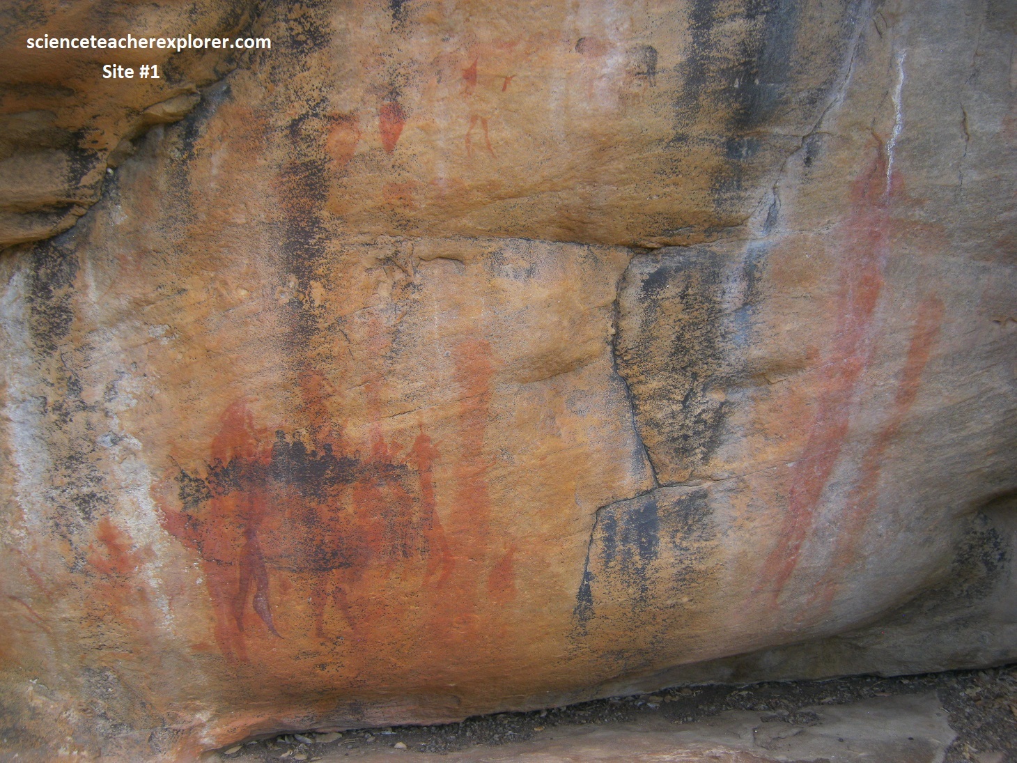
Picture below is Site #1: This very exposed face is notable for its very large, faded red “hook-head” human figures with faint outlines of animals. Over these has been painted a strange large group of people which has been colored black by lichen growing on the paint. There appears to be some relationship between this image and the extraordinary group below. The ‘meaning’ of these groups are unclear.
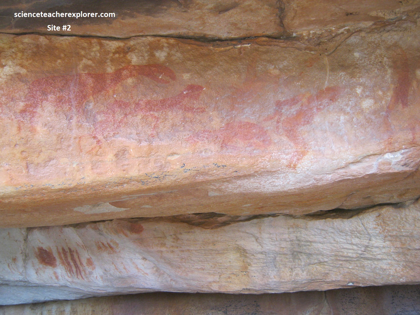
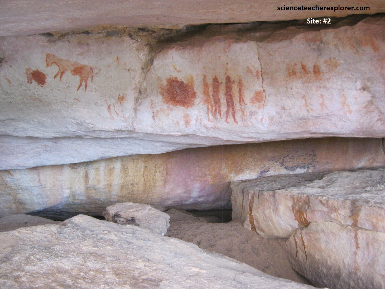
Pictured below is Site #2: This site might be characterized as the “Cave of the Monsters” as it contains variety of fantastical figures. The chameleon/mantis/giraffe/dinosaurian figures below on the left, adorn the entrance. There seems to be more faded “monsters” to the left, right and below the main three. The subject matter of the paintings and the uninhabitable nature of this site may indicate that it was a “shaman” site. Below on the right, the “hook-headed” dancers are clapping hands. Some of the smaller figures appear to be children at play. Additionally, the zebra-like creature is almost certainly a representation of the extinct quagga, (from the detailed coloring).
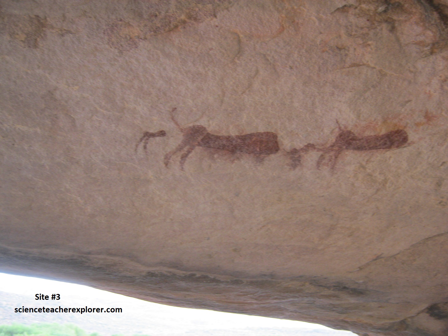
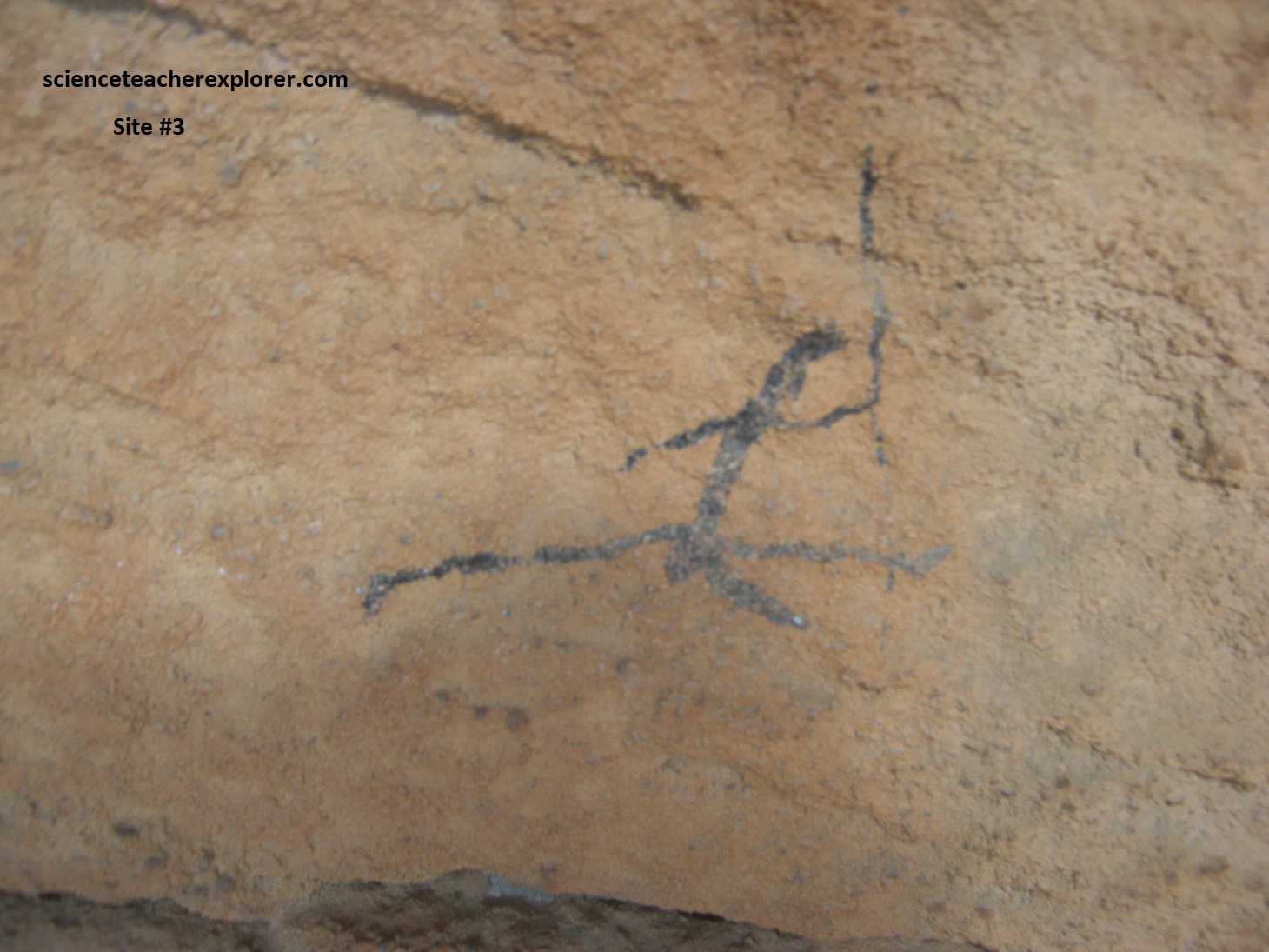
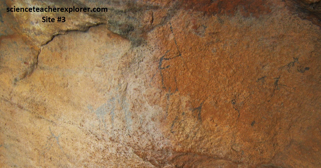
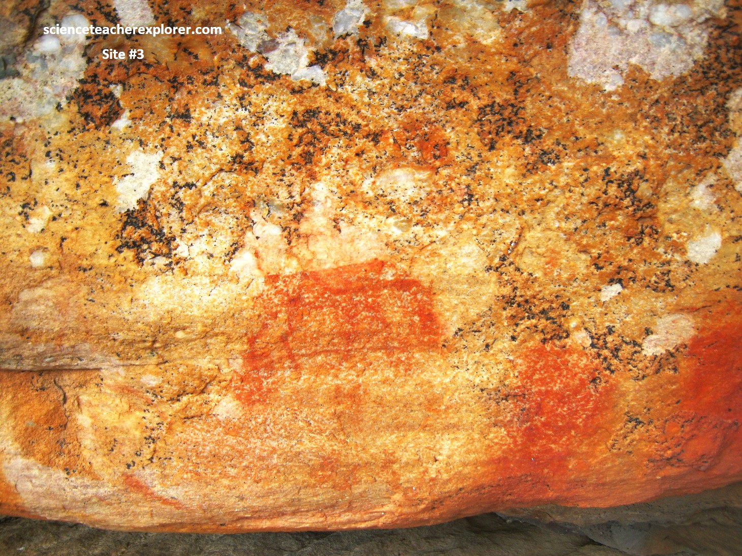
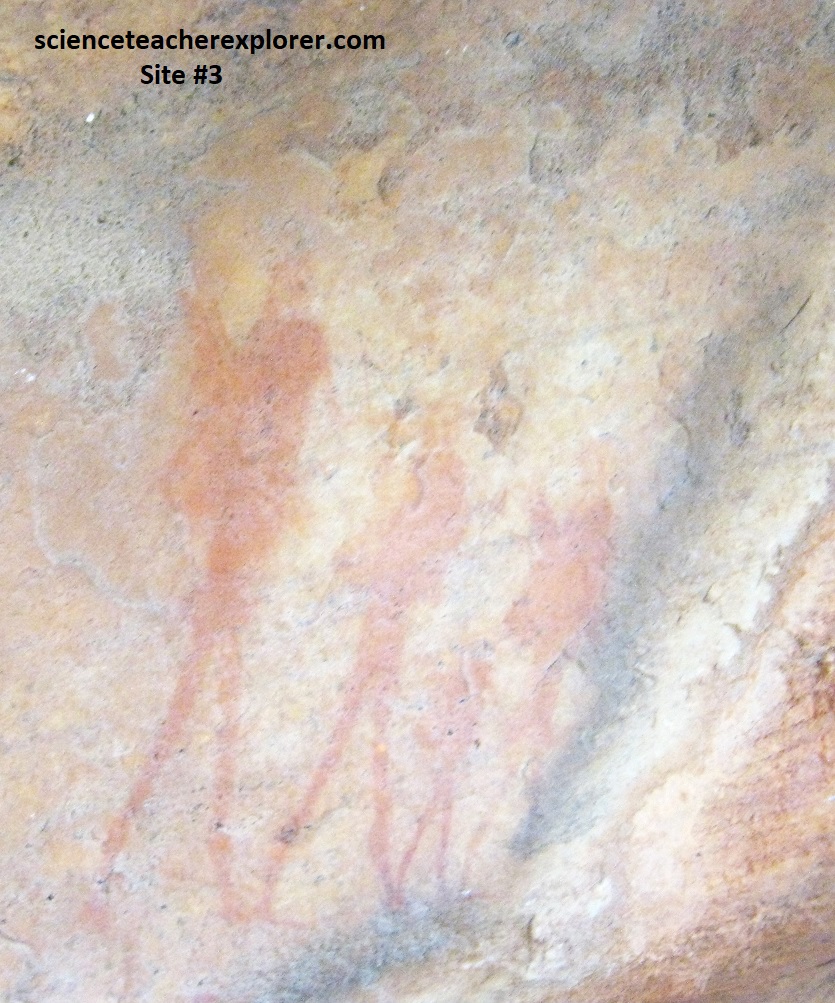
Pictured below is Site #3: We had to lie on our back to see the incomplete animal shapes w/human legs, below & on the right. On the rocks round-about are many other small painting of varying clarity, most notably a group of stick-like figures painted black. The paint seems to come from a tar-like substance created dassie-dung, (hyraxes). Pictured along the bottom-left, is zebra or quagga, which seems common along this trail. On the bottom-right, is a delightful “family group” portrayed, as well as the two small manikins leaping amongst large, faded figures.
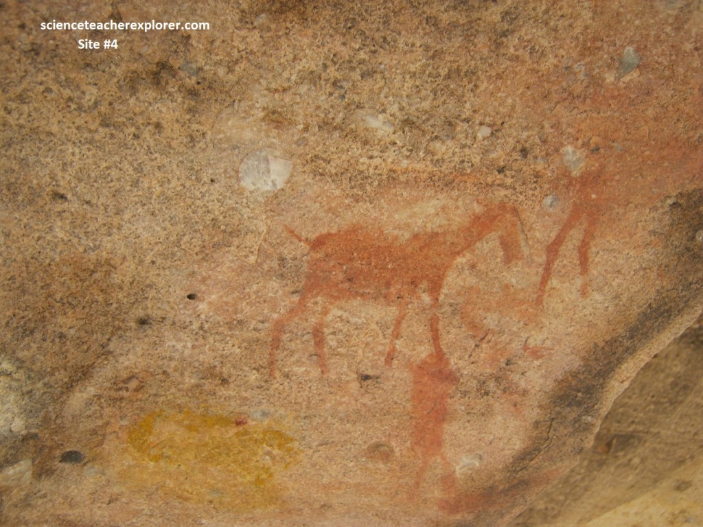
Pictured below is from site #4: This shallow overhang was just below Site#3 and was mainly notable for its collection of equine figures, almost certainly zebra or quagga. This suggests that these animals were once common in this area, or had special significance to the people living here.
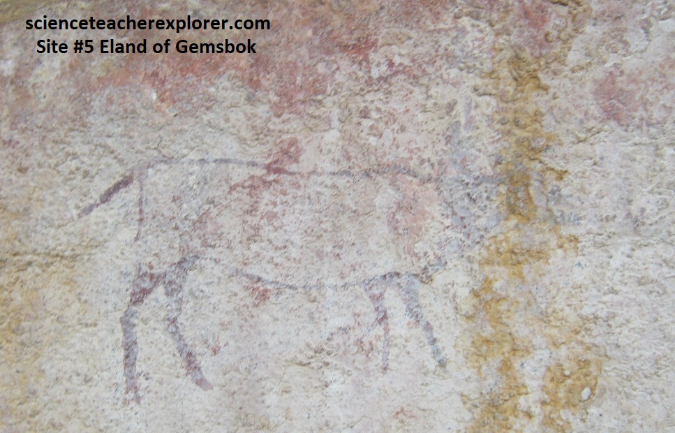
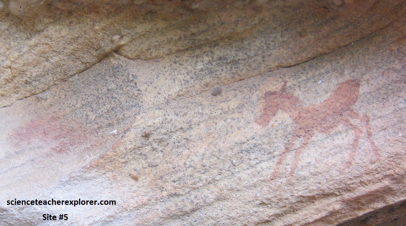
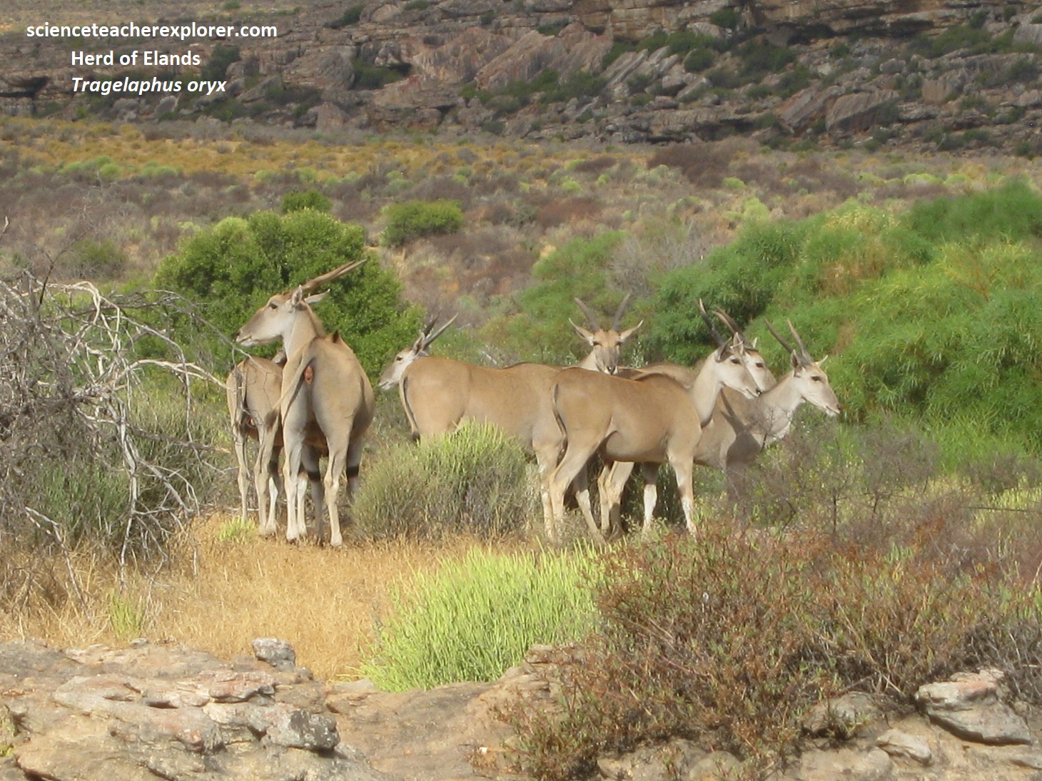
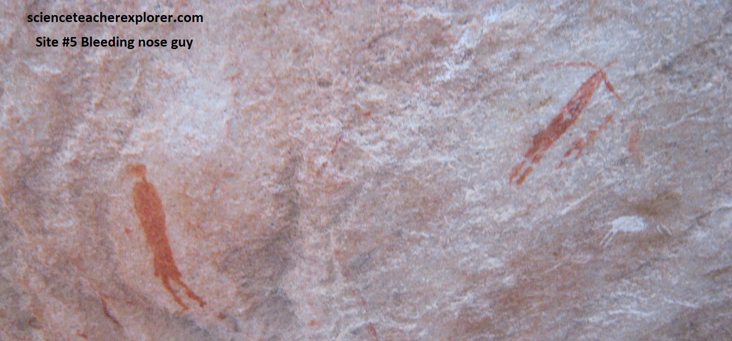
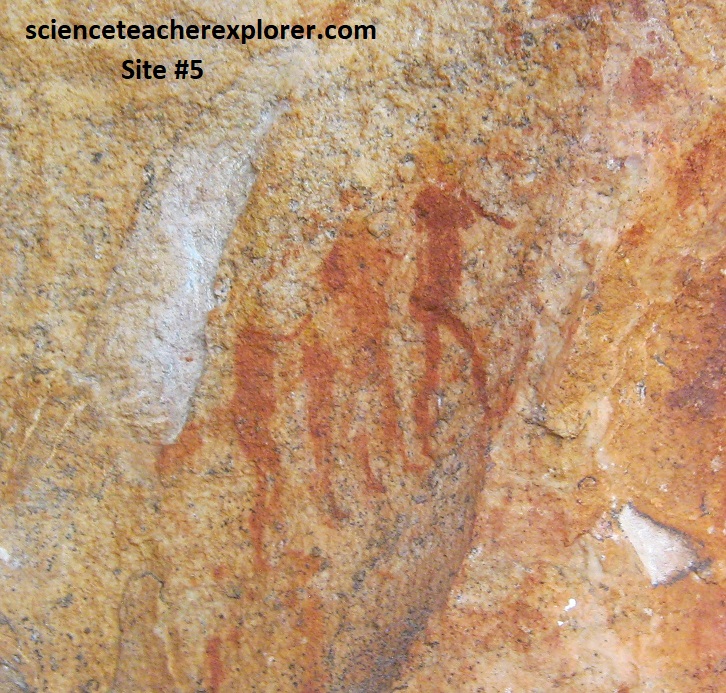
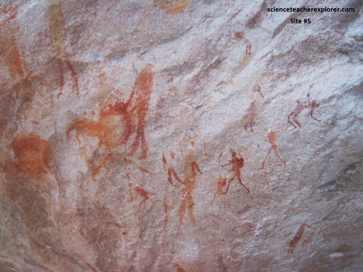
Pictured below is of Site #5: This site was in a long, shallow overhang, distinguished by an enormous and ancient Wild olive tree which stands in front of the “cave”. The overhang was filled with a great variety of paintings, some exceptionally clear and others very faded. Pictured below-left is a rather faint Gemsbok or Eland. Ironically, there was a herd of Elands standing in-front of the cave, (picture below right). Above that is a faded picture of a new-born zebra or quagga foal, struggling to stand on unsteady legs. [Actually, there were many faded bichrome drawings of eland at this site]. Pictured below-middle is an illustrated human figure with a bleeding nose, (a typical ‘trance’ figure). Pictured below-bottom-left, is a delightful line of women and girls who seem to be marching up a hollow in the rock. Pictured below-bottom-right, is an exceptionally clear and delightfully executed archer, shown with bowstring drawn back. Note that the archer’s bow is the arc of a perfect circle, centered on the archer’s left shoulder. The bowstrings are of equal length; the archer’s hands are perfectly placed on a radius of the circle.
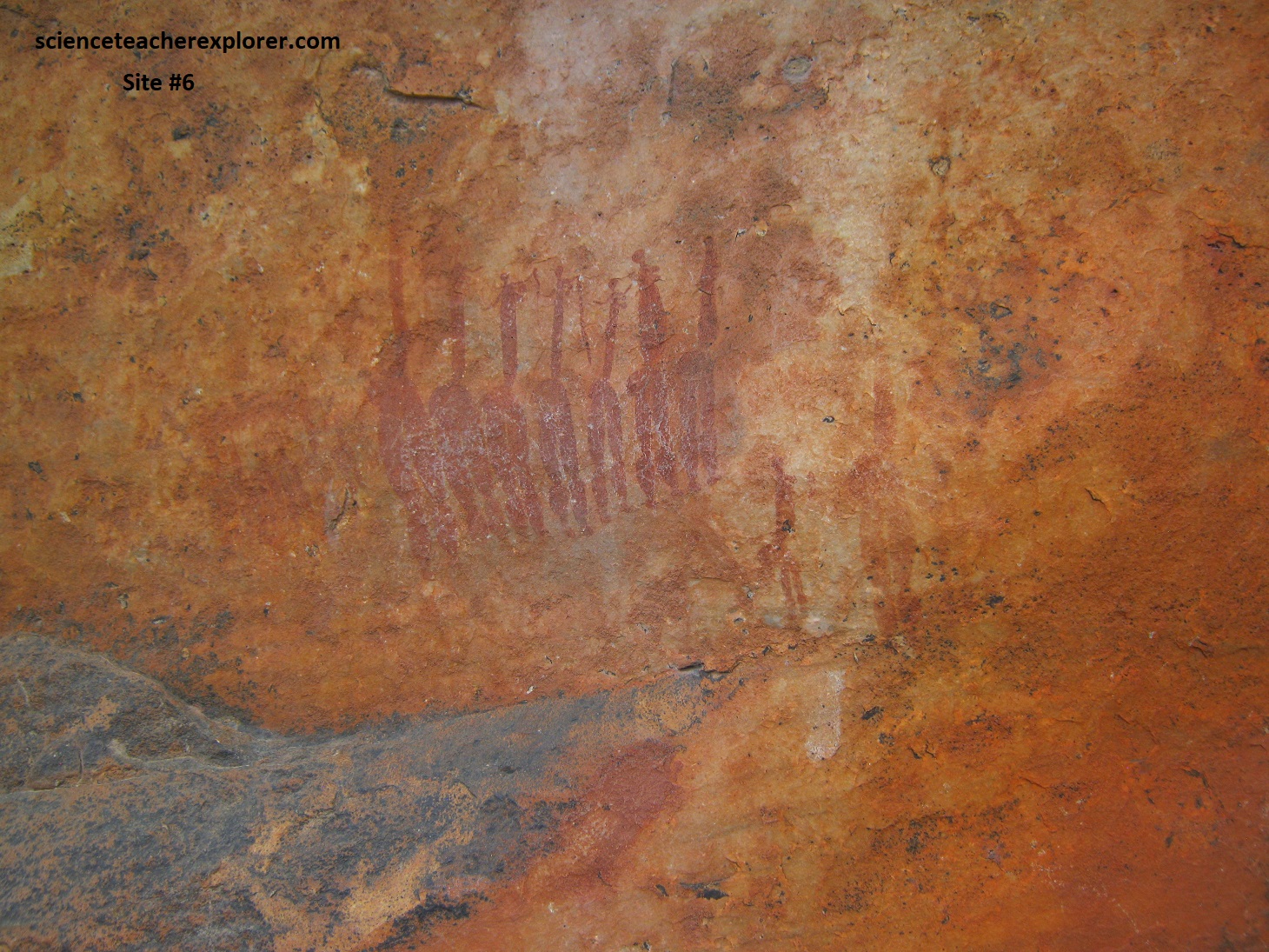
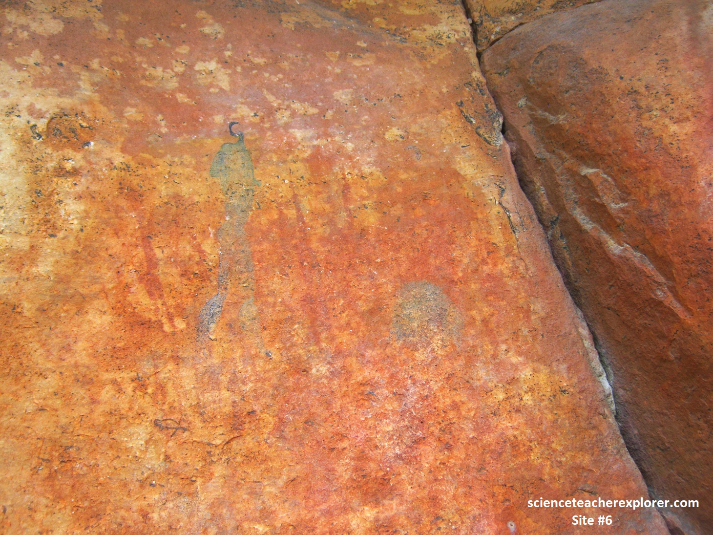
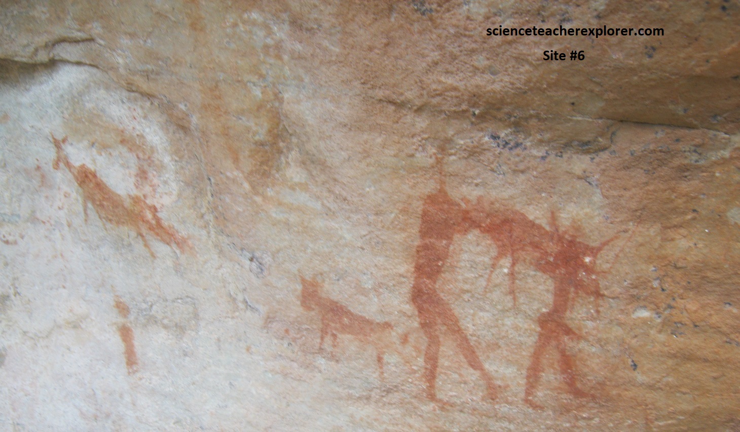
Pictured below is of Site #6: The most interesting drawing is the line of seven dancing women. Pictured below-left, the figures show the characteristic “body type” of the San female. The fat buttocks, allowed the people, especially women, to store fatty reserves of energy. The women in this drawing also sported a variance of breasts. Some of them seem to be carrying diffing sticks. To the right and left, there are more female figures that are very faded. To the right of the dancing ladies, (pictured below-top-right), we could see a weathered surface with many long, faded, red-ochre figures. Superimposed upon these is a large, “hook-head”. The original paint has been overgrown by black lichen. There appears to be a head of a long-vanished painting, but inset over the ‘face’ is a strange pattern of faint geometric lines. Other paintings at this site include a drawing that first appears to show 2 men, (one “hook-head), carrying an animal, (pictured below-lower-right). However, after a careful look at it, we concluded that the 2 men are superimposed upon the animal.
Pictured below is site #7: This was a large overhang that was suitable for habitation. Noticeably, 2 large yellow elephants faced us as we entered the cave. These paintings were exposed and received the full force of the setting sun when we passed. The elephants were about 75cm long. Hidden over the rocks to the left of the elephants revealed 2 large “hook-heads” wearing white karosses and possibly hoods, (pictured below-right). Other figures were not visible nearby.
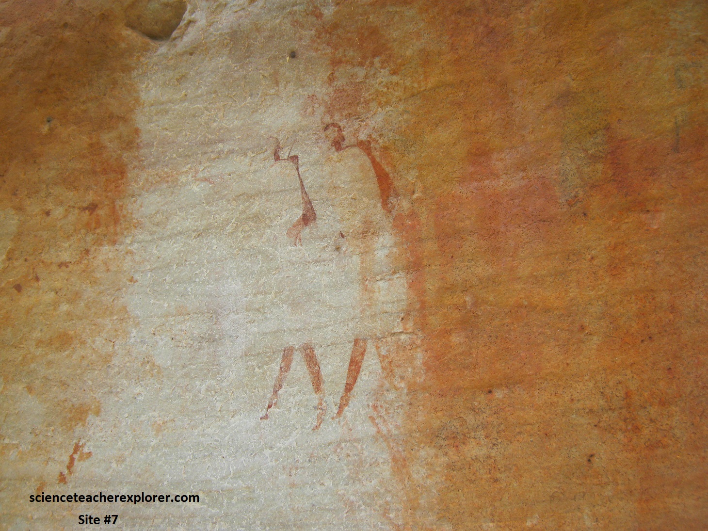
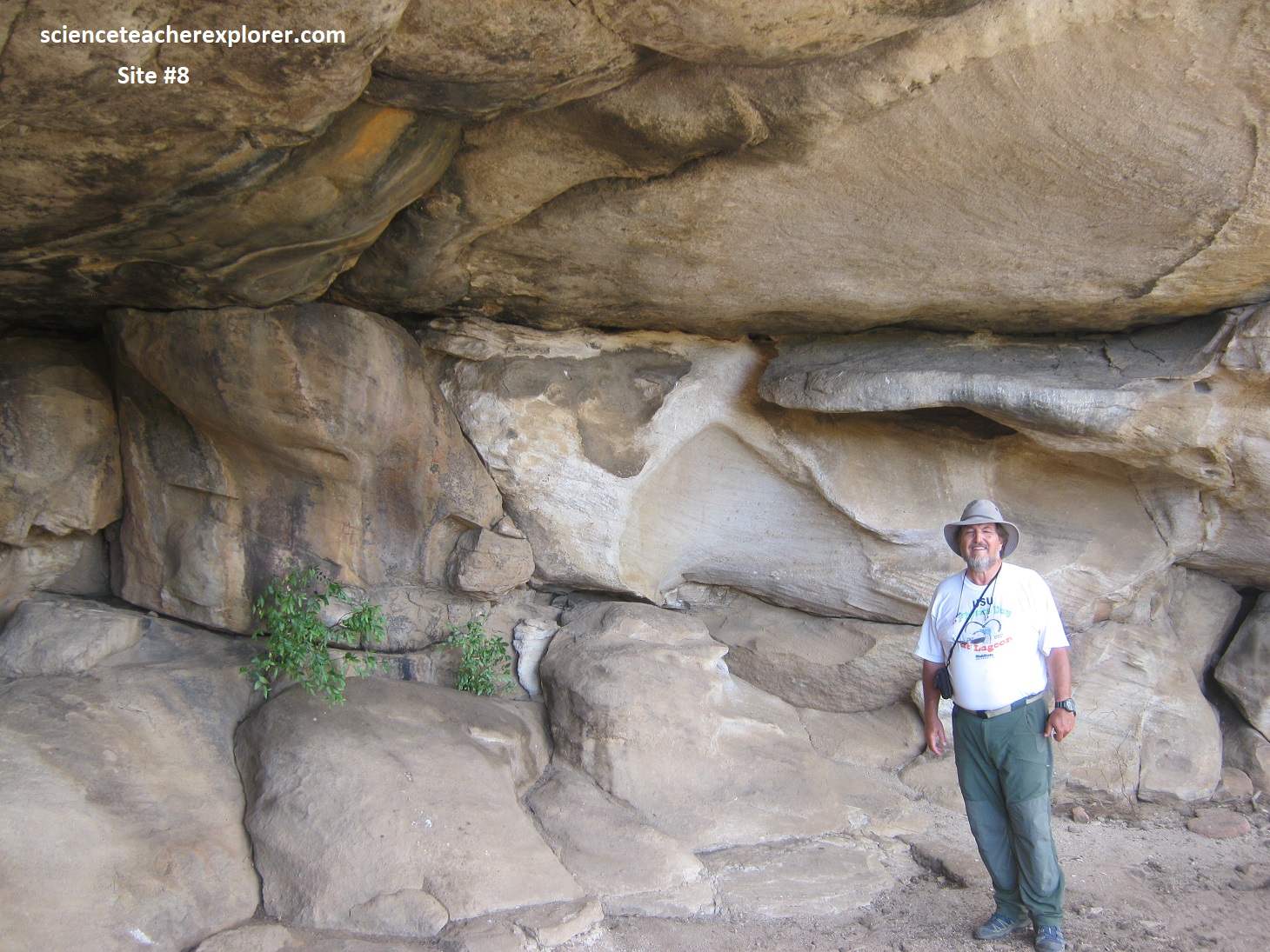
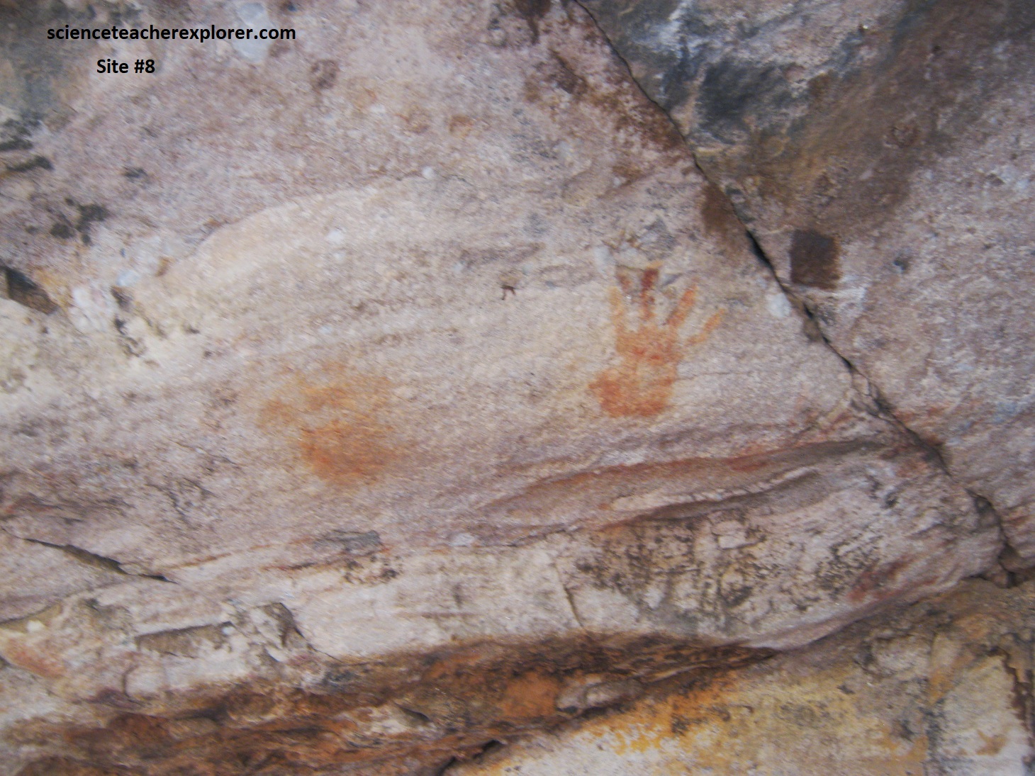
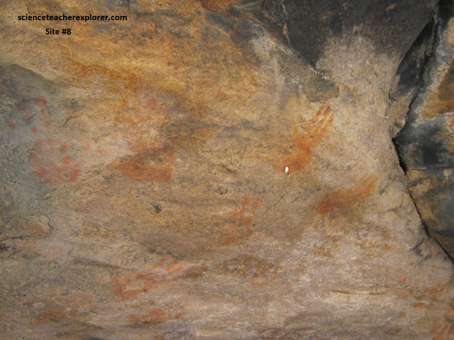
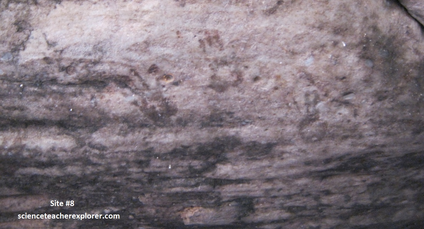
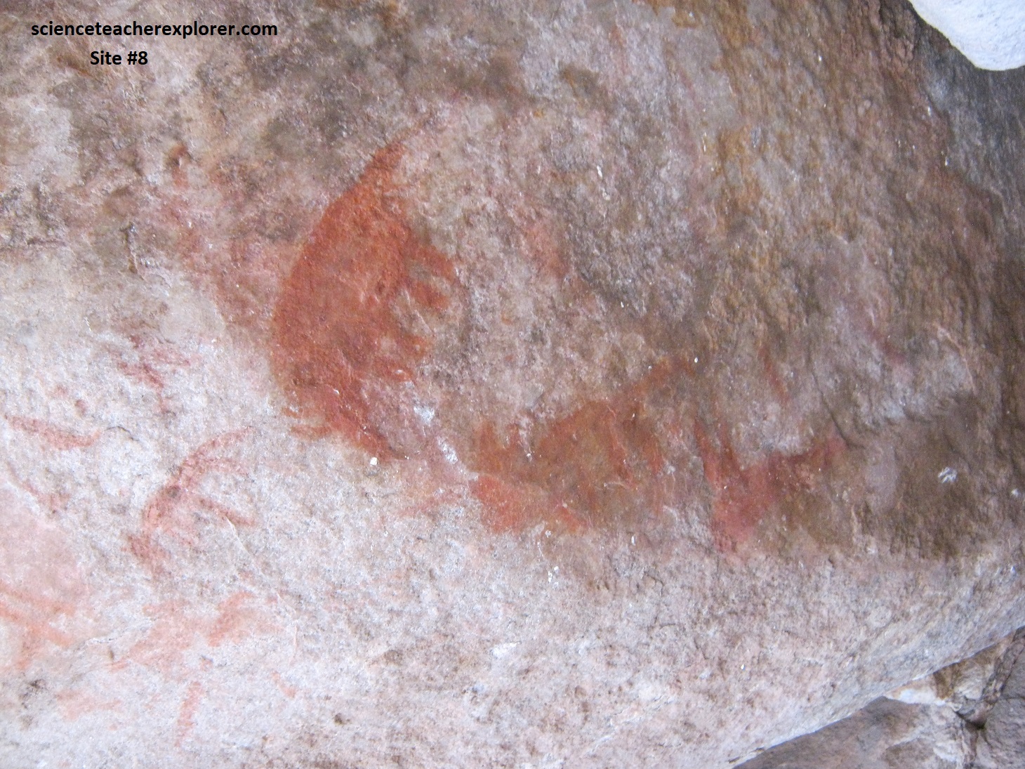
Pictured below is Site #8: This was a cave that was suitable for habitation. Its main feature is the hand-prints it contained. Research tells us that they were probably made by the Khoi, rather than the San. [Sometime beyond about 2,000 years ago, the San’s lonely human occupancy of Southern Africa was challenged from the north west by their herder cousins, the khoi-khoi, and in the east by the herder pastoralists, the Nguni]. To the left, facing the rock, there are hand prints and a remarkable set of tiny prints made by a child, (pictured below & to the right). Pictured on the bottom, below-left, we could see hundreds of faded, blackish hand prints on the ceiling. Pictured below on the bottom-right, is more evidence that the Khoi may have used this shelter: there are three indistinct animals each below the other. The upper-most is the clearest and may represent a cow or an ox.
We continued north on N7 from Clanwilliam to Vanrhynsdorp (81km), and then turned right on R27 to pass through the Vanrhyns Pass of the Great western Escarpment, (pictured below looking south-west from on-top). Nieuwoudtville lies on the edge of the Great Escarpment, (locals call it the Bokkeveld Escarpment). Pictured below, a view from the Vanrhyns Pass that leads down the western Great Escarpment from the Upper Karoo to the arid plains of the Great Karoo. The hills are made of horizontal Beaufort Group shale and lesser layers of harder sandstone, cut in the distance by dolerite (igneous) sills that are part of a major system of Karoo intrusions in the area.
Our trekking destination was the Nieuwoudtville Waterfall on-top of the Great western Escarpment. Some 5 km down the Loeriesfontein road we reached the turnoff to the Nieuwoudtville Falls. After rain the Doorn River plunges into a deep gorge, (100m high). Unfortunately, we were there in March of 2024, at the end of South Africa’s dry season, (pictured below). So, we didn’t expect a waterfall. But there was a nice swimming pool left at the bottom and a great view of the underlying geology. This vast plateau on the interior side of the Great Escarpment is underlain by Karoo strata and dolerite (igneous), and provides iconic ‘Karoo koppie’ scenery. It grades into the Bushmanland Plateau.
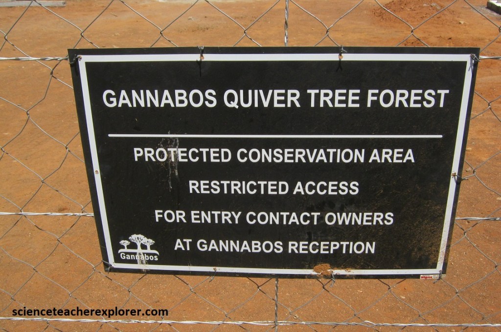
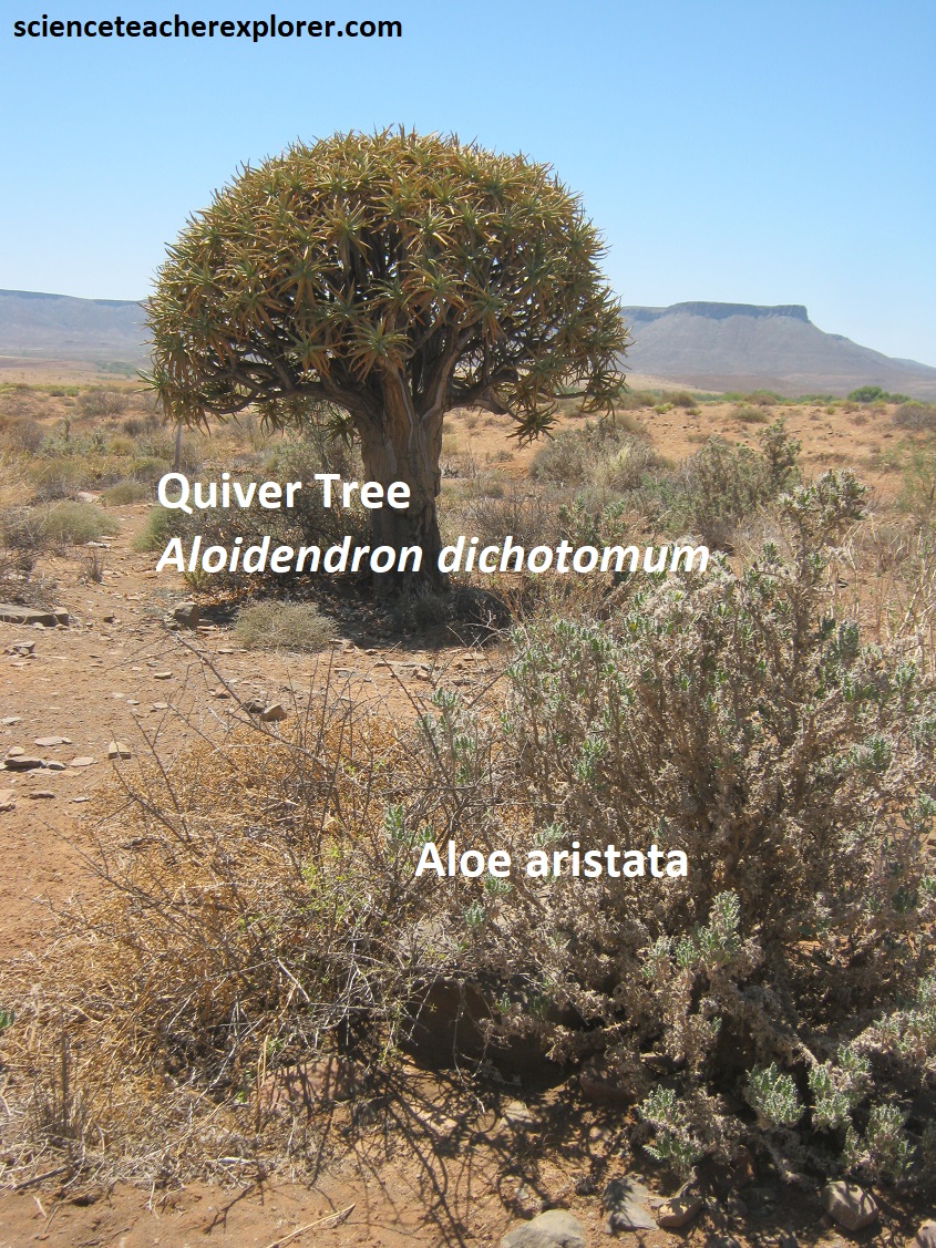
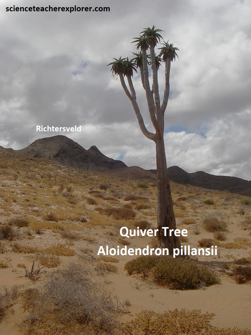
About 25km further we passed an unusually large concentration of quiver trees, known as the “Kokerboomwoud”, (Quiver Tree Forest). Pictured below, the quiver tree forest is situated on Gannabos, a private farm, but luckily the owners, graciously allow visitors onto or close to their property to experience this extraordinary sight.
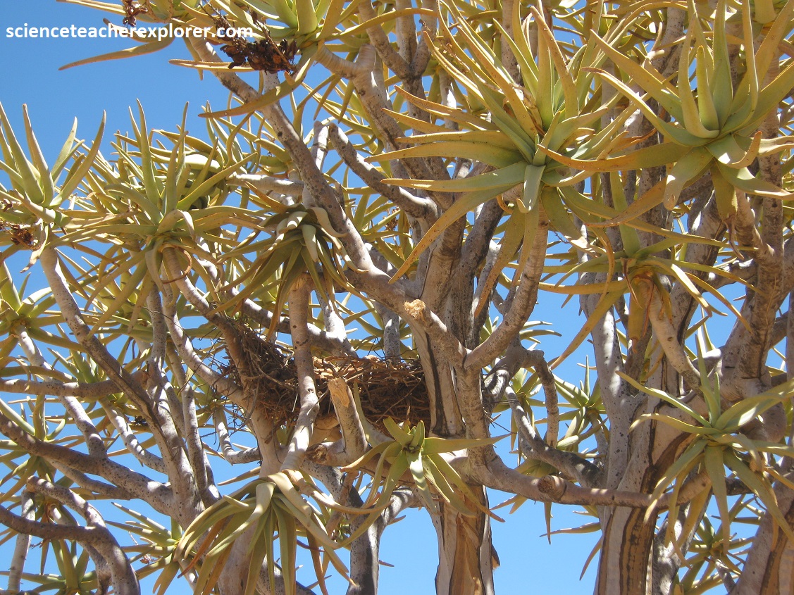
This forest of quiver trees is the largest and southernmost colony for this member of the aloe family. It is also the largest forest of its kind in the world. These trees, which have distinctive smooth branches and scale-like bark, grow to 400 years old and produce vivid yellow flowers in May, June and July, as they have been doing for many thousands of years. The scientific name for the quiver tree is Aloidendron dichotomum formerly known as aloe dichotoma. The term Aloidendron refers to tree-like aloe, and dichotomum relates to their forked branches. The roots of a quiver tree spread widely, reaching up to 1500cm length. They have adapted to various factors such as soil type, sufficient sunlight, and the climate in this region, allowing them to flourish here. However, rain isn’t their best ally, and they can endure challenging weather conditions. It is a remarkable succulent. The Aloidendron dichotomum come in various shapes and sizes, reaching up to 9m in height.
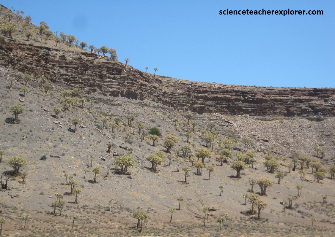
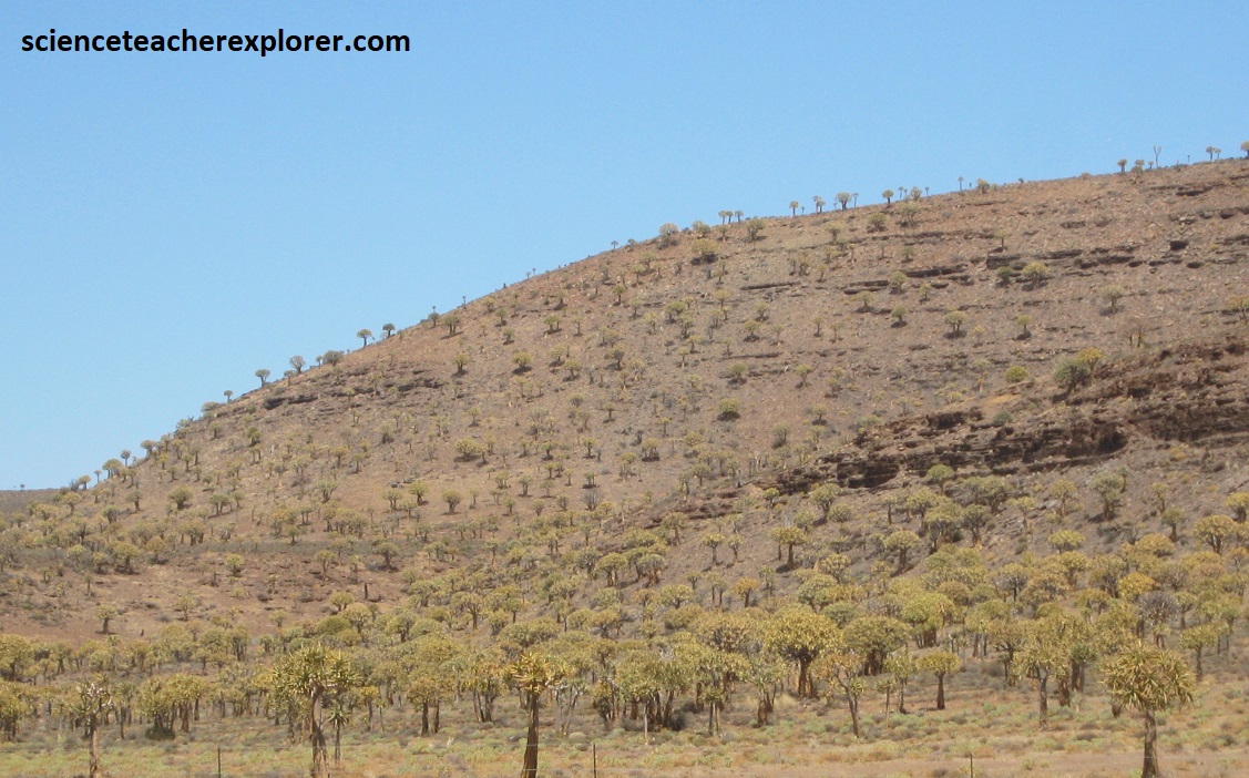
These quiver trees seem to grow among ancient dolerite rock formations, mentioned above. Pictured above, the geology here seems to be part of the Bushveld Basin. This is a relatively lower area largely underlain by the Bushveld Complex and bounded to the north and south by stepped ridges formed by the dolerite sills. Pictured below-left, is part of the exposed surface showing horizontal interlayered beds of sandy siltstone and mudstone. At the time of deposition, the basin was a vast alluvial flood plain crossed by meandering ephemeral rivers and was prone to periodic sediment-laden flooding.
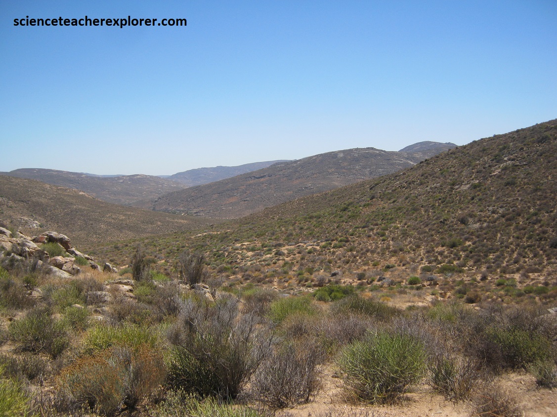
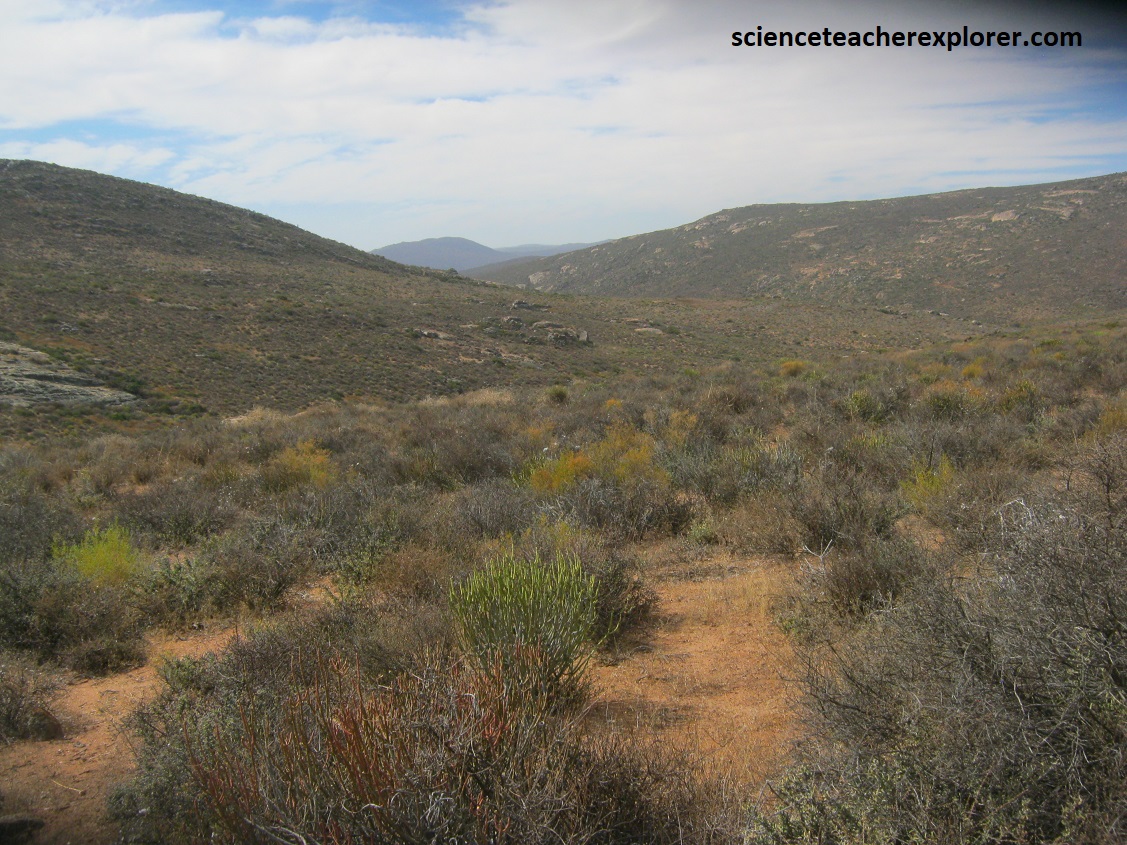
After exploring this region, we returned to Vanrhynsdorp, and drove north 240km on N7 to Namaqualand National Park. Namaqualand is the most northwesterly region of South Africa, (pictured below).
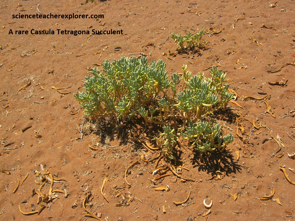
Bounded by the Atlantic Ocean to the west and the Orange River to the north, Namaqualand is a rather arid area. Home to the Nama people, from whom it takes its name, it’s rare succulent plants have provided food for their sheep for the last 2,000 years. The central region sweeps up to granite, (gneissic), peaks but the rainfall rarely cause the rivers to run for any length of time. However, after good winter rains, (September-November) a seeming miracle occurs, as this somewhat uninviting landscape is transformed into a awe-inspiring floral wonderland. Unfortunately, Mike and I were there in March of 2024. However, tourists flock to the area, during the rainy season, to see the huge swathes of veld now splashed with color like a great oriental carpet. The spectacular orange and yellow Namaqualand daisies, which grow where the land has been overgrazed by the local sheep, are the most obvious. However, there are a huge variety of rare species of succulent plants that could be found concealed among the drab bushes.
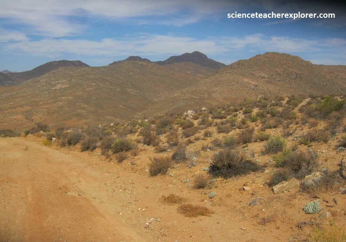
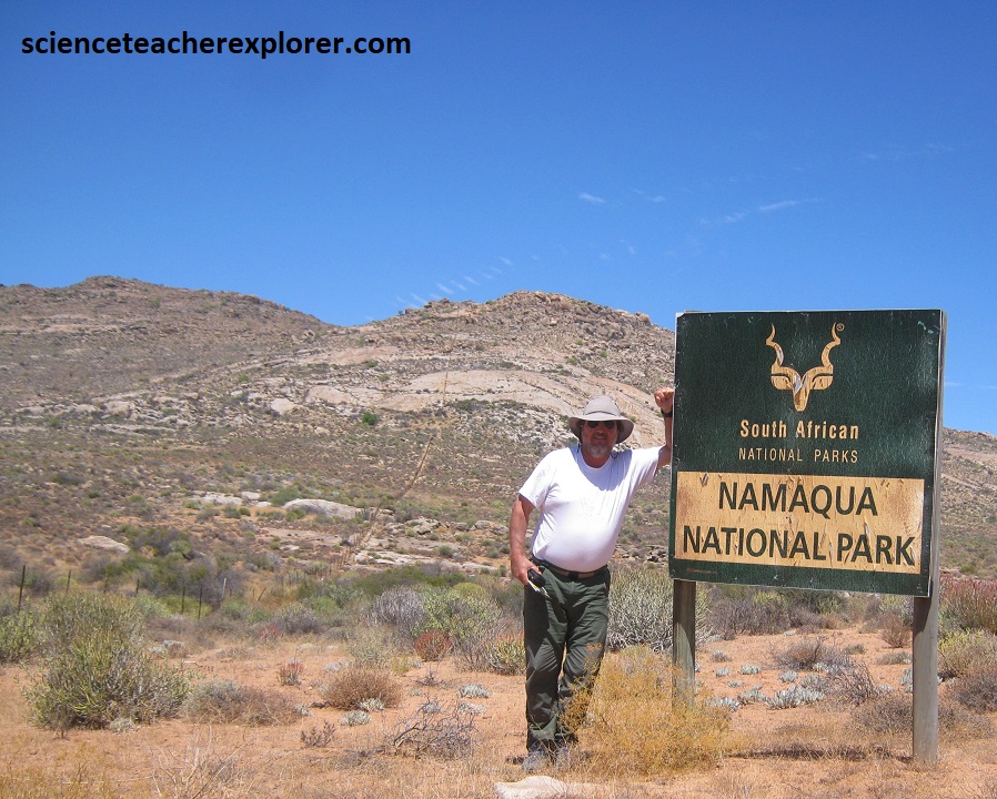
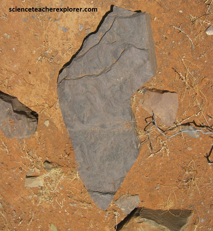
Pictured above, the bedrock within the Namaqua National Park largely comprises of Quartzo-feldspathic Gneiss of the Kookfontein subgroup with the Namaqualand Metamorphic Complex. Bedrock outcrops occur on koppies or mountains with smooth rock faces or large boulders. The Namaqualand granite-gneiss complex consists of mainly meso-zonal biotite gneiss and a fine-grained granulite. Pictured above, Wolfhoek se Berg is the highest point above sea level in the park at 948m above sea level.
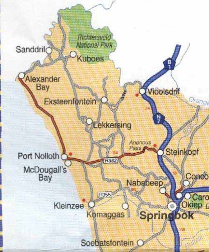
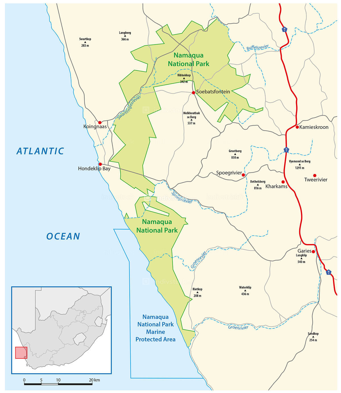
After exploring the graveled and 4×4 roads of Namaqualand National Park, Mike and I continued to Springbok on N7. To complete our exploration of the Great Western Escarpment, we drove north on N7 to Steinkopf where we turned west on R382 through Port Nolloth and then north to Alexander Bay. From there, we drove on a very long graveled road to the Richtersveld National Park, (pictured below).
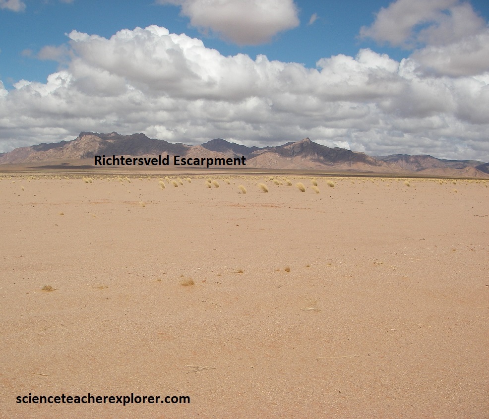
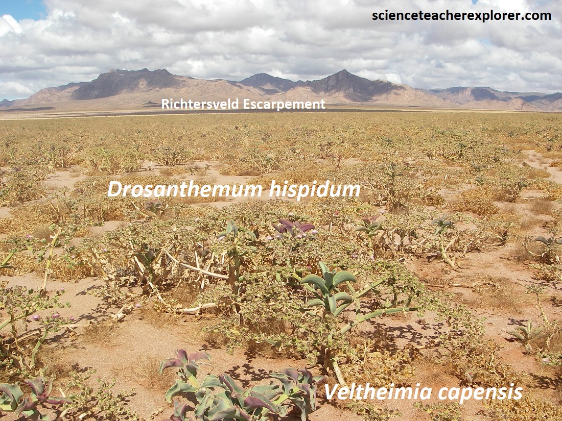
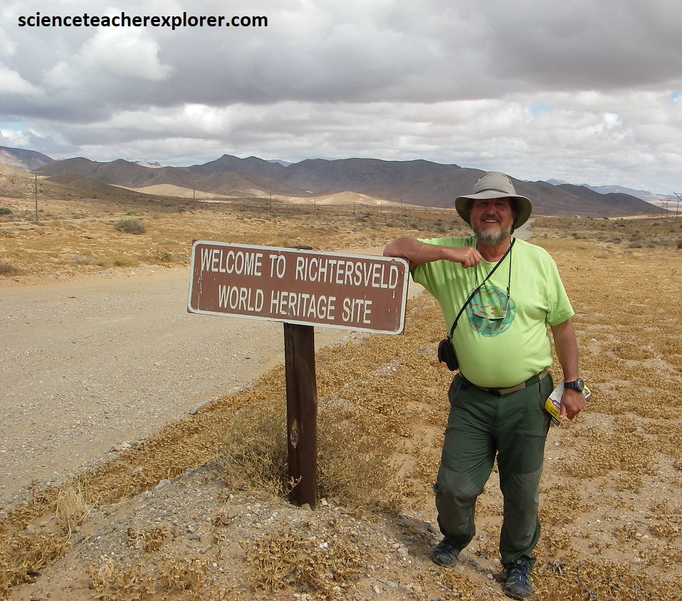
In the northwest corner of South Africa, the Orange River follows a loop to the north for about 100km before it reaches the Atlantic at Oranjemund. On the south side of this loop lies the inhospitable, extremely rocky, and until very recently, largely inaccessible Richtersveld National Park. With the highest peaks reaching above 1,300m; summer temperatures reaching 1220 F and an average rainfall of less than 50mm; the Richtersveld National Park is something of a botanist’s paradise, (pictured above). Of course, we were there to follow the last extent of the Great Western Escarpment, (pictured above). The earliest identifiable rock layers in this region date to around 2 billion years ago. Known as the Orange River Group, these are mainly igneous rocks that are volcanic in origin. The lavas of the Orange River Group were then overlain by some sedimentary rocks (sandstone and shale). These can still be seen in the Rosyntjieberg Formation. The intrusions include: The Vioolsdrift Suit, emplaced 1.9-1.75 billion years ago; The Richtersveld Igneous Suite, dating back 1 billion years; The Gannakouriep Suite, a series of north-south trending black dikes that were emplaced about 870 and 540 million years ago. Some of these sediments are thought to have collected at the foot of an ancient mountain range. This caused calcium carbonate to precipitate out of the water, forming limestone and dolomite. Another element of the sedimentary group is a collection of glacial-tillite once crept through the region. This is the oldest known glacial deposit in the world. However, it seems to have formed the so-called backbone of the Richtersveld and forms the highest peaks in the region. Note that around 570 million years ago, there was a period of sedimentation that created the Nama and Numees Groups, which consists of dolomite, limestone, shale and sandstone.
