Podocarpus, Ecuador
While trekking the Southern portion of Ecuador, my traveling buddy, Mike Stevens, and I explored the Podocarpus National Park and visited the Pumapungo Museum in Cuenca during March of 2022.

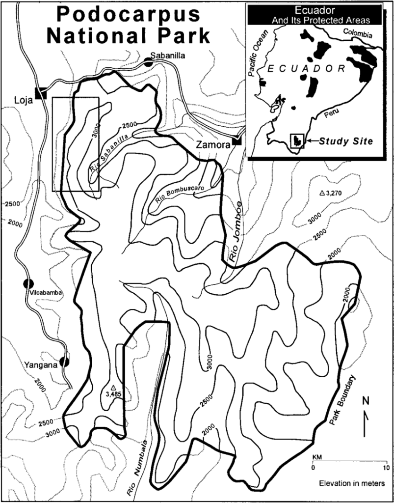
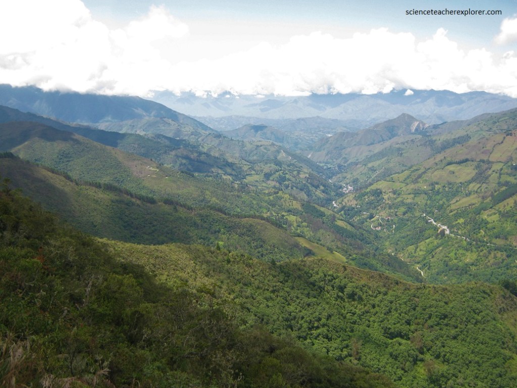
Created in 1982, Podocarpus National Park straddles, the El Nudo de Sabanilla mountain range between the towns of Zamora, Loja and Yangana in southern Ecuador.
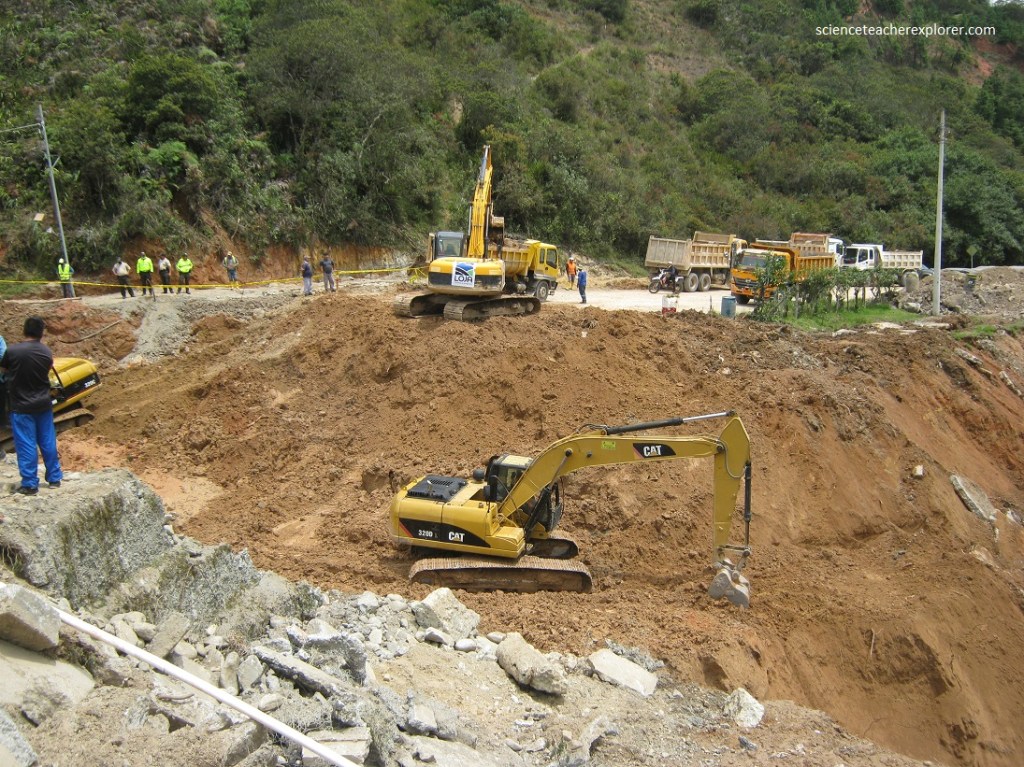
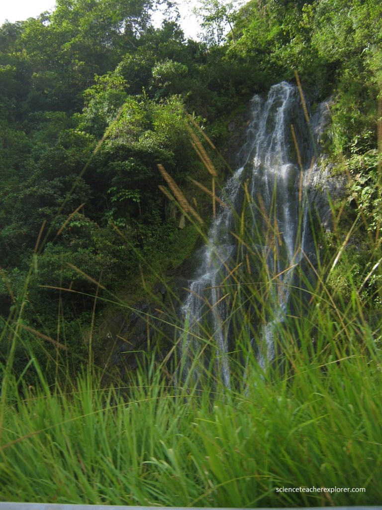
This area around Loja receives a great deal of moisture from the sea, even during dry climatic epochs. However, we were there during an extremely wet episode. El Nino had arrived early, during March of 2022. This caused some problems with landslides covering the highways all over Ecuador. Dealing the a landslide that covers a road was an easy fix for the Ecuadorian Transportation Department. But, Mike and I came across a flood that took-out an entire road, just outside of Loja. As a matter of fact, this was part of the main Pan-American Highway between Cuenca and Loja, (pictured below).
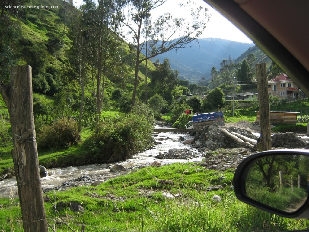
Since we were very motivated to explore the Podocarpus National Park south of Loja, we decided to take a 4 WD detour around the washout. Since this was the only way south of the washout, on the Pan-American Highway, many of the supply trucks took the same route. It was quite the adventure, (pictured below).
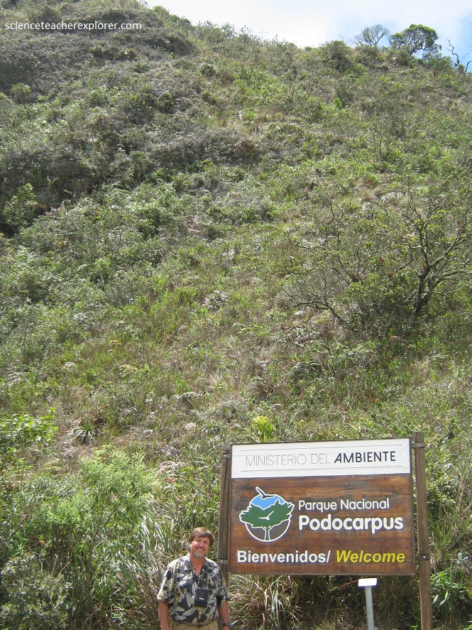
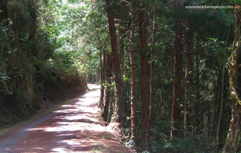
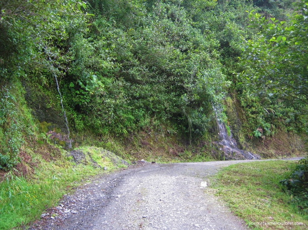
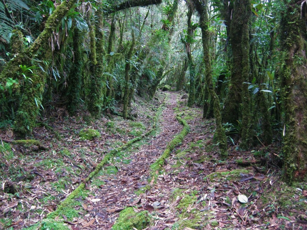
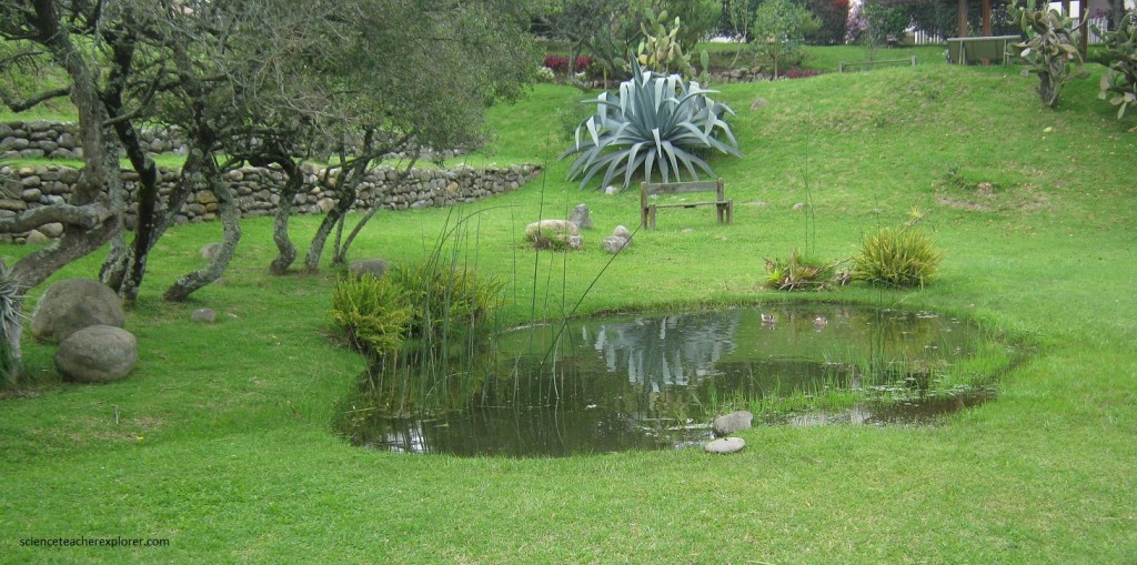
Once we bypassed the flash-flood zone, we continued onto Podocarpus National Park 14 km south of Loja and 23 km north of Vilcabamba. There we went through the gate at the Cajanuma Ranger station and continued onto a dirt road for another 8 km from the highway to a refuge. (pictured below).
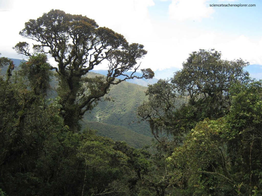
The Podocarpus National Park supports a great variety of habitats and a rich diversity of wildlife. The national park is named after the podocarpus tree, Ecuador’s only native conifer.
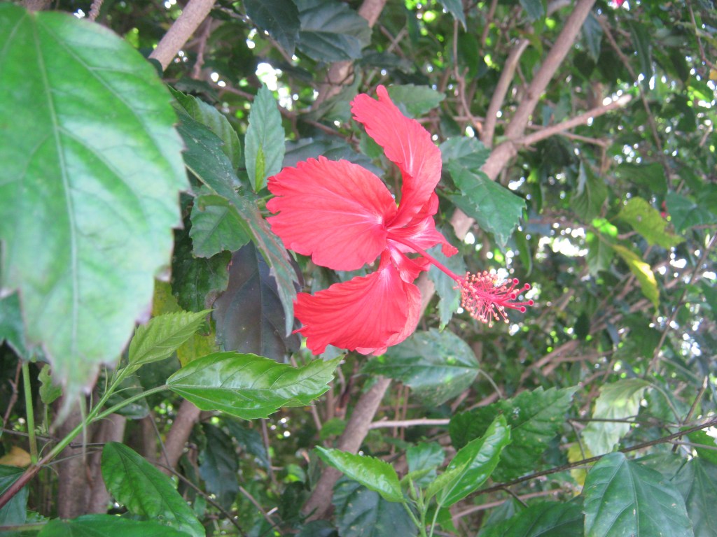
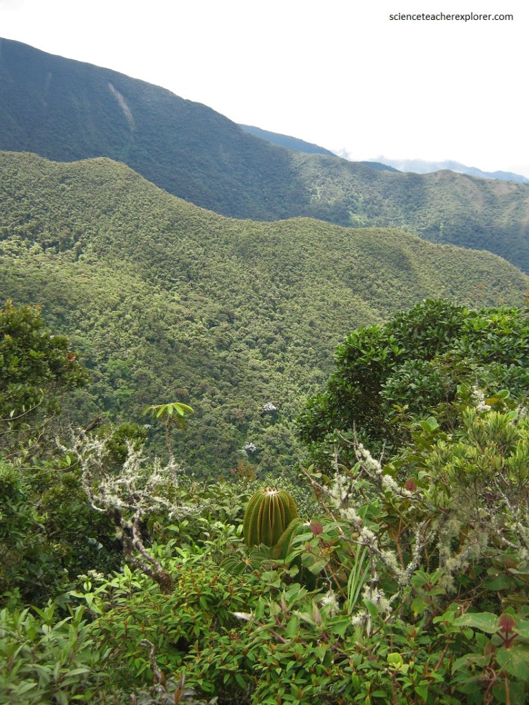
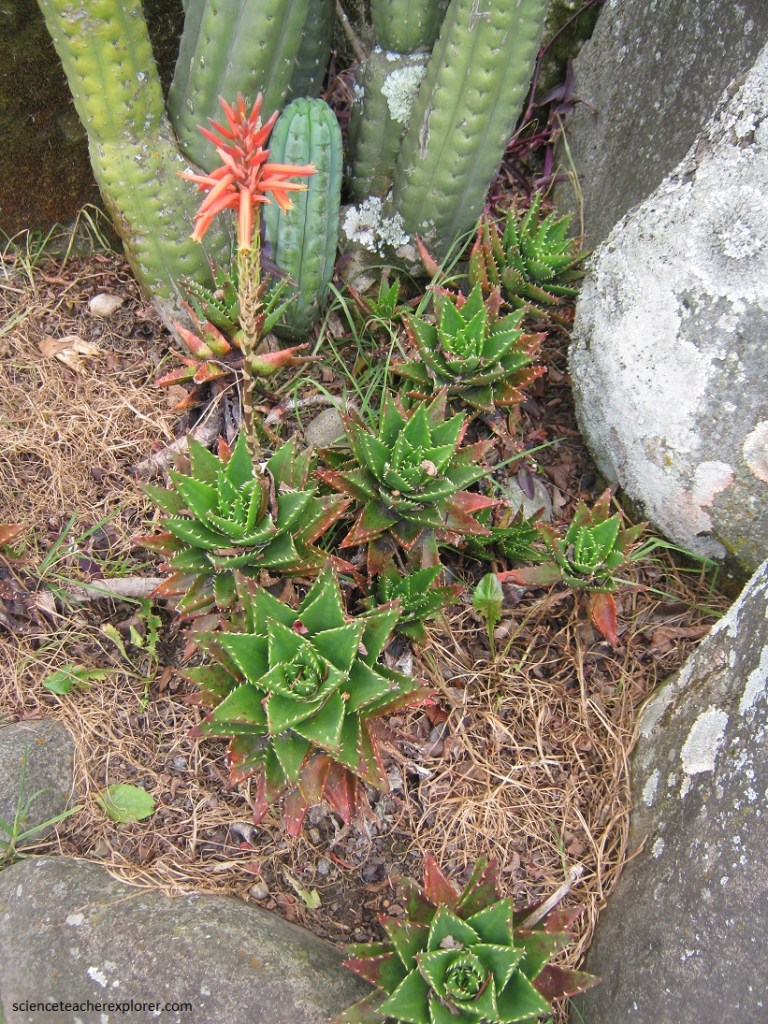
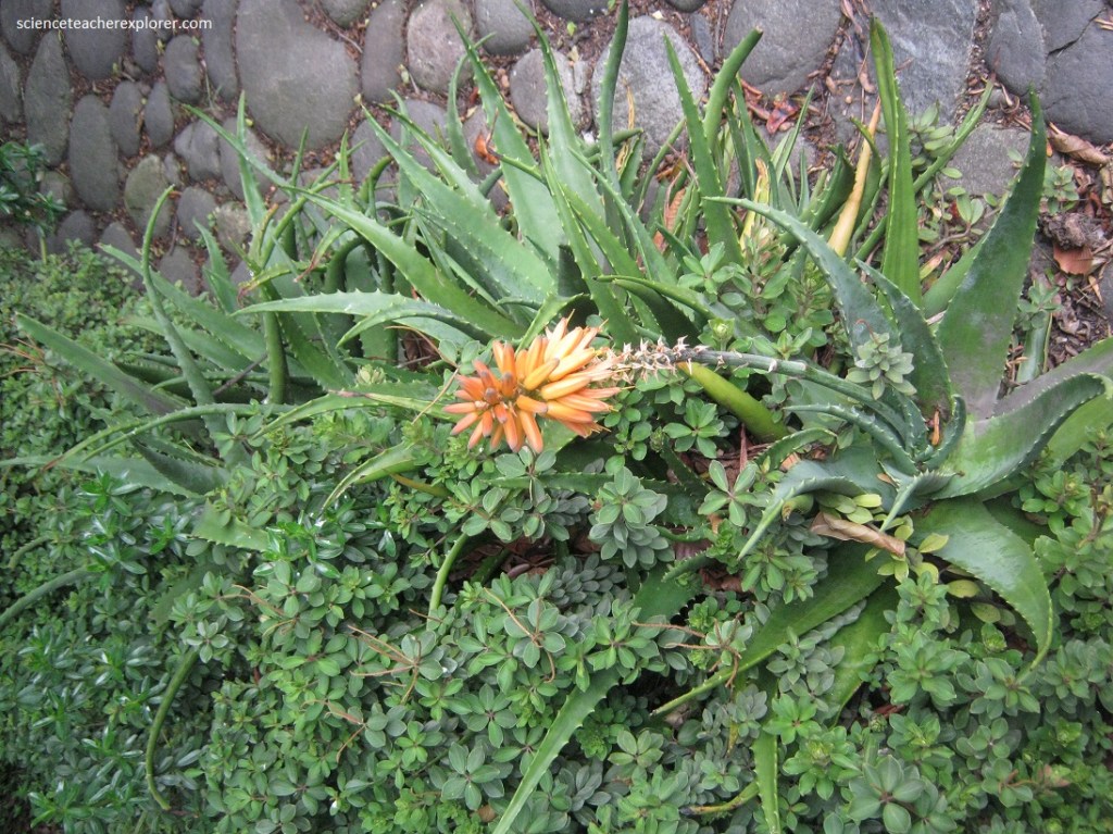
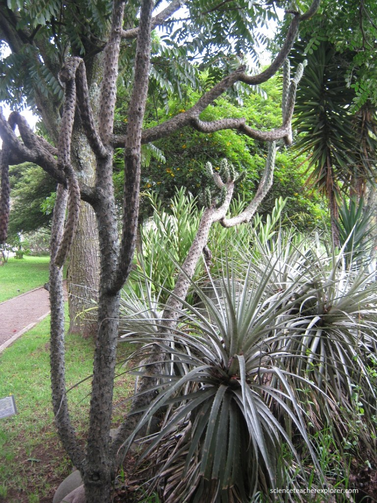
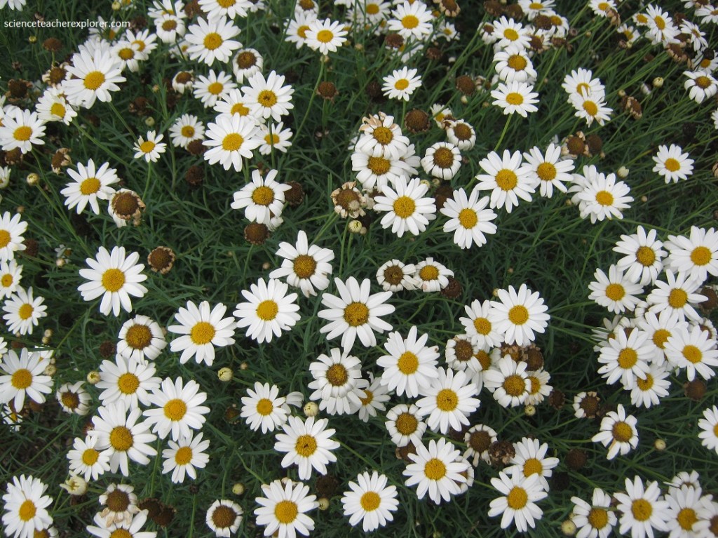
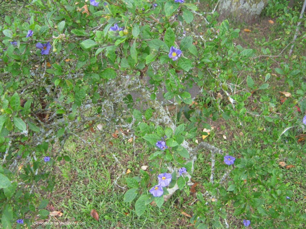
Of the Podocarpus National Park’s 3,000 plant species, many are unique, including over 20% of it’s 365 orchids and several very beautiful passionflower vines (pictured below). The range of diversity in vegetation has earned the park the nickname, “Botanical Garden of America.” Among the main species found in the region are chilca (Baccharis sp.), laurel, San Pedro cactus, uvilla, black elder, pumamaqui (Oreopanax sp.), sappanwood, arrayán, cashoco, alder, acacia, sage, guato blanco, cedar, castor oil plant, walnut, yumbingue (Terminalia guyanensis) and canelón (Swartzia littlei).
The Podocarpus National Park sustains 130 mammal species including northern pudu, mountain paca, mountain coati, and spectacled bear. Spider monkey, ocelot, and giant armadillo occur in this area we’re exploring. However, we were not lucky enough to see any of these the day spent there.
Birds are the park’s crowning glory. Over 60 hummingbird species are among the 600 bird species recorded here. These 600 species represent 40% of Ecuador’s extensive bird list. Additional exploration may yield up to 200 more species, further enhancing the park’s reputation as one of the world’s most bird-rich areas.
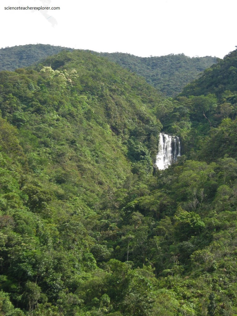
There are three river basins, including Loyola, Nangaritza, and Numbala, nestled amongst two different jettisons of the Andes mountains. The overall region represents the intersection of four ecological habitats creating what is known as a megadiverse zone.
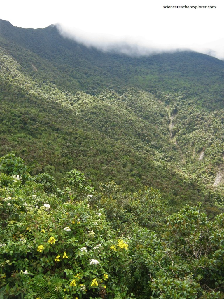
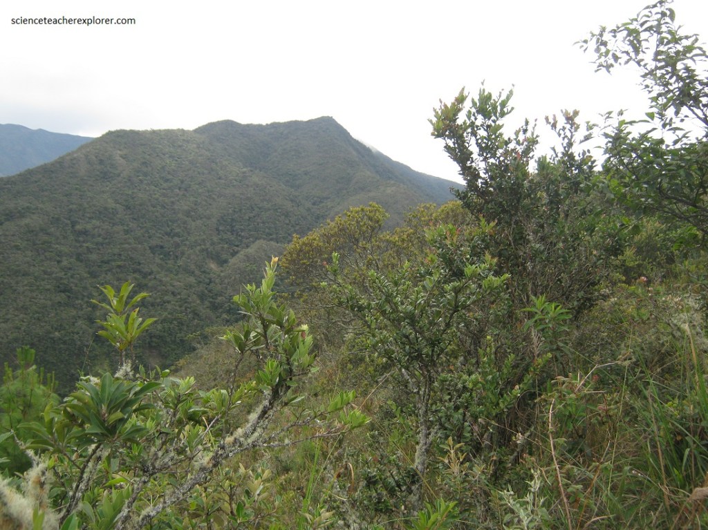
Pictured above, the elevation changes delivering a variety of vegetation habitats such as the montane rain forest in lower elevations and elfin forests in higher elevations.
The Podocarpus National Park was recognized as a Biosphere Reserve in 2007 by UNESCO for its megadiversity in flora and fauna and its moors and cloud forest ecosystems, essential in both Ecuador and Peru.
The Podocarpus National Park is categorized as a megadiverse zone and an area with a high level of endemic species because it is a meeting point between four ecological systems: Northern Andes, Southern Andes, Amazonian and Pacific.
After exploring the western side of Podocarpus National Park, we stayed the night in Vilcabamba. Vilcabamba has historically been famous for the long lives of its population, some of whom claimed to be over 120 years old. While it is true that some old rascals were exaggerating their age (upon investigation, scientists did not find anyone over the age of 96), there was no denying the vigorous health of many elderly residents.
Podocarpus National Park spans the lower montane rainforests at 1,000 meters up to high elevation elfin forests at 3,000 m. Paramo or subpáramo vegetation is found at elevations over 3,000 m where a complex of more than 100 lagoons exists in the park.
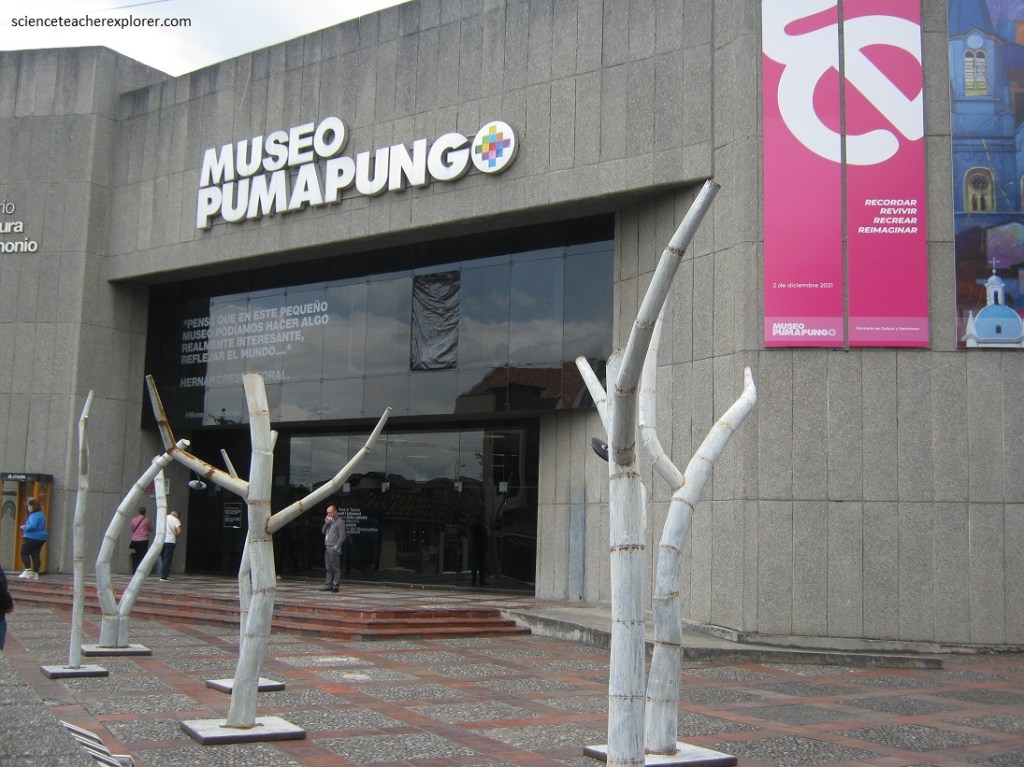
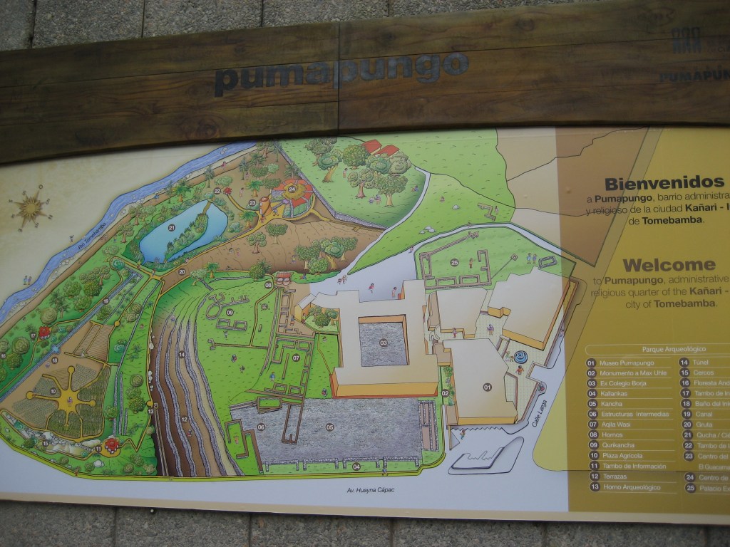
While exploring Cuenca, (162 km north of Podocarpus N.P.), Mike and I decided to make a visit to the Pumapungo Museum, (pictured above). [The name Pumapungo means “Puma Bridge”]. The museum has ethnographic collections that include traditional costumes, objects representative of the beliefs and rites of the peoples of Ecuador.
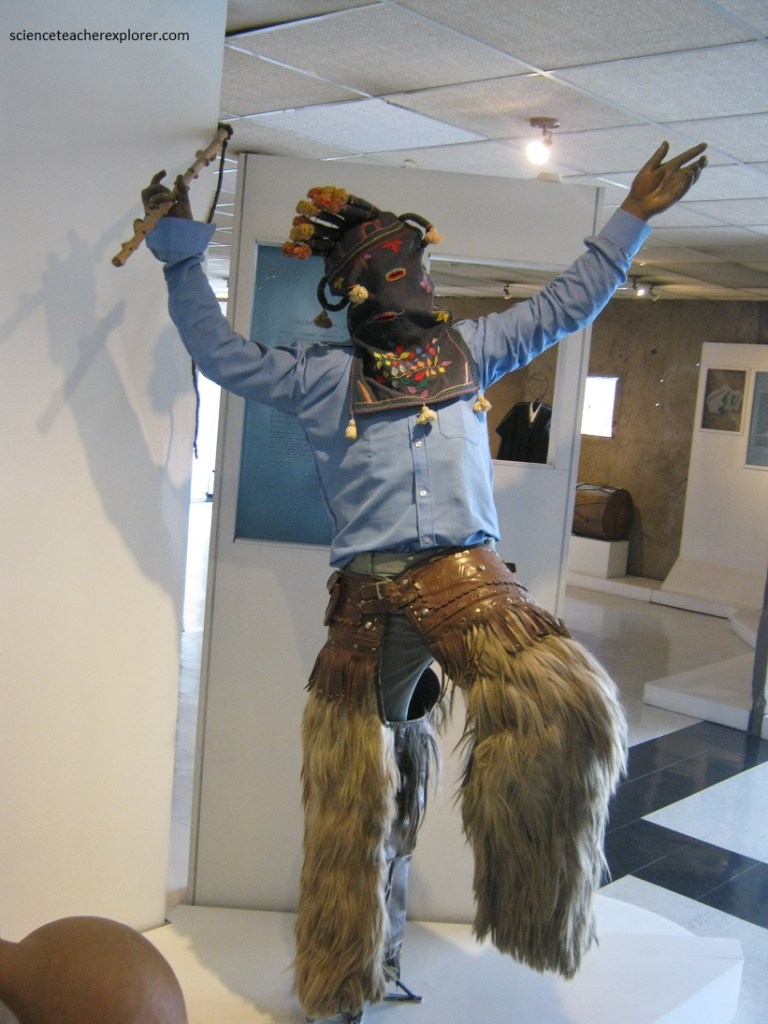
The museum has rooms dedicated to archaeology and ethnography, including ceramics and ucuyayas, which are amulets that represent mythical characters.
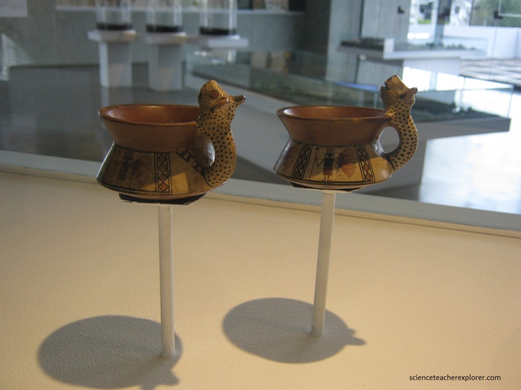
Pictured below, the Pumapungo Museum houses a collection of several hundred recovered objects including pots, ocarinas and statuettes. These collections had been recovered since 2008. Some of the recovered objects came from different cultures at different time periods such as Chobshi (9000-6500 BC), Narrio (1500-500 B.C., Tacalzhapa (500-1200 A.D.), Cashaloma (600 – 1549) & Tomebamba.

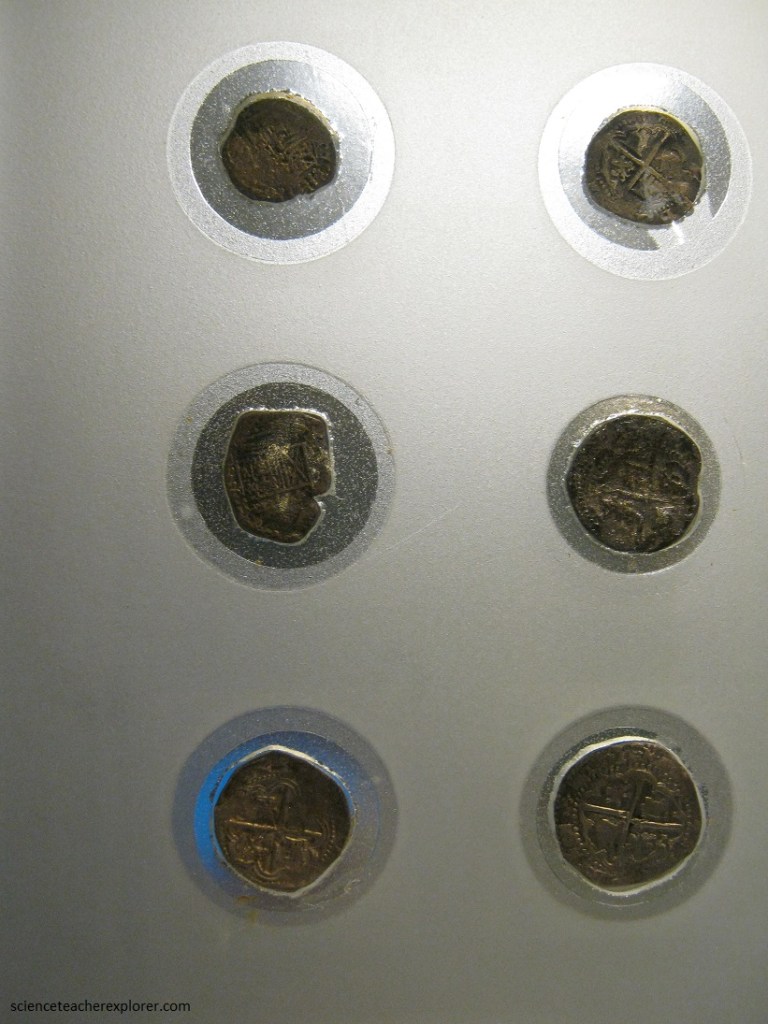
On the bottom level of the museum, we came across a security guard that allowed us to view the history of Ecuador’s Money. There we were able to see some old Spanish coins from the late 1600s, (pictured below).
This was all very interesting, but our main draw to the Pumapungo Museum is the collection of shrunken heads from the Shuar people of Amazonia.
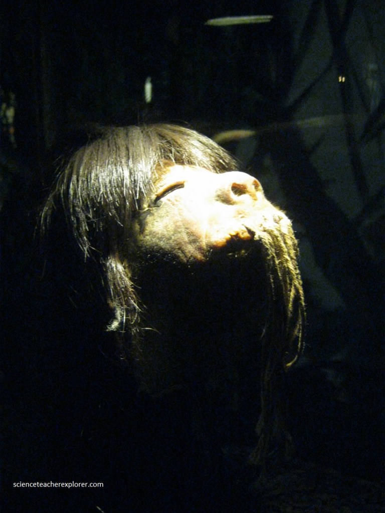
Historically, in some indigenous cultures, part of a boy’s transition into manhood required that he kill an enemy and make a trophy of his skull, scalp, ears, or—in the case of the Shuar—the hide and hair from the entire head. The process of shrinking a head into a necklace-sized pendant, known as tsantsa, was unique to the Shaur.
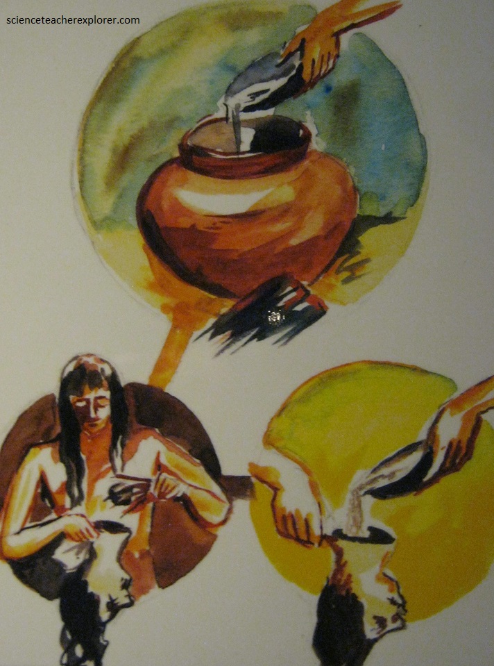
After killing and decapitating the human enemy, the eyelids and lips were sewn or pinned shut to prevent the spirit from escaping. The skull was removed and replaced with a wooden ball to retain the shape.
The head was then boiled in a special herbal tea to reduce it to the size of a man’s fist. After boiling, the head was dried with hot rocks and sand and polished with charcoal ash, (pictured below).
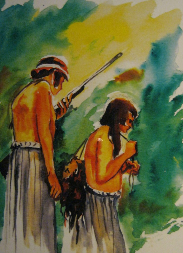
Today, young Shaur boys making the transition from adolescence into adulthood are encouraged to hunt sloths and shrink their heads, (a legal and more socially sustainable substitute called the “Uyundh”). It should be noted that it was a “Transfer of power” of the deceased to his killer; the avenger or “tsankram” became imbued with the power of the dead enemy.
The “Numpena Namperi”, initiation rite of the woman, begins with her first menstrual period. In this rite she is given the capacity to cultivate the garden well, and this symbolizes the arrival of adult life. Initiation rites imply fasting and abstinences led and explained by the adults or “Wea”. The biological changes represent demands and obligations. After the rites, the men and women assume well-defined roles and are qualified for marriage.
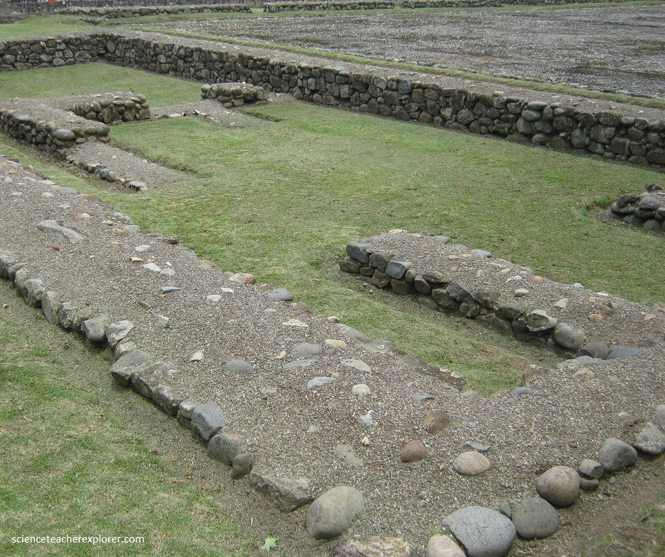
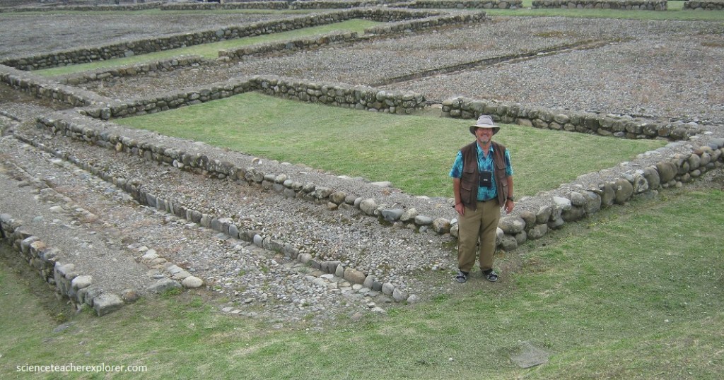
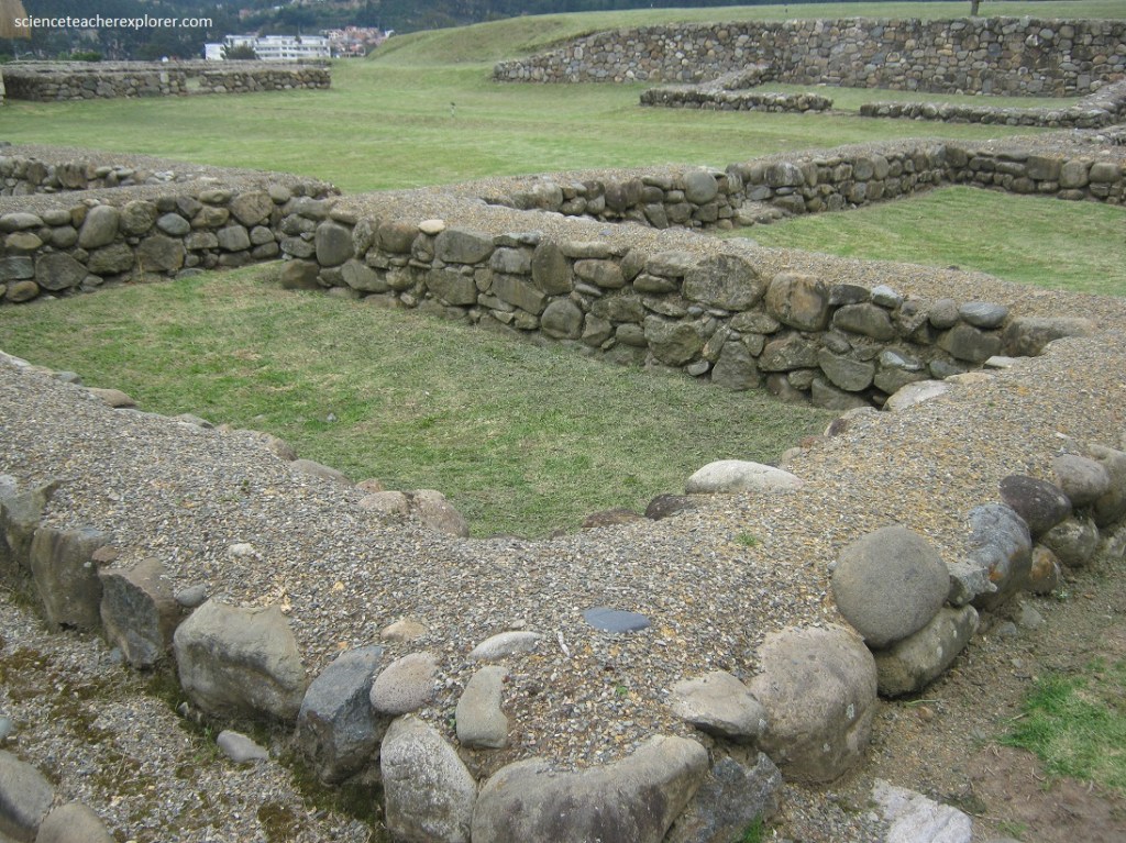
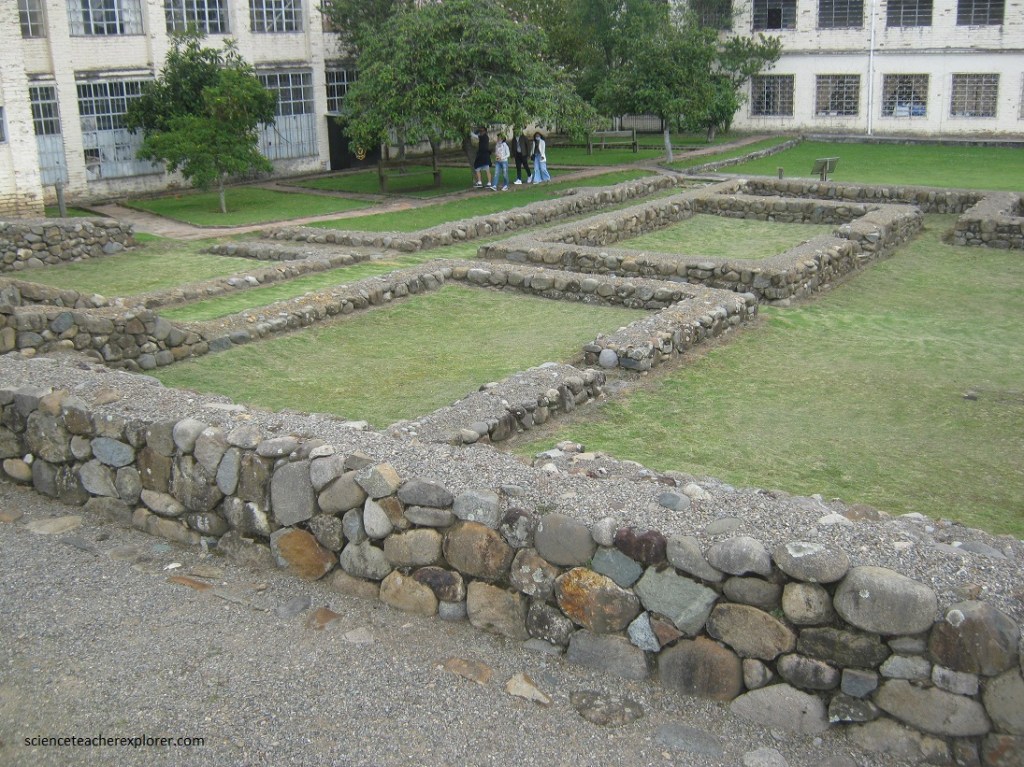
Outside the museum building is a four hectare complex that includes the foundations for a former Incan military post, an archeological ruin site.
“Tupac inka Yupanqui, and later his son, Huaina Capa, dignified these provinces of the Canaris and what they called Tumipampa (now called Cuenca) with buildings and royal houses, adorned the chambers with herbs, plants, and animals of gold and silver; the entrances were plated with gold and settings of fine stones, emeralds and turquoise; they constructed a famous temple of the sun, also plated with gold and silver…” Inca Garcilaso de-la-Vega.
Pictured above & below, the “Kallana” are spacious architectural structures that served, mainly to house the armies in transit through the cities and “tambos”, during the inka empire.
Cieza de-Leon observed the existence of a “large number of rooms where war people are housed”, although they also served as a lodging for people of high rank.
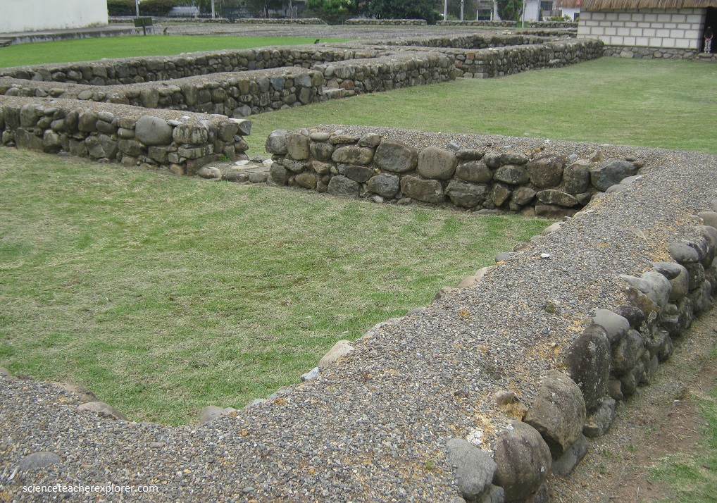
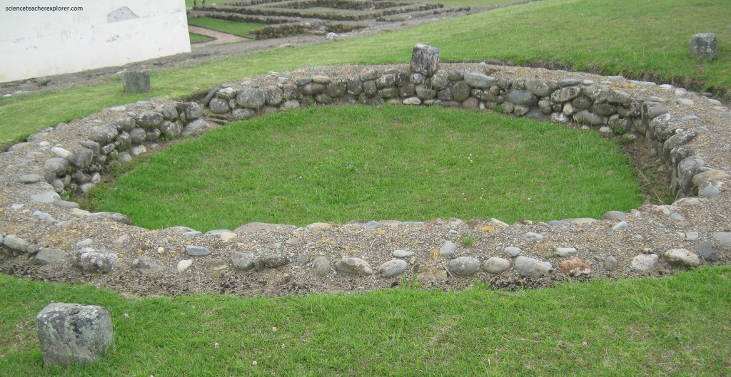
Pictured above, the “Akllawasi” are architectural ensembles located in important cities of the Tawantinsuyu. They resembled convents occupied by the akllakuna or chosen women, led by a kind of “abbesses” called mamakuna.
Pictured above, the “Akllawasi” is a place that young women were initiated into religious practices, the elaboration of fine fabrics and service to the ruling class. Political alliances were eventually made through their marriage to Kurakas and other ethnic dignitaries.
Pictured above, Cieza de Leon describes him as one of the greatest of the Tawantinsuyu: “the virgin women…..were modre than two hundred and very beautiful, natives of the canares and the region…..”.
Pictured above, the “Akllawasi” is a residential complex made up of two bodies of buildings, separated by a narrow corridor, each with its own kancha. The discovery of burials, some with indications of human sacrifice, reveals the sacred character of these rooms.
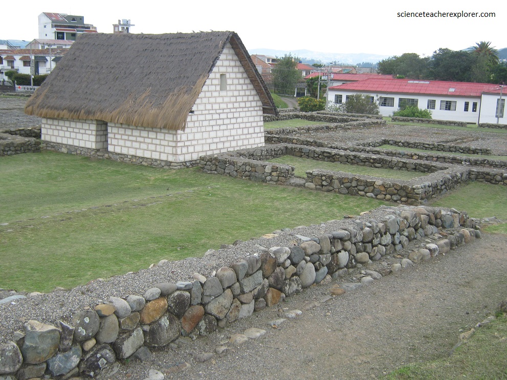
Pictured above, the “Reconstuccion del Akllawasi” is a hypothetical recreation of the Akllawasi, originally built with carved stones, pebbles in the foundations and thatched gabled roof. The roof structure was raised with chauarqueros that grow from the penco or American agave, (extremely light and tied with rope).
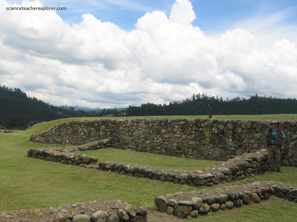
Pictured above, the “Kurikancha” or “Mayor Temple” were the most important religious, political and administrative centers of tha Tawantinsuyu. This also acted as astronomical observatories, dedicated to the Sun and other celestial entities. They were run by priests of high spiritual hierarchy, who also regulated the agricultural calendar. In Pumapungo there were four lateral structures and on semicircular, located around a central kancha.
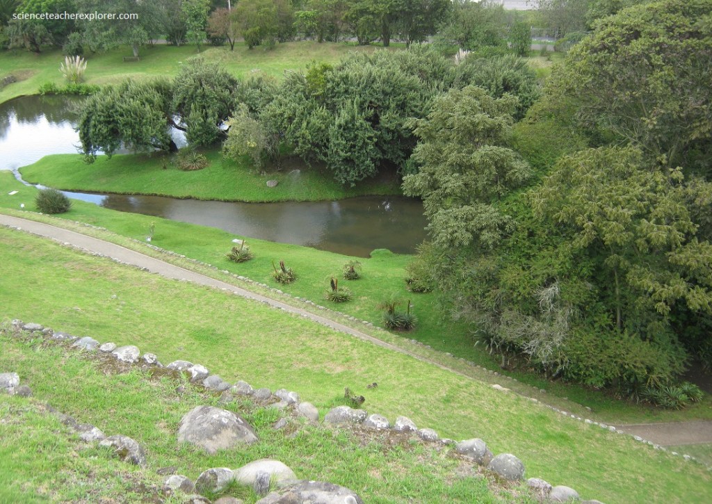
Pictured above, it is said that Wayna-Kapak, (born in Tomebamba), ordered the construction of a kucha or lagoon, in honor of the god Tiksi Wirakucha. For this, it took advantage of the slopes of the area and the rising of the Tomebamba river that runs a few meters from the site, forming to the west of La pampa, a lagoon that has been rebuilt.
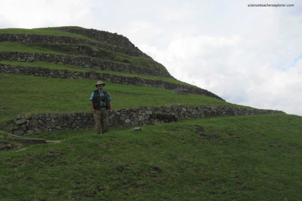
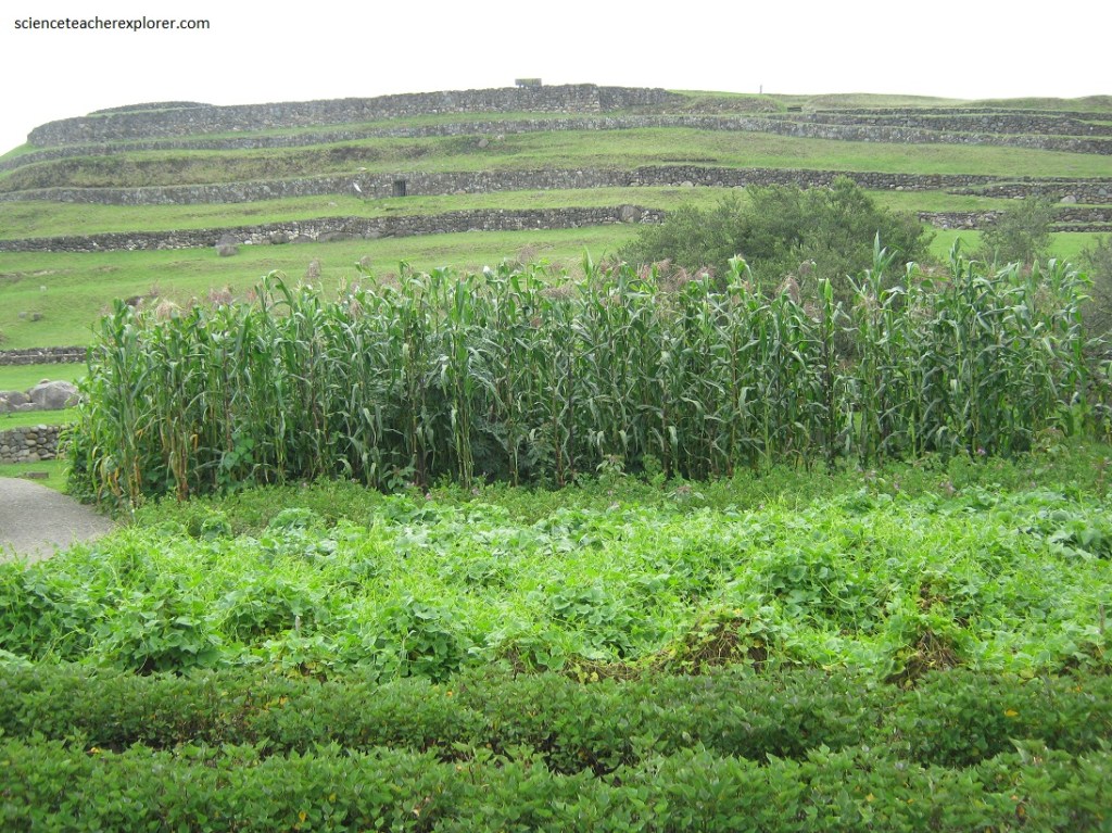
Pictured above and below, the Andean technology of terraces, (also present in Pumapungo), confirms the unique adaptation of the Andean man to his environment.
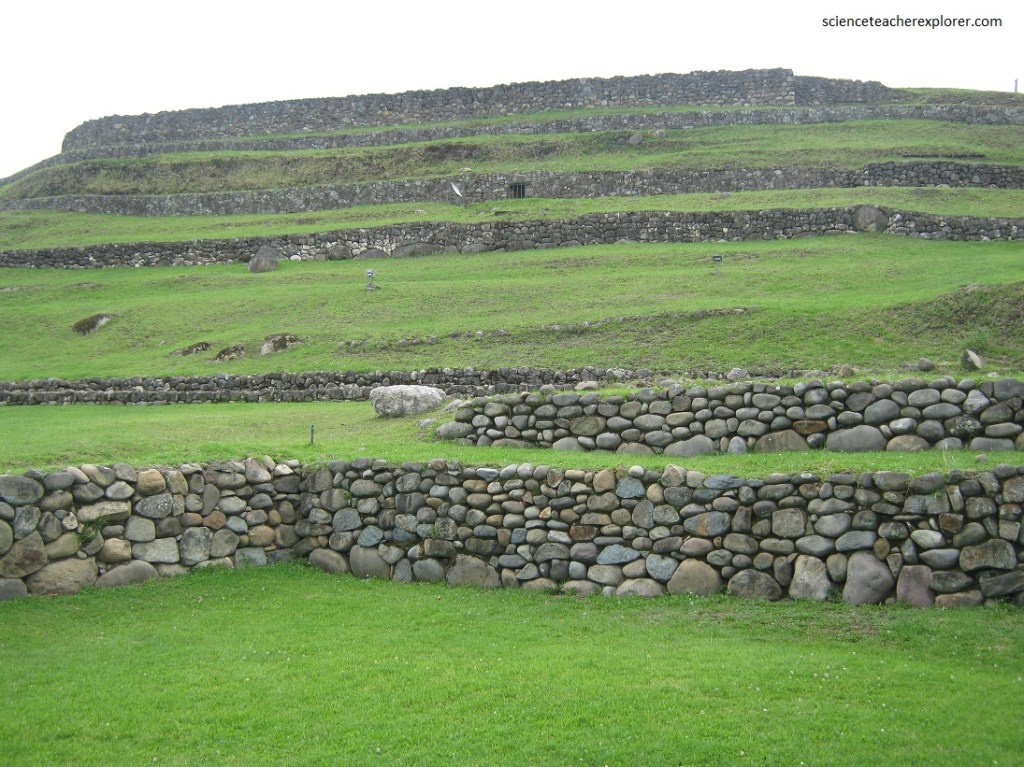
Pictured above, the terraces manage to stop erosion and are the most suitable mechanism to conserve soil moisture, incorperating sloping land not suitable for agriculture. Its unique efficiency and the extent of the fields modified by this technology are worth of admiration.
Pictured above, excavations carried out in the 2002 campaign uncovered part of the low terraces. These structures, (which are under study), could differentiate the terraces erected by Tupak Yupanki and Wayna-Kapak, at two different times.
The contribution of corn to the diet, constituted an essential factor in the development of the Andean societies. Numerous researchers point to the Central American region as the area where corn originated. On the Ecuadorian coast at a place called Las Vegas, the 8,000 year old remains of a corn in process of domestication were discovered; and later, at Real Alto (Valdivia), others of a variety called Kcello ecuatoriana (4,300 years ago). So it is not discarded that corn may have had various simultaneous sites of domestication.
“In the time of the Incas that cultivated area was a garden of gold and silver, as existed in the royal houses of Kings where there were many herbs and flowers of diverse types lesser plants, large trees, animals small and large, wild and domesticated, and creatures, such as snakes, large lizards and tiny ones, snails, butterflies and birds and other large flying-fowl….there was a large field of corn and the seed called Quinua….”, Inca Garcilaso de-la-Vega. [Based on this historic context, the garden was recreated as a homage to the Inka greatness and world view].
Pictured above, the Andean forest is characterized by the great variety of interrelated plants in harmonious coexistence, that is, large or medium trees (sarar, kinhua), shrubs (chillka), bushes (elderberry), herbs and flowers. In this way, the variety of ecological niches is also constituted in the habitat of a diversity of animals such as mammals, birds, insects, etc.
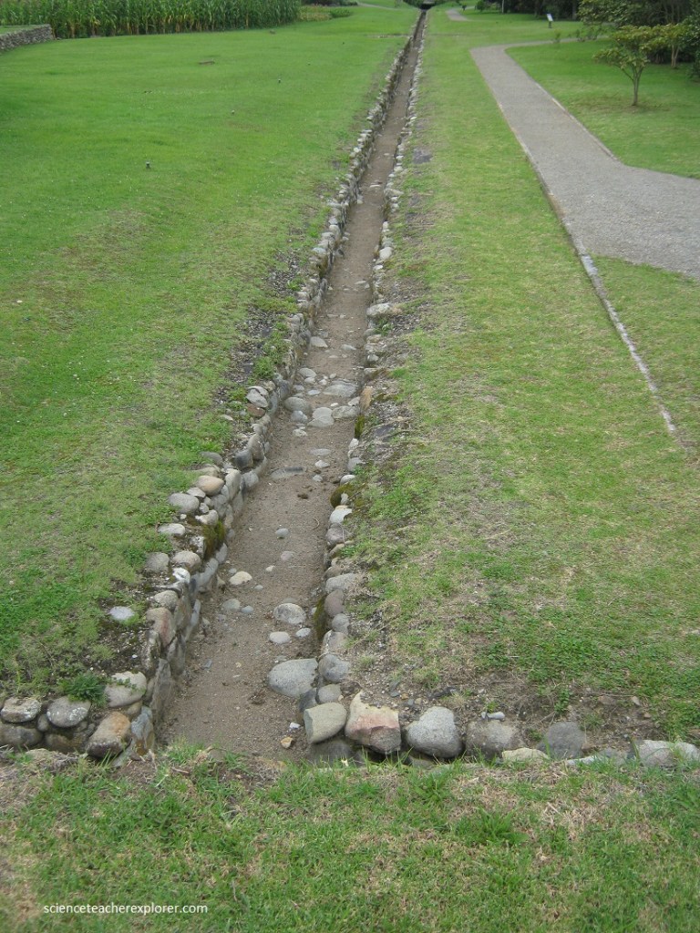
Pictured above, the Pumapungo Museum has an uncovered 180 m long canal in the lower part, including several reservoirs or pools of water, possibly used for purification rites. The knowledge of the celestial cycles marked by certain stars and constellations, by the solstices and equinoxes, is also one of the axes of Andean social, religious and agricultural life. For this reason, the graphic representation of the Southern Cross (Chakana) in the Canal-Banos complex.
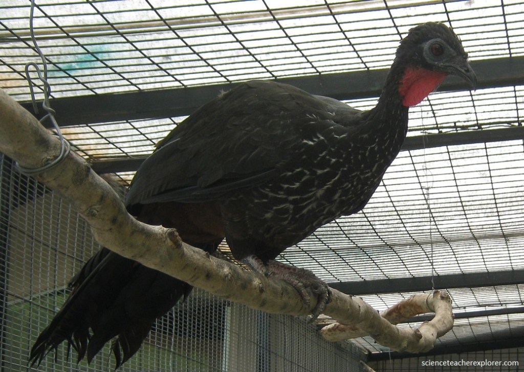
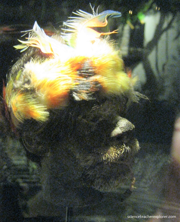
Pictured above, the “Wild Birds Pumapungo Rescue Center” was created to learn about and value the fauna of the natural environment in which Kanaris and Inkas lived, their myths and legends, the respect they had for nature.
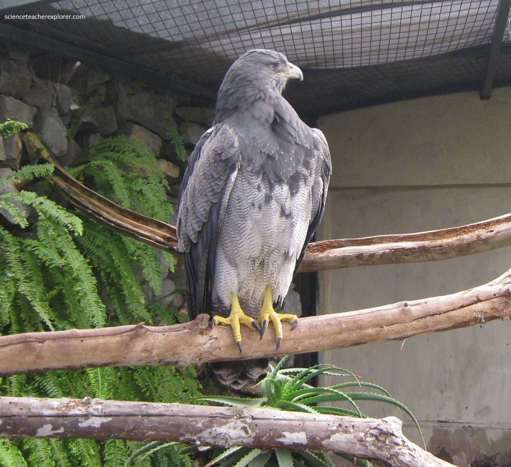
Pictured above, the “Wild Birds Pumapungo Rescue Center” objective is to teach respect for the environment, to inform about the conservation of species, the importance of Andean biodiversity and the persistence of traditions about fauna among current ethnic groups. An example of this is the tradition of contemporary Kanaris who say they descend from macaws and snakes.
