Yellowstone N.P., WYO
Yellowstone was the first national park to be established in the U.S.A., and it is an extraordinary place place with canyons, lakes, geysers, hot springs, and boiling mud-pots. I did a significant exploration of Yellowstone, during June of 2010.
My first stop was Mammoth Springs. Mammoth Springs consists of about 50 colorful and fantastic looking hot springs bubbling up through the chalky bedrock of Yellowstone National Park. Located in the park’s northwest corner, this complex of springs is a natural work of art.
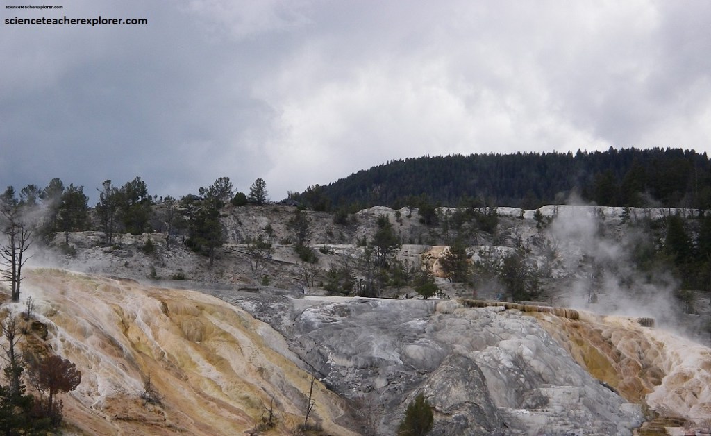
Pictured above and below, Mammoth Springs have fantastically shaped terraces, with a spectacular kaleidoscope of colors. The steaming hot water dissolves the soft limestone of the bedrock deep underground and then deposits it on the surface as a white mineral called travertine when the water cools. The travertine builds up at the phenomenal rate of about 3 cm per year and today some terraces are 90 m high.
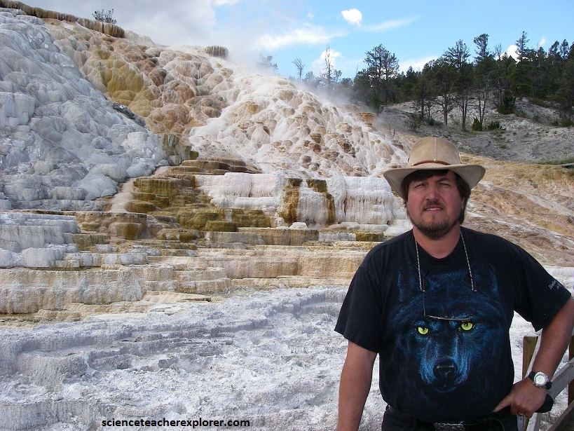
Pictured above, travertine is white when it’s deposited, but these springs are home to heat-loving bacteria and algae that give the terraces brilliant yellow, brown, and green colors. Mammoth Springs are fed by rainwater and snow falling high on the slopes in and around Yellowstone. Then this cold ground water seeps deep into the earth where it is warmed by heat radiating from the magma chamber within Yellowstone, before rising back to the surface.
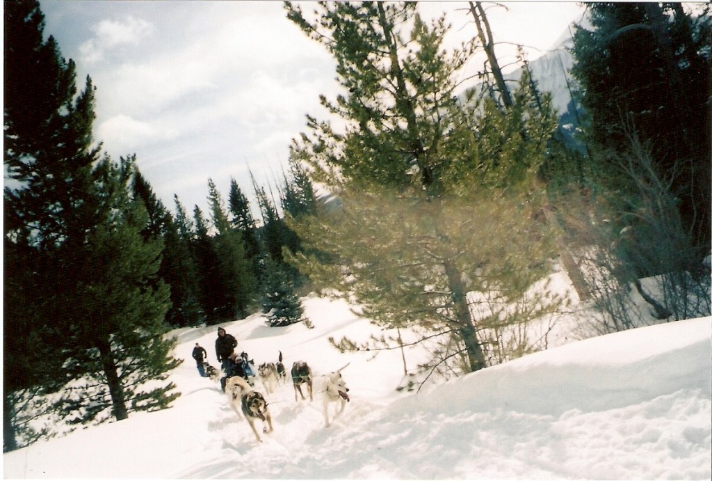
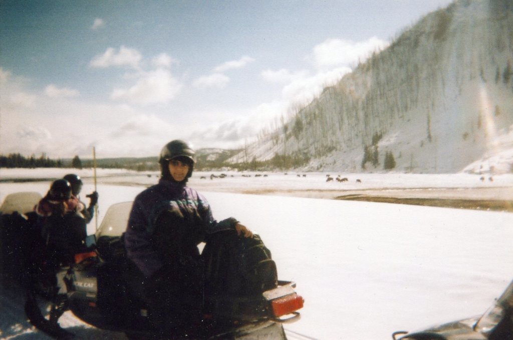
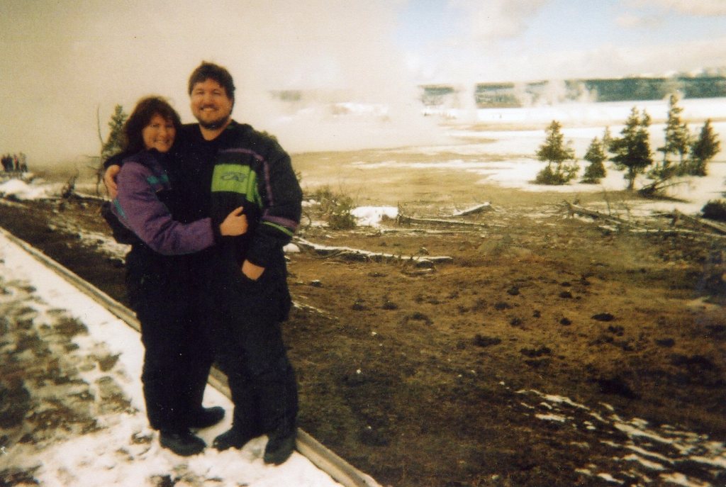
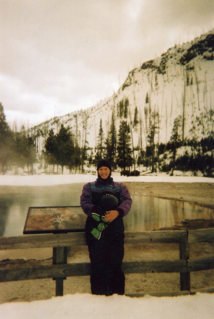
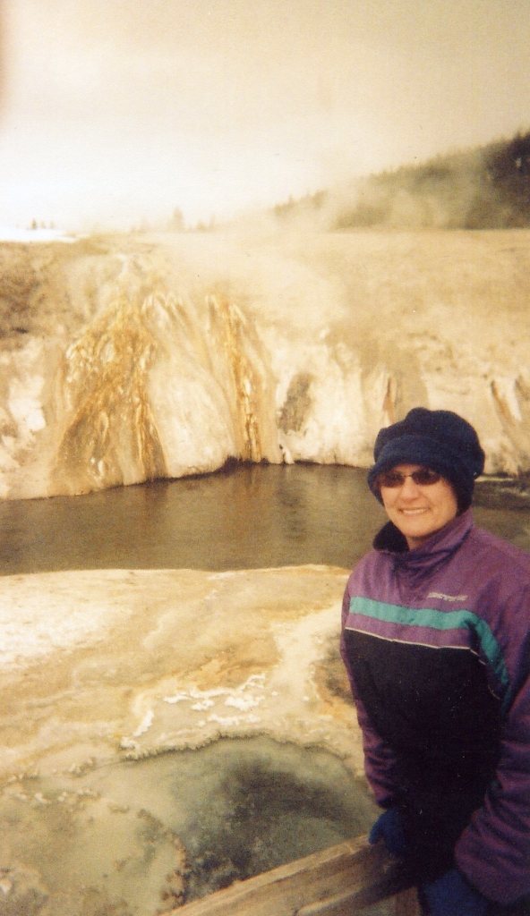
Just a side note: In January of 2007, I also led a tour-group to experience dog-sledding expedition, north of Yellowstone in “Big Sky” Montana. And in February of 2008, Becky and I revisited Yellowstone on snowmobiles, (pictured below).
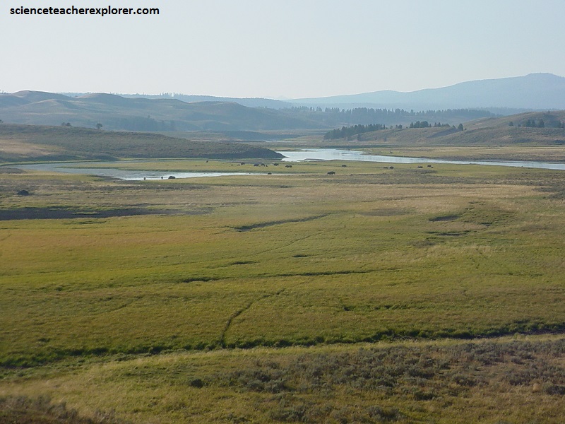
My next stop was Lamar Valley, between Roosevelt and the Silver Gate. Pictured above, and located in the northeastern corner of the park, the Lamar Valley, along the Lamar River, is often called America’s Serengeti for its large and easy-to-see populations of large animals. Among its most famous inhabitants are the Junction Butte and Lamar Canyon wolf packs.
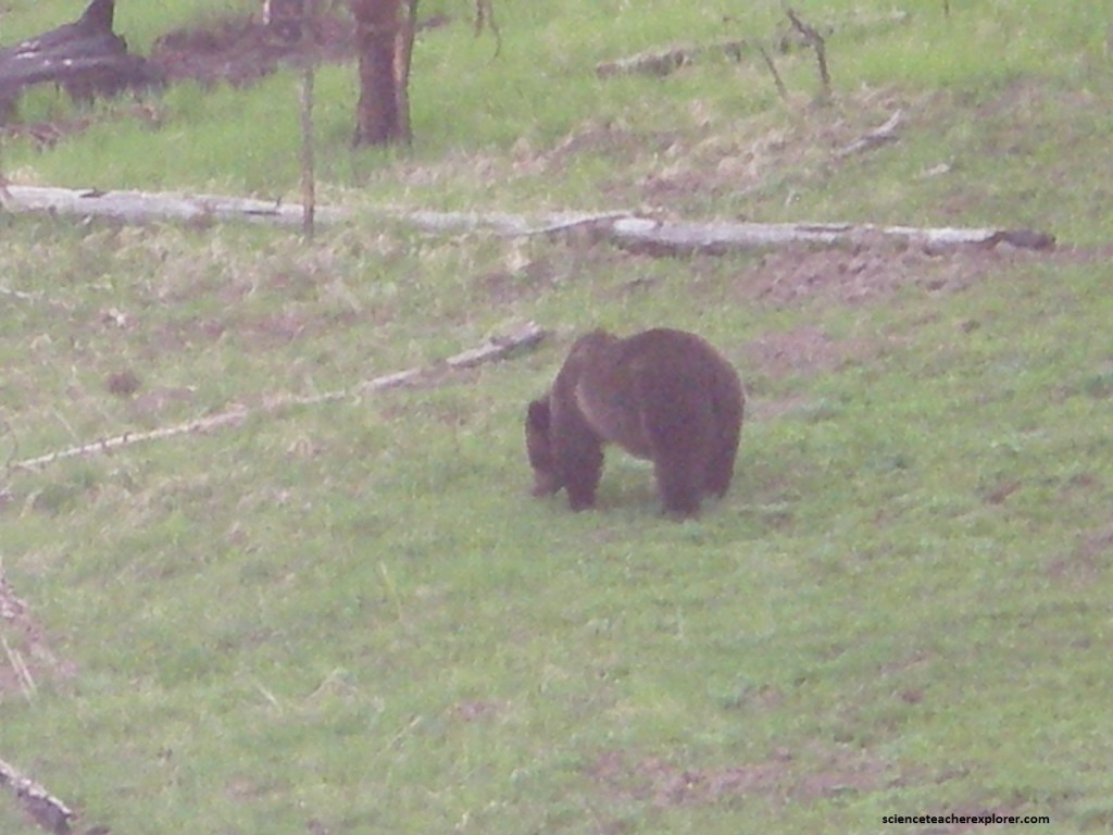
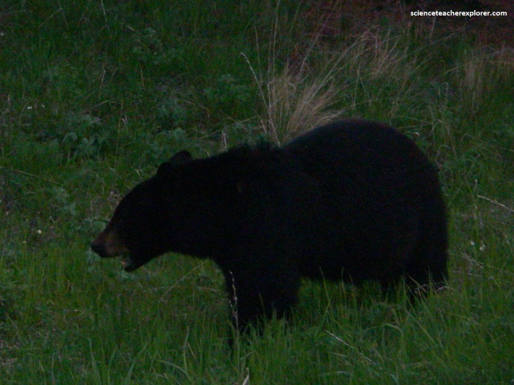
In addition to wolves, other animals roaming the Lamar include large herds of bison, pronghorn, badgers, grizzly & black bears, bald eagles, osprey, deer, and coyotes.
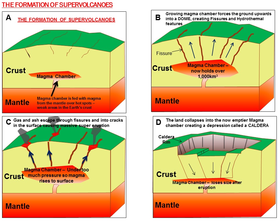
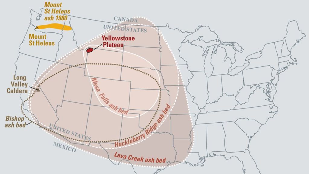
Pictured above, about 640,000 years ago, a huge volcanic eruption occurred in Yellowstone, emptying a large underground chamber of magma. Pictured below, Volcanic ash called the Huckleberry Ridge Ash spread for thousands of kilometers in the southeastern direction. The caldera began to fill with lava and sediments. Infilling of lava flows continued for hundreds and thousands of years.
The Grand Canyon of the Yellowstone formed in rock and sediments about 160,000 to 140,000 years ago. This paleo-canyon was not very deep, wide or long as the canyon I see now.
Past hydrothermal activity has altered and weakened the rhyolite, making the rocks softer. The Yellowstone River eroded these weakened rocks to deepen and widen the canyon, a process that continues today.

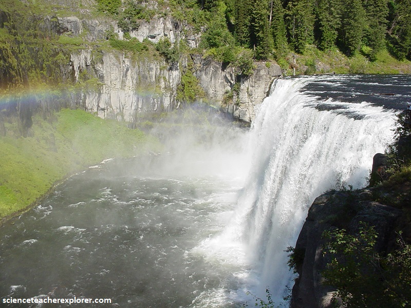
Pictured above, the 93 m “Lower Falls may have formed because the river flows over volcanic rock more resistant to erosion than the downstream rocks, which are hydrothermally altered.
Pictured above, the 33 m Upper Falls flows over similar rocks. The large rocks upstream from Upper Falls are remnants of a lava flow resistant to erosion.
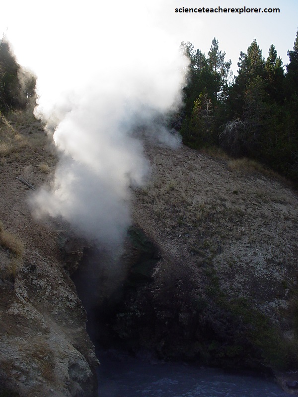
Pictured above, Dragon’s Mouth-Spring was named around 1912, perhaps due to the water that frequently surged from the cave like the lashing of a dragon’s tongue. This dramatic wave-like action often splashed water as far as the boardwalk. The rumbling sounds are caused by steam and other gasses exploding through the water, causing it to crash against the walls of the hidden caverns.
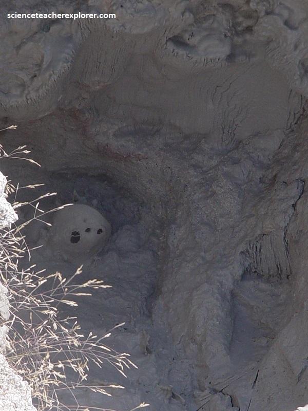
Pictured above, hydrogen sulfide gas rising from Yellowstone’s magma chamber causes the rotten-egg smell. Microorganisms, or thermophiles use this gas as a source of energy, and then help turn the gas into sulfuric acid. Sulfuric acid breaks down the rock and soil into mud. Many of the colors that is seen in the area are vast communities of thermophiles, but some of the yellow is pure sulphur. When iron mixes with sulphur to form iron sulfide, gray and black swirls sometimes appear in the mud.
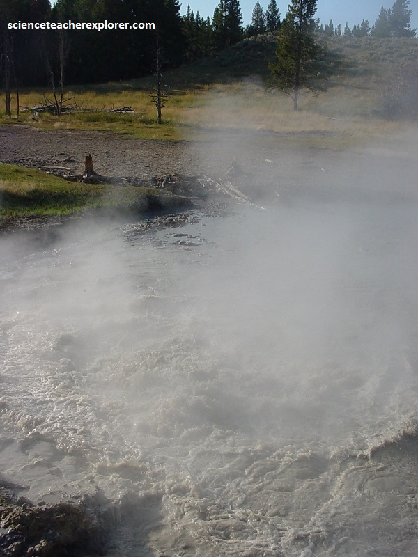
Pictured above, frothing and fuming as heat and gas rise from Yellowstone’s magma chamber, this muddy pool churns and cooks. Shaken again and again by earthquakes, the temperature beneath it rises and falls, transforming “Churning Caldron”. Note: Nearly 500 earthquakes shook the area between July 1 and July 15 in 1995; Churning Caldron’s water still rolled violently in 2010 as gases escaped from below.
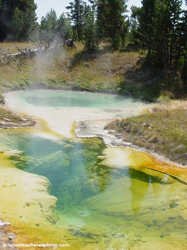
Pictured above, 10x more acidic than lemon juice, Sulphur Caldron sits on the edge of one of the most active areas of Yellowstone’s buried volcano. Sulphur-rick gasses rise furiously here, filling Sulphur Caldron with sulfuric acid. Incredibly, the muddy pool is teeming with life at a pH of 1.
Pictured above, the Norris Geyser Basin sits on the intersection of major faults. the Norris-Mammoth Corridor is a fault that runs from Norris north through Mammoth to the Gardiner, Montana, area. the Hebgen Lake fault runs from northwest of West Yellowstone, Montana, to Norris Geyser Basin. This fault experienced an earthquake in 1959 that measured 7.4 on the Richter scale, (refer to the map below).
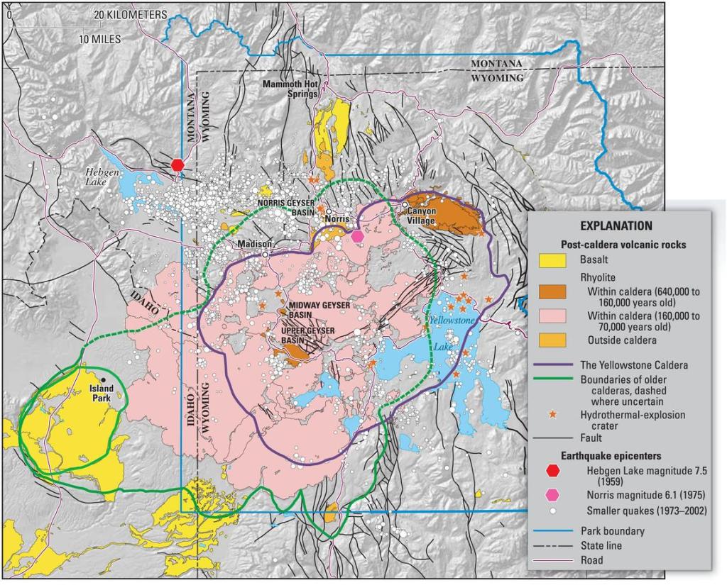
These 2 faults intersect with a ring fracture that resulted from the Yellowstone Caldera of 600,000 years ago. These faults are the primary reason that Norris Geyser Basin is so hot and dynamic. The ragged hills around parts of Back Basin and are thermally altered glacial moraines.
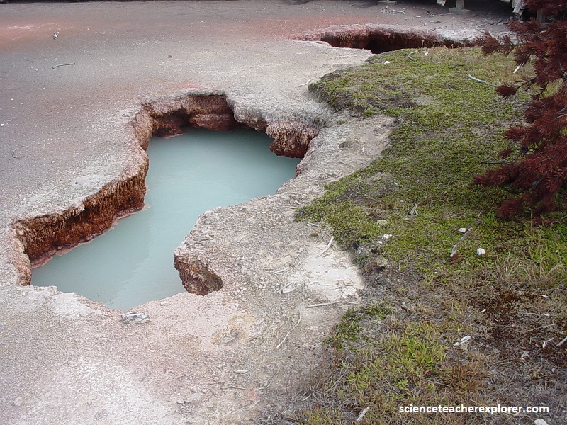
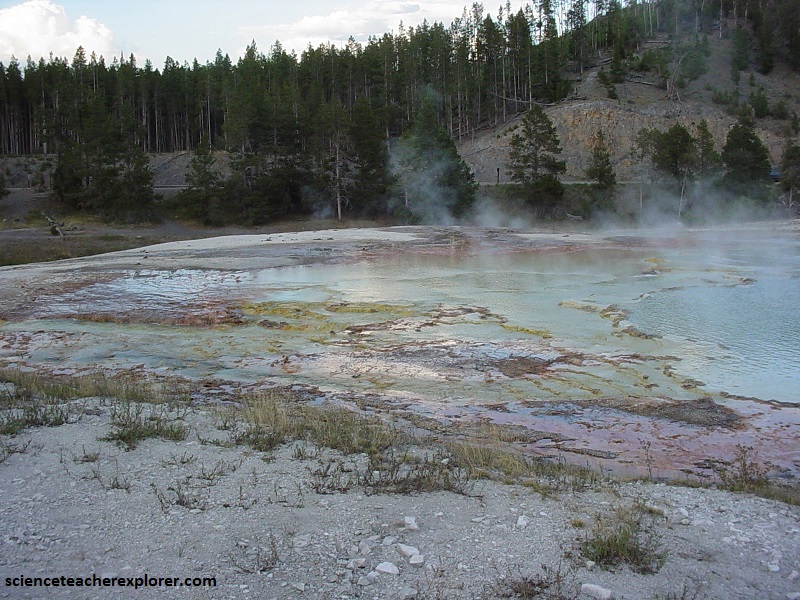
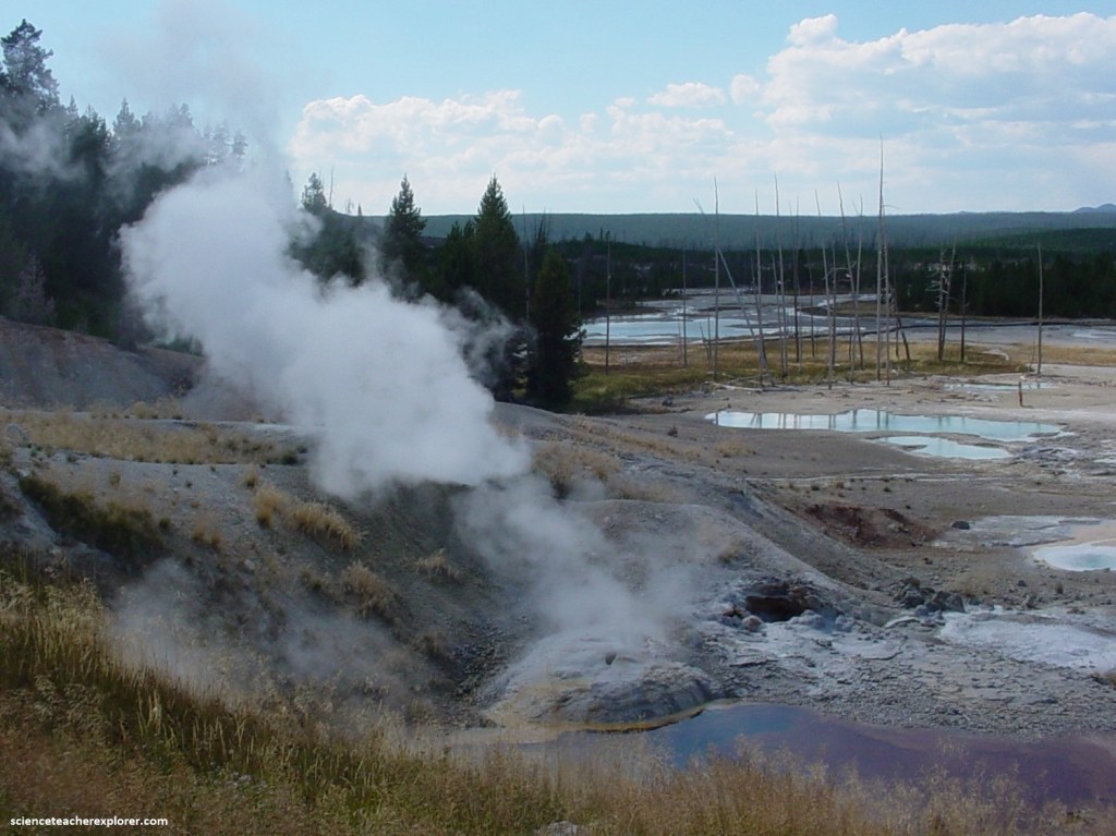
Pictured above, this 1.6 km trail enters a partially burned pine forest, then winds across a wet meadow on a boardwalk. The hydrothermal area within the short loop at the end of the trail contains colorful hot springs, mud-pots and small geysers.
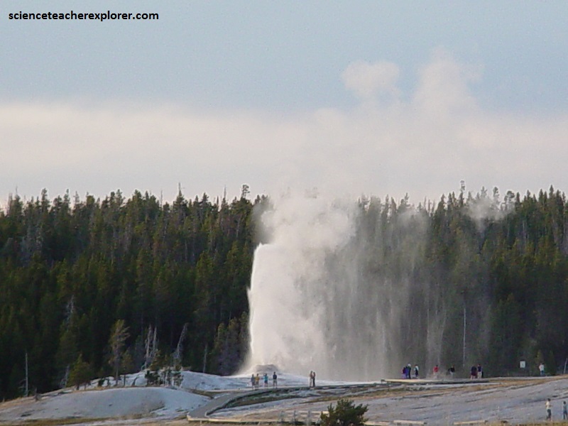
Pictured below, the most celebrated features are the spectacular geysers, the most famous being Old Faithful, which forces a fountain of hot water and steam 60 m into the air every 90 minutes.

Riverside and Excelsior Geysers are known to throw up a curl of boiling hot spray right over the Firehole River.
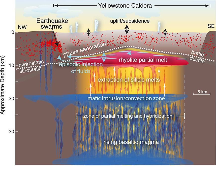
The engine for all this activity is a dome of molten rock that is no more than 3 km below the surface. It provides the heat that turns percolating water to steam, and drives out the dramatic columns of water, (imaged below).
Firehole River flows through one of the most unusual and remarkable landscapes in the world. It begins as a series of small cold-water springs just south of Old Faithful geysers and hot springs which dramatically change its temperature and mineral composition.
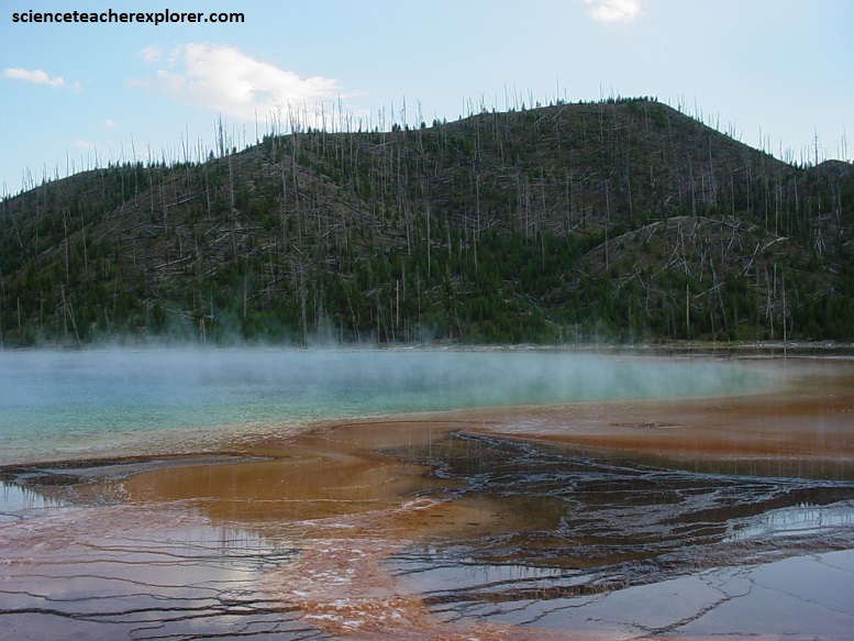
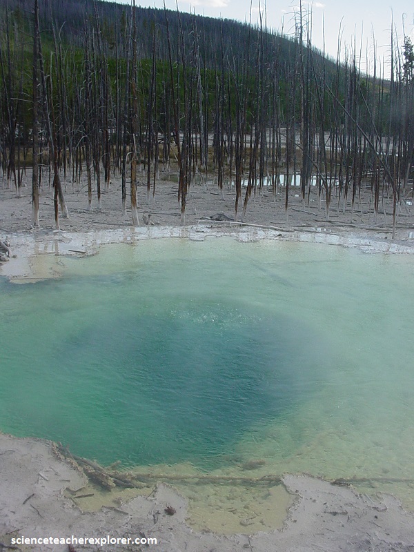
Yellowstone contains 3,000 hot springs and geysers, (the highest concentration in the world), and none is more beautiful than the “Grand Prismatic Spring”, which Firehole River runs past.
Pictured above, this gigantic, steaming hot spring is the largest and most fascinating in Yellowstone. It is nearly 116 m in diameter, and sits upon a large limestone mound, surrounded by a series of step-like terraces.
The Grand Prismatic Spring is a rainbow of colors. At it’s center, where the water is hottest, it is deep blue, turning paler blue farther out, and then green at its shallower, cooler edge where algae grows.
Each type of bacteria adapts to a narrow temperature range, and heat-loving cyanobacteria (blue-green algae) thrive on the spring’s heated terraces producing succeeding bands of yellow, orange, and red. Pictured above, on a sunny day, the steam rising above Grand Prismatic Spring reflects a rainbow that can be seen from a kilometer away.
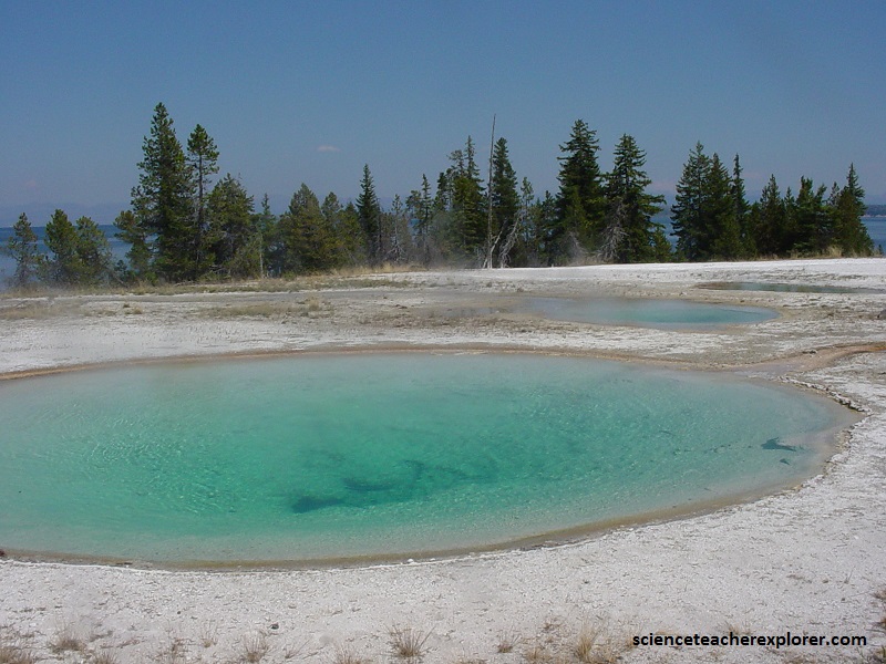
The West Thumb Geyser Basin is a thermal area modest in size and does not have the largest hot springs or geysers in Yellowstone National Park. However, I believe it is the prettiest. The “West Thumb” is, as the name indicates, located on the west side of Yellowstone Lake and is actually a caldera within the larger Yellowstone Lake caldera.
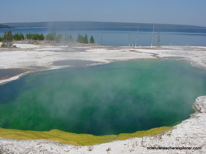
Pictured above, The name might be deceiving as Black Pool is clear blue and by many considered the most beautiful hot spring in Yellowstone. It used to be much darker, but with time the temperature has increased killing the bacteria that created the darker color. I believe the clear blue, turquoise color it currently possessing is prettier. With the lake and mountains in the background is makes quite a view.
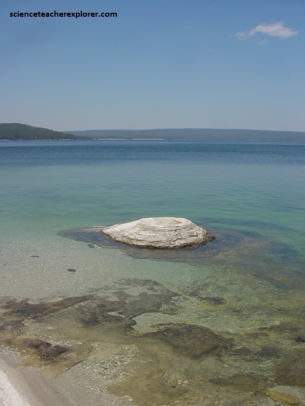
The Fishing Cone is one of the most famous thermal features in Yellowstone National Park. Apparently it got its name from early visitors to the park who would fish for trout while standing on the rim of the cone.
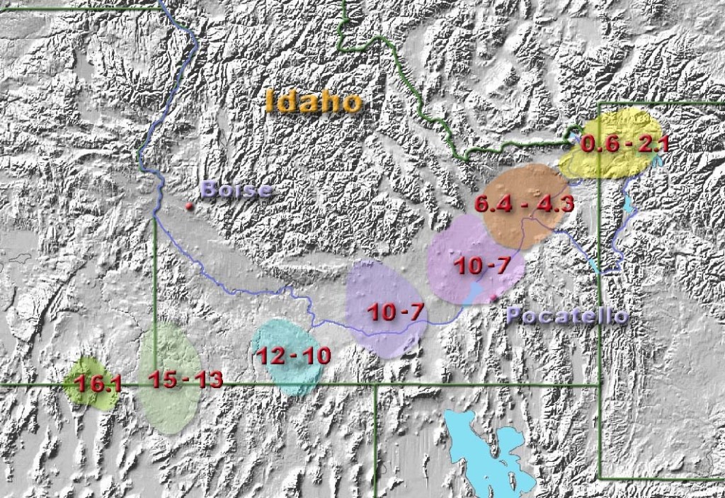
Before I close this page, I should mention the migrating Yellowstone Hotspot. The “Yellowstone Hotspot” is a volcanic hotspot in the United States responsible for large scale volcanism in Idaho, Montana, Nevada, Oregan, and Wyoming as the North American Tectonic Plate moved over it, as it stood still relative to the North Pole. It formed the eastern Snake River-Plain through a succession of caldera-forming eruptions. The resulting calderas include the Island Park Caldera, the Henry’s Fork Caldera, and the Bruneau-Jarbride Caldera. The hotspot currently lies under the Yellowstone Caldera. The hotspot’s most recent caldera-forming supereruption, known as the Lava-Creek Eruption, took place 640,000 years ago and created the Lava-Creek Tuff, and the most recent Yellowstone Caldera.
