Hilton Head, SC 2022
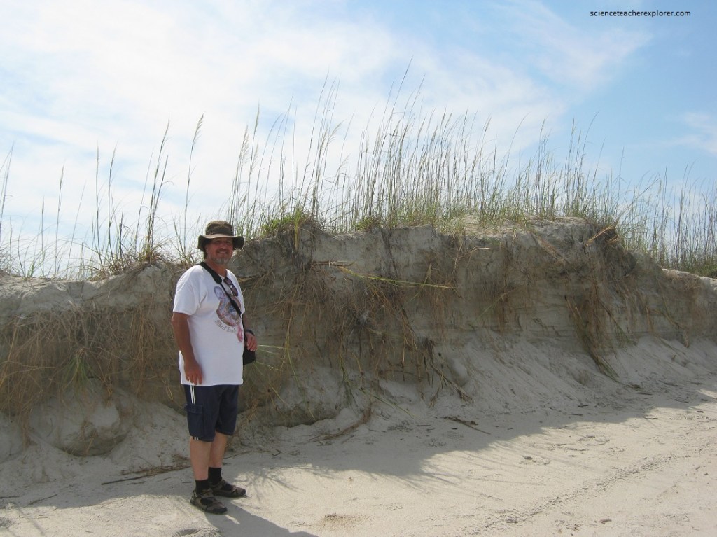
Becky (my wife) and I, took a trip to Hilton Head, South Carolina in May of 2022. We stayed and explored the island for about a week. We had decided to spend most of our time on the ocean front.
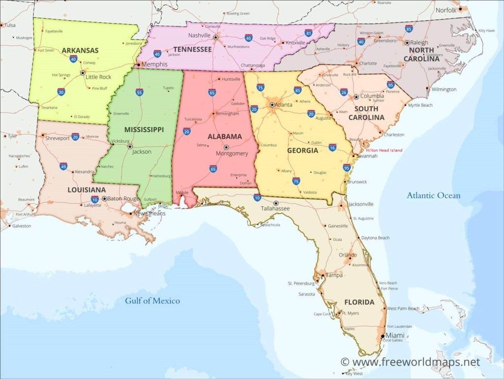
The second-largest barrier island on the East Coast was named in 1663 by adventurer Sir William Hilton, who thoughtfully named the island, (with its notable headland or “Head”), after himself. A broken necklace of sand isles runs parallel to the Atlantic & Gulf coasts. Scientists call these tidewater landforms barrier islands. Like an outer line of defense, they protect the mainland from the effects of sea storms. It is estimated that there are 295 major barrier islands in the 18 coastal states, from Maine to Texas, (imaged below).
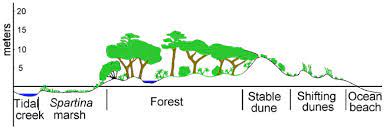
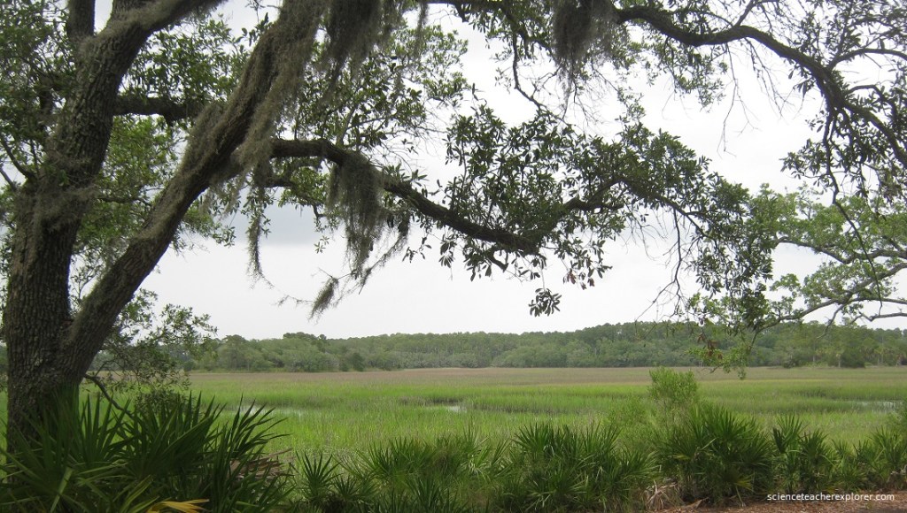
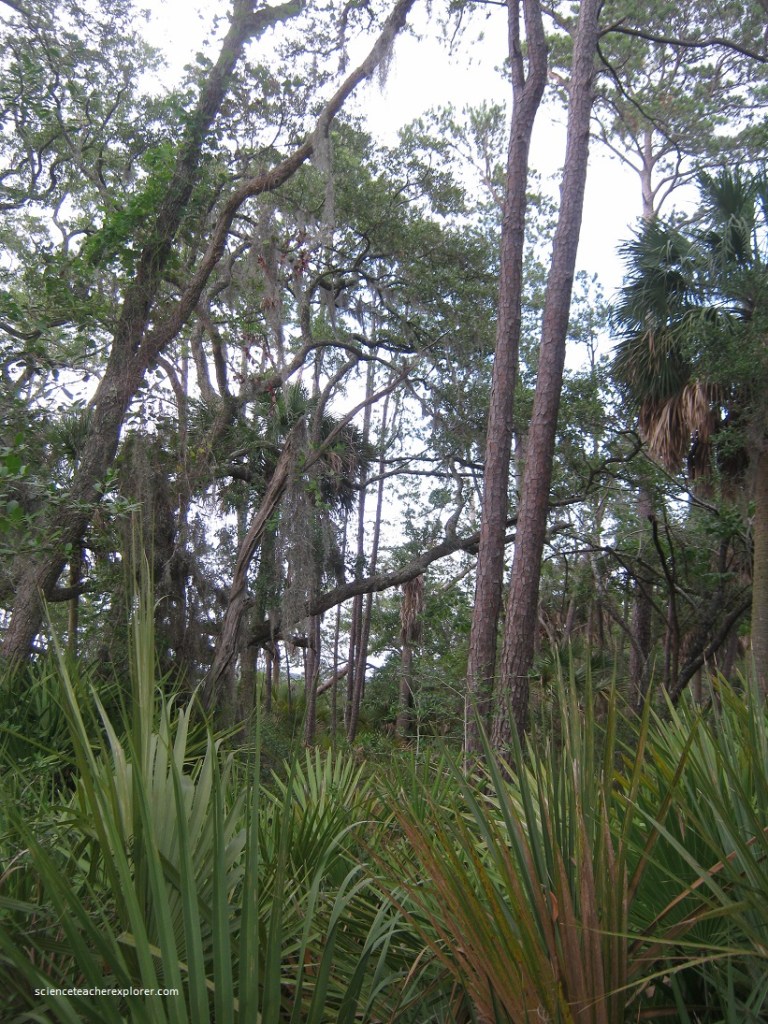
Generally the terrain of a barrier isle is characterized by: (1) A dynamic beach system with offshore bars, pounding surf & shifting or eroding beaches. (2) A series of grassy dunes behind the beach. (3) Maritime forests with wetlands in the interiors. (4) Salt or tidal marshes on the lee side, facing the mainland. The classic shape of barrier islands is elongated with one end typically wider than the other.
Imaged below, the large barrier islands of the south, (including Hilton Head), owe their origins to melting ice. When the Pleistocene Epoch ended 10,000 years ago, the great continental ice sheets thawed, causing the sea level to rise. Ridges & hills that once extended eastward on the mainland were cut off by the tidal surge. Lowlands & river valleys were inundated. Eventually, only high zones were left standing as isolated islands in the new, higher seas. Sedimentation from seaward-flowing rivers constantly adds material to the lee or bay-sides, building the cordgrass & mud prairies in our spacious saltmarshes. Mean while, storms & currents erode sand from the sandy seashores.
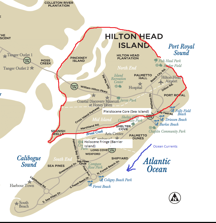
Imaged above, coastal contours on Hilton Head Island have been moving since ancient times. The island’s peculiar footshape is the product of erosion in 2 distinct geologic periods. In the pleistocene Epoch (1.75 million-10,000 years ago), higher sea levels deposited sand on the northern sector. As recently as the Holocene Epoch (5,000-10,000 years ago), rising sea level deposited a barrier fringe on the Pleistocene core, (forming the areas from Por Royal Plantation to South Beach).
(1) Ancient Hilton Head, (within the red circle imaged above): A crescent-shaped plateau that impede waves & collected sand, this Sea Island extended perhaps a kilometer Northeast into Port Royal Sound & South into Broad Creek. Rising sea levels & storms will continue erode the beachfront from “Fish-Haul Park” to northern “South Beach”.
(2) Present Hilton Head, (outside the red circle imaged above): Storm waves & longshore currents erode northern headlands & transport most of the sand southward. The southern “toe” of this Barrier Island is a “spot” of sand that the currents drop. Broad Creek is now a landlocked tidal marsh.
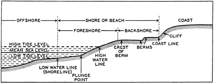
Pictured above, swells & ridges moving across the surface of the sea may take many shapes & sizes. Roller, “breakers”, ripples….most waves result from wind acting on the open ocean. A strong, steady blow forms waves, exerting direct force on the backside & an eddy on the front. This pushing & sucking effect move the wave forward. The height, distance between ridges, (called the period), & length of waves are determined by wind speed & duration as well as by the fetch, (distance the wave has traveled). [The more massive waves make an oceanic journey of over 800 kilometers]. Breakers or surf wave form, when waves run toward shore. Here the shoals cause the wave to drag bottom sand or rock. Moving more rapidly on the surface than on the bottom, the top slams forward in a wall of churning, white water.
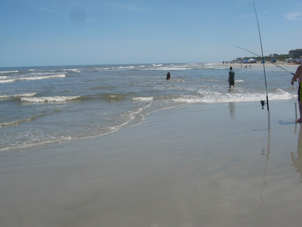
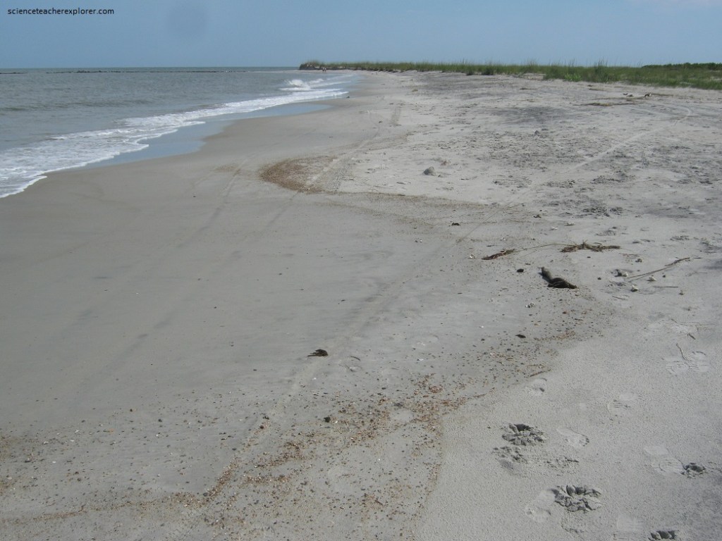
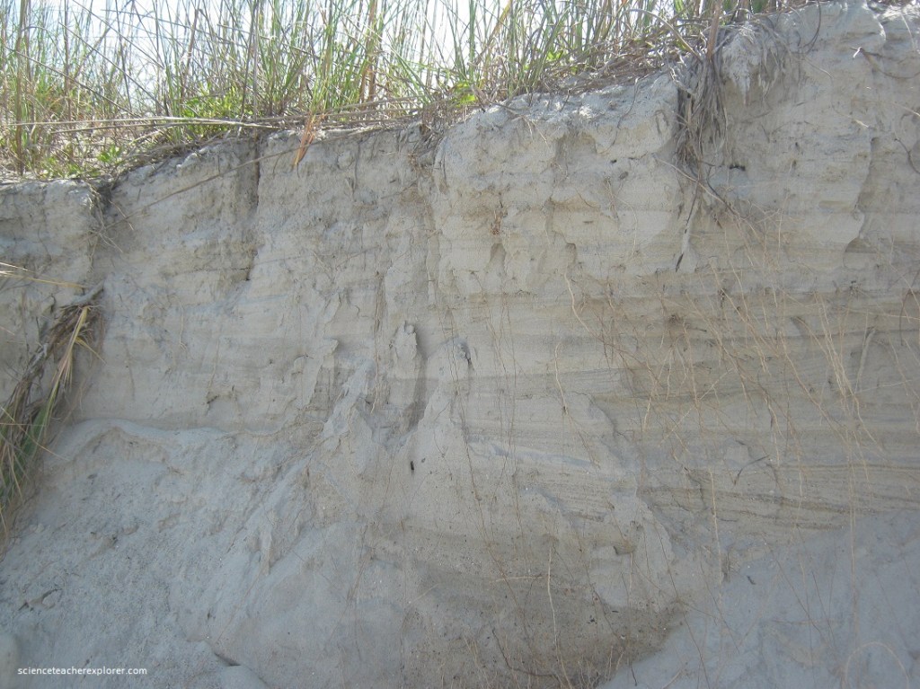
Imaged above, beaches come & go overnite on the force of sea currents, waves, winds, flotsam & plants. Shoal-water waves charge the beach on Hilton Head beaches at an oblique angle, pounding into the northern headlands & floating loosened till southward in a “longshore current”. Splashed ashore by storm surf, sand is hoisted airward by sea breezes.
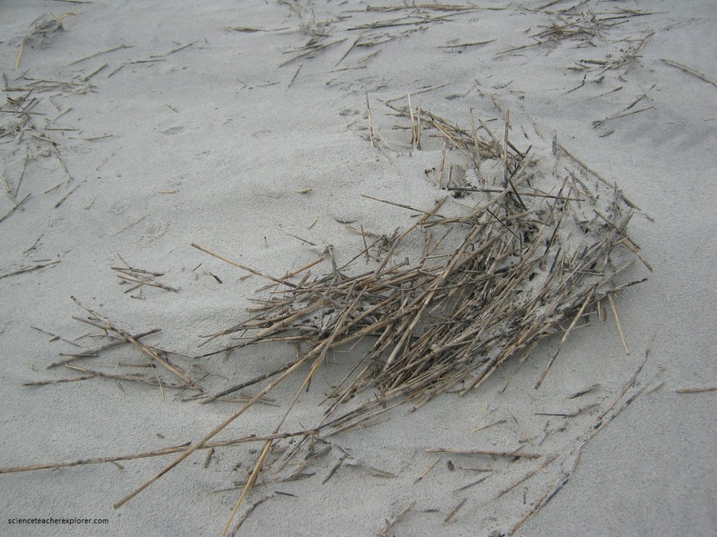
Pictured above, for this show of sand travel, the curtain falls in Salt Hay. The tan-brown decaying spartina grass (perennial cordgrass top- stalks), provides vital beach mulch. [ (1) Degrading grass restores fiber to porous sand; (2) The decay yields nitrogen & 14 other essential elements beach plants need to grow; (3) Rain & tides keep salt hay damp, encouraging seed germination]. Pictured above, windblown/tide “Bitter Panic Grass” bens before the latent current. Its blades create a barrier that catches & collects air-borne sand. Grains pile around the shoots. In time, shrubs & trees colonize our salt hay dunes, crating a life-saving holdfast against erosion.
Pictured above, the shoreline called “North Forest Beach” is submerged under 3 meters of seawater at high tide. The main beach is frontage suffering of extreme erosion. A southbound “littoral drift” current and a rising sea level has peeled dunes back inland 3 meters a year! To barricade their dangling homes, most residents here have constructed this colossal rock seawalls to rebuff attacking waves.

Pictured above, seawall at the North Forest Beach is built by grading sand banks, laying on a thick back nylon mesh & weighting it down with tremendous aggregate boulders. Big rocks measure 2 meters across. But high surf floating suspended sand, dirt & salt hay chips off small pebbles packing in the crevices and making hideaways for odd sea creatures.
The shrub palm of the Hilton Head barrier island is called the “Saw Palmetto”. The Fronds make a fan-shape 0.8 meters in diameter. But unlike those of palmetto trees, saw palm leaves radiate out from the base of the leafstalk. The root is the reason saw palmettos are shrubby. It spreads laterally underground, sending fresh green fronds upward every few centimeters.
Pictured above, to watch the running sea day after day is to learn of the enormous to-&-fro power of the tides. The sun & moon exert a gravitational pull on the whole ocean, producing the effect of high & low tides. Tidal currents occur when the incoming or outgoing mass of water increases in height & forward motion along the coast. Normally, this “tidal wave” move about 3 mph, but the narrow passage here constricts the water flood and can run along at 12 mph.
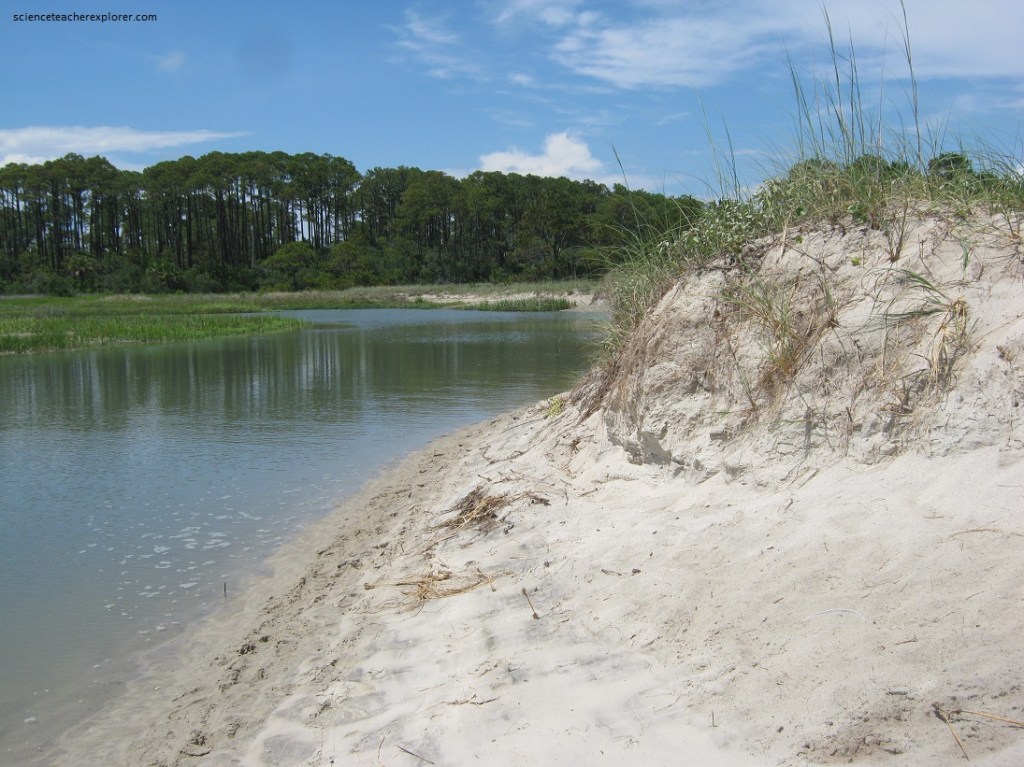
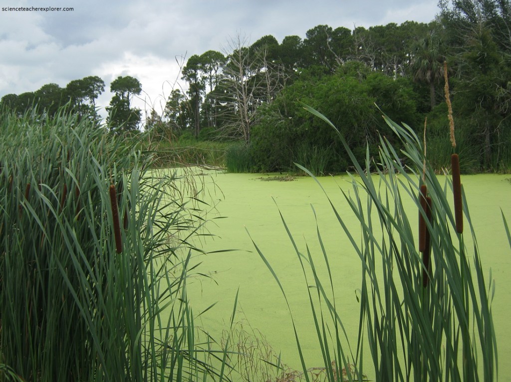
Imaged above, one of the Hilton Head islands’ most unique natural systems has one of the oddest names…..the slough. Pronounced sloo…., a slough is a linear, depression or bottomland usually filled with water, mud & aquatic plants. Today these wet swales, commonly run parallel to and are located west of the seashore.
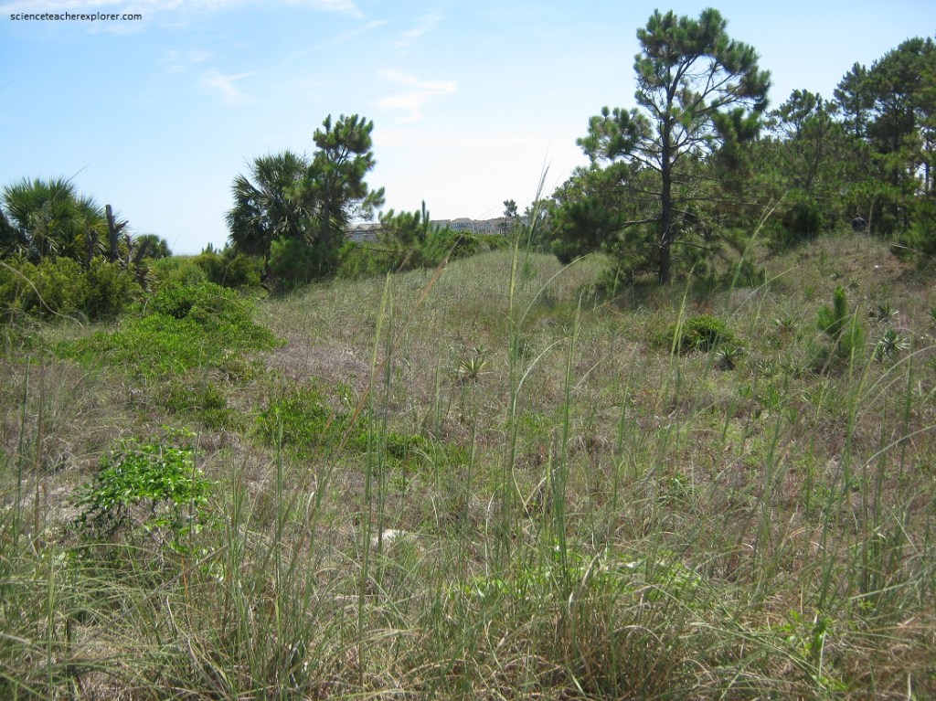
Pictured above, sloughs originated as ancient shorelines during the last “Ice Age” (approximately 10,000 years ago). When the sea level dropped, (due to glacial refreezing), these low zones of wave action were stranded inland. New beaches formed to the east as the sea receded. What were ancient dunes are now forested ridges containing the slough.
Pictured above, the natural wetlands forming between dunes & ridges are far too often overlooked as useful. They are commonly dredged, filled & forever destroyed on developing barrier island. However, these sloughs perform critical functions which affect our very live. For the 4 reasons below, marshes, swamps & bogs must be conserve…..(1) Flood Control: low-lying troughs absorb & refrain rainfall & hurricane surge which would flood houses/roads. In drier weather, wetlands release their store of water to nearby creeks. (2) Pollution Cleansing: Sewage, pesticides, chemical fertilizers, heavy metals & animal wastes are trapped by slough plant-life. Bound in the mesh of roots & oxygen-poor soil, pollutants like nitrates are transformed into harmless substances by bacteria. The water seeping underground would be filtered free of dangerous compounds by the slough. (3) Groundwater Recharge: Collected surface water percolates into the soil to underground reservoirs, restoring shallow supplies, needed by plants & perhaps deeper (artesian) sources consumed by humans. (4) Recreation: Fishing, photography & nature study are easily available quite near the beach to all who make the small effort to visit sloughs, the Hilton head’s most hidden-most resource.
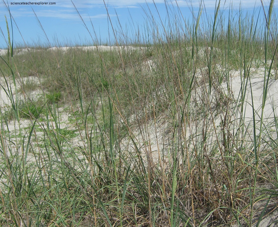
Pictured above, the backshore dunes reign the beach grasses which flourish in extra-thick. These herbs alone can survive the blistering salt-spray, drenching spring tides, scalding heat & arid solid, for 3 good reasons. (1) Flowering seed spikes produce 100’s of seeds. (2) Stickers, wings & parachutes launch seeds, which can lie dormant for years until growing condition are just right. (3) New sprigs sprout from running root-stocks. Pictured above is an abundant population of Bitter Panic Grass, (bluish-green, the 1 meter tall grass is topped with a 30 cm long seed spike.)
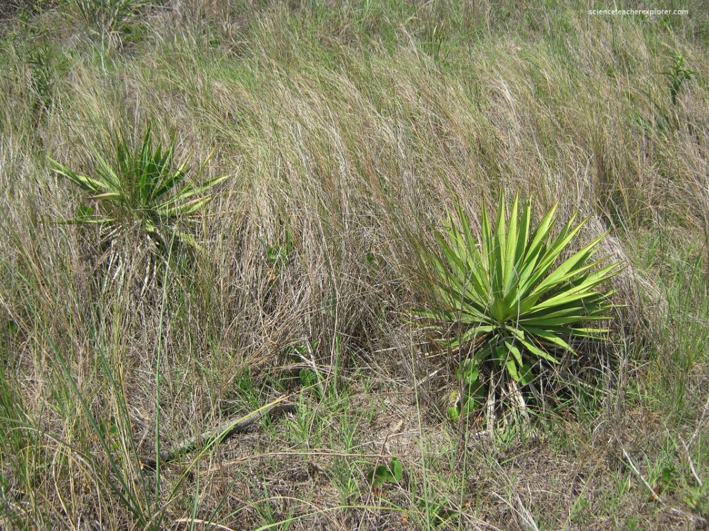
Pictured above, the “Spanish Bayonet” is one of coastal Carolina’s most familiar Yuccas, (a group of shrubs & trees in the lily family). The back of dunes & sandy openings are hot habitats where they flourish naturally. Maturing to 4 meter heights, the woody trunk bristles with an awesome array of stiff dagger-shaped leaves. The 60 cm long blades are tipped with a sharp-spike whish will poke painfully upon contact.
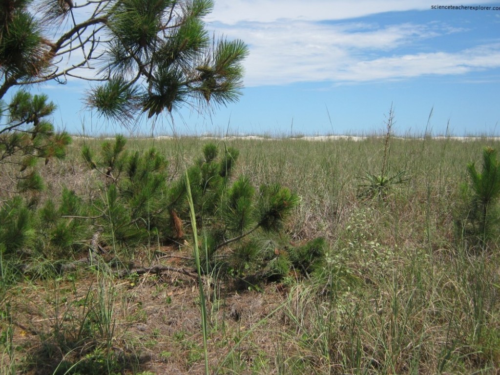
Pictured above, Yellow Pines are the most abundant green growth of the Hilton Head Head barrier island. Their pole-straight branchless trunks topped with silvery umbrella crowns are seen in all habitats here. Each pine species is specially adapted to different areas.
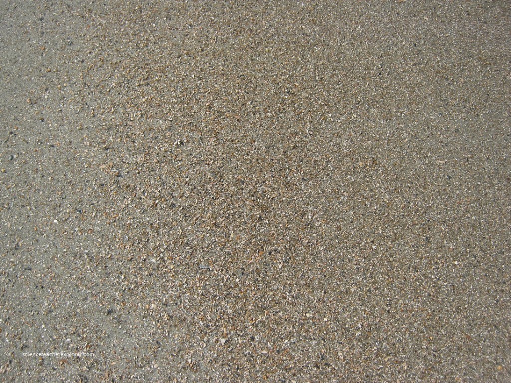
Pictured above, loose mineral & rock grains larger than salt but smaller than gravel, sand is colored chalky gray. 3 ingredients are involved: (1) Quartz: translucent, angular grains weathered from Appalachian granite & transported here by ancient rivers. The micro-pebbles {1mm} squeak under foot when granules chafe together. (2) Ground-up sea shells: Calcium carbonate chunks pulverized by surf into a sparkling, ivory powder. (3) Detritus: decayed marine plants, dead animals, plankton skeletons, fecal pellets & bacteria show as black specks.
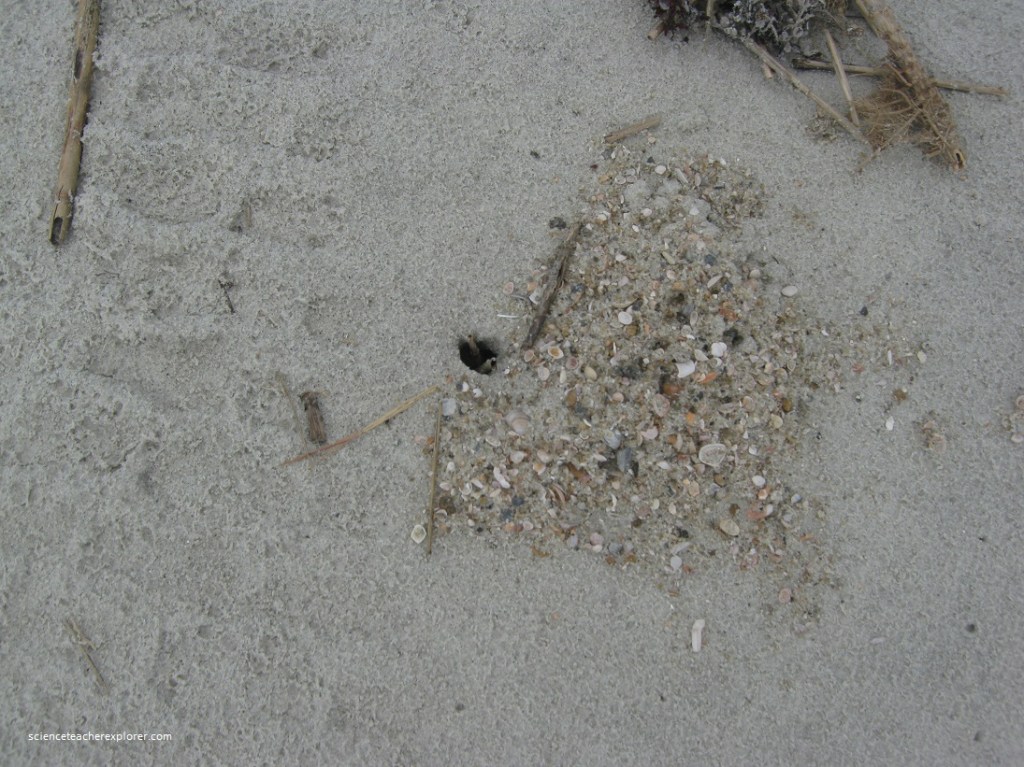
Pictured above, waves & currents gouge, tumble & float sand along shores by the ton. Heavier grains lodge on offshore bars, but lighter particles are stirred & suspended in the waters. As tides ebb & flow, this fine sand is dragged seaward by waves & settles into a layered hard-pan with barely a slope, The flat, packed surface, firm enough for jogging/biking is a boon to animal life. Below-the-beach, creatures burrow or empty tubes, tunnels or siphons to hide & feed. With little air space between tightly compressed grains, our sand provides a habitat that won’t collapse.
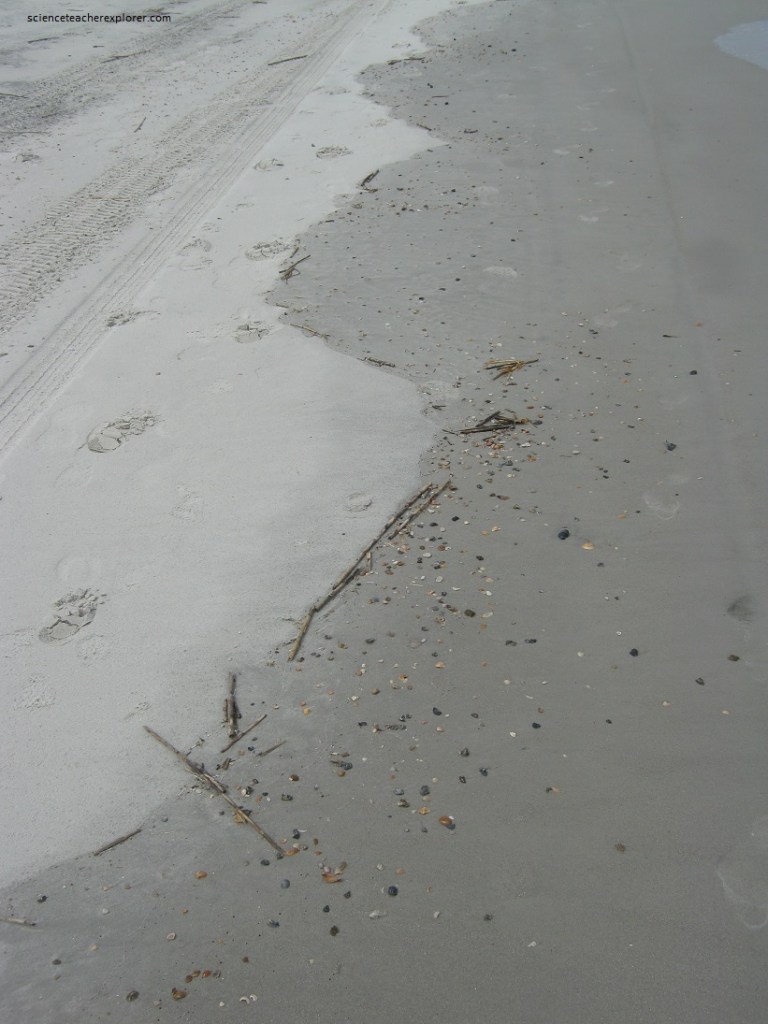
Pictured above, when up-rushing waves skim up the beach, a tin film of water bulldozes a line of sand & flotsan ahead of itself. After the swash sinks into sand & slides back seaward, arching debris formations remain at the high water mark like a “scorecard of wave action”.
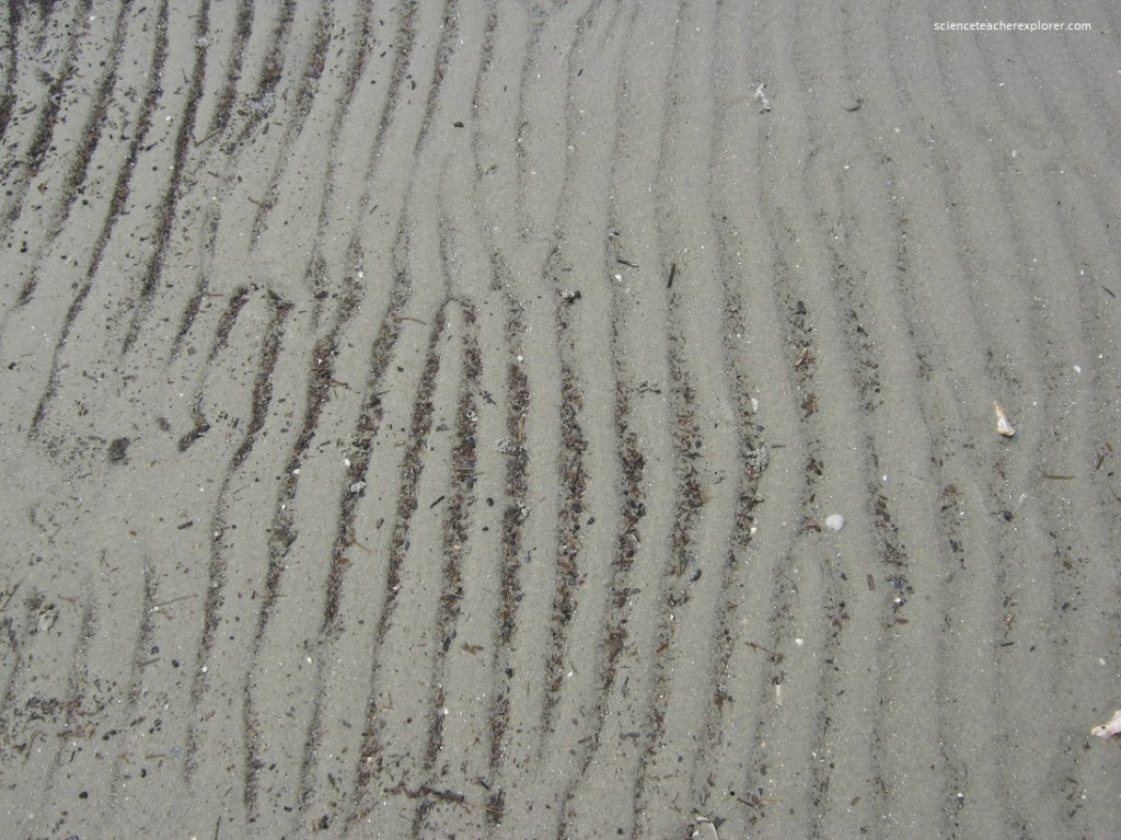
Pictured above, small waves in the sand on low tide flats. Ripples form under the back & forth motion of high tide water moving across shoal sand. Average onshore ripple measures 3-6 centimeters crest to crest.
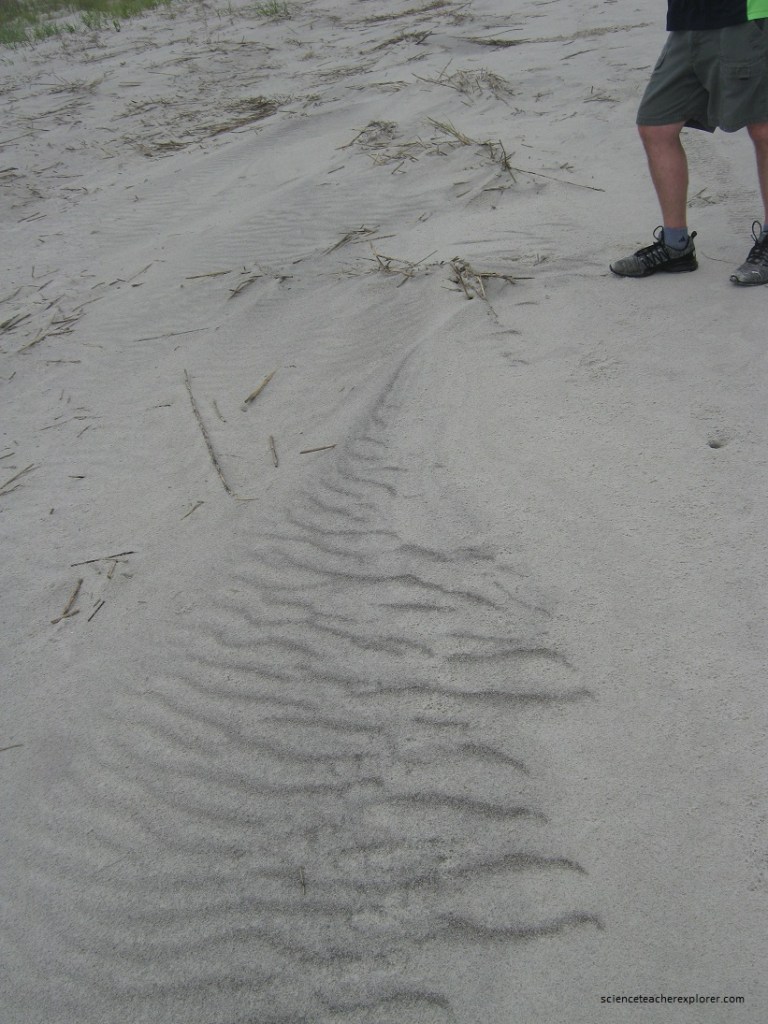
Pictured above, miniature river deltas draining high tide swash back o the sea. Rills float out debris, shells & animals.
Pictured above, odd concave, crescent-shaped depressions evenly space across the wet beach. Cusps may form when up-rushing swash excavates this small bay, dredging the center on the ebb. Successive waves surge in, deepening cusps.
Pictured above, the island’s heel is a curving spit of sand & mud bordering Port Royal Sound & the Atlantic. In 1663, the namesake explorer, Capt. William Hilton guided his ships inshore using this easternmost facing point as a landmark. Old mariner’s maps soon called the prominence “Hilton Head”. Hilton Head Beach is located in Port Royal Plantation.
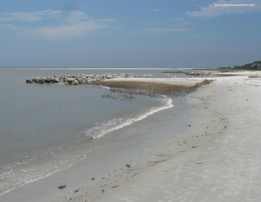
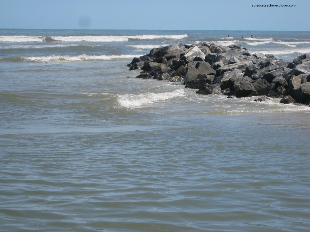
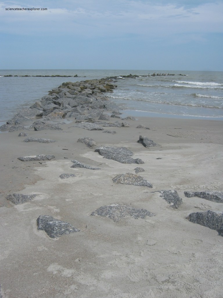
Pictured above are 5 oyster-encrusted jetties that have current-borne sand. Now the beach is one of Hilton Head’s widest….30 meters of dry sand & seat oats grading to 100 m of rippled tide-flats with “pecking Puddles for hungry shorebirds, (pictured below).
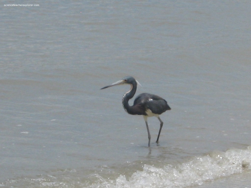
Pictured above, the graceful “Louisiana Heron” is a common, permanent resident to the Hilton Head Island. This 66 cm wader is tri-colored. Purplish-blue on the neck & back contrasts the obvious white underpants. The sharp black bill swiftly strikes worms, frogs, tadpoles, snails, insects, fish and lizards. The Louisiana Heron is tamer in disposition than most other waders.
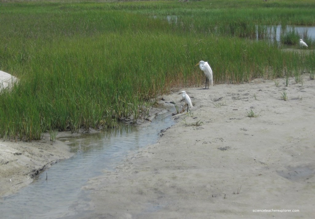
Pictured above, with quiet alabaster poise the “Great Egret”, on the right, wades shoal water of marsh sloughs & lagoons. The 100 cm, dazzling white bird with black legs, extend the lengthy crooked neck out near the surface, to spear with its long yellow bill at crabs, snails, small fish or frogs. To the left, is a little snow egret with the golden slippers. 61 cm long, this heron is noticeable shorter then its lanky cousin on the right. A snow’s plummage is also ivory, (white), but far softer & and fluffier looking. Note the bill is black, as are the legs.
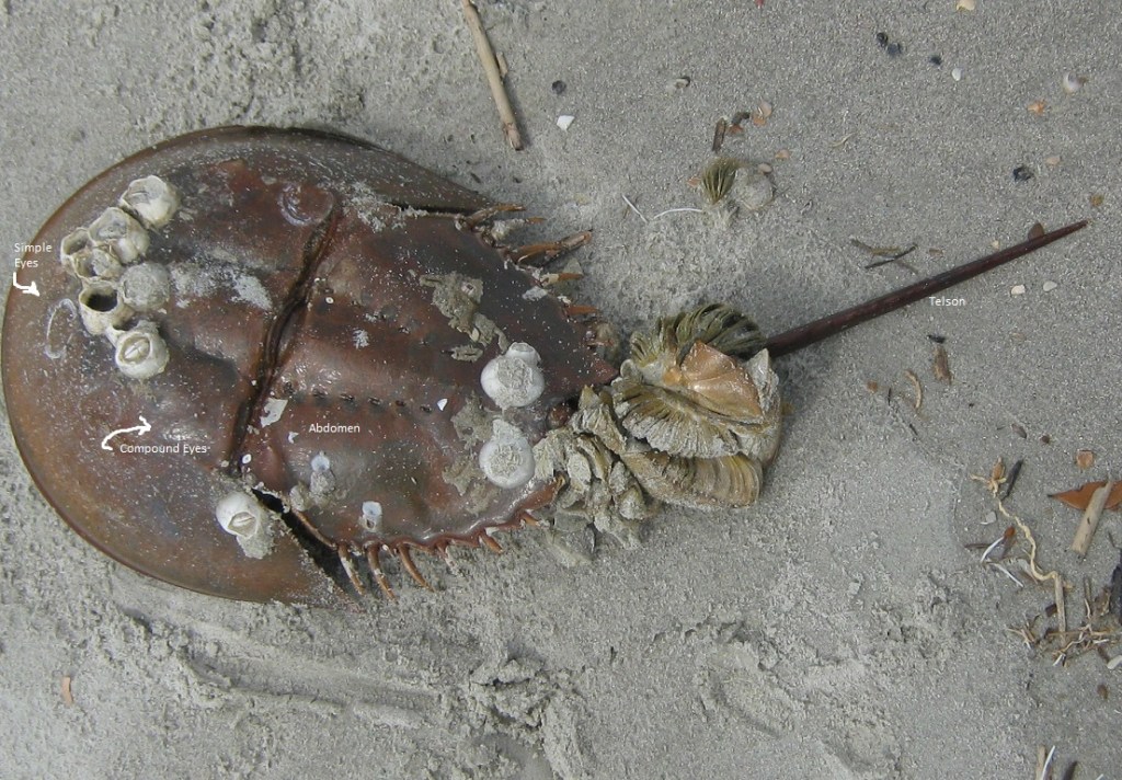
Pictured above and below, Hilton Head islanders come to know “Big Brown” with its saddle-brown shell & spiked tail. Named for their “U” shaped hard-hat, Horseshoe Crabs litter Hilton Head’s after-tide beaches, thanks to ebbing waves. Note the “Barnacles” that have attached themselves to the “Horseshoe Crab”. In the world of shell-fish, Barnacles are the saltwater city-dwellers. Limey hordes overcrowd Hilton Head’s jetties, dock pilings & bulkheads with a crusty stibble best observed at low tide. Up close the 0.6 cm wide, Barnacle shells look like knubby, white acorns with flat, sticky bases. {Additionally, it appears to have a “Moon Snail” attached to its butt. Moon snails aggressively search shoal-water sand bottoms for meaty victims.}
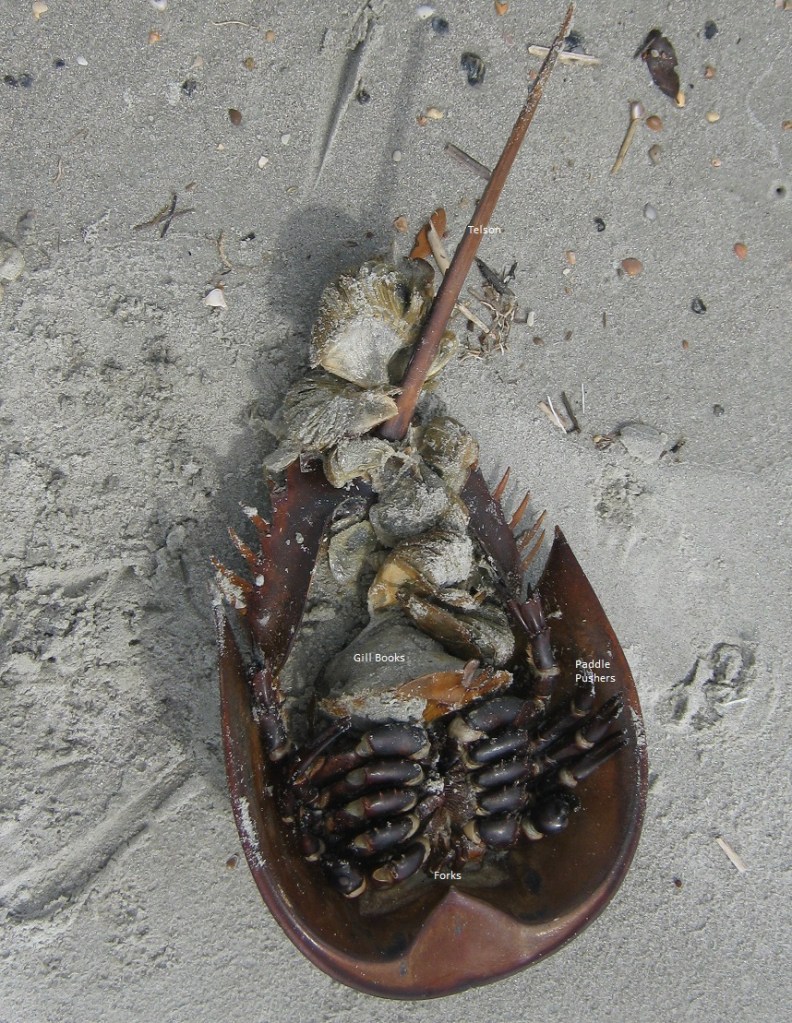
Pictured above, Zoologist argue that the Horseshoe Crab is no crab at all, rather a seawater-scorpion with armor, gills & a tail. Compound eyes, located beneath horny shields atop the shell & 2 simple eyes at the shell-front register light & dark. The hinged abdomen, acts as a anchor & flaps to jet the ‘Horseshoe’ along muddy estuary bottoms. Here it feeds on worms, shrimp, small clams & algae, which it forks in with tiny foreclaws & then rubs them raw with bristly hairs between the 10 walking legs. Note the 2 back legs are flanged paddles, giving extra propulsion. Behind the legs are found 6 groups of “gill books”, that are used as the creatures respirators. The sharp tail, or “telson” isn’t a weapon. It acts as a swim rudder or cane to flip the “crab” over if up-ended by waves.
Pictured above, clustered colonies of oyster shells combine to form one of the marshlands richest animal communities, called a bed or “rake”. A mild tidal flow, laden with plankton & detritus decay supplies foo & oxygen to the filter-feeding bivalves.. Easily observed at the mid-tide zone in salt creeks & flats, together these oysters are a center hub in a wetland wheel of life and death.
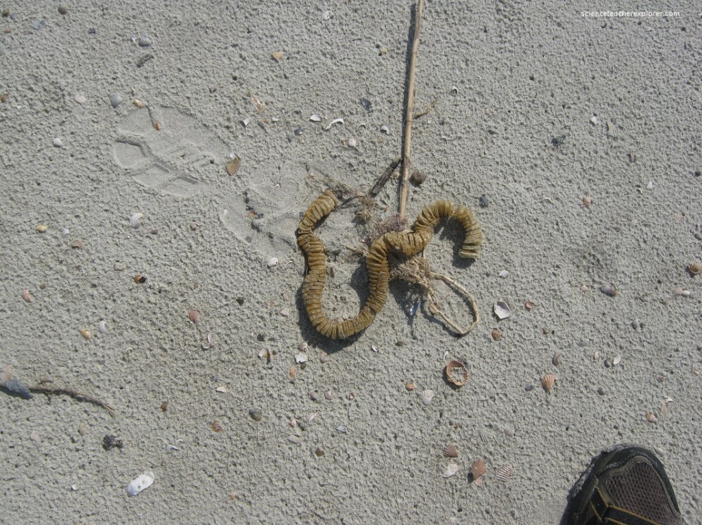
Pictured above, walking along the “Fish Haul Beach” area, I found the Whelk Egg Case in the tidal flotsam. The females create these 60 cm long, papery disc-shaped chambered chains, & cement them to rocks & dead shells. Each tan capsule holds 10-15 eggs; which hatch as miniature whelks that feed on plankton stored inside. At 2 weeks of age, the knobbies chew out of their cases leaving a hole in the camber.
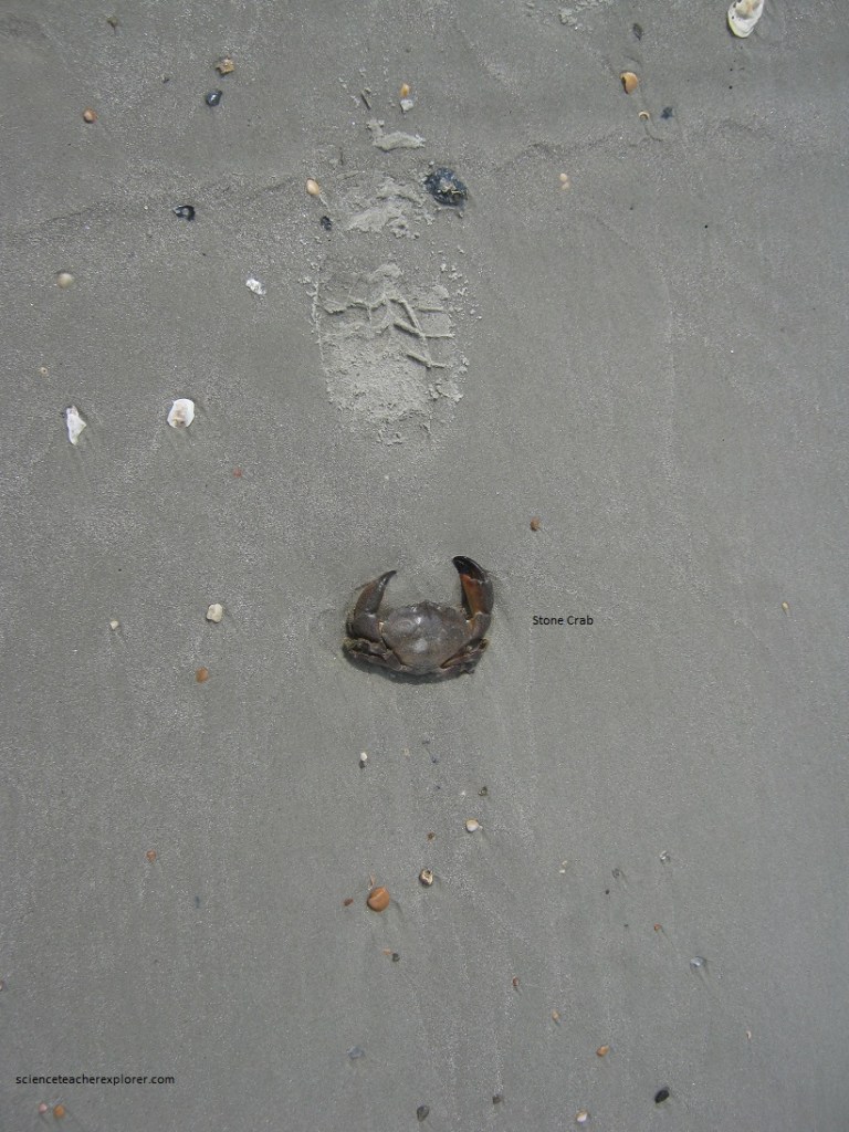
Pictured above, the “Stone Crab” is a chunky member of the mud crab family. It is identified by the dark tips on both big claws. Colored the hue of muddy sand, the oval carapace (top shell) is about 8 cm. The body is nearly 4 cm thick. I found the hollow carcass of a dead stony awash on a sand spit. This crustacean dwells abundantly in oyster beds.
Pictured above, this solitary stretch between Dolphin Head & Fish Haul Creek is characterized by craggy headland bluffs facing the mighty Port Royal Sound. Lofty for Hilton Head’s gently sloping shoreline standards, the 5 meter, sheer face is a beachfront battle-zone.
Buckling under the slap & slosh of storm surf, tidal currents & a rising sea level, woodland trees & sod tumble in great hunks to the mudflats below. The bluffs erode 1 meter a year in this manner.
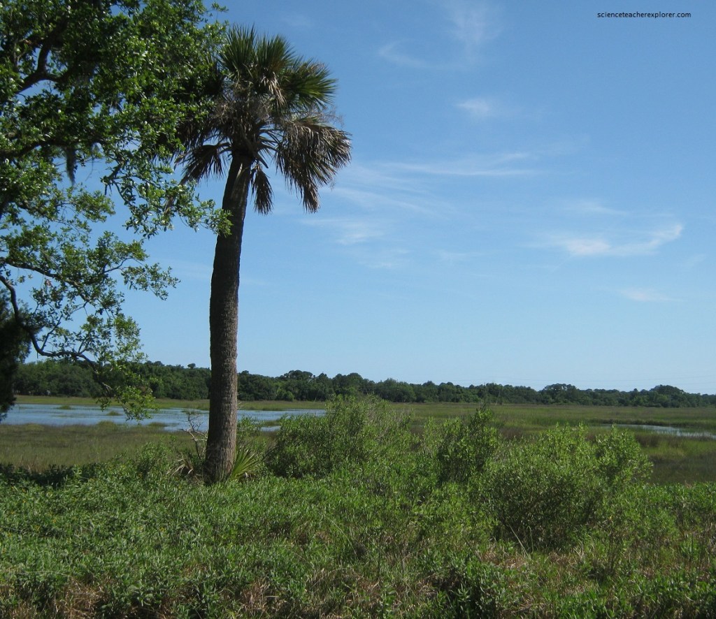
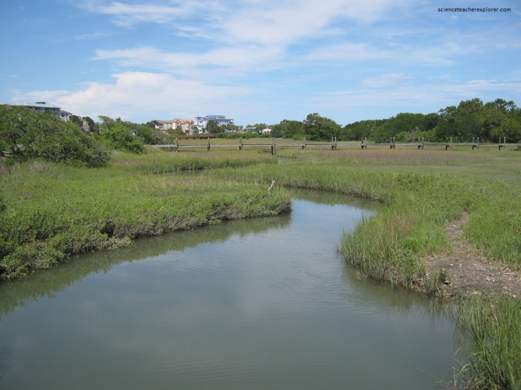
Pictured above, a two-way watercourse where the widening lower reaches of a river system empties into & is influenced by tidal waters is called an estuary (the “Broad River is a classic example). The estuary includes the arm of the sea, (such as a sound or bay), that extends inshore to merge with the river mouth. This estuarine drainage creates a unique mix known as brackish water, (a solution less briny than sea-water but more salty then rainwater runoff). Plants & animals flourish in the blend of brackish water.
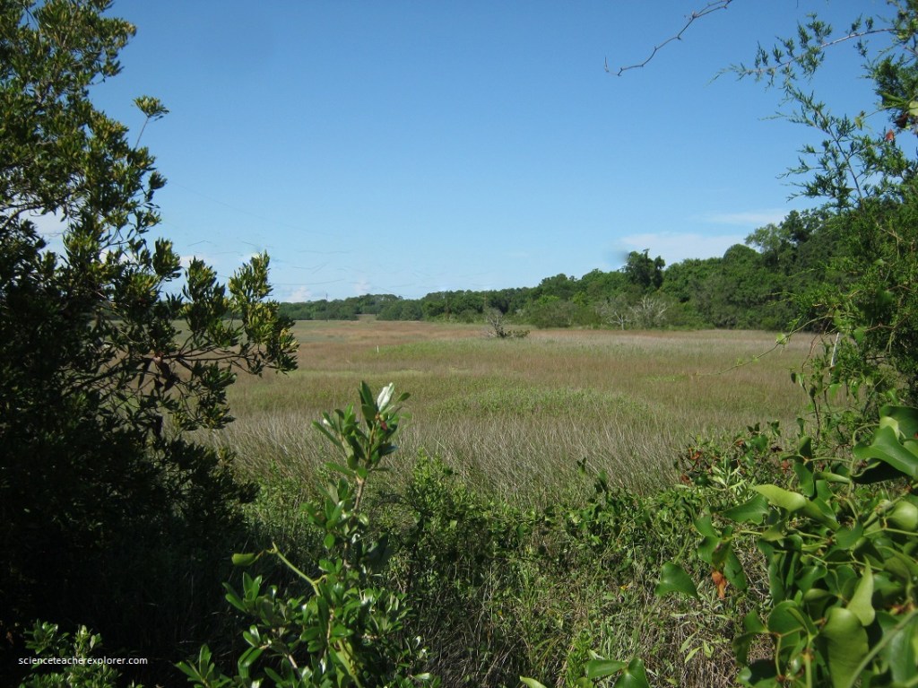
Pictured above, a chartreuse swash of waving grass prairies, steaming mudflats & forever winding, high-banked creeks is the wetland world of the salt marsh. These low-lying, border environments are found in estuaries, (like the Broad Creek Estuary), and inshore zones between barrier islands & the mainland, (like the Pinckney Island Wildlife Refuge pictured below). Salt marshes form in silt deltas which deposit at river mouths. Imaged below, Pinckney Island National Wildlife Refuge combines 4,053 acres of diverse habitats, (salt marsh, tidal creeks, marsh island, forest hammocks and freshwater ponds).
Pictured below, saltwater tolerant plants colonize the muck & trap further sediment running off islands following rains. The seasonal death & decay of stems & leaves builds the soggy peat soil of the marsh, called muck.
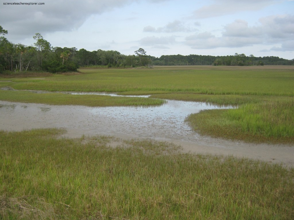
Pictured above, tidal currents are diverted around the islands’ ends where they gently bathe & flush the fertile salt marshes with a clockwork supply of salt water. At high tide, (every 6 hrs. & 6 mins. tides flood in), nearly cover grasses, stirs up bottom nutrients (thereby supplying shellfish with food), and carries along oceanic fish & plankton to feed & breed. Ebbing waters of low tides (1-3 knots) transport a tan slurry of dissolved nutrients, marsh grass & small animals (dead or alive) to nourish the offshore food chain.
The greening of the saltmarsh is ushered in by the first rains of March. Winds shifting back to the southwest push in storms, (which drench dormant marsh seedlings), carry burdens of minerals & nutrients from melting mountain snows, down rivers & into coastal estuaries. Fed by this fertilizer, tidewater plankton & algae in mud bloom, attracting hosts of hungry marine creatures to the wetlands.
Pictured above, small tree island embraced on all sides by wide-open salt marshes are know locally as hammocks. These 1-2 acre microzoic mounds stick out of cordgrass meadows as eye-catching protuberances. Here water-borne sediment accumulates around some refuse as a bar or “sill”. Salt tolerant seeds germinated in the muck & build layers of soil with their rotting leaves. “Maritime” shrubs & trees thrive in the hammock humus. The increasing elevation of the isle decreases the killing effect that salt water has on roots & leaves. Over-time, the hammock interior seems a jungle-like mass of twisting, tangled, vining evergreens, while the exterior is ringed with a sentinel colon of high marsh vegetation.
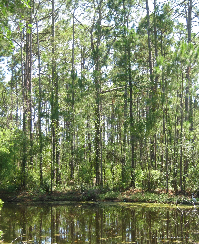
Pictured above, saltmarsh hammocks are miniature wildlife refuges for many birds & mammals of the barrier islands.. Although they are located on the protected lee-side of the island, the forested humps, still may sit as far as 1 kilometer from the nearest high ground. Enclosed by the dynamic wetland world of flood & ebb, the hammock habitats provide for vital wildlife needs, (cover, nesting & food). Pictured below, wading bird hob-knob on hammocks while hunting fiddler crabs/snails in nearby marsh banks.
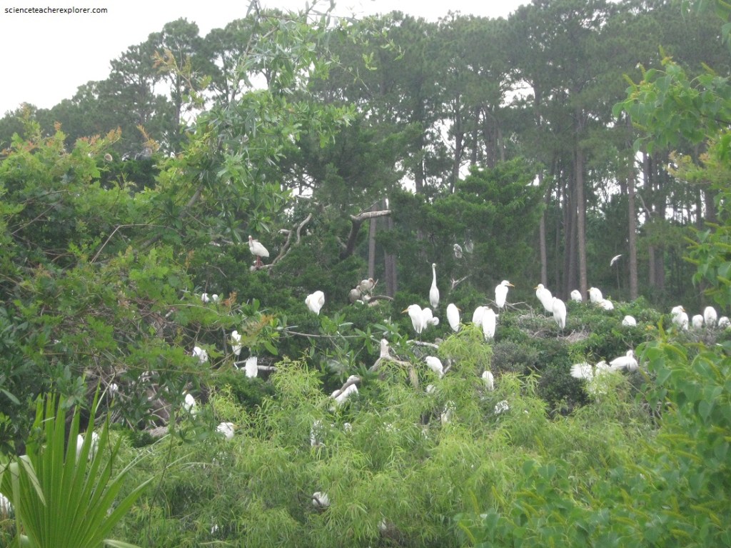
Pictured above, several snowy families rest in a shared southern “Red Cedar”. For this is the 16 meter Juniper with the whispy, viridian-green crown, colonizing brackish mudbanks & wettish sand/oyster spits. It’s centimeter scale-like leaves (not needles) are closely pressed in opposite pairs & stay on the twig 5-6 years before browning up. Red Cedars thrive wherever calcium-rich shells abound. They indicate high pH soil…
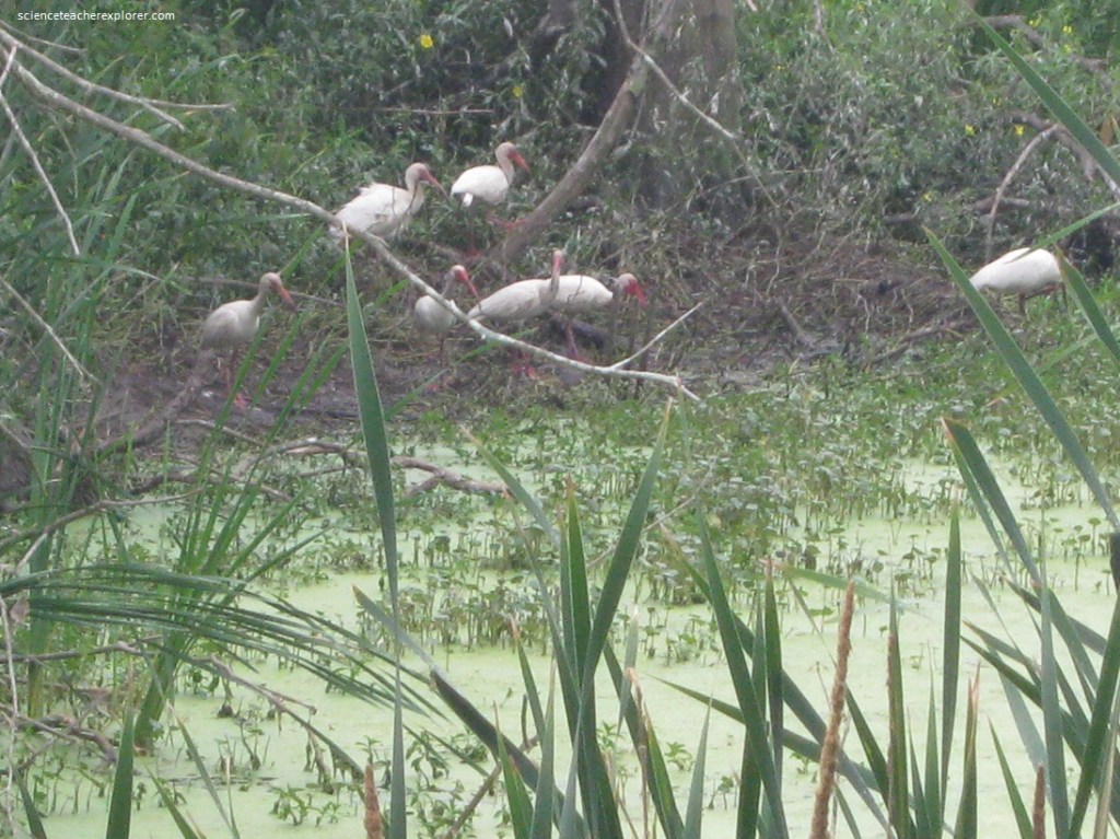
Pictured above, the “White Ibis” is best known by its turkey-red bill & legs contrasting snow-white plumage. The slender “decurved” bill is evenly curved down to the tip. It is used for sweeping pond water or mud-probing for crayfish, fiddler crabs, insects, worms & frogs.
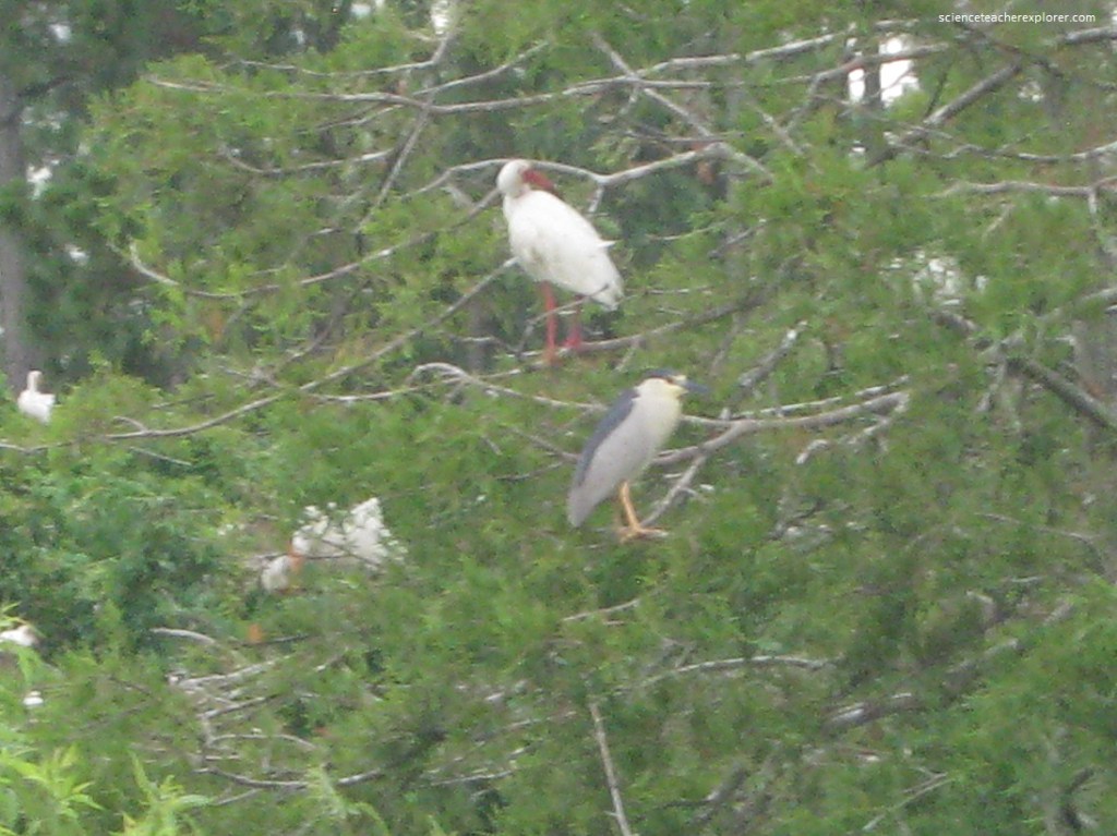
Pictured above, Black Crowned Night Herons are 70 cm chunky-gray, short-necked waders always identified by their black cap & shoulders. The bill is black, the shortish legs yellow to pink. By day it is most inactive & roasts, perched on over-water limbs. Frogs, fish or snakes are easy targets for the quick-stabbing bill guided by the big eyes with refined night vision.
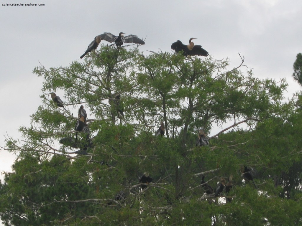
Pictured above, after feeding, cormorants characteristically dry their feathers by perching with their wings outstretched. Double-crested cormorants perch on trees, rocks, buoys, and other objects that overhang or project from water. Cormorants are expert divers. Some dive as deep as 45 meters. They speed along underwater via their webbed feet, using their wings as rudders. Some colonies of cormorants have been observed herding fish for more efficient hunting.
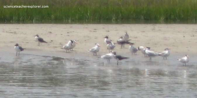
Pictured above, Caspians breed in bunches in South Carolina, nesting with Laughing Gulls, on sparse, offshore bars like Pinckney Island. Terns are generally smaller than the gulls. Terns dive to fish and Gulls float/land on water to pick up prey…
Nowhere is the “man discovers the shore” phenomenon more evident than on Hilton Head Island, South Carolina. Largest of the southern barrier isles. This foot-shaped strand has undergone substantial land development since the 1960s. I was intrigued by the coastal creatures in the numberless finned, feathered, crusty, blobbed forms. Highly specialized plants adapting to the long growing season here lends tropical air to the island. This semi-tropic bit of botany is enough for a lifetime of study of endemic flora and greenery.
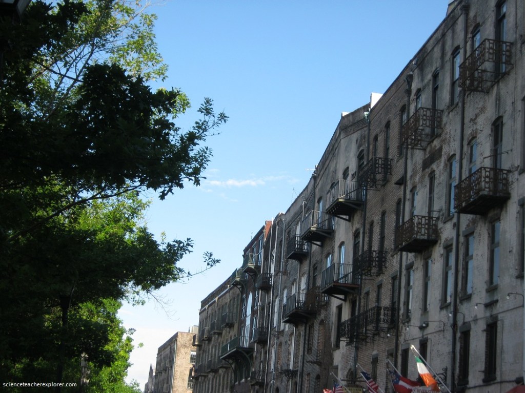
While visiting, Hilton Head Island, South Carolina, we took a day to visit and explore Savannah, Georgia.
