Kodachrome, UT 1998
In the Spring of 1998, I organized an educational field-trip for 4 days in the Kodachrome Basin State Park area of Southern Utah.
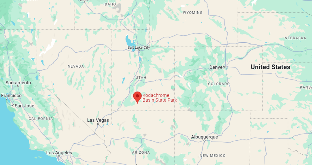
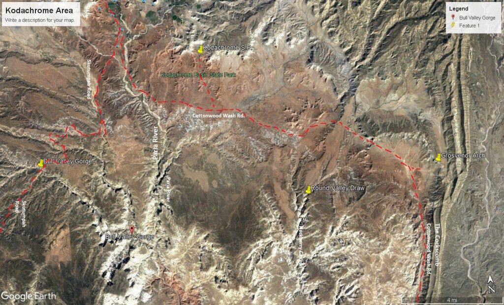
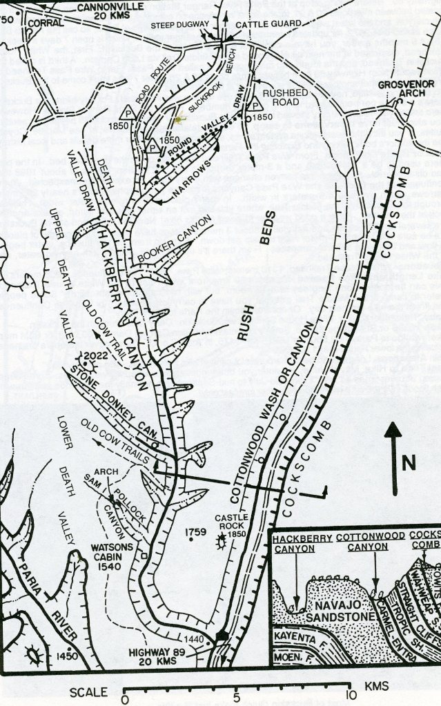
Our first day of the field trip, our group simply drove south on Interstate 15 from our High School in Layton, Utah, to US 20. Then we headed east to US 89. From the Bear Valley intersection we traveled south through Panquitch to US 12. From that intersection, we drove east to Cannonville where we again turned right, (south), onto a road called the Cottonwood Canyon Road. Kodachrome Basin State Park was only another 11.6 km from Cannonville on Cottonwood Canyon Road. This took most of the day, and so we camped at the campground for the next 3 nights.
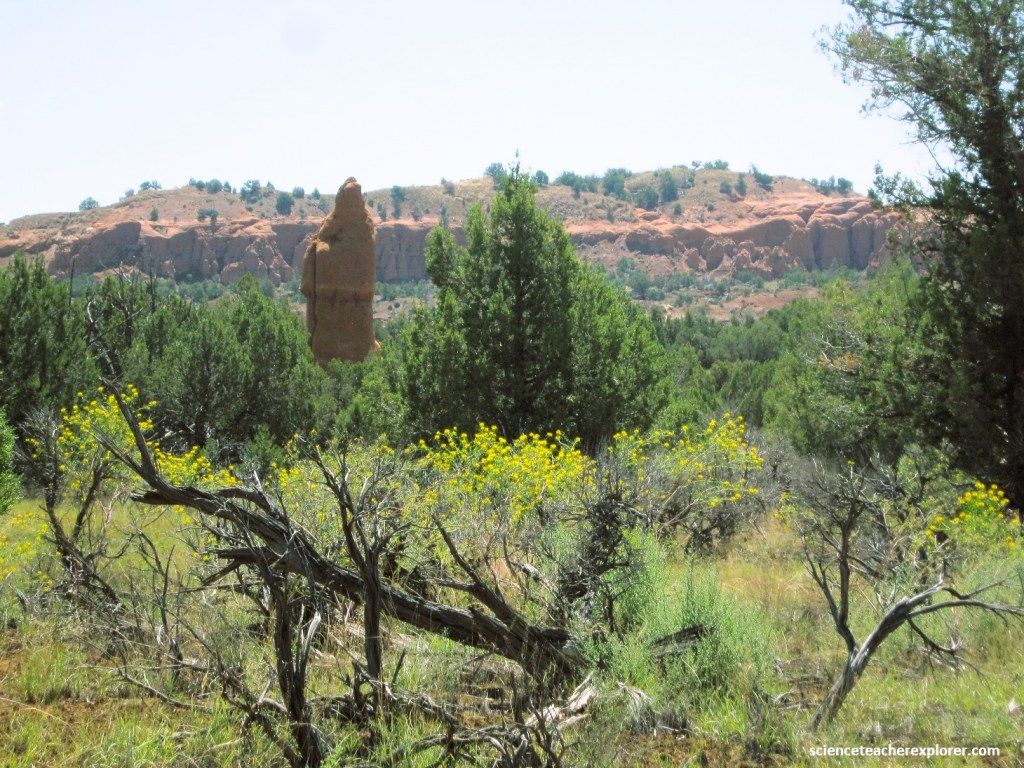
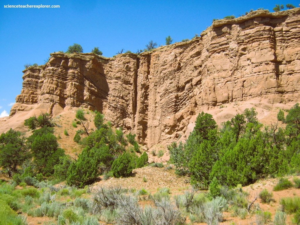
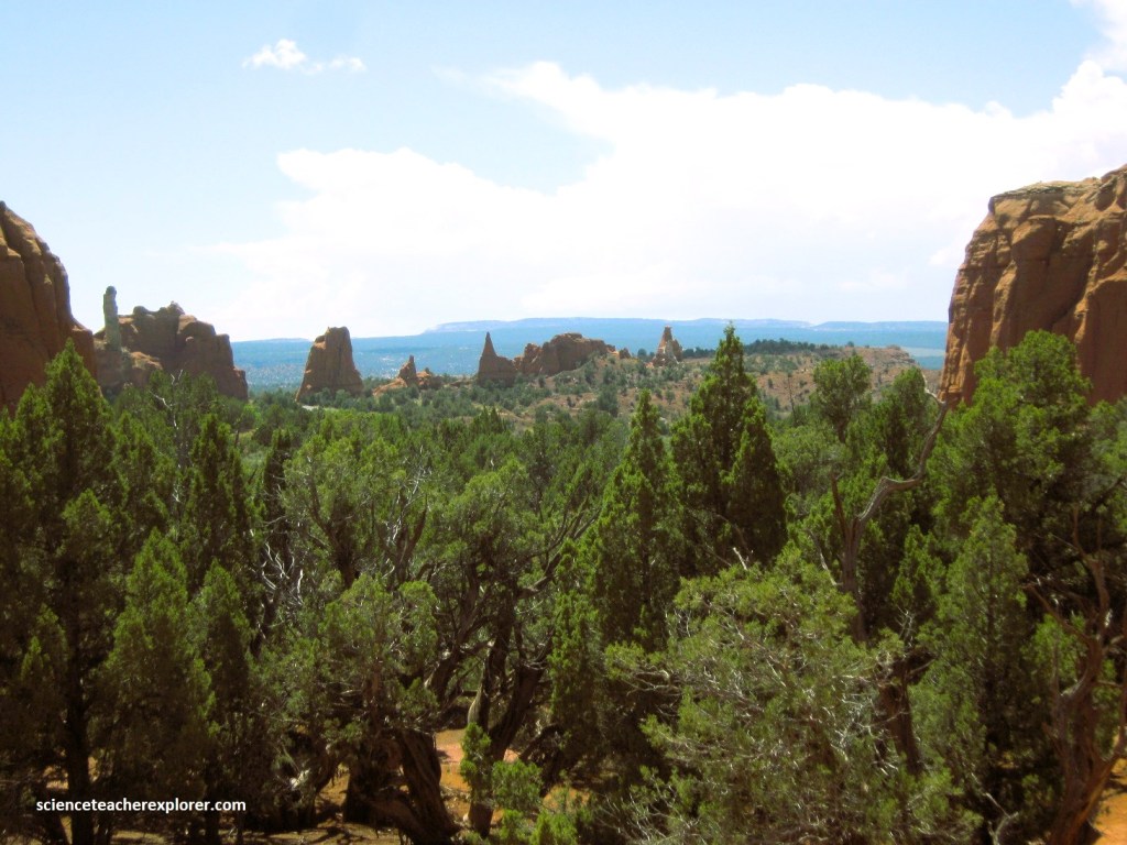
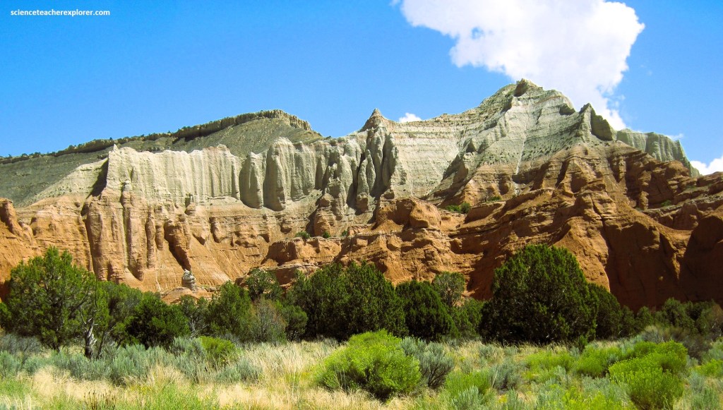
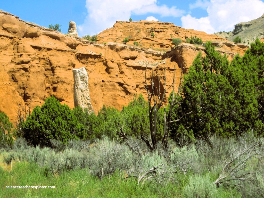
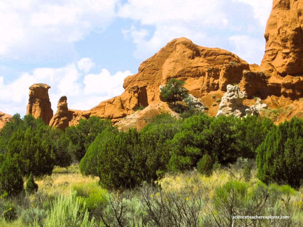
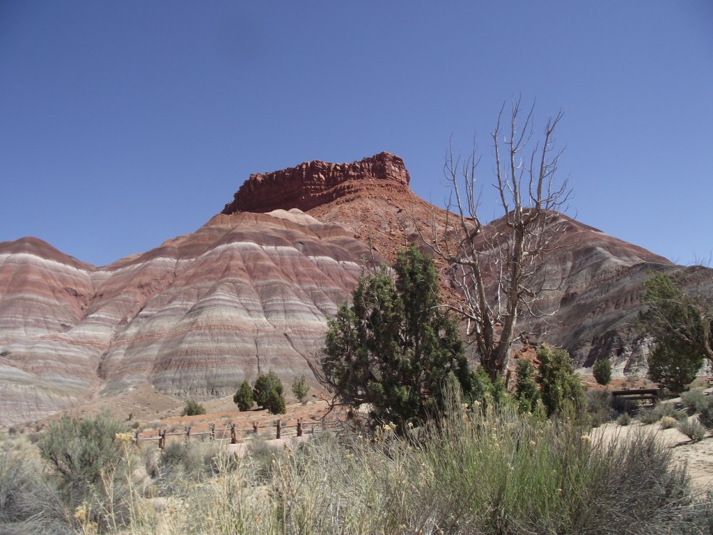
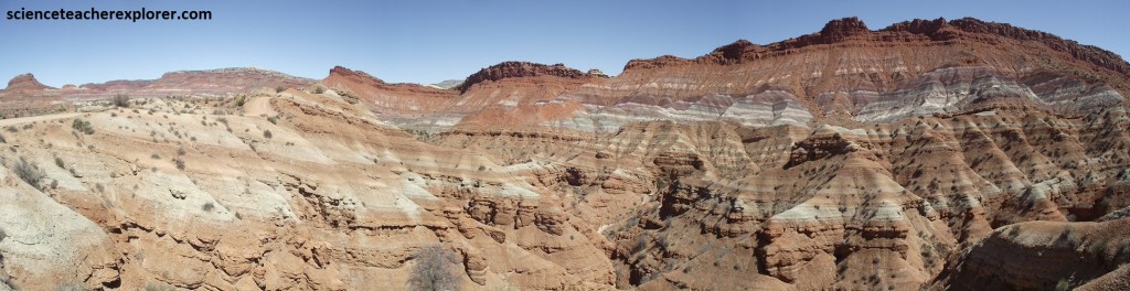
Rock formations and coves were near our campsite with ever-changing colors ranging from gray and white to several shades of red and orange, depending on the mood and light of the time of day. Some of the slickrock was easy to explore for may students in the evening when we return from our daily treks. Many layers of geological formations are seen in the strata of the park, (imaged below).
My plan was to take the students on daily expeditions in the region during the day and allow the students to explore Kodachrome Basin State Park in the afternoon on their own.
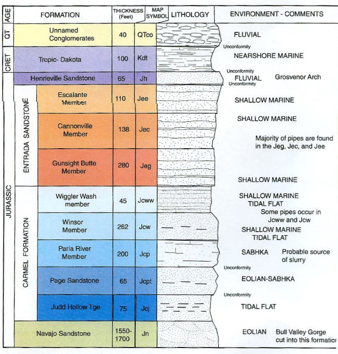
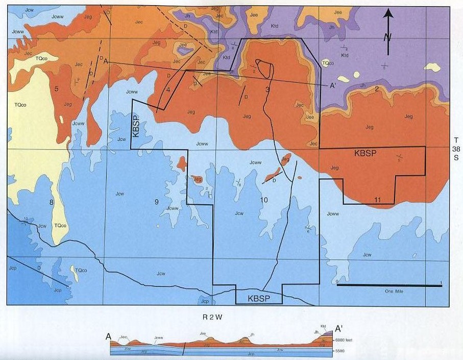
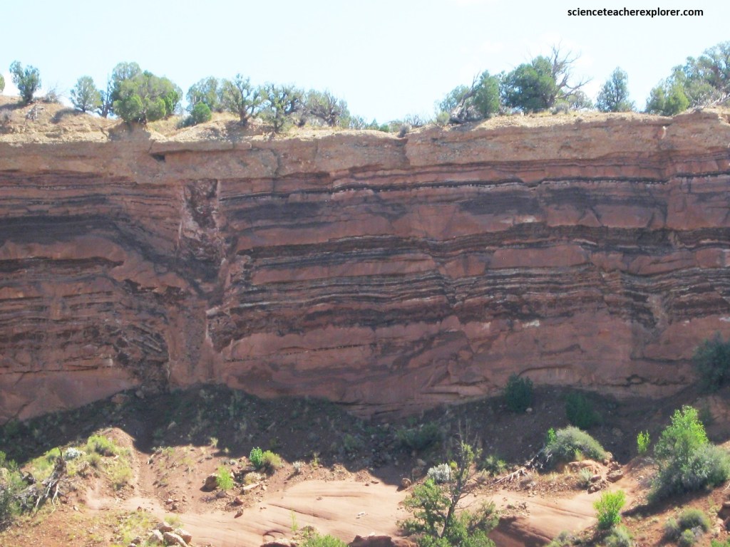
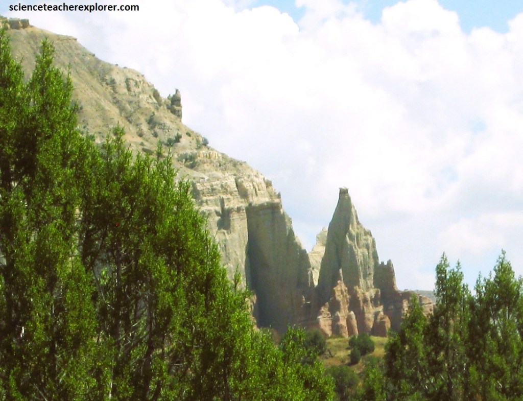
Kodachrome Basin State Park has an area of approximately 8.45 square kilometers with typical Colorado Plateau style geology with the majority of the rocks being Middle to Upper Jurassic sedimentary units that have been disturbed by only minor faulting. The sedimentary layers of the park are flat to gently dipping, (imaged below).
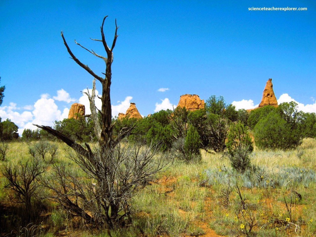
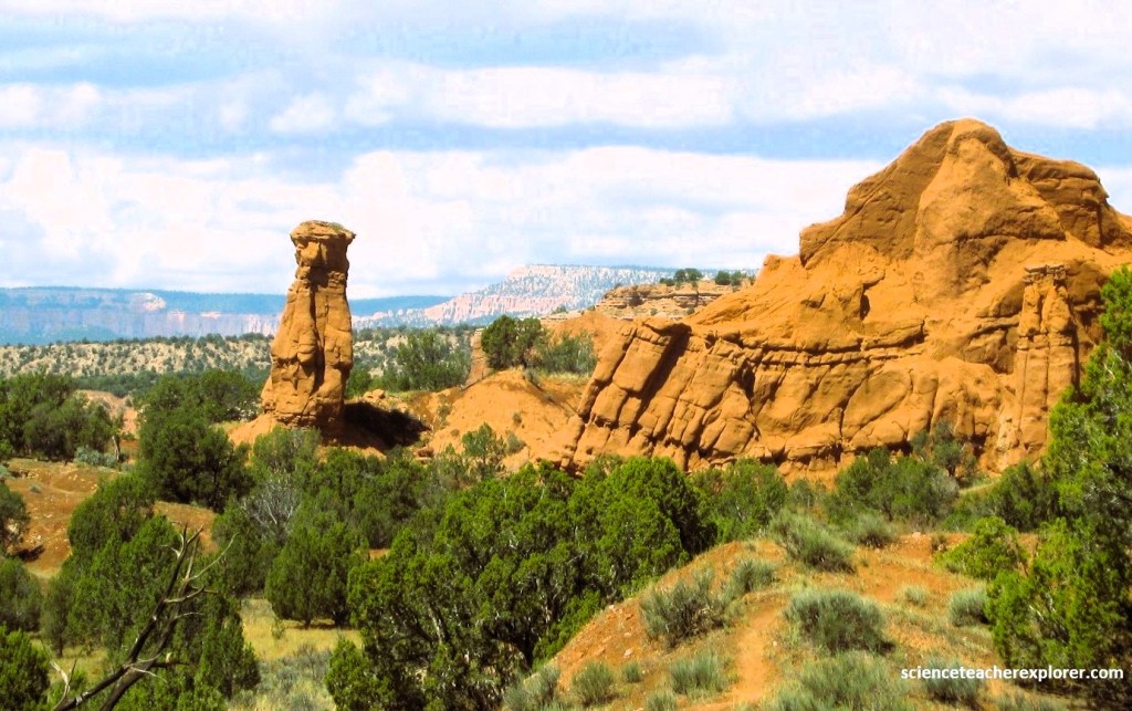
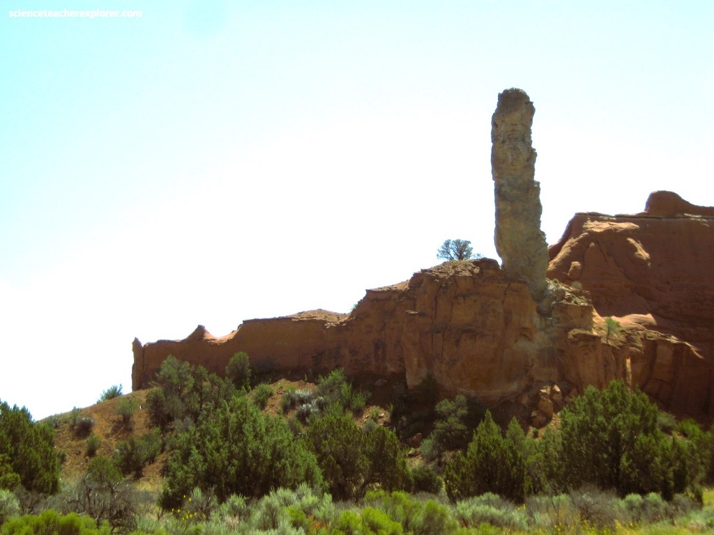
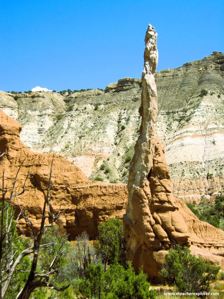
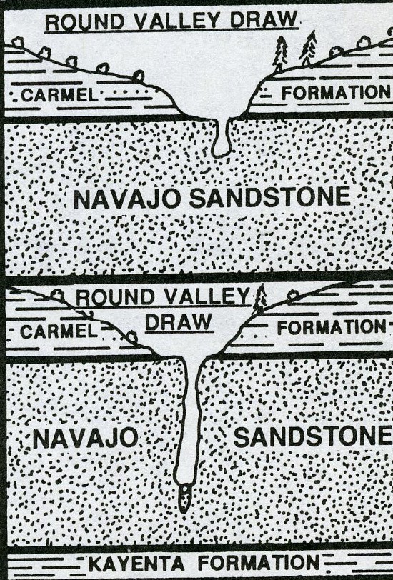
However, the most intriguing feature of the park’s geology is the presence of many sedimentary pipes. Pictured below, these pipes penetrate rocks representing the Carmel Formation and Entrada Sandstone. In many places the pipes stand alone, while some are still totally or partially encased in the Jurassic age rock.
Until a party from the National Geographic Society came through the park in 1949, the place was known as Thorley’s Pasture, after a local rancher. The National Geographic Society renamed it Kodachrome Flats for obvious reasons.
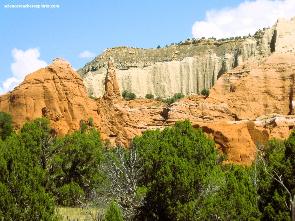
The enigmatic sandstone pipes of Kodachrome Basin are free-standing towers of light-grey to whit rock that rise in contrast to the red Entrada Sandstone layers that surround them. A total of 67 sandstone pipes have been identified in Kodachrome Basin.
When looking closely at these pipes within the park, each pipe is composed internally of a chaotic mixture of sand and angular shards of sedimentary rock, in sharp contrast with the still-layered red sandstone that surrounds it.
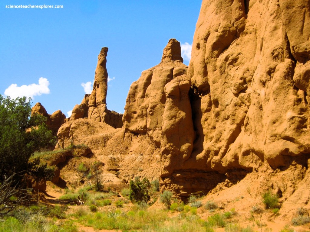
The pipe-filling rock in each of these pipes, are harder and more resistant to erosion than the surrounding red sandstone. Overtime, the surrounding softer sandstone was stripped away by erosion, leaving the pipes standing tall above the landscape.
Theories about how the pipes formed range from geysers and springs to liquefaction triggered by earthquakes. A move recent, and perhaps simpler, explanation suggests that the pipes are the result of over-pressuring of a fluid-filled sediment slurry derived from the Carmel Formation.
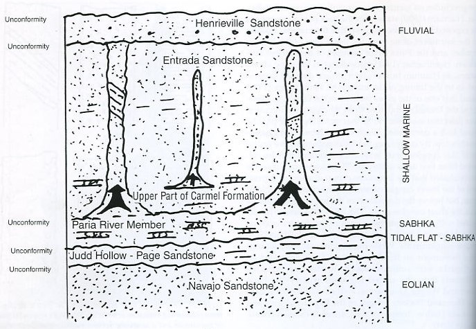
In the model above, the pipes formed where a water-sand-sediment slurry, under pressure, forced its way upward from the Carmel Formation into the overlying Entrada Sandstone. As the slurry worked it’s way upward, it scoured out the host rock (Entrada Sandstone) and entrained fragments of the host rock within the slurry.
Once created, the pipe acted as a conduit for fluids moving vertically through the rock, (pictured above). These fluids cemented the pipe-filling sediment more tightly than the surrounding host rock, and bleached the pipes in the process.
These sandstone pipes were presumed to have formed sometime after the deposition of the Entrada Sandstone. It is speculated that they may have formed during deposition of the overlying Henrieville Sandstone when rivers buried the Entrada sand dunes about 150 million years ago.
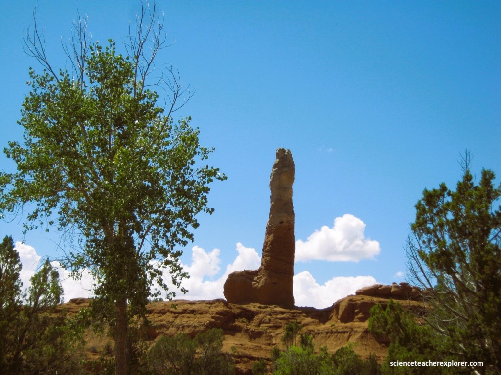
Pipes range widely in size, ranging in diameter from less than 1 meter to over 10.3 m. They also range from 1 meter to 20m high, with some serving as good navigation points in the park for my curious students.
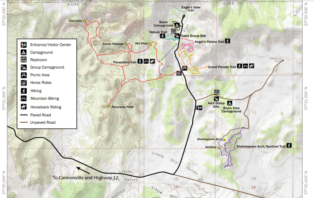
Near our camp, there was a 1 km nature trail that identified many of the local desert plants at Kodachrome Basin State Park.
Pictured above, the Utah Juniper (Juniperus osteosperma) is one of the most widely distributed trees in the intermountain west and one of the most common trees in Utah. Slow growth and specialized leaves that retard moisture loss allow this tree to flourish in this arid environment. In fact, overgrazing, fire suppression and climate change have allowed this species to “invade” areas where it normally would not grow. The wood from the Utah juniper is highly decay resistant so it is often used in construction and for fence posts. American natives used the leaves, bark and wood for many purposes.
Pictured above, Pinyon pine (Pinus edulis), along with the juniper, make up the pinyon-juniper forest, common at elevations between 5,000 and 7,000 feet in the southwestern United States. The pinyon is monoecious, meaning it produces both male and female cones on the same tree. The seeds were a staple food in American native diets and were eaten raw, roasted or ground into flour. Needles were steeped for tea. Today incense is made from crushed cones. American natives today still use the pitch as a caulking compound for watertight baskets and as glue for turquoise jewelry.
Pictured above, the stems and leaves of Mormon tea (Ephedra viridis) were used by American Natives and early pioneers as a medicinal drink. Mormon tea contains pseudoephedrine, a drug commonly used in the manufacture of nasal related to ephedrine. The brew was used as a substitute for coffee and tea, and for treating stomach and bowel disorders, colds, fevers and headaches. It is a gymnosperm, the group of non-flowering plants that includes pines and junipers. It produces small cones with the male and female cones on separate plants. Male plants grow on steeper drier spots with female plants, requiring more moisture for seed production, can be found in wetter areas. Photosynthesis is carried out in the green jointed stems of the plant.
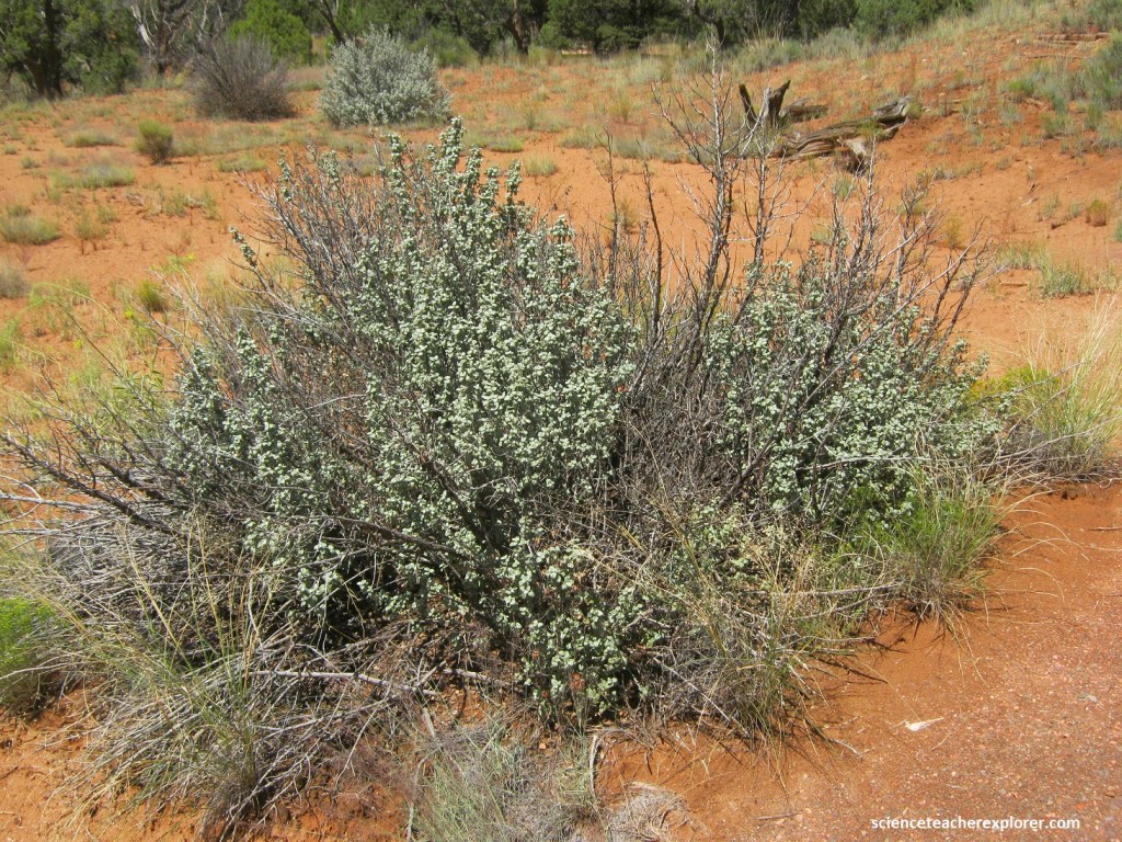
Known locally as lead bush due to the color of the leaves, roundleaf buffaloberry (Shepherdia rotundifolia) is a common plant at Kodachrome Basin, (pictured above). It is a large evergreen shrub with tightly packed clusters of silver-blue-green warty leaves that curve inward from the sides and downward at the tip. It produces a bright yellow flower that gives way to an edible fruit. The berries of the plant are eaten by wildlife, and supposedly, were made into a sauce by early settlers. The berries can also be used to make jams, jellies and a condiment similar to cranberry sauce.
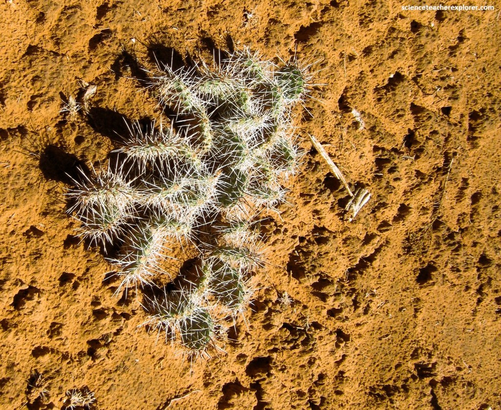
Pictured above, Prickly pear (Opuntia app.) is a common cactus in the southwestern united States. Like other varieties of cactus, the prickly pear has several adaptations that allow it to flourish in the desert. The large spines are modified leaves that help prevent excessive moisture loss. The large leaf-like pads are actually the stem of branches of the plants. They are important for water storage, photosynthesis and flower production. The fruit and pads of the prickly pear are edible and both are high in soluble fiber.
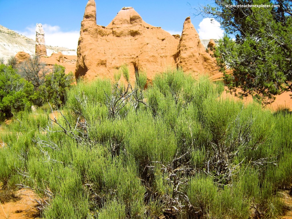
Pictured above, Big sagebrush (Artemisia tridentata) is one of the most common western plants. It’s gray-green three-lobed leaves and aromatic fragrance make it easy to identify. American Natives commonly used big sagebrush for fuel and in the construction of dwellings. The leaves, which contain camphor, were used medicinally for coughs, colds, headaches, stomachaches, fevers, pain relief and as poultices. The leaves and flowers could also be boiled and used as a dye.
Other plants found in the park include: Indian rice grass, false buckwheat, four-winged saltbush, Freemont holly, bee balm, Indian paintbrush, evening primrose, yellow flax, biscuit root, locoweed, corral grass, needle grass, thread grass, snake weed, princess plume, rubber rabbitbrush and yucca. All are important to the local wildlife & ecosystem.
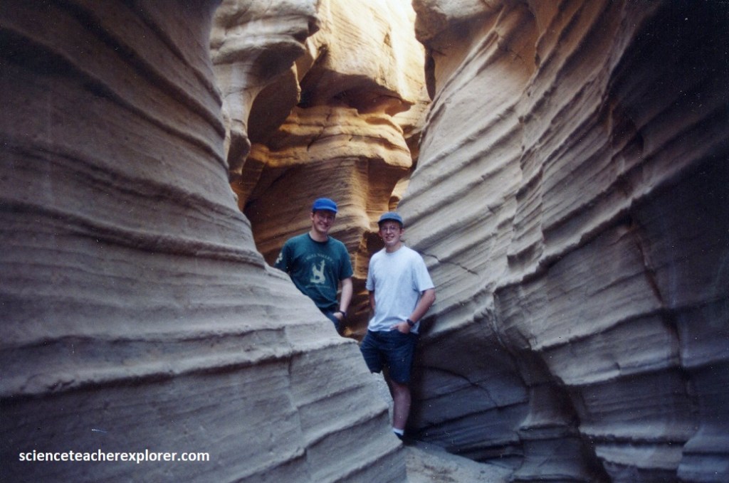
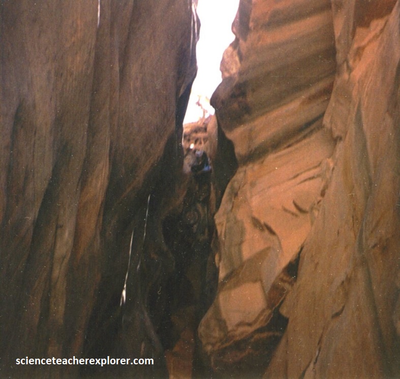
Our second-day expedition took us east on Cottonwood Canyon road, (16 km) to Round Valley Draw.
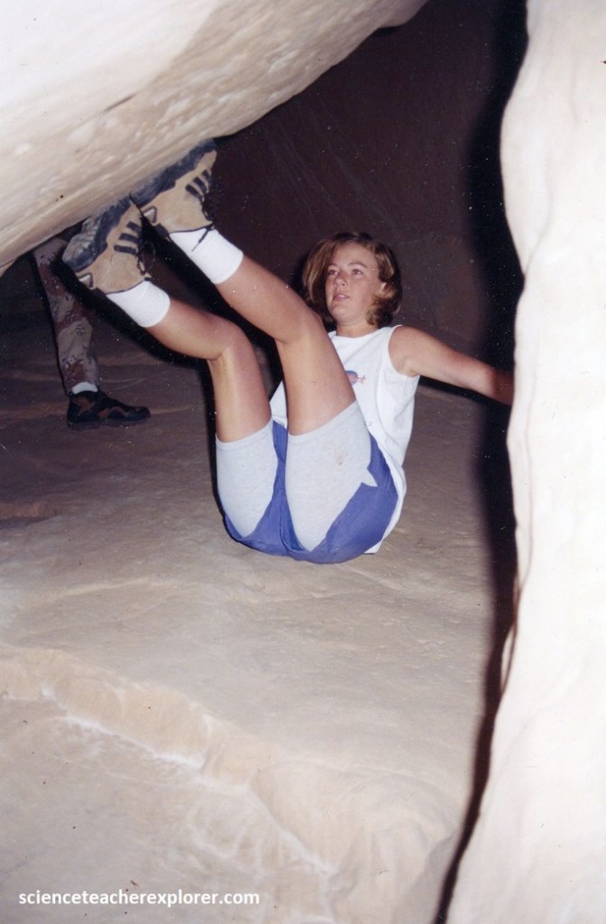
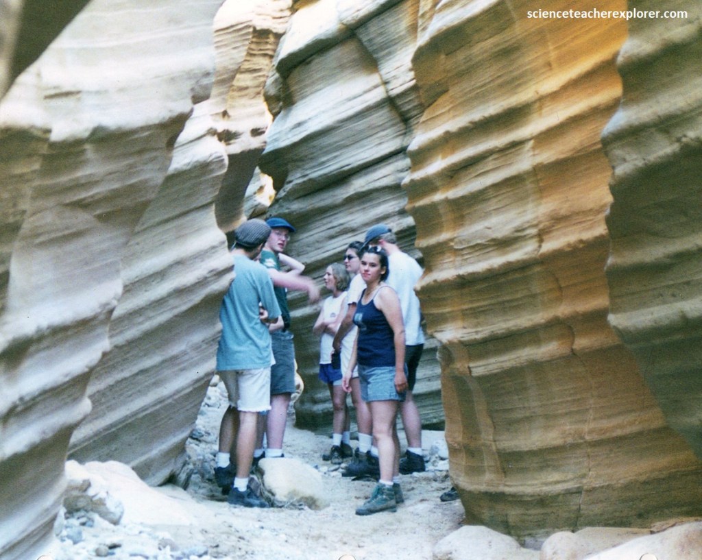
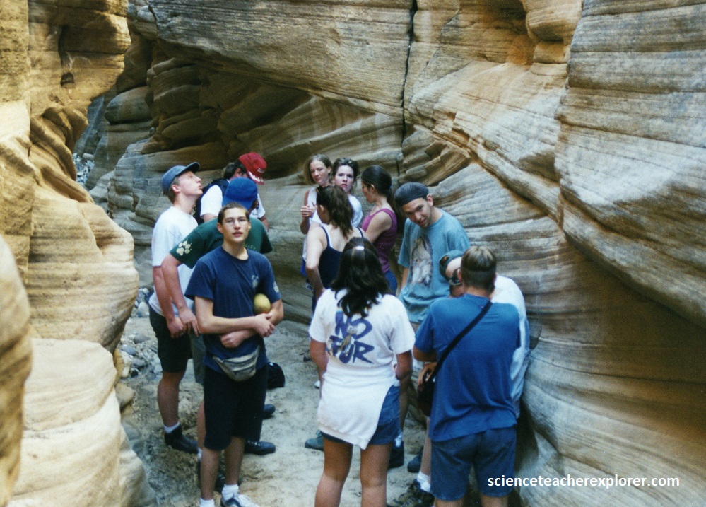
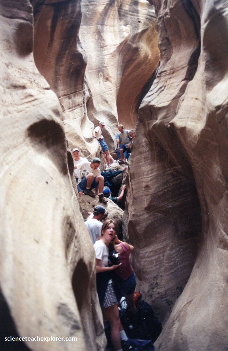
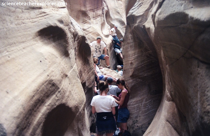
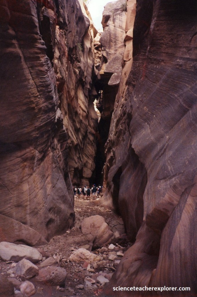
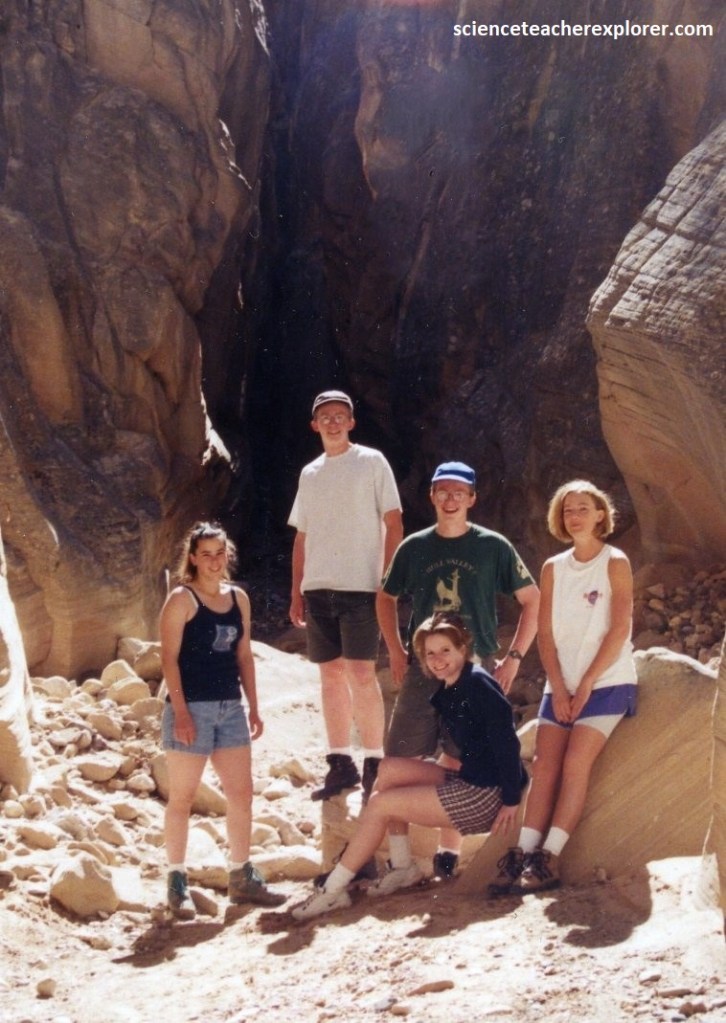
Imaged above, from the Round Valley Draw Car-park, we trekked southwest in the open valley about 1.5 km until we came to where the narrow slot began. We squeezed in at that point with difficulty and in single file, (pictured below are two of my students making it through).
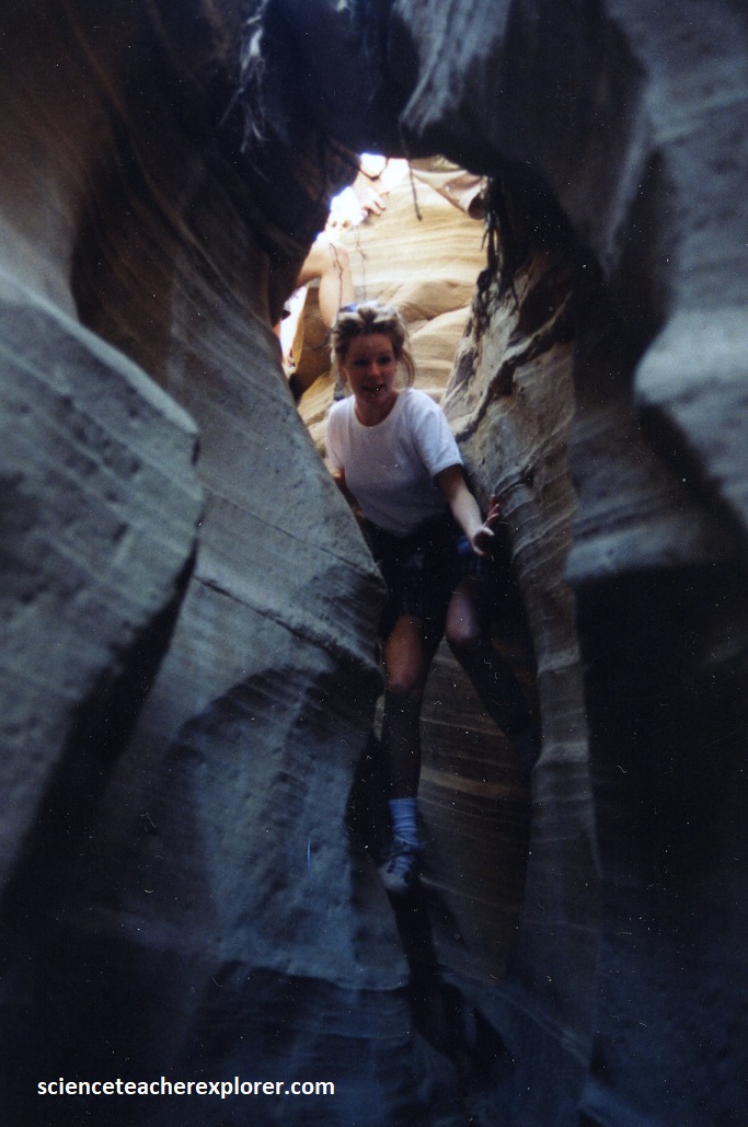
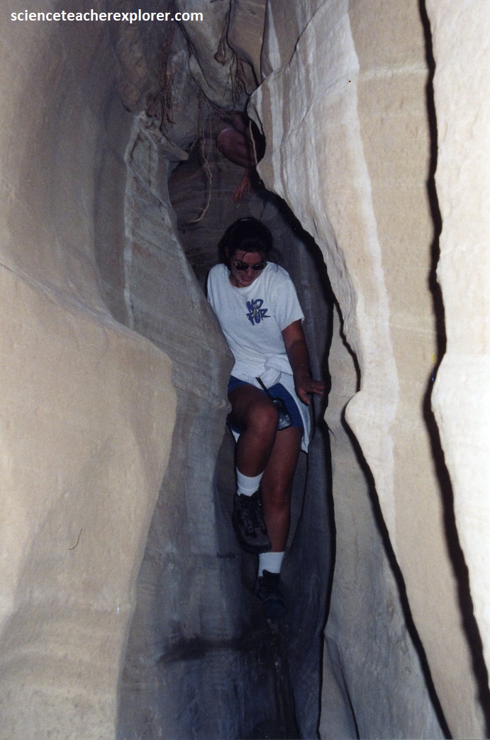
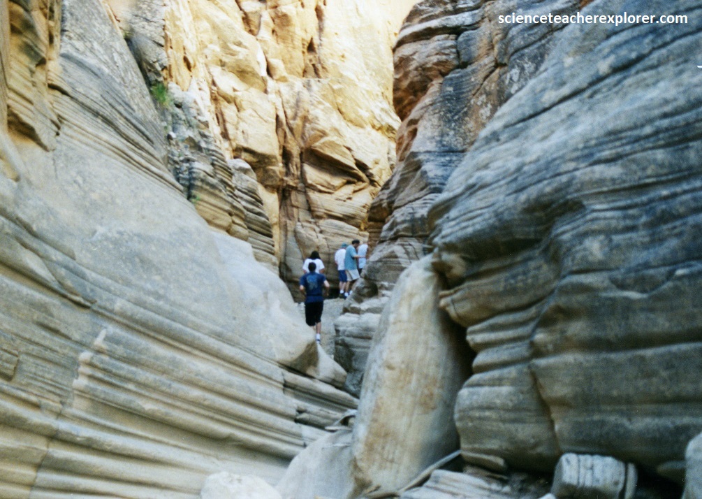
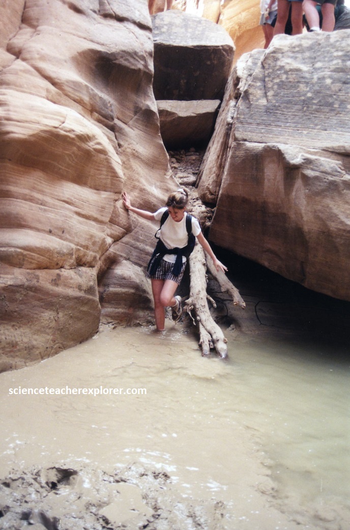
This part of the Round Valley Draw slot was a little difficult for some, but we took it slow. It was only 7-8 meters deep at that point. Pictured below, further down there were 2 choke-stones that required us to wiggle down on the left side by placing our feet on the wall, and our backs on the other.
Kodachrome Basin State Park region is located on the Colorado Plateau, an uplifted region that covers much of the four corners area of Utah, Arizona, New Mexico and Colorado. Around the park, the exposed formations range from the middle Jurassic Period (180 million years ago) to the Cretaceous Period (95 million years ago).
The Early Jurassic Navajo Sandstone is exposed at the confluence of Cottonwood Canyon and Hackberry Canyon where Round Valley Gorge is located. It is a massive cliff former and its upper part forms the White Cliffs riser of the Grand Staircase.
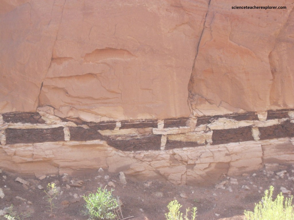
Pictured above and below, the Navajo is a light-colored, fine- to medium- grained, massive sandstone. It displays here and elaborate array of high-angle cross-beds and forms bizarre erosional forms. Most of the grains are sub-rounded to well rounded, well sorted, frosted and quartzose.
Pictured above, the Navajo Formation is dominantly an eolian deposit laid down in dunes above a shallow water table. As the sands subsided, the water table surface rose and wind commonly blew away sand above it to form a set boundary before the next dune was deposited over it. A thick iron scum or froth accumulated on the tops of the water tables. During diagenesis these hardened to form ironstone sheets within the sandstone. At Round Valley Draw, iron sheets have been deformed to produce bizarre shapes.
The top of the Navajo Sandstone is a major regional unconformity. In the Grand Staircase section of the Kodachrome region, it is overlain by the Judd Hollow member of the Carmel Formation, (seen at Kodachrome Basin).
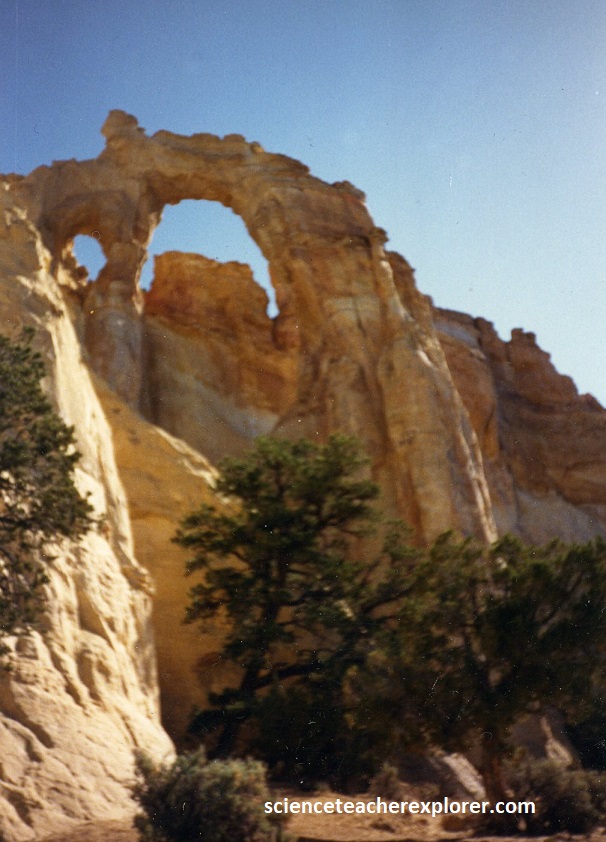
After leaving or climbing out of Round Valley Draw, we continued one kilometer down the Cottonwood Canyon Road to Grosvenor Arch, (pictured above). Grosvenor Arch was named after Gilbert C. Grosvenor, the founder of the National Geographic Society. It was a double free-standing arch cut in the younger Jurassic Henrieville Sandstone, the Cedar Mountain Formation, and the Dakota Sandstone. The unconformities that divide these formations were plainly visible in the arch.
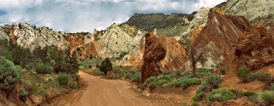
From the arch, we continued south on the long dirt road of Cottonwood Canyon, into the Cockscomb. Pictured above, the bent, broken, and tilted rocks of “The Cockscomb” represents the northern limb of the Kaibab Uplift. This is one of the Colorado Plateau’s major structural features that stretches over 160 kilometers to the Arizona Border. The Cottonwood Canyon Road winds trough a series of strike valley developed along the monocline. Differential erosion has created a bizarre landscape of sandstone fins and ridges standing tall against the eastern skyline. The road generally follows a valley and sandstone cliffs to the east in the Cretaceous Strait Cliffs Formation. Exposed in the walls of the canyons are microscale faults and fractures formed when the rocks buckled to form the East Kaibab Monocline during the Laramide orogeny around 65 million years ago. The rock strata dips abruptly eastward at angles ranging from 15 degrees to slightly overturned, with an average dip of 40-60 degrees in the steepest part of the flexure. The picture above shows how the road drops steeply into a tight little valley called “Candyland” by local ranchers. Rocks here, have been displaced downward as much as 1700m.
Like the “Land of the Sleeping Rainbow”, the region at the southern end of the long dirt Cottonwood Canyon Road, is an area that is special because of the brightly banded outcrops of the Petrified Forest Member of the Chinle Formation in the Grand Staircase. However, this region is also special for views of the Vermilion Cliffs, (pictured above), steeply dipping Moenkopi strata, channels of the Shinarump Member of the Chinle Formation, faults, the flood plain of the Paria river, the ghost town of Pahreah, Shurtz Gorge, and the movie set for the film, “The Outlaw Josie Wales”, (which was just dismantled by 1998).
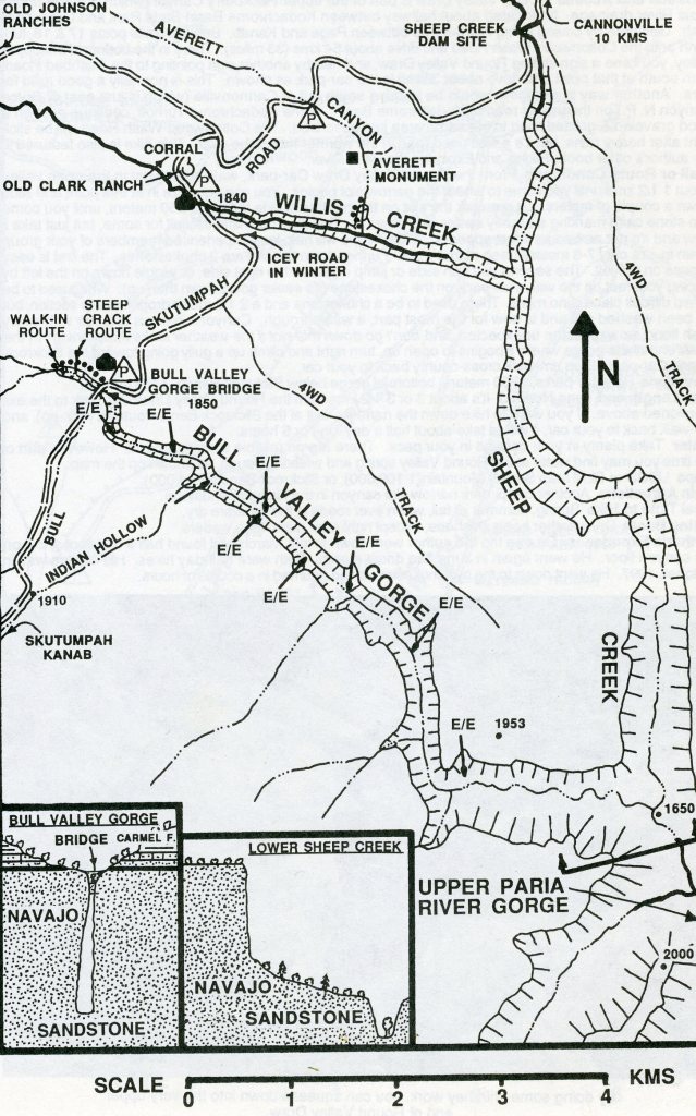
Our 3rd day expedition, took us west to Skutumpah road for the exploration & trekking of Bull Valley Gorge. Skutumpah road was about half way back to Cannonville from Kodachrome Basin State Park, where we had to turn left on a dirt road heading southwest toward Jonson Valley and Kanab, Utah. The parking area for Bull Valley Gorge was about 10 km from the intersection of Skutumpah road and Cottonwood Canyon road.
Pictured above, the road-cut just southwest of Shepard’s Point, (on the Cottonwood Canyon road), reveals the characteristic lithology of the Winsor Member of the Carmel Formation. The Winsor Member is interpreted to have been deposited in a clastic dominated tidal flat. Some of the sandstone are representative of channels that formed on the tidal flat. Mud cracks are well developed and some can be seen in the road cut just southwest of Shepard’s Point, (pictured above).
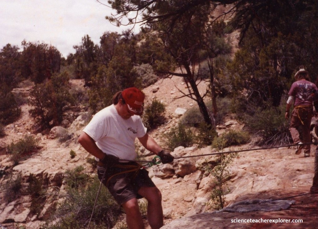
To enter Bull Valley Gorge, we parked on the north side of the dirt bridge and walked west along the north side of the slot. After 300m, we chose to rappel into the Gorge as a group. The rappel was about 25m.
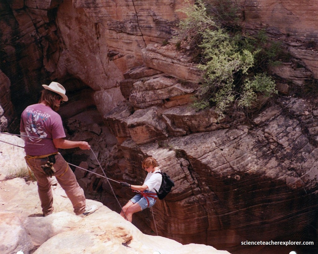
This was a chance to teach the students the art of a rappel. All had never attempted this before and it was quite the adventure for them.
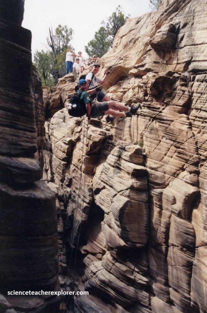
Pictured below, once the group was in the gorge, we continued exploring it by slowly trekking down deeper into the canyon. This type of “Canyoneering” included techniques that required hiking, scrambling, sliding, stemming, chimneying and rappelling. Bull Valley Gorge was perfect place where I could show-off this sport to my students. Canyoneering is the intimate exploration of a forgotten Earth. It is poetry in movement.
{Picture below are my students scrambling along the bottom of Bull Valley Gorge in 1998}.
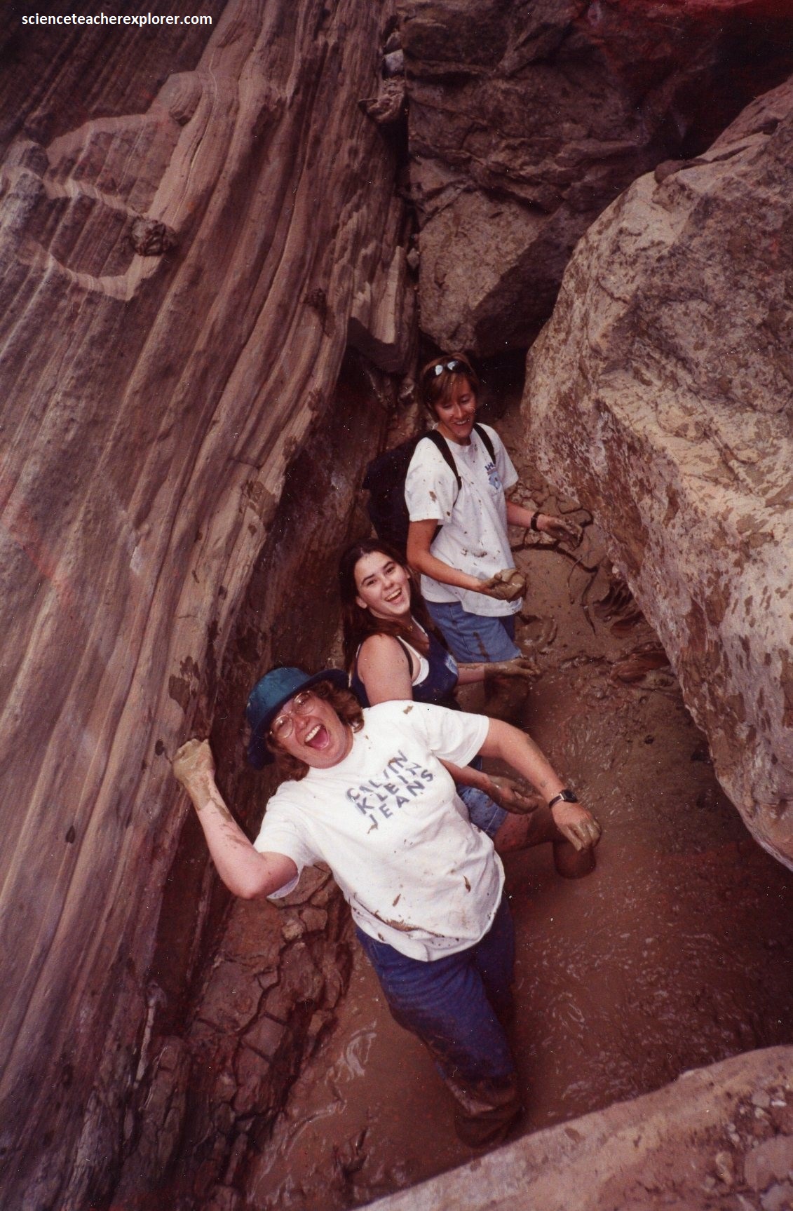
Then to complicate the canyoneering experience, most of the bottom of Bull Valley Gorge was very muddy. It made the group a muddy mess, (pictured below).
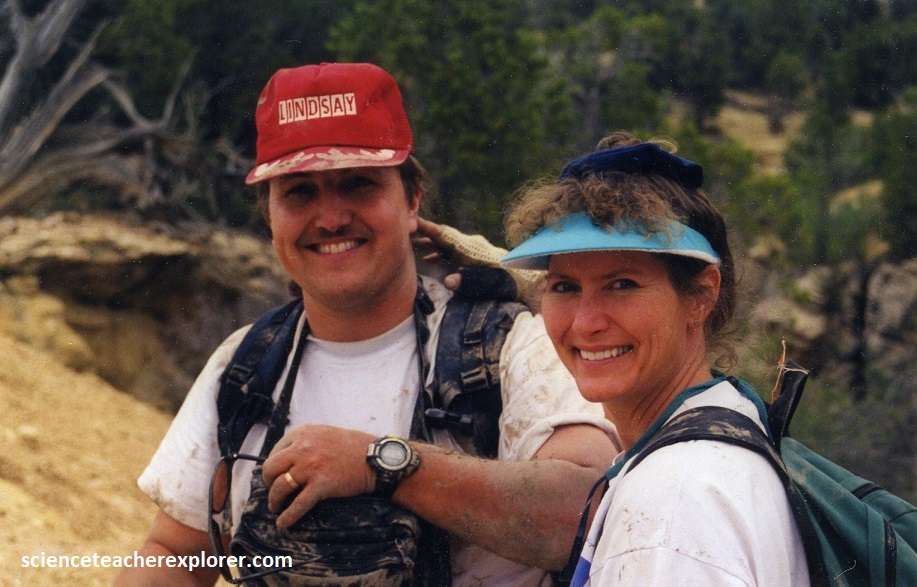
{Note: the person throwing the mud at me is LaRue Fillerup, another asst. advisor for the trip}.
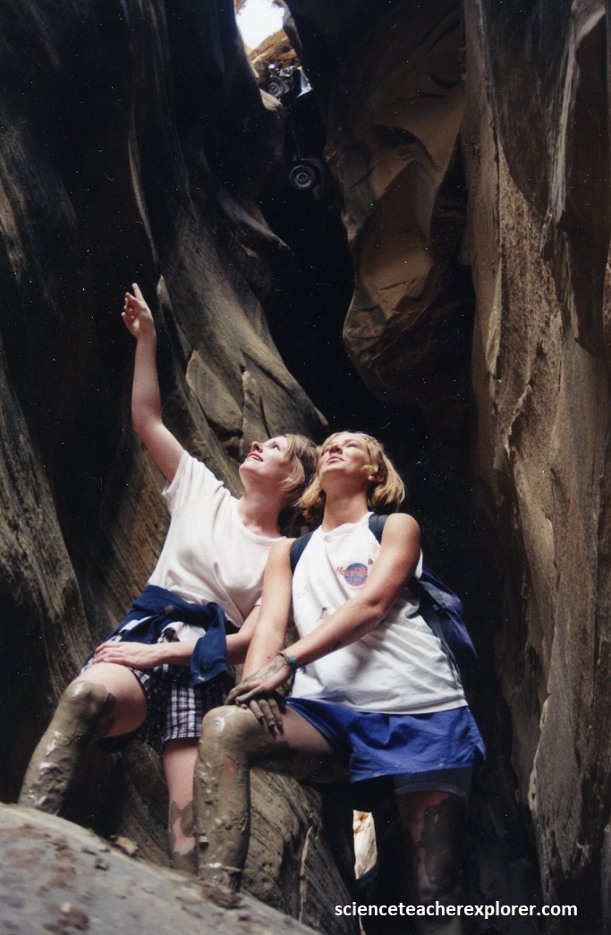
We were headed back towards the Bull Valley Gorge Bridge. The Bull Valley Gorge Bridge was the seen of an accident on October 14th, 1954, where 3 men were killed. The Pickup was still wedged in the slot on the westside and at the bottom of the dirt bridge in 1998. We could still see it from the bottom of the gorge, (pictured below with a couple of my students pointing at it in 1998).
Like Round Valley Draw, the Bull Valley Gorge was eroded through the Early Jurassic Navajo Sandstone. The light coloration of the Navajo has ben described with almost every color; white, tan, buff, salmon, pink, vermilion, brown, red, yellow, cream, orange and grey. Hematitic cement produces the red colors, limonite the yellows, and ferrous iron minerals the browns and local greens. In this case, I felt that the color was a little less white than the nearby Round Valley Gulch. It had a slight brownish yellow tint.
Once we made it back on top, we all got together to take a group photo after a exciting day of Canyoneering in Bull Valley Gorge. We were all caked in mud.
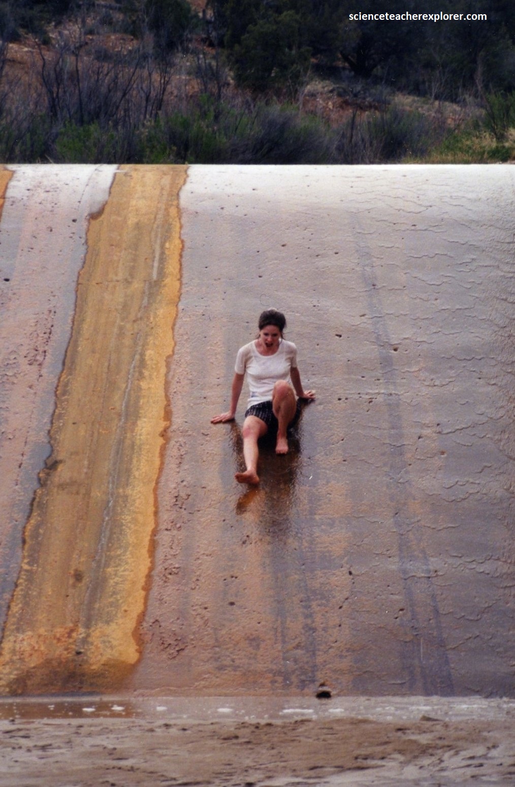
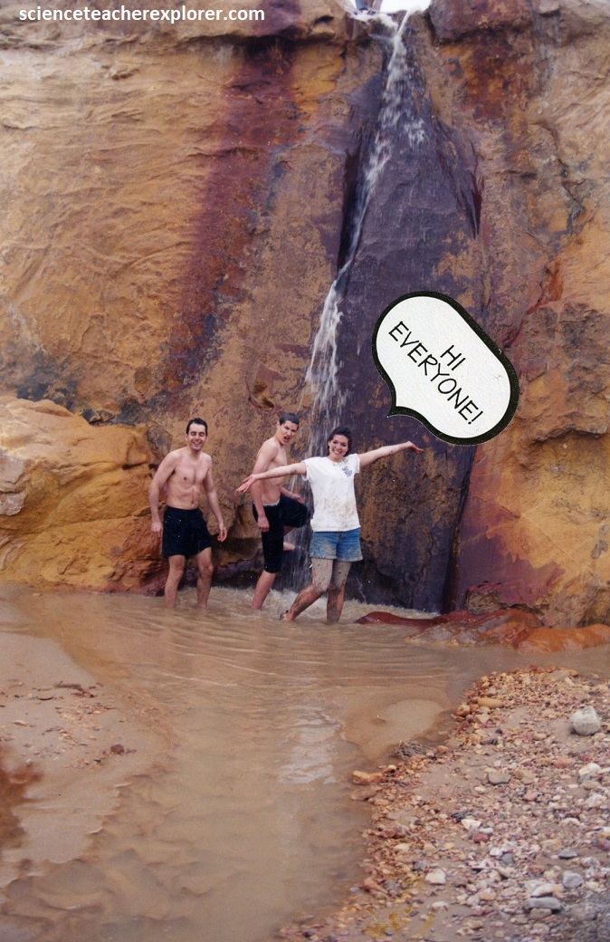
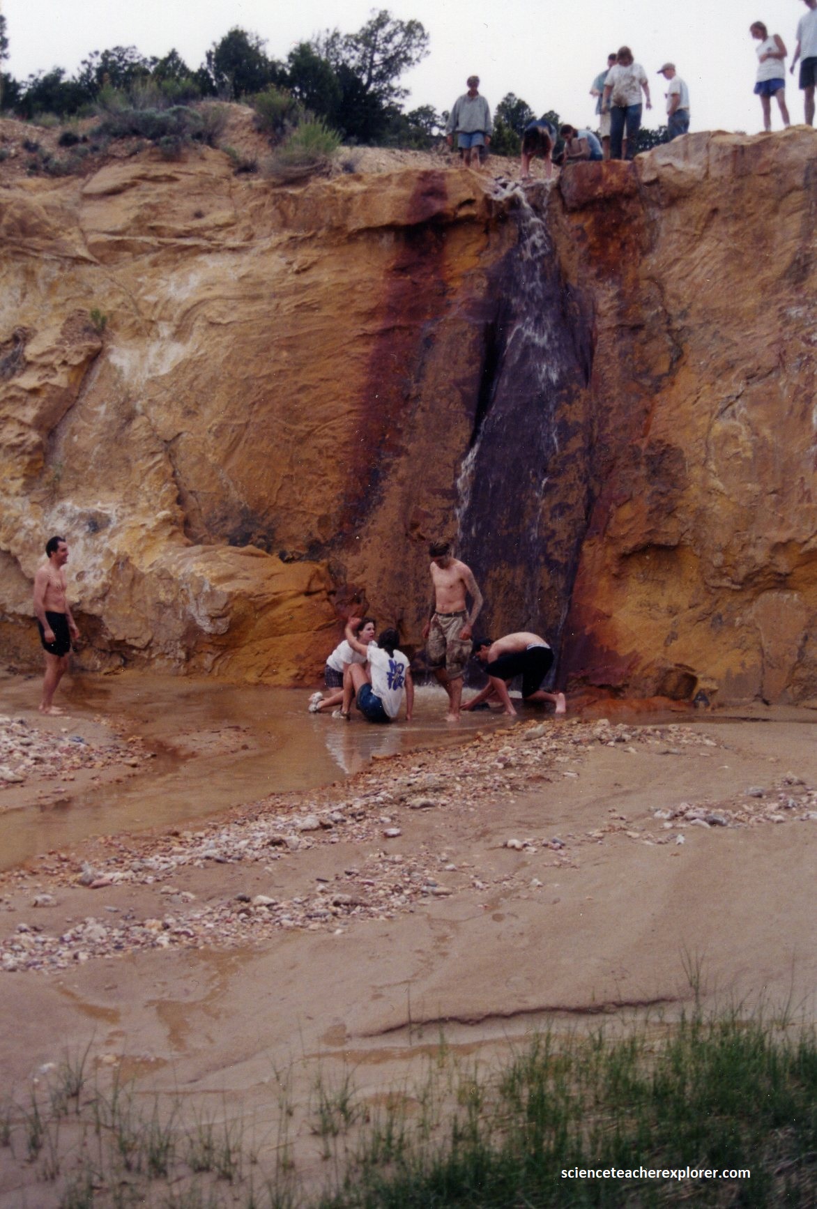
On our way back to camp, the students and advisors decided to clean up the mud at the Willis Creek water-fall and Sheep Creek Dam Site, (pictured below).
{Note: one of the advisors, without a shirt on, was Trace Taggert (a biologist)}.
On the 4th day of our expedition, we simply drove back to Layton High School.