Overland Stage Trail, UT
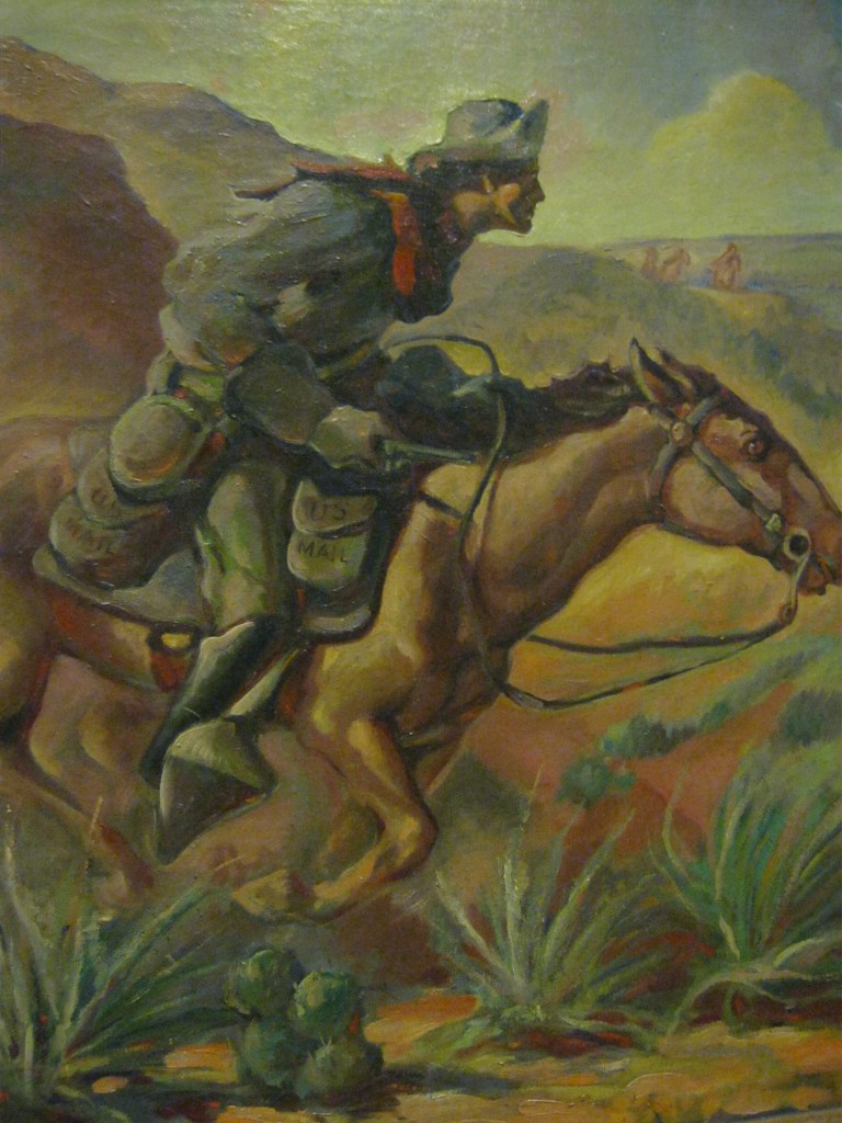
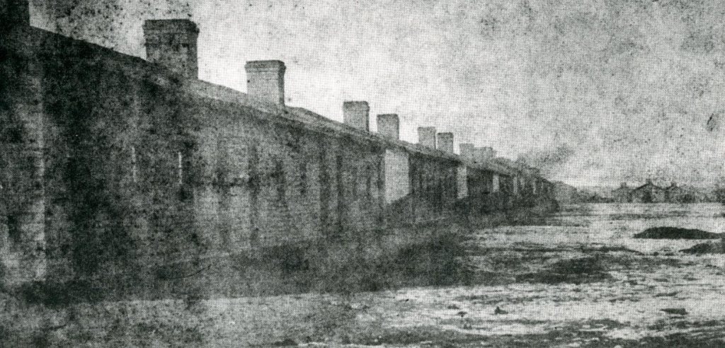
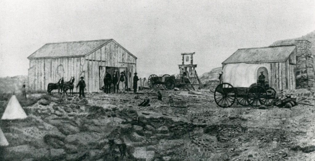
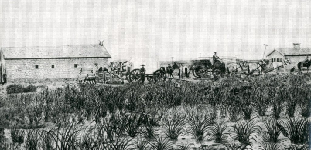
For people in the 1860s, it could take weeks or months to hear the latest news or get updates from friends and family on the other side of the country. The fastest delivery time for news and mail was 22-25 days by the Overland stagecoach. The Pony Express reduced that time by more than half, making mail delivery in 10 days or less possible for the first time. It achieved this record-breaking speed through its network of relay stations where constantly-supplied fresh horses and a team of riders enabled the mail to pass over long distances faster than by any one messenger alone. Stations and stables were constructed every 25 miles (40 km) along the nearly 2,000 miles (3,220 km) between Sacramento, California, and St. Joseph, Missouri. Eighty skilled and experienced riders, 500 horses and approximately one hundred-eighty-four stations were built in two months. Thirty riders needed to be paid and housed. It operated from April 3, 1860, to October 26, 1861. The stations and station keepers were essential to the successful, timely, and smooth operation of the Pony Express mail system. The stations were often fashioned out of existing structures, several of them located in military forts, while others were built anew in remote areas where living conditions were very basic. To maintain the rigid schedule, 157 relay stations were located from 5 to 25 miles (8 to 40 km) apart, as the terrain would allow. At each “swing station”, riders would exchange their tired mounts for fresh ones, while “home stations” provided room and board for the riders between runs. This technique allowed the mail to be moved across the continent in record time. Each rider rode about 75 miles (120 km) per day.
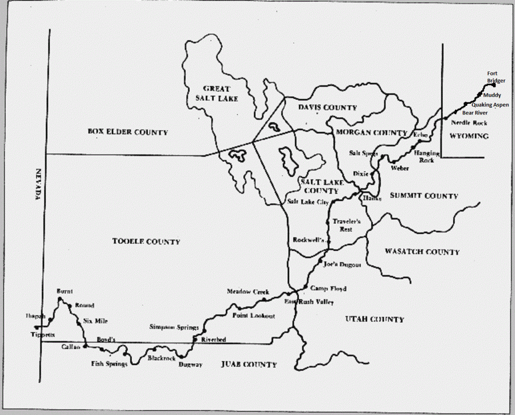
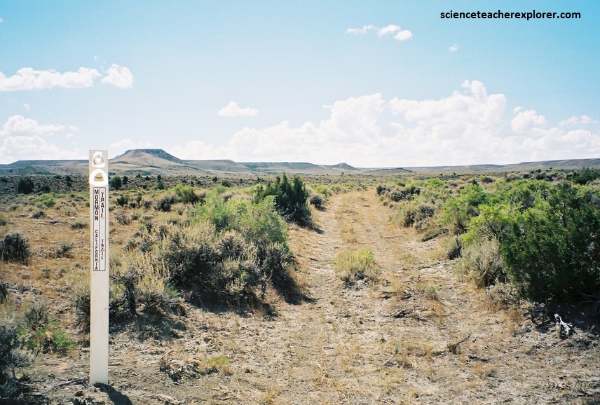
I decided to create an educational tour from Fort Bridger, Wyoming to Ibapah, Utah to explorer the Utah-portion of this “Pony Express/Overland Stage Historical Trail” in the spring of 2002.
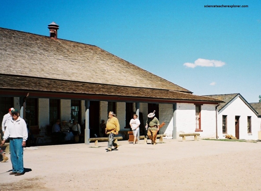
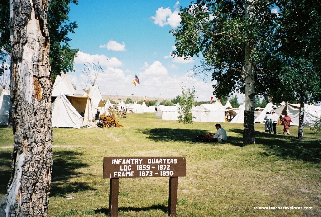
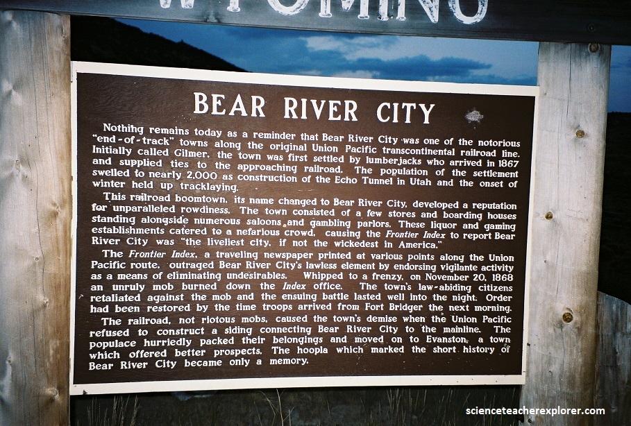
I did the reconnaissance of this tour in the September of 2001 with my father Patrick Lindsay on Labor Day. Conveniently, the “Mountain Man Rendezvous” at Fort Bridger was on this same day, (pictured below).
Jim Bridger established Fort Bridger in 1843 as a fur trading post. It was composed of two double-log houses about 40 feet long that were joined by a pen for horses. The fort soon became a vital resupply point for wagon trains on the Oregon, California, and Mormon trails and expanded in size.
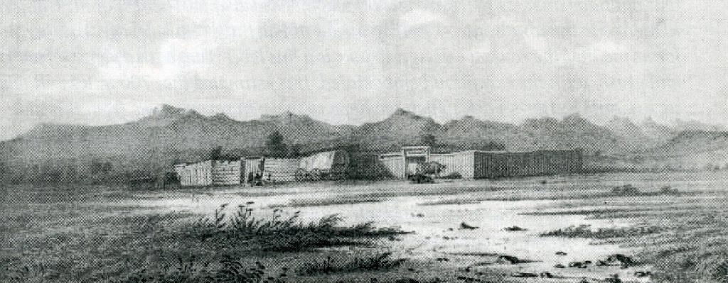
In 1857, during the Utah War, Mormons set fire to the fort to prevent the U.S. Army from using it. However, the army rebuilt the fort a year later and used it as a military post until 1890. In the 1860s, it also served as a Pony Express station.
It should be mentioned, the Overland Stage was developed parallel to the Pony Express Route, which had also begun operating in 1861. While the two shared some stations, the stage line constructed additional facilities between Pony Express stations because its heavier stages required more frequent changes in horses. In 1862 or 1863, the Overland revised the western portion of the trip across Nevada, requiring the construction of new stations. These changes came just as the Pony Express was discontinued and the transcontinental telegraph was completed.
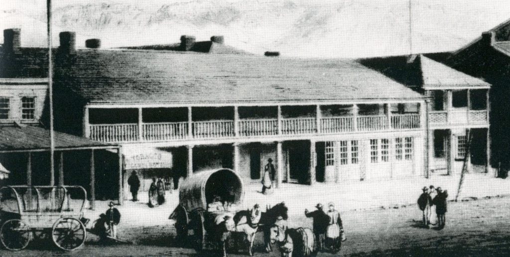
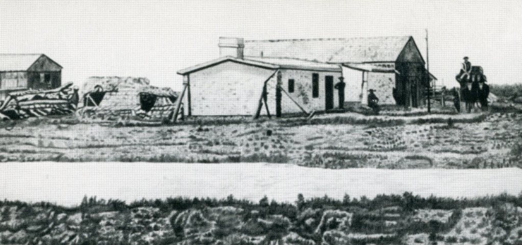
Judge W.A. Carter was Fort Bridger’s Sutler in the 1860s where he also operated the Pony Express and overland stage station. Within the fort is the Sutler’s complex. Located in the northwest corner next to the carriage house is a portion identified as the Pony Express Barn. This white building housed the post office and store complex run by the Sutler. The founders of the Pony Express were William Russell, Alexander Majors and William Waddell. Carter had been appointed as the Pony Express agent by William Russell.
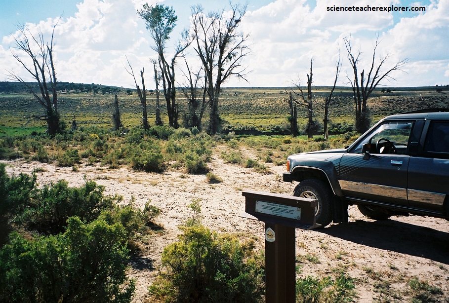
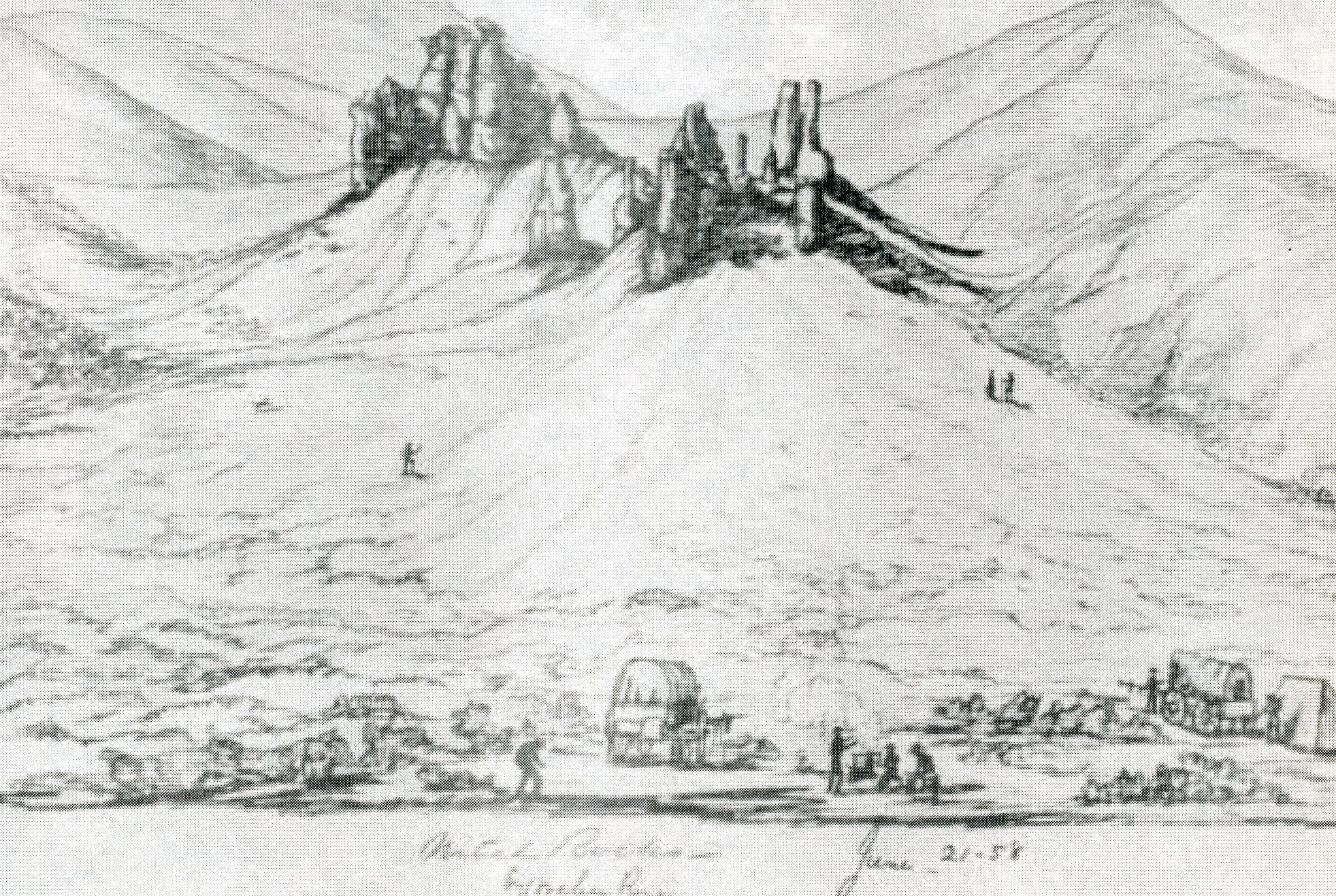
Leaving Fort Bridger, the Pony Express/Overland Stage route-trail runs south of Bridger Butte along the old Mormon Trail. It then ascended the top Bigelow Bench and crosses the tableland until it reaches Gravel Hill, (pictured below).
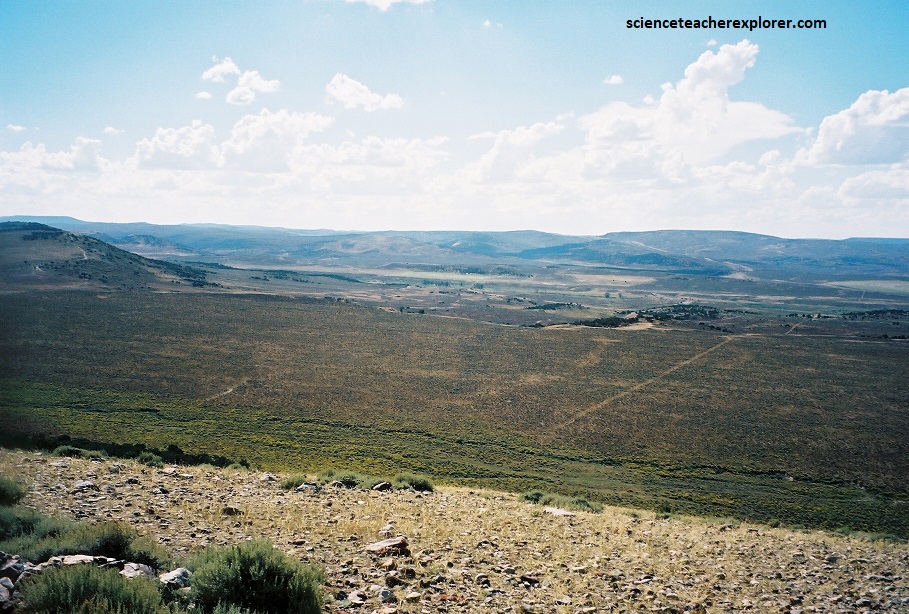
Pictured above, the descent from “Gravel Hill” was the steepest and most difficult on the trail. A famous explorer (Richard Burton) riding the stagecoach described “Gravel Hill” as a “descent that appears little removed from an angle of 35 degrees, and suggests the propriety of walking down”. A small stream called Musselman Creek runs near the foot of “Gravel Hill”. A blacksmith shop was established here to repair the many mishaps encountered on the descent. From “Gravel Hill” the trail continued to Muddy Creek, (pictured below).
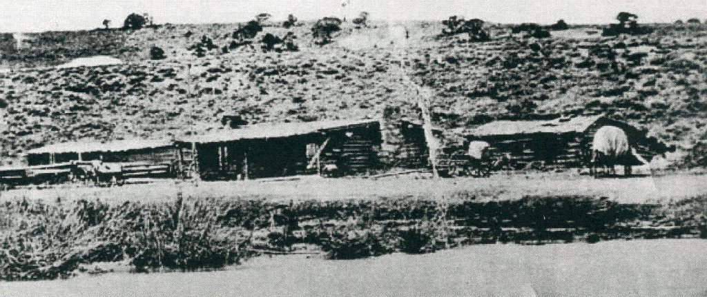
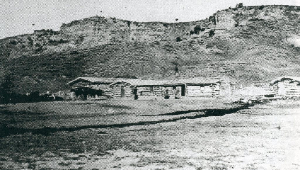
Pictured above, Muddy Creek Station” was the first station west of Fort Bridger. The station keeper was named Moses Byrne. The Bryne family claim that Muddy Creek Station was built by Moses Byrne and the Byrne helped build the Stage and Pony Express stations from Point of Rocks, Wyoming to the Utah border.
Pictured above, Byrne was the station keeper at Muddy Creek until 1868 when the operation was turned over to his brother-in-law, Charles Guild. The Guild family still owns the property where the station stood. Bryne built a toll bridge across Muddy Creek and traded horses.
Pictured above, 2 km south of Muddy Creek Station on S.R. 173, is the ghost-town of Piedmont. Piedmont was a Union pacific Railroad town. It was established in 1868 and began as a “Hell on Wheels” tent city. Moses Byrne built a house and five charcoal kilns, (pictured below).
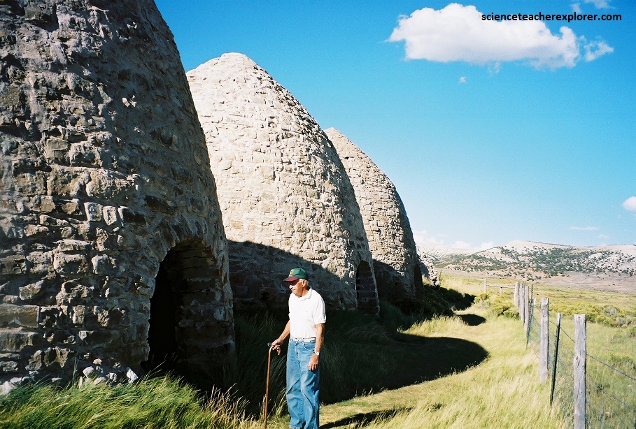
Pictured above, these kilns were used to make charcoal and had the capacity to process 20 cords of wood. Each kiln could be filled and burned three times a month and produce 1000 bushels of charcoal, which was shipped from Piedmont to smelting furnaces in Salt Lake City, Utah, Virginia City, Nevada, and San Francisco, California. Wood for the kilns was transported by canals 32 km away from the Uintah Mountains.
In May, 1869, Thomas C. Durant of the Union Pacific Railroad was taken hostage here, Durant was on his way to Promontory for the celebration of the joining of the Union Pacific and Central Pacific Railroads when he was taken prisoner by several hundred of his workers who had not been paid since the previous January. Durant’s private car was chained to the track and he was told that they would take him to the mountains and feed him salt, horse, and sagebrush if he didn’t telegraph for their back pay. A telegraph was sent to the army at Fort Bridger notifying them to send troops to Piedmont, but the message was intercepted by the telegraph operator at Piedmont. On the second day, money was wired and Durant was on his way to Promontory. The celebration was scheduled for May 8, 1869, but because of this delay, it didn’t take place until May 10th.
Pictured above, my father and I continued on from the Piedmont ghost-town to the Quaking Aspen Springs Station. The not much information is given on this site. A group of researchers found a number of items (i.e. :1864 Indian head penny, buttons, etc.) near the place I parked my vehicle in the picture above, with a metal detector. Just above this station is Aspen Ridge. It is the highest point on the trail.
Pictured above, Bear River Pony Express and Overland Stage station was located where the Myers ranch is today. In 1860, when the famous explorer, Richard Burton, visited the station, Mr. Myers was the station-master. This property is still owned and operated by the Myers family. Of course I didn’t get permission to take a picture of their ranch.
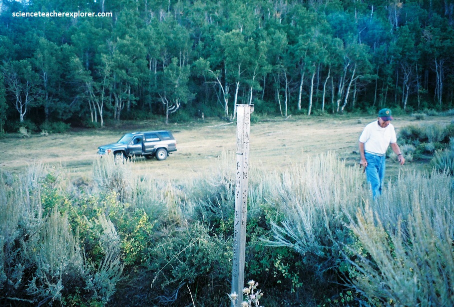
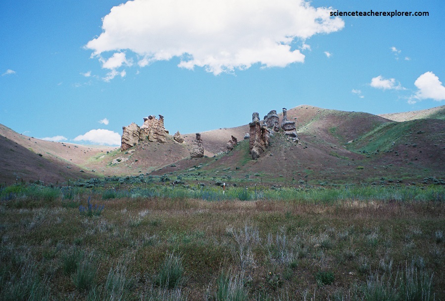
Pictured above, after fording the Bear River, the trail passed “The Needles” on the north side of the road. Needle Rocks Stage and Pony Express Station was not built until 1861.
Located on Yellow Creek just east of the present-day Utah-Wyoming border, this impressive rock formation is a conglomerate that erodes in a line of pinnacles that overlooks the site of the Needle Rocks Pony Express Station. This is one of the few stations that you can view structure-stone foundations with concrete reinforcement and scattered artifacts from several periods. However, the site is extremely protected by the local land-owners. Permission is essential to enter the site. This is where I started the educational tour.
Pictured above, from Needle Rocks Station the trail winds west over the Yellow Creek Hill to the southwest. At the base of this hill on the west side was a large spring named Emigration Springs.
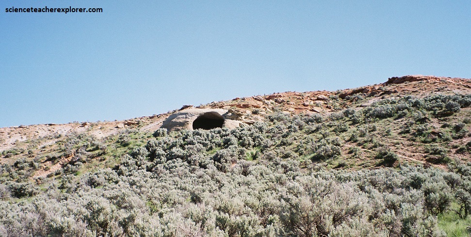
Pictured above, Cache Cave was another well-known landmark on the Pony Express & Overland Stage trail in Utah. It was also known as Redden’s Cave, having been discovered by Return Redden Jackson in 1847.
Numerous emigrants and travelers inscribed their names on the walls inside the cave. Some historians have postulated the Cache Cave may have been used as a Pony Express relay station for a time.
As the coach entered Echo Canyon, Richard Burton, (famous 19th Century explorer), noted, “Echo Kanyon has a total length of twenty-five to thirty miles, and runs in a south-easterly direction to the Weber river. Near the head it is from half to three quarters of a mile wide, but its irregularity is such that no average breadth can be assigned to it.”
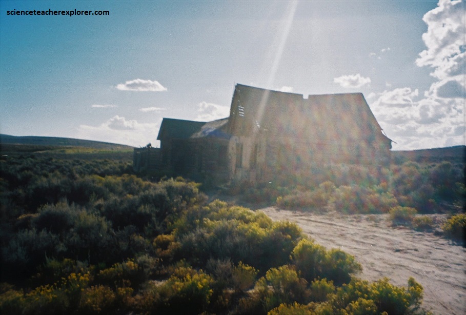
Pictured above, after the trail entered the head of canyon, it passed a sandstone formation called the “Castle Rock”. This was the site of a relay station called “Head of the Echo Canyon” or “Castle Rock” or “Frenchie’s Station”. Pictured above, the station was a log structure.
Pictured above, as with many Pony Express stations, the location of this the “Head of Echo Station” has been the subject of some controversy. Interviews with the longtime residents of the area have convinced me that the building and spring seen in the A.J. Russel photograph was found at the Castle Rock site. The above photo verifies this.
Pictured above, Hanging Rock, or Halfway Station was located about halfway down Echo Canyon. It was also know as Daniels’ Station named after the station keeper.
Pictured above, I found access the this site at the mouth of Echo Canyon at the intersection of I-80 and I-84, where I drove east on the access road for 14.6 km. The “Hanging Rock” for which the station was named is a stone arch just down the canyon from the station site.
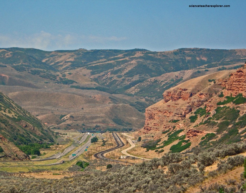
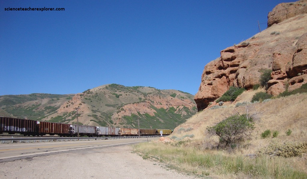
Pictured above and below, Weber Station was located at the junction of Echo and Weber Canyon near the old landmarks of Pulpit Rock and Hanging Rock.
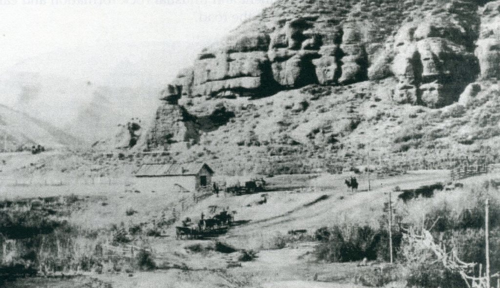
Pictured above, it is believed that the building that served as the station had been constructed in 1853. From here the trail turned to the northwest along the Weber for 8 km toward Henefer before turning to cross the Wasatch Mountains.
The famous explorer, Richard Burton, noted that the station keepers were Mormons and “The station was tolerably comfortable, and the welcome addition of potatoes and onions to our usual fare was not to be despised.” James Bromley settled at the Echo site in 1854 and was the only settler until 1860. So, the Weber Station was probably operated by Bromley. In He happened to be the division superintendent for the stage and pony express stations between Pacific Springs, Wyoming and Salt Lake City, Utah. It should be noted that in 1850, Parley P. Pratt, (a Mormon Leader), opened a toll road to Salt Lake City at the crossroads near Weber Station. He called it the “Golden Pass Road”.
Pictured above, the area at the junction of Echo Creek with the Weber River has been subject to extensive grading, leveling and filling to make possible the junction of the Interstates. Matching the exact location of the historical site was difficult.
Just a few kilometers west of the Weber Station Site is the travelers historical landmark called “Witch Rocks”, (pictured above). Witch Rocks is a conglomerate of the Henefer Formation that was deposited about 90 to 85 million years ago when Sevier thrust faulting in Utah had reached its peak. The conglomerate is composed of sandstone and quartzite pebbles, cobbles, and boulders eroded from the mountainous areas to the west and northwest. Streams then carried these sediments off of the highlands, eventually depositing the heavier material in large alluvial fans (fan-shaped stream and debris-flow deposits). The elements have eroded areas of the conglomerate near Echo into the fantastic shapes seen in the above photo. The upper “caps,” or witches’ hats, are formed of a lighter-colored conglomerate layer cemented into a harder mass than the softer, underlying conglomerate layer that forms the witches’ “robes.” The harder cap rock erodes more slowly and helps protect the rock underneath.
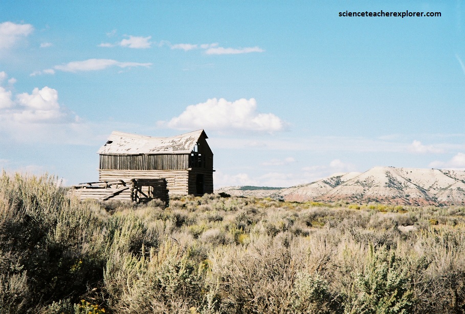
At a point about 3 kms west of the Weber Station, the Pony Express trail crossed the Weber River and went up and over the Wasatch Range. The riders and stage continues on to the Brimville Emergency Station, (Henefer townsite), then following the old Mormon Trail south, which is the same as Utah S.R. 65. Pictured above, Dixie Creek Station was located in Dixie Hollow. Although, the actual location has been debated. However, farrier tools and horseshoes and mule shoes have been found in the area of the photo taken above. This is the probable location of the stock corral.
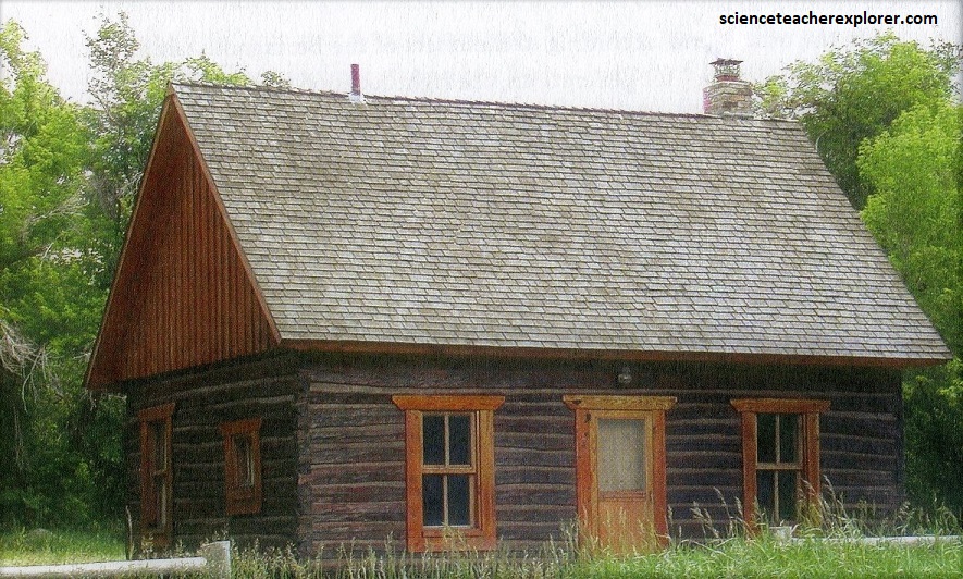
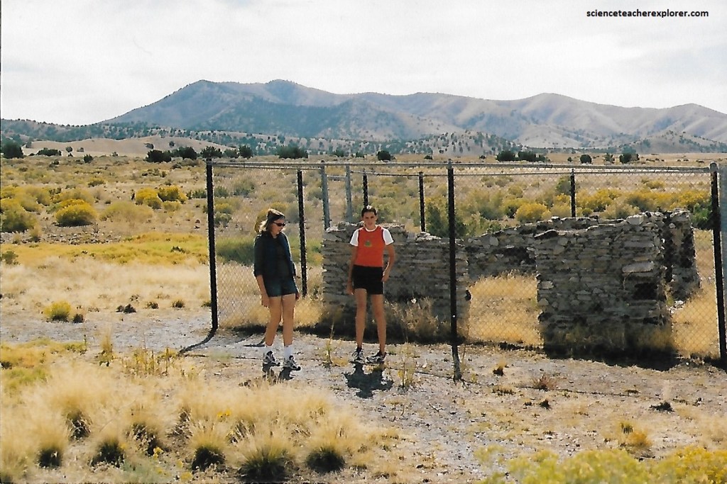
Pictured above, the sixth contract station in Utah is usually referred to as Bauchmann’s but also “East Canyon Station”. The site is located at the south end of East Canyon on the Clayton-MacFarland Ranceh east of East Canyon Creek. The station is a one-room cabin. It measures 8 meters north-south and 6 meters east-west. The original station had been moved about 100 meters southeast of where it once stood and has been restored. The original site is now a loading area for the ranch.
I was unable to find the seventh station in Utah called the “Mountain Dale Station”. It was supposedly located 19.3 km east of Salt Lake City, in the bottom of Mountain Dell Canyon south of Big Mountain. I believe it was posted, “Keep Out” by the Salt Lake City Corporation in 2002.
Imaged above, Pony Express mail was probably handled at the express office across the street, the “Salt Lake House provided accommodations for Pony Express riders and Overland Stage customers. The building was found on 143 South Main in Salt Lake City, Utah. There were no interpretive signs found there about the original structures in 2002.
The ninth contract station was located on 6400 South and State Street in Salt Lake City, Utah. It was called the “Trader’s Rest”. No sign of the station remained in 2002. Our group visited the site in passing, because the lack of evidence found at the site.
Imaged above, the westbound Pony rider or stage-coach proceeded south along today’s State Street to the next station, which was located just south of the location of the Utah State Prison in 2002. This was Porter Rockwell’s Hot Springs Brewery Hotel. The large adobe barn stood at the site well into the 1900s. At the Bluffdale/State Prison exit #291, I was unable to make out any historical structures at the site on private property. However, the station was run by the famous Mormon gunfighter, Porter Rockwell. Rockwell had been one of Brigham Young’s bodyguards and served as Territorial Marshall for Utah in the 1850s.
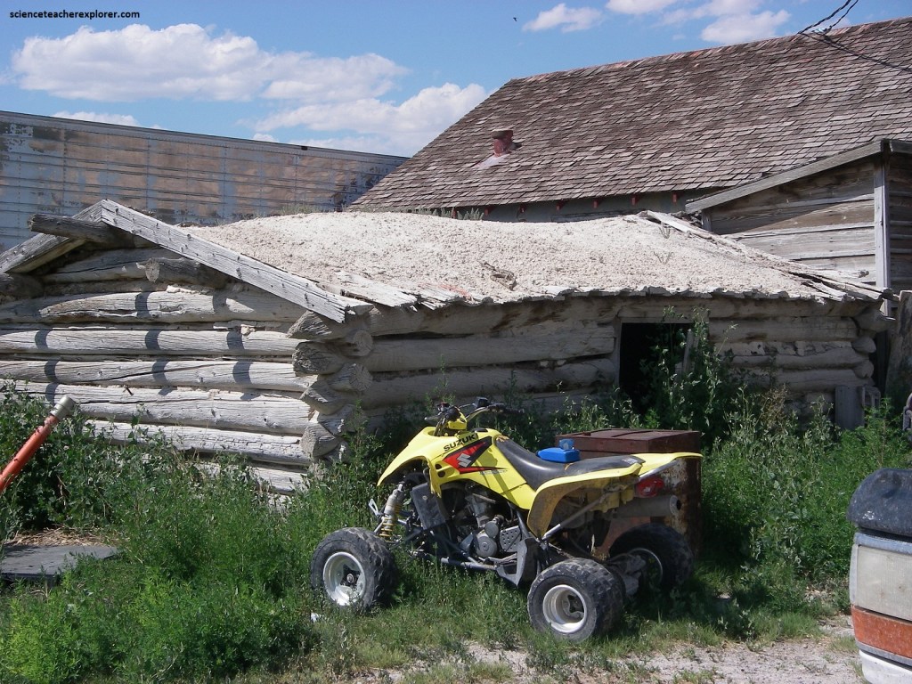
Pictured above, the eleventh contract station in Utah was “Joe’s Dugout”. Also known as Dugout, Joe Dorton’s and Seven Mile, it was located on the pass between Utah Valley and Cedar Valley in northern Utah County. The old photo above shows the old well site that was dug to get water. The attempt failed.
Pictured above, the station included a two-room adobe house, a log barn, a dry well and a dugout for Joe’s young Native-American helper.
In 1858, a contingent of nearly 3,000 U.S. Army troops entered Utah. They had been sent the previous year by President James Buchanan to quell a purported “Mormon uprising” in Utah. By negotiated settlement, the soldiers moved to the village of Fairfield, Utah, about 72 km south and west of Salt Lake City. They named their post Camp Floyd, for Secretary of War John B. Floyd. The name was later changed to Fort Crittenden when Floyd defected to the Confederacy.
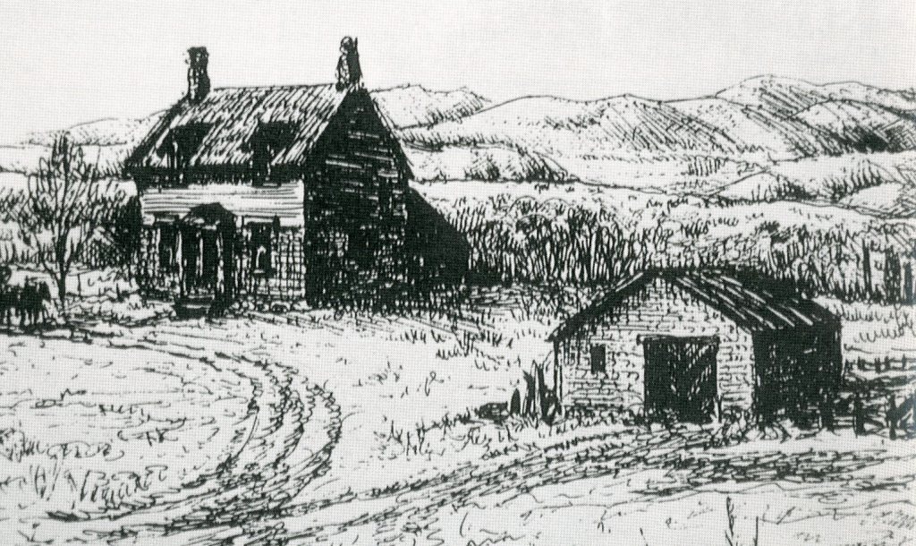
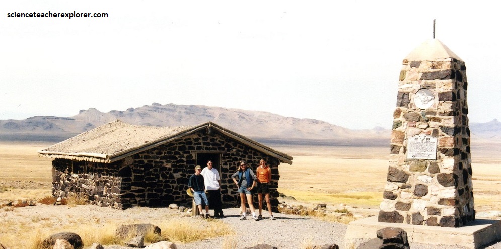
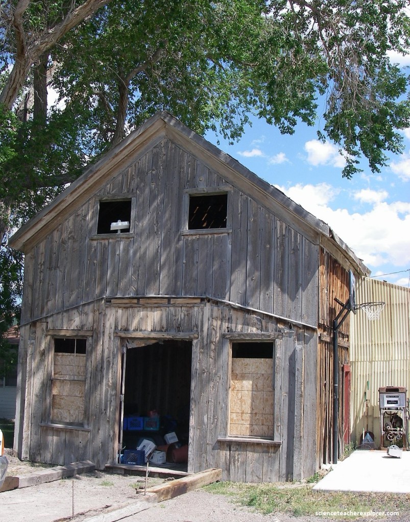
Pictured above, John Carson had built a two story adobe home and inn in 1858 in Fairfield, Utah within the Cedar Valley. It was used as a stage stop and later part of the express station and a place for riders to sleep. In 2002, there was no sign of the Pony Express Station, but the Overland Stage Station had been restored and maintained in excellent condition as the Utah State Park.
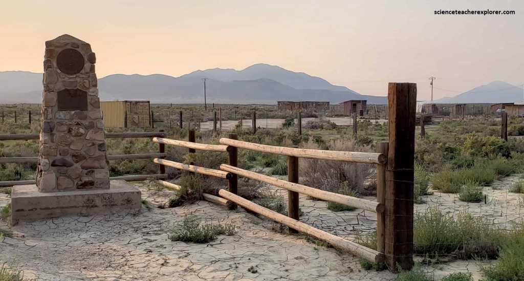
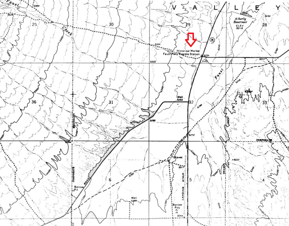
Pictured above, the first station west of Camp Floyd was called “East Rush Valley”. It was built as a dugout. In 2002, a monument marked the site. Water still collects in the low spot and more vegetation grows in it. Russell, Majors, and Waddell grazed their stock in Rush Valley. George Chorpenning had erected a stone stage stop there in 1858. It was located 30.6 km west of Camp Floyd. In 1851, the United States Post Office awarded a contract to George Chorpenning and to Absalom Woodward to establish the first mail route between Sacramento, California and to Salt Lake City, Utah. The route would become known as “The Jackass Express”. We approached the site from the Pony Express road and the intersection of Highway 36, (imaged below).
Henry Jacob “Doc” Faust served as the station-keeper for the Chorpenning’s line and then for the Pony Express. The station has been called Rush Valley, Bush Valley, Faust Station and Meadow Creek. It is believed that the station served as a home station. Faust also acted an an alternative rider when needed. The station house was a log structure with a low pitched roof and perhaps as many as seven rooms. Pictured above, the site was very littered in 2002 with the debris of extensive activity over the years.
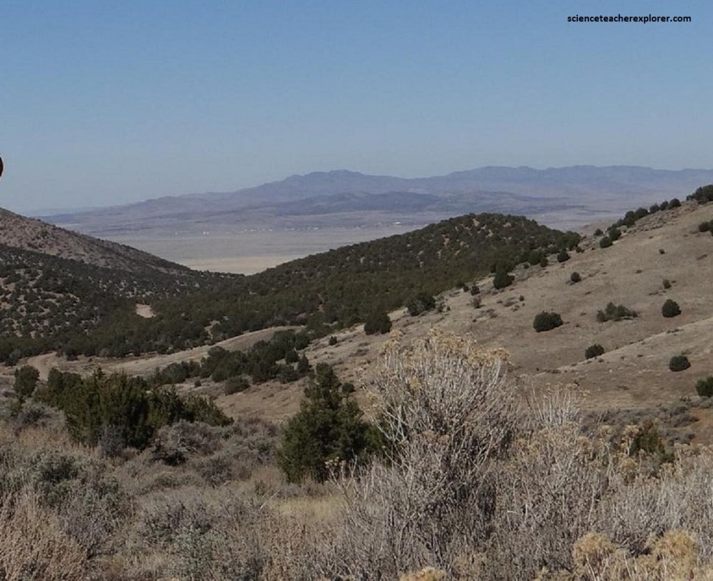
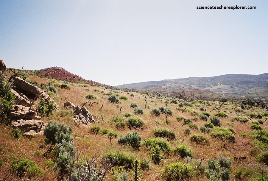
The 15th contract station in Utah is “Lookout Pass”. Pictured above, it is located in the saddle pass between the Rush Valley and Scull Valley. The trail crossed the rest of Rush Valley and then headed up Johnston’s (Lookout) Pass. From the pass, there’s a good view to the west of the desert that was called “Paiute Hell.”
Pictured above, during the 1870s, Horace Rockwell (Porter’s Brother) and his French wife “Libby” occupied what had earlier been a Pony Express station, on the west side of the pass, 1.2 km in descent. In 2002, there was a hole left to where the log cabin once stood. Mr. Jackson was the Pony Express keeper in the 1860s. However, the station was abandoned during the Paiute War with the Pony Express Company.
Pictured above, the stone enclosure 150 meters to the south of the Lookout Pass Station is said to contain three human graves and the remains of Rockwell’s pet dogs.
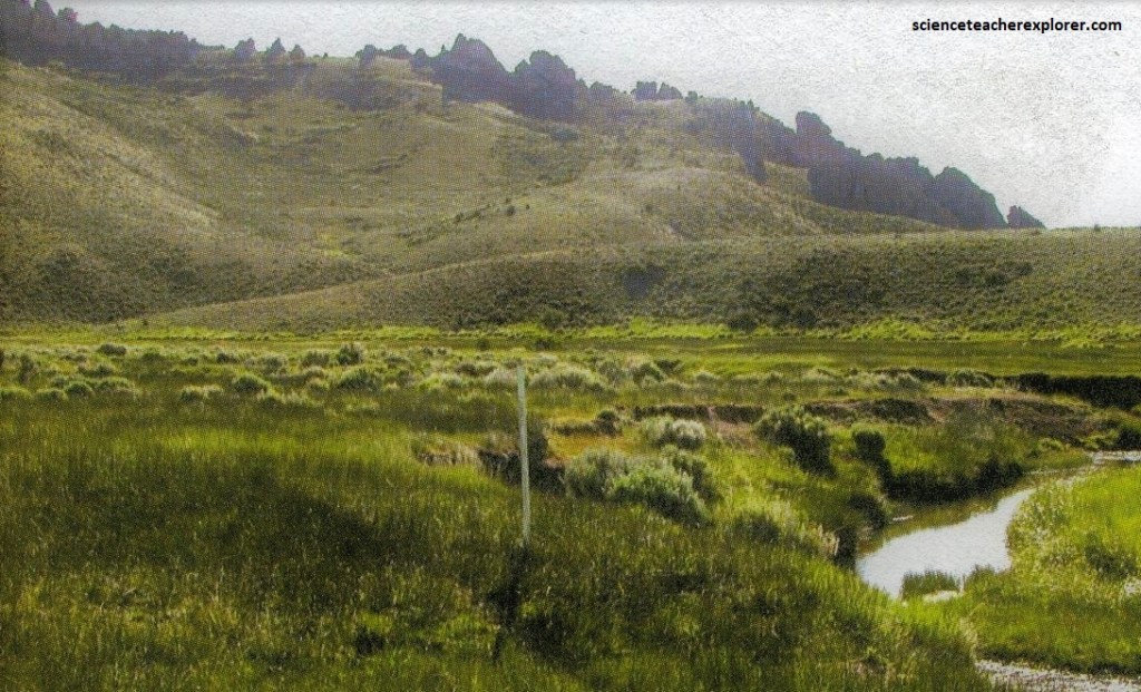
There was a non-contracted relay station about 13 km west of Lookout Pass, at a place called Government Creek. The station consisted of two stone structures, one a house and the other the telegraph station. Being unmarked, it was impacted by erosion, grazing and animal burrows in 2002. No interpretive sign or structure was present in 2002.
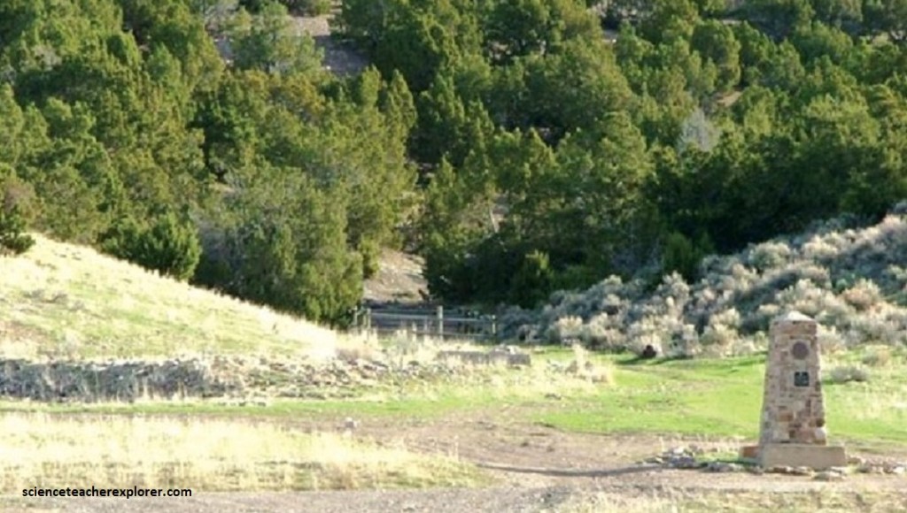
Simpson Springs Station is 26.5 km west of Lookout Pass. One of the few places in Utah’s western desert where there was plentiful water, this was an important station from the time of Chorpenning’s Jackass Mail. Pictured above, there is a fine reconstructed stone building (probably 100 meters east of the actual site), and very attractive BLM campsite.
The springs in the Simpson Springs area had long been known and used by the Native Americans. Howard Egan had located them, and Chorpenning and Simpson used them. Chorpenning first occupied the site in 1851. A stone station and stables with a wooden corral were soon built there by Chorpenning for his stage line, and like his other stations, were used by the Pony Express in 1860. The express station is said to have had two or three rooms. The station keeper was George DeWees. It served as a relay station where the rider could get a refreshing drink of water, which in this area was a real luxury.
Pictured above, the next station west was Riverbed or River Bed Station. It was not until 1861 near the end of the express that this station was constructed with upright logs. It was about 13 km west of Simpson’s Springs. In 2002, nothing is left of the structures, except the pile of rocks from the chimney. A small marker identified the site. Also, William Hosiepool, Oscar Quinn, and Georg Wright were all station keepers who reported being afraid of the “desert Fairy” hauntings.
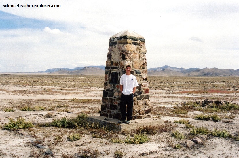
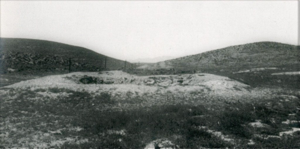
Pictured above, Dugway Station is the nineteenth contract station in Utah. It is located east of the pass between the Thomas and Dugway mountain ranges. From the monument at Simpson Springs, it is 26 km west on the Pony Express Road. The site consists of a depression and rock pile northeast of the CCC monument and south of an arroyo running west to east and dividing the site in half. It was reported that the site was a mere dug-out, (a hole 1 meter deep), roofed over with split cedar trunks, and provided with a rude adobe chimney.
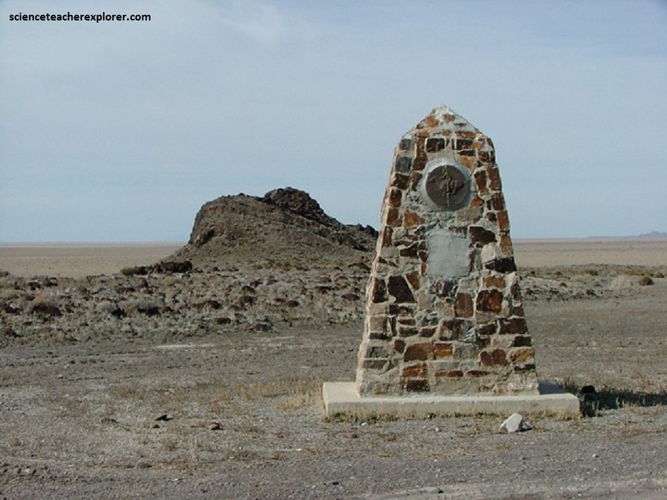
Pictured above, little is know about Black Rock Station. There is some evidence to indicate that the station may have been south of the rock formation in a cleared area near large scattered rocks where the trail cut over the small rise. The site seems to have derived its name from a volcanic outcrop of black basalt on the tip of the bench. The CCC monument was badly vandalized in 2002.
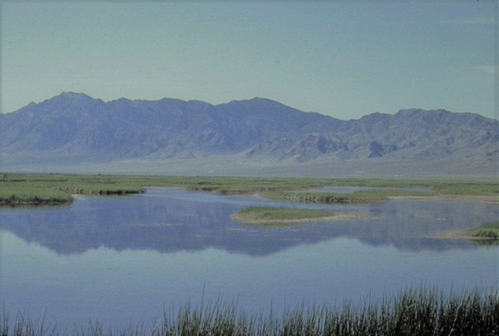
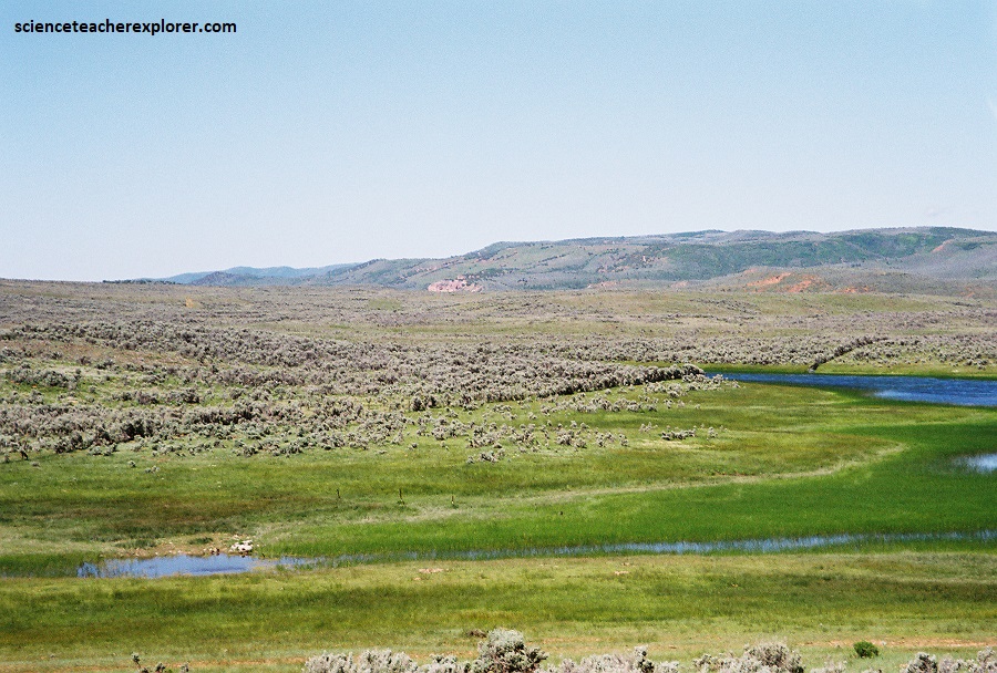
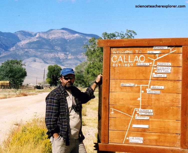
Pictured above, Fish Springs is the twenty-first contract station in Utah. It was located near the picnic area on the Fish Springs Wildlife Refuge, about 37 km east of Callao, Utah. The Fish Springs area was used from pre-historic times to well into the twentieth century. The main stone structure of the Thomas Ranch, was removed in the 1930s. The foundation of the “L” shaped, single-story, living stone-structure remains with a barn remnant. The Fish Springs site served as a home for the John Thomas family which developed into a successful ranch and was used to supply the Fish Springs Mines directly to the west. Fish Springs was a popular way-station for travelers from Pony Express times until the demise of the Lincoln highway in 1927. The Stage, and in bad weather, the Pony Express, travelled around the north end of the Fish Springs Range on the approximate route of the modern road.
Fish Springs is a true desert oasis, and a birdwatcher’s paradise. The refuge contains a 10,000 acre spring-fed marsh criss-crossed by roads built on dikes, and is especially rich in ducks, heron, and egrets.
Several natural springs feed the wetlands. These are along a linear path at the range front (that is, fault controlled), and include North Springs, Deadman Springs, House Springs, Middle Springs, Thomas Springs, South Springs, and Percy Springs. Fish Springs is thought to be the end of a long flow-path of groundwater, starting in the Schell Creek Range and Snake Range area and flowing along permeable bedrock (for example, limestones) or faults toward Fish Springs.
The annual discharge of the springs is (33,900,000 m3)/year, and the annual recharge for the drainage area (the range front and Fish Springs Flat) is about (4,900,000 m3)/year, meaning over 6 times more water flows out of the springs than falls in the valley annually by precipitation. The springs and several wells in the area are monitored by Fish and Wildlife personnel and/or the Utah Geological Survey. The water of Fish Springs area is not suited for human consumption, being warm (~80 °F (27 °C)) and highly saline.
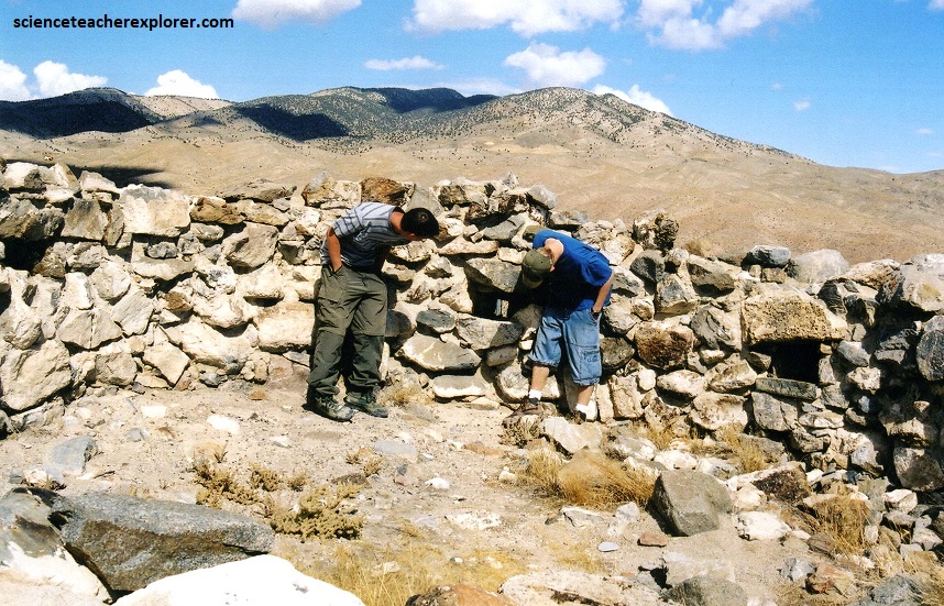
Pictured above, Boyd’s Station was the 22nd station in Utah. It was located 16 km east of Callao and 22.5 km west of Fish Springs on the north side of the Pony Express/Overland Stage Road. The site consists of the remnants of the stone walls of the living structure enclosed in a chain link fence. The foundation of a barn lies to the northwest of the structure and sign of a corral north of that. Although the Boyd Station is one of the best preserved of the Pony Express stations in Utah, it played a minor role. It was considered to be a noncontracted station.
The 23rd contract station in Utah was Willow Springs Station. It is located in Callao, Utah. Pictured above, the 1868 engraving shows the Pony Express/Overland Stage station as a small adobe building with a thatched roof, a door and two windows in the front. Additionally, there is a barn to the right and another barn a few meters to the rear.
Pictured above, the Bagley family, who have been on the land for more than a century, described Willow Springs as a Pony Express home station that also provided meals and accommodations to travelers on the stage route.
Six Mile was the 24th site in Utah that was a non-contract station. The site is located west of the road from Callao to Ibapah, 9.7 km north of Callao. However, it was privately owned with no sign of the station remains. So we didn’t stop and continued on to the next station.
Constructed in 1863, Round Station replaced Burn’t Station to serve the Overland Stage. It was located west of the Pony Express/Overland Stage Road, 19.3 km northwest of Callao at the mouth of Overland Canyon. Pictured above, the remnants of a round rock structure included gun-ports and had been stabilized and enclosed by a chain link fence. Following the destruction by Paiute Native Americans of the station in Overland Canyon, a more strategically located and defensible station was constructed about 3.2 km down the hill at the mouth of Overland Canyon. Attacks by Native American tribes angry about the intrusion of the stages on their lands interfered with regular service and resulted in considerable delays and loss of mail and other cargo (not to mention a few lives).
There were two stations in Overland Canyon and both destroyed by the local Native Americans. The first location of “Canyon” Station was at the mouth of Blood Canyon, 19 km east of the Ibapah Post Office on the Pony Express/Overland Stage Road. It lied 30 meters to the west of the road on the alluvial flat at the mouth of the canyon. The location of the second station was near the CCC monument nearby. A very steep gully in Overland Canyon prevented us from getting access to these sites in 2002.
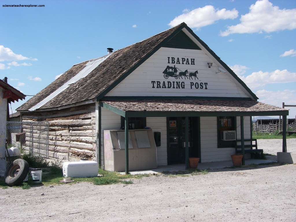
Pictured above, Ibapah Trading post, 2 km north of Ibapah, Utah, is the actual site of Deep Creek Station, the home station of Howard Egan, Division Superintendent between Salt Lake City and Roberts Creek (near Eureka, Nevada). The Trading Post was primarily a private ranching enterprise, although they did run a general store and gas station in 2002.
The famous explorer, Richard Burton riding the stage, describes the Deep Creek Station as “two huts and a station-house, a large and respectable-looking building of unburnt brick, surrounded by fenced fields, watercourses, and stacks of good adobe”.
The most westerly station located within the present boundaries of Utah was the home of Howard Egan at Deep Creek Valley. He laid out the Overland Road and supervised its construction even before Simpson “surveyed” the route. As the largest station west of Camp Floyd, Egan’s ranch supplied several of the other stations with hay, grain, vegetables, meats and milk.
Pictured above, the Ibapah Trading Post was on the original “Lincoln Highway”. The Lincoln Highway was the first transcontinental road for automobiles in the United States, dedicated in 1913. It wound its way between New York City and San Francisco. In Utah, it initially followed the Overland Stage Route but was later changed. Pictured above, Owen Sheridan opened this hotel that advertised good beds, home cooking, gasoline, & supplies.
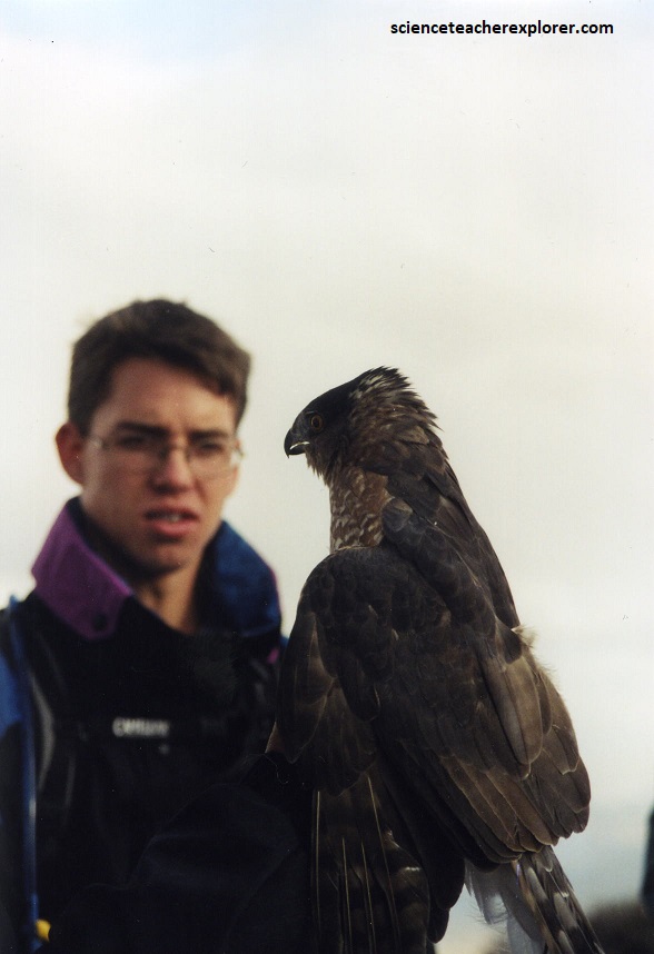
Dedicated to the conservation of raptors, hawks and other birds of prey, HawkWatch International is a Utah-based non-profit organization whose work with migrating raptors brings them to the Nevada/Utah border each year. With an important field station situated in the Goshute Mountains, a team of wildlife biologists captures, surveys, and releases raptors of all kinds who follow the Pacific Flyway over the Goshute mountain range. To end our educational tour of the Pony Express/Overland Stage Trail in Utah, we decided to hike 3.2 km up to the top of the Goshute Mountains to see what HawkWatch International was up to.
