Cimarron, NM 2013
On June 2013, while drive-touring through north-eastern New Mexico, I found myself in the Cimarron Territory of the Santa Fe trail. Cimarron is Spanish for wild and untamed and originally was used in New Mexico to refer to the wild bighorn sheep, and later to the wild horses and cattle that once roamed throughout the north-central mountains of New Mexico. Today, the sparsely populated Cimarron country can still be described as wild and untamed with its rugged, timbered mountains (the Cimarron Range), towering cliffs, and the previously unpredictable Cimarron River.
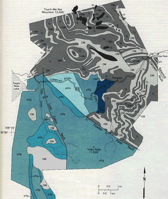
Cimarron Canyon State Park extends along Cimarron Canyon from Eagle Nest Lake to Ute Park and along US-64. Cimarron Canyon exposes nearly two billion years of complex geologic history. The canyon separates the older Proterozoic rocks to the south from younger Tertiary rocks to the north. These two distinct terranes are separated by the Fowler Pass fault that is found on the eastern part of the canyon. In the middle portion of the canyon, I stopped at the “Palisade Cliffs” to take a break.
The imposing granite cliffs of Cimarron Canyon are a dominant scenic feature of this beautiful “State Park”. This was a cool, enjoyable place to take a break from the blasting heat that occurs from the lower elevations. A sparkling river runs through the canyon for 19 km, adding an additional soothing element. On the eastern side of the canyon, the high cliffs extend horizontally to form a palisade above the canyon, something akin to the battlements of an old castle, (pictured below).
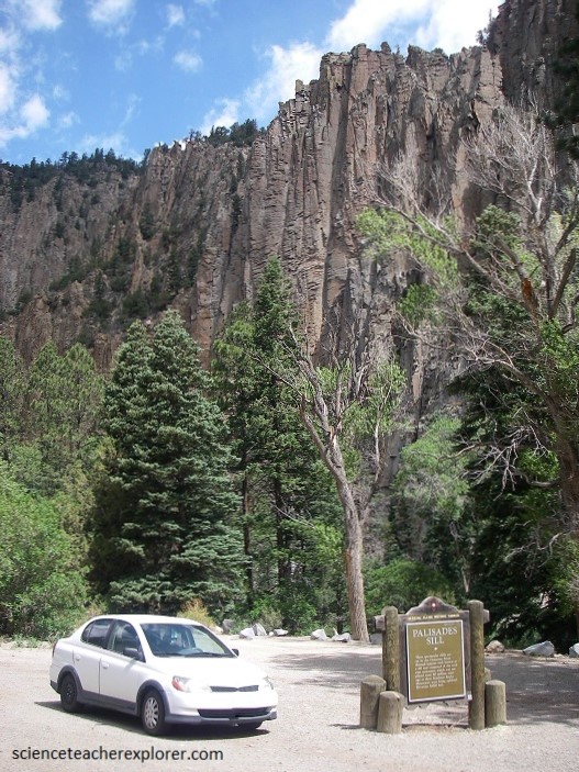
The Palisades in the eastern part of Cimarron Canyon State Park are one of the most spectacular geologic features in northern New Mexico. These cliffs were formed by a light-gray, fine-grained Tertiary (25 million years ago) sill that intruded the Cenozoic and Mesozoic sedimentary rocks and Proterozoic metamorphic rocks. The Palisades Sill is a fine-grained porphyritic dacite (visible crystals of plagioclase, quartz & biotite) sill which forms the spectacular cliffs, (pictured above with my car). As this magma cooled and solidified, it contracted and fractured perpendicular to its cooling surfaces, (the top and bottom of the sill). As water seeps into the joints and enlarges them through weathering, columns break and fall, creating piles of blocks at the base of the cliffs.
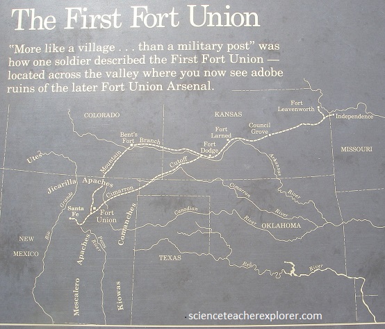
After leaving Cimarron Canyon, I continued down to the Fort Union National Monument. Fort Union, a hundred and eighty kilometers east from Santa Fé, is situated in the pleasant valley of the Moro.
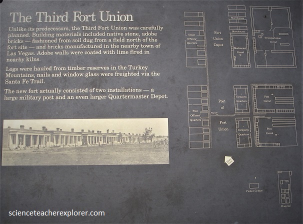
The fort was established on the Santa Fe Trail. It was provisioned in large part by farmers and ranchers of what is now Mora County (formally created in 1860), including the town of Mora, where the grist mill produced most of the flour used at the fort. The fort served as the headquarters of the 8th Cavalry in the early 1870s and as the headquarters of the 9th Cavalry in the late 1870s during the Apache Wars.
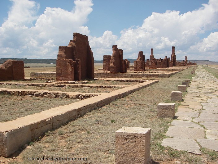
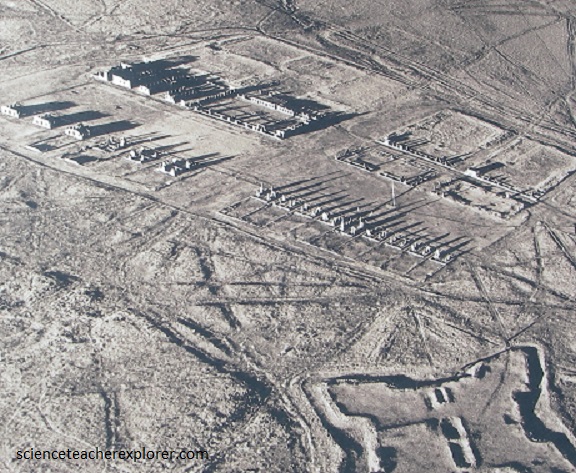
Pictured above, the Fort Union site preserves the second of three forts constructed on the site beginning in 1851, as well as the ruins of the third. Also visible is a network of ruts from the Mountain and Cimarron Branches of the old Santa Fe Trail.
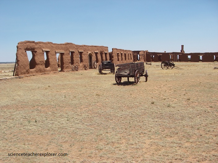
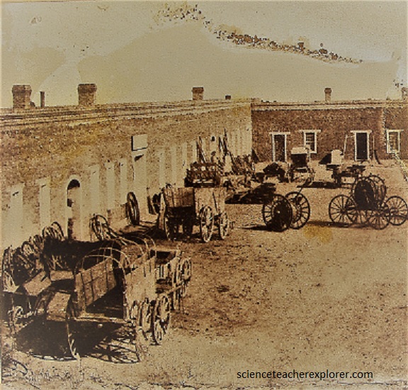
Pictured above, a fascinating array of wagons, running gear, wheels, wheelbarrows–even a plow–clutters this photo taken in the 1860s.
In 1870 Fort Union was a major stop on the 1,200-mile Santa Fe trail, easily the home stretch for caravans starting in Missouri. The Civil War had officially ended but the “Union” army still occupied New Mexico’s Fort Union, which was also a center of trade in addition to being a well-known military outpost. It was populated by a mix of soldiers, locals, travelers, and anyone else who had business on the Santa Fe Trail. This is of course until the railroads came.
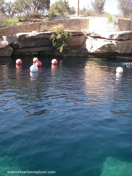
Just south of Fort Union and located just off of the famous Route 66 is the Santa Rosa Blue Hole, a natural swimming hole that has a hidden system of underwater caves which were unexplored until 2013. Like many natural pools of its kind, the Santa Rosa Blue Hole is a small body of water that seems to fill a surprisingly deep hole in the ground with shockingly clear waters.
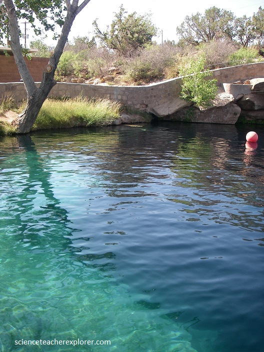
Water gushes into the Blue Hole at a prodigious rate of 11,350 liters per minute, so the water is remarkably clear; so clear in fact that it is possible to see to the bottom when the water is not being disturbed by divers. It’s diameter is 25 m at its surface, which increases to 40 m at its base. The temperature of the water remains a constant 18 degrees Celsius and recycles every six hours. The surrounding countryside is semi-desert, making this place a welcome oasis.
