Spanish Fork Cyn., Utah
In the summer of 2013, I did a major exploration of Spanish Fork Canyon in Utah. Highway #6 cuts right through it, from Spanish Fork to Price, Utah. Many interesting traveling sites are included along the way.
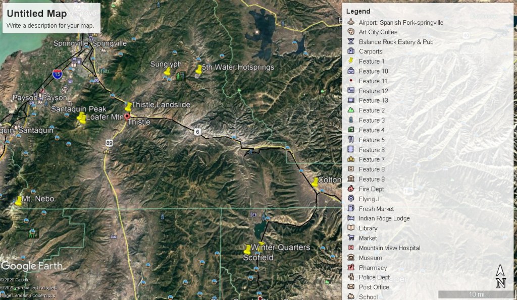
My first stop is the Thistle Landslide. With record-breaking precipitation in the fall of 1982, followed by a deep winter snow pack, then warm spring temperatures and rapid snowmelt in 1983 set the stage for the Thistle landslide. Once triggered, the slide reached a maximum speed of 1.0 m per hour and dammed Spanish Fork River within a few days.
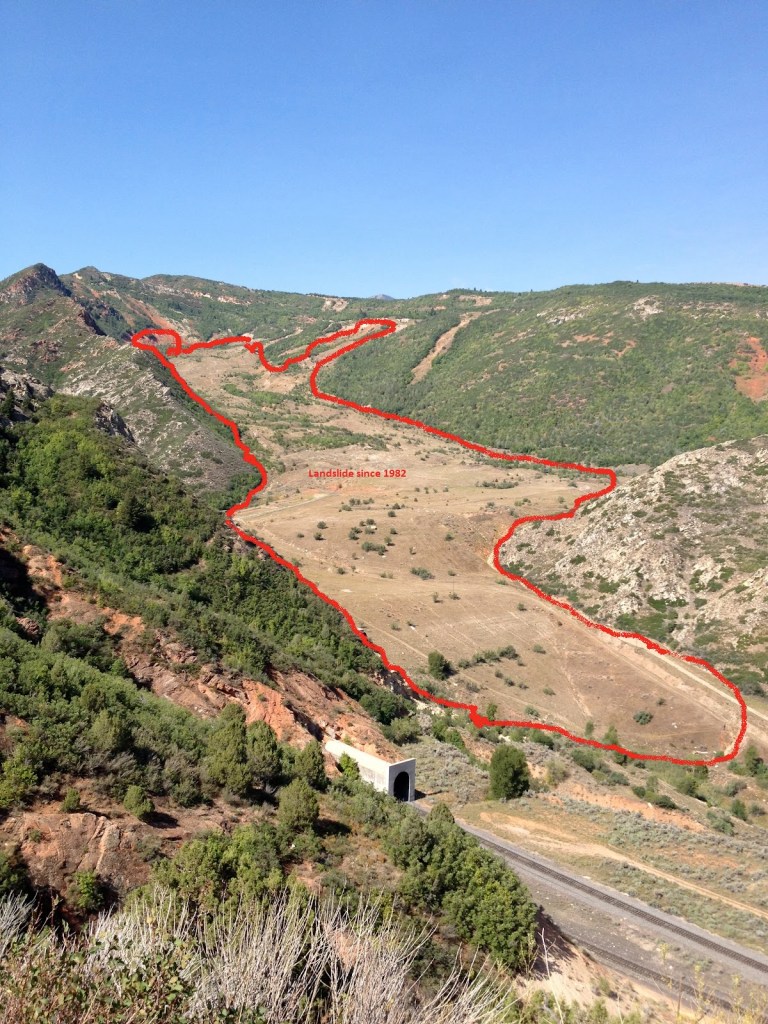
The landslide ultimately reached 1000 feet in width, nearly 200 feet in thickness, and over one mile in length. The lower end of the slide formed a 220-foot-high dam where it abutted against a sandstone cliff at the base of Billies Mountain. Behind this dam, “Thistle Lake” reached a maximum depth of 160 feet before being drained by diversion culverts.
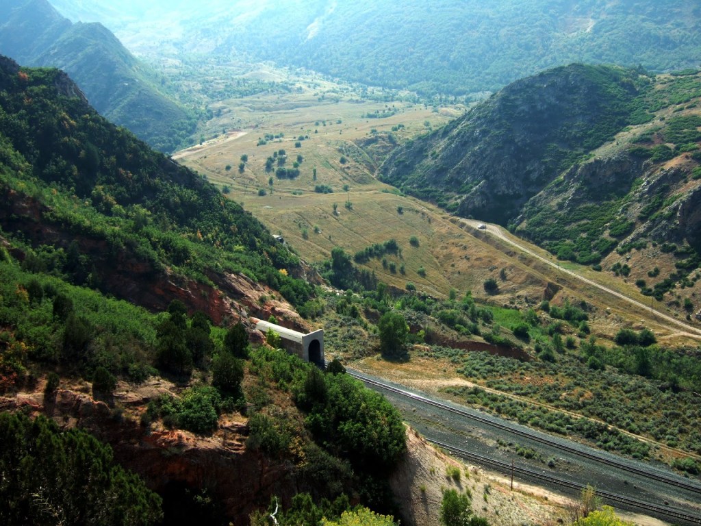
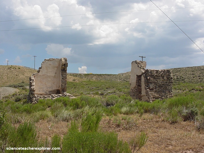
The Thistle landslide and “Thistle Lake” severed railroad service between Denver and Salt Lake City, flooded two major highways (U.S. 6 and U.S. 89), devastated the town of Thistle, behind the natural dam.
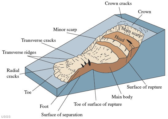
The 1983 landslide consisted of detritus from the North Horn and Ankareh Formations that moved along a trough-shaped depression in deeper bedrock (a paleovalley).
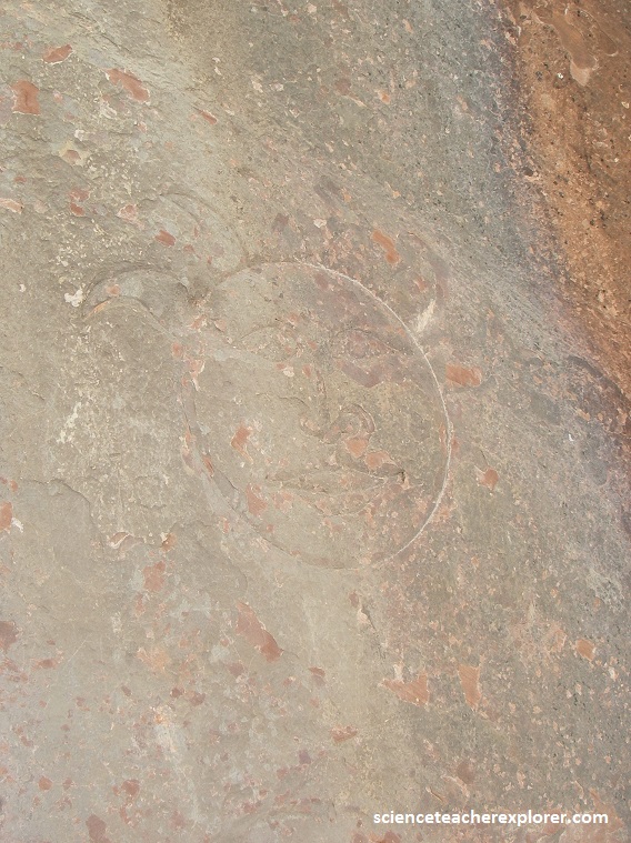
Utah has a rich history of Spanish explorers including Father Dominguez and Father Escalante. On September 23, 1776 these two Catholic fathers and their crew did in fact come through Spanish Fork Canyon and stand on a hill to overlook the valley. It is possible that somebody from this group, explored the side canyon of Diamond Fork and carved this glyph. Apparently, the glyph has been around since the Pioneers settled in the area.
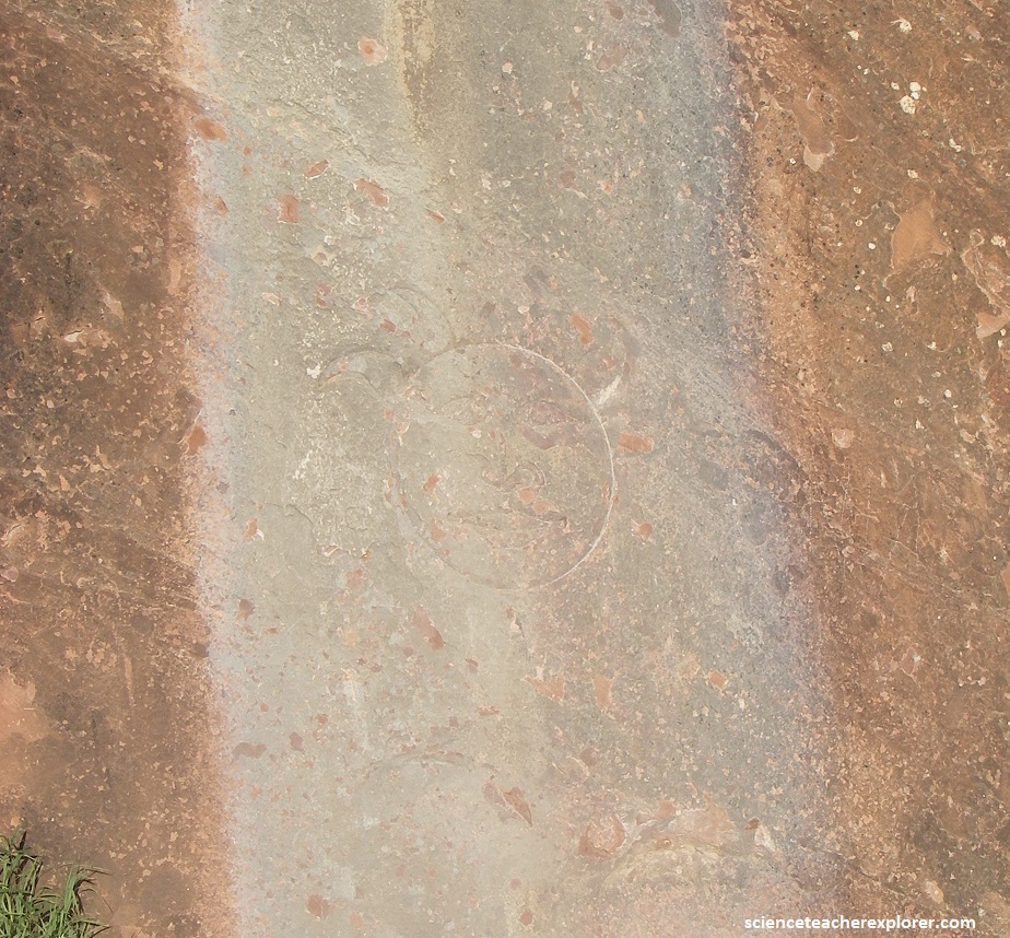
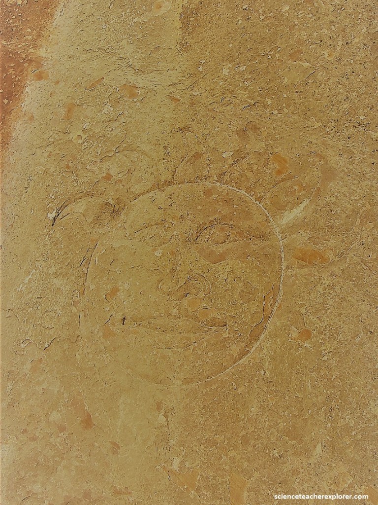
Pictured above and below, The sun face is pretty big and has six rays on top.
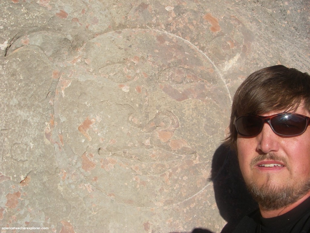
There is a great deal of speculation about the Sun-glyph. However, there is no proof that the “Sun-glyph” was created by the Spaniards or an America Native. Additionally, there is no proof that it is connected to a treasure.
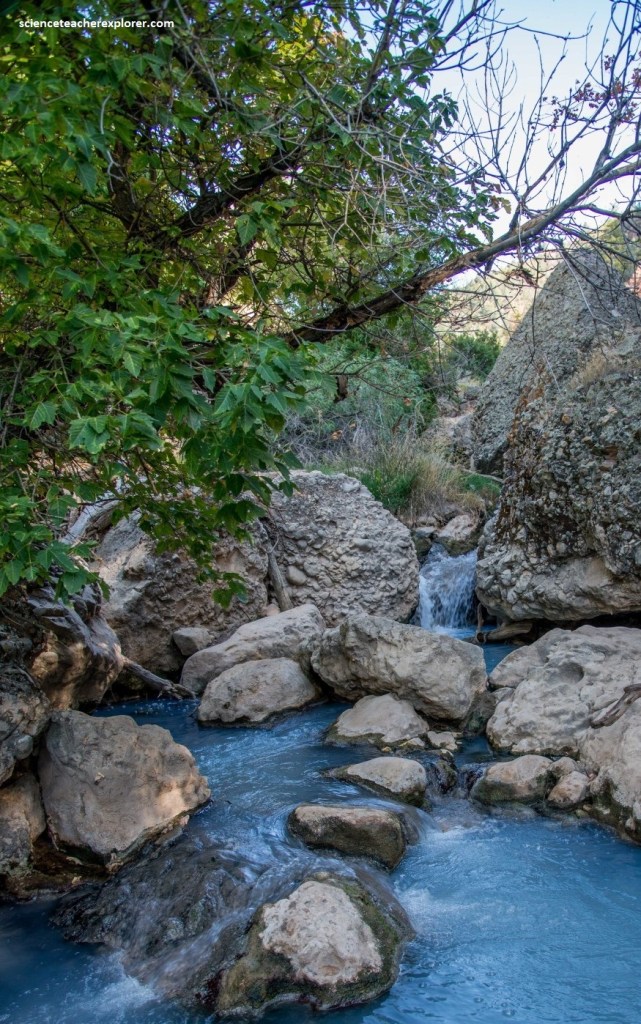
Pictured above, 5th Water hot-springs is found further up Diamond Fork. The hot springs are very popular and draw crowds. The water is clear and you can vary its temperature by positioning yourself at different points in the pools, and by regulating the water flows into the pools. Warning: some individuals choose to soak nude in the pools. However, I’m amazed by the dark-blue water. By the way, it is quite the hike to get there.
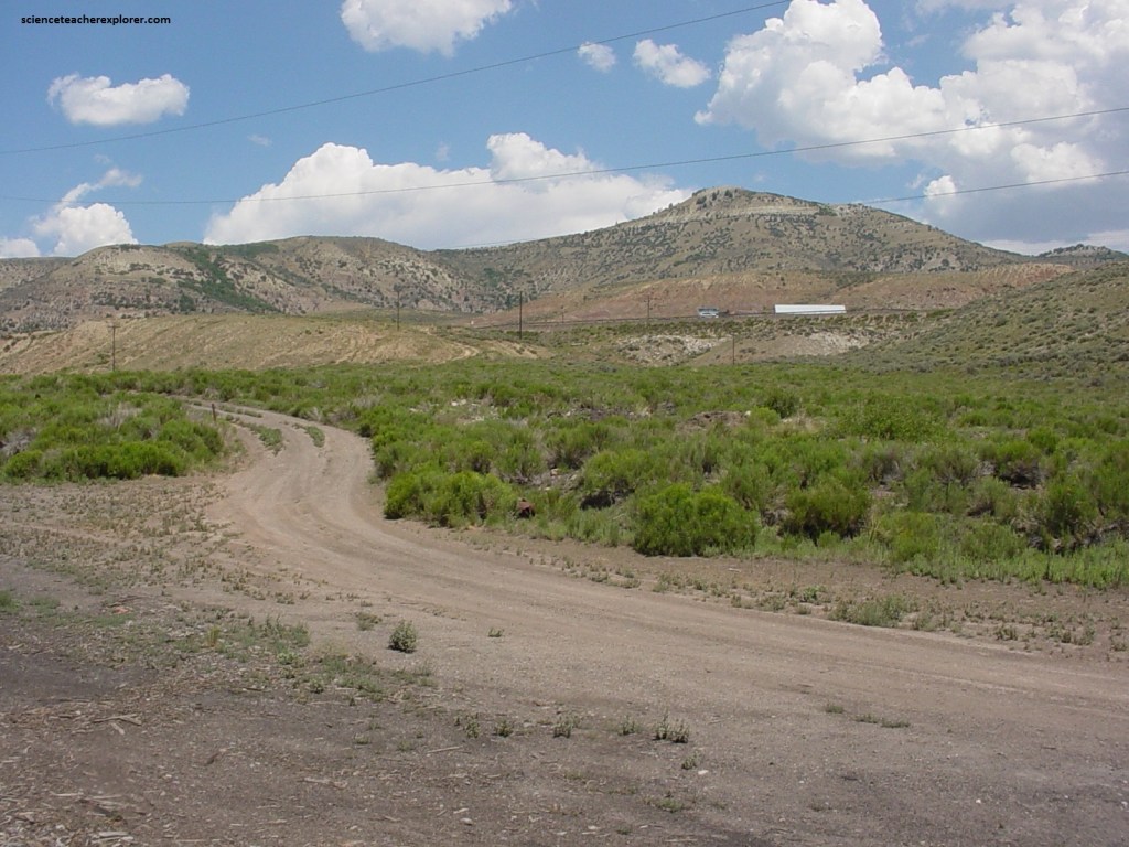
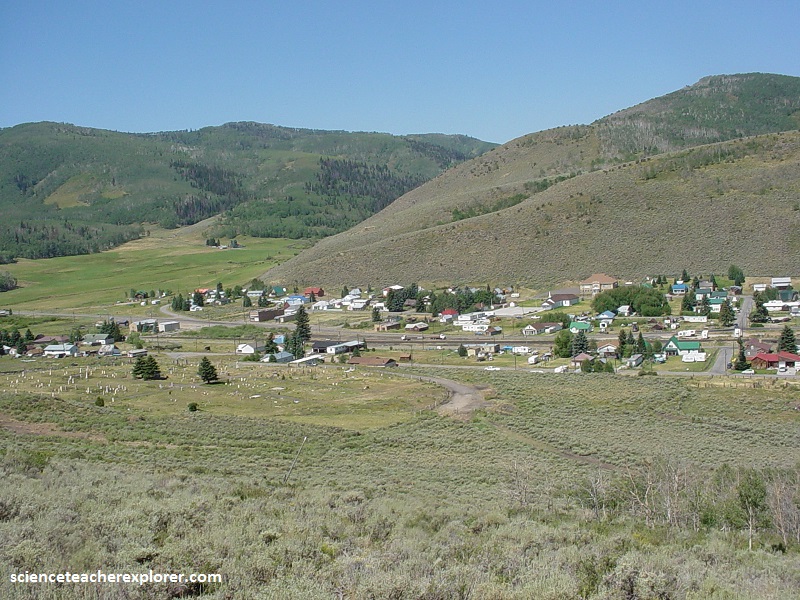
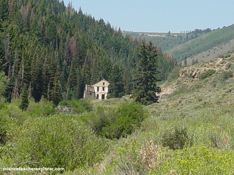
As you continue east up Spanish Fork Canyon, on Hwy 6. You reach the top at Soldier Summit. There is a small store called “Hilltop” there, but it is usually closed when I pass by. However, this is the site of a Ghost-town called of Colten, Utah.
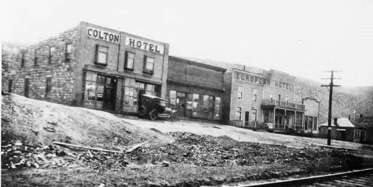
Originally called Pleasant Valley Junction in 1883, its name was changed to Colton in 1898. In 1940 it’s population was 327. The town died around 1950 when the Railroad operations were ended. Another part of Colton’s economy in the 1900s was the mining & milling of Ozokerite, a mineral wax found only here and in Austria…
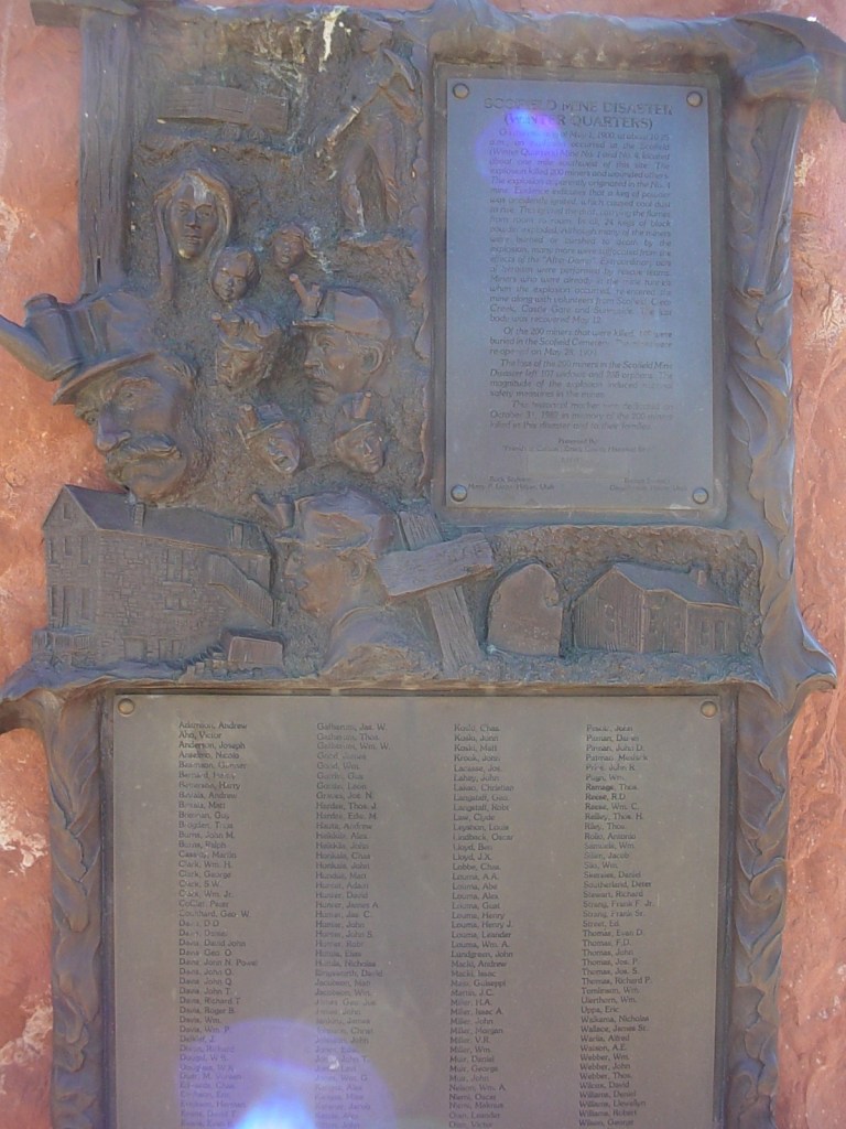
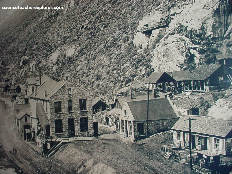
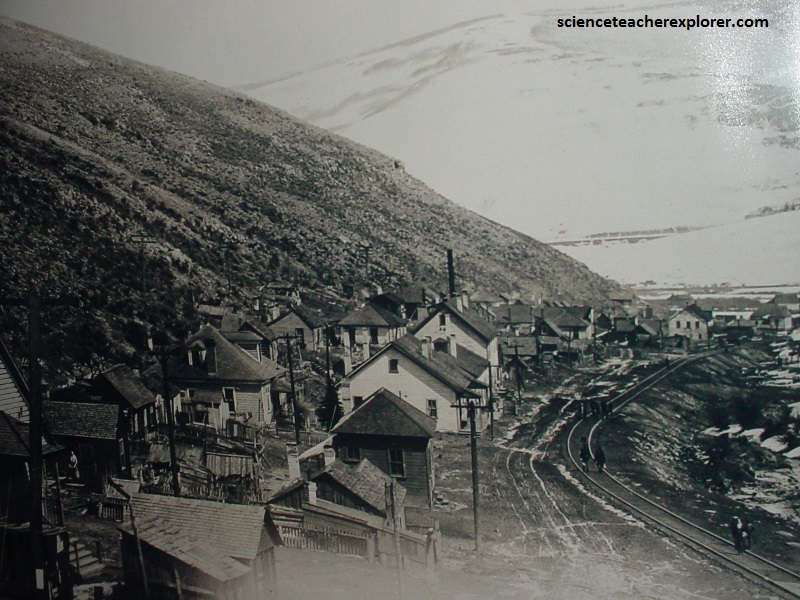
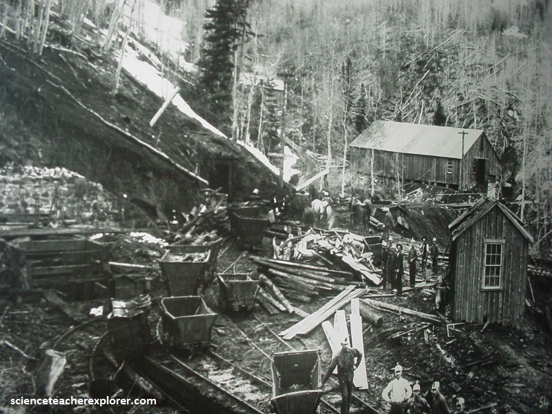
Nearby Colton Ghost-Town, a road splits off to Scofield, Utah. This is the home of-one-of-the “worst” mining disasters in U.S. History.
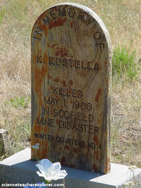
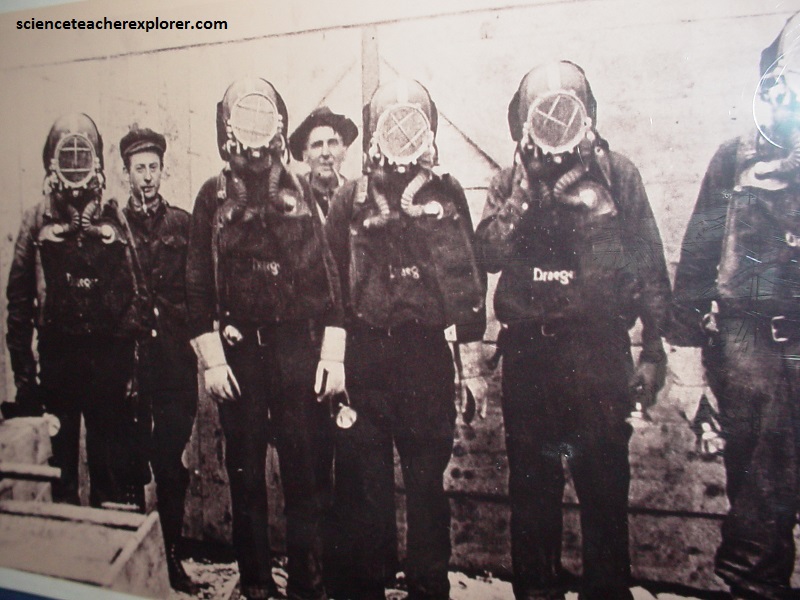
On May 1, 1900, a coal-dust explosion in the “Winter Quarters Mine” killed at least 200 men, with some rescuers placing the death toll as high as 246.
Some were killed outright by the explosion, but most died of asphyxiation by whitedamp and afterdamp. Death came so quickly that some of the mine workers were found still clutching their tools.
The State Mine Inspector’s Report determined that ten 25-pound kegs of black powder detonated in the Winter Quarter Mine # 4 Section. This ignited coal dust which spread throughout # 4 with explosive force killing the miners, and igniting another 20 scattered kegs of powder.
The explosion blew up the fan used to ventilate # 4. However in Winter Quarter #1 mine which was connected, the fan continued to run and pulled the remnants of the explosion, including afterdamp (primarily carbon monoxide) into #1.
When the miners inside Winter Quarter Mine # 1 felt the explosion, they tried to escape through the most direct route, which happened to be through #4. Unaware of where the explosion originated, they walked directly into the poisonous gas, and were overcome and killed. Many workers were too far into the mine to escape.
Most of the bodies from Winter Quarters Mine # 4 were burned and mutilated and had to be placed in sacks whereas those killed by gas were loaded into coal carts by the dozen to be hauled out of the mine.
The disaster left 107 widows and 268 fatherless children. In order to bury all of the dead, 75 caskets had to be imported from Denver, Colorado, because only 125 caskets could be brought in from Salt Lake City.
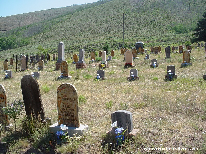
Pictured above, 135 graves were dug at the Scofield cemetery, some of which were widened to hold fathers and sons. Funeral trains with more than 51 coffins carried the remaining miners home.
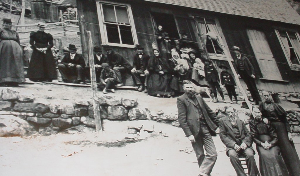
Sixty-one of the dead were Finnish Americans. Pictured above, the Luoma family lost 6 sons, 2 grandsons and a son-in-law.
At the time, the Winter Quarters Mine explosion was the country’s worst mining disaster; it now ranks fifth.