Book Cliffs, Utah 2009
In 2009, I was asked to explore the “Range Creek” area for a future tour with the University of Utah. Range Creek is part of the Book Cliffs of east-central Utah. It is found just north of the city of Green River, Utah. It was easy to approach this area from Hwy. 6, (paved), between Price and Green River, Utah.
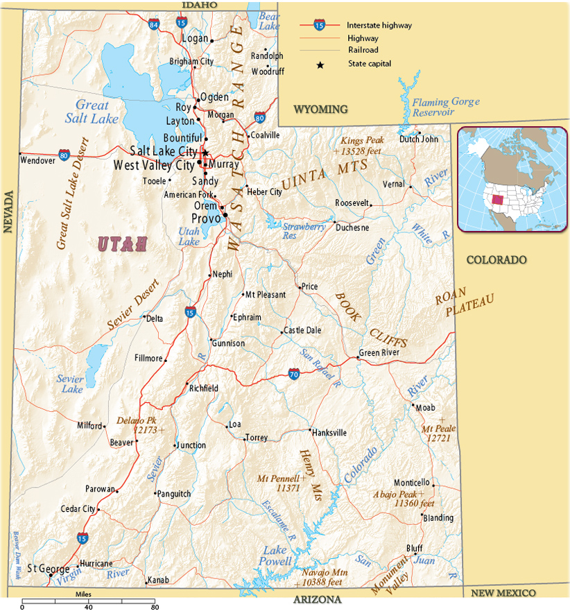
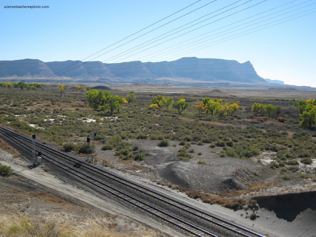
The Book Cliffs are a series of desert mountains and cliffs in east-central Utah, part of the western United States. They are so named because the cliffs of Cretaceous sandstone that cap many of the south-facing buttes and appearing similar to a shelf of books. The Book Cliffs have preserved excellent strata of the foreland basin of the ancient Western Interior Seaway that stretched north from the Gulf of Mexico to the Canadian Territory in the Cretaceous Period.
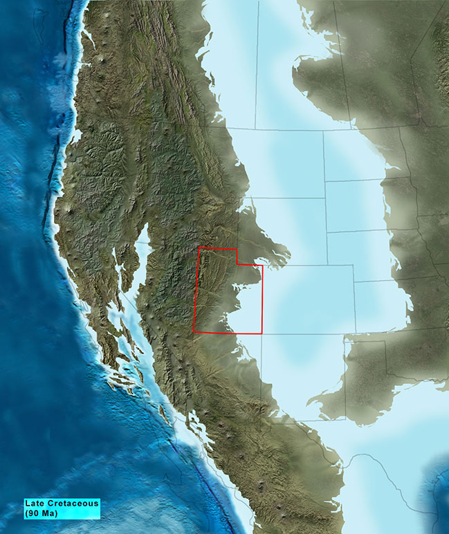
Roughly 130 million years ago, as the mountains bordering the western United States region, (and supplying the source of the sediments), were gradually eroded away, a new sea encroached upon the region from the south (imaged above). The thick marine shales of the Mancos Group (sedimentary layer), were deposited in this area (imaged below).
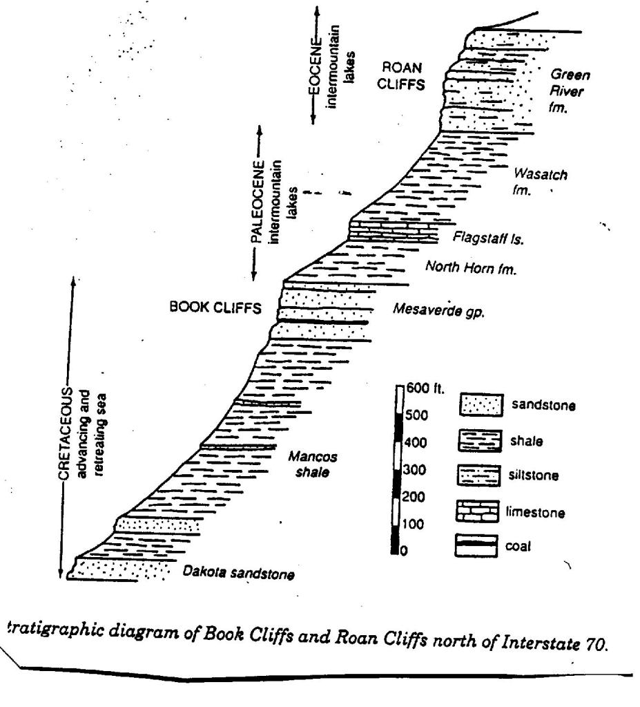
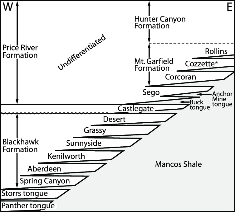
A fierce shoreline battle was waged over the “Central-Utah” region for the next 60 million years, between a low coastal plain and beaches to the west, and a deep sea to the east which stretched far into Colorado and New Mexico. The “Castlegate and Ferron” (imaged below) were deposited as beaches during this time along with coal deposits which formed in lagoonal swamps behind these beaches.
Several other thick coal bearing formations were deposited over the region during this time. They are found today to the north and on the Wasatch Plateau to the west of the “Book Cliffs”, but have long since been removed by erosion.
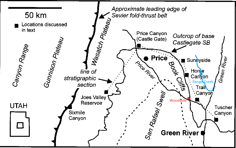
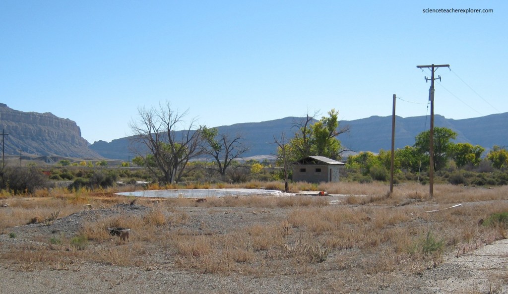
Before, exploring the “Book Cliffs”, the nearest civilized or man-made structure, in the area is an old service-station at the “old Woodside ghost-town site”. The Woodside ghost-town is located on the west bank of the Price River in the nearly uninhabited eastern part of Emery County, Utah. Pictured above, it’s fenced-in service station is one of the only signs of human activity along the lonely stretch of Hwy. #6 between Price and Green River, Utah.
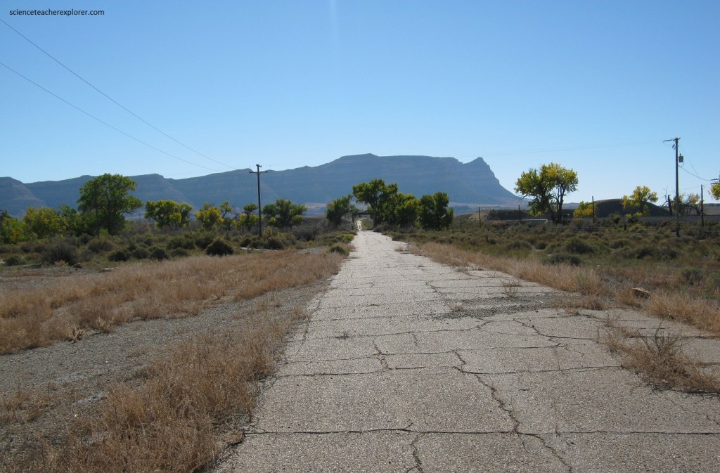
Construction on the site began with a “Denver and Rio Grande Western Railroad bridge and water-stop. The area’s first resident was a prospector in 1881. Attracted by relatively abundant water and an extensive growth of cottonwood trees, other pioneers founded a settlement known as “Lower Crossing”. As a town grew (population 330), it was renamed “Woodside” for the cottonwood groves. However, the Price River’s large drainage basin meant that a distant cloudburst brought destructive flash floods. Despite this, a hotel, (pictured above) and stockyards were built adjacent to the railroad station, and Woodside became a supply point for neighboring ranches.
In the late 1920s Woodside’s livestock shipping facilities and railroad station were taken away when the railroad consolidated much of its operations in the nearby Helper, Utah. This blow was followed by severe droughts in the 1930s and by WWII the population had dropped to 30.
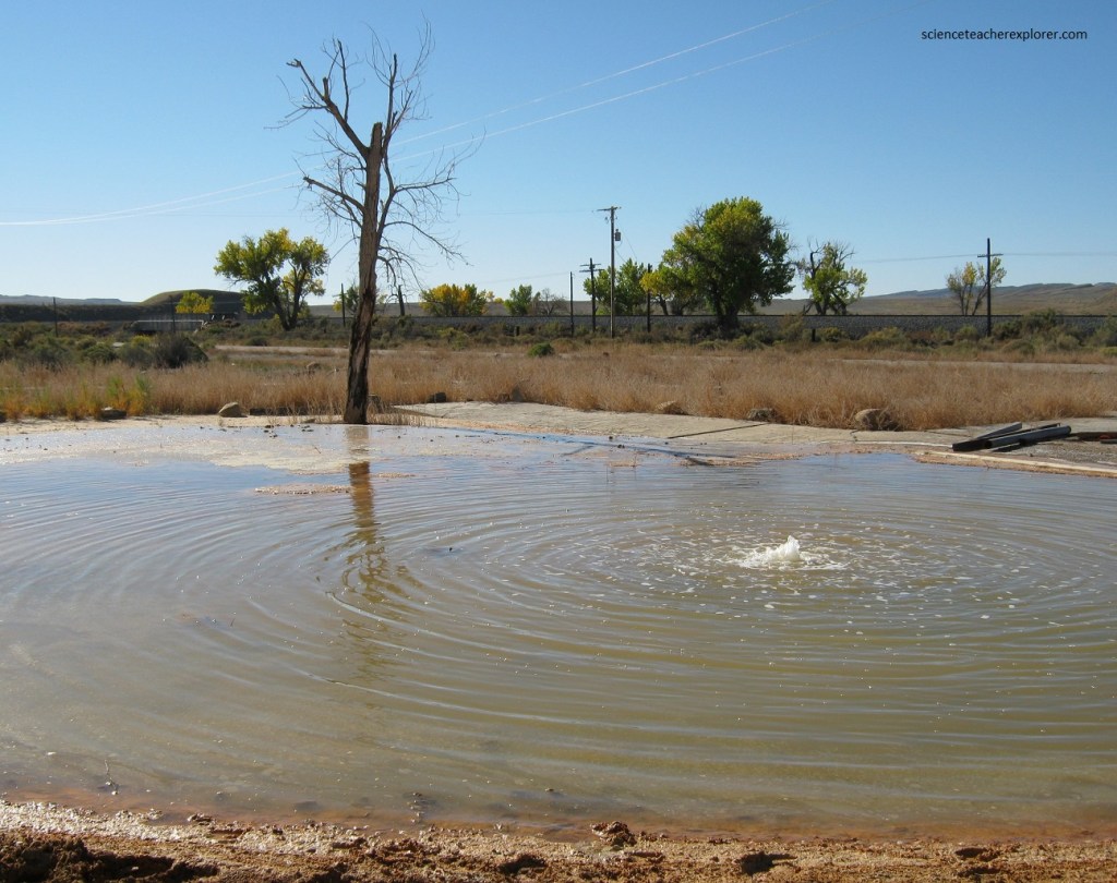
In the 1880s the railroad had dug a large water well near the service station here, which had later turned into a cold bubbling mud-pot driven by naturally occurring pressurized carbon dioxide gas. The hole was developed into a cold water geyser, along with a filling station, store, and cafe (pictured below from an old “Post-Card”.
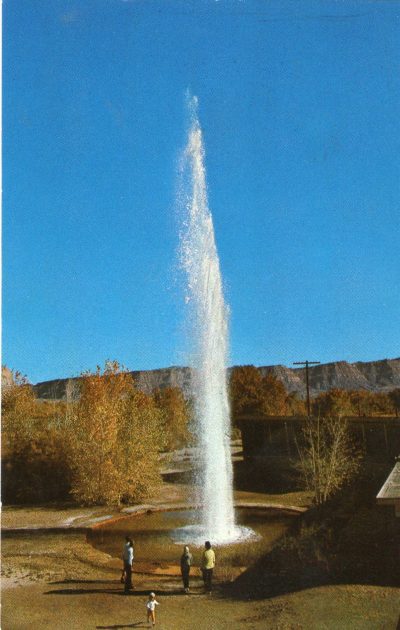
In the 1940s Woodside became a minor tourist attraction. In the 1960s, the Highway Beautification Act led to the removal of a number of billboards advertising the town’s geyser along U.S. Hwy # 6, which had a major impact on tourist visits from the railroad and car traffic.
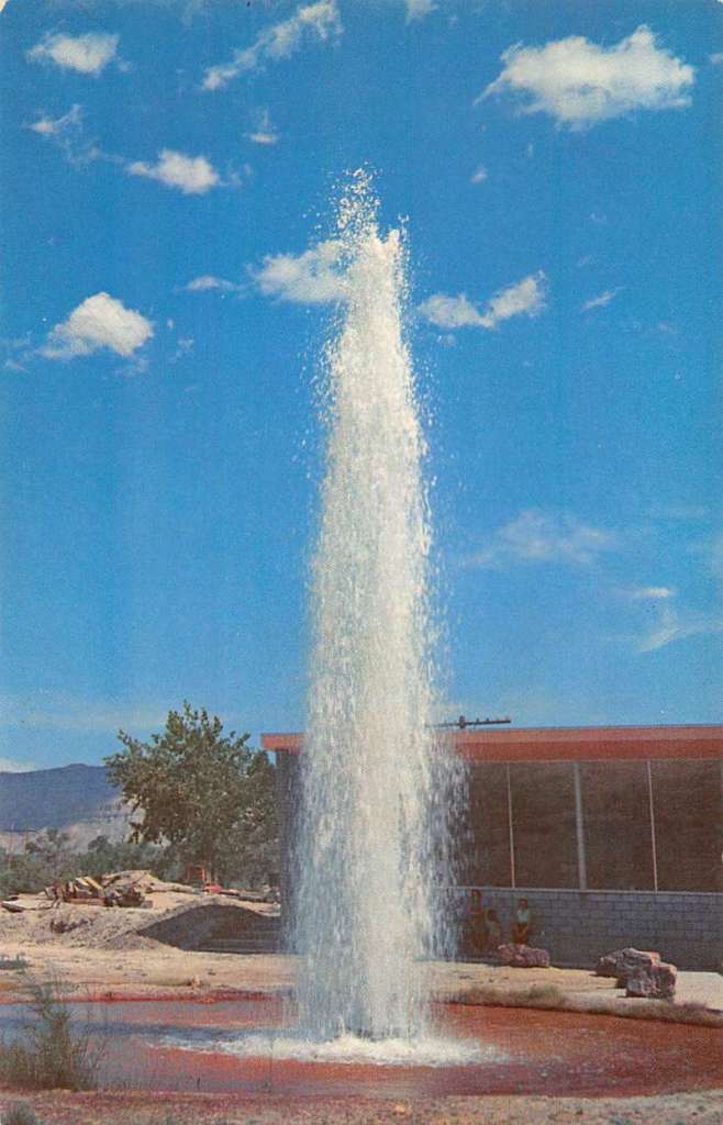
The cafe and store burned down around 1970, and the geyser and filling station are the only remnants of Woodside. The geyser formerly spouted as high as 23 m (pictured above), but is much lower now for a variety of reasons. The entire site is now forgotten into the historical past.
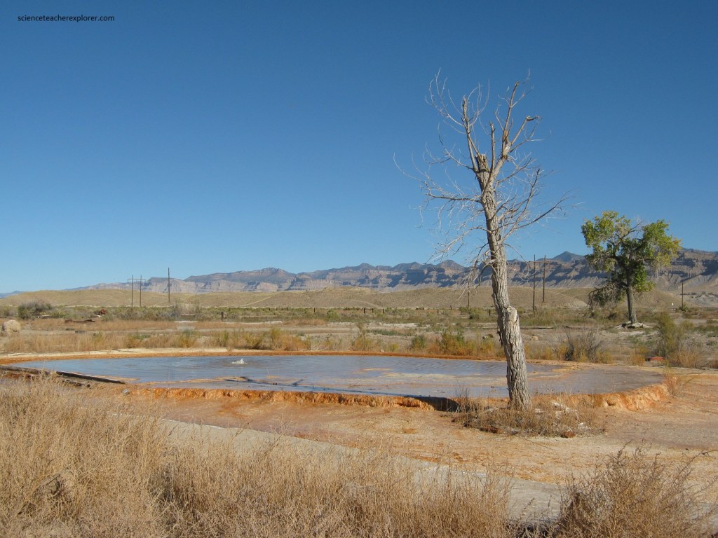
The Woodside Ghost-town was bought by Roy Pogue in the early 1990s. I visited the site several times to socialize with Roy and he allowed me to bring my tour groups by to watch the Geyser go-off, even though it was only a couple of meters high. There is a cemetery just above the old Ghost-town, on a sage-brush hill (pictured below).
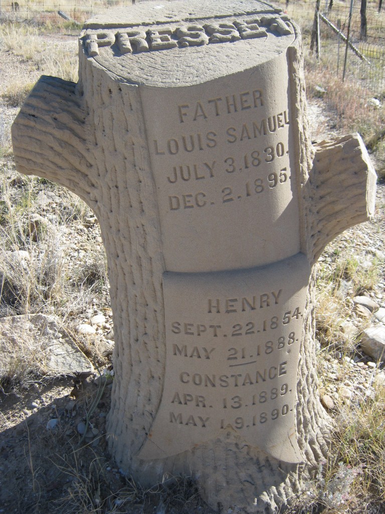
Pictured above, as far as ghost-town cemeteries, the headstones here were in good shape and non-vandalized in 2011. It is probably due to the fact that the cemetery location is well hidden and hard to find. Of course in 2011, when I took these pictures, Roy had abandoned the site. Then in 2012, Roy Pogue decided to sell the Woodside Ghost-townsite.
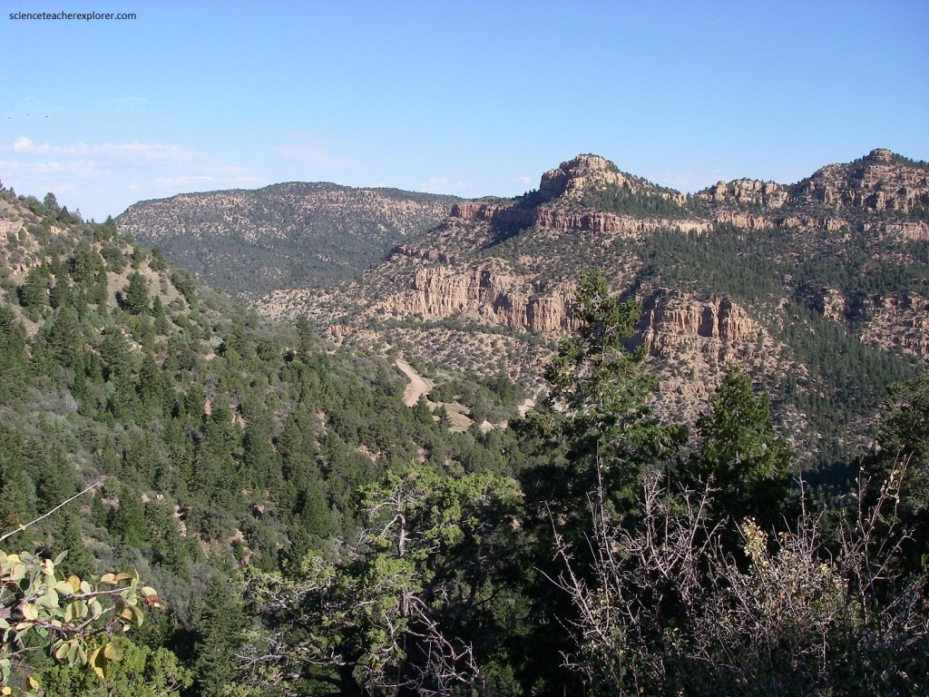
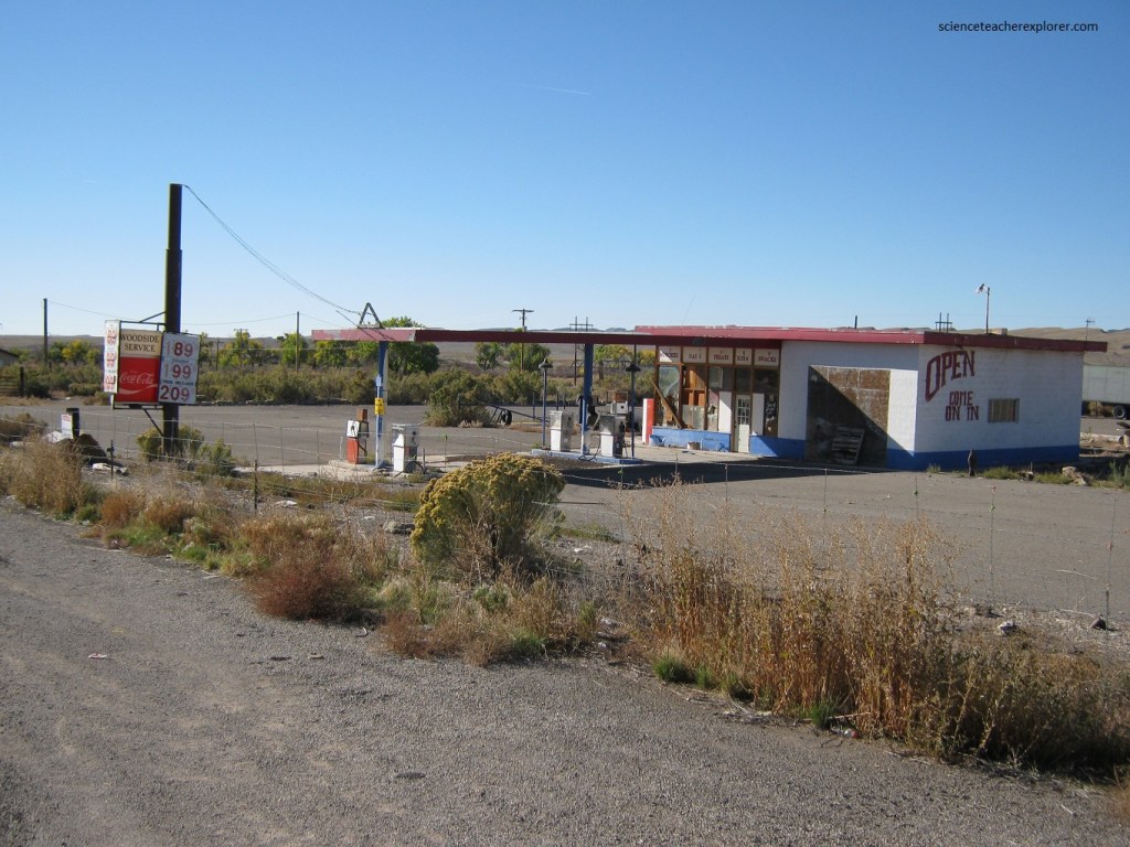
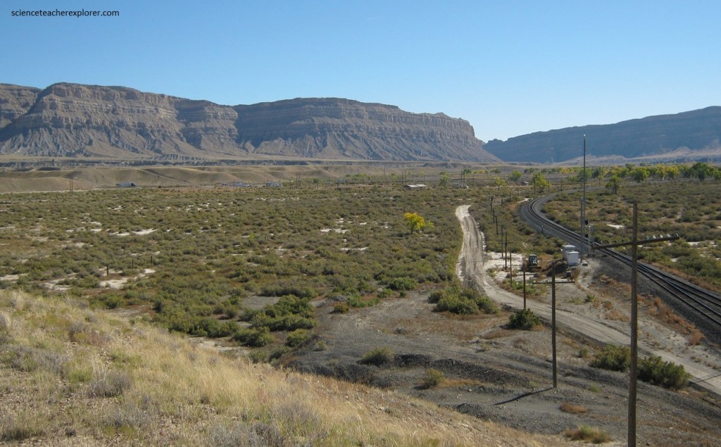
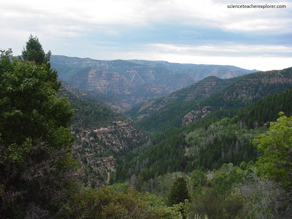
Of course my main objective is to explore the “Book Cliffs” east of Woodside Ghost-town. To gain access deep into the “Book Cliffs” is to take a 4wd road from Hwy. #6 into a canyon called Horse Canyon, (imaged below). Ascending Horse Canyon and descending Little Horse Canyon is the entrance-way to the famous and highly publicized “Range Creek Canyon”.
While driving into Horse Canyon, the lower slope of the Book Cliffs, exposes marine shales of the Cretaceous Mancos Shale while interfingering sandstone beds of the upper Mancos and overlying Price River Formation (generally referred to as the Mesa Verde Group or Formation) were deposited in fluvial (stream), swamp, flood plain, and near shore marine environments.
In the Horse Canyon area, the Book Cliffs contain important reserves of coal. A major coal-mining structure, (abandoned) is found at the mouth of Horse Canyon.
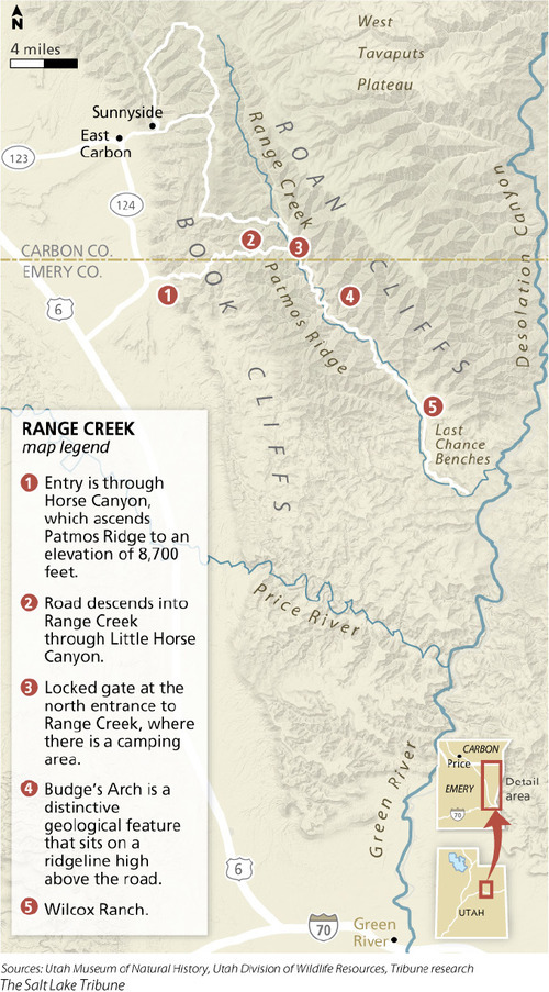
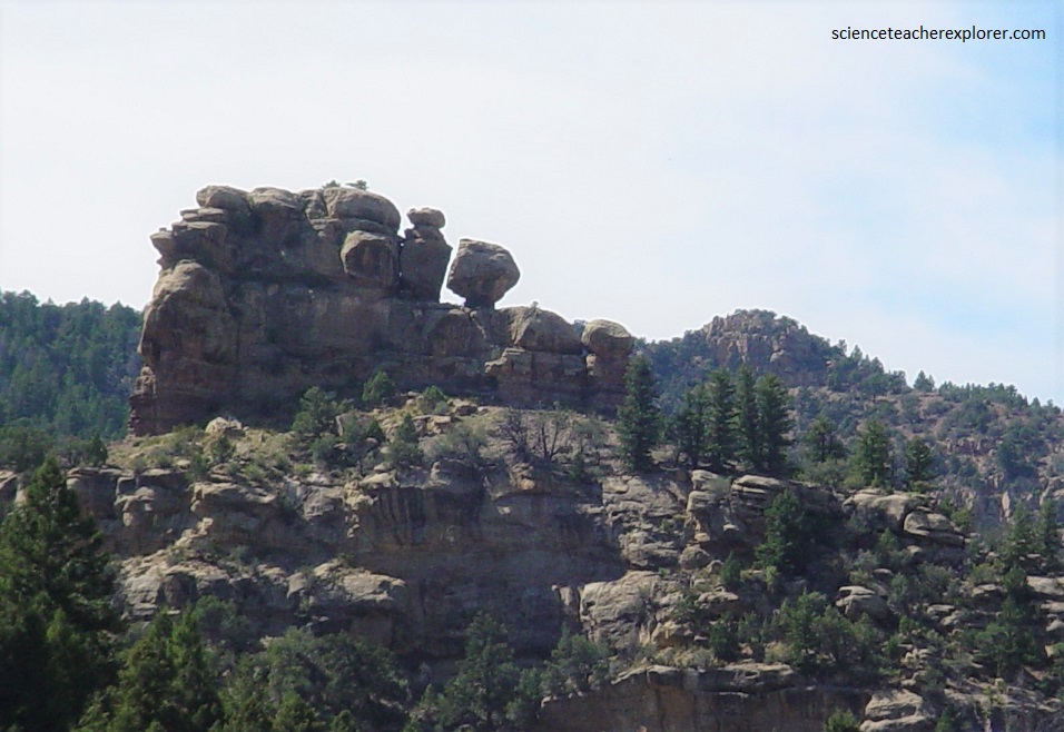
Positioned on top of the sandstone, but usually situated back from the edge, are various early Tertiary rock units, for example the Green River Formation and the Flagstaff Formation (limestone). These are usually known as the Roan Cliffs and are of Tertiary age.
The Range Creek ecosystem is the area of the West Tavaputs Plateau drained by Range Creek, a perennial stream that flows about 45 km in a roughly northwest to southeast direction to its confluence with the Green River.
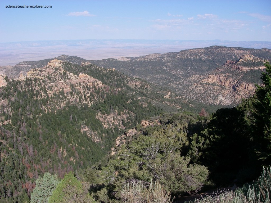
Physiographically the Range Creek area is situated in the Book Cliff-Roan Plateau section of the Colorado Plateau Provenience. The nearly vertical Book Cliffs are carved into Cretaceous (145-65 MYA) sandstones and shales of marine origin. The Roan Cliffs found to the north and at higher elevations, are composed of river and flood plain deposits of Paleocene (55-65 MYA) and Eocene (34-55 MYA) origin. This is rugged, often impassable country. Vertical cliffs restrict travel in this region to just a few narrow and hazardous trails. Until about 1950 everything brought into Range Creek had to be dismantled and carried in on the backs of pack animals which were led single-file up scree slopes and stone ledges.
The Range Creek canyon is classified, as an area with pristine archaeological remains and rock art of the Fremont culture, a ancient Great Basin archaeological culture that was contemporaneous to the Ancestral Pueblo culture located to the south within the four-corners area.
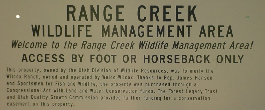
The 4,200 acres of land along Range Creek was owned by a cattle rancher by the name of Waldo Wilcox. He recognized the value of the prehistoric remains and protected them by erecting a gate with “no trespassing” signs on the only road in. He successfully kept the artifacts a secret.
In 2001 he sold the property to the Trust for Public Land which later deeded it to the state of Utah. The Utah State Archaeologists developed a plan for carefully protecting and studying the cultural resources of Range Creek. Archaeological interests was very high due to the undisturbed nature of the sites within the canyon. However, in 2009, the State of Utah turned over stewardship of Range Creek to the University of Utah archaeology staff in a land swap deal.
A vast majority of the sites recorded to date are associated with the Fremont archaeological complex, which dates between about 500-1350 A.D.

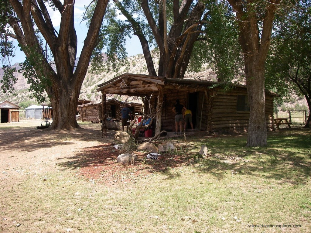
The University of Utah archaeological department state that the Range Creek Canyon site includes 1,000-year-old hamlets of the Fremont people. (highly mobile hunters and farmers who lived mostly in Utah from around A.D. 200 to 1300), [imaged above].
Pictured above, according to Archaeologists from the University of Utah, there are Pit houses dug halfway in the ground, their roofs caved in and intact, dotting the valley floor and surrounding hills. Arrowheads, beads, ceramic shards and stone-tool remnants were strewn all over the valley floor within the Range Creek Canyon archaeological zone.
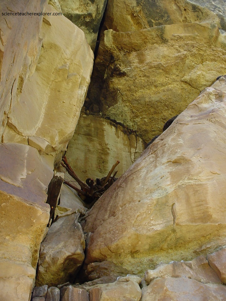
Pictured above, according to the University of Utah, human bones poking out of rock overhangs within the Range Creek Canyon archaeological zone.
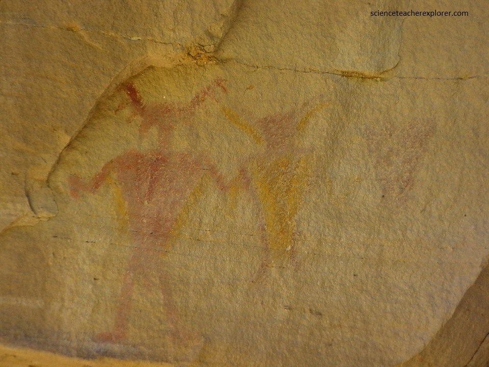
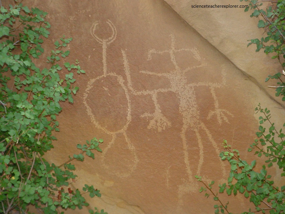
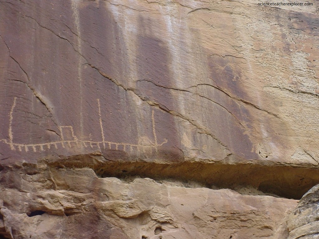
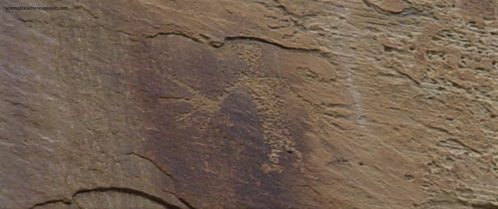
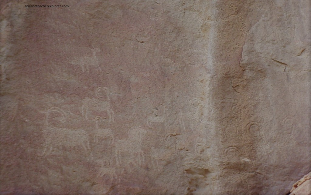
Pictured above and below, according to the University of Utah, hundreds of bizarre human figures with tapered limbs and odd projections emanating from their heads were chiseled and painted on the cliff walls within the Range Creek Canyon archaeological zone.
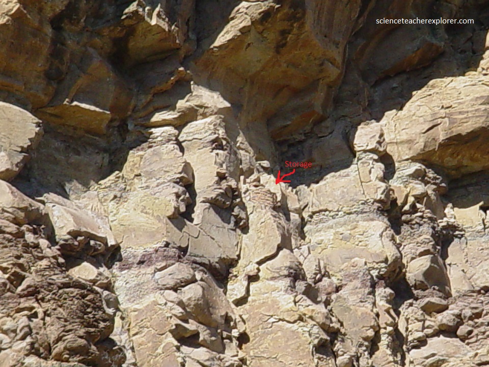
Pictured below, according to the University of Utah, granaries were stuffed with corncobs that are a thousand years old within the Range Creek Canyon archaeological zone.
As of 2020, The Range Creek Canyon location was open to day-trip visitors for a nominal fee, with a pass—for a specific date — available for purchase in advance, on-line; where only a limited number of passes were issued for each day. High temperatures in the summer, and black bears, are commonly seen and should be a concern. Camping is only allowed outside the front gate at the bottom of Little Horse Canyon.
