Bandelier, NM 2013
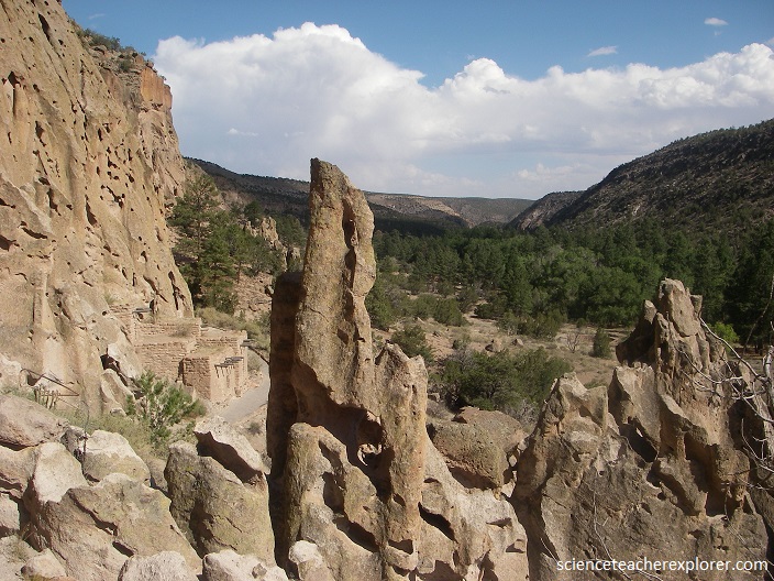
While trekking through north-central New Mexico during June 2013, I had the opportunity to visit the Bandelier National Monument near Los Alamos. Bandelier is a small metropolis of Pueblo cave dwellings that have been carved right into the hillside of this national monument.
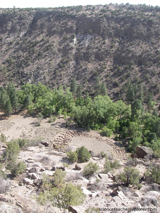
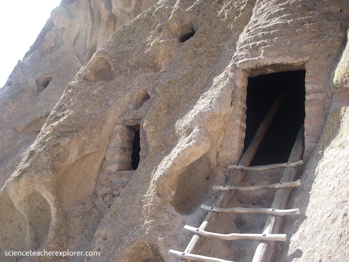
Carved right out of the soft (and ironically-named) tuff rock, the small shelters and their rows of windows pock the side of some of the hills in the natural landscape as though they were created by massive ants. Built across a number of eras between the years 1150 and 1550, the settlement would have been an impressive sight with buildings on the ground and built into the cliffs. Some of the dwellings stood as tall as three stories, supported by beams jammed right into the rock.
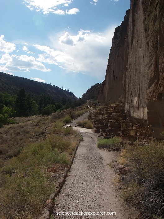
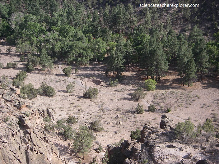
The remaining cave dwellings are accompanied by the ruins of buildings constructed on the valley floor, also made of the soft volcanic rock.
Nearby the Bandelier National Monument, more than one million years ago, huge volcanic explosions rained ash and cinders over a 3900 square kilometer area. After the volcano emptied its magma chamber, it collapsed into itself, leaving a circular depression called a caldera.
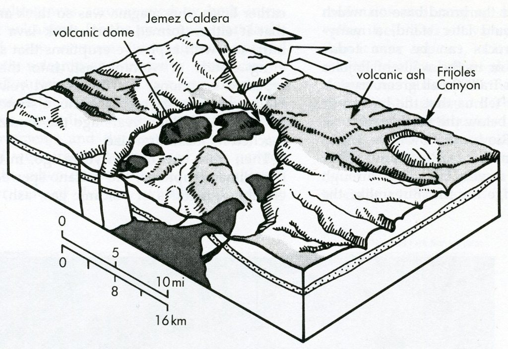
Bandelier is located on the outer slope of this caldera, known today as the Valles Caldera.
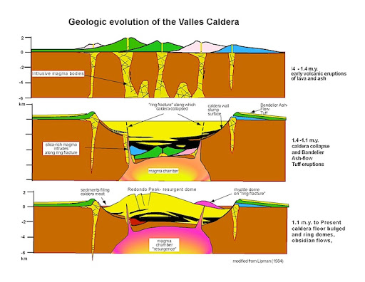
During the eruptions that formed the Valles Caldera, ash flows up to 320 m thick covered the landscape from the caldera rim to the Rio Grande. As the hot ash cooled, it welded into a rock called tuff. Bandelier is located on this broad, sloping layer of tuff called the Pajarito Plateau. A complex series of volcanic events shaped the landscape from 3-1.25 million years ago.
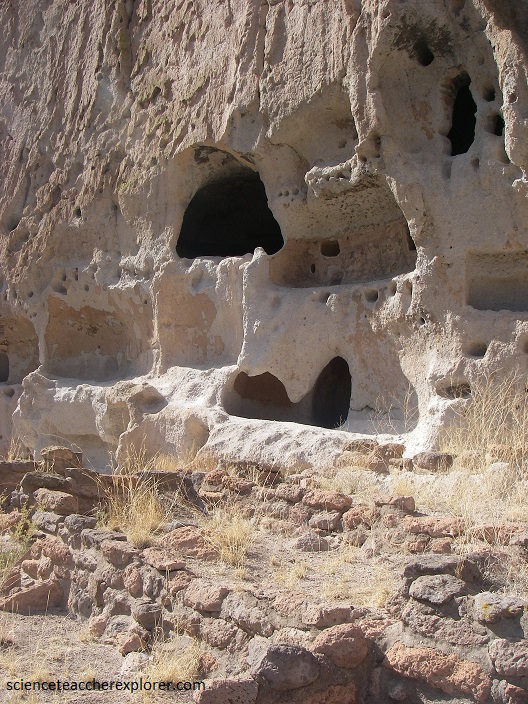
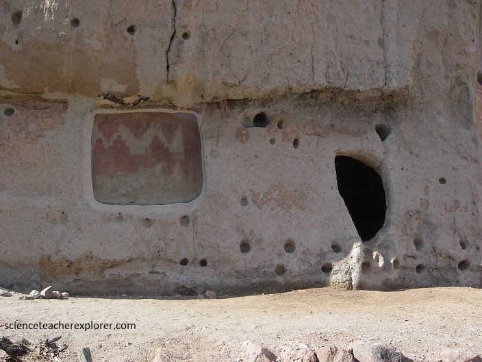
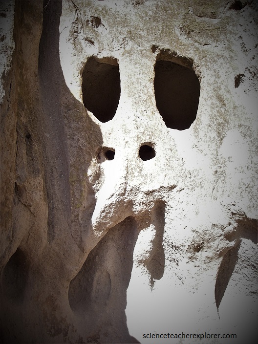
Tuff is very light and soft. Over time, wind and water gradually eroded away softer areas of tuff, creating holes in the exposed canyon faces. The Ancestral Pueblo people used these to their advantage. With hand tools, they enlarged and shaped cliff openings into useful shelters called cavates. They used tuff blocks to build apartment-like homes along the cliff faces in front of the cavates, (pictured below).
By 1550, the Ancestral Pueblo people had moved from this area to pueblos along the Rio Grande. After over 400 years the land here could no longer support the people and a severe drought added to what were already becoming difficult times.
The ancestral Pueblo people built homes carved from the volcanic tuff and planted crops in mesa-top fields. Corn, beans, and squash were central to their diet, supplemented by native plants and meat from deer, rabbit, and squirrel.
Just a few kilometers northwest of Bandelier National Monument is the Soda Dam. Pictured below, the Soda Dam looks like a giant rock that tumbled into the Jemez River. [Note the map] But the story of this geological formation is even more bizarre. It started forming one million years ago when water from hot underground springs reached the surface and cooled, leaving a thick mineral deposit of calcium carbonate, or travertine. This deposit has since grown, and now forms a 100 m long limestone structure that has overgrown the river. However, the hot water contains elevated levels of calcium, magnesium, bicarbonate, sodium, chlorine, lithium, boron and bromine, as well as arsenic and radium.
The Soda Dam lies along a deep fault in the Jemez volcanic field, which last erupted 130,000 years ago. A body of molten hot igneous rock deep below the surface heats the groundwater sufficiently to dissolve minerals from the limestone bedrock. Water in the springs originates from a 400-600 degree Fahrenheit hydrothermal system within the Valles caldera. The water mixes with groundwater and is discharged from the springs around Sod Dam at temperatures varying between 86-118 degrees Fahrenheit.
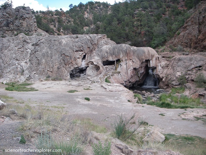
Inside the dam is a warm humid cave that is accessible through a small entrance. Here the spring waters bubble up with their cargo of travertine. Over the years, the river has managed to cut a path through the dam in order to continue its course. Yet while the river water erodes the dam, the spring water contributes to its unique structure. An equilibrium is met.
