Snow Cyn. S.P., UT
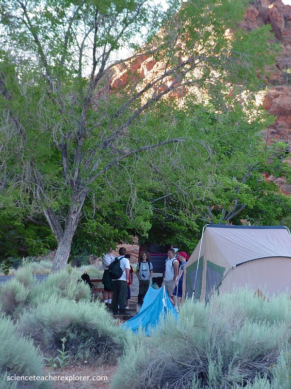
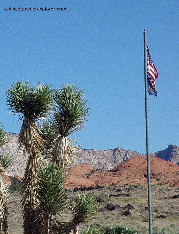
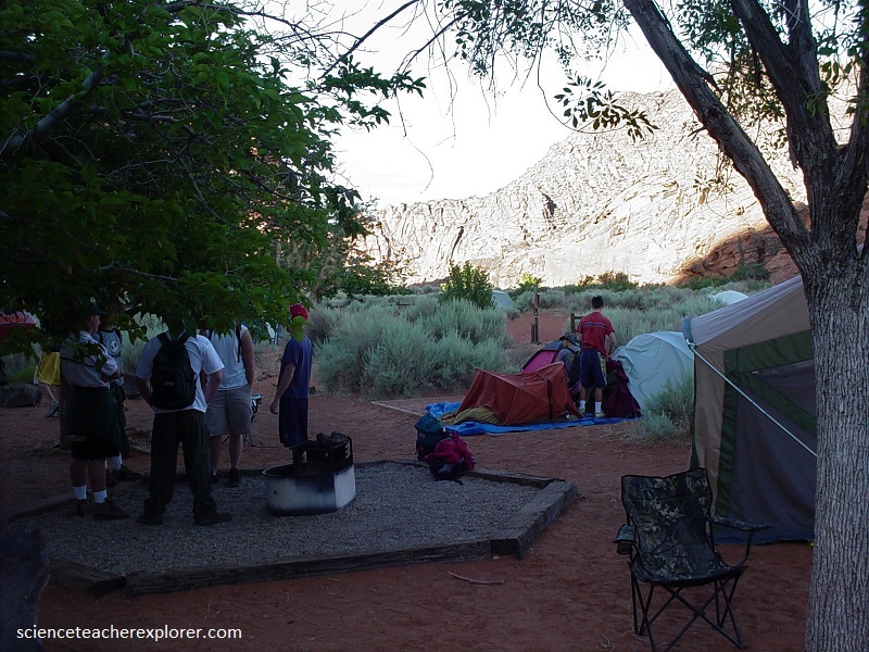
In the Spring of 2004, I led a group of students and adults to the southern portion of Utah/Nevada border to explore. There, we stayed in a campground at Snow Canyon State Park, Utah. Snow Canyon Park is located in the southwest corner of Utah, northwest of St. George, (picture below). The canyon is approximately 8 km long, with elevations in the park ranging from 915 m at the mouth of the canyon to 1,532 m at the top of a sandstone peak northwest of the canyon.
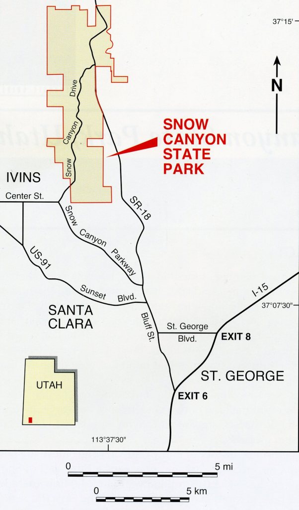
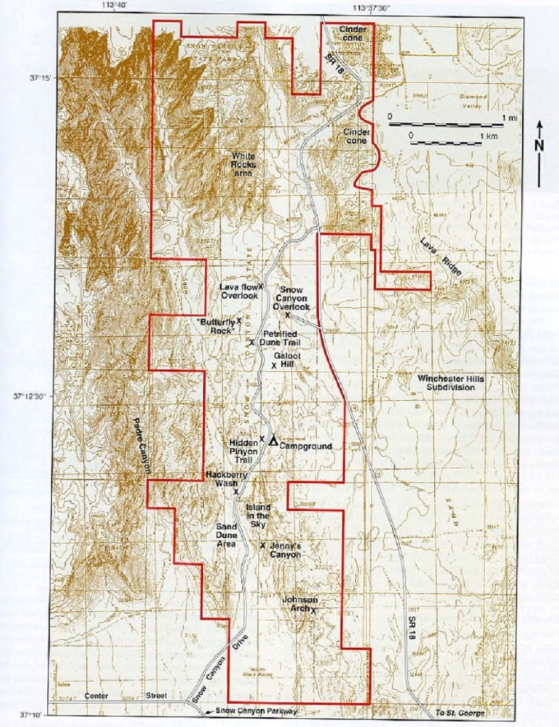
The canyon is approximately 8 km long, with elevations in the park ranging from 915 m at the mouth of the canyon to 1,532 m at the top of a sandstone peak northwest of the canyon, (imaged below).
Snow Canyon State Park is physiographically located in the transition zone between the Colorado Plateau to the east and the Basin and Range Province to the west. It also coincides with the leading edge of the Sevier orogenic belt. Additionally, the stratigraphy of Snow Canyon has been uplifted and tilted northeastward as part of the west limb of the St. George syncline that formed in the Late Cretaceous to early Tertiary compressional event (imaged below).
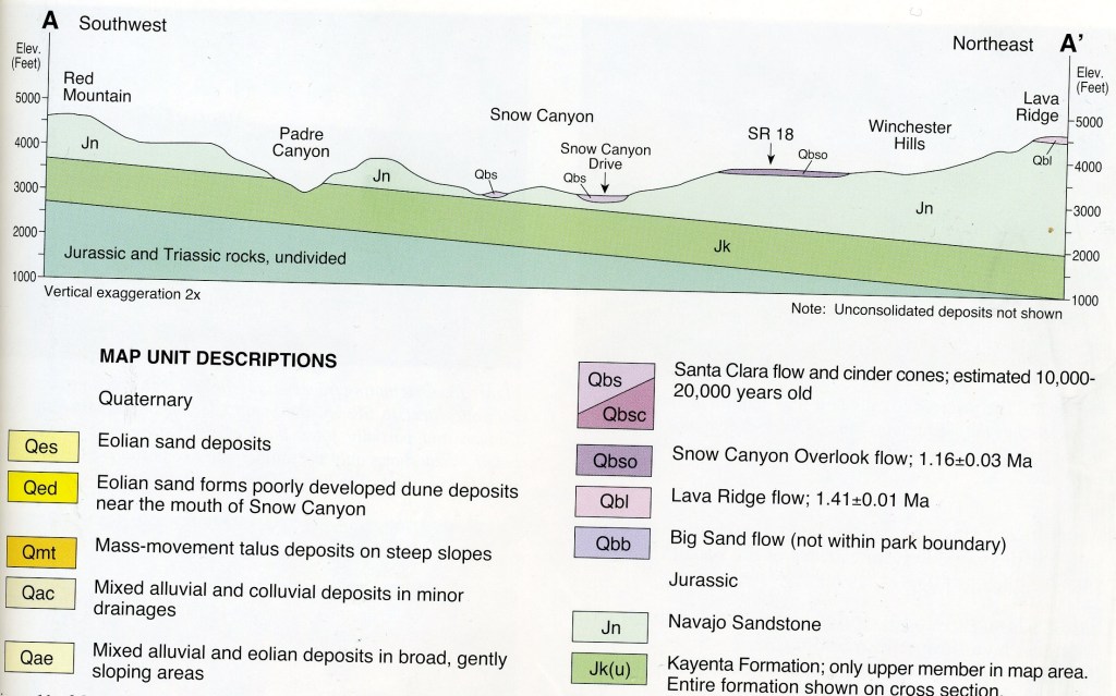
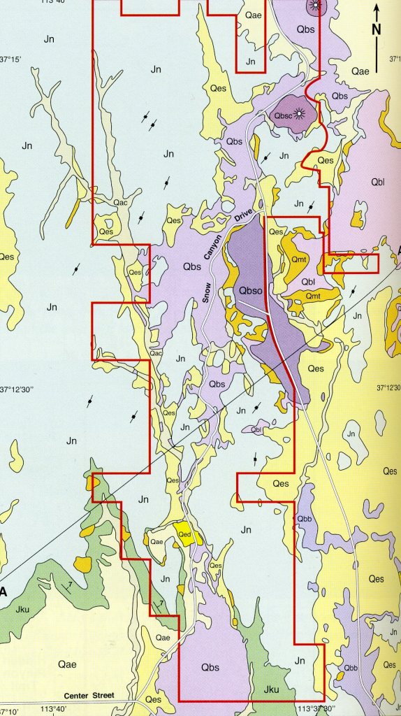
Imaged below, sedimentary rocks within Snow Canyon State Park include the upper member of the Kayenta Formation and the overlying Navajo Sandstone, both Early Jurassic in age. The Quaternary section of Snow Canyon State Park includes three lava flows: (1) Lava Ridge flow; (2) Snow Canyon Overlook flow; (3) Santa Clara flow. Additionally, there is a variety of unconsolidated deposits.
Imaged below, during the early Jurassic Period, the sand and silt that was to become the Kayenta Formation was deposited in fluvial, playa, sabkha, and minor lacustrine environments around Snow Canyon. The area then began to be inundated by desert sand that would become the Navajo Sandstone. The environment oscillated between a slowly encroaching desert and an extensive system of braided and meandering streams.
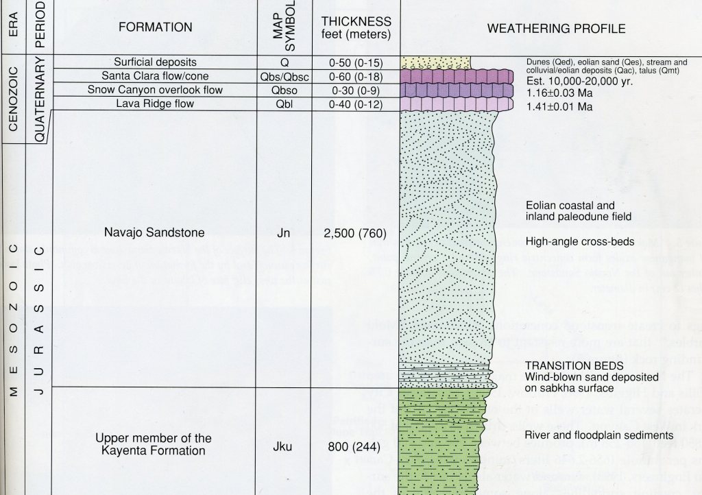
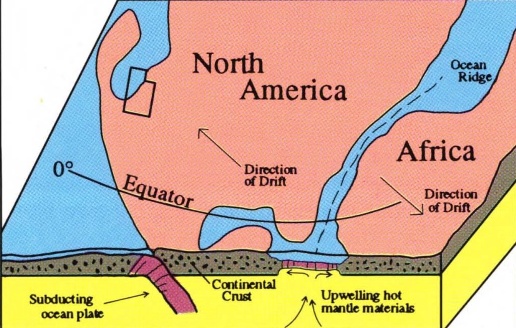
Imaged below, rivers eventually ceased flowing as water became scarce and windy desert conditions prevailed, perhaps because Snow Canyon area was only about 15 degrees north of the equator at that time in a climate belt of an arid, west coast, low-latitude desert.
Following the deposition of the Navajo Sandstone, this area experienced a period of erosion. Subsequent deposition created younger rocks that formed in later Jurassic and early Cretaceous time. These rock layers have now been removed from on top of the Navajo Sandstone.
As mentioned before, compressional deformation occurred during the Late Cretaceous to early Tertiary Sevier orogeny. This compression formed the broad, northward-plunging St. George syncline. This movement cause the brittle, massively bedded, Jurassic Navajo Sandstone to fracture in two intersecting sets of parallel crack, called joints. {One set of relatively closely spaced fractures the trend northeast, and another set of more widely spaced fractures that trend just west of north}. Erosion along this second set forms the major canyons in Snow Canyon.
During late Tertiary and Quaternary time, tectonic stress changed from compression to tension. This resulted in normal faulting and thinning of the crust due to extension. Magma, already closer to the surface because of crustal thinning, was able to erupt along the joint systems.
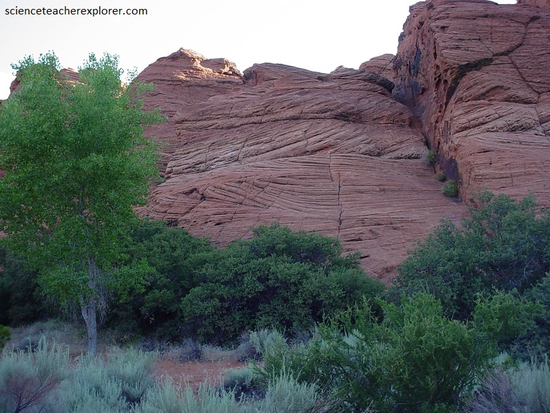
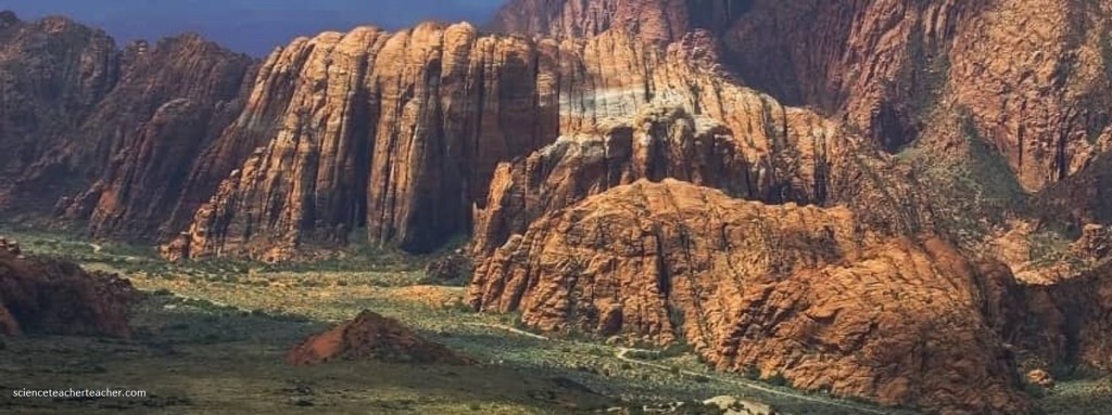
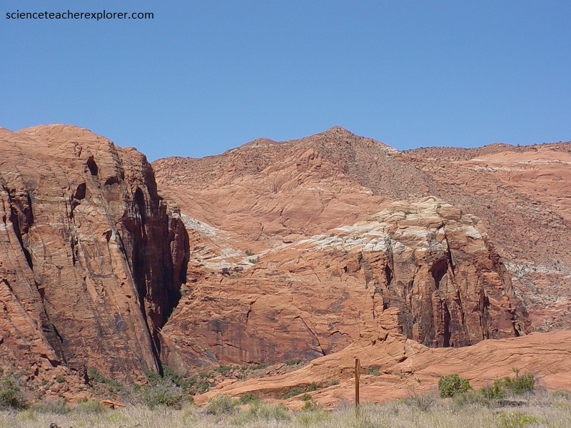
Pictured above, the 760 m Navajo Sandstone consists of massive cross-bedded, fine-to-medium grained, well-rounded and frosted quartz grains that are poorly to moderately well cemented. This highly jointed sandstone weathers to form the bold, rounded cliffs seen above. The curved lines seen in the rocks are called cross beds. They formed when ancient winds lifted grains off of one side of a pile of sand and dropped them on the other side. Over time, several thin layers of grains built up to form a dune. The horizontal lines in the rocks represent slight erosional periods and changes in wind directions.
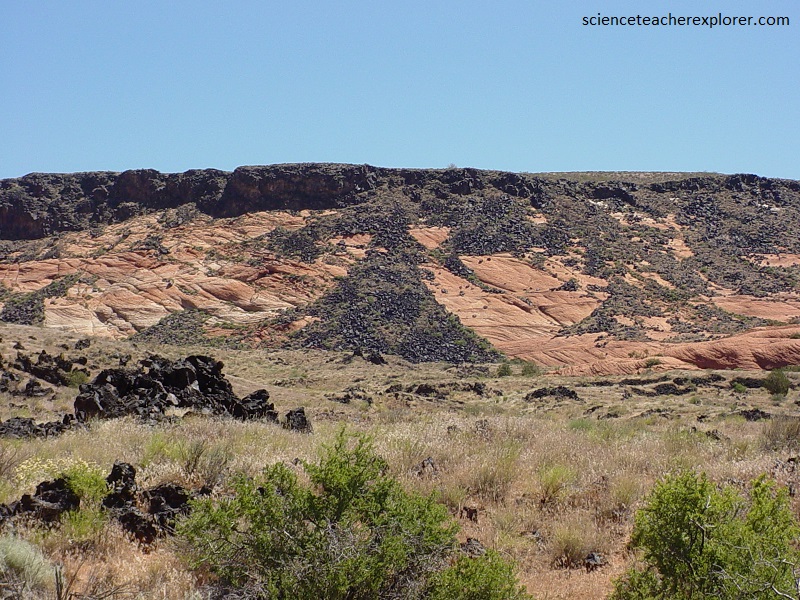
Pictured above, the “Lava Ridge flow” erupted from a group of heavily weathered cinder cones on Lava Ridge about 1.6 km east of the park. The Lava Ridge flow caps the ridge to the east of Snow Canyon and is also is also visible half way up Snow Canyon in the east canyon wall. There the “Lava Ridge flow fills the bottom of an old channel in the Navajo Sandstone, after cascading over 180 m in 0.4 km to reach the channel, (pictured below).
Pictured above, differential weathering accentuates cross-bedding and small vertical cracks in the Navajo Sandstone to give it a “checkerboard” or “elephant skin” look.
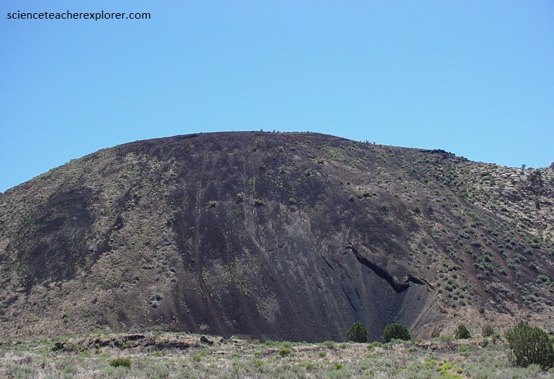
Pictured above and below, cinder cones are distinct landforms found in the north part of the park. They formed when volcanic materials were explosively ejected from openings or vents in the earth’s crust. The unique profile of the cones forms when expelled fragments accumulate around vent openings and assume the angle of repose. Large fragments are usually found near the source of the vent with particles getting smaller with increased distance from the source.
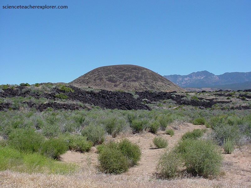
Pictured above, about 3 million years ago, molten rock began pouring onto this part of the land and, like water, flowed into the low areas and covered stream beds and channels. The hot masses cooled and formed rocks more resistant to weathering. Existing streams shifted to areas adjacent to the flows and carved new channels through the softer sedimentary rocks. Over time, erosion sculpted steep-walled canyons. What was once a topographic low is now a topographic high and is referred as inverted topography. This process continues today as streams carve new channels along the edges of the lava flows that presently line the floor of Snow Canyon. Eventually, these canyons too will stand high in relief.
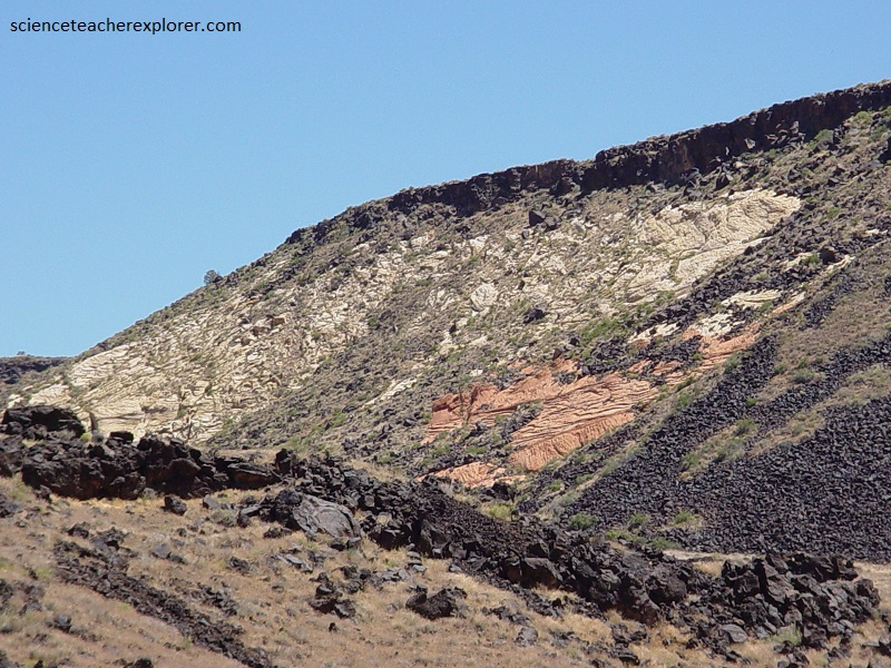
Pictured above, the youngest lava flow within Snow Canyon State Park, and the entire region, is the Santa Clara flow that is 10,000-20,000 years old. Vents at the base of the two cinder cone vents at the head of Snow Canyon are the sources of the Santa Clara flow. Although the cones themselves are extinct and local volcanism is considered dormant, the extensional tectonic setting that caused these eruptions along joint systems in the Navajo Sandstone is still present. The Santa Clara flow is nearly at the same level as the “Snow Canyon Overlook flow”. The Santa Clara flow then cascaded into the “West Snow Canyon”, partially filling the stream-eroded, V-shaped canyon with basalt and flattening out the canyon floor, (pictured below).
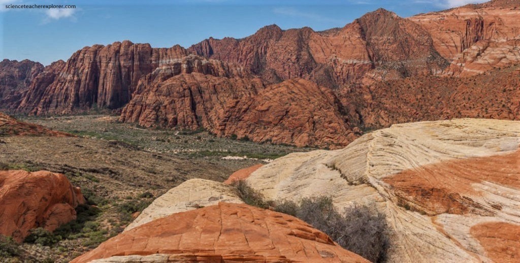
Pictured above, rocks in upper part of Snow Canyon’s Navajo Sandstone are white but the older rocks in the formation have a reddish-orange color. Between these distinctly colored rocks is a zone where the colors interfinger as if a gigantic paintbrush stained the cliff faces. The color changes are puzzling since they occur without regard to cross bedding or other obvious geologic features. The coloration seems to interfinger here. Red colors are caused by the presence of an iron oxide (rust) mineral called hematite. Yellow colors are caused by a different iron oxide mineral limonite.
Pictured above, the discoloration or “whitening” of the rock occurs after lithification. The subsequent loss of color is caused by fluid interaction that either dissolves the cementing minerals out from between the sand grains, leaving the sandstone very friable, or reduces the cementing minerals (chiefly iron through chemical reactions that change the oxidation state. Perhaps fluid associated with the close-by intrusion of the Pine-Valley laccolith, (northeast of Snow Canyon), is partially responsible for the interfingering color change of the Navajo Sandstone around Snow Canyon area.
Pictured above, exactly why iron oxide is present in the lower part of the Navajo Sandstone Formation in Snow Canyon, but absent in the upper part is because the upper-northern part is closer to the Pine-Valley laccolith is closer there. However, this explanation is still being debated within the geologic community.
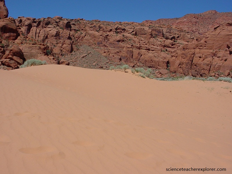
Pictured above, well to very well sorted, fine to very fine grained well-rounded, mostly quartz eolian sand has accumulated in thin sheets and irregular hummocky mounds on gently sloping areas in the southern part of Snow Canyon and in depressions and protected areas on the Navajo Sandstone. Most of the sand has weathered from the Navajo Sandstone.
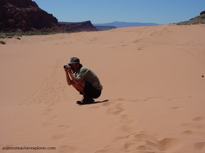
Pictured above, the sand-dune deposits are 0-15 m thick where it is more extensively thick at the mouth of Snow Canyon. The stark intensity of Snow Canyon State park’s colors, terrain, and vegetation create a surrealistic flair to one of southern Utah’s most striking areas.
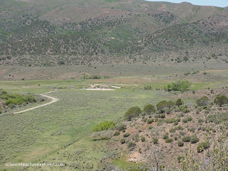
Pictured above, is the location of the “Mountain Meadow Massacre”. The “Mountain Meadows Massacre” occurred from September 7-11, 1857. It was actually a series of attacks that resulted in the mass murder of at least 120 members of the Baker-Fancher emigrant train. The massacre was perpetrated by the Mormon settlers belonging to a Utah Territorial Militia, called the “Nauvoo Legion”, who recruited and were aided by some Southern Paiute Native Americans. The wagon train, made up mostly of families from northwestern Arkansas, was bound for California, traveling on the Old Spanish Trail that passed through the Territory. The leaders of the militia, wanting to give the impression of tribal hostilities, persuaded Southern Paiutes to join with a larger party of militiamen disguised as Native Americans in an attack. During the militia’s first assault on the wagon train, the emigrants fought back, and a five-day siege ensued. Eventually, fear spread among the militia’s leaders that some emigrants had caught sight of the white men, likely discerning the actual identity of a majority of the attackers. As a result, militia commander ordered his forces to kill the emigrants. By this time, on Sept. 11th, the emigrants were running low on water and provisions, and allowed some members of the militia—who approached under a white flag—to enter their camp. The militia members assured the emigrants they were protected, and after handing over their weapons, the emigrants were escorted away from their defensive position. After walking a distance from the camp, the militiamen, with the help of auxiliary forces hiding nearby, attacked the emigrants. The perpetrators killed all the adults and older children in the group, in the end sparing only seventeen young children under the age of seven.
