Havasu Cyn., AZ 2003
In the spring of 2003, I led an educational group of students and adults to Havasu Canyon in northeastern Arizona. Havasu Canyon was approached by us from Las Vegas Nevada. From Las Vegas, we took U.S. 93 south, across the Arizona border for 167 km. We then merged onto I-40 for 6.5 km and then exited #53 towards Kingman Arizona for 0.16 km. From there we took AZ-66 (or the historic US-66) for 80 km through Peach Springs, Arizona. There, we turned left onto Indian road 18 and drove 97 km to the Hualupai Hilltop/Havasu Falls Trailhead.
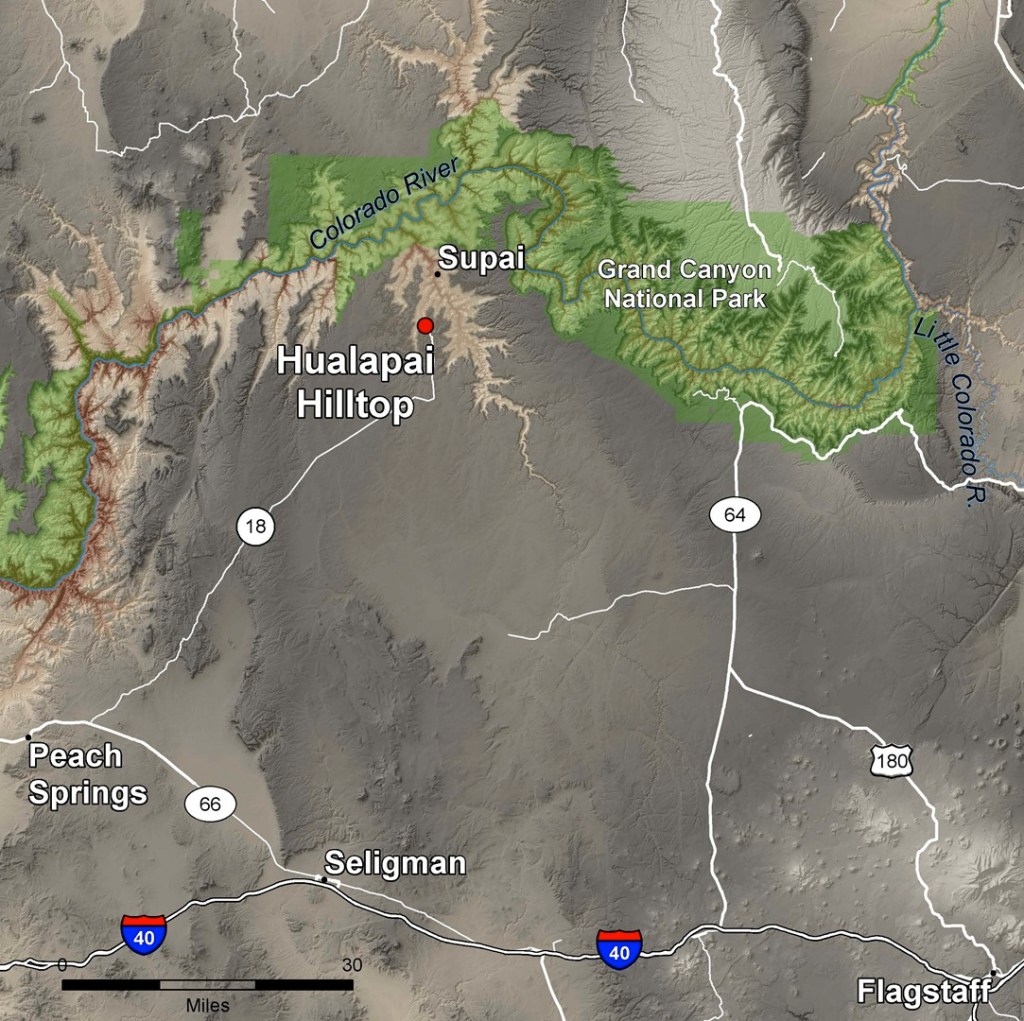
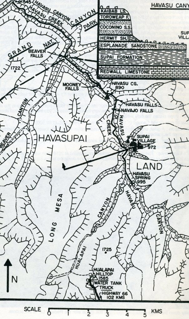
Once we reached Hualapai Hilltop, my group had to prepare of a hike/camping trip for 3 days & 2 nights. From the Hualapai Hilltop, there was a very good and well-used pack trail leading down Hualapai Canyon to Havasu Canyon and to the village of Supai (13 km). The trail was used by mules and was extremely dusty. When we arrived at Supai, we all paid an entrance & camping fee. From Supai, we hiked down an additional 3 km, to as far as Havasu Falls with the campground just below that.
The trail at the Hualapai Hilltop began in the Toroweap formation because the road to the Hilltop cut through the Kaibab Limestone in its last few miles. The trail immediately dropped down a steep series of switch-backs winding between small cliffs of limestone. Here, in the western part of the Grand Canyon, 265 million years ago, lay deeper waters of the open ocean, where limestone accumulated. Therefore, the Toroweap formation forms cliffs and thus creating the steep initial descent.
After 0.4 km, we came across the contact between the Toroweap and the Coconino Sandstone. The Coconino’s well-exposed, sweeping cross-beds were up to 32 m tall, which reveals a huge desert of sand-dune origin.
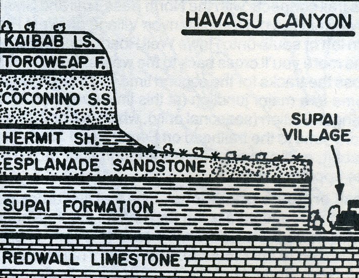
On the trail within the Coconino formation, more switchbacks follow for a kilometer. From the bottom of the switchback, the path turns northward and descends more gradually into the Hualapai Wash below. The Hermit formation is a soft layer that erodes very easily, gradually undercutting the cliffs of stronger Coconino Sandstone rising above it, (scarp-retreat). The Hermit’s great thickness, (200-330 m), has accentuated the scarp-retreat process, creating a broad, flat platform know as the Explanade.
At 2 km, two pink sandstone ledges to the right of the trail marked our passage onto the Esplanade Sandstone, the uppermost formation in the Supai Group. For the rest of the hike to the village, our path took us ever deeper into the Supai Group as the canyon walls rose higher and higher above us. Like the Coconino Sandstone, the Esplanade Sanstone had high-angle cross-bedding, indicating its sand dune origin. The cross-beds weren’t as tall here, though, because these were low coastal dunes rather than the massive, Sahara-sized dunes that formed the Coconino.
An increase in mudstone in the Supai Group rocks at the 4.8 km point indicated our passage below the Esplanade Sandstone into the underlying Wescogame formation. The underlying Manakacha and basal Watahomigi, named for points overlooking Supai village, completes the tongue-twisting package of the Supai Group formations.
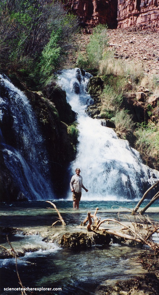
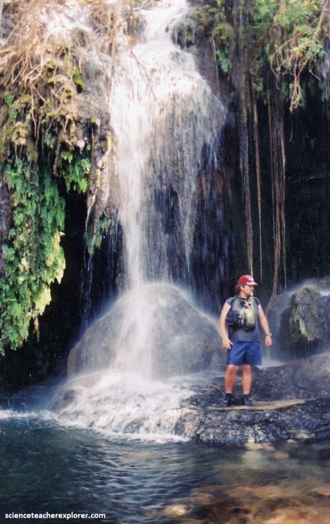
We reached the confluence with Havasu Canyon at the trail’s 9.7 km mark in a cluster of cottonwood trees that signaled Havasu Creek’s perennial flow. Havasu Canyon was much wider and was filled with lush growth, a marked contrast to the nearly barren floor of Hualapai Canyon. On the short descent into the village we got excellent views of the distinctive twin spires composed of Supai Group rocks. 1.6 km past the village, we see the spectacular Navajo Falls. Ten meters below this spot, small limestone cliffs rise up on either side of the creek. These cliffs are composed of Mississippian Limestone (350-330 million years old), and Navajo Falls was positioned at the Redwall-Supai contact (pictured below). The Redwall gorge deepened progressively downstream.
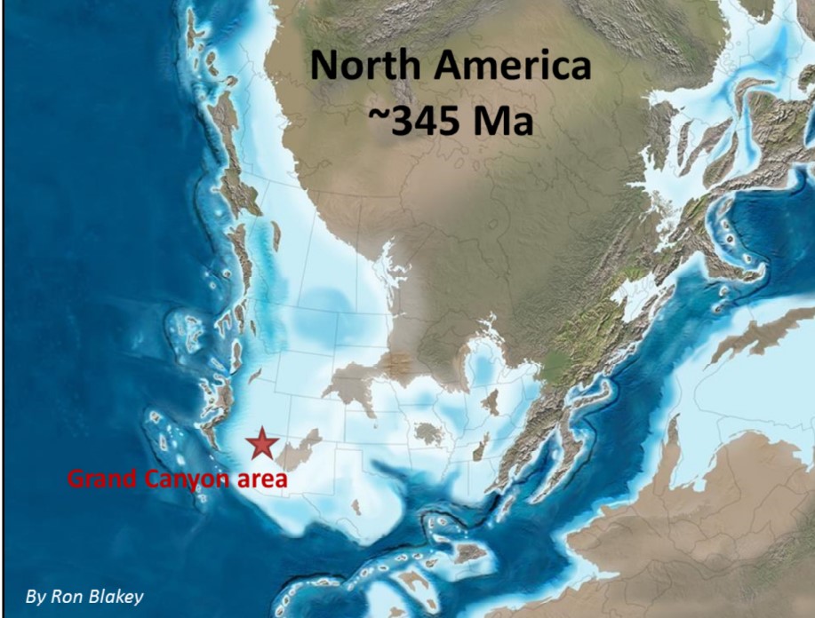
The Redwall formation was created when the supercontinent Rodinia split apart and sea levels rose worldwide, creating the “Sauk Transgression”, whereby marine waters slowly rise over lands and cover up sands with
muds, then lime, hence Tapeats sandstone, covered by Bright Angel Shale (mudstone), and then Muav Limestone, [the Tapeats, Bright Angel and Muav formations make up the Tonto Group (~550 to 500 million years ago). A significant unconformity of ~100 million years separates the Redwall Limestone and Tonto Group. The “Great Explosion of Life” occurred around 550 million years ago. Life has evolved tremendously by
Redwall time (350 million years ago). During the Redwall time, the seas were vast, very warm, and shallow, teeming with life.
Pictured above, Navajo Falls is an impressive site. It’s overlook was situated on travertine, and this was a great place to study the travertine’s weird shapes and fine laminations that are created as each succeeding generation of layers on top of the preceding one.
Pictured above, I ventured about 20 meters above Navajo Falls to discover several springs exit from the base of the cliff near the trail. A short distance above this, fences lined the edge of a 17 meter cliff where the creek had carved into very fine-grained, soft, and unstable sediments. These were some fertile ancient-lake deposits that underlie the village and it’s surrounding fields. Navajo Falls tumbled down below me, on a travertine-coated escarpment carved into the lake deposits.
Travertine is a form of limestone deposited in caves, springs, rivers, and lakes. When groundwater passes through extensive amounts of limestone and becomes saturated with calcium and carbonate. The carbonate forms carbon dioxide when it is dissolved in water. Where the groundwater emerges onto the earth’s surface, it loses pressure, causing the carbon dioxide to bubble away. This loss of carbon dioxide causes travertine to precipitate out of the water. In Havasu Creek, three additional processes are also at work. First, some bacteria species secrete crystallized travertine, creating small dams. Second, the water cascading over the dam becomes agitated. Just like emerging groundwater, agitated water is prone to losing carbon dioxide, so travertine is continuously added to the dam. Finally, evaporating water concentrates the calcium and carbonate, leading to their precipitation on the pools edges.
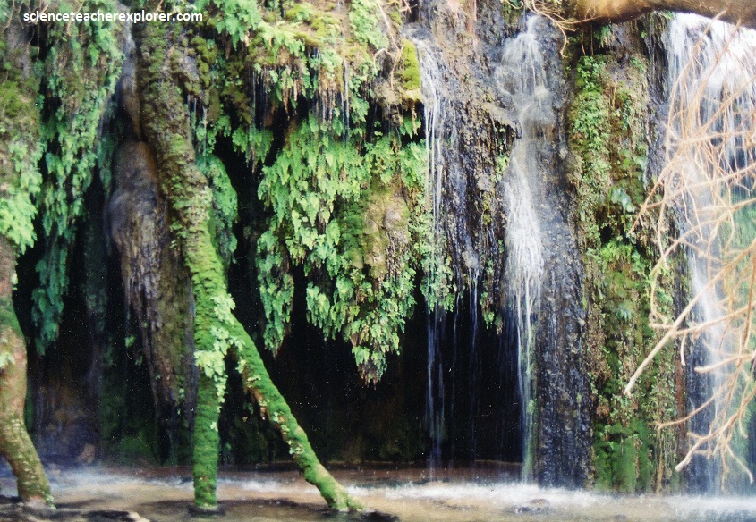
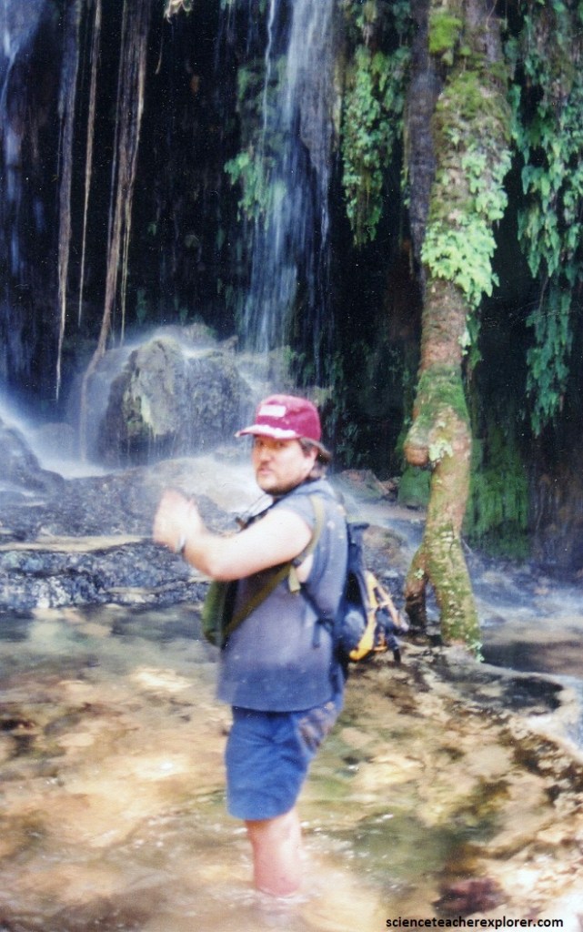
Pictured above, many of the bacteria that crystallize travertine grow on twigs, trees, and even leaves that line the stream’s banks or collect in blockages, for instance, where a log das dammed the creek. Because of this, travertine often encrusts these logs.
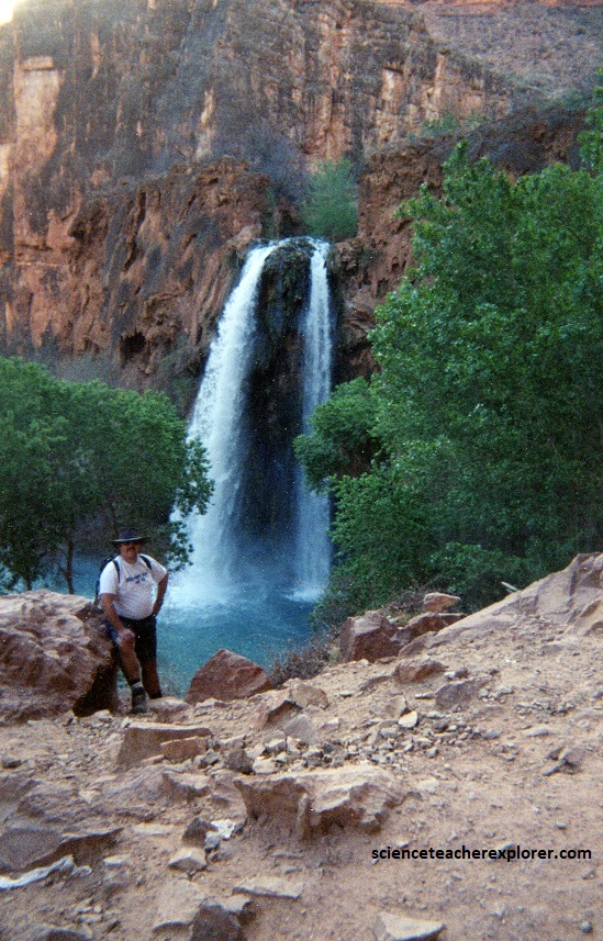
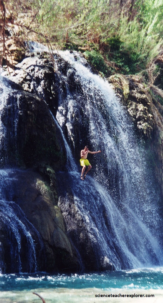
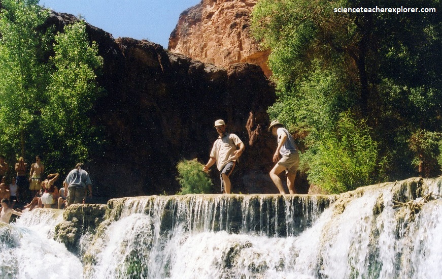
Pictured above, about 0.4 km past and below Navajo Falls, the trail reaches an open area of travertine outcrop at the brink of the stunning Havasu Falls. The trail hugged the cliff of Redwall Limestone as it descended a steep pitch beside the falls. The majestic twin jets are in full view during this inspiring descent.
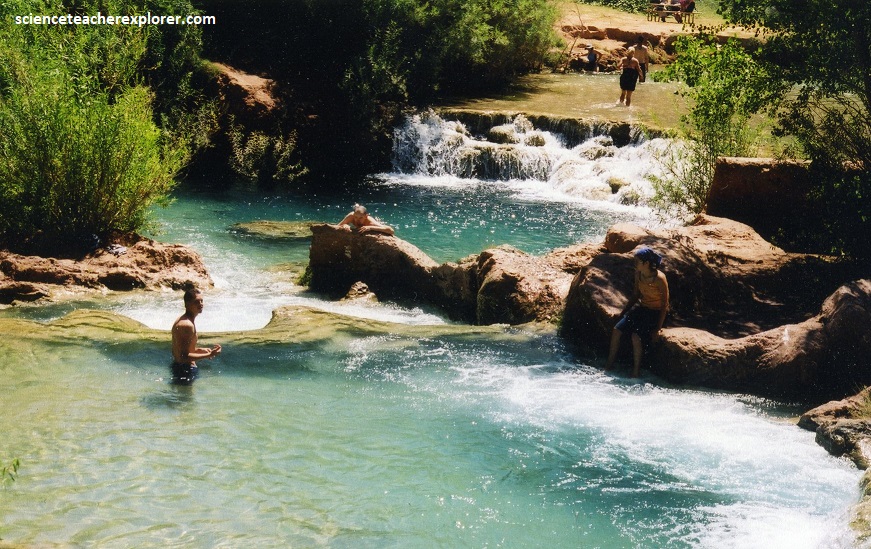
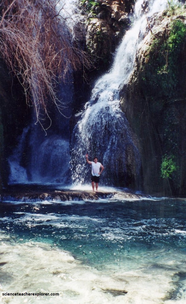
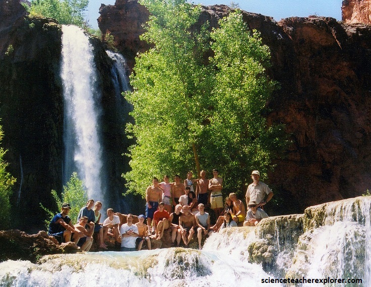
Pictured above and below, where the trail flattened out, several spurs led to the tranquil, turquoise-blue pool at the base of Havasu Falls. Actually, Havasupai means people of the blue-green waters. The blue-green color of Havasu Falls is a result of the spring-fed waters that are rich in magnesium, calcium, and high concentrations of bicarbonate. As these waters make their way through Havasu Creek, these ions combine to form tufa and travertine. Taken together, the dissolved ions and tufa/travertine, reflect sunlight resulting in a more intense blue-green color.
Havasu Creek arises in Havasu Spring, just upstream from where the trail enters Havasu Canyon. The groundwater reaching the surface there is saturated with dissolved minerals, (mentioned above), in its passage through the Kiabab and Toroweap Limestones. It is this tremendous load that gives it it’s color. Then below Suai village, the creek passes several springs that produced enormous quantities of travertine, (again, mentioned and explored above). Havasu Creek has eroded through most of these deposits, but where it has not yet carved through the larger travertine plugs, spectacular waterfalls plunge over them, (like Havasu and pictured below).
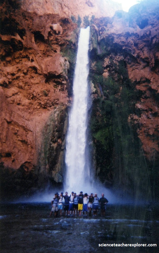
Below our campsite at Havasu Falls, it was only a short distance downstream to Mooney Falls. I went to explore the Mooney Falls before I attempted to take students there. The sign said, “Descent to Mooney Falls base requires extreme caution”. I took only one of my advisors: Dave Fillerup.
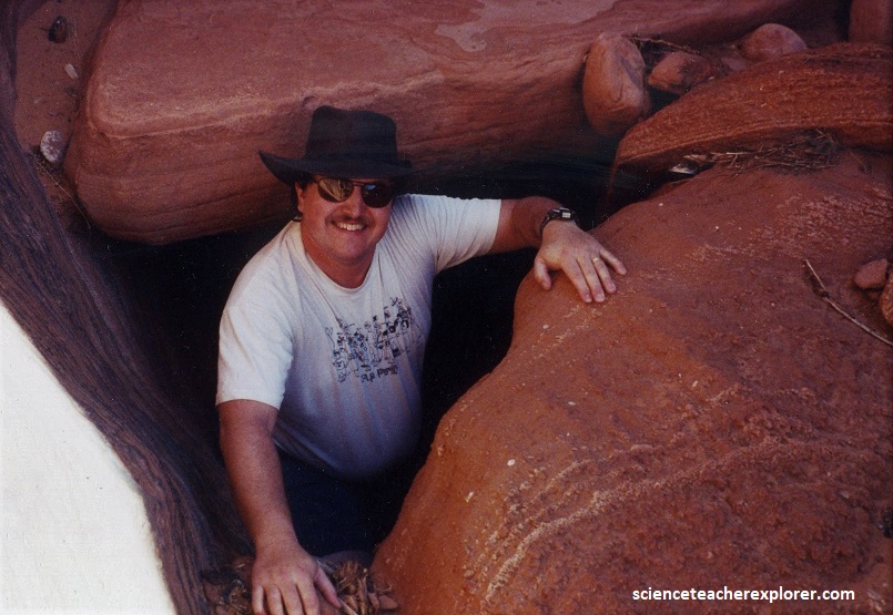
Pictured above, from the sign, Dave Fillerup and I climbed through the short tunnel. In the narrow gap between it’s end and the beginning of the next tunnel, we were treated to a particularly inspiring view of the waterfall, with huge travertine stalactites hanging above our heads, (pictured below).
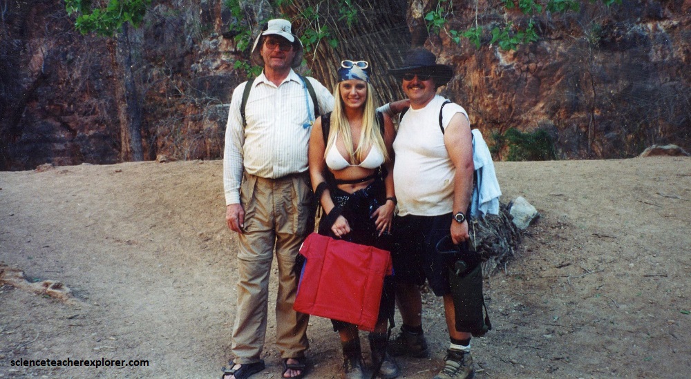
Pictured above, I was about to “give-up” and turn back when we met a couple coming up and climbing the ledge. It was a professional photographer from “Playboy” magazine and a young women in a tiny white bikini. We had to return. There was only room for one on the ledge anyway.
At the top, we all sat down and ate lunch together. The young woman happened to be from Price, Utah and we had a-lot to talk about. She had already explored the Havasu Canyon below Mooney Falls, and told us that only the best healthier/gutsier students could handle it. Her name was Cassandra Lynn Jensen, (pictured below). She later became the “Playmate-of-the-month of February 2006”, but passed-away in 2014.
After our visit with Cassandra Lynn, we decided to go back and pick out a few of our most adventurist and brave souls to explore the remaining falls below Mooney Falls. I would only lead them.
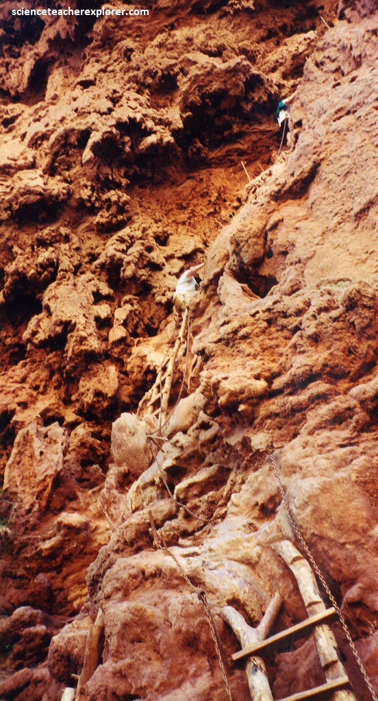
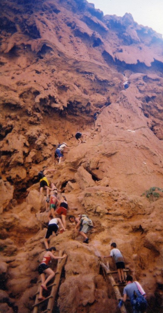
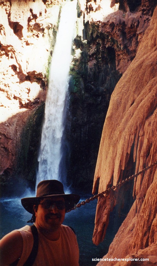
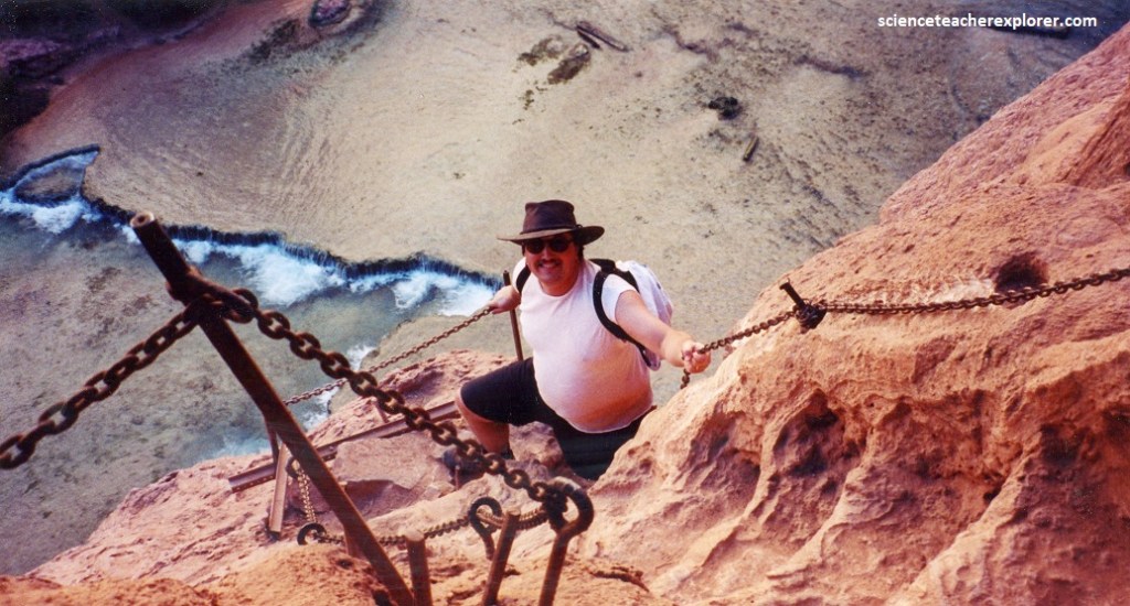
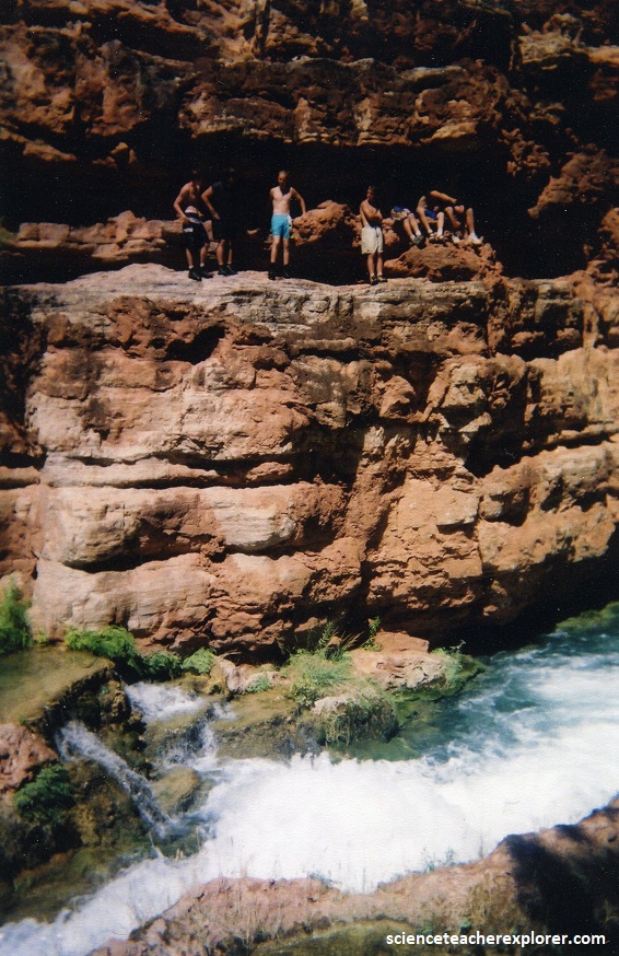
The following day, we emerged, (with 10 students), from the second tunnel to find the falls thundering a short distance upstream and its spray making the already-slick travertine even more slippery. The path was possible to follow here, (pictured above), because thick chains provided some assistance down the steepest sections. A couple of wooden ladders guided us down the final cliff.
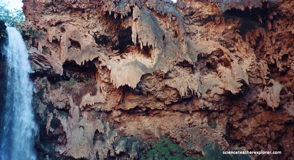
Of note are the huge travertine stalactites formed by the slow crystallization of travertine from millions of water droplets that dripped from the roof of the overhanging cliff. While at the bottom, we hung-out for about an hour, realizing we would have to come back this way, after exploring Beaver Falls down Havasu Canyon.
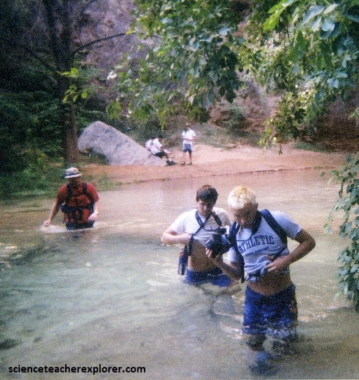
Immediately below the falls, the path picked its way through grasses, mesquite trees, and thickets of prickly pear growing on the flat floor. We reached the first of many fords 200 meters below Mooney Falls, (pictured below).
In 300 meters downstream from the first major left-hand tributary, the cliffs of Redwall Limestone that had previously reached the canyon floor now end about 17 meters above it. The slopes below are mostly covered with debris fallen from the cliffs above, but in places outcrops of thinly bedded, purplish limestone peek through. This is the Temple Butte Limestone, a shallow marine deposit dating from the Devonian Period.
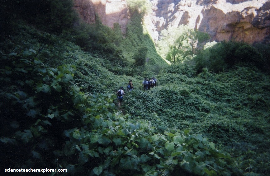
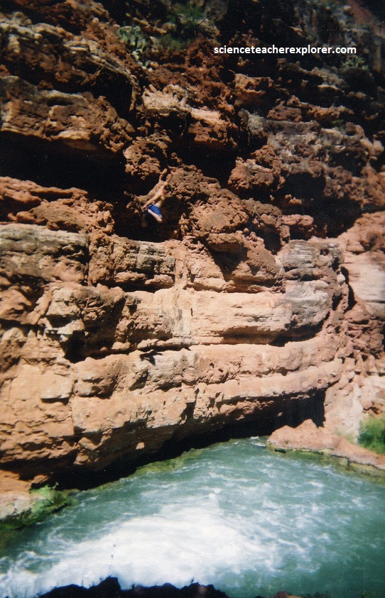
Pictured above, the path traverses travertine benches and open jungle-like, (or tropic-like) meadows, crossing the creek several times en-route. About 3.2 km below Mooney falls, we encountered a tricky section. On the right side of the creek, the path scaled a cliff of Temple Butte Limestone. A few old, tattered ropes dangled over the rock face. They provided a helpful boost or swing over the creek, (pictured below).
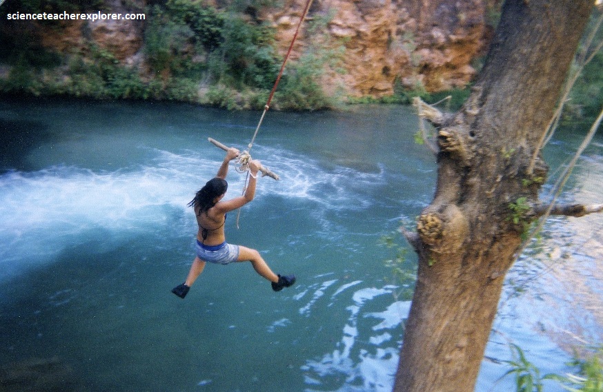
Pictured above, the view into this particularly beautiful section of the trail revealed more travertine-controlled pools and drops in the vivid turquoise water. About 0.5 km farther, the path drew even with the confluence between Havasu and Beaver Creeks. The last of Havasu’s waterfalls, Beaver Falls, was visible below, a short distance above the confluence. The path stayed high until it was about 100 meters below the confluence, where it picked its way down a steep slope to the creek, which it immediately forded. From there a path led us up the river left-bank to the pleasant swimming hole below the falls, (pictured below).
It should be mentioned, Tufa is formed in cool, calm water, and can be quite soft, like a white mud. As a result, tufa can be reshaped or even washed away by large flows, creating an ever-changing stream channel. Travertine is very similar, but it is formed in areas of geothermal activity, where the water is warmer, and it is harder than tufa. The resulting dams and formations in Havasu Canyon are in perpetual change due to their malleable nature and are often altered significantly during flash floods. In 2008, a torrential flash flood prompted residents in the village to evacuated by airlift. The flash flood reshaped the falls and pools most notably obliterating the dual-spout formation on Havasu Falls and altering large portions of Havasu Creek’s stream coure.
For centuries, long before the arrival of European explorers, the Havasupai have revered their connection to nature that on constant display within their native landscape. The Havasupai irrigated spring and summer crops with the mineral-rich water of Havasu Creek, migrating upslope at other times of the year to hunt and escape the intense heat of the summer. By 1919, the Havasupai were restricted to a reservation. Their village and tribal center of Supai is the only settlement remaining inside the Grand Canyon itself. It can be reached by helicopter, or a 13 km hike, or on horseback. In my opinion, this location is the United States of America’s secret paradise. I find the Havasupai a fortunate group to be raised here.
