Laguna Colorada, Bol
After exploring the Salar de Uyuni on July 26th, 2019, my trekking group continued south with our Toyota 4-Runner to explorer the area of Laguna Colorada near the Chile and Bolivia border.
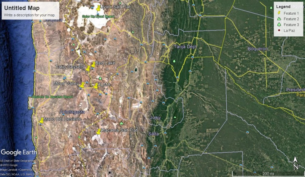
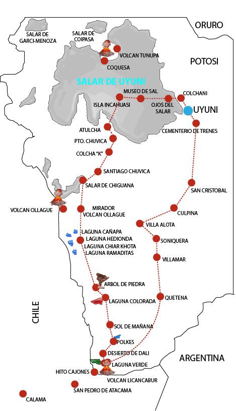
Seen by some as an extension of the Atacama in Chile, the Laguna Colorado drive is arguably even more barren and isolated, making it truly seem like world’s end while here! From Uyuni, it will take my trekking buddies and I four days of constant travel to explore this landscape, (imaged below).
Indeed, it is this feeling which stands the region out as one of South America’s great untouched landscapes, a place that combines the open wilderness of Uyuni with the towering geology, in the form of distant rolling mountains landscapes.
For me, ‘off the beaten track adventure’ doesn’t do it justice, as a trip to the Laguna Colorada Desert is one of real explorative travel and high-altitude desolation of the Laguna Colorada Locale, that the inhospitable, otherworldly feel associated with this region of South America comes sharply into perspective.
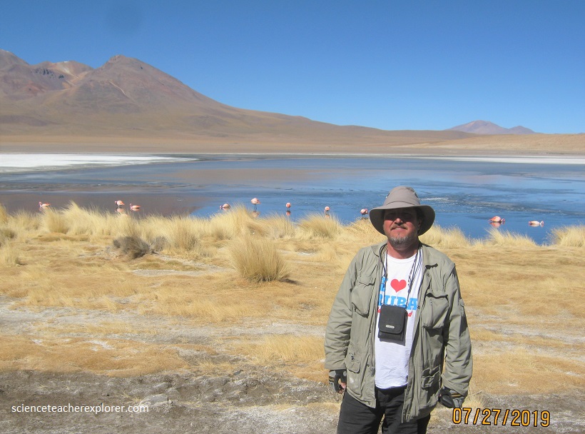
Our first photo opportunities, were at the Laguna Hediona and Capina. Laguna Hedionda (Spanish for “stinking lake”) is a saline lake that is notable for the three rare- migratory species of the local flamingos (pictured above). Laguna Hedionda is one of the nine small saline lakes in the Andean Altiplano. It lies at an altitude of 4,121 m (13,520 ft), with an area of 3 square km. Salt flats and bofedales (wetlands) are spread over the periphery of the lake. It is in a very remote area where human habitation is negligible. Laguna Hedionda has a water surface area of 3 square km and are sourced by springs and have high sulphur content. The peripheral area of the lake is strewn with black volcanic rocks. The catchment area of the lake is primarily covered with semi-desert steppe and dwarf scrub.
The Andean flamingo (Phoenicoparrus andinus) is a species of Flamingo and one of the rarest of its type in the world. The Andean flamingo has a pale pink body with brighter upperparts, deep vinaceous-pink lower neck, breast, and wing coverts. It is the only flamingo species with yellow legs and three-toed feet. The bill of the Andean flamingo is pale yellow and black. The flamingos feed from the bottom layer of the lake for small particles, mainly diatoms. They have a deep-keeled bill; the upper mandible is narrower than the lower, creating a gape on the dorsal surface of the bill. The bill morphology facilitates feeding of diatoms through inertial impaction. This mechanism entails that food particles denser than water, such as diatoms, would impact the filtering surface in the bill, causing water to flow out of the mouth and leaving diatoms in the flamingo’s bill. The flamingos forage in shallow salty waters for resources.
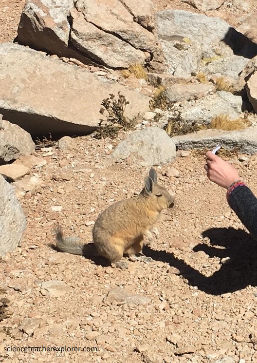
Pictured above, The viscachas are rodents in the family Chinchillidae. They are native to South America and look similar to, but are not closely related to rabbits. The viscacha looks much like a rabbit due to convergent evolution. It is dorsally gray or brown in color, with a bushy tail and long, furry ears. This species lives in large colonies separated into individual family units, like an apartment complex. It eats a wide range of plant matter, settling for almost anything it can find growing in the harsh, rocky environment.
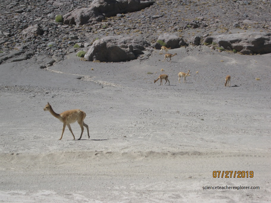
Pictured above, the Vicuña is the smallest member of the family of camelids in South America and is regarded as the alpaca’s wild ancestor. It looks endearing, with its large, forward-facing eyes and small, wedge-shaped head with sharply triangular ears. The color of the head varies from reddish-brown to yellow, and its neck is pale orange. Its chest is covered with a silky white mane, but the fur of the rest of its body is soft and of the same length. It has a pale brown back and its underside and the inner parts of its flanks are dirty white.
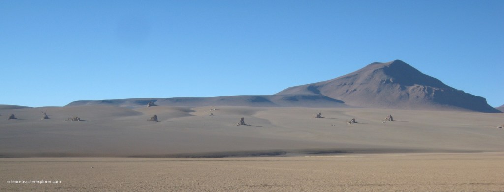
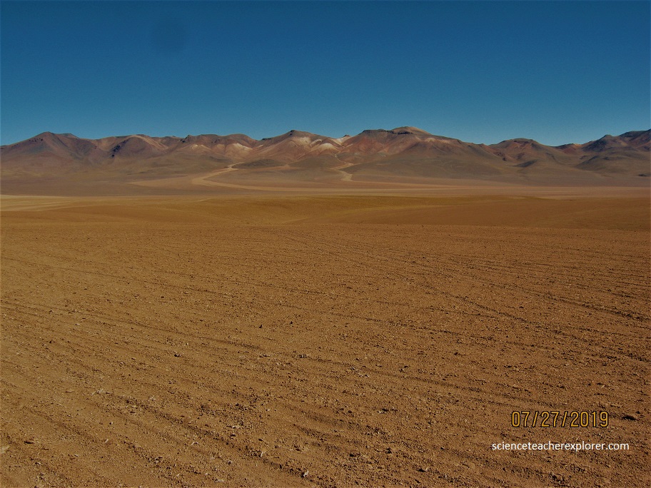
Along the road to Laguna Colorada, there is a surreal, barren, wind-swept swath of land that has been frequently compared to a Dalí painting. Salvador Dalí was a Spanish painter best known for dreamy, sometimes eerie, nonsensical images against a minimalistic backdrop. Though Dalí never painted this particular Bolivian reserve, the arid, stark desert horizon coupled with strange rock formations strike a strong resemblance to the famous surrealist’s work.
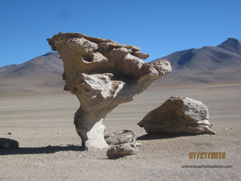
In particular, the Árbol de Piedra, or Stone Tree, could be one of Dalí’s disturbing subjects. The base of the rock has been weathered away by wind and time, while the top remained intact. The seemingly impossible structure stands 8 m tall and casts its shadow even longer across the flat sandy desert.
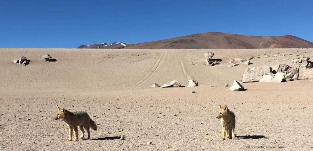
Pictured above, The Culpeo is a South American fox species. It is the second-largest native canid on the continent, after the Maned wolf. Culpeos have grey and reddish fur, a white chin, reddish legs and a stripe on their back that may be barely visible. The neck and shoulders are often tawny to rufous in color, while the upper back is dark. The bushy tail has a black tip.
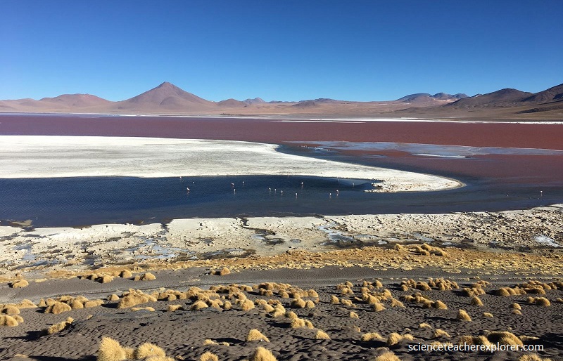
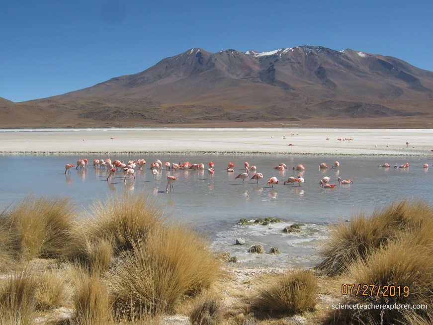
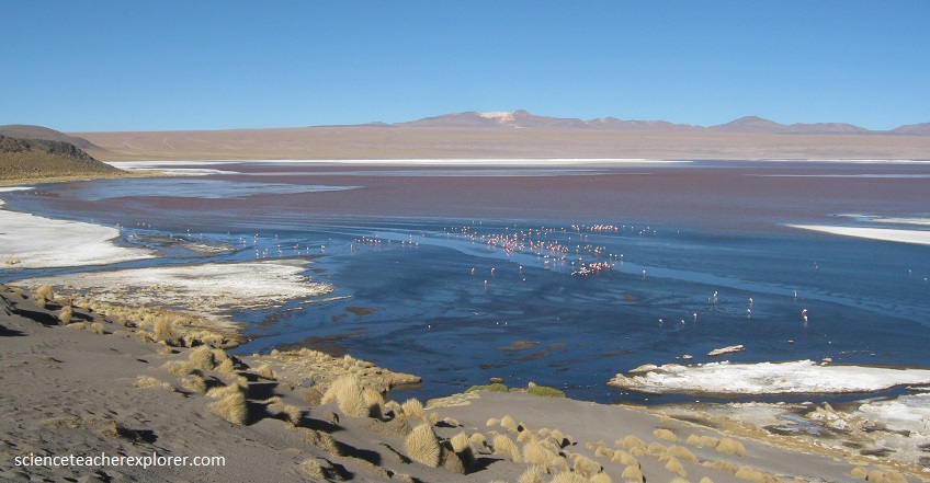
The Laguna Colorada is a high-altitude lake in the southwestern Bolivian Altiplano. Colored by an abundance of tiny shrimp and algae, it attracts up to 30,000 flamingoes of three species, including the extremely rare James’ Flamingo.
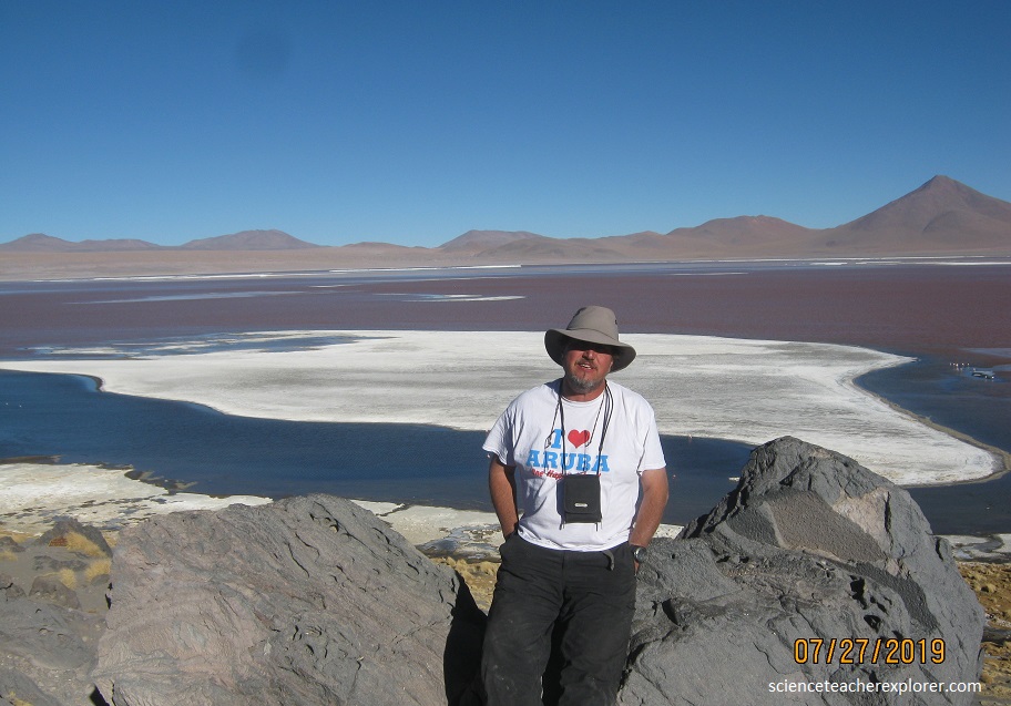
The exact color of Laguna Colorada depends on the sun’s angle, and so varies through the day appearing blue, crimson, or deep maroon. Huge blocks of salt float in the water and look like icebergs.
Pictured above, the James’s flamingo is smaller than the Andean flamingo, and is about the same size as the Old World species, the lesser flamingo. Its plumage is very pale pink, with bright carmine streaks around the neck and on the back. When perched, a small amount of black can be seen in the wings; these are the flight feathers. Bright red skin occurs around the eyes, which are yellow in adults. The legs are brick red and the bill is bright yellow with a black tip. The easiest method to distinguish James’s flamingos is by the lighter feathers and the bright yellow on the bill.
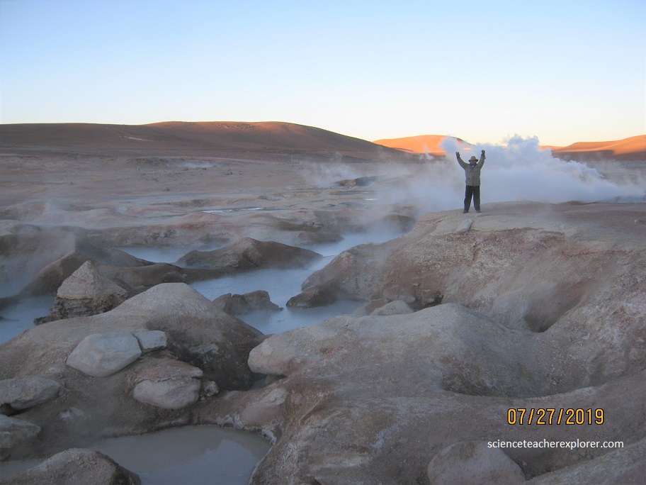
Pictured above, Sol de Mañana (Spanish: Morning Sun) is a geothermal area past the Laguna Colorado or to the south. It extends over 10 square km, between 4800m and 5000m in altitude. This area is characterized by intense volcanic activity and the sulphur-springs field is full of mud lakes and steam pools with boiling mud. Sol de Mañana, together with El Tatio, is among the geothermal fields located at high altitude and is associated with the volcanic system of the Altiplano-Puna volcanic complex, as well as with a fault system that connects the two. Sol de Mañana is part of the geothermal system of the Laguna Colorada caldera.
The region of Sol de Mañana is volcanic, with extensive exposure of Miocene-Pleistocene materials ranging from andesite to rhyodacite, as well as extensive faulting. Moraines also occur in the area.
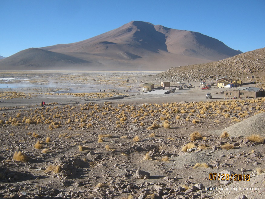
Pictured above, we stayed at the Ecologica de Piedra for the night. I took the picture above, the next morning. Located there, is the Polques Hot-springs. The Polques Hot-springs were formed as a result of volcanic activity from the nearby Polques Volcano. The Hot-Springs have a high content of minerals which is said to relieve the symptoms of arthritis and rheumatism. The water temperatures hover at a comfortable 29°C. They are by no means boiling but offer a blissful contrast to the chilly weather outside the pool. Undoubtedly, the best time to arrive was late at night or sunset. And we did! The ambient temperatures were as low -5°C or -10°C which made changing into my swimwear a major challenge. However, despite how crazy this may sound, we did not regret it when we were sitting back in the naturally warm waters, glass of wine in hand, looking out at the beautiful southern-constellations above of the massive lagoon!
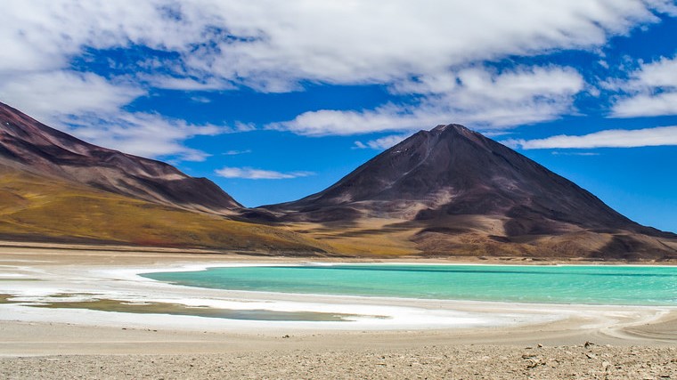
Laguna Verde lies at the extreme southwest of Bolivia, not far from the border with Chile and (64 km south of Laguna Colorada). Depending on the strength of the winds, which whip up the water, minerals, and sediments within it, the color of the lake ranges from a tranquil turquoise to a brilliantly frothy emerald. Laguna Verde, as the name suggests, is very, very green. And at times it looks… kind of toxic. Which is why flamingos choose not to feed in this particular lake. Laguna Verde has high concentrations of lead, sulfur, arsenic and calcium carbonates, making it less than appealing to all but the most resilient extremophiles. And due to the high mineral content, the waters of Lake Verde can remain liquid at temperatures as low as -6.16 degrees Fahrenheit (-21.2 degrees Celsius). But these same minerals give the lake its fantastic green color.
The picturesque nature of Laguna Verde is further enhanced by the presence of Volcán Licancabur, a stratovolcano whose near perfect cone rises up less than three miles to the southwest of the lake. Licancabur is considered a holy mountain, and archaeological sites have been found on its slopes and summit crater, which is said to have once concealed an Inca crypt.
