Water Holes Cyn., AZ
In the Spring of 2003, I took a group of students and adult-advisors to the South Rim of the Grand Canyon. We started in Northern Utah and drove to the southern Utah/Arizona border.
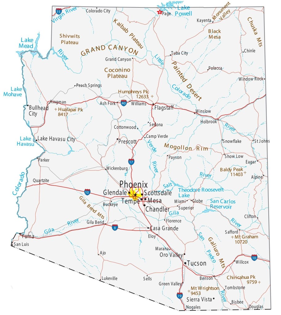
We stayed the night at the Wahweap Campground near Page, Arizona. The next morning we got up early to explore a small slot canyon called Water Holes Canyon, 10 kilometers south of Page, on Highway 89 (to milepost 542). It is immediately west and south of the Navajo settlement of Leche-e. [The milepost 542, was next to the bridge spanning Water Holes canyon]. Water Holes Canyon drains northwest into Glen Canyon and the River, not far upstream from Lee’s Ferry.
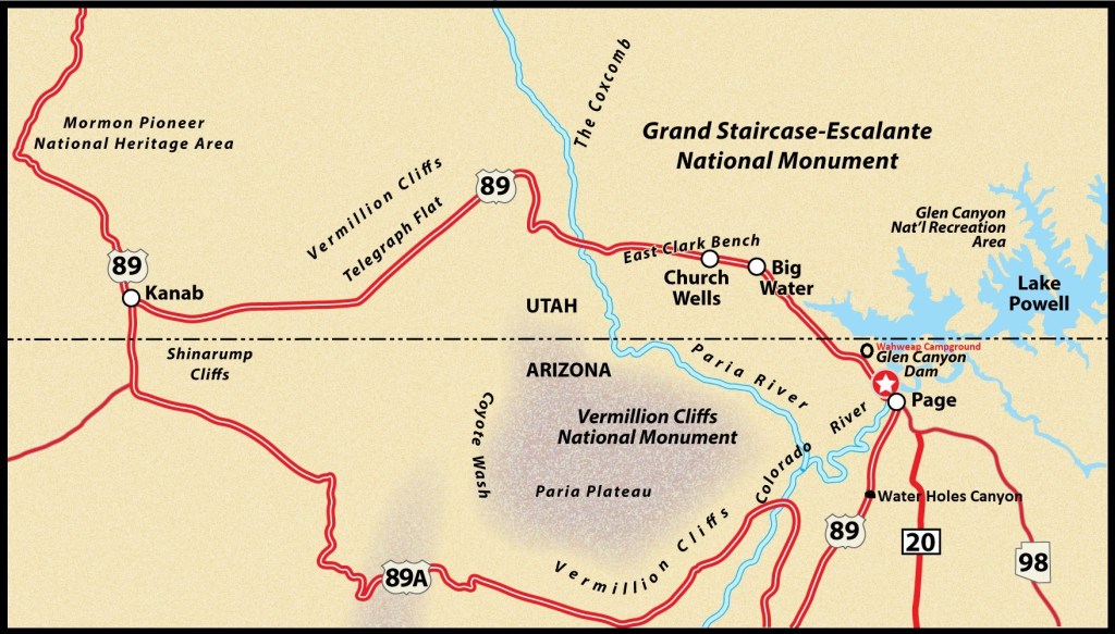
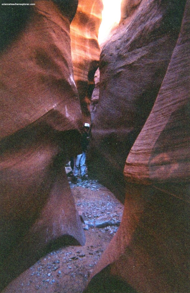
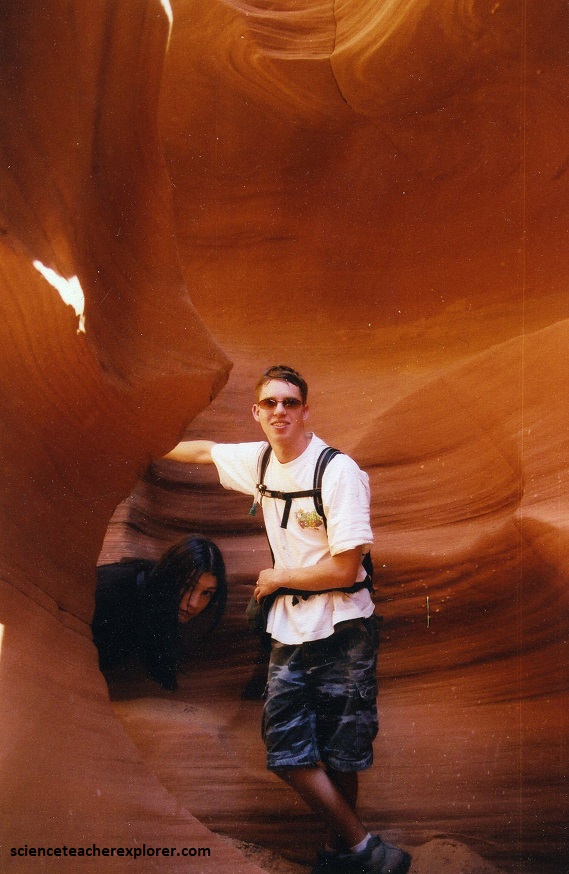
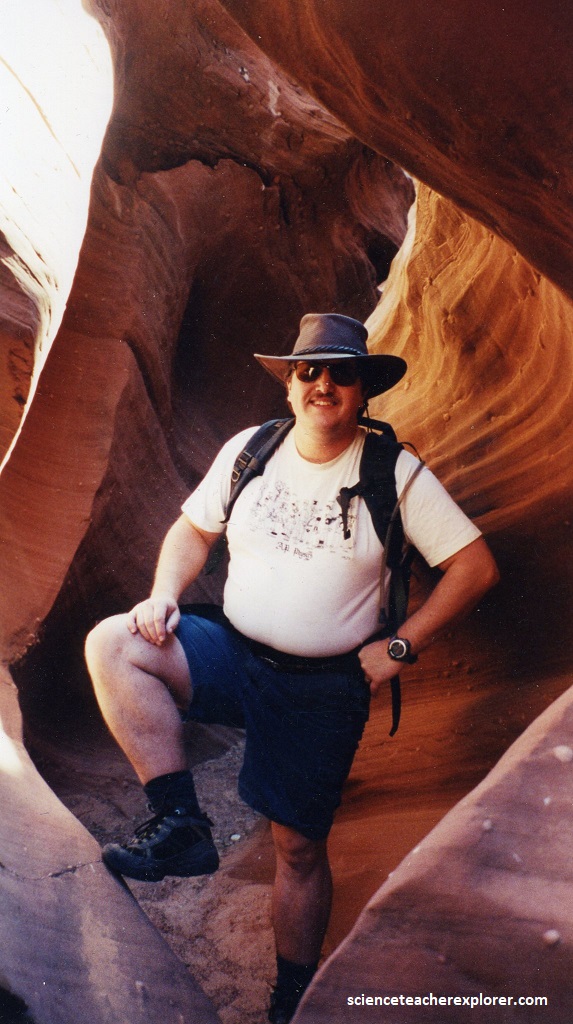
Water Holes Canyon was a great little spot to see tight Navajo Sandstone narrows right off the highway. We could of walked upstream (east) of the bridge, or downstream. Both directions had narrows, but we decided to do the downstream version.
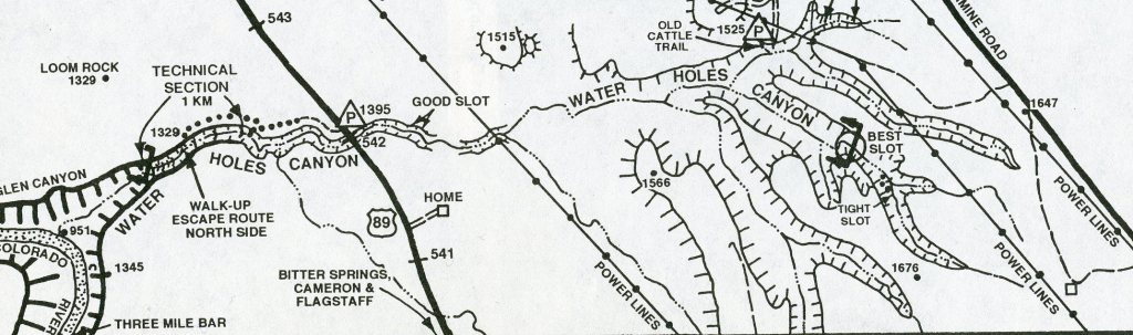
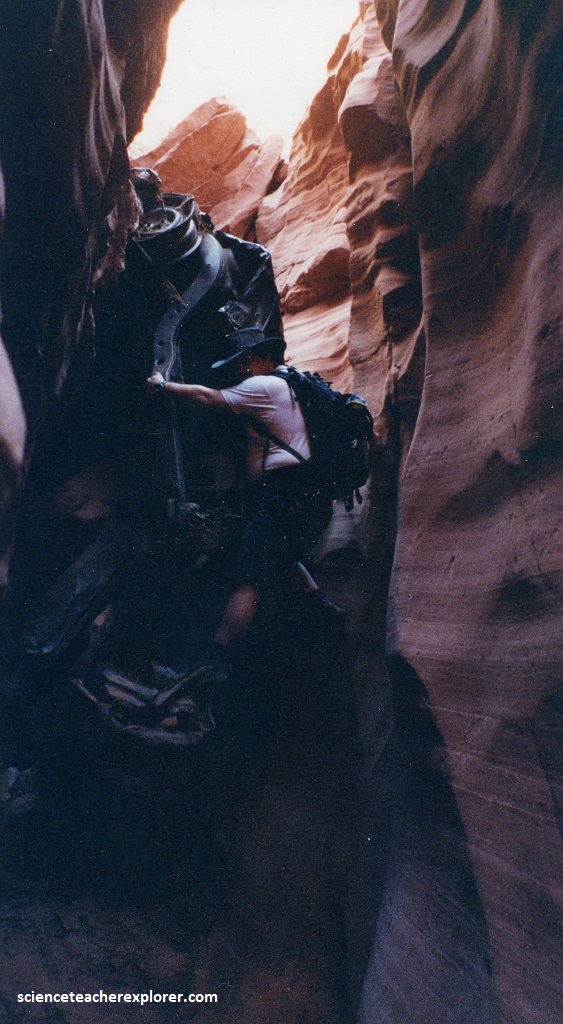
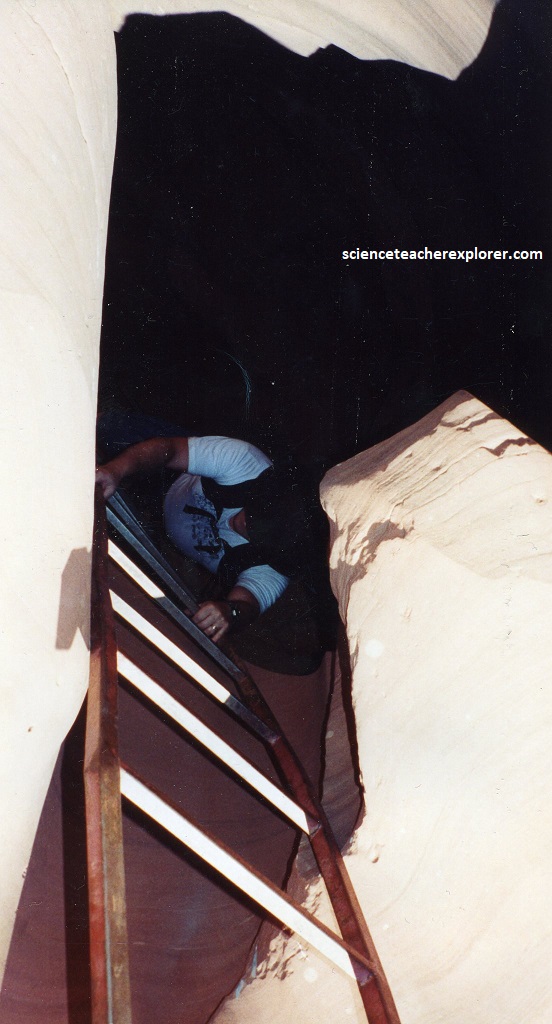
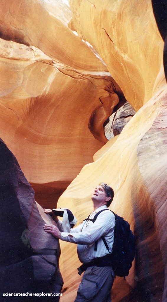
Immediately downstream from the the bridge, the access was blocked by an old car wedged between the walls, creating a fall. We downclimbed the rusty metal, (pictured below).
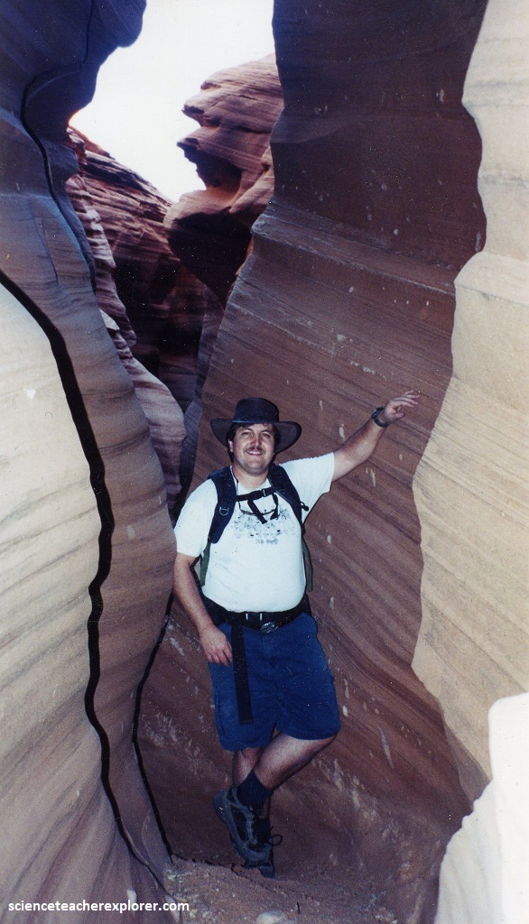
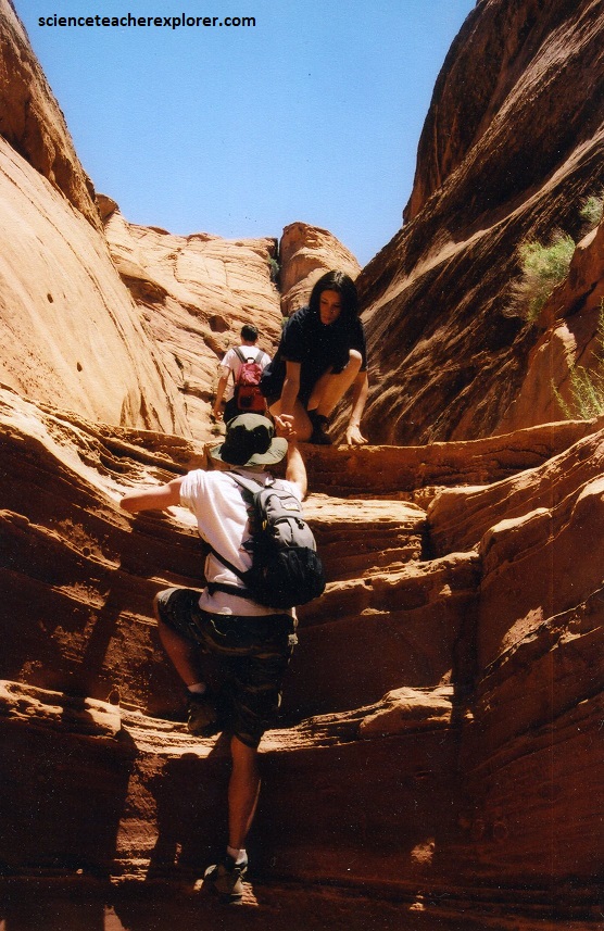
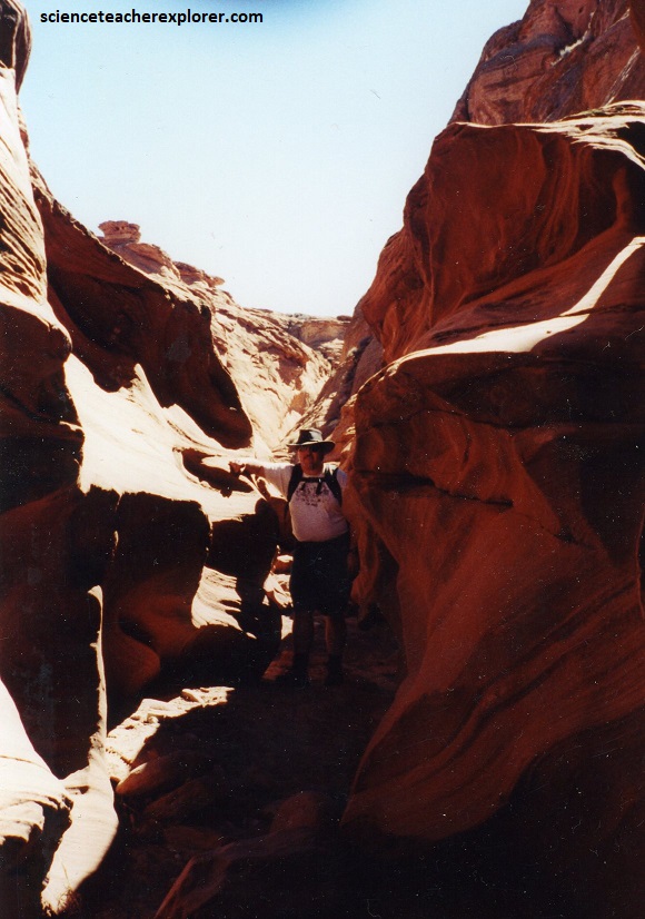
Continuing downcanyon (west) from the bridge are several dropoffs and short narrows. The locals from Leche-e had installed a ladder at the first drop-offs in 2003, (it may not be there anymore). [Pictured below].
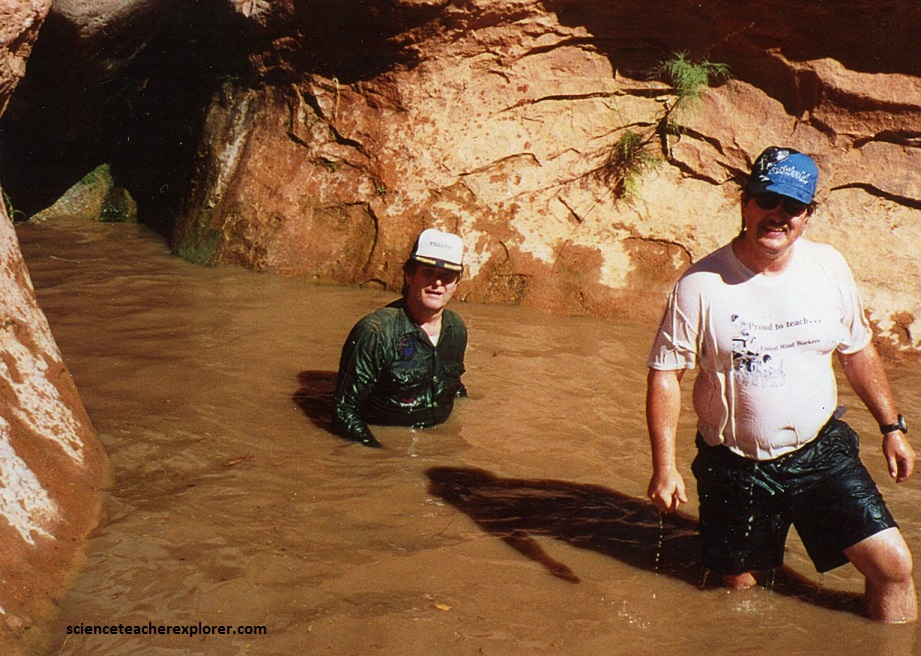
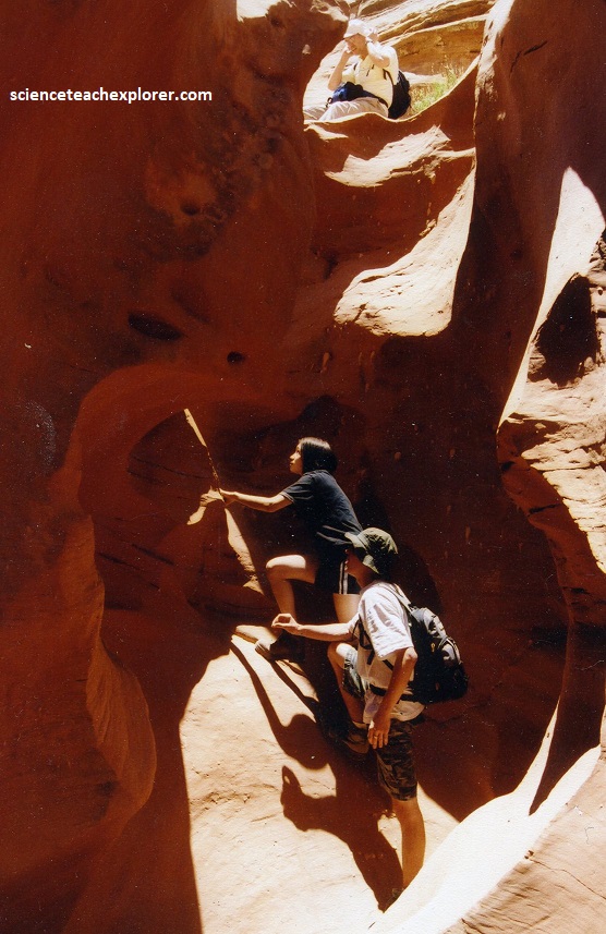
Below the 3 meter ladder, the canyon alternated between open and narrow until reaching a 10 meter fall. We rappelled this into a pool of water and continued to the “Big Drop-off” of 110 meters. This is where we turned around and came out.
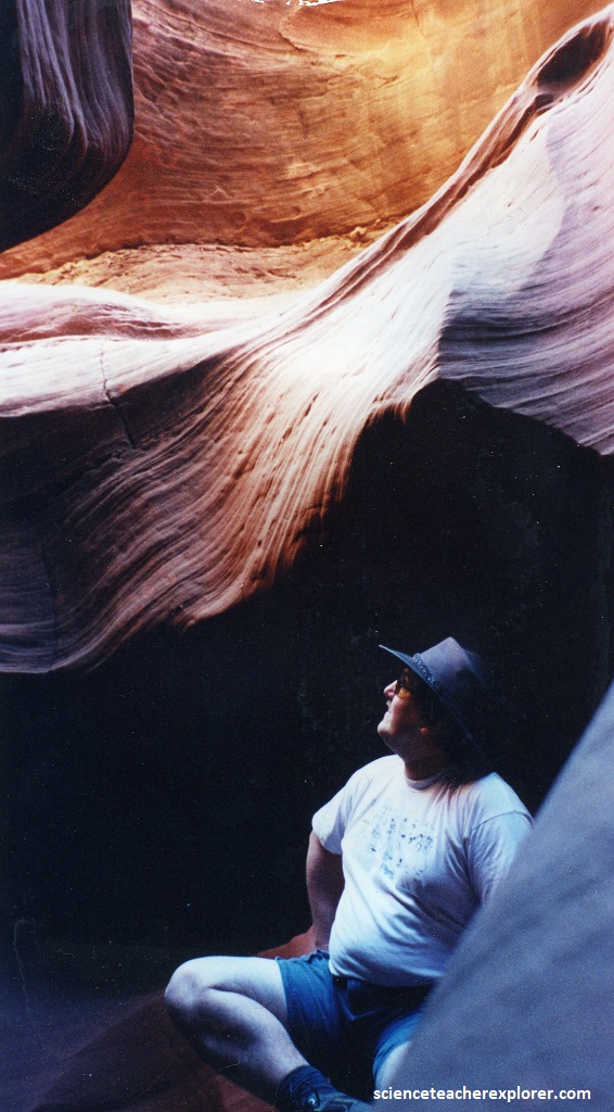
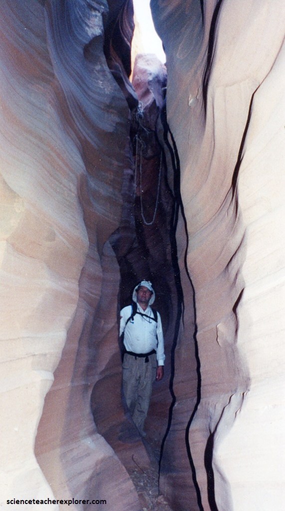
Sensuously curving walls arched high above us. They formed bulbous chambers wider at bottom than they were overhead, giving the canyon the feel of a cave illuminated by a single sunbeam. Soft light filtering through the narrow roof slit suffuses the complex curves of the walls, bathing their sweeping patterns with an ethereal glow, (pictured below).
The interactions between sunlight and the particular orientation and shape of this canyon make for dazzling lighting effects, scattering sunbeams and unveiling the brilliant fire within.
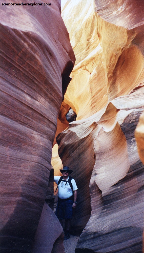
Pictured above, true slot canyons are unusual features, even in northern Arizona and southern Utah, which have the highest concentration in the world, (a few dozen spread across an area the size of Indiana). The key to comprehending why slot canyons are relatively plentiful in this corner of the globe is to understand how, when, and where they develop.
There are several prerequisites for the formation of a slot. Though the exact recipe can vary, the basic ingredients include resistant rock, water, and a youthful landscape. Not surprisingly, only certain rock types are well suited to forming slot canyons. First and foremost, a nearly perfect layer must be exposed. This raw material must be uniformly hard and strong to composition, with few weaknesses or flaws.
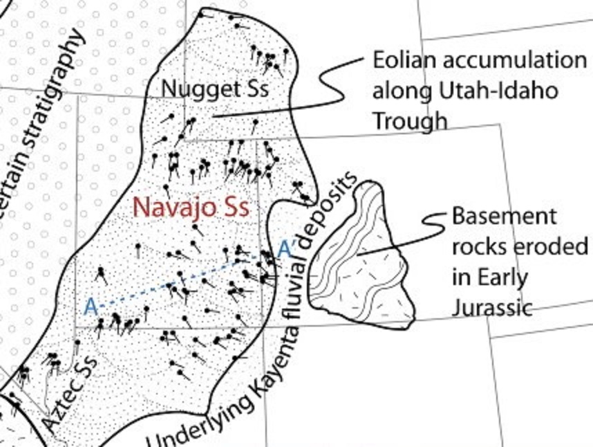
Because it’s grains have been patiently sorted by wind, desert dune sandstone satisfies these stringent requirements. In particular, the Navajo Sandstone, seen in the walls of Water Holes Canyon, comprises on e of the thickest layers of pure sandstone found anywhere on earth and is thus ideally suited to host slot canyons.
Deposited between 192 and 178 million years ago, the Navajo Sandstone is the remarkable legacy of a great sand sea that once stretched from here to modern day Wyoming. Comparable in size to the Sahara, this ancient desert hosted and dunes that towered 330 meters high. Pictured above and below, the sweeping lines we see in the Water Holes Canyon walls are a direct inheritance now frozen in time, from these ancient dunes.
Pictured above, notice some of the thousands of individual laminations, each thinner than a sheet of cardboard, that comprise Water Holes’ walls. Notice how they seem to come in groups, with one package tilting crazily one way, and a separate group just above or below slanting in a different direction. Scientists call each tilted lamination a cross-bed and each package of parallel cross-beds a cross-set. Nearly horizontal lines called bounding surfaces separate cross-sets from one another. In this area, the Navajo Sandstone blankets the land horizontally, parallel to the bonding surfaces, largely undisturbed by the tectonic forces that have swept this region over the last 192 million years. However, this sandstone were deposited at steep angles; each of the thousands of cross-beds we see in the walls preserves a single sand avalanche down the inclined face of an ancient sand dune.
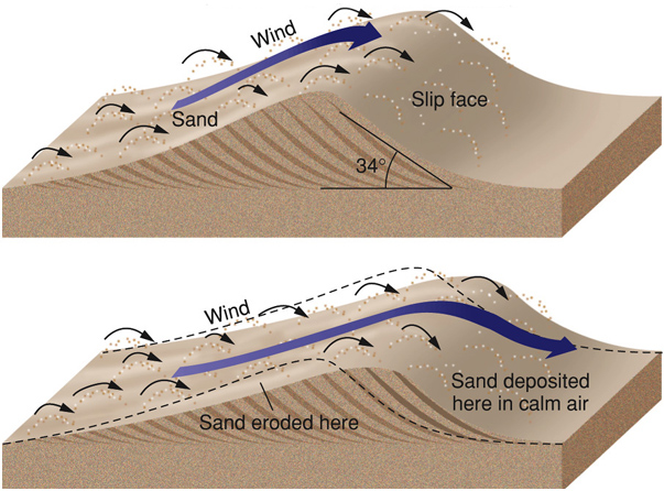
Imaged above, wind blows sand up the gentle face and piles it at the dune crest, where eventually it cascades down the steep lee face in a turbulent sand avalanche. Through the processes of lithification, cross-beds are locked in stone. Just by looking at their orientations, you can still tell which direction the wind was blowing in this spot over 190 million years ago. Note that each cross-set represents the migration of a single dune before a major shift in wind reshapes the sand into a new dune and drives it in a different direction. As the young dune begins to travel, it planes the top off the previous dune, leaving a flat boundary between cross-sets.
Wind in one of the most efficient natural mechanisms for sorting sediment. Because wind isn’t strong enough to pick up large particles, it only transports sand and dust. Any obstruction the wind meets will slow it down, causing heavier sand to drop to the ground while lighter dust keeps blowing by. Because the Navajo sandstone was deposited by many generations of sand dunes, it now comprises one of the thickest layers of nearly pure sandstone found anywhere on earth, (over 667 meters thick in places).
At the time the Navajo Sandstone was deposited, North America’s tectonically triggered wanderings placed the continent in the tropics, where the dominant trade winds blew from east to west. The massive bulk of the Pangaean supercontinent, (which at the time was beginning to split apart), lay to the east, robbing the trade winds of almost all their moisture before they reached northern Arizona on Pangaea’s west coast, leaving it a parched desert.
Once the perfect rock is in place, water is required to actually carve the canyon. This erosion occurs mainly during large floods, when terrifying walls of water roar between the narrow walls, sweeping away everything in their path. When a river is flooding, its swollen waters lug huge loads of sand and gravel. Most of this material is dragged along the riverbed, literally sandblasting the channel and deepening the canyon in the process. Some of this debris also gets hurled at the walls, eventually widening them. However, because most of the abrasion occurs along the channel bottom, widening is a slower process, and the slot deepens much faster than it widens.
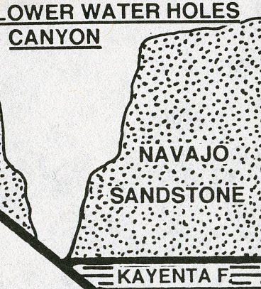
Imaged above, all slot canyons terminate where the stream has breached softer rock that is more susceptible to the power of the abrasive-filled floodwaters. In this region, this usually means that the stream has either cut clear through the thick Navajo Sandstone into the underlying, softer Kayenta formation, or it has encountered a weaker layer within the Navajo itself, usually consisting of the finer-grained oasis sediments.
Like most of the Colorado Plateau’s slots, Water Holes Canyon Slots are linear because they were carved along a joint. Joints are long, planar hairline cracks that develop in the rock in response to tectonic stresses, contraction during cooling, or expansion, as erosion relieves deeply buried rock layers of their immense burden of overlying material.
All rocks have multiple sets of parallel joints in them, and the twin forces of weathering and erosion exploit these preexisting weaknesses. First, freeze-thaw cycles and other small-scale weathering processes widen the cracks, helping to concentrate water flow. Once water begins flowing down the joint, it accelerates the erosion, eventually turning the crack into a full-fledged stream course. Joints favor slot canyon development because they act like guide grooves for a crosscut saw, focusing the flow of water and its abrasive load of sand and gravel. Joints concentrate the erosion as long as the host rock is strong, thick, and uniform enough to contain the river.
The Colorado River is the master stream that sets the tempo for all other river erosion in the area. Glen Canyon, (the 267 meter deep canyon on the Colorado river just north west of Water Holes Canyon), was carved in just the last 500,000 years. Because Glen Canyon established a new low-elevation point in this area, it triggered a host of new tributary streams that funnel water from the surrounding Navajo Sandstone tableland down to the bottom of this canyon.
For many of these new tributaries, including Water Holes Canyon, joints provided the fastest and most expedient paths down to the river. A handful of these canyons have carved awe-inspiring slot canyons in the process, including Water Holes Canyon. These wonders of the southwest are ephemeral, rare and beautiful to behold.
