Promontory, UT 2004
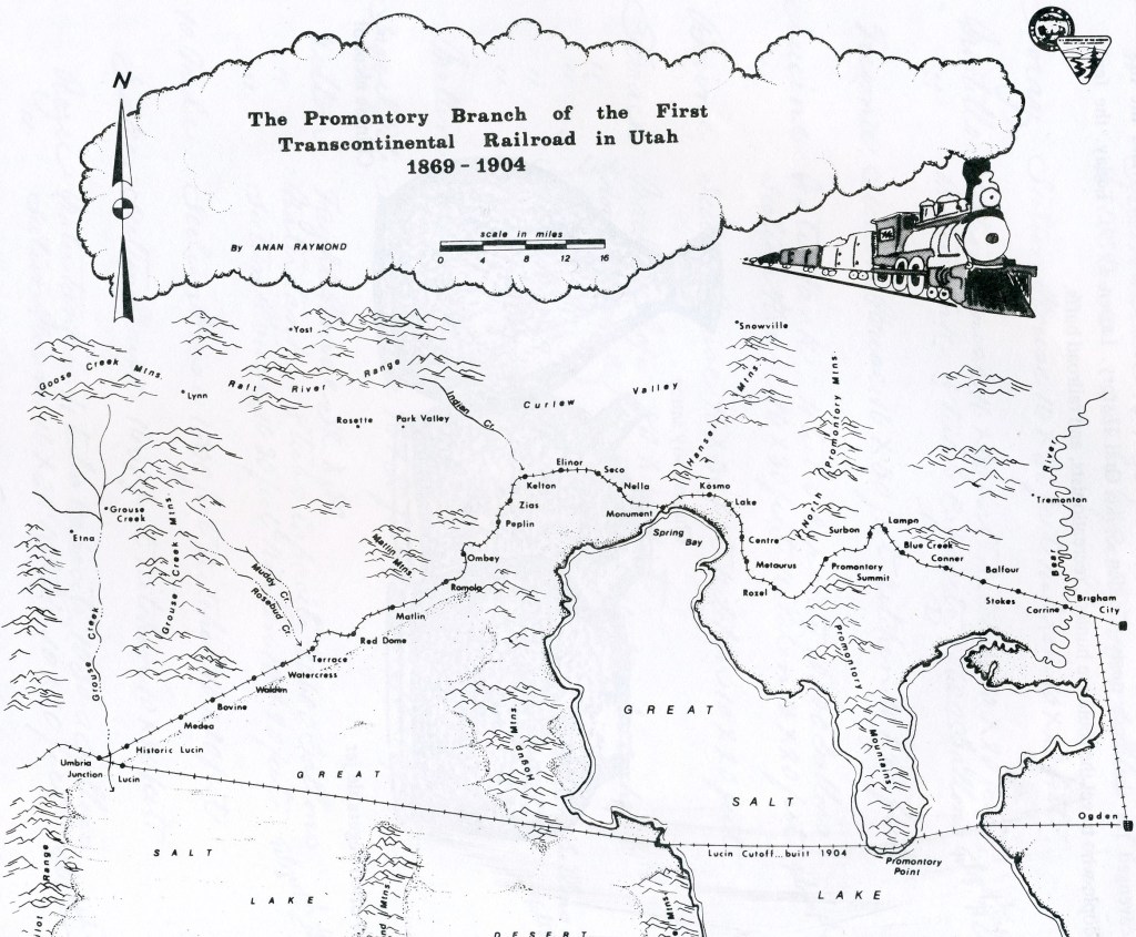
In the fall of 2004, I organized an adult tour with the University of Utah Natural History Museum to explore the historical Transcontinental Railroad from Ogden, Utah to Lucin, Utah. We collected enough people to fill four SUV-Suburban vehicles. Promontory Summit in northern Utah has experienced colorful history. The area has seen boom and bust. It has been famous world-over, yet remains anonymous in many ways. The completion of the country’s first transcontinental railroad, and the “Wedding of the Rails Ceremony” commemorating this historic event, are taught to virtually every United States child in basic U.S. history classes. But few people know where these events really happened. Many historians point to the “Last Spike Site” as the single most historically important site in our country, west of Independence Hall. Yet it is rarely visited by explorers for more than a century.
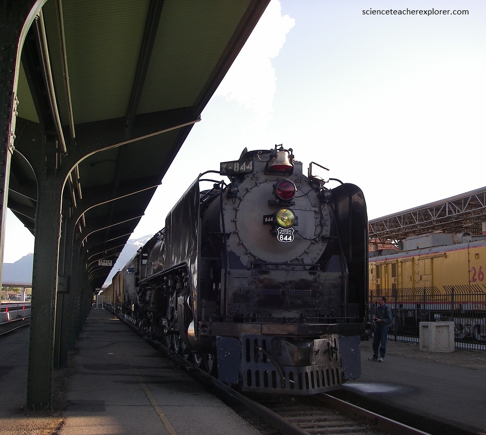
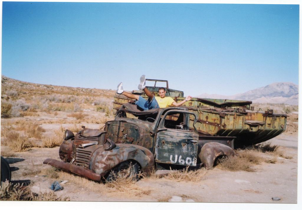
Our tour started at the “Union Station” in Ogden, Utah. {Of course, before I ran the tour, I had to do a reconnaissance mission with the help of my assistant, (Mike Stevens). Many of the photos in this webpage is of that mission}. Coincidentally, the “Living Legend” was visiting at the Union Station museum. The “Living Legend” Steam Locomotive No. 844 is the last steam locomotive built for Union Pacific Railroad. It was delivered in 1944. A high-speed passenger engine, it pulled such widely known trains as the Overland Limited, Los Angeles Limited, Portland Rose and Challenger. Another one is on permanent public-display there, but not running, Steam Locomotive No. 833.
Our next stop was Corrinne, Utah. After the completion of the Transcontinental Railroad, Corrinne quickly became Utah’s second largest city and had hopes of becoming it’s capitol. When first surveyed and named Connor City for General Patrick Connor in 1868. In a few weeks, the new town boasted a population of 1,500, not counting the thousands of railroad employees, and had more than 500 buildings. Besides 28 saloons and two dozen gambling halls, there was a cigar factory, a flour mill, and brickyard, several fine hotels, (one a block long), two theatres, and opera house and even a block set aside for a university!
The booming town’s name was changed from Connor City to Corrine, but why is now forgotten. It quickly became a main supply point for the northern mines and its freight companies were busy night and day. The wild, raw town boasted five newspapers and murders were a daily fare. During its palmy days, a large smelter was built to reduce the ores from the mines at Rush Valley. Several large steamships carried the ore & passengers from Lake Point across the Great Salt Lake to the railroad here in Corrinne. You could almost claim that Corrinne was a port-town or shipping center, due to its elaborate boat dock.
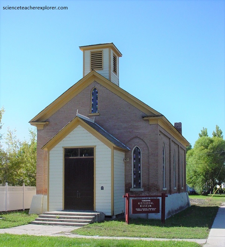
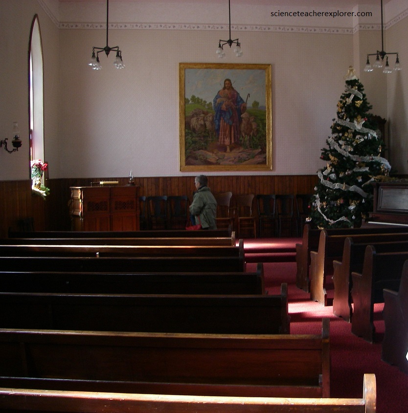
There were seven churches established in Corinne: Episcopal, Methodist, Presbyterian, Catholic, Baptist, Jewish, Buddist, and the Church of Jesus Christ of Latter-Day Saints (L.D.S.). Pictured below, the Corrinne Methodist Church was build in 1870. It is being restored by the Corinne Historical Society.
With the building of the Utah-Northern Railroad, Corinne’s hopes and dreams were shattered, and she swindled fast as a freighting center, but she was still a busy station until the building of the Lucin Cut-Off across the Great Salt Lake in 1904-05. Corinne is now a small, quiet community with several service stations, a farm cooperative that services Box Elder County in Utah.
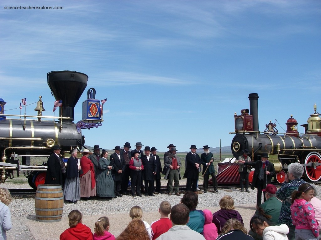
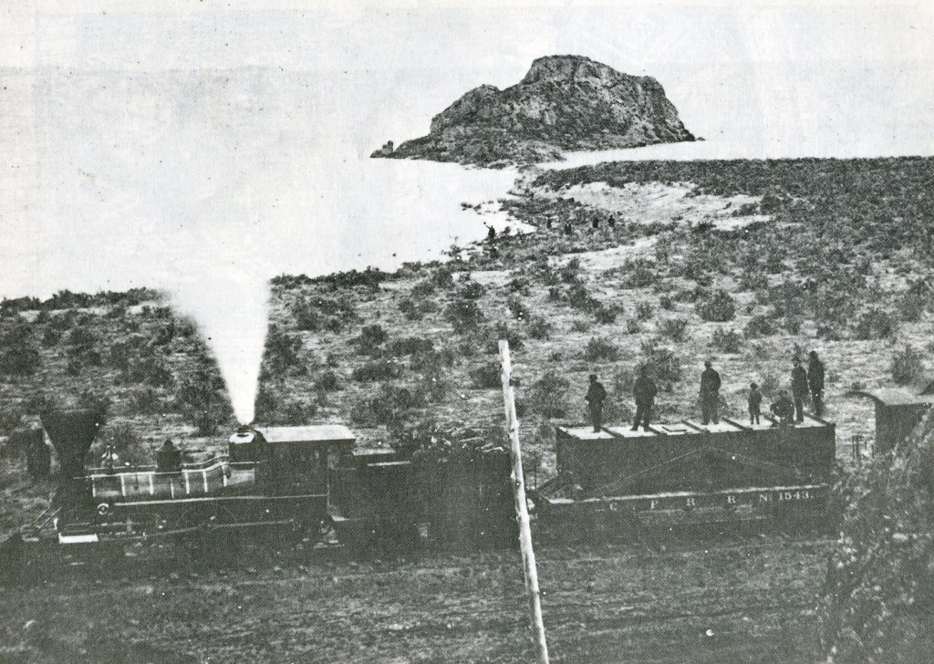
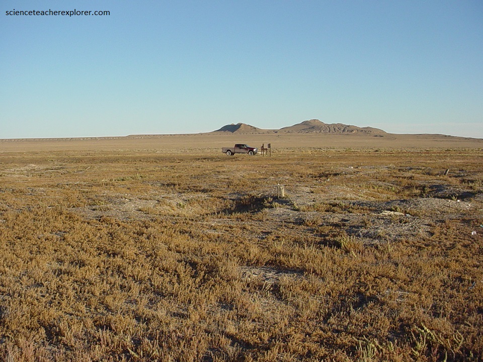
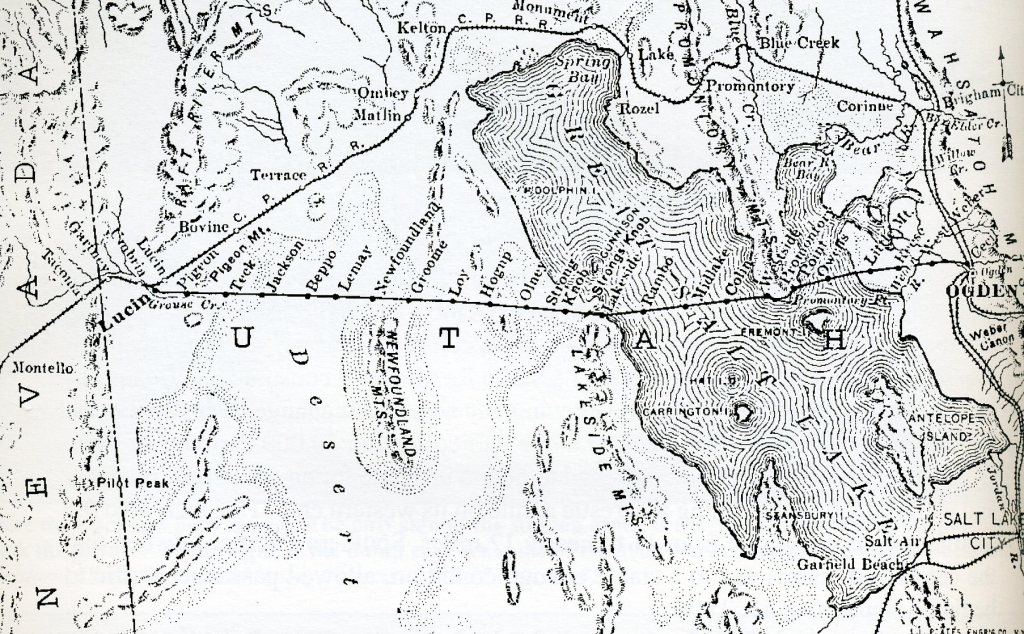
Our next stop was Promontory. The historic meeting place where Engine #119 of the Union Pacific and the Central Pacific’s Jupiter engine touched cowcatchers on May 10th, 1869. The meeting place, 42 kilometers west of Corrinne and 166 kilometers from the Nevada line, had been designated by Congress, and was named for the high promontory of land rising out of the desert above the lakeshore.
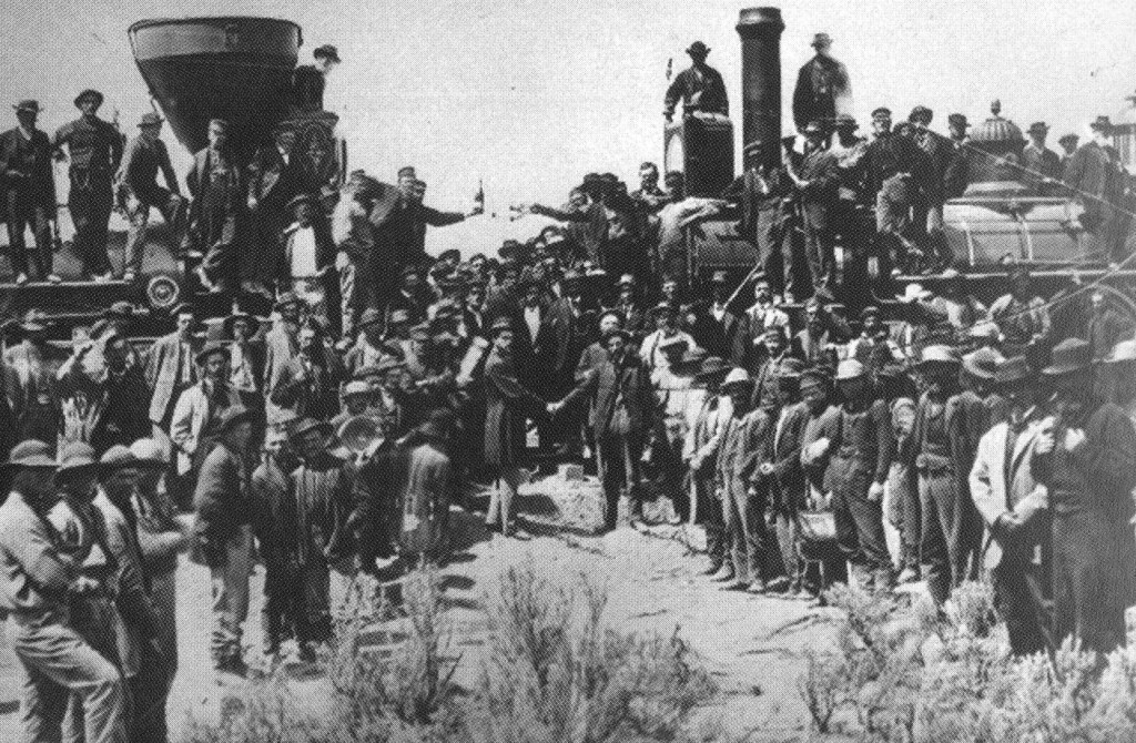
Pictured above, a golden spike was placed in a hole already drilled into a cross tie of laurel wood, while California’s Governor Leland Stanford stood by ready to drive home the gold spike with a silver hammer. Finally, Governor Stanford swung a mighty blow…., and missed! At the same instant the telegrapher tapped out, “The last rail is laid, the last spike is driven, the Pacific Railroad is finished!”
The Union Pacific had laid 1,749 kilometers of track at a cost of $90,000,000 while the Central Pacific put down 1,110 kilometers that cost $75,000,000. When the ceremonies were over and the crowds gone, the last cross tie and the golden spike were returned to California and is now on display at the Stanford Museum at Palo Alto. With the celebration over, Promontory couldn’t live up to the great things expected of it, and soon faded into obscurity. When the route was abandoned in favor of the Lucin Cutoff, it lost its only reason for being.
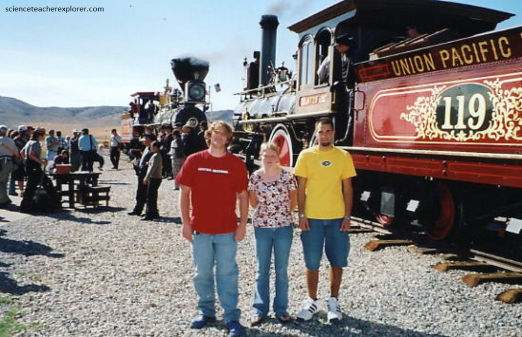
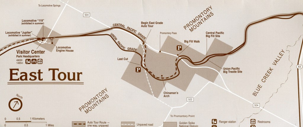
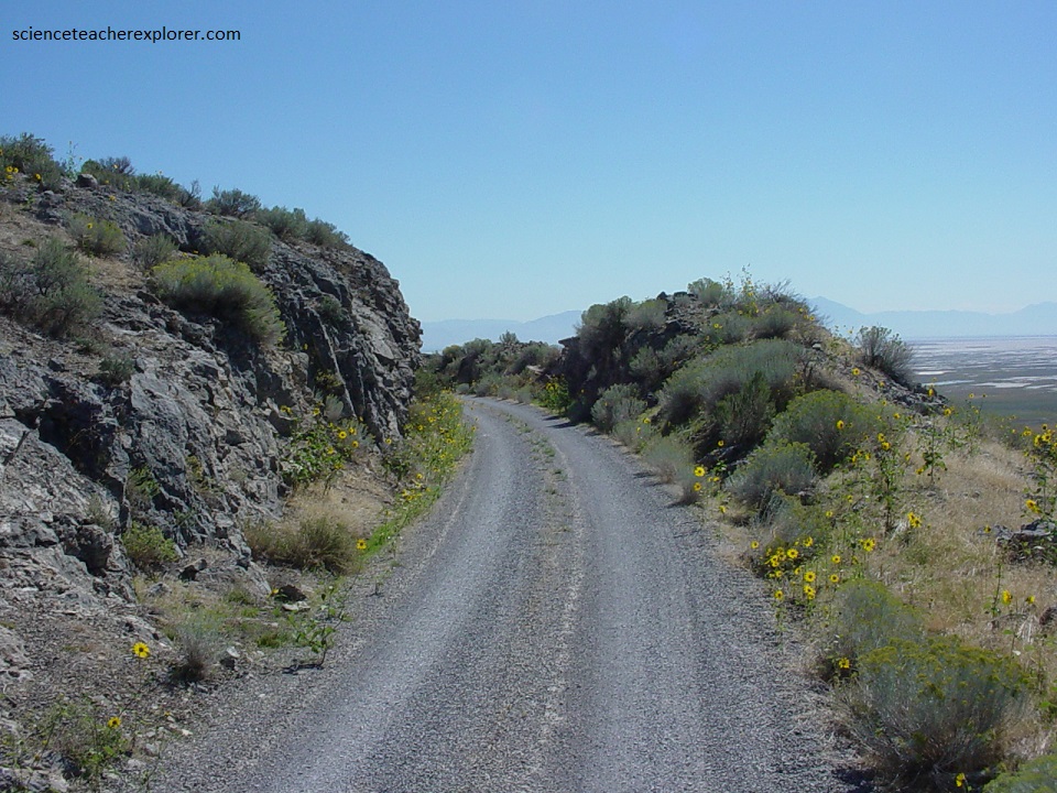
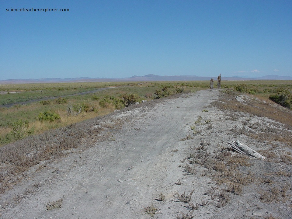
A fine museum has been built where tourist can view scenes from the building of the railroad. Two replicas of the Jupiter and #119 engines are fascinating tourist attractions. We then took the tour onto the nearby Promontory Trail, (pictured below).
An interesting side note: May 8, 1869 was the date agreed upon to complete the railroad. The Central Pacific dignitaries, led by railroad President Leland Stanford, arrived the evening of May 7th. Dr. Thomas Durant, Vice-President of the Union Pacific, wired ahead that his part was unavoidably delayed. Wat he did not say was that his train was chained to a siding in Piedmont, Wyoming Territory by his own contractors who had not been paid in over four months. Durant wired for enough money to pay the workers and the ceremony took place two day late on May 10th.
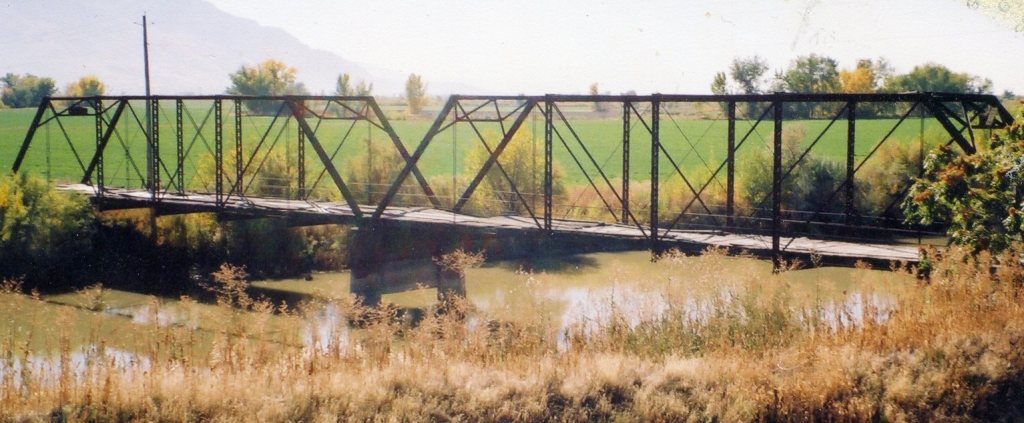
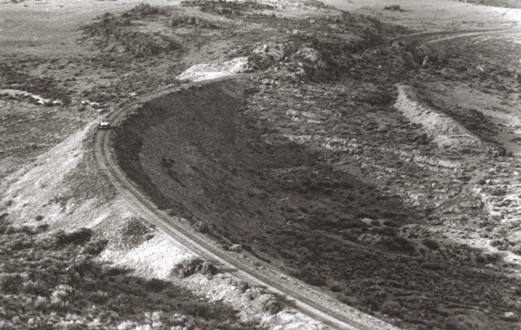
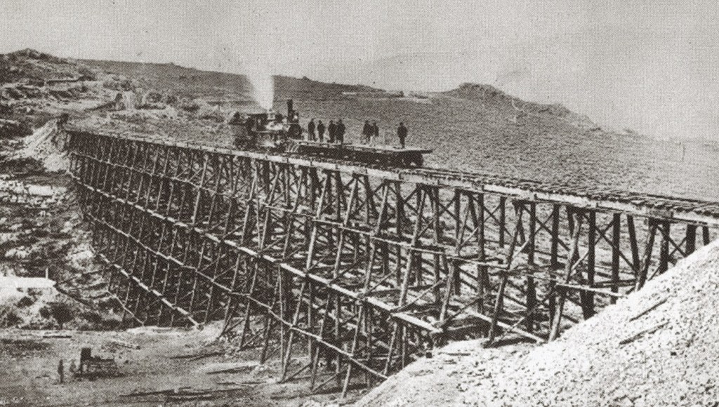
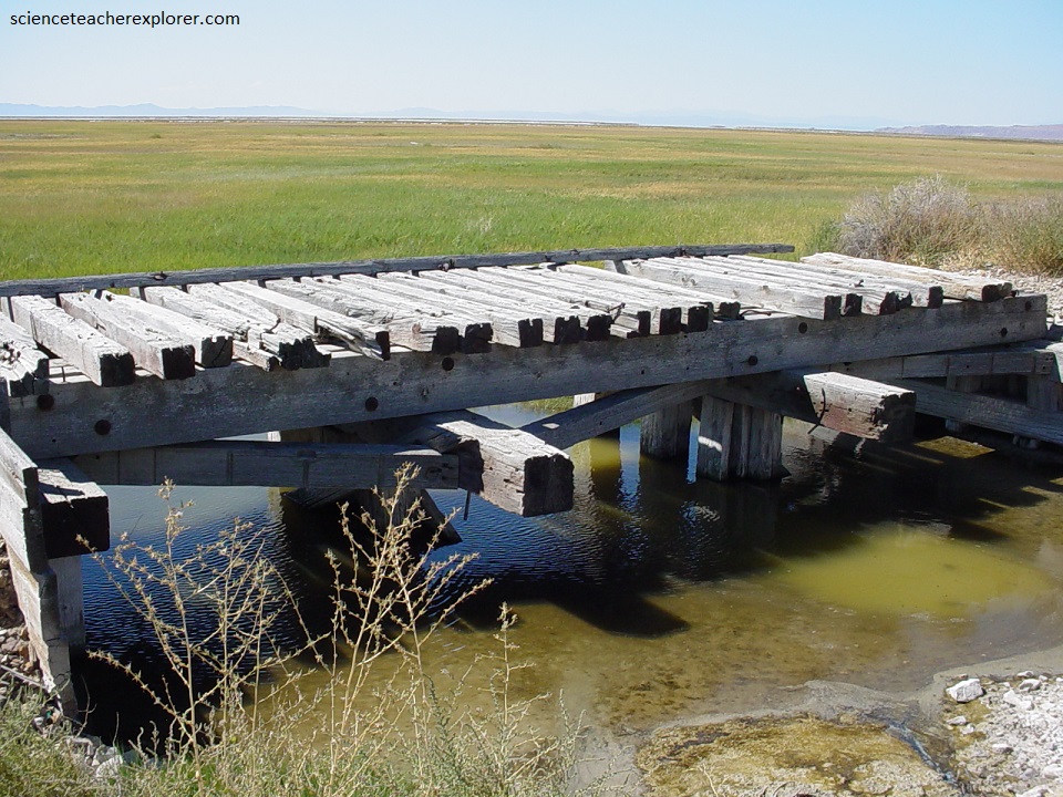
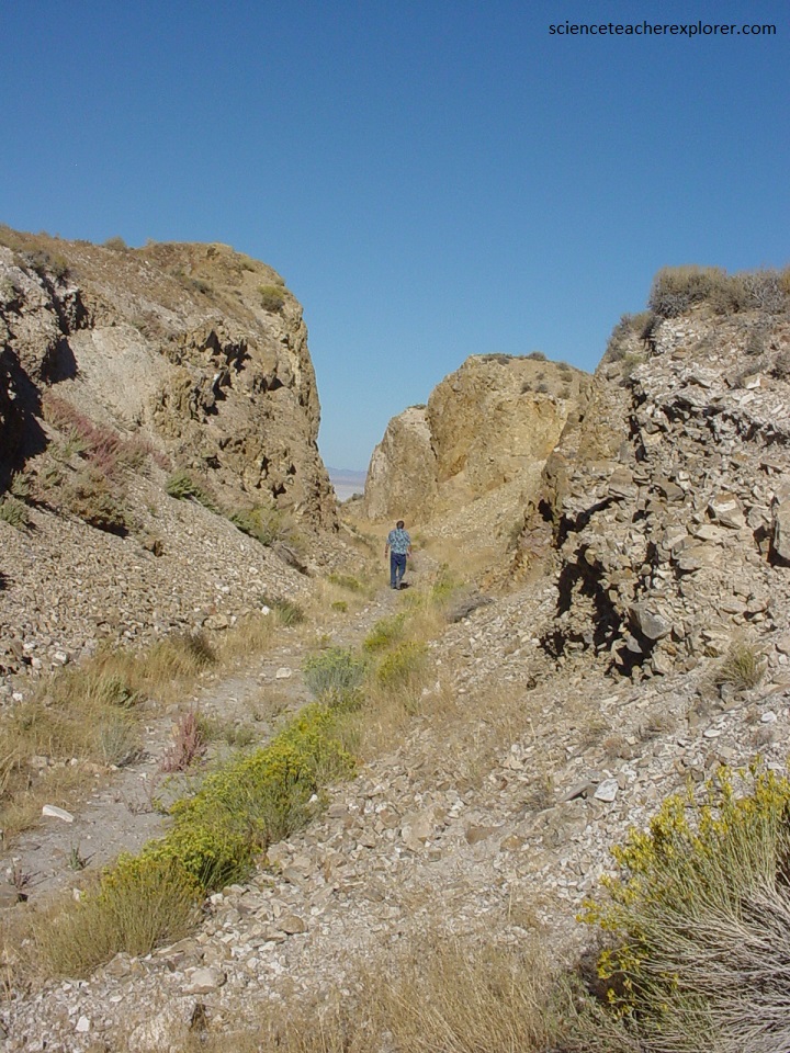
Ironically, some of the most difficult work for the Union Pacific on their line from Nebraska to Utah, was here in these mountains, only a few kilometers from the completion site. Pictured above, a tortuous 16 kilometers of track, with and average climb of 16.5 meters per kilometer, was laid from the valley floor to the summit of the pass. Included in the construction were four long fills, four major trestles, five sizeable rock cuts, and numerous culverts.
Pictured above, deep rock cuts like this one required specialized labor, tools, and huge quantities of explosives. Cuts were started by two-man drilling teams called double jackers. One worker rotated a steel, chisel-like star drill while the other struck it with a sledge hammer. A good double-jack team could drill a 76 cm deep hole in an hour. When drilling was completed, a powder monkey filled the holes with black powder and connected each hole with fuses. Once everyone was out of the way the charges were ignited.
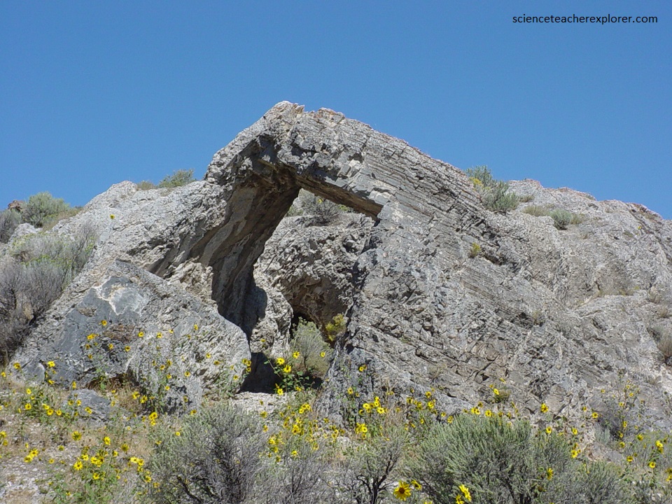
The limestone formation picture above is known as, “Chinaman’s Arch”, and has become a memorial to the thousands of Chinese who helped build the transcontinental railroad. Labor was scarce in California. Chinese were first employed experimentally by the Central Pacific in 1865. They proved themselves excellent workers and soon the company recruited directly from China. By 1868, over 11,000 were employed on the railroad. Many of the Chinese remained with the company after the race to Promontory ended. Travelers often noticed their tents along the transcontinental route. Apparently one such camp was here during the 1880s when this arch was given its special name.
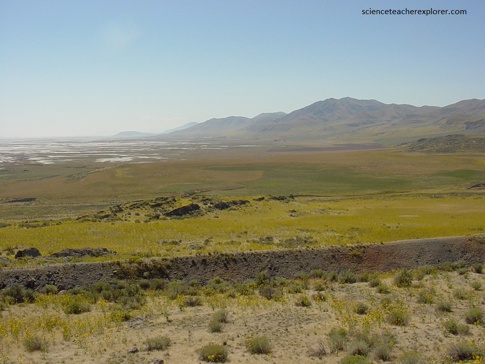
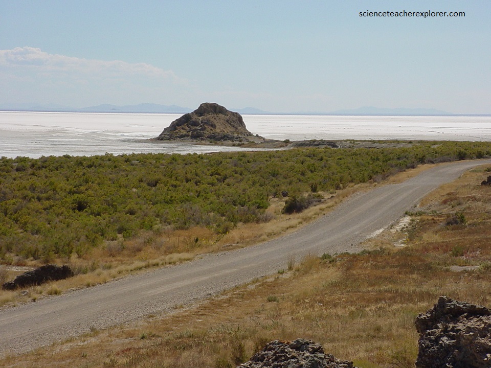
Pictured above, the Great Salt Lake created a sizeable barrier to the railroad. The Union Pacific entered the valley from the east through Weber Canyon into Ogden. The choice then was to go around the lake either to the north or the south. Residents of Salt Lake City pressed the railroads for a southerly route, which would bring it right through Salt Lake City. However, planning engineers recognized geologic evidence that suggested the northern route. This would prevent the line from being endangered by the rising lake waters.
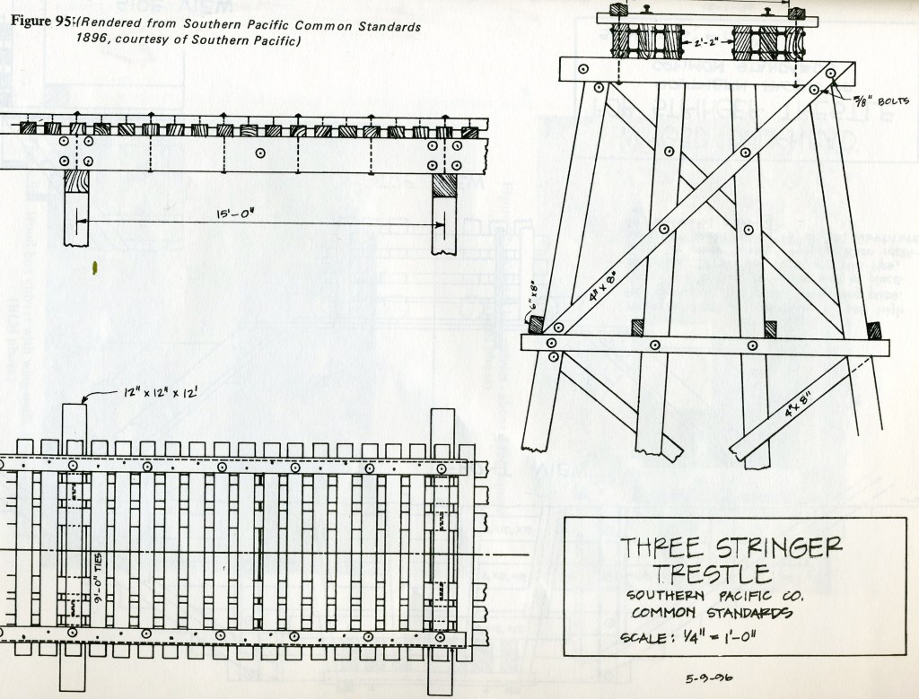
Pictured above, when building grade across a gully, a rock fill was preferred to constructing a wooden trestle. A fill took longer to build but was easier to maintain and more durable. This “Big Fill” was built and named by the Central Pacific. However, the Union Pacific was pressed for time and chose a trestle for this site. Only thirty-two days were needed for construction but it produced a rickety structure at best, (pictured below).
When the Central Pacific took control of the mainline between Promontory and Ogden, they moved the track to their own grade and abandoned the trestle.
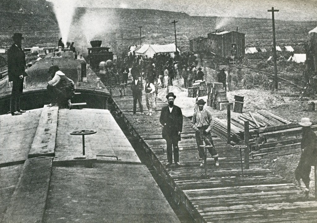
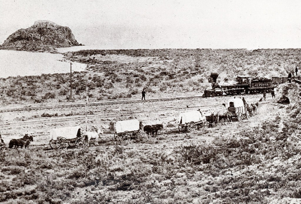
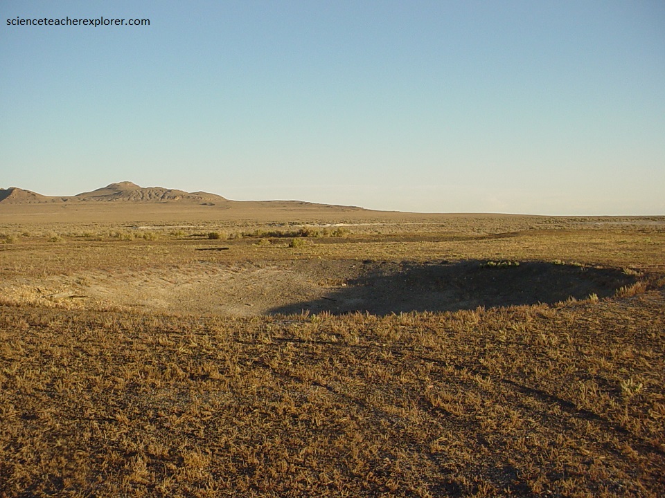
Imaged above, are remnants of the great railroad race to Promontory. With huge land grants and government subsidies to be gained, both the Union Pacific and Central Pacific Railroads strained hared to build more track than the other. In 1864 Congress authorized each company to send graders up to 483 kilometers ahead of its end-of-track. Here in Utah, the Union Pacific and Central Pacific crews actually met and passed one another with roadbeds. The result was utter duplication of effort, with grades often running within sight of one another for miles. Congress finally stopped the wastefulness on April 10, 1869 by establishing Promontory Summit as the meeting place. Thereafter each company concentrated on reaching Promontory, the shallow valley ahead.
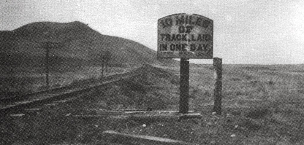
Pictured above, on April 28, 1869 the Central Pacific established a record that has never been equaled. The Union Pacific once laid eight and one half miles, (13.7 km), of track in a single day and boasted that their feat could not be matched. Charles Crocker, Central Pacific construction superintendent, was determined to beat that record. He shrewdly waited until the distance between the two companies was so short that the Union Pacific could not try again. Ten miles, fifty-six feet, (16.1 km) of track were laid. It was an orchestration of humanity as magnificent as the Pacific Railroad effort itself.
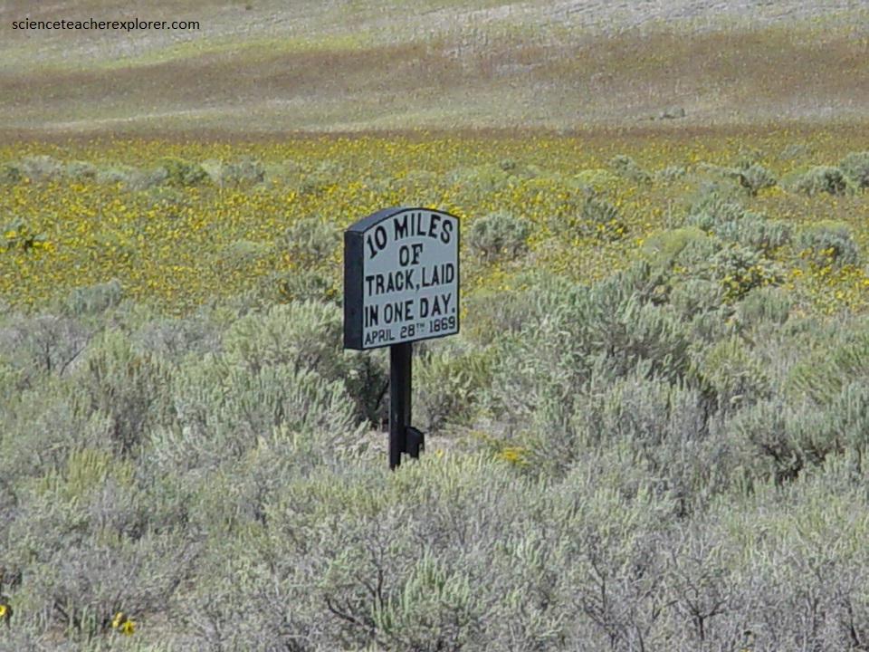
The iron rail used by the railroads came in twenty-eight foot, (9.3 m) sections and weighed 56 lbs./yard, (25.5 kg/m). Eight Central Pacific tracklayers, supported by hundreds of other workers, carried all of the rail on that record setting day. If each man carried his fair share he hefted 123 tons between sunrise and sunset. Relief tracklayers were standing by but the first crew was so proud of their work that a rest was not requested.
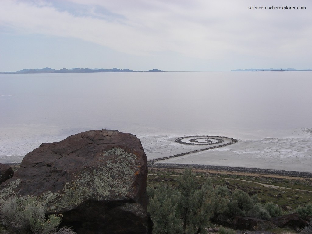
From this point, we took a short side-trip to the spiral jetty, south of the “Promontory West Trail” railway track.
The monumental earthwork “Spiral Jetty (1970) was created by artist Robert Smithson and is located off Rozel Point in the north arm of Great Salt Lake. Made of black basalt rocks and earth gathered from the site, “Spiral Jetty” is a 5 meter-wide coil that stretches more than 500 meters into the lake. Undoubtedly the most famous large-scale earthwork of the period, it has come to epitomize Land art. Its exceptional art historical importance and its unique beauty had drawn us and my tour group to its location.
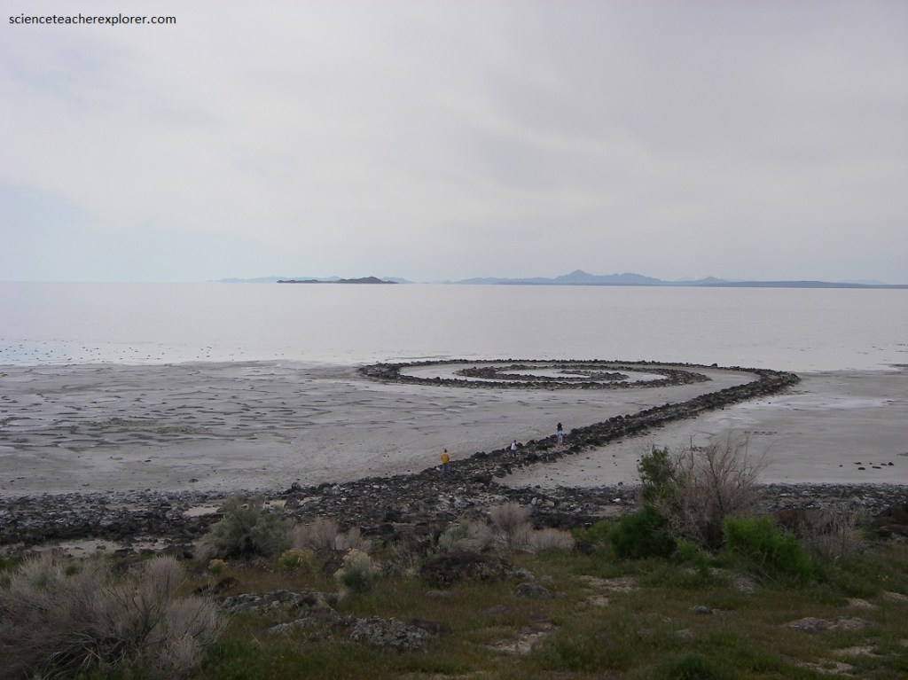
Rozel Point attracted Smithson for a number of reasons, including its remote location and the reddish quality of the water in that section of the lake (an effect of algae). Using natural materials from the site, Smithson designed the “Spiral Jetty” to extend into the lake several centimeters above the waterline. However, the earthwork is affected by seasonal fluctuations in the lake level, which can alternately submerge the work or leave it completely exposed. The causes it to be covered in salt crystals. The close relationship between “Spiral Jetty” and the super-saline Great Salt Lake emphasizes the entropic processes of erosion and physical disorder with which Smithson was continually fascinated.
Once we explored the “Jetty Spiral”, we returned to the railroad track and continued west to the Rozel Station site. The site of Rozel was christened Victory on April 30, 1869 when Strobridge’s Irish workers rested for lunch after laying six miles, (9.66 km), of track during the famous “ten-mile race”. In 1869, a siding was built.
Pictured above, Rozel was an “unimportant station”, where trains meet and pass. However, “helper” engines stationed here assisted heavy trains up the steep grades of the Promontory Mountains. Railroad structures included a section house, train car body, bunkhouse, cookhouse, and water tank. Census figures indicate a population of 25 people in 1870.
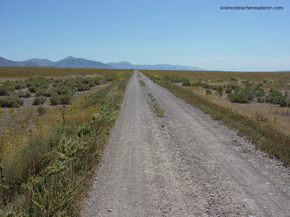
Pictured below, the “Centre” siding site. Lower priority trains, usually freights were required to wait on a siding while higher priority trains, pulling passengers or mail, continued on. Sidings were build about every 5-8 kms along the route. Sidings, (approaching 0.8 kms), were installed parallel to the main track in slow trains to pass slow moving or on-coming traffic. {An additional use of a siding included the loading/unloading of freight or livestock}.
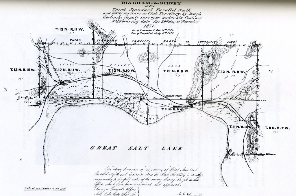
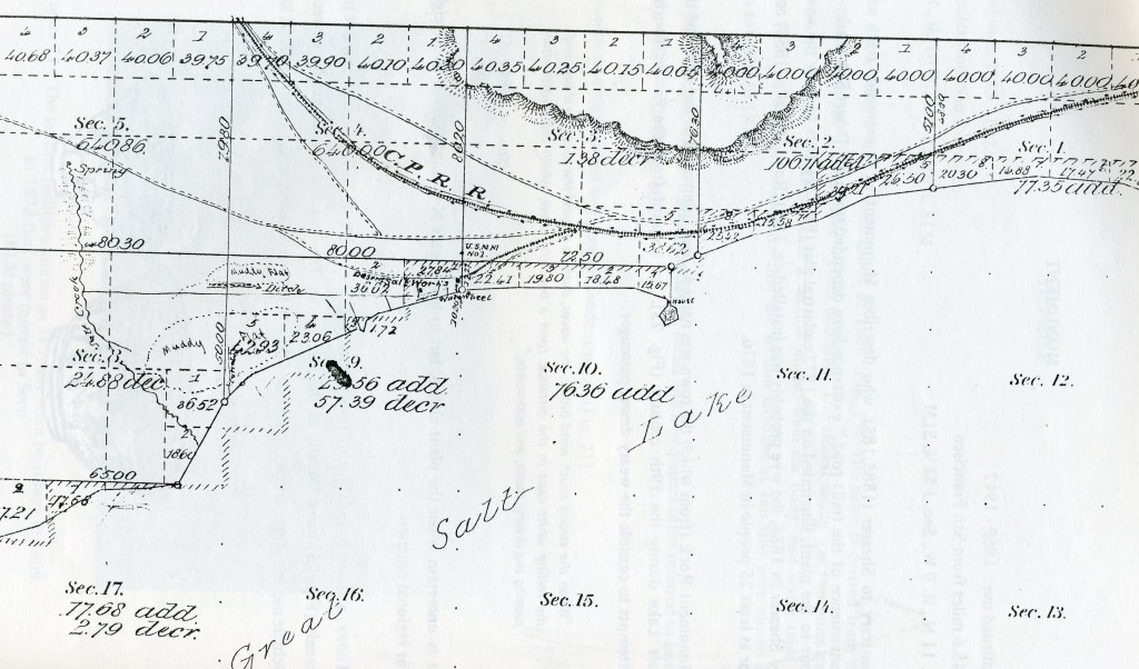
Imaged below is an 1887 Cadastral Plat, (surveying map), showing the next two sidings, “East and West Lake”. Both areas were used and occupied simultaneously. East Lake contained the section maintenance facilities and West Lake possessed a siding and wye built in February 1877 and 1899.
Pictured below, a marsh separates the two Lake settlements. The moist environment conditions may have prevailed in the 19th century and may have required dual settlements.
Although on sand/clay dunes above the marsh, both settlements lacked suitable building sites. Dugouts for example, (a preferred Chinese shelter), may have been flooded out. At East Lake, field investigations found evidence for a substantial Chinese community.
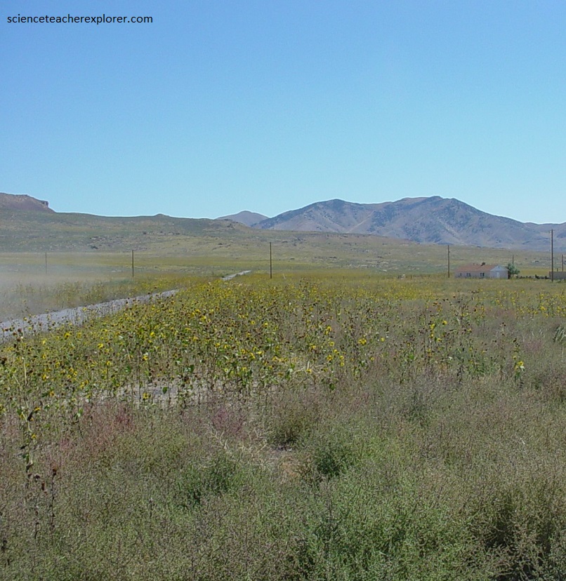
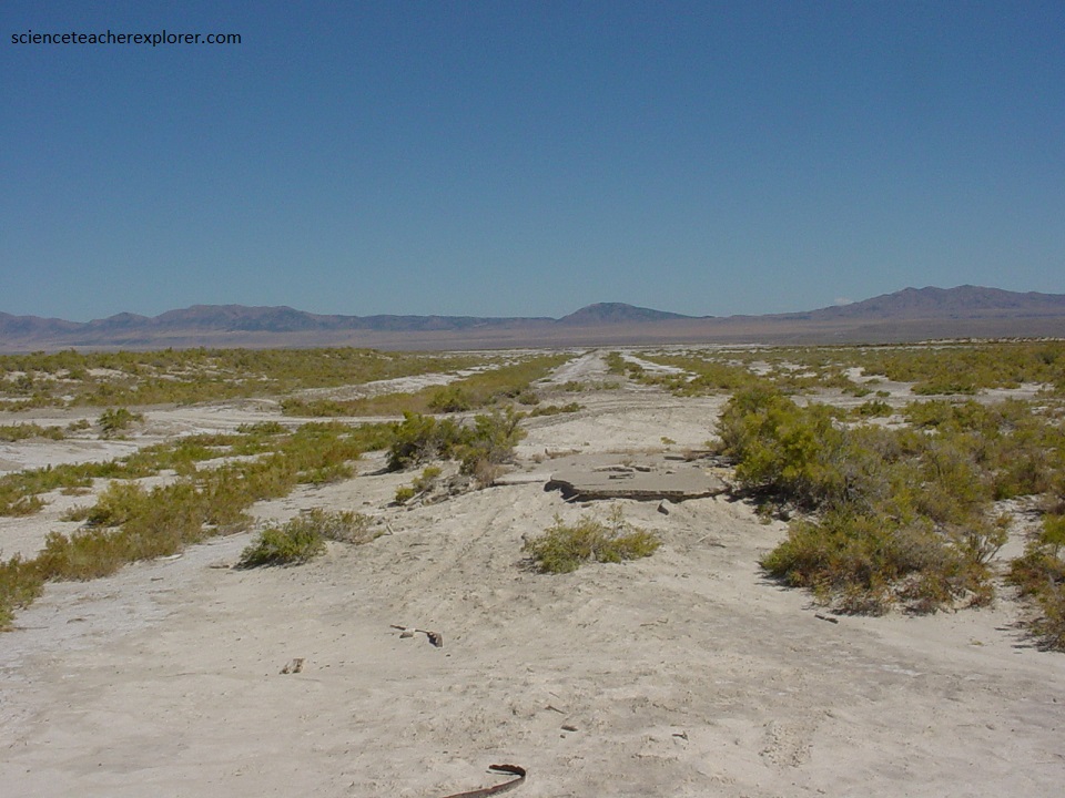
Pictured below, our next site was 8 kms to Kosmo from Lake. Two sidings, (0.8 kms apart), were constructed here. Kosmo West was built in 1912 in conjunction with potash, (used to manufacture gunpowder) activities. The original Kosmo East, was constructed in 1901, to serve the area ranchers. Many years after its railroading days were over, Kosmo became the site of a large potash plant. At that time the reoccupied townsite boasted more than 40 houses and several stores, but all that come to an end when the venture failed. In 2004, both the railroad camp and the potash plant were gone.
From Kosmo, Monument was our next stop in 4.8 kms to the southwest. Other than its role as an end-of-track camp like so many before it, Monument never amounted to much. Only the crudest kind of shelter, tents, shacks and empty box cars were home to the nearly eight thousand Chinese who labored there. A newspaper reporter called it “Parker’s camp”, and described it as three separate comps of Chinese, most living in their little white tents all lined up in neat rows.
Pictured below, the old and the new come face to face at Monument, marking the end of an era. What is believed to have been the last California bound wagon train to cross the country before the railroad was completed met the Central Pacific’s first eastbound passenger train at Monument on April 18th, 1869. A photo taken by an unknown photographer recorded the meeting for posterity.
Years after the last Chinese laborer was gone and forgotten, a salt works was built at Monument. But its life was almost as short as the railroad camp had been before, because series of drought years had shrunk the lake, leaving the plant kilometers from shore.
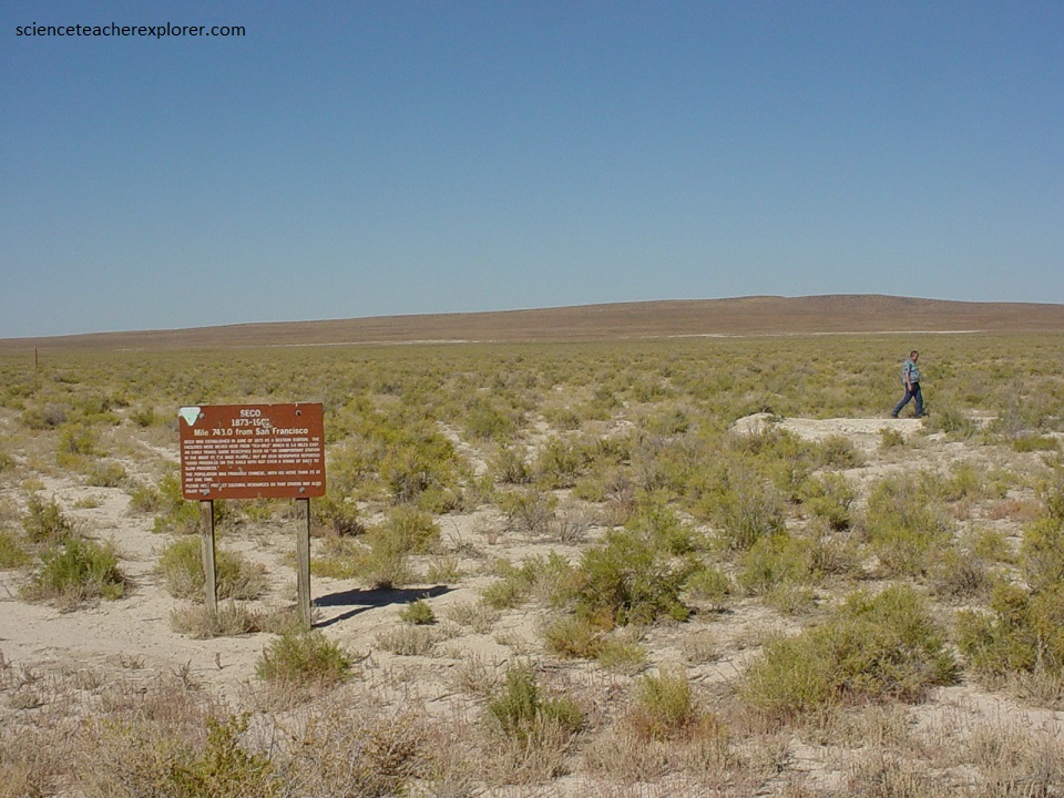
From Monument, it was 11 kms, (west) of cross ties, ballast and heavy rails to Seco, (our next site). The Seco townsite was established in June 1873 as a section station to accommodated the moving of facilities from “Ten-Mile”, which is 5.8 kms east, (we passed it). The siding, unpretentious and apparently lacking any ancillary features or structures, was completed in September 1872. The work crews and inhabitants of Seco were Chinese, (possibly 25).
From Seco, the iron trail of the Central Pacific head for Kelton, 11 kms to the east. There the roadbed turned northward around the north end of the Great Salt Lake. The thousands of Chinese laborers, pushed hard by there American bosses, laid track rapidly, for there wasn’t even a stand of sage to slow their progress. Square cross ties cut hundreds of miles away in the California Sierras were laid kilometer after weary kilometer on a roadbed of soft gray mud, where hardly a stone could be found for a ballast.
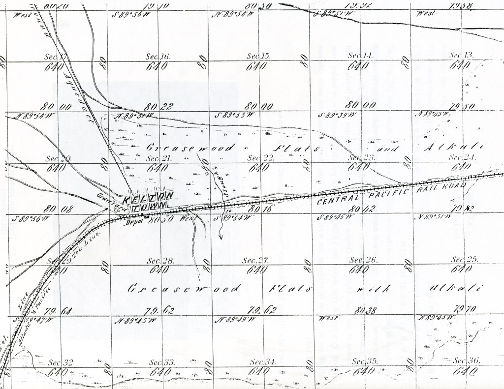
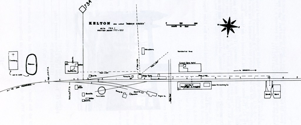
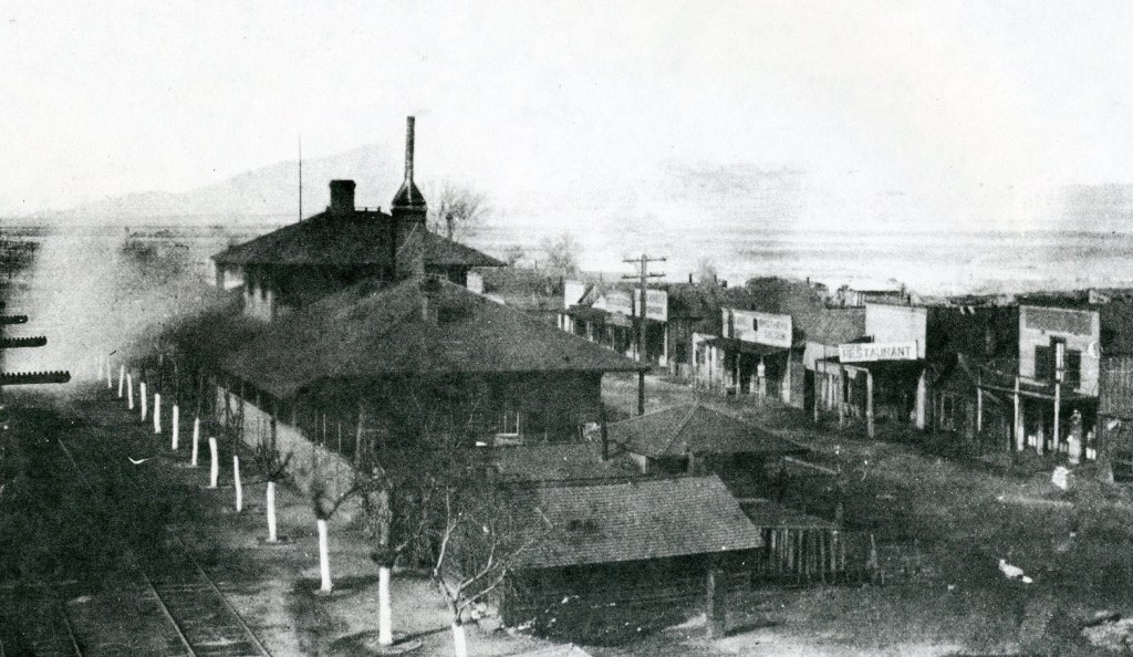
Imaged above, Kelton was located at the northwest end of the Great Salt Lake 103 kms from the Nevada border. At first it was called Indian Creek but was later named Kelton for an early stockman.
Kelton quickly grew from rough end-of-track camp into a prosperous city and important stop on the Central Pacific line as well as a supply point for the northern mines and stage station on the road to Boise Basin and the Snake River diggings.
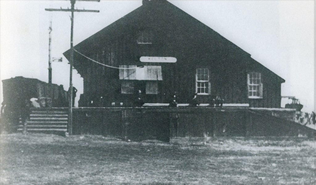
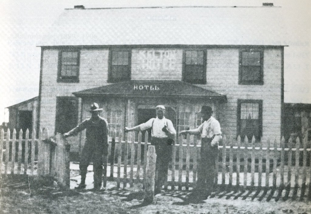
(Pictured below), Kelton boasted several fine two story hotels, well stocked stores, comfortable homes, a whole row of saloons and gambling halls and even a telephone exchange. The stage road from Kelton north went by way of “10-Mile”, “Hard Luck”, and Strevell to the rich gold mines in Idaho and Montana. Nearly all the supplies for the northern mines were shipped from Kelton and stagecoaches heavily laden with gold and silver bullion returned the treasures to the railroad there. Wagon trains headed north daily while stagecoaches brought back miners carrying bags tightly packed with gold.
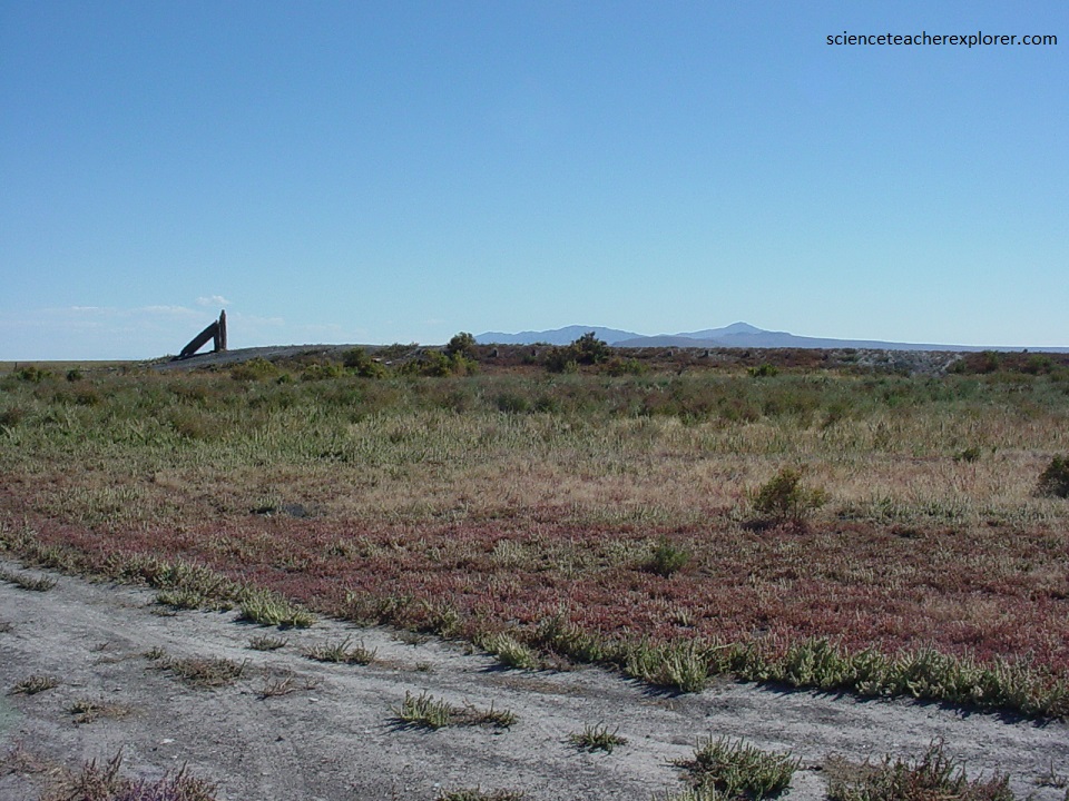
Until the Lucin Cutoff was built across the Great Salt Lake, Kelton remained a booming place, but after the rails were rerouted it quickly faded. In 1934, when it still claimed a small population, Kelton was at the epicenter of a severe earthquake. Houses and other buildings were rocked violently and the schoolhouse was tilted at a strange angle.
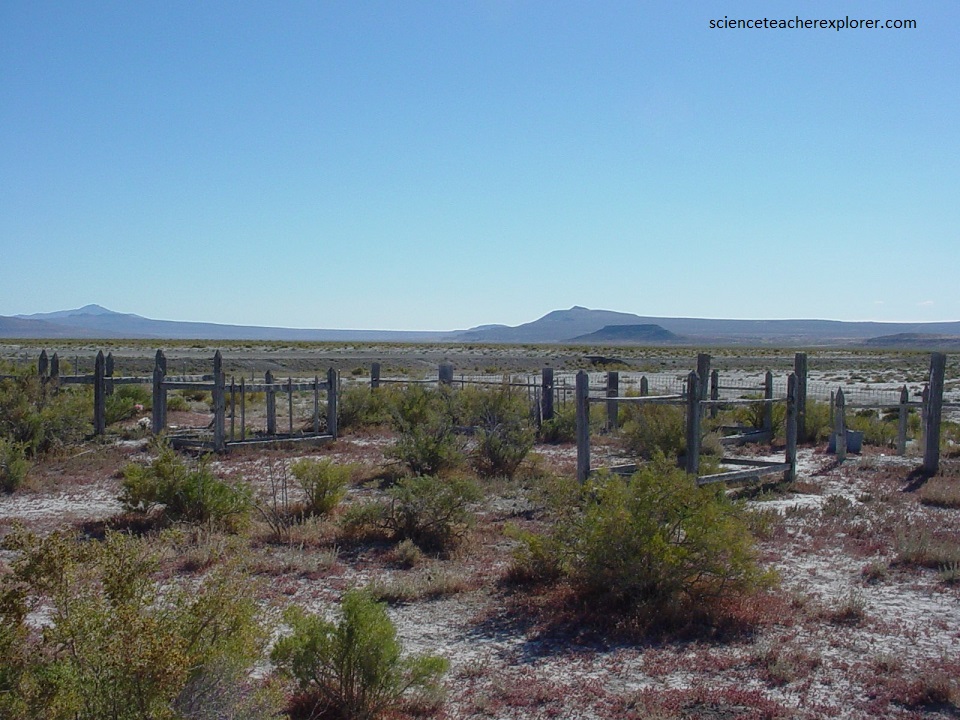
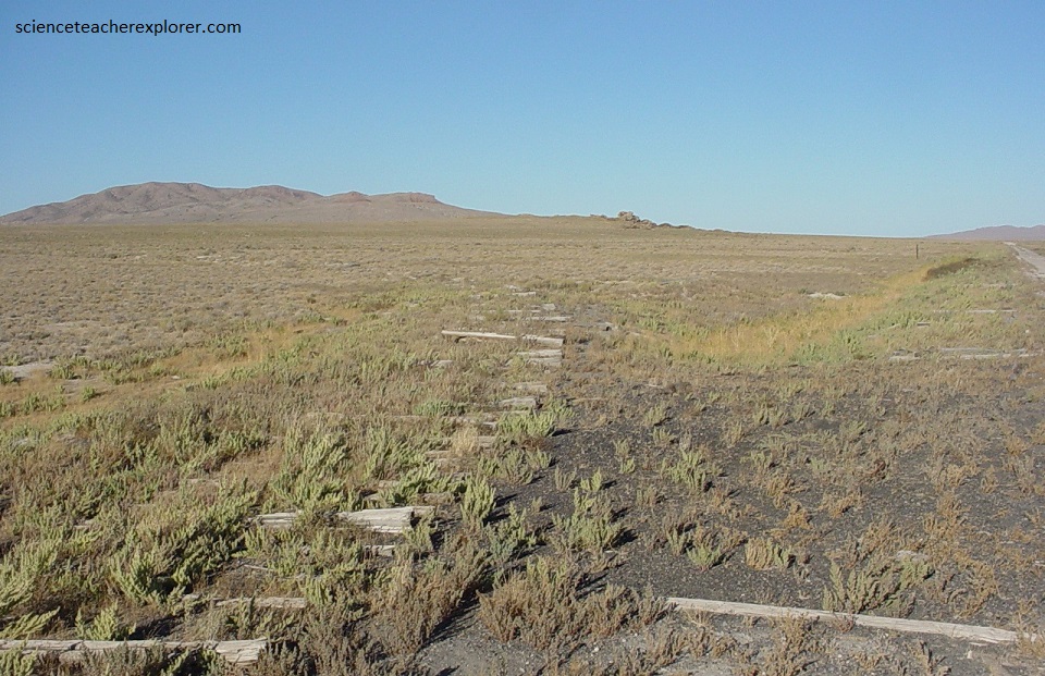
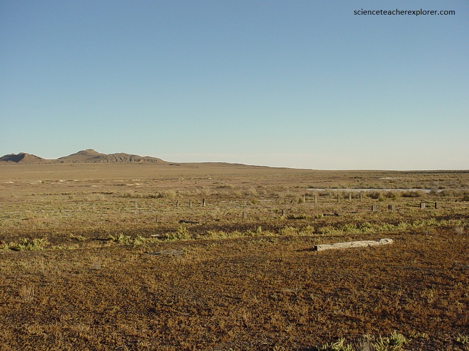
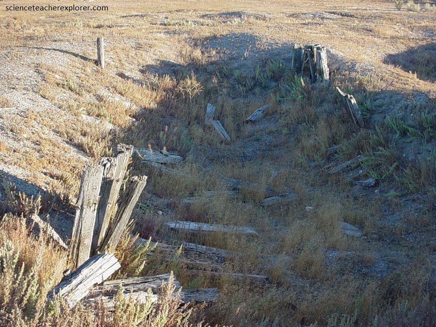
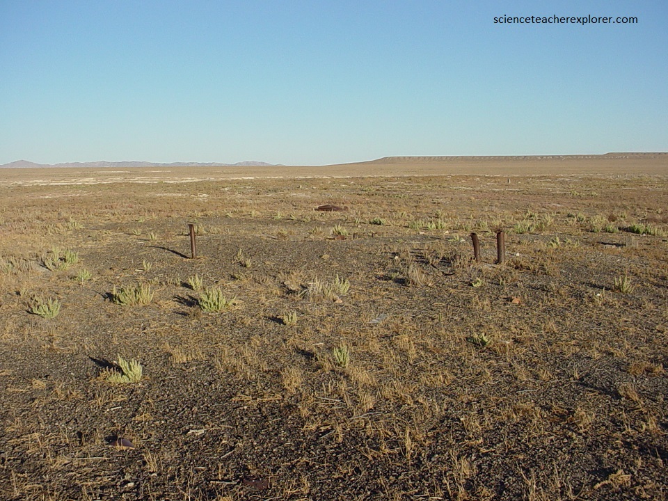
After the earthquake, Kelton became completely abandoned, and today a few broken foundations hidden in the sagebrush, long dead trees and a vandalized cemetery are all that was left in 2004, (pictured below).
11 kms west of Kelton by rail, a camp named Peplin was built. Pictured below, while the slow work on the long horseshoe shaped cut through the mountains was being dug, Peplin bustled with activity. Hastily build joss houses and opium dens served the Chinese while shacks and cabins replaced the little white tents usually used for shelter. Central Pacific track layers reached Peplin on April 9, 1869. Pictured below is a gooseneck bend that cut deep through the north end of the desolate Hogback Mountains. It was a cut where progress was slow, where large crews of laborers inched their way along as they dug the great cut ever deeper.
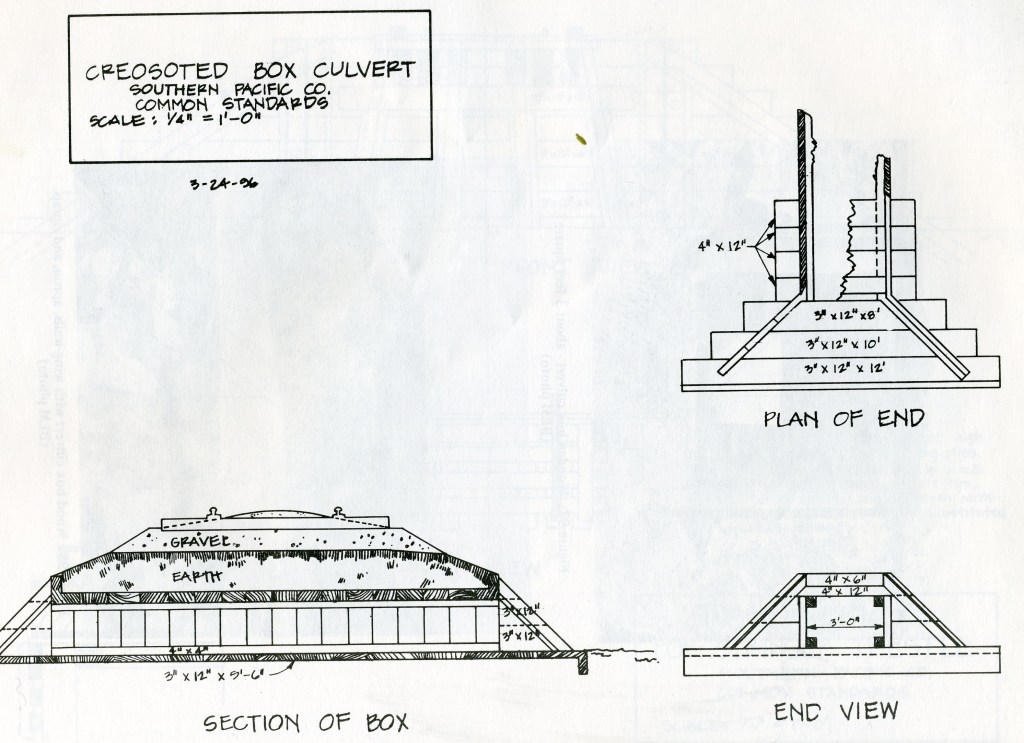
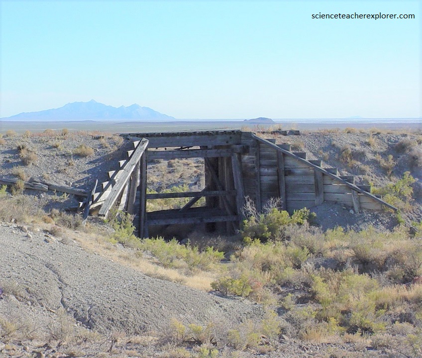
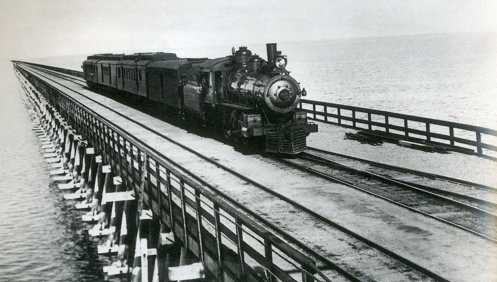
Pictured below, large washes and deep arroyos required open deck, piled, trestlework bridges, (as seen near Promontory). However, smaller drainages and gullies required wood box culverts, often constructed of California redwood.
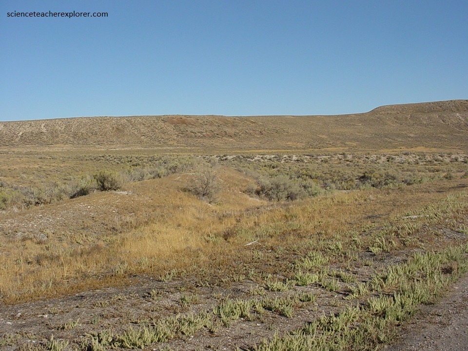
Six and a half kilometers beyond Peplin, (west), is Ombey. Pictured below, Ombey was a fuel station where engines stopped to load up wood to fire their boilers. It was named for the Ombey Mountains, a barren, waterless range nearby. Great piles of cordwood cut for to the north in the Raft River, or Sawtooth Mountains were stacked high along the track, waiting for engine tenders to load up before work trains pushed off into the barren mud flats to the east.
For a few months, Ombey served as home to thousands of Chinese laborers, many whom lived like desert coyotes, in dens and burrows dug into the hillsides.
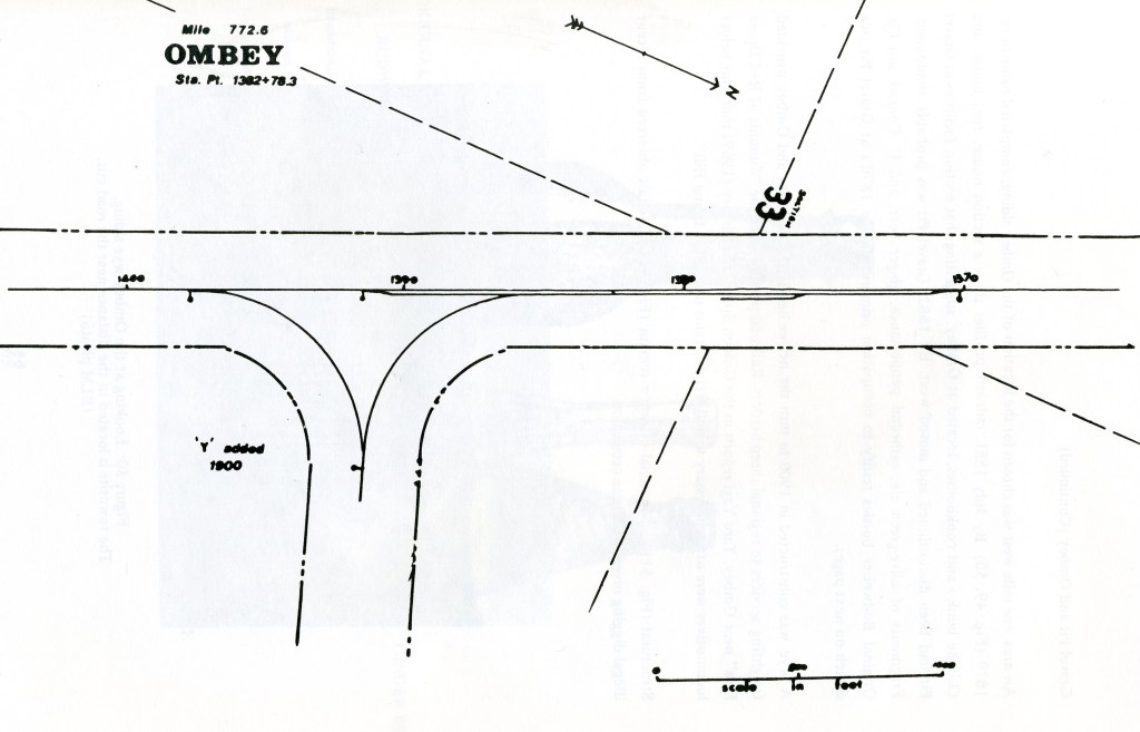
Pictured above, a wye was constructed in 1900 to turn the newer heavier locomotives and Ombey provided freighting services to regional sheep herders. A wye is a “Y” shaped railroad siding which enables locomotives to turn around.
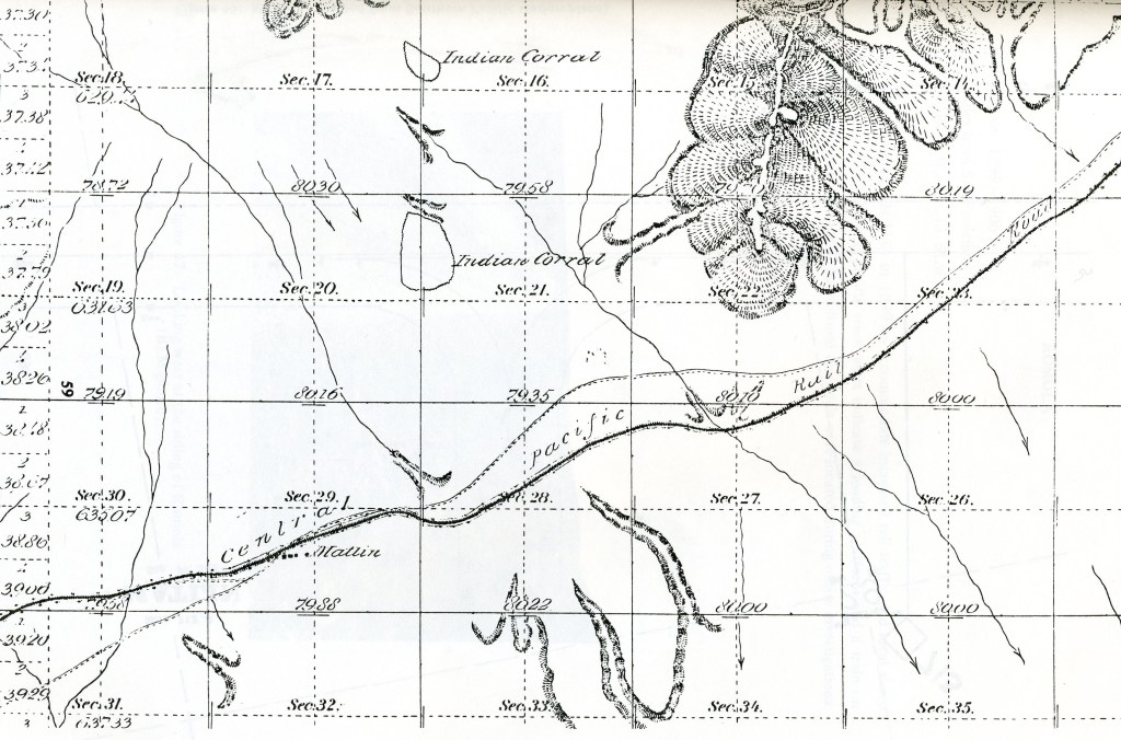
Engineering profiles indicate that track laying crews reached the site of Matlin, (17 kms west of Ombey), on April 5, 1869. Here a share of the Chinese railroad workers built section facilities and a small Chinese community.
Pictured above, Matlin is where the rails leaves the sub-baked hard clay foothills to the west and enters the soft gray mud flats of the east, where the Hogback mountains can be seen dancing above the shimmering heat waves of the great salt desert.
The Central Pacific route in this area was paralleled for many kilometers by a hastily surveyed grade built by rival crews of the Union pacific. Both companies were allowed to grade their right of way 483 kms beyond their actual end-of-track, and since they were being paid $32,000 a mile in the desert areas, both built their grades as quickly and as cheaply as possible. In this location, both grades paralleled each other, often only a 30 meters apart.
Pictured above, eleven kilometers east of Matlin is the Red Dome siding. Both Red Dome and Matlin wee short-lived places, where for a few weeks great piles of rails and cross-ties stood alongside the long rows of little white tents used by the Chinese track layers. The railhead had hardly moved to the next line camp before the tents were taken down and the transient camp left behind.
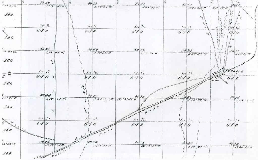
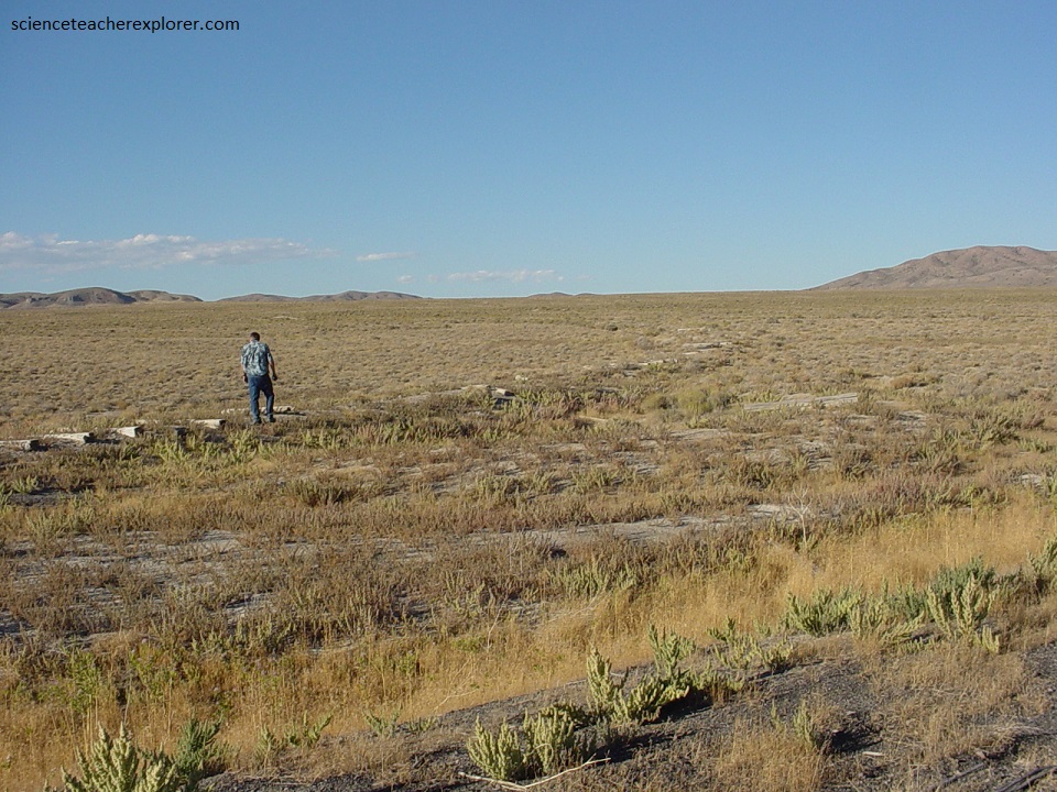
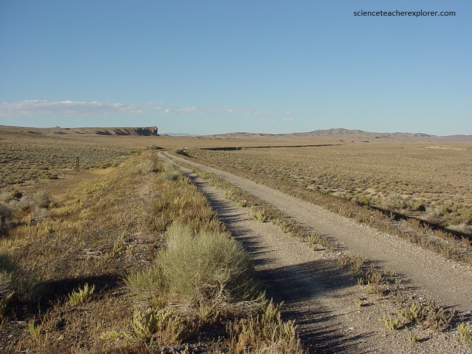
In another 8 kms west of the Red Dome siding is the remains of the largest Central Pacific towns build in Utah, (Terrace). Terrace was 52 kms east of the Nevada border with a large depot and many supply warehouses, as well as schools for employees children, stores, saloons and other businesses. The Central Pacific built their huge 16 stall roundhouse and repair shops at Terrace, (imaged below). A roundhouse is and arc shaped building for housing and repairing locomotives. This roundhouse had a turntable, (or track platform), that rotated and allowed the locomotives to turn around.
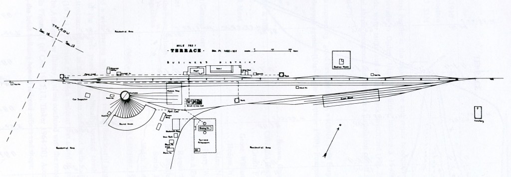
Some of the firms doing business at Terrace included: Cave & Hinley’s general store, William Grose’s meat market, Smith’s fruits and vegetables, Parry’s Saloon, King’s Hotel and Pearson & Eager Livestock Company. Railroad employee’s were taxed $1 per month to maintain the library.
Pictured above, Terrace’s population quickly soared to more than two thousand, not counting the 6-8 thousand Chinese laborers who called it home for a time. Many of them remained or returned to operate stores and shops, and built a Chinatown second only to San Francisco. The Chinese shops featured items like wild rice, seaweed, duck and dried fish. Opium was sold openly for $7 a bar, enough to last a careful smoker one month. Terrace’s population 30 years later was still 900, by that time nearly all Chinese.
Pictured below, a 19 km wooden aqueduct, (from springs charging Rosebud Creek in the Grouse Creek Mountains), supplied Terrace with water for domestic and railroad use. A reservoir and structures built of ties, (located today at the Rosebud Ranch), mark the probable source. An engineering report describes the aqueduct being replaced by a 9 cm metal pipe in 1887 by work crews, (pictured below).
Until the famed Lucin Cutoff was built across the Great Salt Lake in 1903, Terrace remained the Central Pacific’s largest town and maintenance station in Utah, but after the line was shortened, most of the shops were moved to Elko and Carlin, (Nevada), and the big town slowly faded away. Terrace lingered, still having a Justice of the Peace and Constable in 1908.
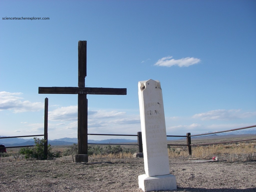
Except for the 60 people buried at it’s Lone Hill Cemetery, no one remained at Terrace in 2004. This cemetery is located east of town on the south side of the track.
Our next stop was the Watercress siding, 3 kms to the west.
Pictured below, Watercress was a water station located 3 kms west of Terrace. It had a high water tower which was kept filled with spring water piped from springs to the north where watercress grew in abundance, hence its name. Watercress was an important stop since it was the only place steam engines could replenish water supplies before continuing into the desert ahead.
Pictured above, (as the sun is going down), Watercress didn’t last long, but its water tower made it a necessary stop for years after its few shaky building were abandoned. Early in the 20th Century, the Terrace waterline was rerouted to Watercress and then south to the Lemay siding on the Lucin Cutoff.
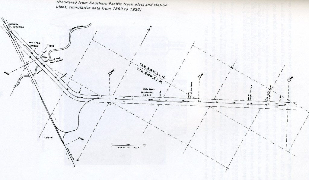
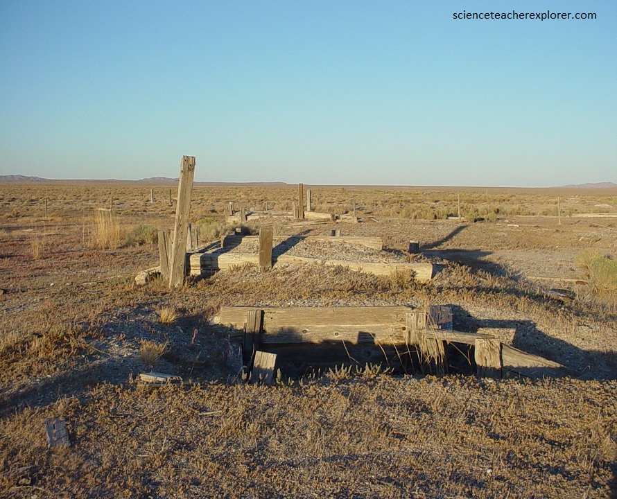
Pictured above and below, Lucin was the first Central Pacific camp in Utah, 12 kms from the Nevada line in Box Elder County. In its heyday when it was a booming construction camp, it was often known as Pilto Peak, but when it became a main supply point for railroad workers and desert dwellers it was named Lucin, for the large numbers of Lucina-Subanta, (a type of fresh water fossil found there).
When the end-of-track moved farther east, Lucin didn’t just dry up and blow away as many camps did. It remained a supply town for ranches and farm towns in the Grouse Creek and Goose Creek mountains to the north. Railroad track pat maps refer to the location of the convergence of the 1904 Lucin Cutoff with the Promontory Branch as Umbria Junction.
Railroad traffic had increased to such a point that operation over the steep and crooked old line was becoming constantly more and more vexatious and difficult. So, the leaders of the railroad decided to build a short-cut across the lake, called the great “Lucin Cutoff”. Imaged above, the Lucin Cut-Off was 164 kms in length, from Ogden to Lucin, including twenty one kilometers of fill and nearly nineteen kilometers of trestle across Great Salt Lake. Seventy one kilometers were saved in length. [Note: I actually walk the “Lucin Cutoff” on this webpage: https://scienceteacherexplorer.com/francis-peak-ut-2003/
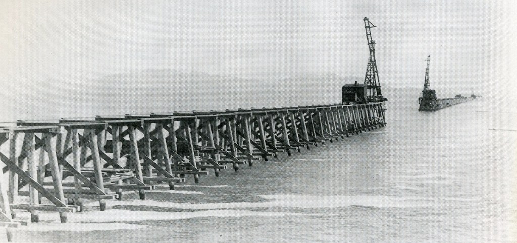
The Lucin-Cutoff project required the labor of 3,000 men, took one and one-half years of actual construction, and cost over $8 million. The Lucin Cutoff saved considerable time and expense. Two difficult stretches were eliminated—the 233 meter climb in 18 kms, across the Promontory Summit and the 167 meter crossing in 9 kms of a spur of the Hogback Mountains near Kelton.
38,256 trees were cut down to make piles for the trestle bridge part. But the trestles were necessary to allow the Bear River water to flow into the southern portion of the lake. Eventually, the trestle was functionally replaced in the late 1950s with a parallel dirt and rock causeway.
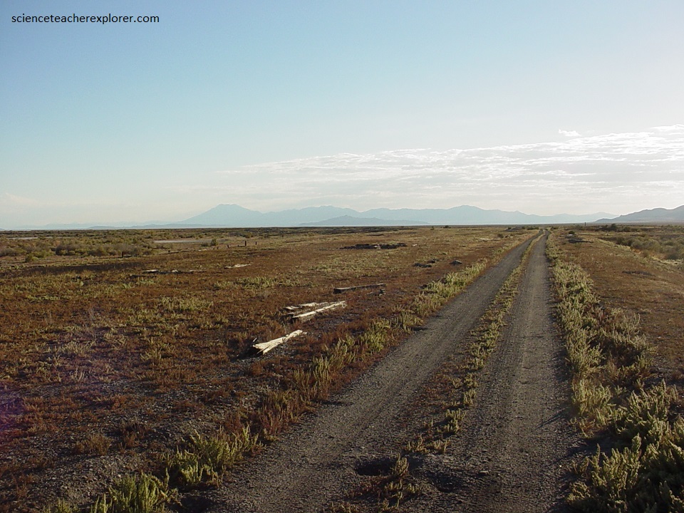
After camping at the Lucin Camp, our tour got permission to return to Ogden, on the causeway service road the next day.
