The Ozarks, AR 2013
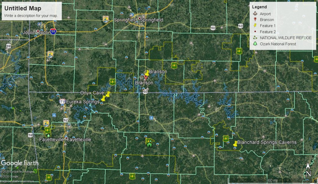
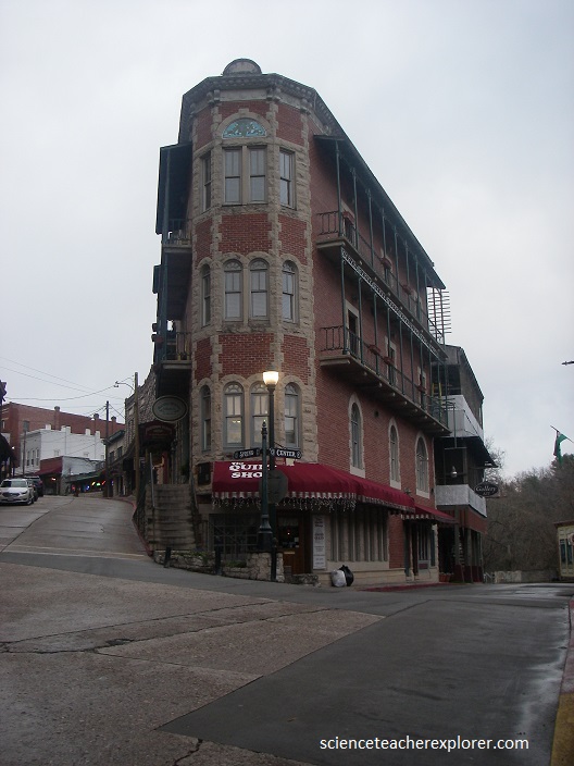
During the March Spring Break of 2013, Becky (my wife) took a week long vacation in the Ozark Mountains on the Arkansas and Missouri border. Our main attraction was Branson, Missouri where we saw Mickey Gilley’s show. We stayed at a little Ozark community called Eureka Springs.
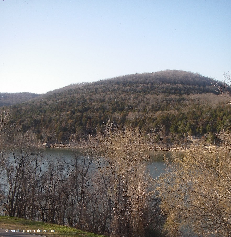
The Ozarks, also known as the Ozark Plateau, is a physiographic region in the U.S. states of Missouri, Arkansas, Oklahoma and the extreme southeastern corner of Kansas. The Ozarks cover a significant portion of northern Arkansas and most of the southern half of Missouri, extending from Interstate 40 in Arkansas to Interstate 70 in central Missouri. The Ozarks cover nearly 120,000 square kilometers, making it the most extensive highland region between the Appalachians and Rockies. There are two mountain ranges within the Ozarks: the Boston Mountains of Arkansas and the St. Francois Mountains of Missouri.
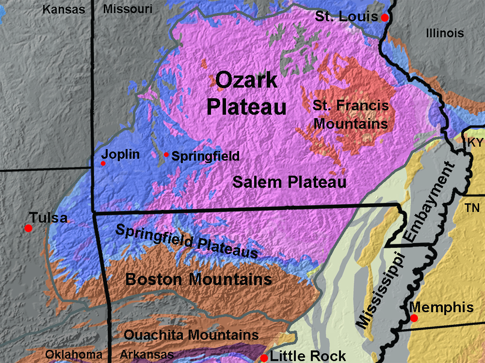
Geologically, the area is a broad dome with the exposed core in the ancient St. Francois Mountains. The Ozarks region is characterized by erosionally dissected plateaus with steep valley walls and narrow river bottoms. The region is mostly covered with shrub-oak forests. The Ozarks is subdivided into four general regions based on elevations and bedrock characteristics, (pictured above). Becky and I spent all of our time in the Salem and Springfield Plateaus.
The St. Francis Mountains of Missouri is a region where crystalline basement rocks are locally exposed through the sedimentary cover of the greater Mid continent region. These rocks are Precambrian age (about 1.5 billion years) and consist of a mix of granitic and metamorphic rocks.
The Springfield Plateau region of rolling hill country that exists where a belt of Mississippian-age limestone (the Boone Formation) crops out across northern Arkansas. The Boone Formation contains nodular chert beds and the limestone is host to karst erosional characteristics, having caves, caverns, and sinkholes. Highest portions of the plateau region reach about 600 m in elevation.

The Salem Plateau region extends south of the St. Francis Mountains into northern Arkansas. Sedimentary rocks of marine origin make up the bedrock of the Salem Plateau, consisting mostly of Ordovician-age dolostone, with some limestone and sandstone. The Salem Plateau region ranges from about 200 m to 500 m in elevation.
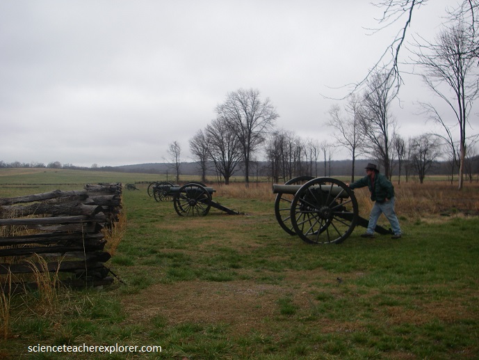
The Battle of Pea Ridge (March 7–8, 1862), took place in the American Civil War near Leetown, northeast of Fayetteville, Arkansas and on the Springfield Plateau. Maj. Gen. Earl Van Dorn launched a Confederate counter-offensive, hoping to recapture northern Arkansas and Missouri. Curtis held off the Confederate attack on the first day and drove Van Dorn’s force off the battlefield on the second. By defeating the Confederates, the Union forces established Federal control of most of Missouri and northern Arkansas.
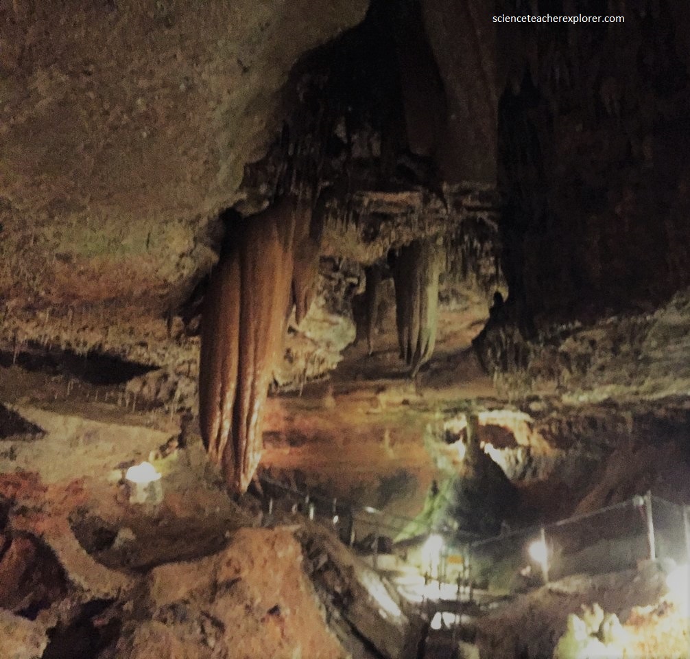
About mid-week, Becky and I visited and explored the Blanchard Springs Caverns. Blanchard Springs Caverns is a cave system located in the Ozark–St. Francis National Forest in Stone County in northern Arkansas, 1.2 km off Highway 14 a short distance north of Mountain View.[1] It is the only tourist cave owned by the United States Forest Service and the only one owned by the Federal government outside the National Park System.
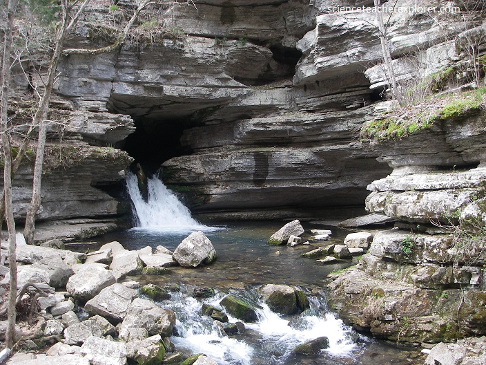
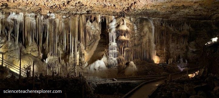
Blanchard is the second longest cave in Arkansas and the largest in volume. The limestone rock from which the caves and their formations developed was laid down in an ancient sea more than 350 million years ago. The cave is in middle Ordovician to lower Mississippian rocks and extends through six stratigraphic formations. At that time northern Arkansas was covered by a shallow sea that teemed with life. During most of the period limey sediments built up from the shells of the sea animals that died. As the layers of shells got deeper and deeper, they were compressed to form limestone rock.
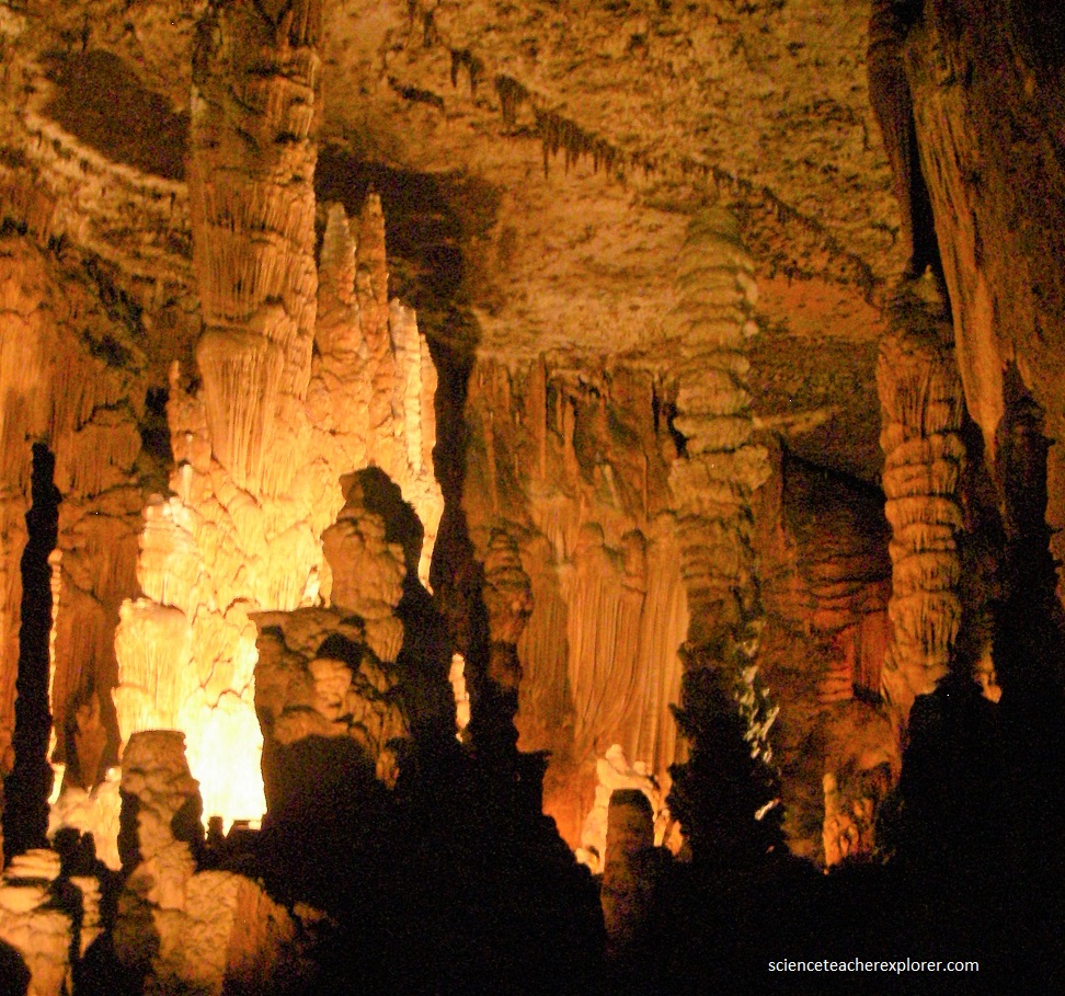
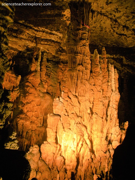
Lower Pennsylvanian (about 310-350 million years ago). Enormous forces in the earth’s crust began a gradual uplifting of the large, oval-shaped landmass that became known as the Ozark dome. During the uplifting, which was very slow, layers of rock often cracked or fractured under the stress, (note the cracks in the ceiling in the above and lower photos.
As the land raised, the surface streams flowed over the land in the weakest places producing deep valleys, sheer bluffs, and the rugged topography as we know it in the Ozarks.
As the surface eroded, so did cavities underground, though by a different process. Some of the rainwater percolated down through the cracks in the rock layers. As the water passed through the soil, it picked up CO2 (produced during the decomposition of organic material) to add to the CO2 picked up in the air. This formed a mild acid called carbonic acid, giving the water greater dissolving power. As the acid water came in contact with the limestone, the limestone (CaCO3) chemically reacted with the carbonic acid. In this way solutioning occurred along the fractures. Very slowly, over long periods of time (50-70 million years ago), crevices became channels; channels enlarged into tunnels; tunnels joined together to form rooms, water filling the whole carved out area.
Blanchard Springs Caverns is a cavity formed primarily in layers of limestone with thin layers of shale and sandstone which collapsed. The cavern cavity zone lies between Boone Formations, which are mostly bedded chert, an insoluble siliceous rock, and St. Peter Sandstone, which is also insoluble.
As the surface streams carved deeper into the hillsides, the water table gradually dropped. Springs, where water emerges from the hillsides, give the cave water an outlet. Finally the water table dropped below the level of the cave, leaving the cave air-filled and ready for speleothems.

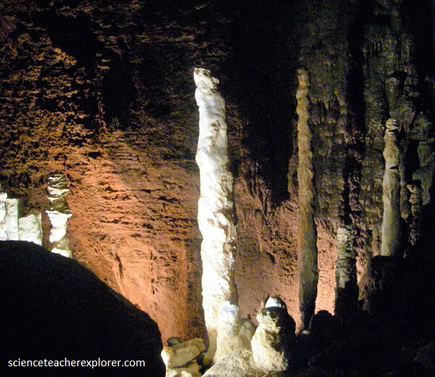
Because Blanchard Springs Caverns still has water entering and flowing through it, it is considered a “living” or “active” cave. The vast majority of speleothems in Blanchard Springs Caverns are made of calcite, a crystalline mineral of calcium carbonate (CaCO3). The CaCO3 is dissolved from the limestone bedrock by the weak carbonic acid solution resulting from rainwater percolating down through the rock. When the solution enters an air-filled passage the CO2 is released due to the difference in CO2 concentration between ground water and cave air. The loss of CO2 can cause calcite deposition. The tremendous variety of speleothems is due to the number of paths the water may take when it enters the cave by dripping through the ceiling, running down the walls, splashing on the cave floor, or oozing through the walls.
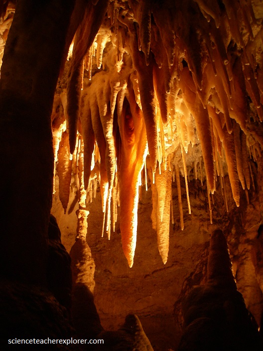
Most speleothems at Blanchard Springs Caverns are stained by impurities carried into the cave with water and deposited between the crystals of calcite. Iron impurities typically stain speleothems yellow, brown, or orange. Black, blue-gray, and pastel blue colors are probably due to manganese compounds. A sample of dark stains on the cave ceiling over the loop in the Coral Room was found to be manganese dioxide.
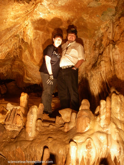
Later in the week, Becky and I visited a similar cave called Onyx Cave. It was privately owned and smaller (pictured above). We posed below, for a photo opp at one of their better formations.